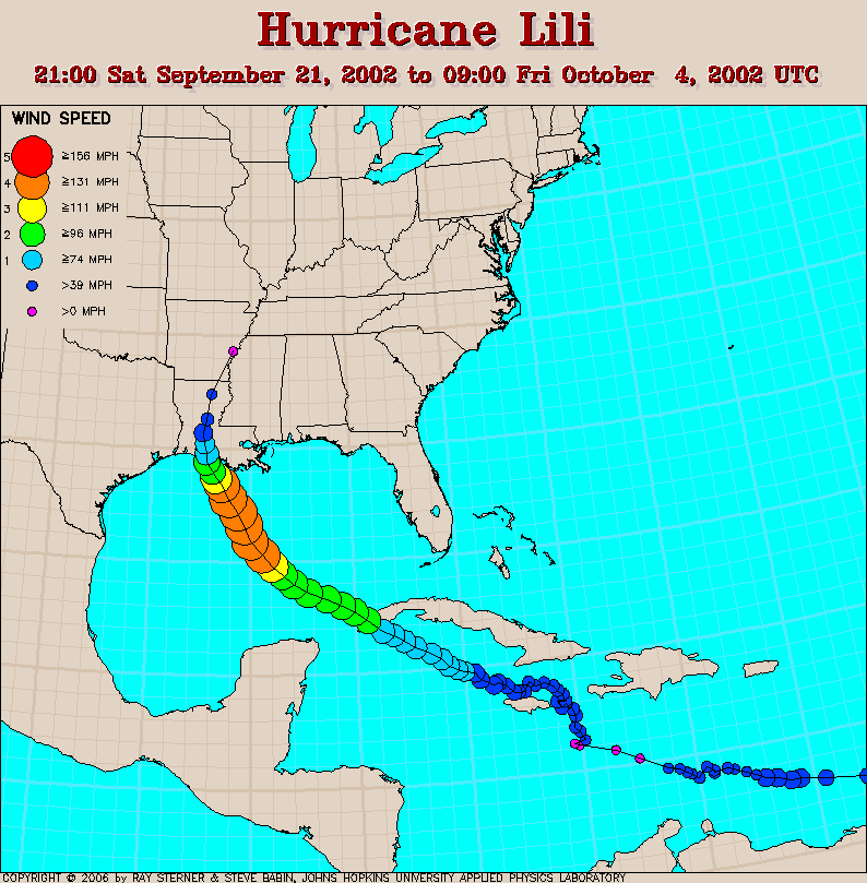
Lili developed from Tropical Depression Thirteen over the tropical North
Atlantic Ocean.
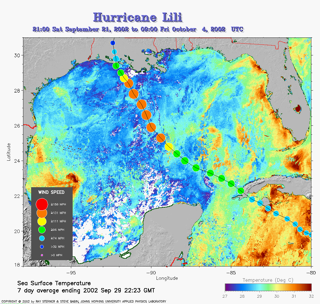 Lili track on
SST image of Gulf of Mexico from 29 September (331 Kb) This image
represents the average composite sea surface temperature (SST) derived
from NOAA satellite AVHRR data
over the 7 days ending 29 September 2002. The averaging is done to
remove clouds. The temperature scale for SST is 27C to 32C.
Note the wide cool swath left by the previous passage of Isidore up the
middle of the Gulf of Mexico. The track of Lili is overlaid on this
image.
Lili track on
SST image of Gulf of Mexico from 29 September (331 Kb) This image
represents the average composite sea surface temperature (SST) derived
from NOAA satellite AVHRR data
over the 7 days ending 29 September 2002. The averaging is done to
remove clouds. The temperature scale for SST is 27C to 32C.
Note the wide cool swath left by the previous passage of Isidore up the
middle of the Gulf of Mexico. The track of Lili is overlaid on this
image.
Track file
Track data (lat/lon, winds, etc.) in a text file.