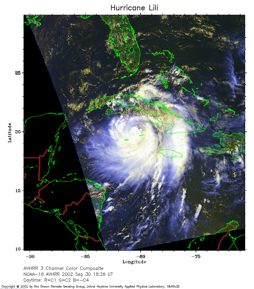
 2002 September 30 18:26 UT
NOAA-16 satellite AVHRR 3 channel color composite afternoon image.
A closer view (301 Kb) is seen by clicking on this small image.
The maximum sustained winds are 75 mph.
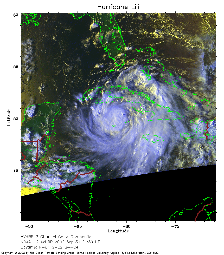 2002 September 30 21:59 UT
NOAA-12 satellite AVHRR 3 channel color composite evening image.
A closer view (334 Kb) is seen by clicking on this small image.
The maximum sustained winds have increased to 80 mph.
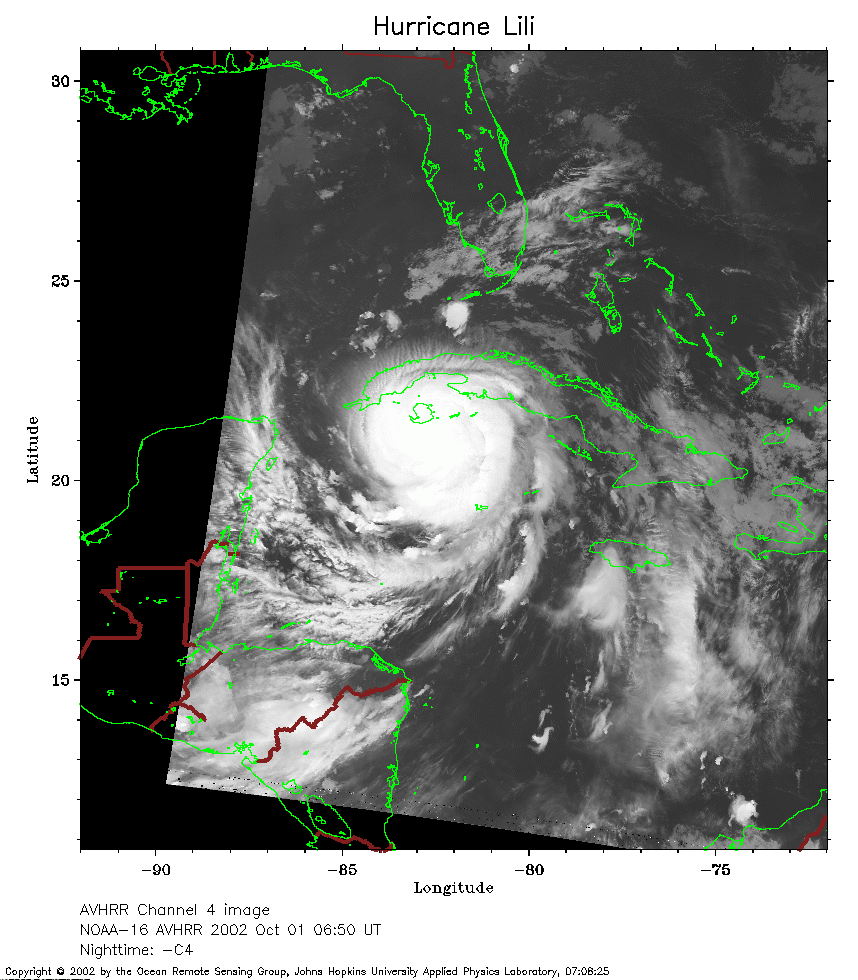 2002 October 1 06:50 UT
NOAA-16 satellite AVHRR channel 4 early morning image.
A closer view (249 Kb) is seen by clicking on this small image.
The maximum sustained winds have increased to 85 mph.
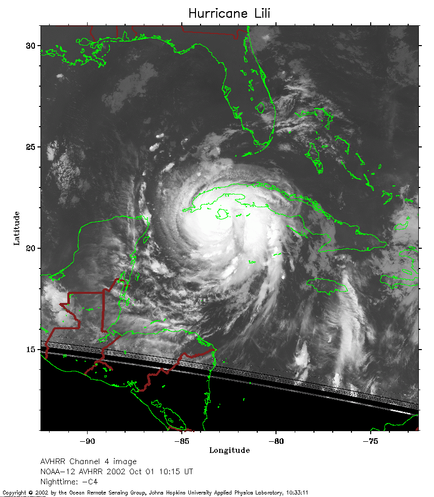 2002 October 1 10:15 UT
NOAA-12 satellite AVHRR channel 4 morning image.
A closer view (250 Kb) is seen by clicking on this small image.
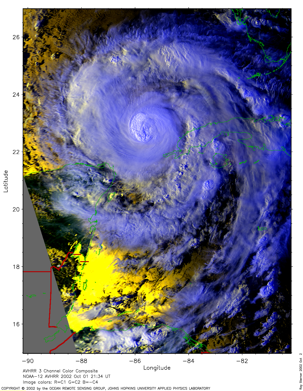
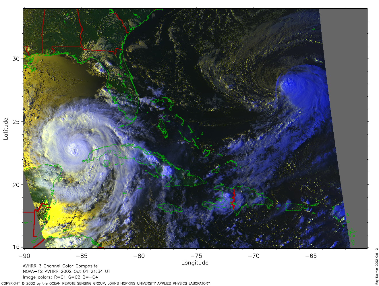
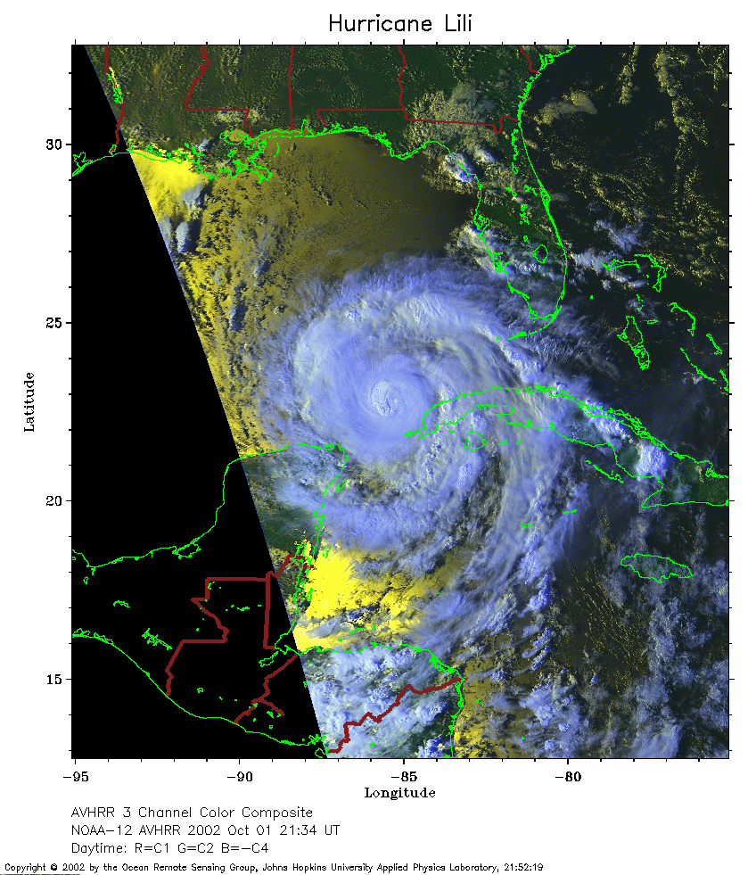 2002 October 1 21:34 UT
NOAA-12 satellite AVHRR 3 channel color composite evening image.
A closer view (325 Kb) is seen by clicking on this small image.
The maximum sustained winds have increased to 105 mph.
A very large image (1820 Kb)
of Lili is also available.
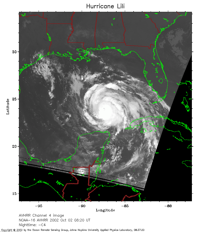 2002 October 2 08:20 UT
NOAA-16 satellite AVHRR channel 4 morning image.
A closer view (214 Kb) is seen by clicking on this small image.
The maximum sustained winds have increased to 110 mph.
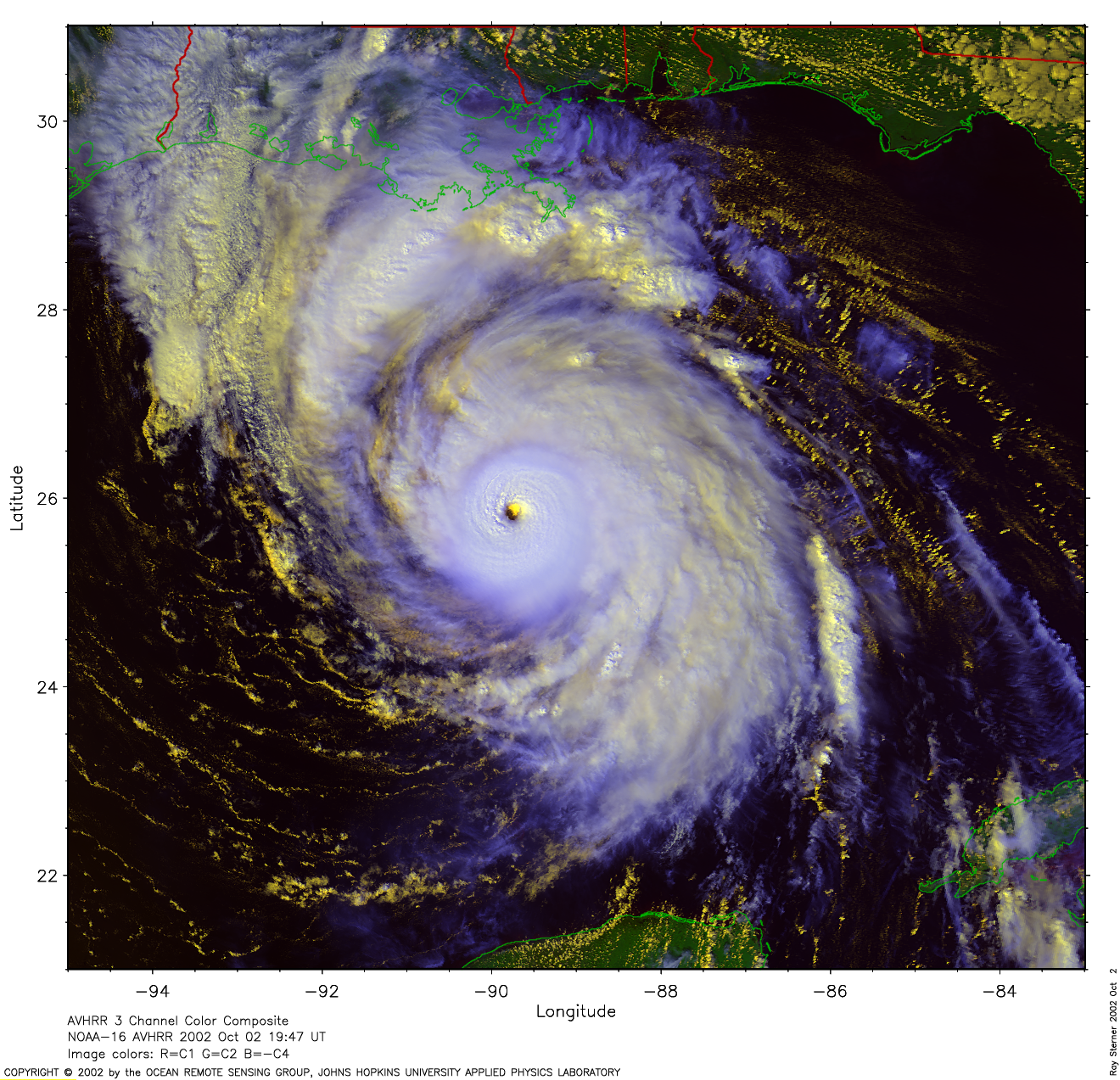
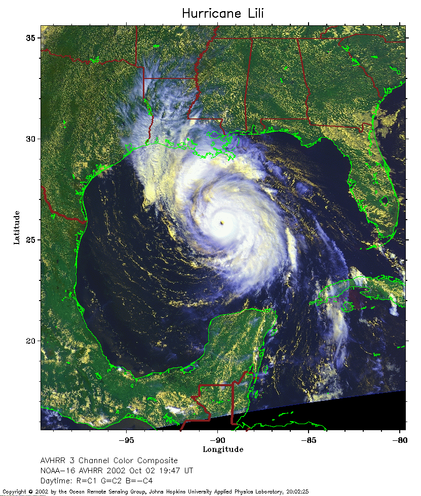 2002 October 2 19:47 UT
NOAA-16 satellite AVHRR 3 channel color composite afternoon image.
A closer view (393 Kb) is seen by clicking on this small image.
The maximum sustained winds have increased to 135 mph.
A very large image (2255 Kb)
of Lili is also available.
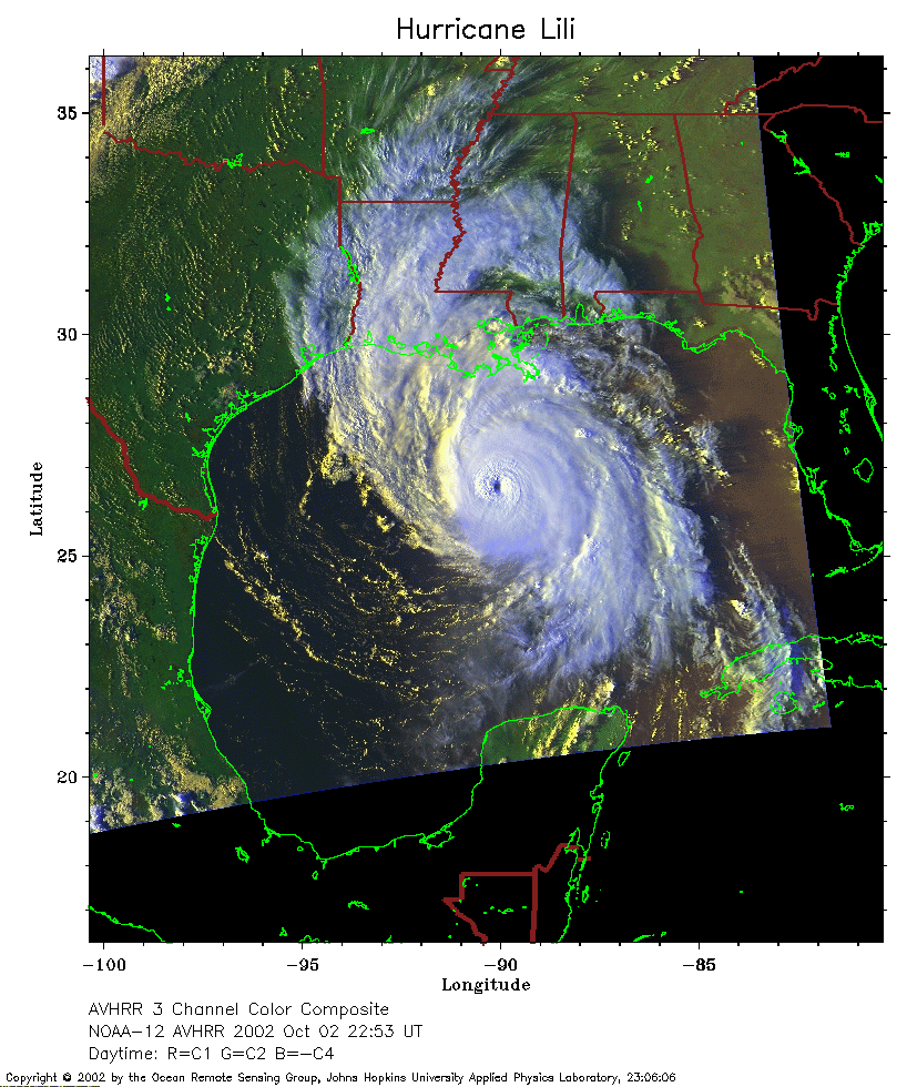 2002 October 2 22:53 UT
NOAA-12 satellite AVHRR 3 channel color composite evening image.
A closer view (287 Kb) is seen by clicking on this small image.
The maximum sustained winds have increased to 140 mph.
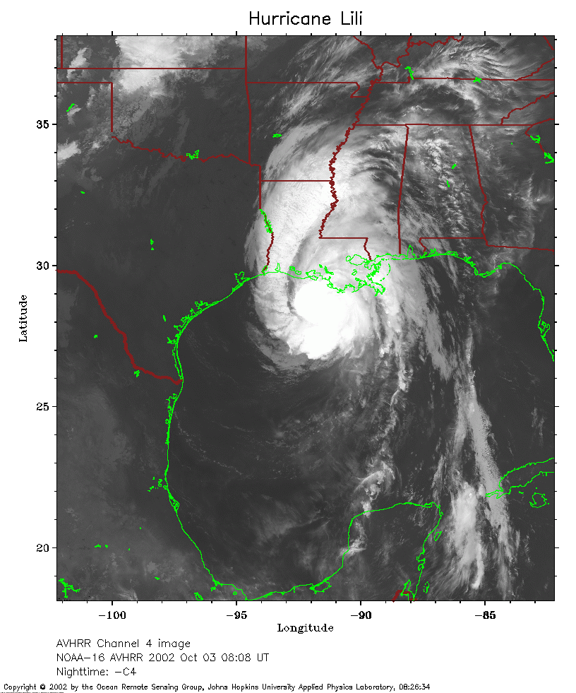 2002 October 3 08:08 UT
NOAA-16 satellite AVHRR channel 4 early morning image.
A closer view (262 Kb) is seen by clicking on this small image.
The maximum sustained winds have decreased to 135 mph.
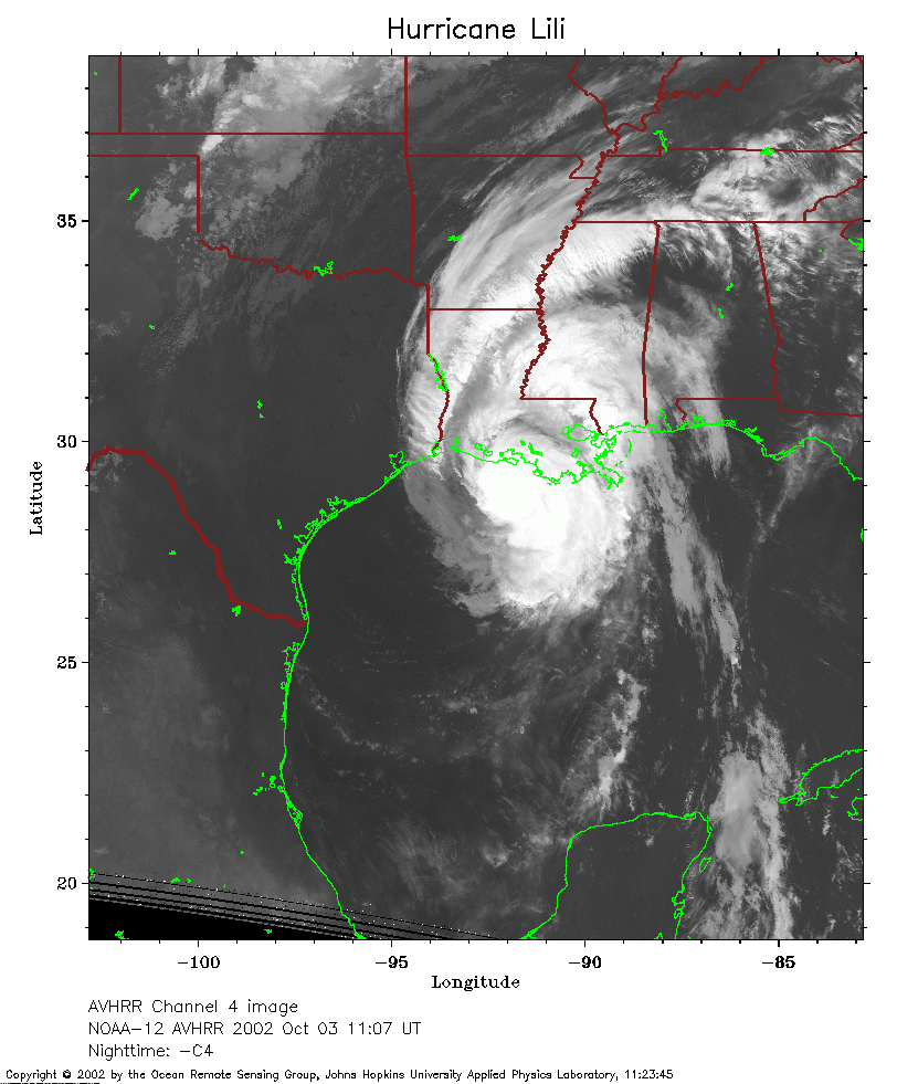 2002 October 3 11:07 UT
NOAA-12 satellite AVHRR channel 4 early morning image.
A closer view (255 Kb) is seen by clicking on this small image.
The maximum sustained winds have decreased to 100 mph.
 2002 October 3 19:36 UT
NOAA-16 satellite AVHRR 3 channel color composite afternoon image.
A closer view (376 Kb) is seen by clicking on this small image.
The maximum sustained winds have decreased to 70 mph.
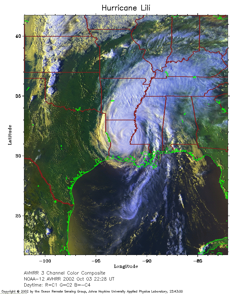 2002 October 3 22:28 UT
NOAA-12 satellite AVHRR 3 channel color composite evening image.
A closer view (375 Kb) is seen by clicking on this small image.
The maximum sustained winds have decreased to 50 mph.
 2002 October 4 07:57 UT
NOAA-16 satellite AVHRR channel 4 early morning image.
A closer view (253 Kb) is seen by clicking on this small image.
The maximum sustained winds have decreased to 40 mph.
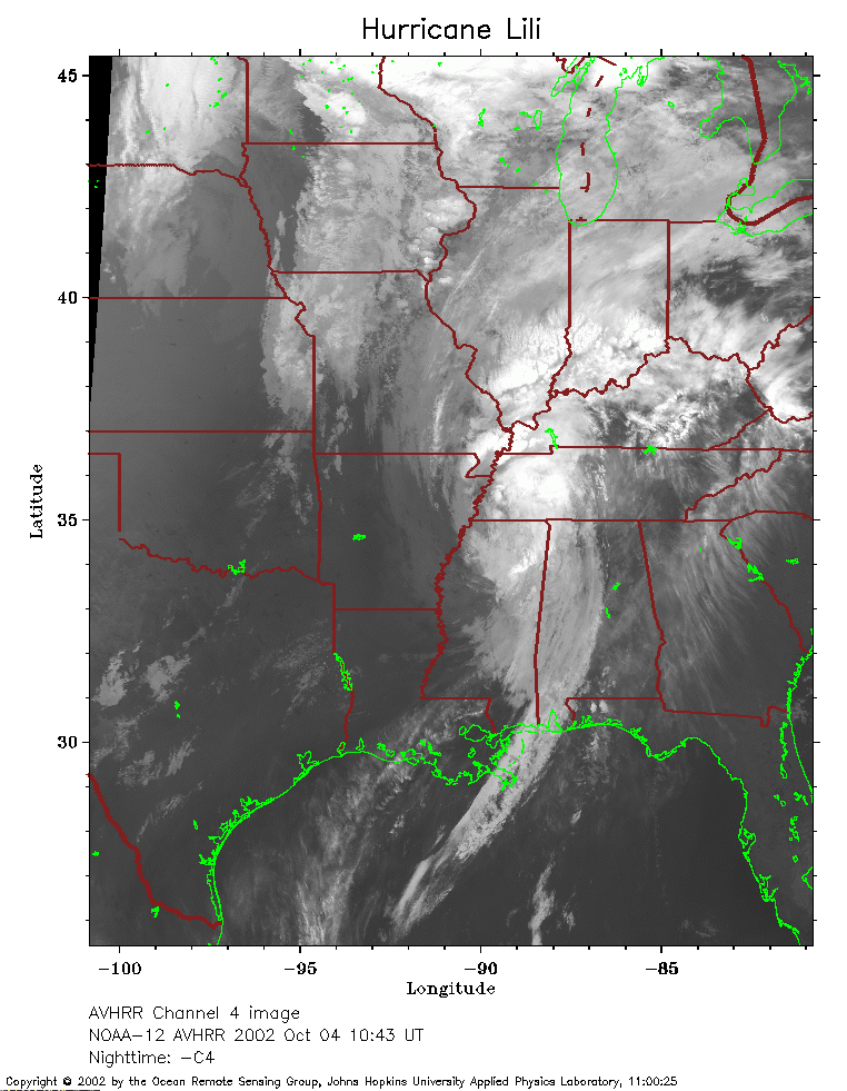 2002 October 4 10:43 UT
NOAA-12 satellite AVHRR channel 4 morning image.
A closer view (246 Kb) is seen by clicking on this small image.
The maximum sustained winds have decreased to 35 mph.