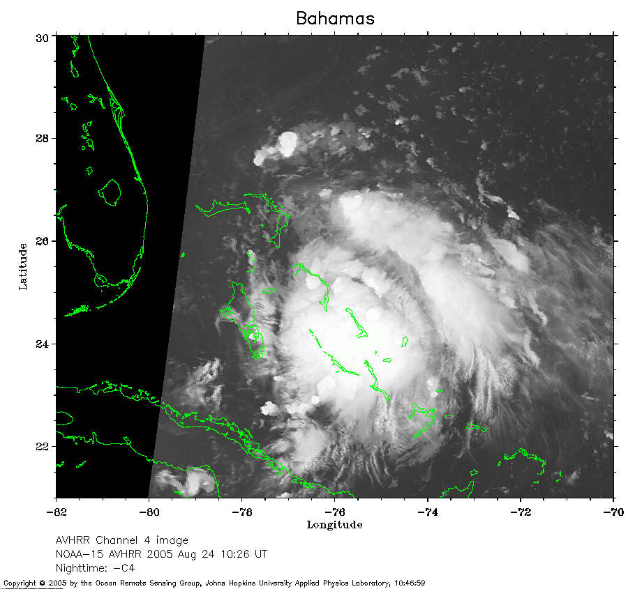
 2005 August 24 10:26 UT
NOAA-15 satellite AVHRR channel 4 early morning image.
A closer view (202 Kb) is seen by clicking on this small image.
The maximum sustained winds are 35 mph.
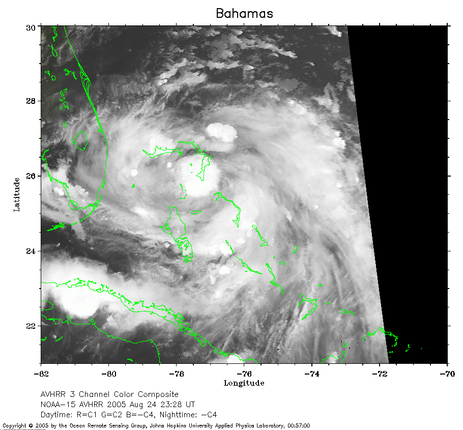 2005 August 24 23:28 UT
NOAA-15 satellite AVHRR channel 4 nighttime image.
A closer view (272 Kb) is seen by clicking on this small image.
The maximum sustained winds have increased to 45 mph.
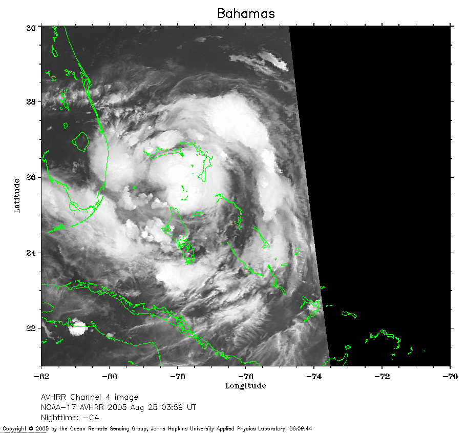 2005 August 25 03:59 UT
NOAA-17 satellite AVHRR channel 4 nighttime image.
A closer view (186 Kb) is seen by clicking on this small image.
The maximum sustained winds have increased to 50 mph.
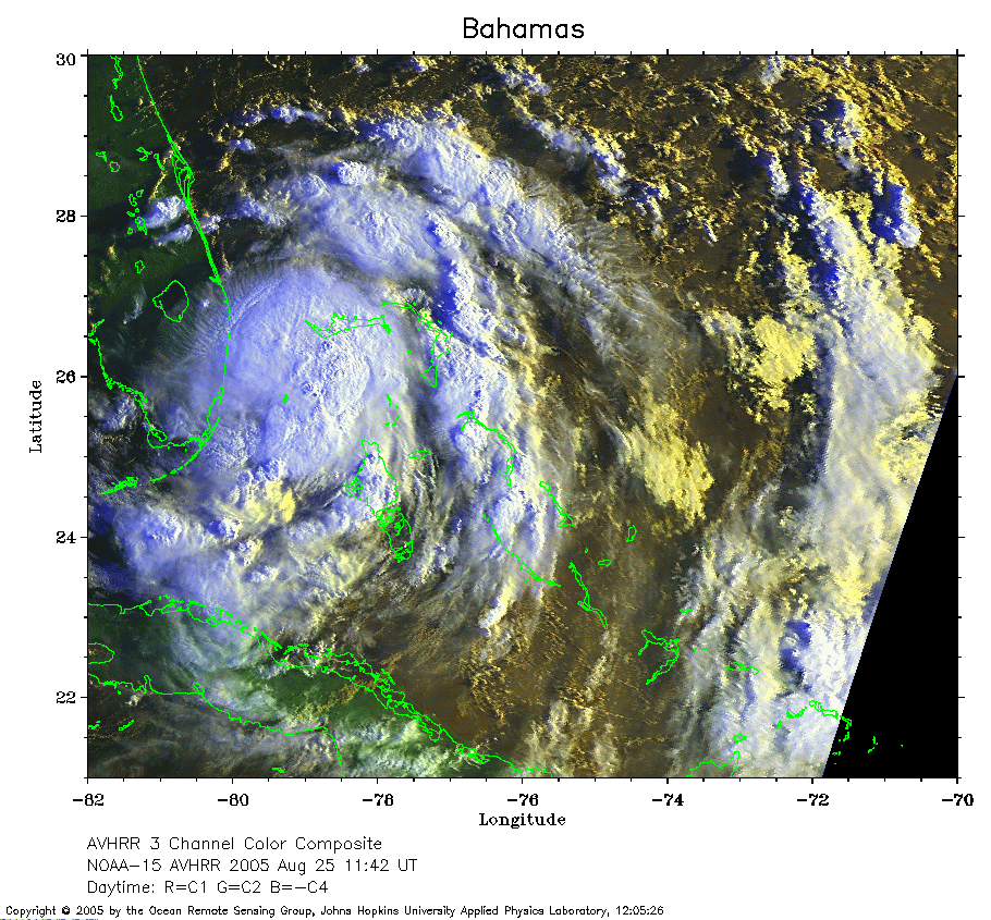 2005 August 25 11:42 UT
NOAA-15 satellite AVHRR 3 channel color composite morning image.
A closer view (382 Kb) is seen by clicking on this small image.
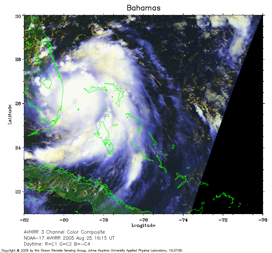 2005 August 25 16:15 UT
NOAA-17 satellite AVHRR 3 channel color composite daytime image.
A closer view (279 Kb) is seen by clicking on this small image.
The maximum sustained winds have increased to 60 mph.
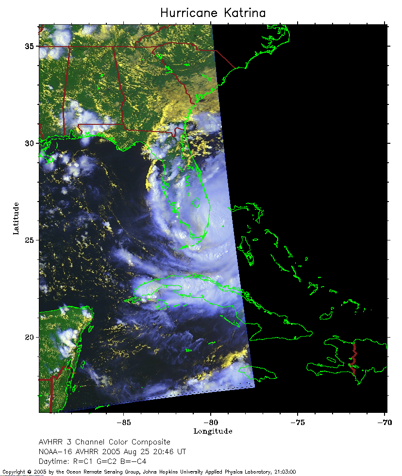 2005 August 25 20:46 UT
NOAA-16 satellite AVHRR 3 channel color composite daytime image.
A closer view (216 Kb) is seen by clicking on this small image.
The maximum sustained winds have increased to 75 mph.
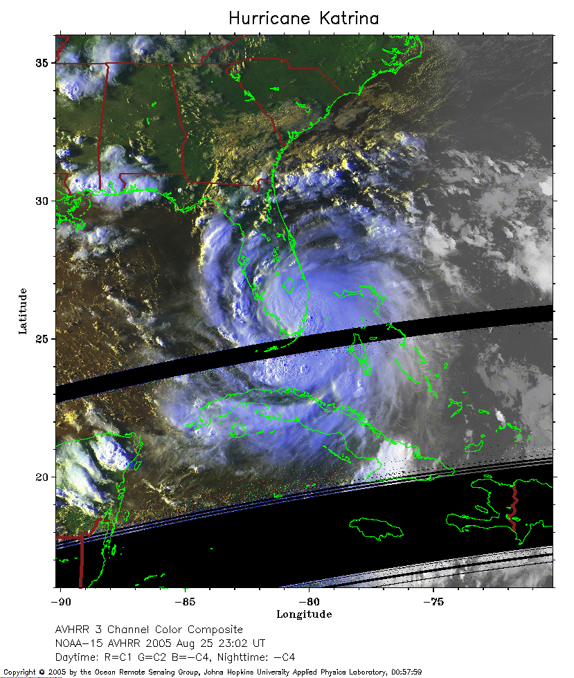 2005 August 25 23:02 UT
NOAA-15 satellite AVHRR 3 channel color composite evening image.
A closer view (293 Kb) is seen by clicking on this small image.
The maximum sustained winds have increased to 80 mph.
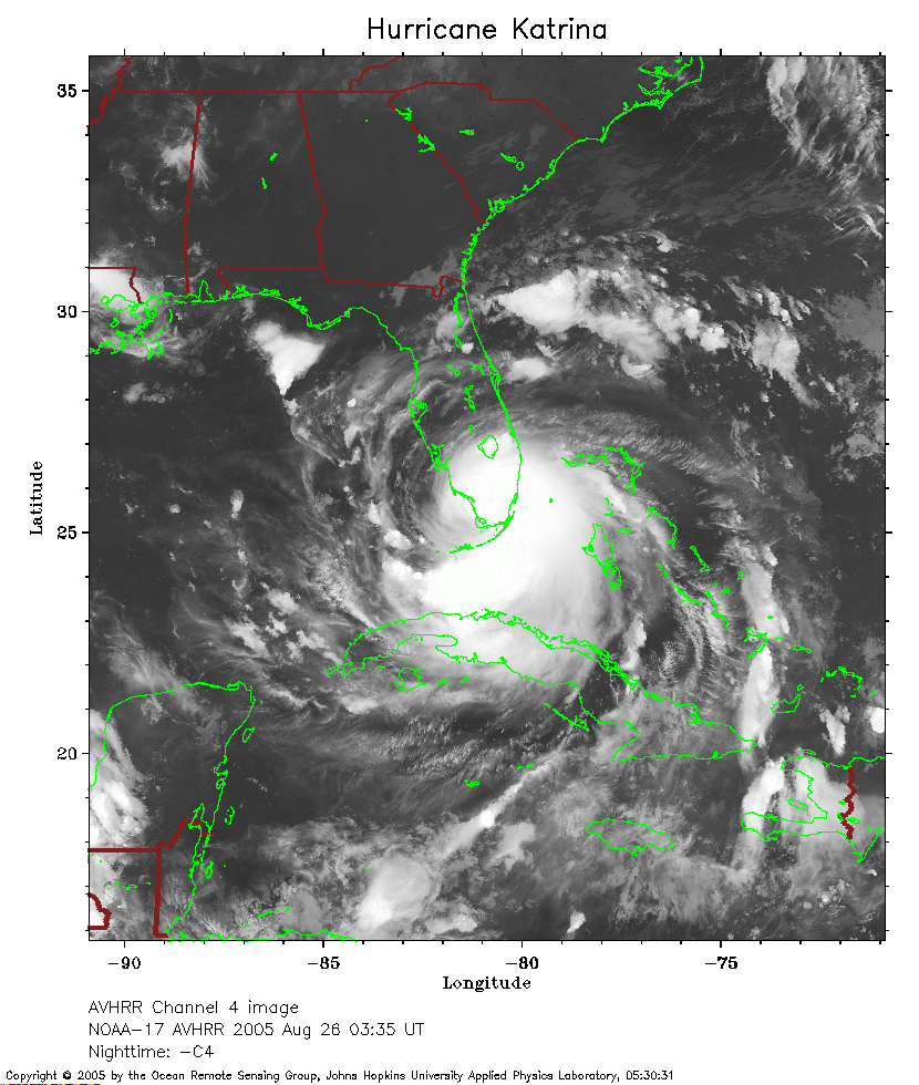 2005 August 26 03:35 UT
NOAA-17 satellite AVHRR channel 4 nighttime image.
A closer view (298 Kb) is seen by clicking on this small image.
The maximum sustained winds have decreased to 75 mph.
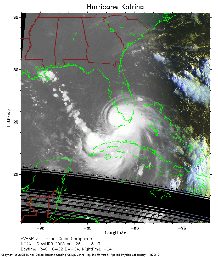 2005 August 26 11:18 UT
NOAA-15 satellite AVHRR 3 channel color composite early morning image.
A closer view (237 Kb) is seen by clicking on this small image.
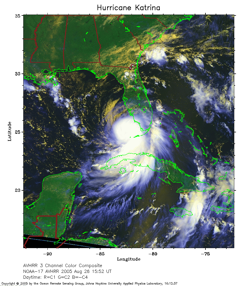 2005 August 26 15:52 UT
NOAA-17 satellite AVHRR 3 channel color composite daytime image.
A closer view (356 Kb) is seen by clicking on this small image.
The maximum sustained winds have increased to 100 mph.
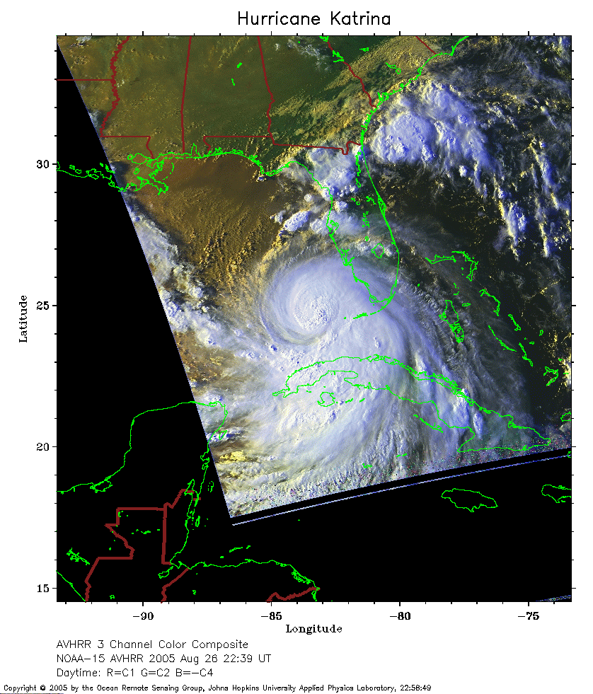 2005 August 26 22:39 UT
NOAA-15 satellite AVHRR 3 channel color composite daytime image.
A closer view (268 Kb) is seen by clicking on this small image.
 2005 August 27 03:12 UT
NOAA-17 satellite AVHRR channel 4 nighttime image.
A closer view (275 Kb) is seen by clicking on this small image.
The maximum sustained winds have increased to 105 mph.
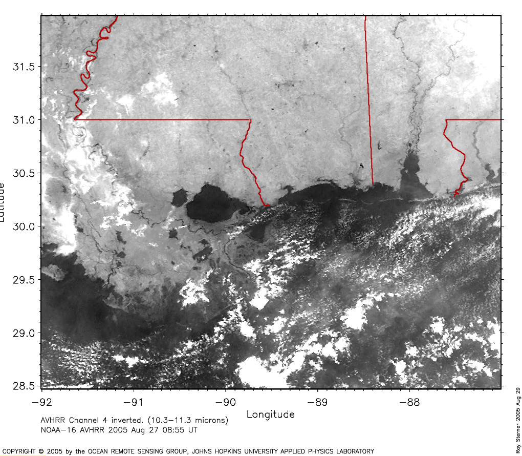
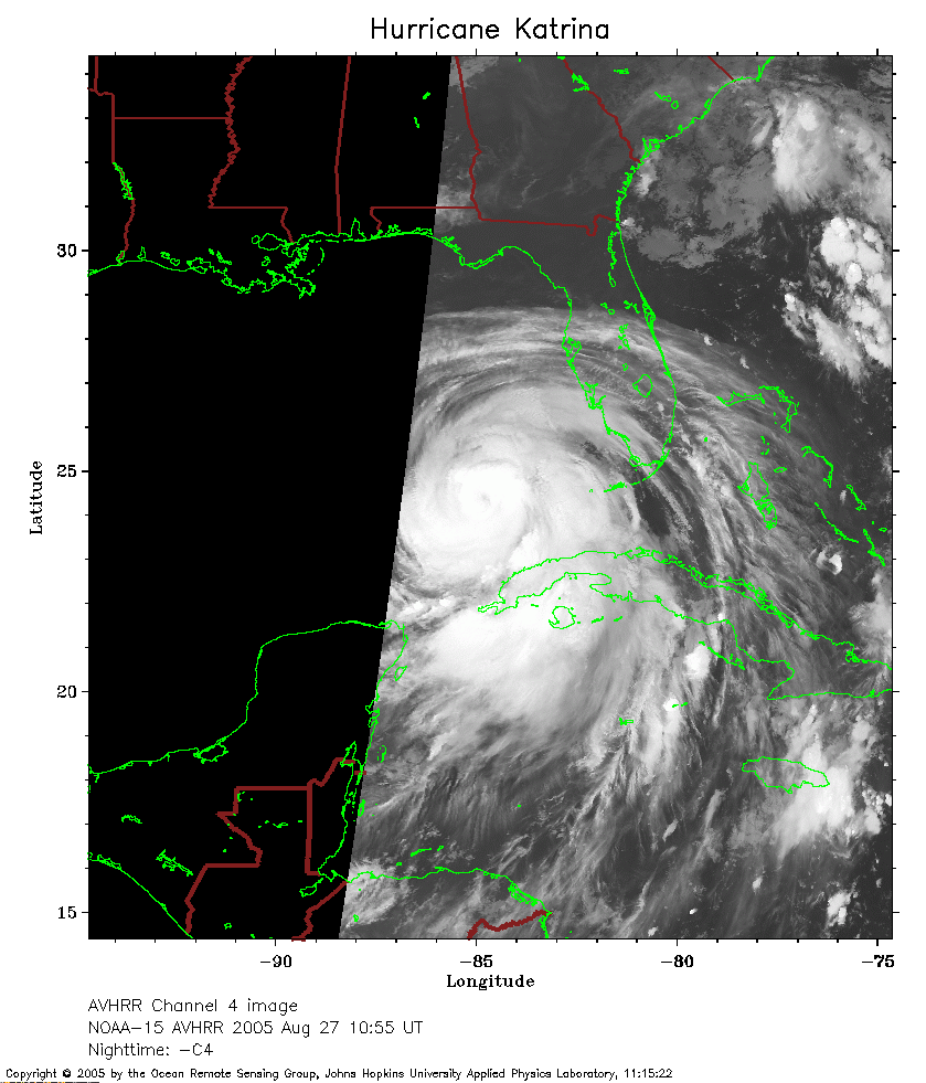 2005 August 27 10:55 UT
NOAA-15 satellite AVHRR channel 4 early morning image.
A closer view (211 Kb) is seen by clicking on this small image.
The maximum sustained winds have increased to 115 mph.
A New Orleans image
(455Kb) from the 0855 UT pass of NOAA-16 shows the city
on the Mississippi River as Katrina's cloud
shield approachs. This image was made by Ray Sterner.
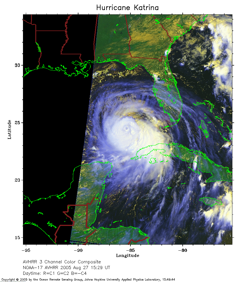 2005 August 27 15:29 UT
NOAA-17 satellite AVHRR 3 channel color composite daytime image.
A closer view (285 Kb) is seen by clicking on this small image.
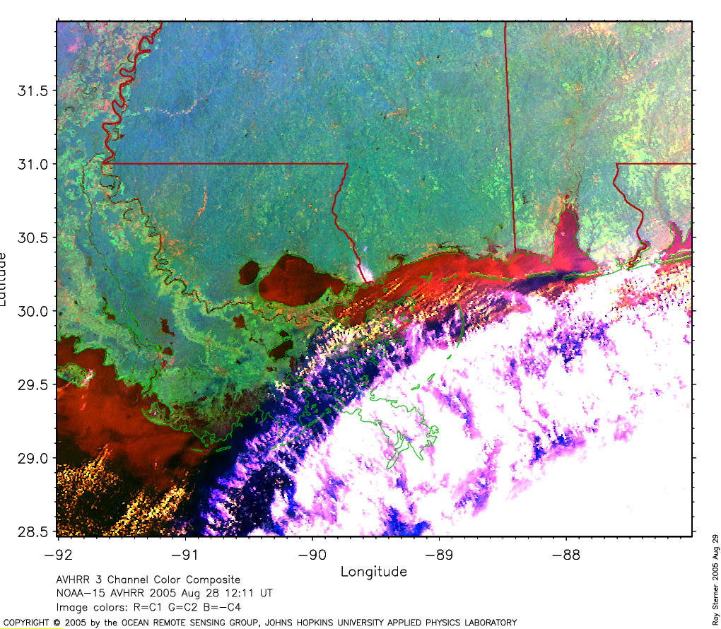
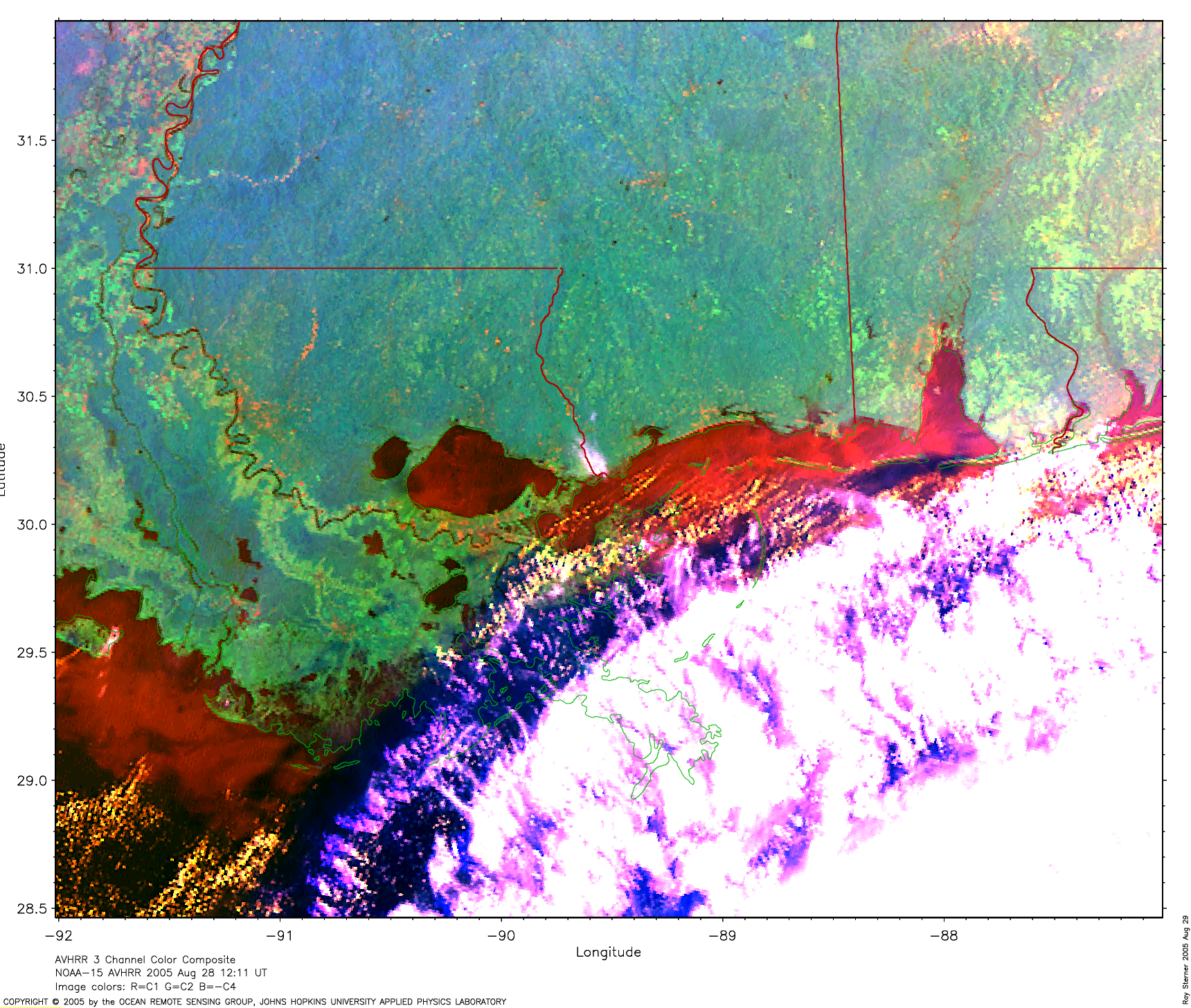
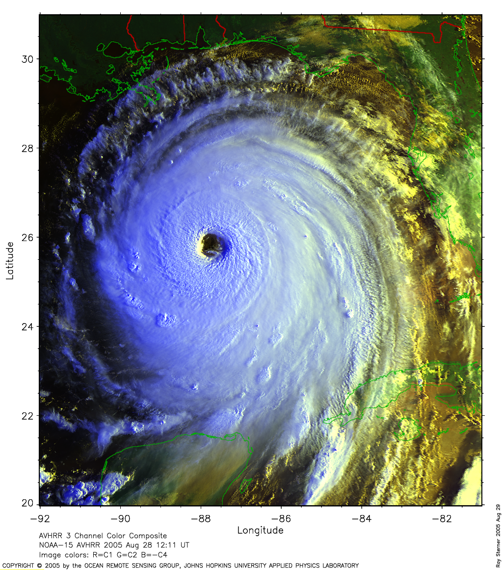
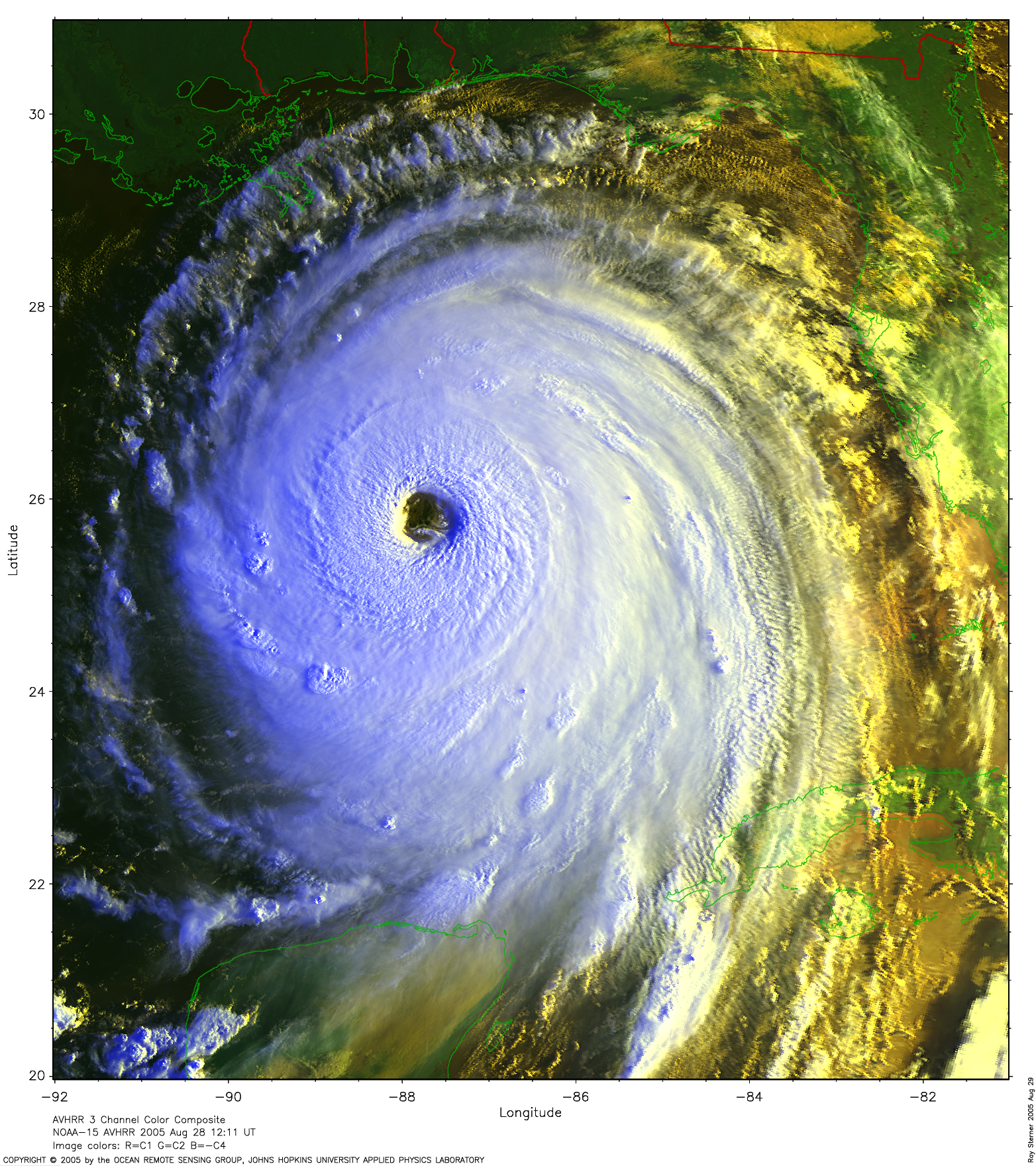
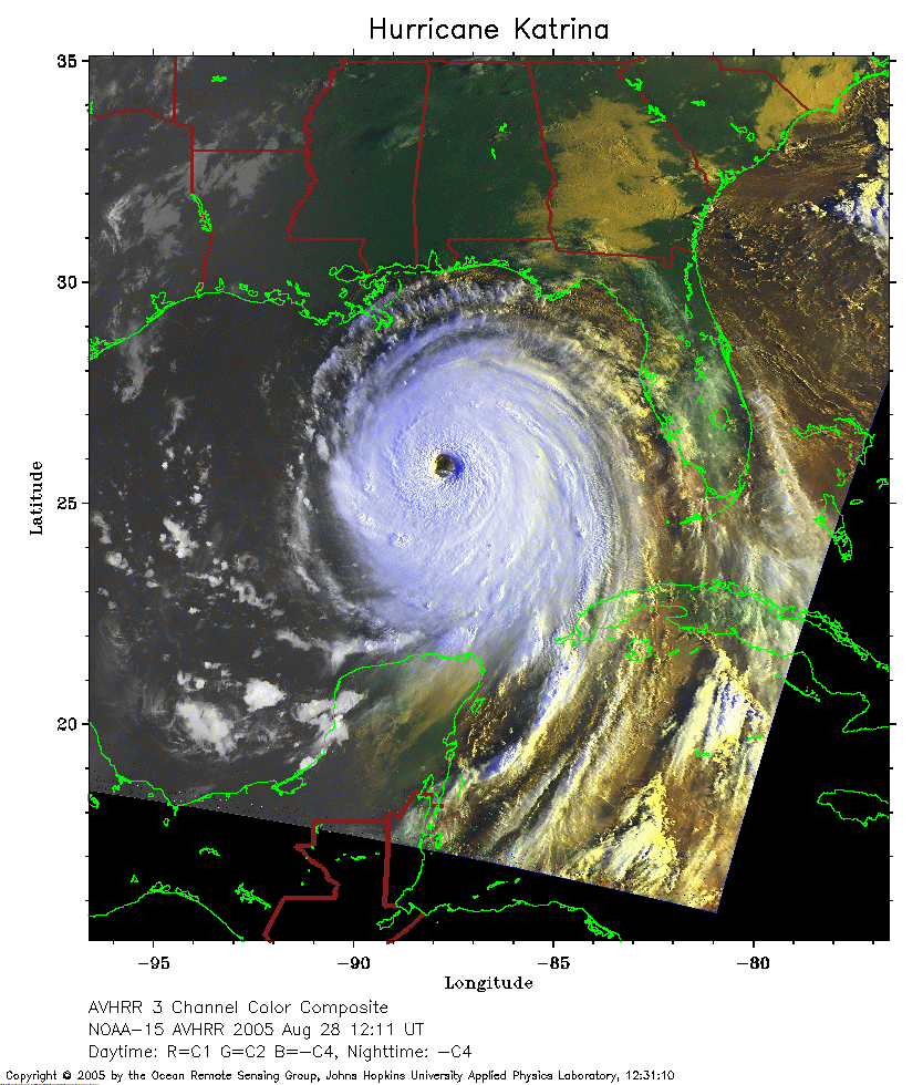 2005 August 28 12:11 UT
NOAA-15 satellite AVHRR 3 channel color composite daytime image.
A closer view (317 Kb) is seen by clicking on this small image.
The maximum sustained winds have increased to 160 mph.
A New Orleans image
(709 Kb) shows the city on the Mississippi River as Katrina's cloud
shield approachs (image made by Ray Sterner).
A larger New
Orleans image
(1290 Kb) shows the city on the Mississippi River as Katrina's cloud
shield approachs (image made by Ray Sterner).
A larger image
(1776 Kb) of Katrina is available (image made by Ray Sterner).
A very large image
(3679 Kb) of Katrina is also available (image made by Ray Sterner).
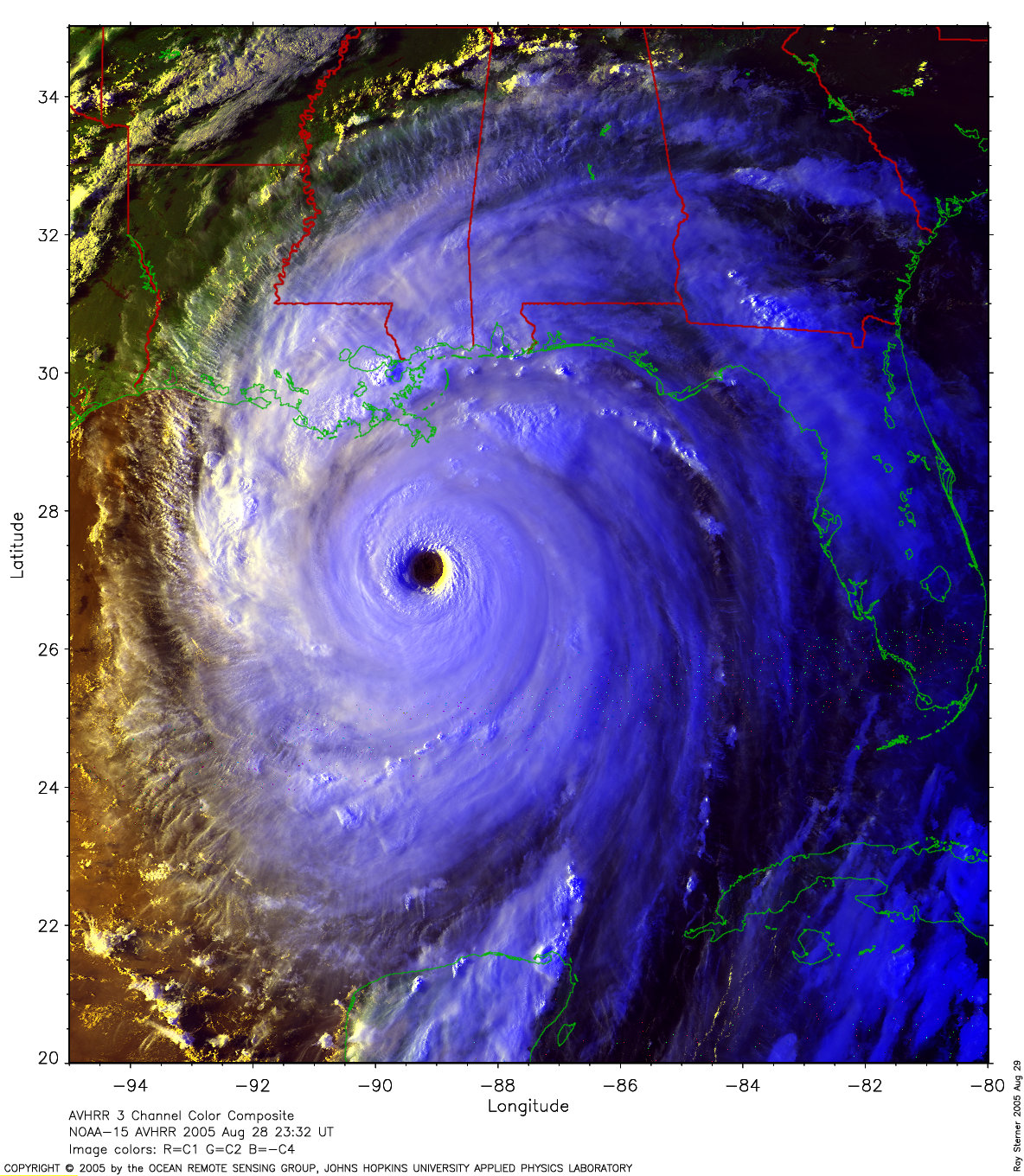
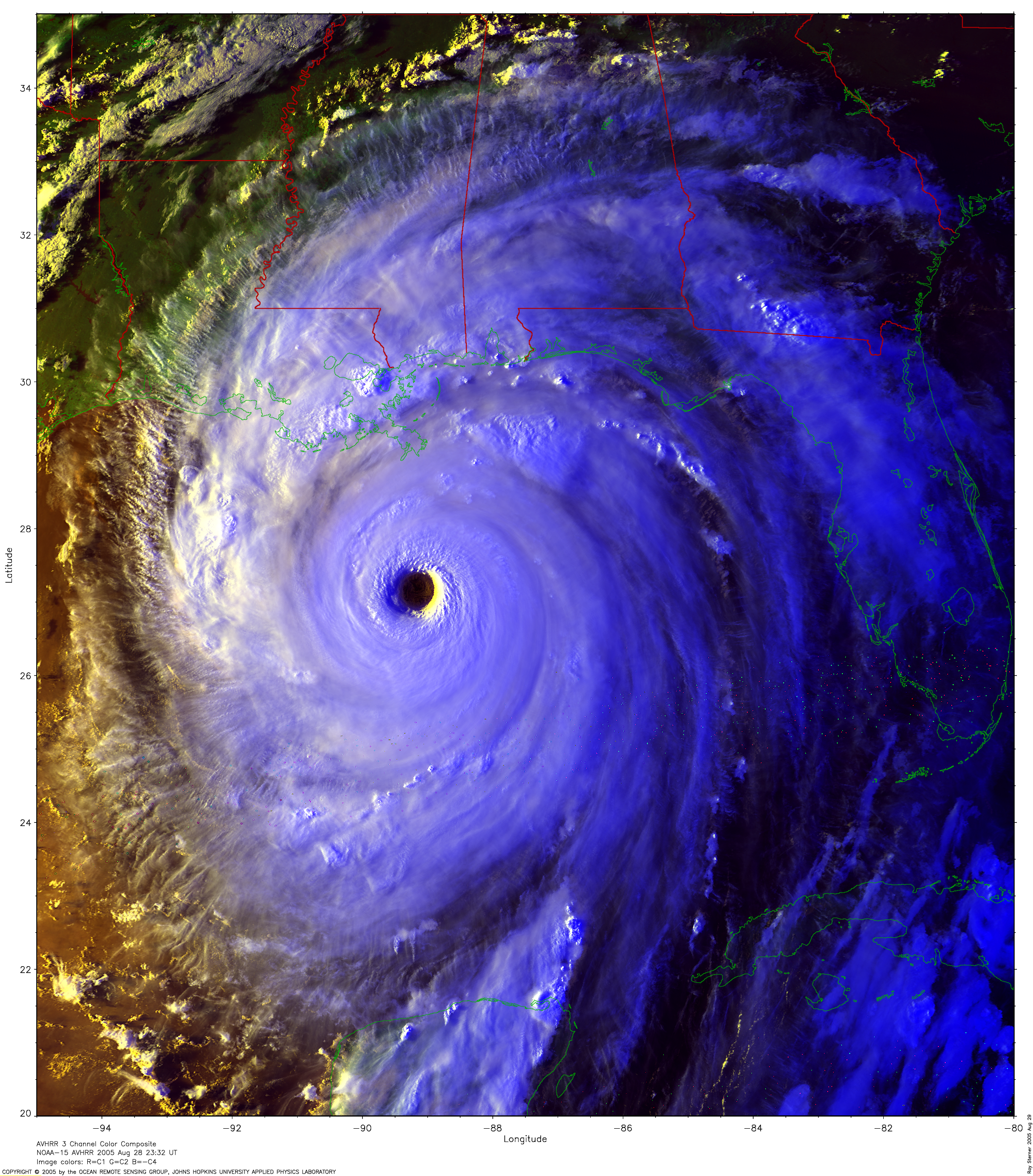
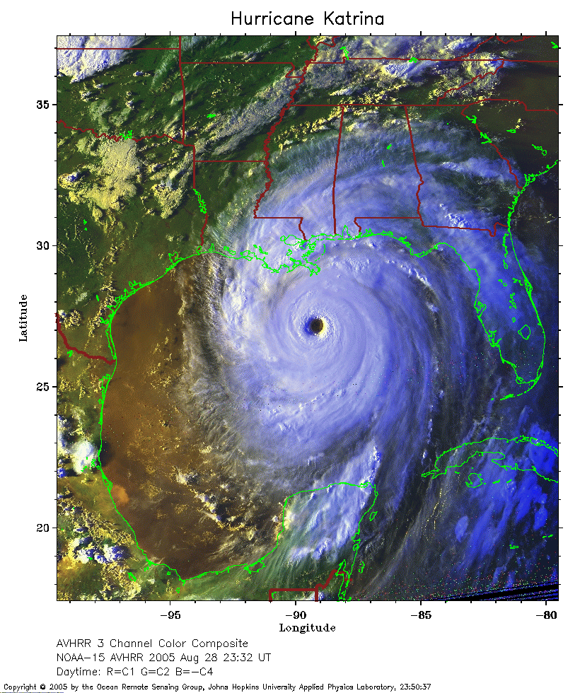 2005 August 28 23:32 UT
NOAA-15 satellite AVHRR 3 channel color composite daytime image.
A closer view (361 Kb) is seen by clicking on this small image.
The maximum sustained winds have increased to 165 mph.
A larger image
(2327 Kb) of Katrina is available (image made by Ray Sterner).
A very large image
(6875 Kb) of Katrina is also available (image made by Ray Sterner).
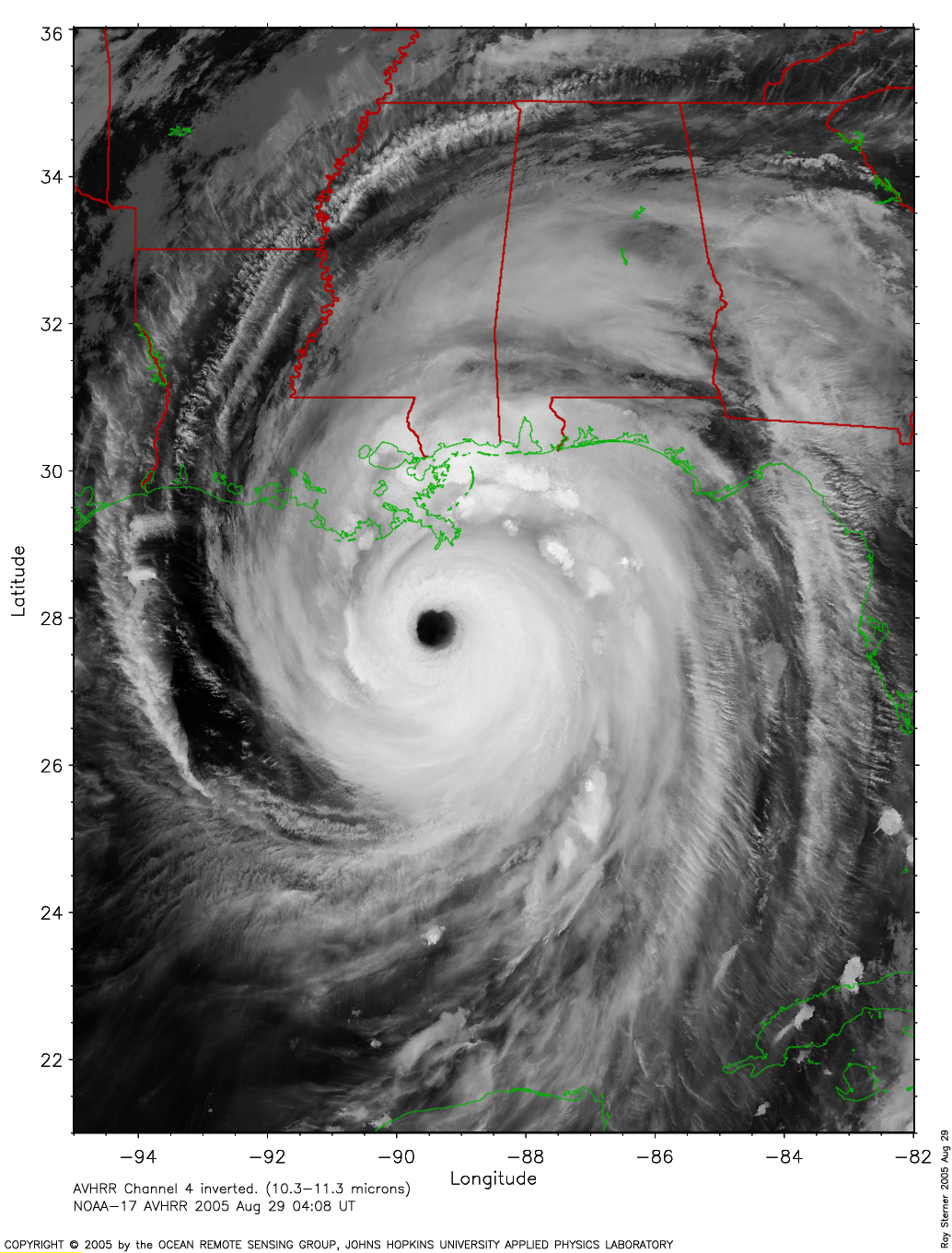
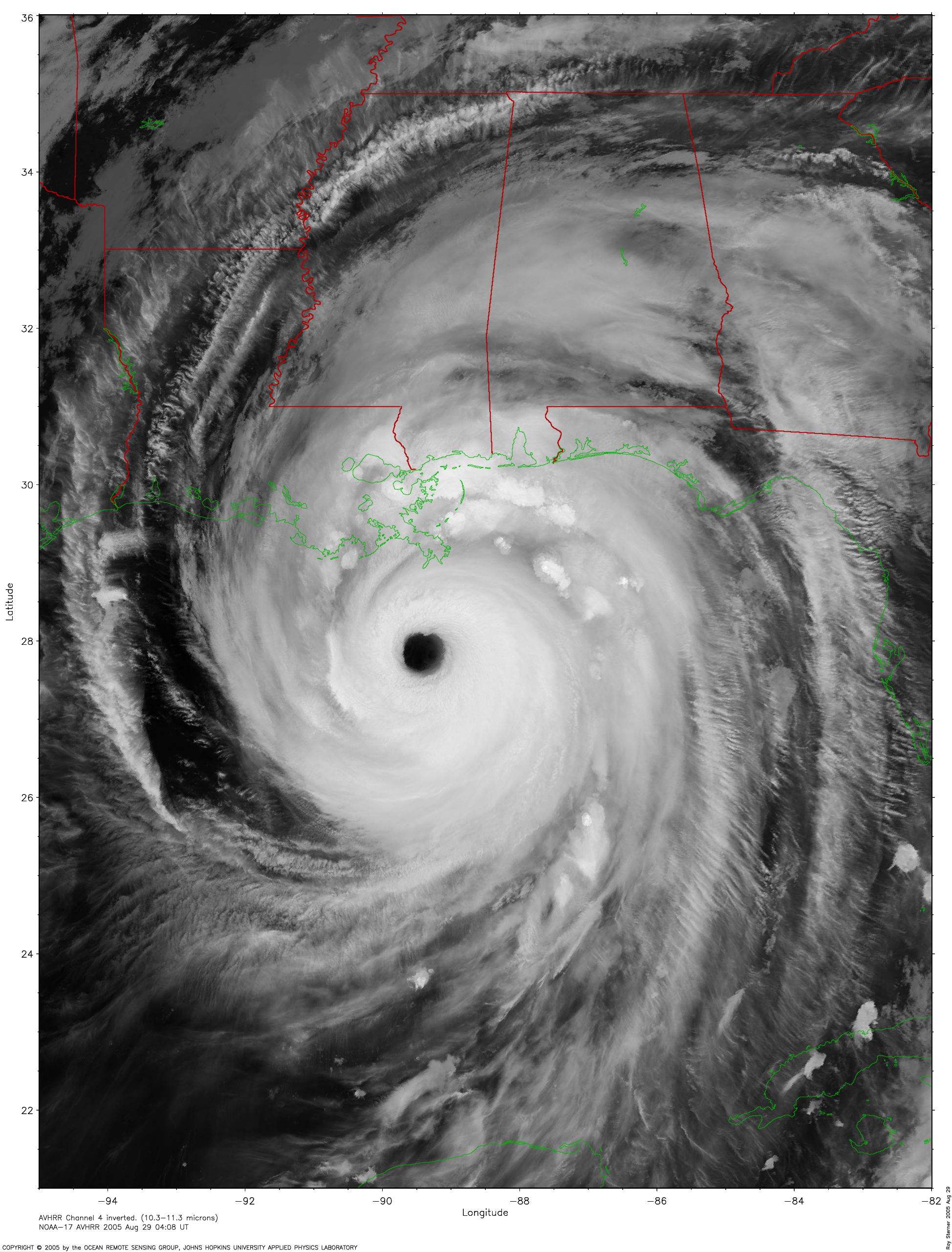
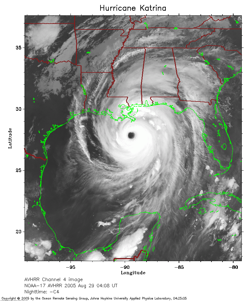 2005 August 29 04:08 UT
NOAA-17 satellite AVHRR channel 4 nighttime image.
A closer view (298 Kb) is seen by clicking on this small image.
The maximum sustained winds have decreased to 160 mph.
A larger image
(1155 Kb) of Katrina is available (image made by Ray Sterner).
A very large image
(3182 Kb) of Katrina is also available (image made by Ray Sterner).
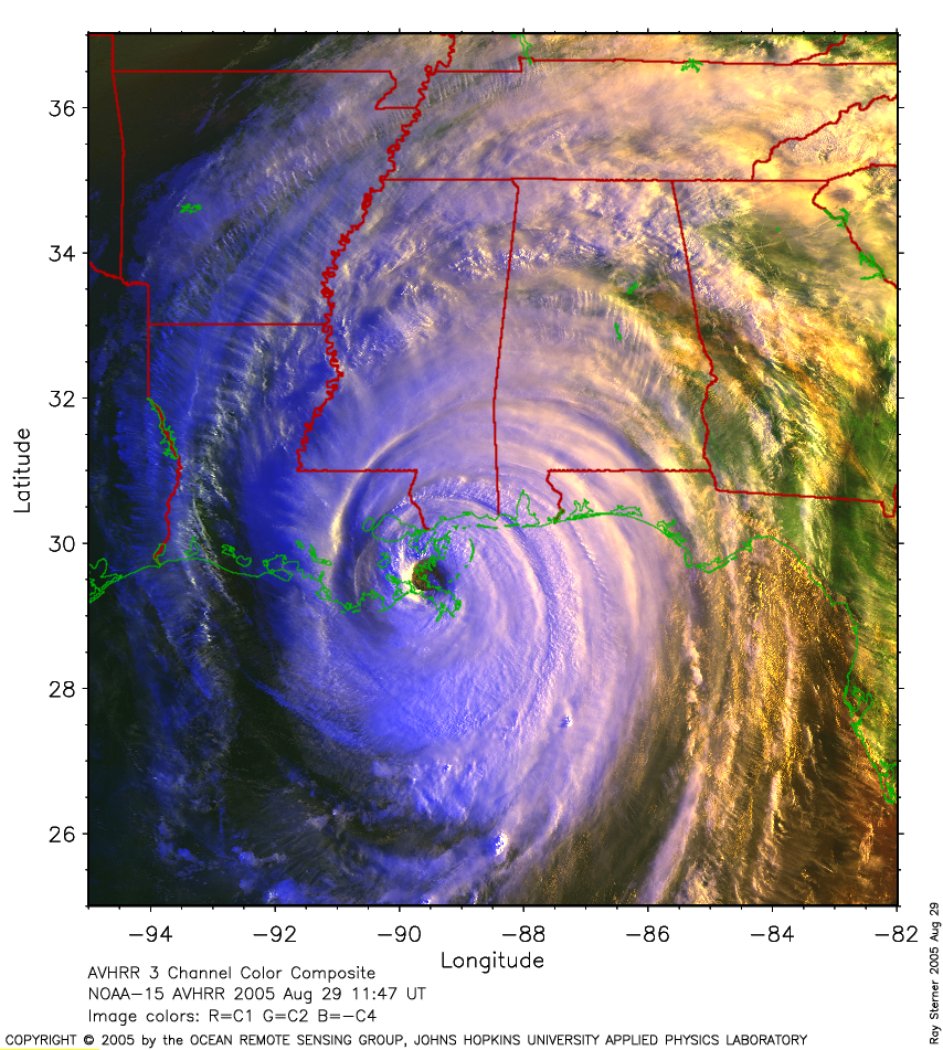
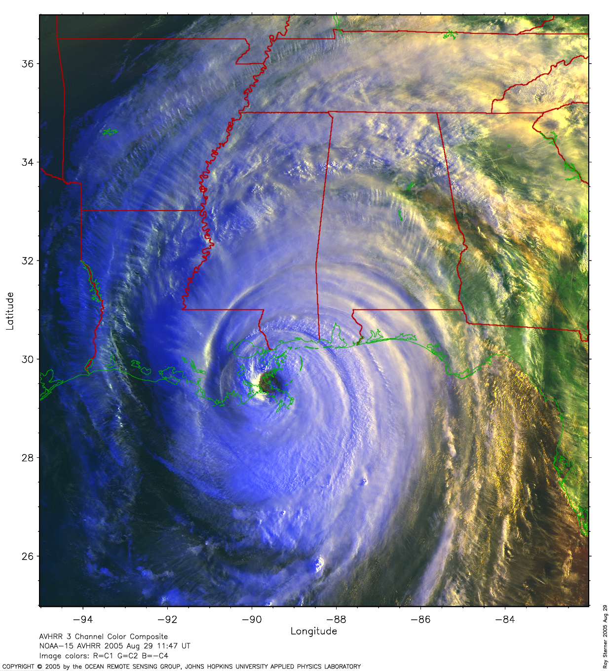
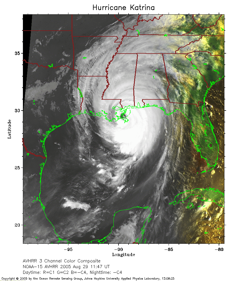 2005 August 29 11:47 UT
NOAA-15 satellite AVHRR 3 channel color composite morning image.
A closer view (298 Kb) is seen by clicking on this small image.
The maximum sustained winds have decreased to 145 mph.
A larger image
(1163 Kb) of Katrina is available (image made by Ray Sterner).
A very large image
(2405 Kb) of Katrina is also available (image made by Ray Sterner).
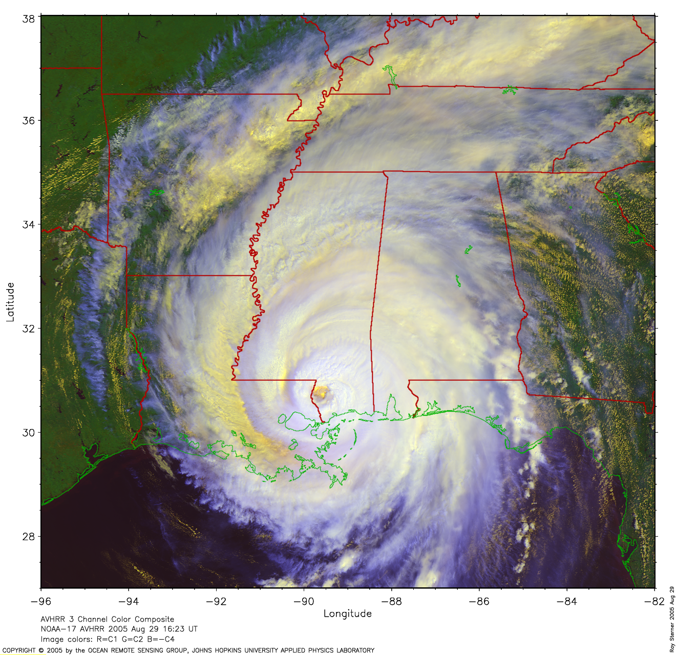
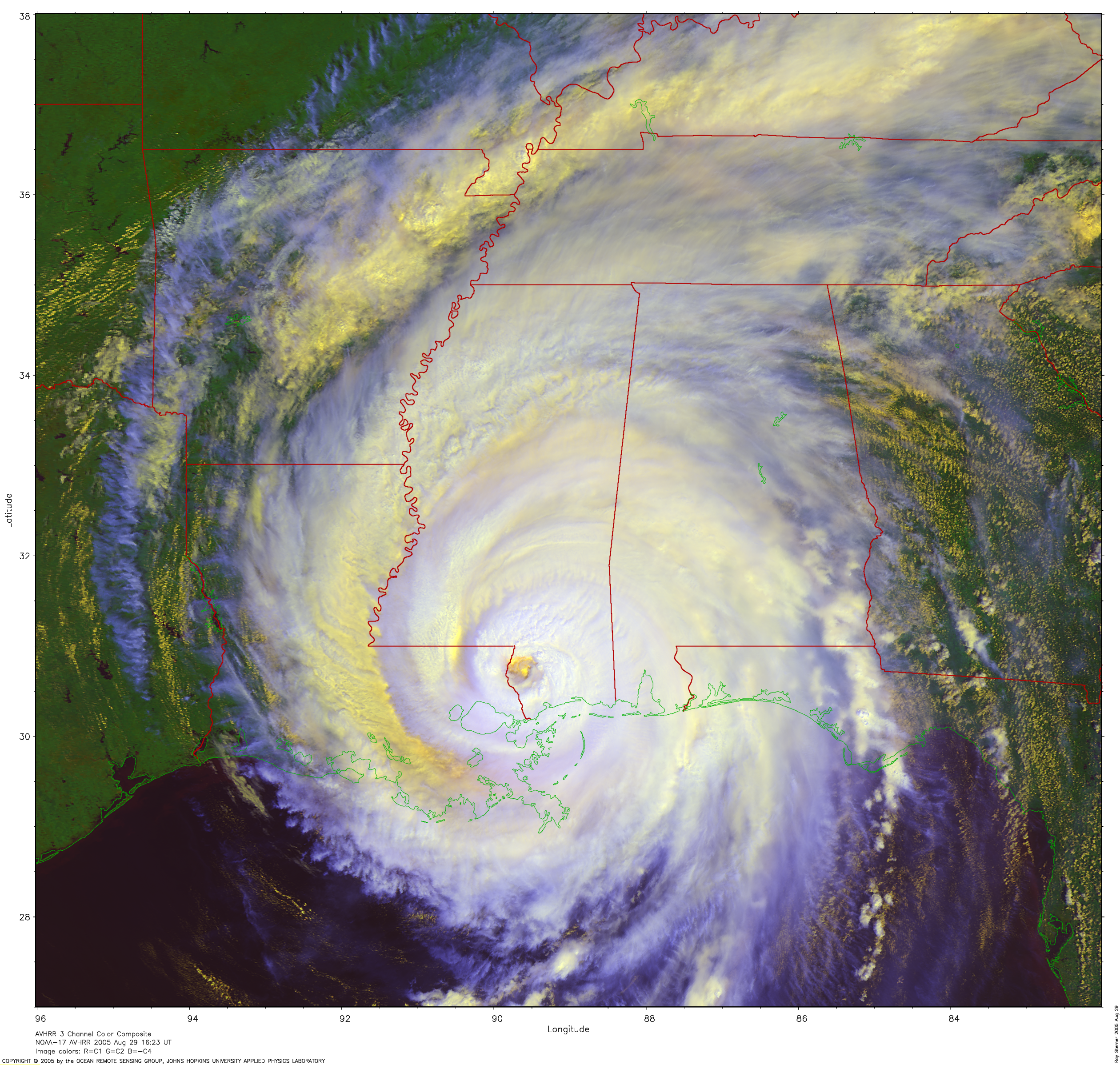
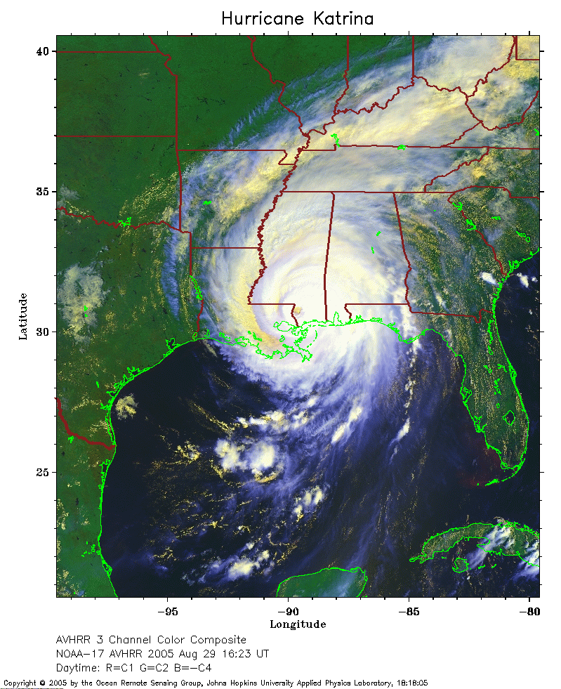 2005 August 29 16:23 UT
NOAA-17 satellite AVHRR 3 channel color composite daytime image.
A closer view (335 Kb) is seen by clicking on this small image.
The maximum sustained winds have decreased to 125 mph.
A larger image
(2291 Kb) of Katrina is available (image made by Ray Sterner).
A very large image
(5712 Kb) of Katrina is also available (image made by Ray Sterner).
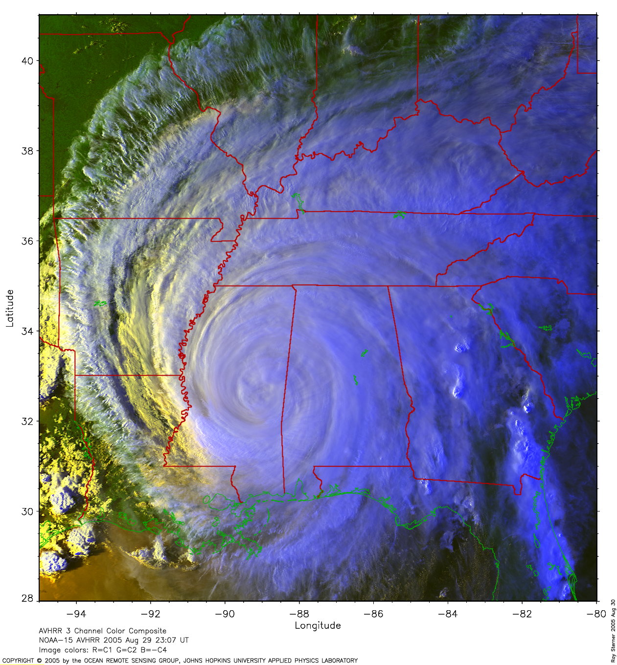
 2005 August 29 23:07 UT
NOAA-15 satellite AVHRR 3 channel color composite evening image.
A closer view (308 Kb) is seen by clicking on this small image.
The maximum sustained winds have decreased to 75 mph.
A larger image
(2401 Kb) of Katrina is available (image made by Ray Sterner).
A very large image
(5226 Kb) of Katrina is also available (image made by Ray Sterner).
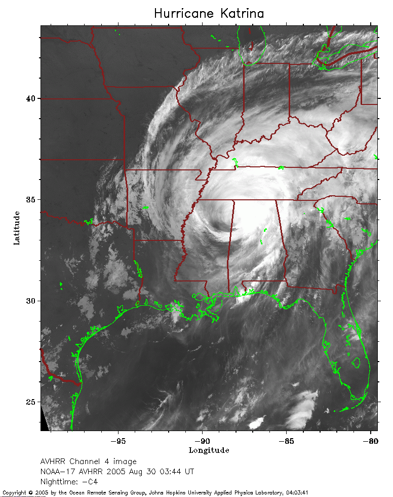 2005 August 30 03:44 UT
NOAA-17 satellite AVHRR channel 4 nighttime image.
A closer view (262 Kb) is seen by clicking on this small image.
The maximum sustained winds have decreased to 60 mph.
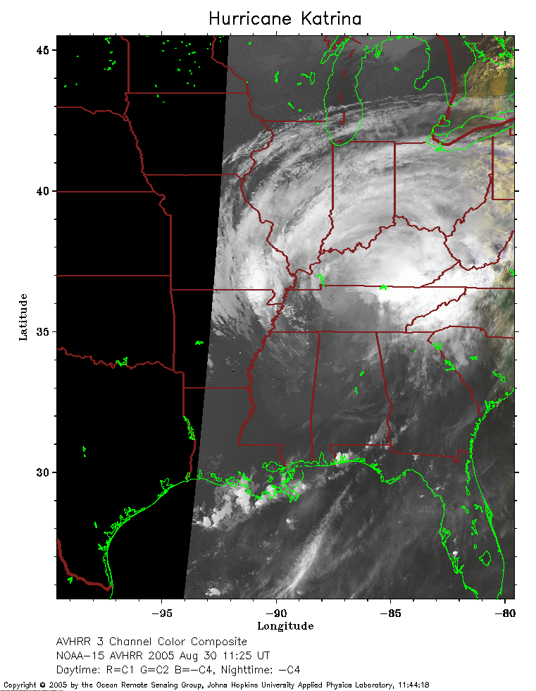 2005 August 30 11:25 UT
NOAA-15 satellite AVHRR channel 4 early morning image.
A closer view (173 Kb) is seen by clicking on this small image.
The maximum sustained winds have decreased to 50 mph.