|
|
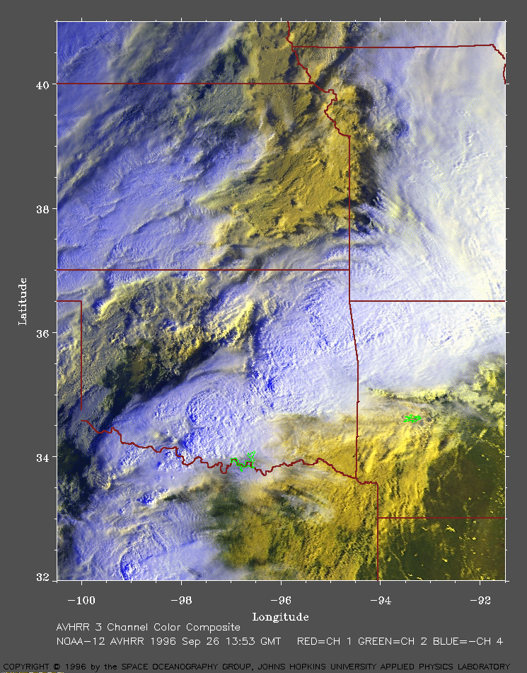
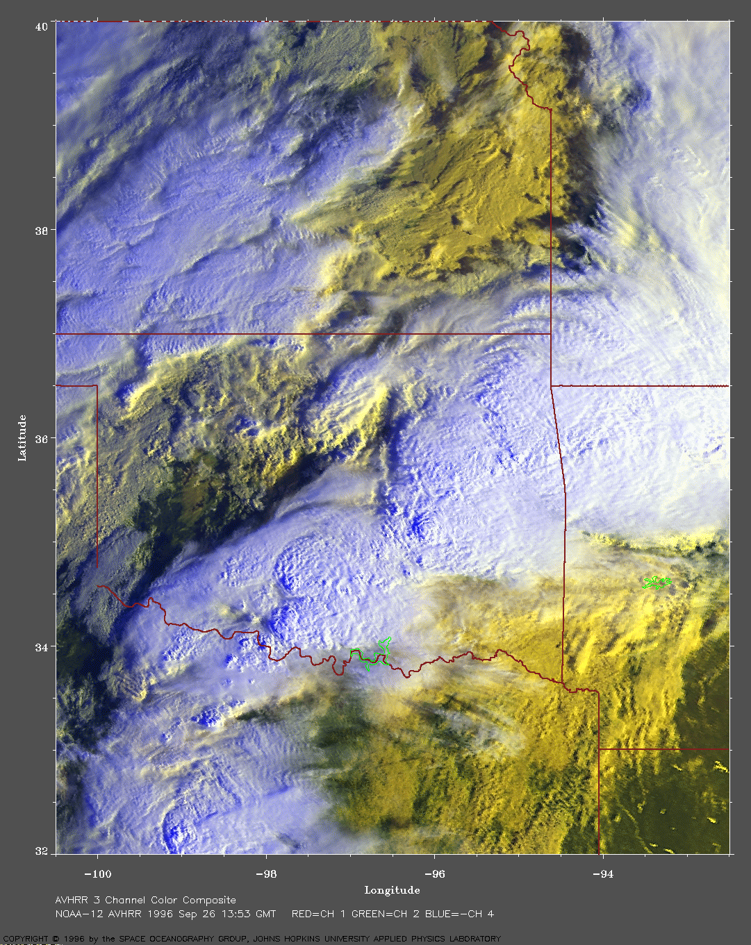
Southern plains of the U.S. on Sep 26, 1996
In this image, the warmer (and lower) clouds are yellow. The cooler (and higher) clouds are white. |
|
The clouds in this image are aligned
along a strong but very slow moving cold
front trailing toward the southwest from a
low pressure center located
over north central Missouri. To the south of this cold front is a mass of
warm air from the Gulf of Mexico. This warm air is very moist with
dew points of about 70 F. To the north of
this cold front is a mass of cool dryer air from Canada. Where the warm
moist air is pushed above this cool dryer air, clouds form. The
convergence of these
air masses along the front results in lifting and a
cyclonic circulation at the surface.
The image shows numerous cumulonimbus clouds developing along and on the southeastern side of the cold front. Some of these clouds have tops up to 50,000 ft. The air is very unstable with the 00~UTC sounding from Little Rock, AR, indicating a CAPE of around 2500 J/kg and the 00~UTC sounding from Ft.\ Worth, TX, giving a CAPE of more than 3000 J/kg. A southerly low-level jet of 50 knot winds from the Gulf of Mexico provides sufficient wind shear for the development of severe thunderstorms. These thunderstorms are part of a large MCS located just ahead of the cold front and approaching the Arkansas-Louisiana-Texas border. The National Weather Service issued a tornado watch for southeast Oklahoma, northeast Texas, and western and central Arkansas at 1645 UTC. This line of clouds produced severe thunderstorms with heavy rain. Parts of northwest Arkansas received 3-6 inches of rainfall. Rainfall rates of 1-2 inches per hour were measured by Doppler radar in some areas. Flash flood warnings were issude for central and northeast Oklahoma, Arkansas, and southwest Missouri. Radar showed several persistent mesocyclones and brief tornadoes were reported in Texas. One inch hail and three tornadoes were reported in Arkansas. Note the cloud shadows. From the date and time and the length of a shadow, you should be able to estimate the height of the cloud. Click here for A VERY LARGE image of this storm system (921 Kb). |
To return to the index page, click here |