|
|
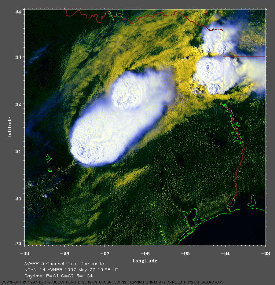
Texas on May 27, 1997
In this image, the warmer (and lower) clouds are yellow. The cooler (and higher) clouds are white. |
|
At 130 am CDT, the National Weather Service reported that a slow moving upper
level trough over the central U.S. was interacting
with a slow moving weak
cold front associated with a low pressure area
moving toward southern Missouri. Also at this time, high
dew points in the upper 60's F were being
measured across eastern Texas ahead of a
dry line. Because moist air is
less dense than dry air, this makes the atmosphere very
unstable. As the day
progressed, this upper trough became
negatively tilted resulting in a
diffluent pattern that enhanced the low level
convergence .
A 30 to 40
knot westerly mid-level flow was also available to provide wind shear.
Despite hazy skies, surface heating was strong and a nighttime
capping
inversion was weakening. The stage was set for severe thunderstorms .
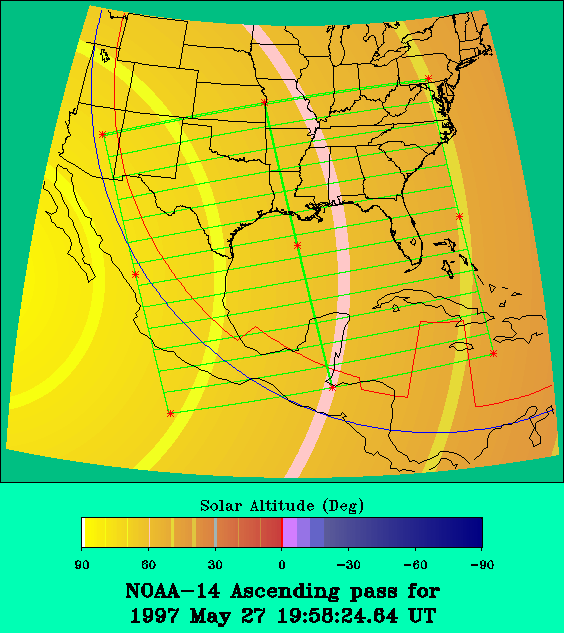
By 2 pm CDT, surface dew points ahead of the cold front had reached the mid-70's F. Surface-based CAPES were determined to be over 3000 J/kg. Tornado watches had been issued. Clusters of cumulonimbus clouds are seen in this image developing along the cold front. Some of these clouds have tops of around 55,000 feet altitude. These clouds are forming mesoscale convective systems (MCS) At least two supercells developed which spawned several tornadoes . Just before 2 pm CDT, a tornado damaged several mobile homes and destroyed a house near Lorena, TX. Hail up to 2.75 inches in diameter was reported in Eddy, TX. Around 230 pm CDT, a tornado was reported in Belton, TX. At this time, hail up to 1.25 inches in diameter was reported near Tatum, TX. By about 4 pm CDT, surface heating had raised temperatures to near 90 F ahead of the cold front and surface-based CAPES had reached the 5000-7000 J/kg level. A tornado was reported in Cedar Park, TX, in northern Williamson County. Another tornado moved across Jarrell, TX, at around 4 pm CDT, producing extensive damage and fatalities. At one point, this tornado was nearly one-half mile wide. The associated MCS was slow moving and the heavy rainfall produced flooding. Hail in excess of golf ball size was also reported. Interstate highway 35 south of Temple, TX, was closed due to debris and heavy rain. After a preliminary survey of the damage, the National Weather Service estimated that the tornado that hit Jarrell was an F5 on the Fujita scale. Here is a map of the satellite ground track and sun angles courtesy of Ray Sterner. A very large view (930 Kb) is also available. |
For more interesting satellite AVHRR images, return to the index page. |
|
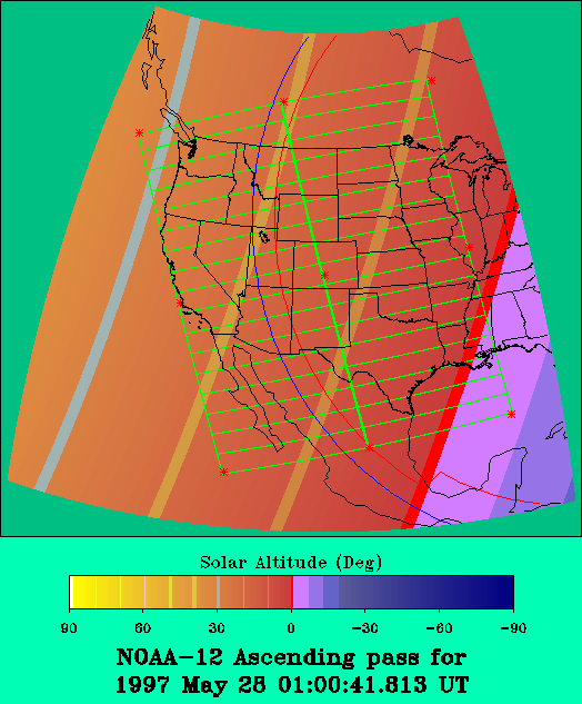
Another image (366 Kb) of the same region 5 hours later. Note that the sun angle is different. Here is a map of the satellite ground track and sun angles courtesy of Ray Sterner. |
Other information: Federal Emergency Management Agency |