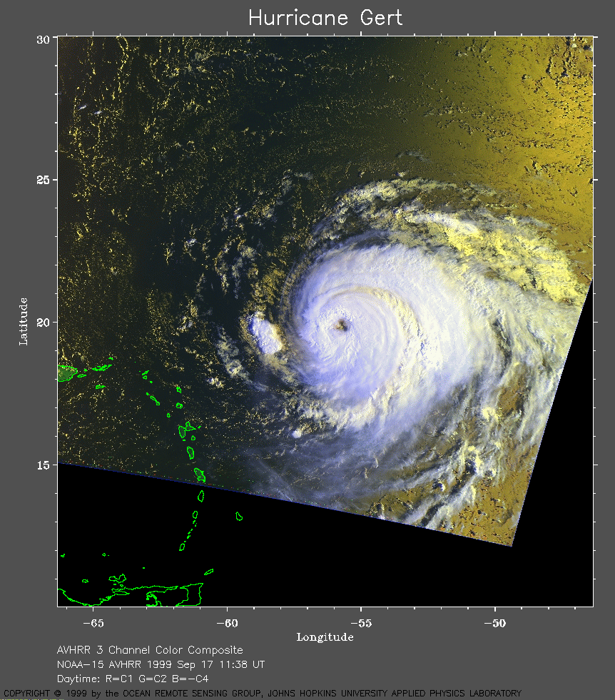
 1999 September 17 11:38 UT
NOAA-15
satellite AVHRR 3 channel color composite daytime image. A closer view
(363 Kb) is seen by clicking on this small image.
Gert has maximum sustained winds of 140 mph.
A very large image (872
Kb) of Gert is also available.
 1999 September 17 19:54 UT
NOAA-14 satellite AVHRR 3 channel color composite daytime image. A closer view (216 Kb) is seen by clicking on this small image. Gert has maximum sustained winds of 130 mph. A very large image (392 Kb) of Gert is also available.
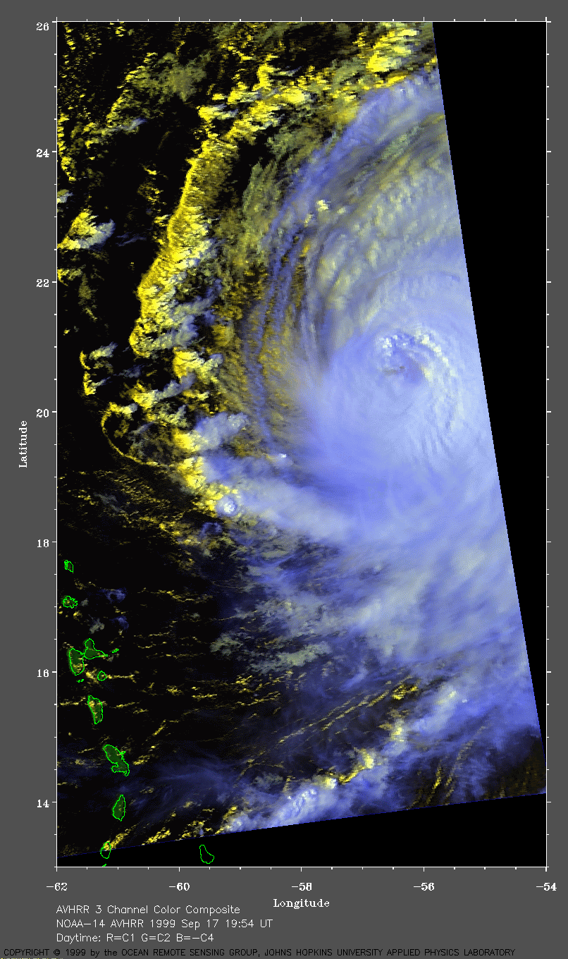
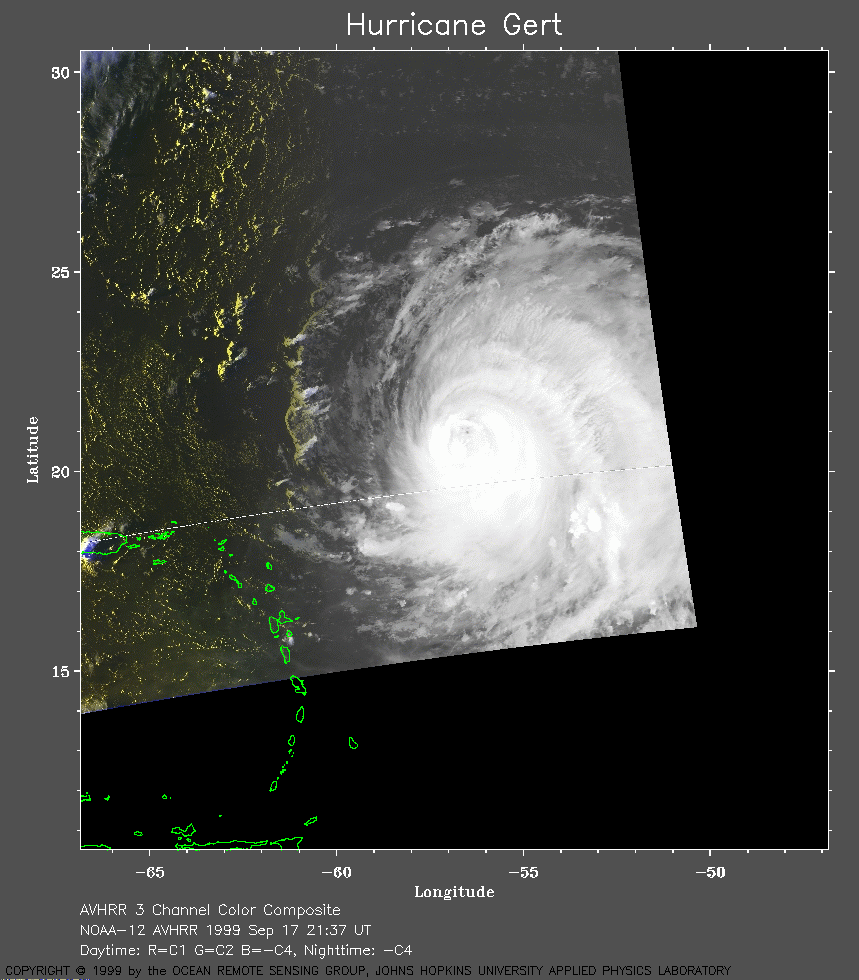 1999 September 17 21:37 UT
NOAA-12
satellite AVHRR 3 channel color composite daytime image. A closer view
(200 Kb) is seen by clicking on this small image.
A very large channel 4 image (642
Kb) of Gert is also available.
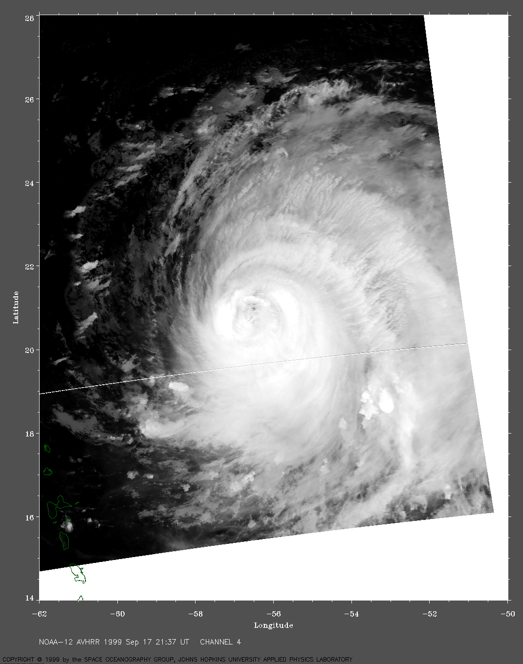
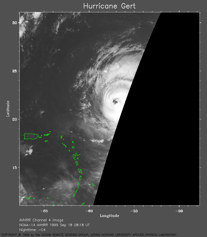 1999 September 18 08:18 UT
NOAA-14 satellite AVHRR channel 4 early morning image. A closer view (169 Kb) is seen by clicking on this small image.
 1999 September 18 09:58 UT
NOAA-12
satellite AVHRR 3 channel color composite morning image. A closer view
(299 Kb) is seen by clicking on this small image.
Note the spiral of clouds inside the eye.
A very large image (594
Kb) of Gert is also available.
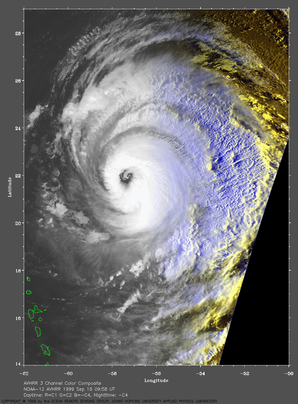
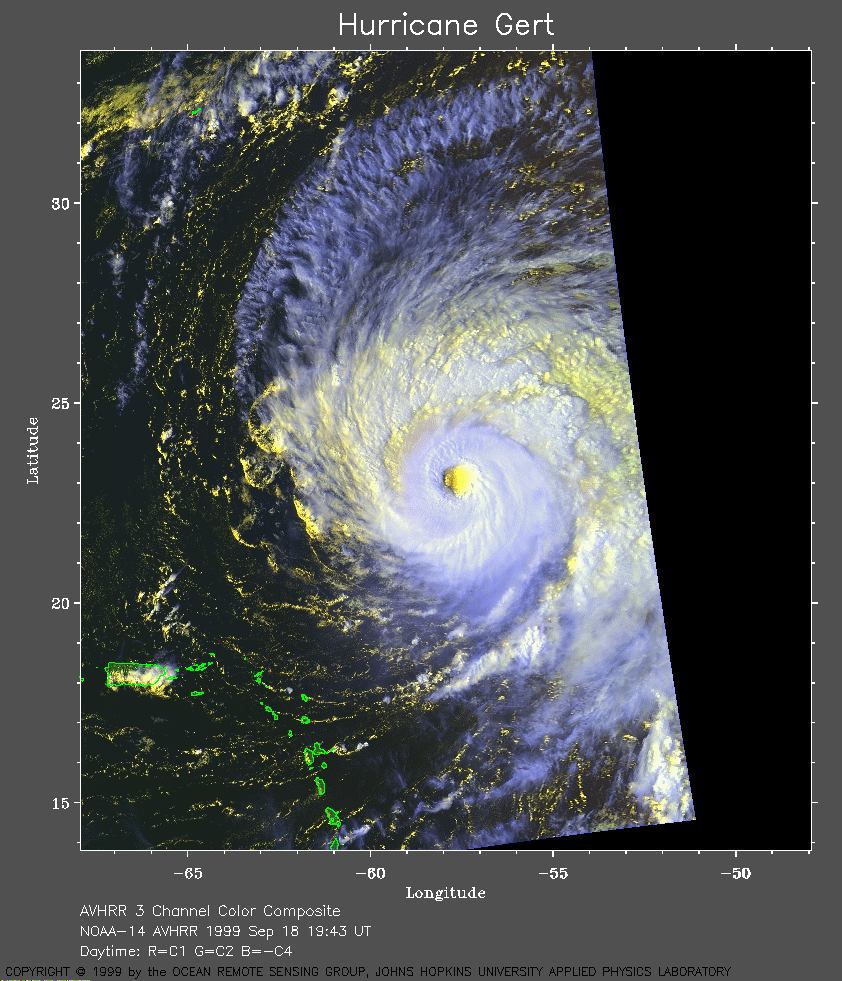 1999 September 18 19:43 UT
NOAA-14 satellite AVHRR 3 channel color composite daytime image. A closer view (331 Kb) is seen by clicking on this small image. A very large image (498 Kb) of Gert is also available.
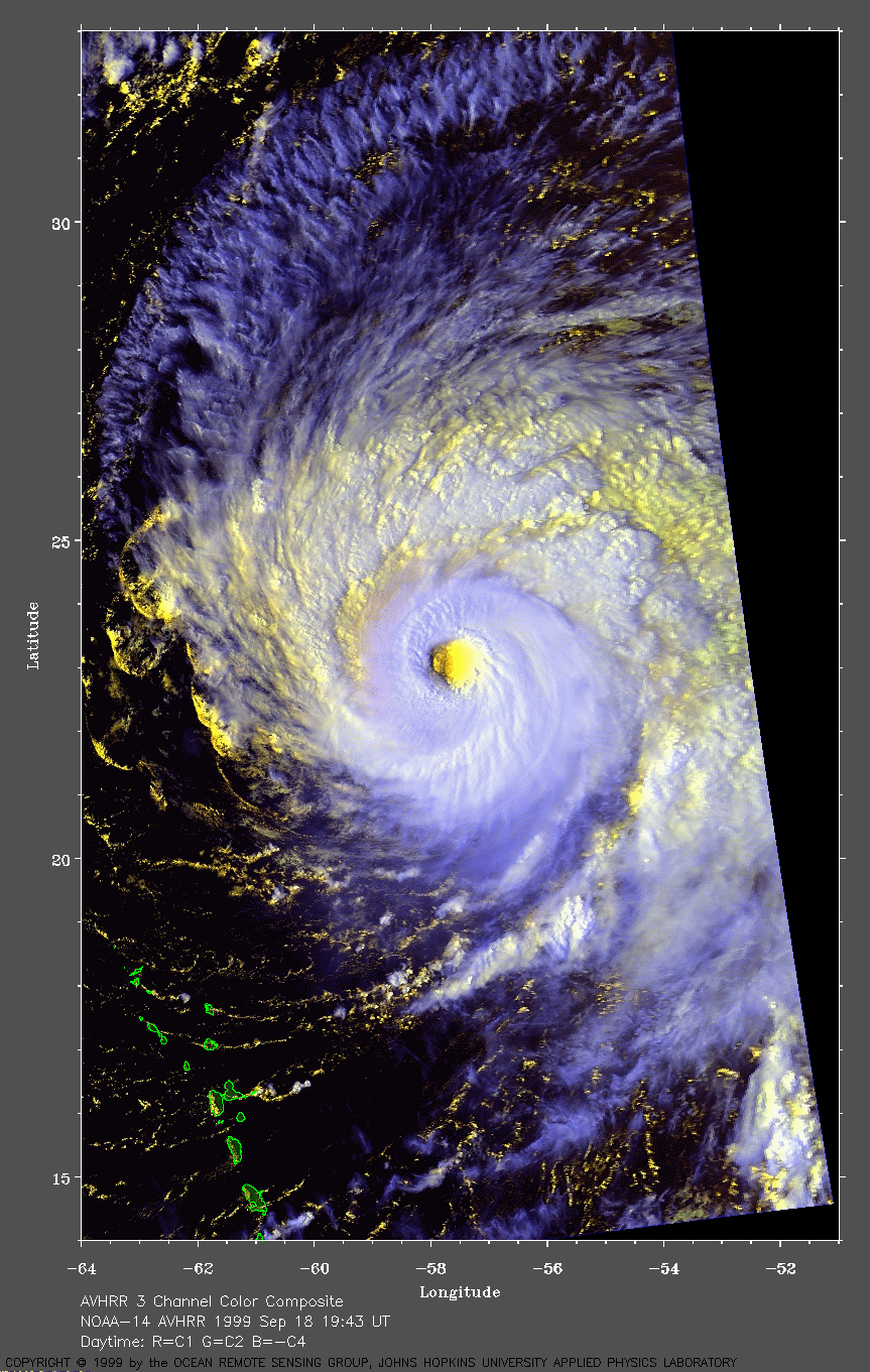
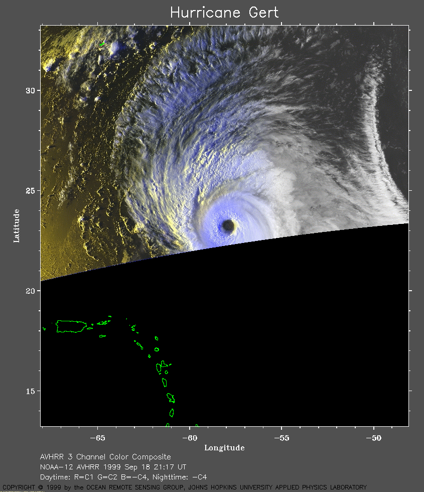 1999 September 18 21:17 UT
NOAA-12
satellite AVHRR 3 channel color composite daytime image. A closer view
(272 Kb) is seen by clicking on this small image.
The maximum sustained winds are increasing from 120 mph to 125 mph.
A very large image (728
Kb) of Gert is also available.
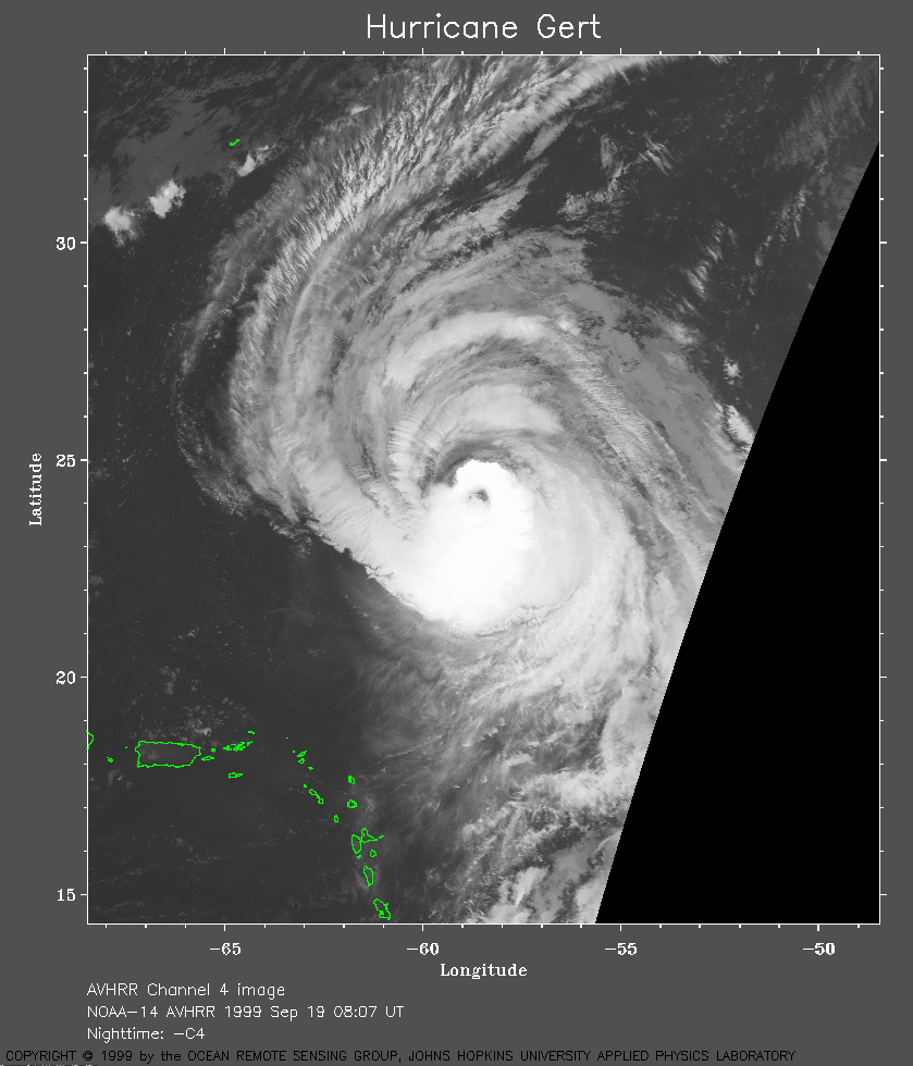 1999 September 19 08:07 UT
NOAA-14 satellite AVHRR channel 4 early morning image. A closer view (260 Kb) is seen by clicking on this small image. The maximum sustained winds are increasing from 125 mph to 130 mph. A very large image (744 Kb) of Gert is also available.
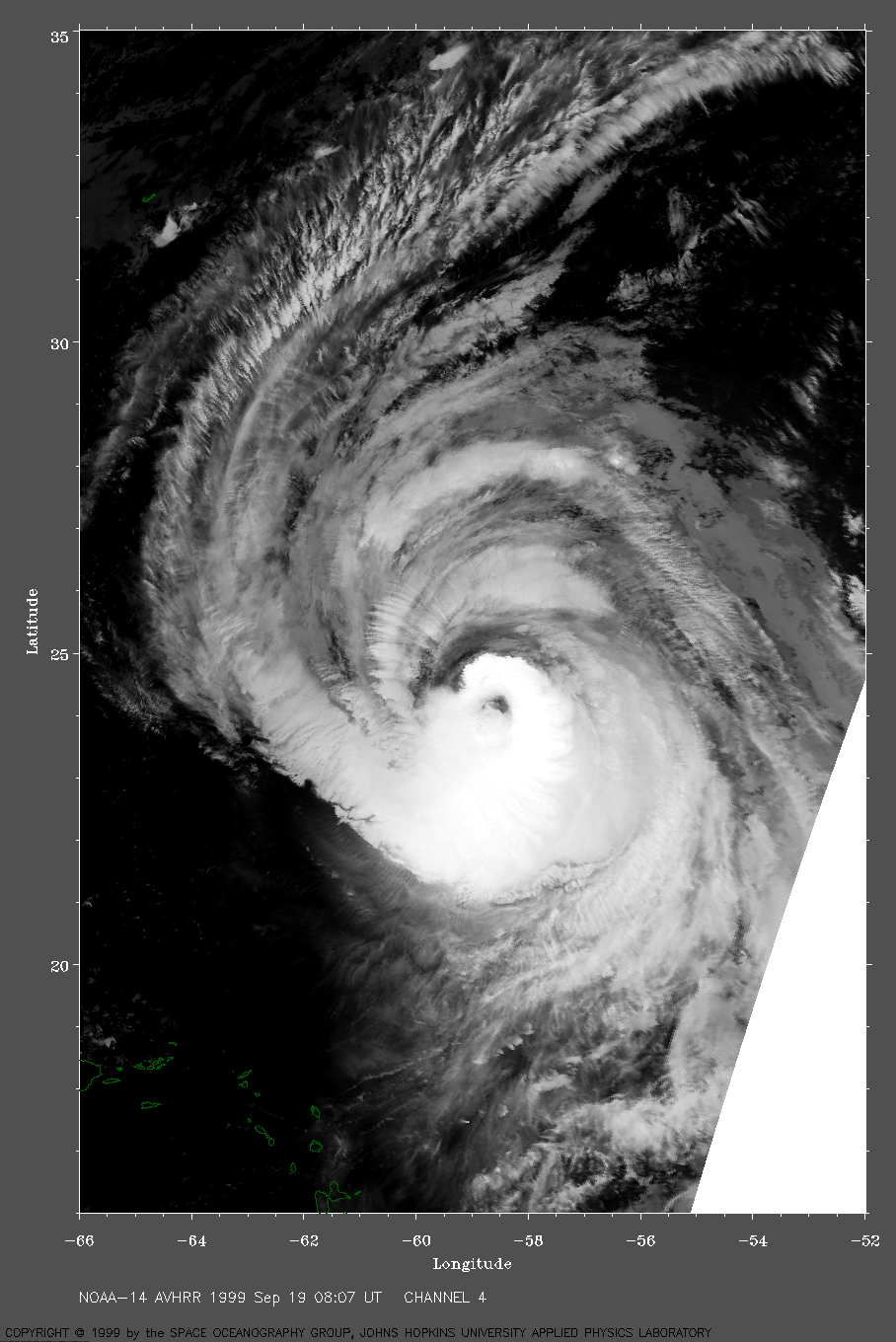
 1999 September 19 09:33 UT
NOAA-12
satellite AVHRR channel 4 early morning image. A closer view
(314 Kb) is seen by clicking on this small image.
A very large image (1058
Kb) of Gert is also available.
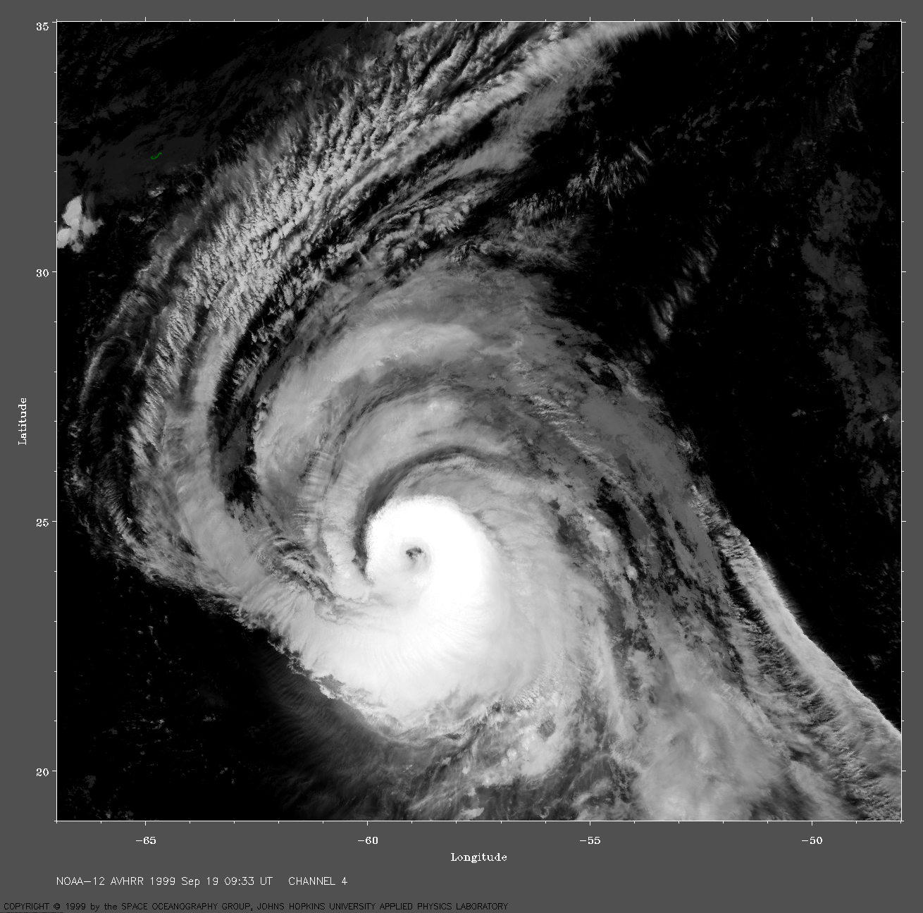
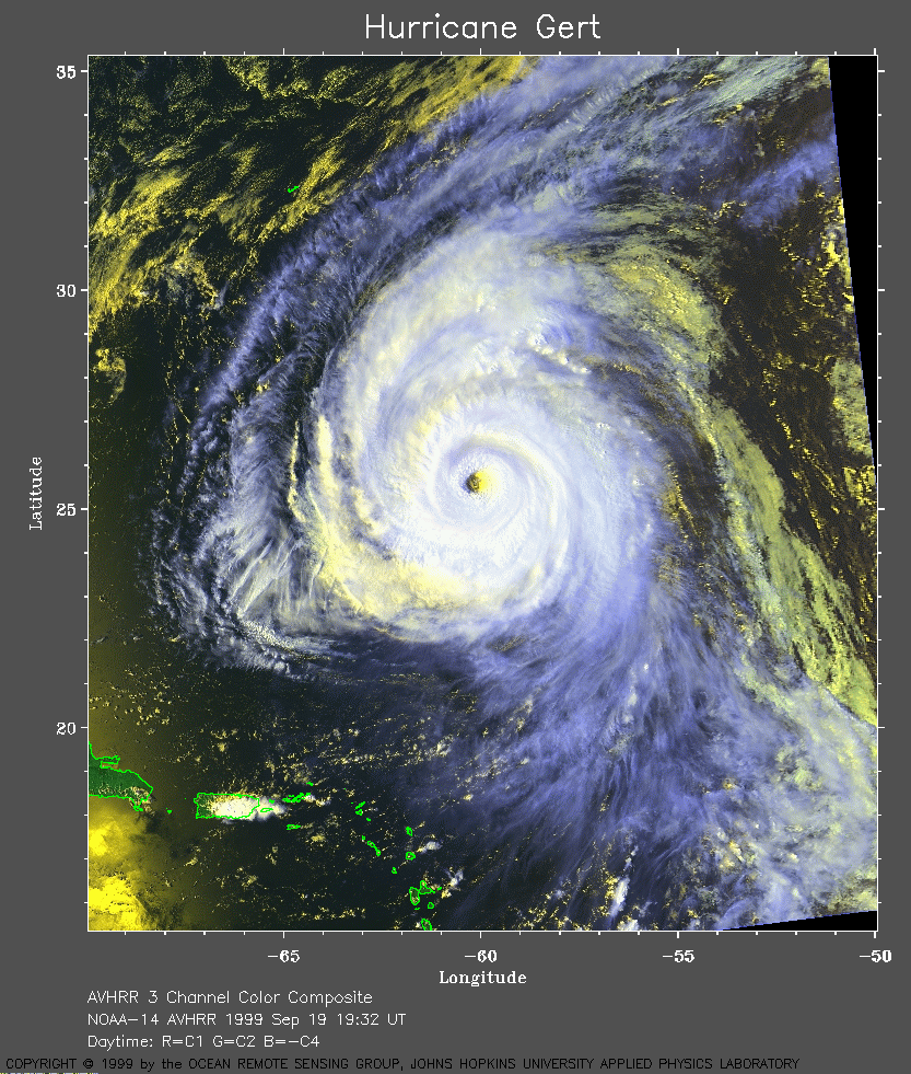 1999 September 19 19:32 UT
NOAA-14 satellite AVHRR 3 channel color composite daytime image. A closer view (451 Kb) is seen by clicking on this small image. A very large image (786 Kb) of Gert is also available.
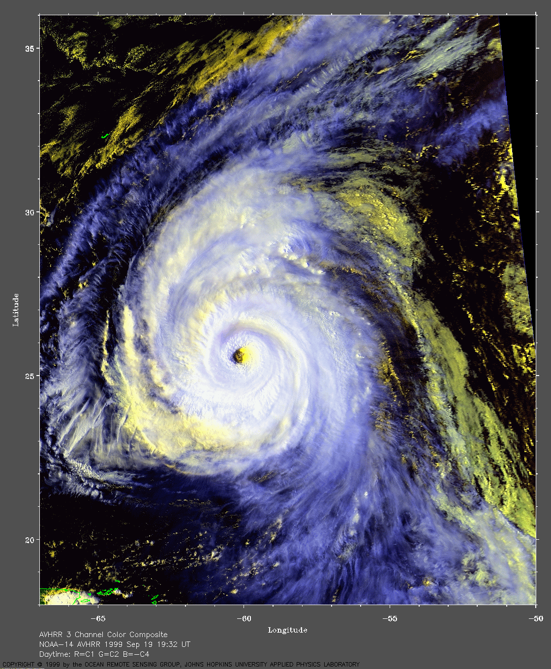
 1999 September 19 20:55 UT
NOAA-12
satellite AVHRR 3 channel color composite daytime image. A closer view
(272 Kb) is seen by clicking on this small image.
A very large image (1049
Kb) of Gert is also available.
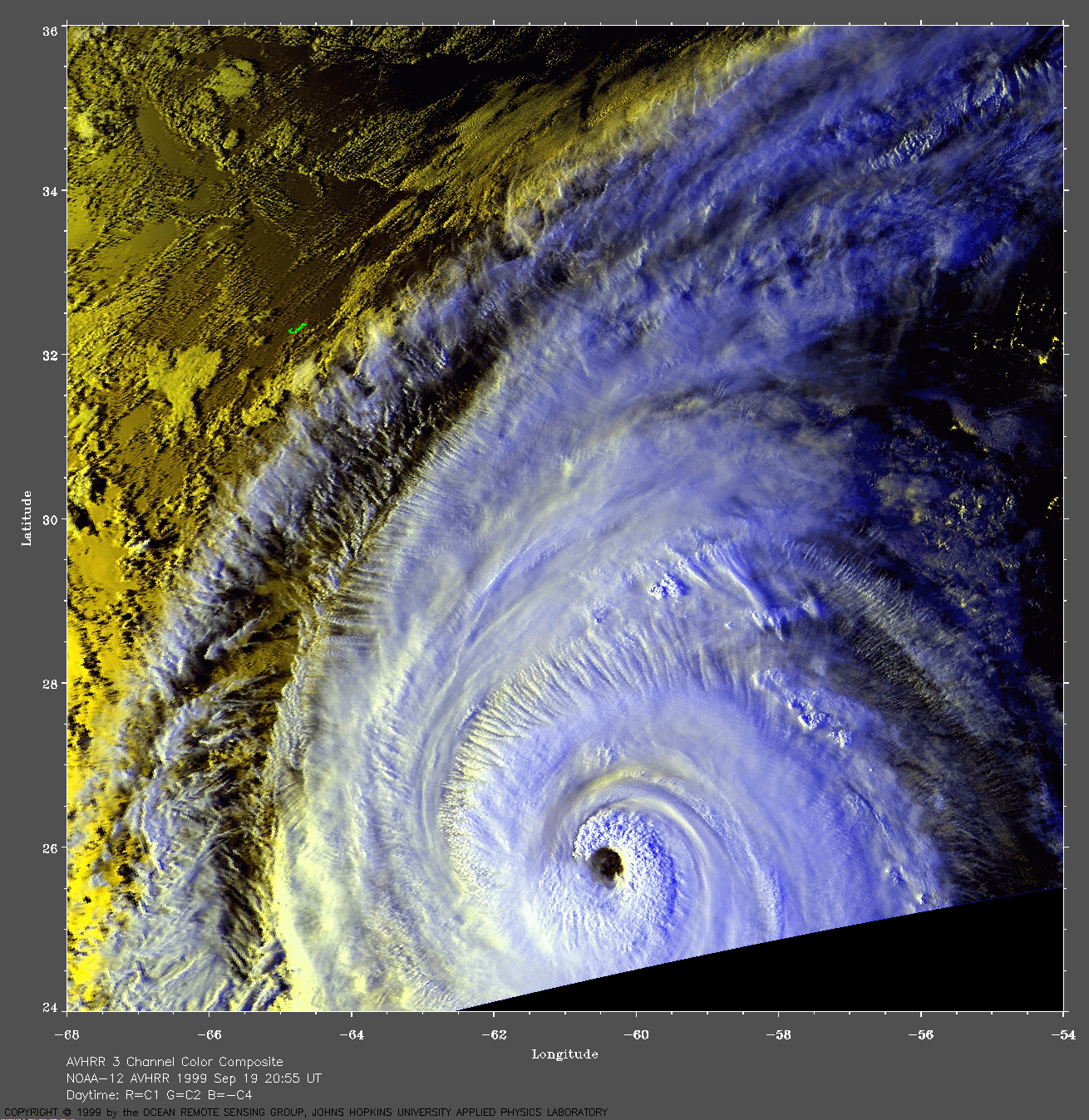
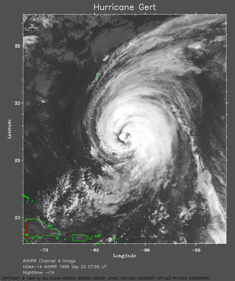 1999 September 20 07:55 UT
NOAA-14 satellite AVHRR channel 4 early morning image. A closer view (326 Kb) is seen by clicking on this small image. A very large image (892 Kb) of Gert is also available.
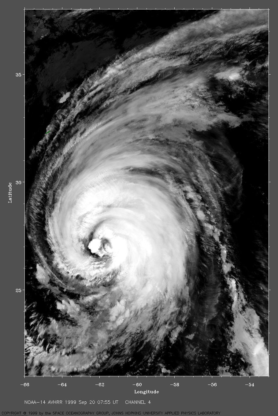
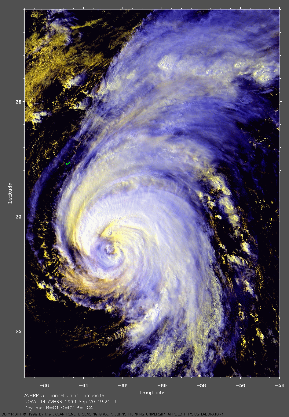
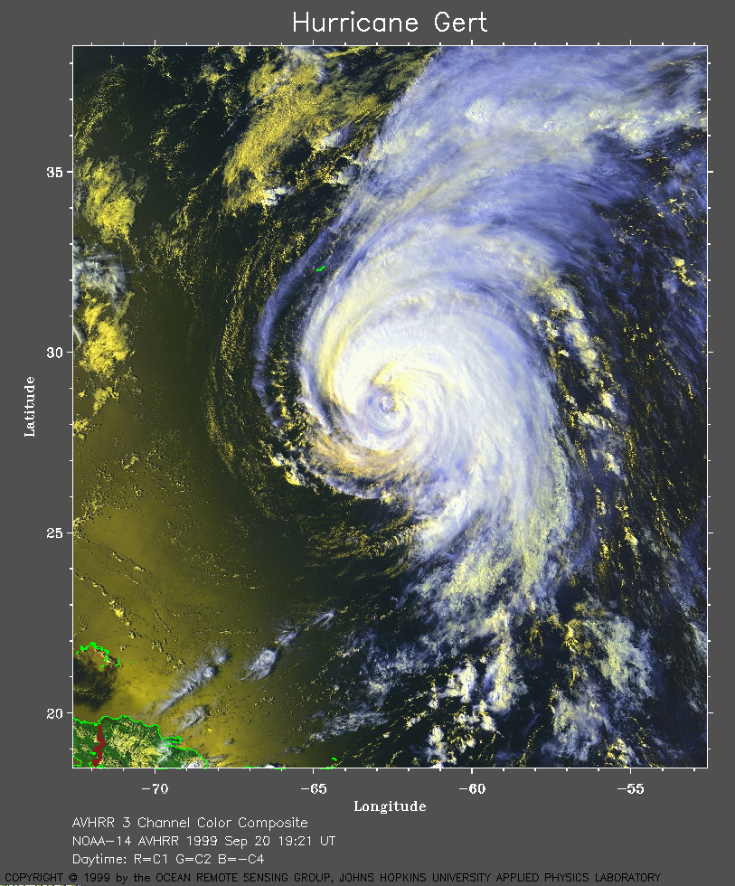 1999 September 20 19:21 UT
NOAA-14
satellite AVHRR 3 channel color composite daytime image. A closer view
(432 Kb) is seen by clicking on this small image. The small J-shaped
island near the northwest side of Gert is Bermuda. Gert has maximum
sustained winds of 120 mph.
A very large image (614
Kb) of Gert is also available.
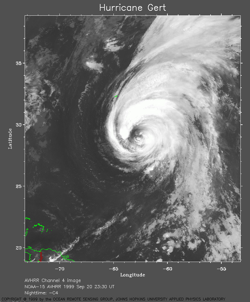 1999 September 20 23:30 UT
NOAA-15 satellite AVHRR channel 4 evening image. A closer view (311 Kb) is seen by clicking on this small image. A very large image (774 Kb) of Gert is also available.
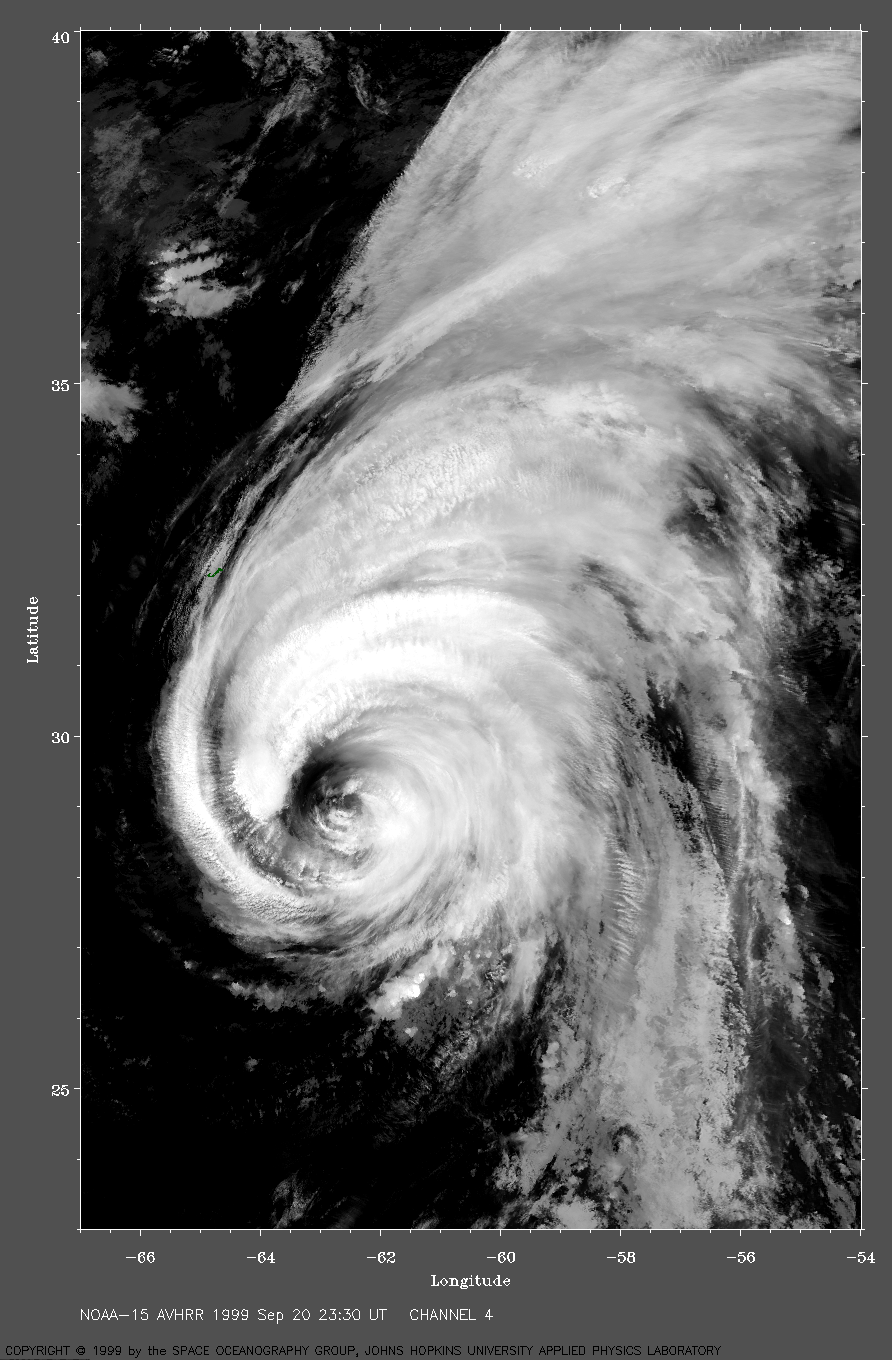
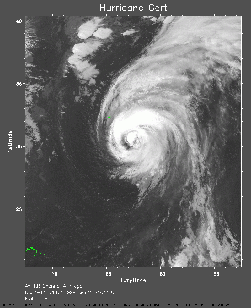 1999 September 21 07:44 UT
NOAA-14
satellite AVHRR channel 4 morning image. A closer view
(291 Kb) is seen by clicking on this small image.
Gert has maximum sustained winds of 110 mph.
A very large image (581
Kb) of Gert is also available.
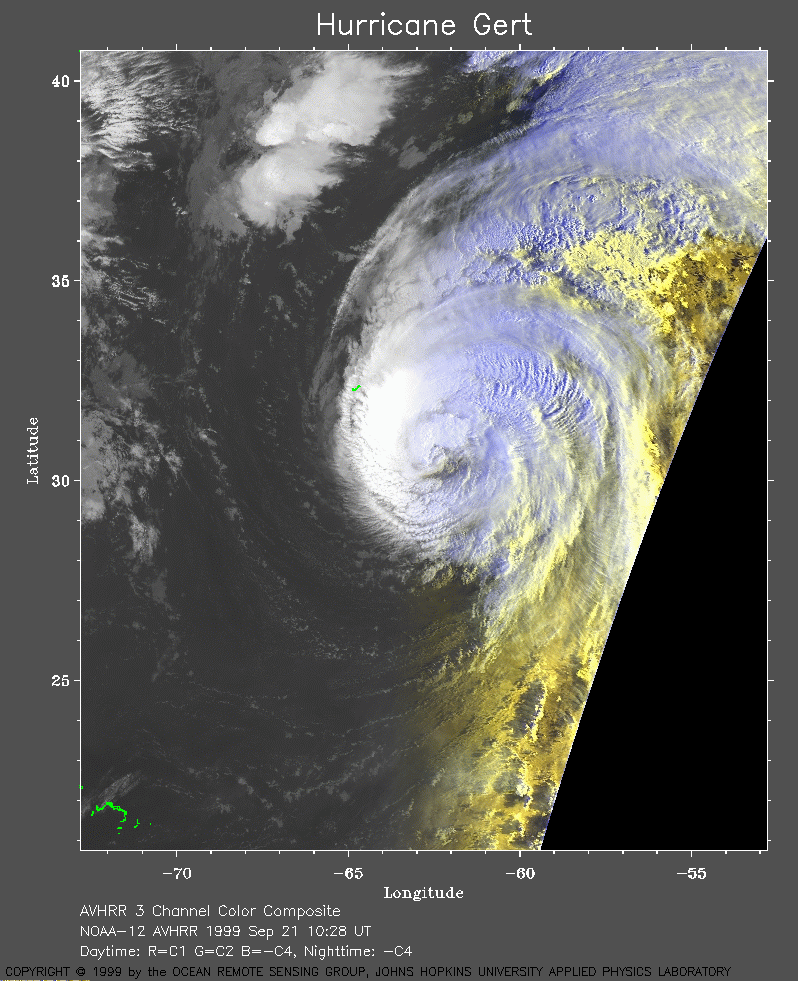 1999 September 21 10:28 UT
NOAA-12 satellite AVHRR 3 channel color composite morning image. A closer view (316 Kb) is seen by clicking on this small image. A very large image (650 Kb) of Gert is also available.
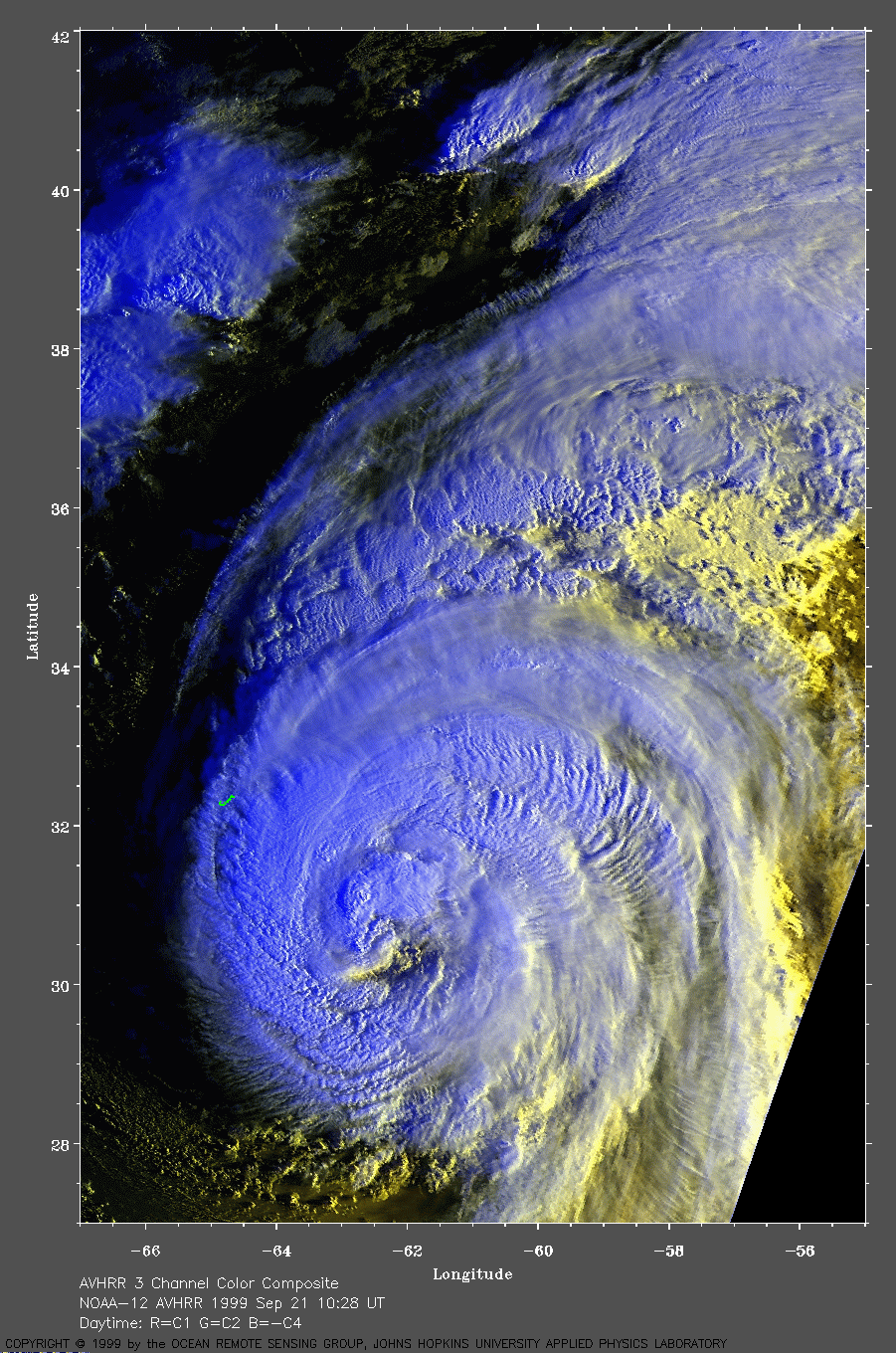
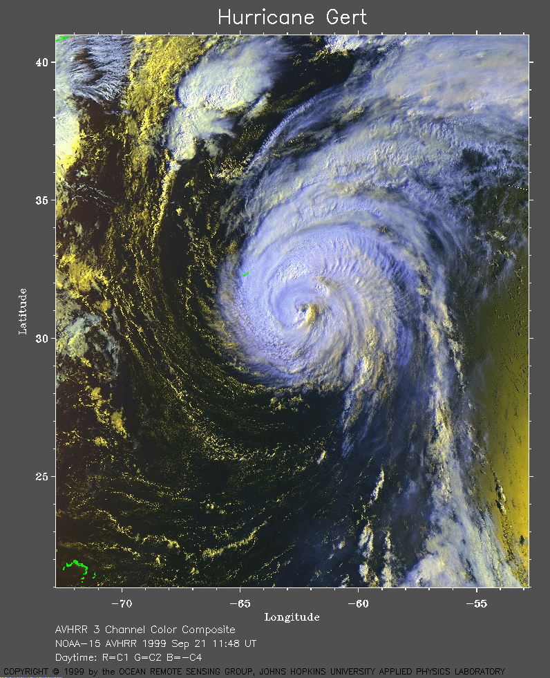 1999 September 21 11:48 UT
NOAA-15
satellite AVHRR 3 channel color composite morning image. A closer view
(453 Kb) is seen by clicking on this small image.
A very large image (657
Kb) of Gert is also available.
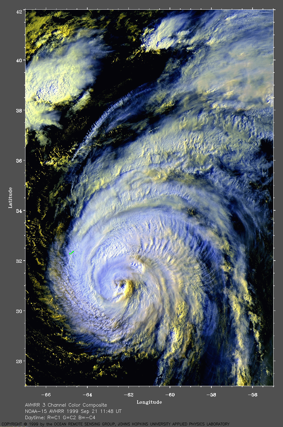
 1999 September 21 19:11 UT
NOAA-14 satellite AVHRR 3 channel color composite daytime image. A closer view (427 Kb) is seen by clicking on this small image. The maximum sustained winds are 105 mph. Note the coast of Massachusetts in the upper left corner of the image. Bermuda is the small J-shaped island in the west side of the storm. A very large image (721 Kb) of Gert is also available.
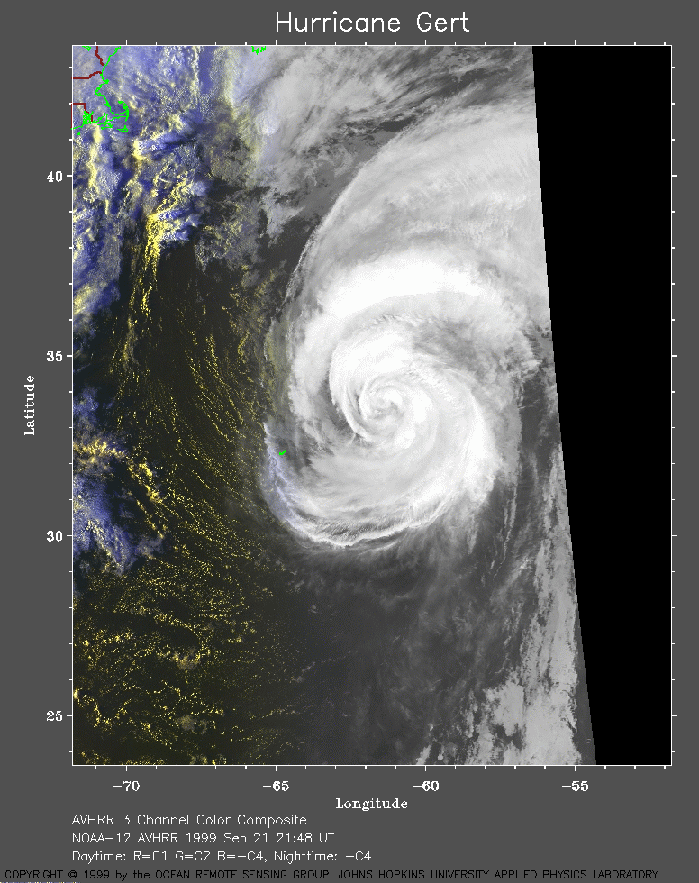 1999 September 21 21:48 UT
NOAA-12
satellite AVHRR 3 channel color composite evening image. A closer view
(292 Kb) is seen by clicking on this small image.
A very large Channel 4 image (755
Kb) of Gert is also available.
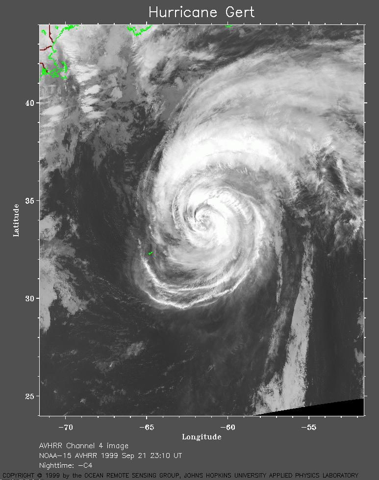 1999 September 21 23:10 UT
NOAA-15 satellite AVHRR channel 4 evening image. A closer view (296 Kb) is seen by clicking on this small image. The maximum sustained winds are decreasing from 105 to 90 mph. A very large image (900 Kb) of Gert is also available.
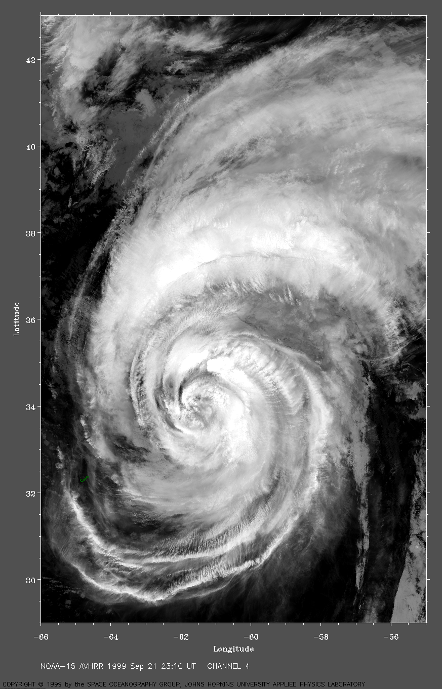
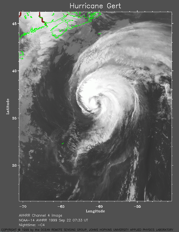 1999 September 22 07:33 UT
NOAA-14
satellite AVHRR channel 4 morning image. A closer view
(267 Kb) is seen by clicking on this small image.
The maximum sustained winds are decreasing from 90 to 85 mph.
A very large image (689
Kb) of Gert is also available.
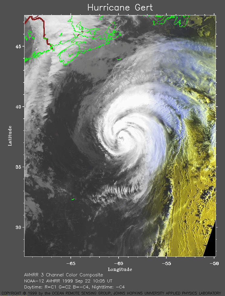 1999 September 22 10:05 UT
NOAA-12 satellite AVHRR 3 channel color composite morning image. A closer view (313 Kb) is seen by clicking on this small image. A very large image (737 Kb) of Gert is also available.
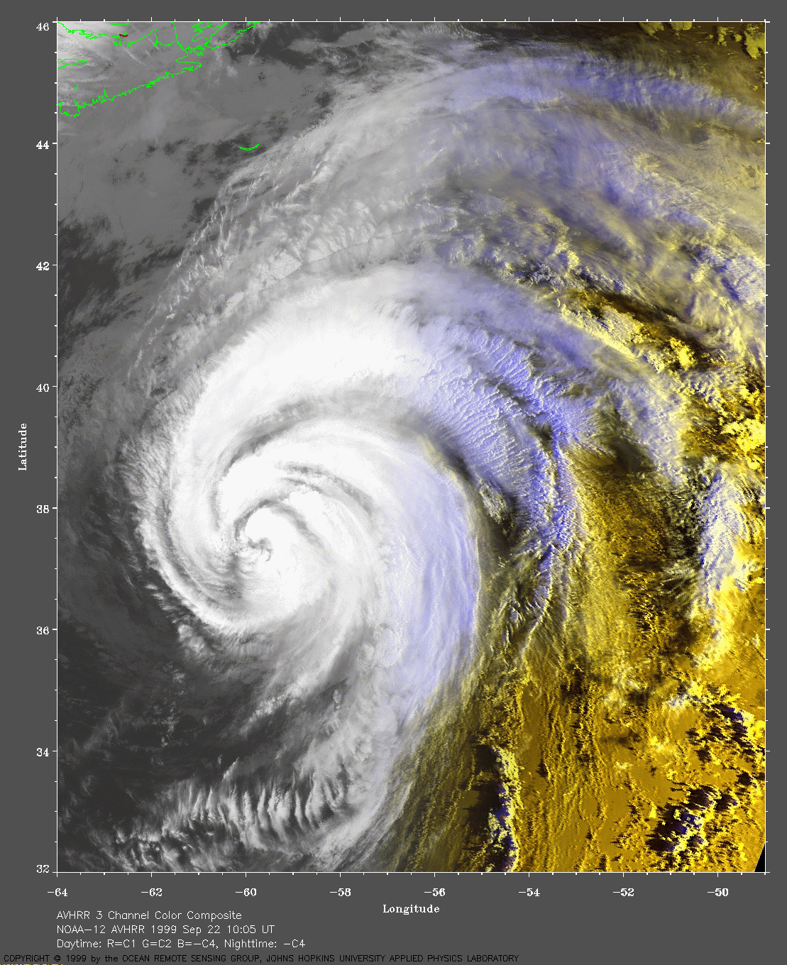
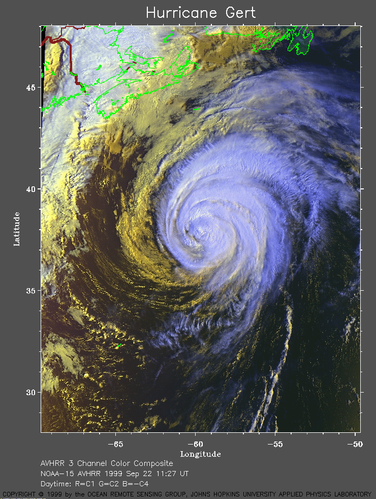 1999 September 22 11:27 UT
NOAA-15
satellite AVHRR 3 channel color composite morning image. A closer view
(399 Kb) is seen by clicking on this small image.
A very large image (850
Kb) of Gert is also available.
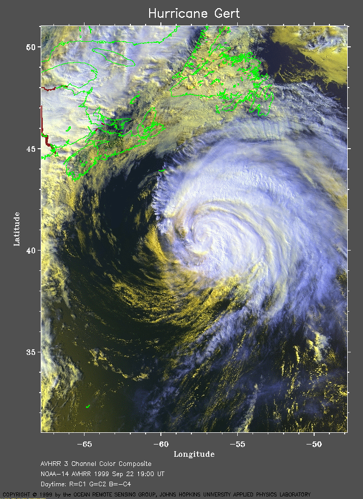 1999 September 22 19:00 UT
NOAA-14 satellite AVHRR 3 channel color composite daytime image. A closer view (399 Kb) is seen by clicking on this small image. Note the proximity of Gert to Newfoundland. A very large image (1011 Kb) of Gert is also available.
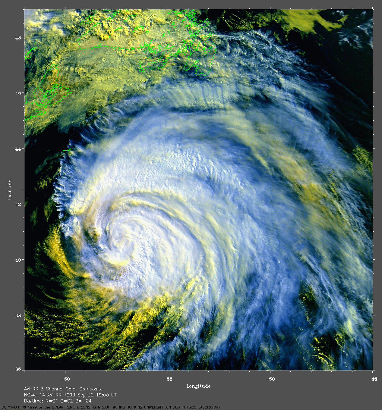
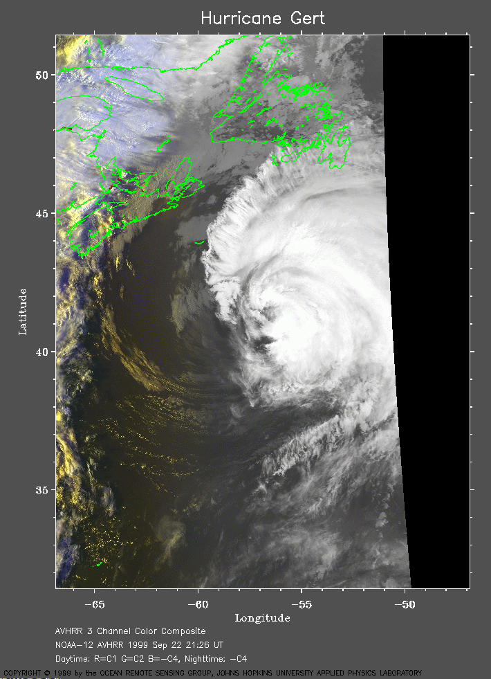 1999 September 22 21:26 UT
NOAA-12
satellite AVHRR 3 channel color composite daytime image. A closer view
(258 Kb) is seen by clicking on this small image.
A very large Channel 4 image (576
Kb) of Gert is also available.
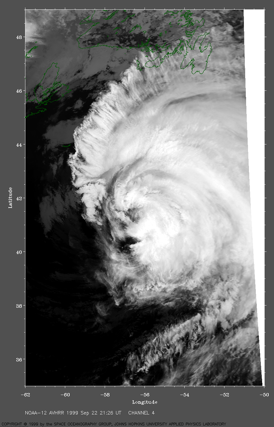
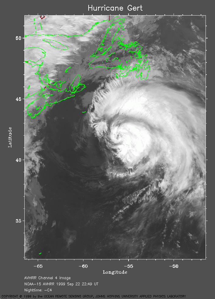 1999 September 22 22:49 UT
NOAA-15 satellite AVHRR channel 4 evening image. A closer view (257 Kb) is seen by clicking on this small image. A very large image (1081 Kb) of Gert is also available.
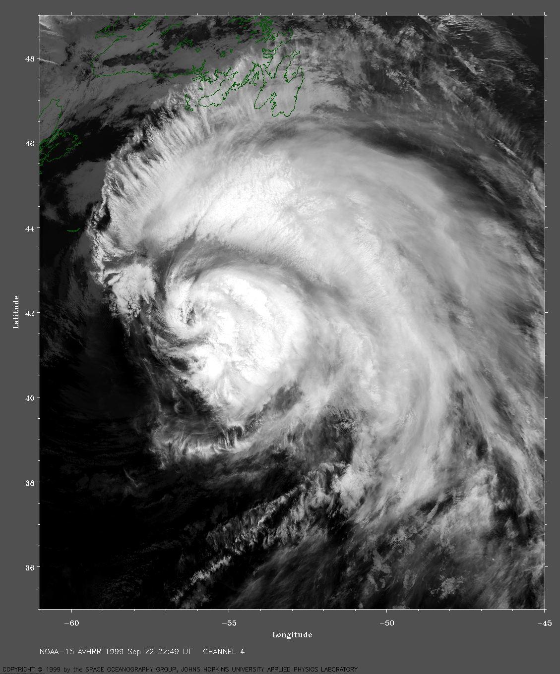
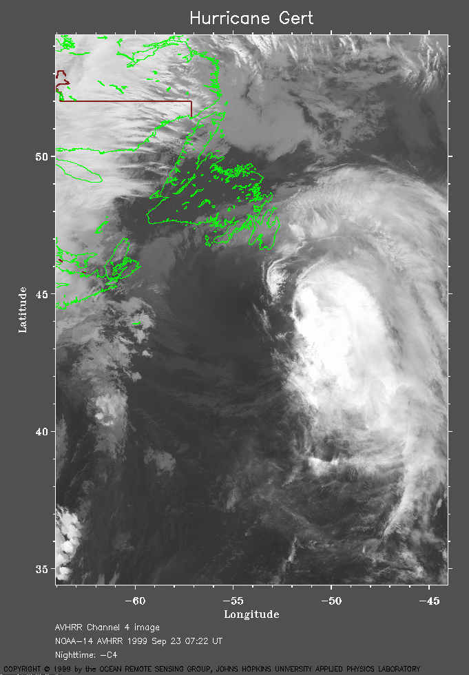 1999 September 23 07:22 UT
NOAA-14
satellite AVHRR channel 4 morning image. A closer view
(242 Kb) is seen by clicking on this small image.
Note the proximity
of Gert to Newfoundland.
The maximum sustained winds have fallen from 80 mph at 03:00 UT to 70
mph at 09:00 UT.
A very large image (934
Kb) of Gert is also available.
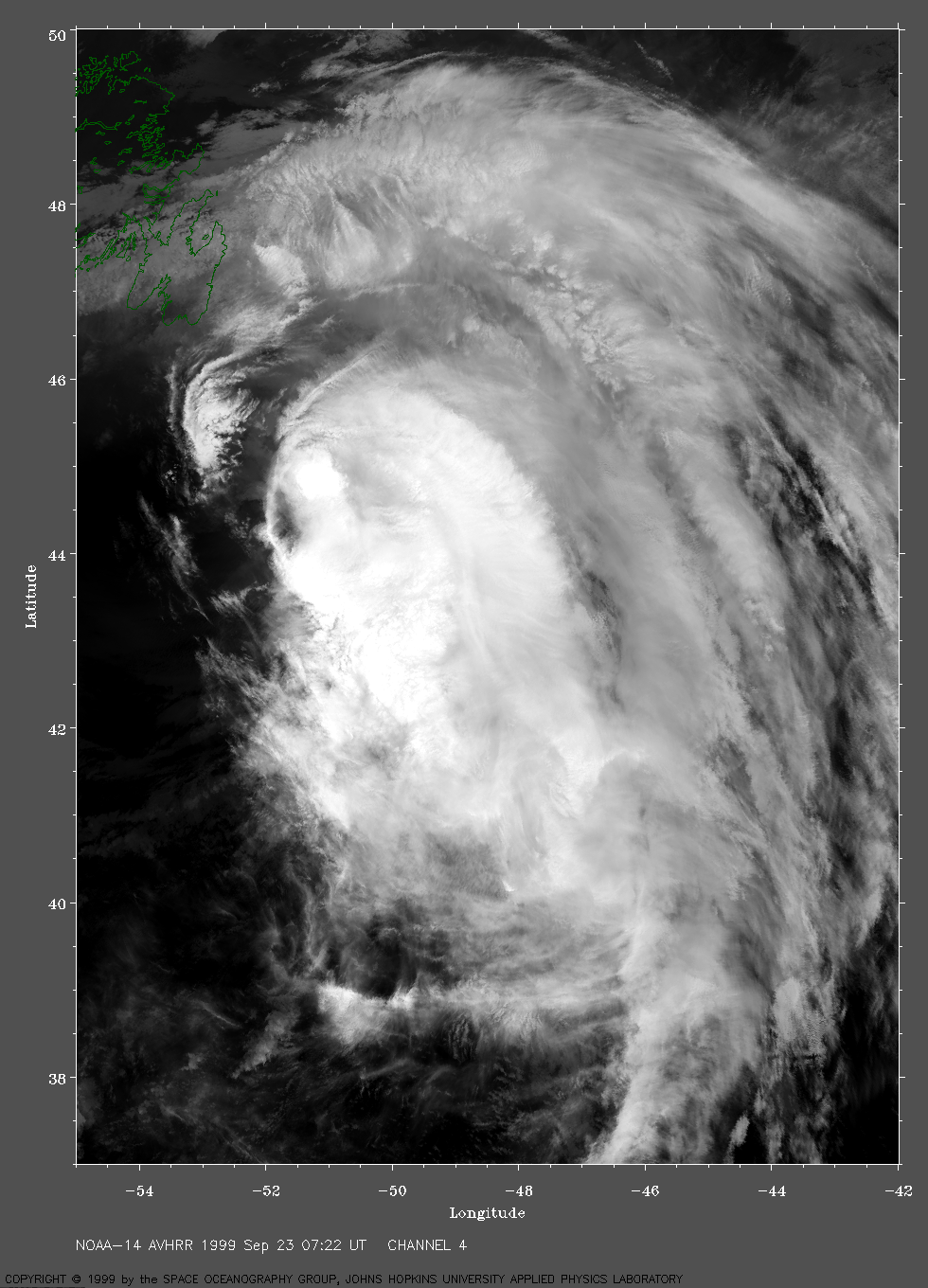
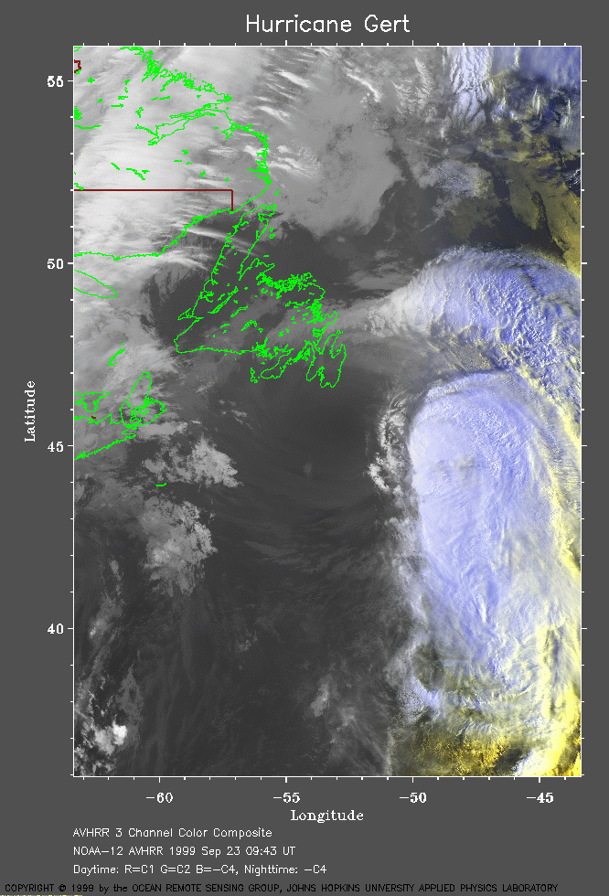 1999 September 23 09:43 UT
NOAA-12 satellite AVHRR 3 channel color composite image. A closer view (256 Kb) is seen by clicking on this small image. A very large image (824 Kb) of Gert is also available.
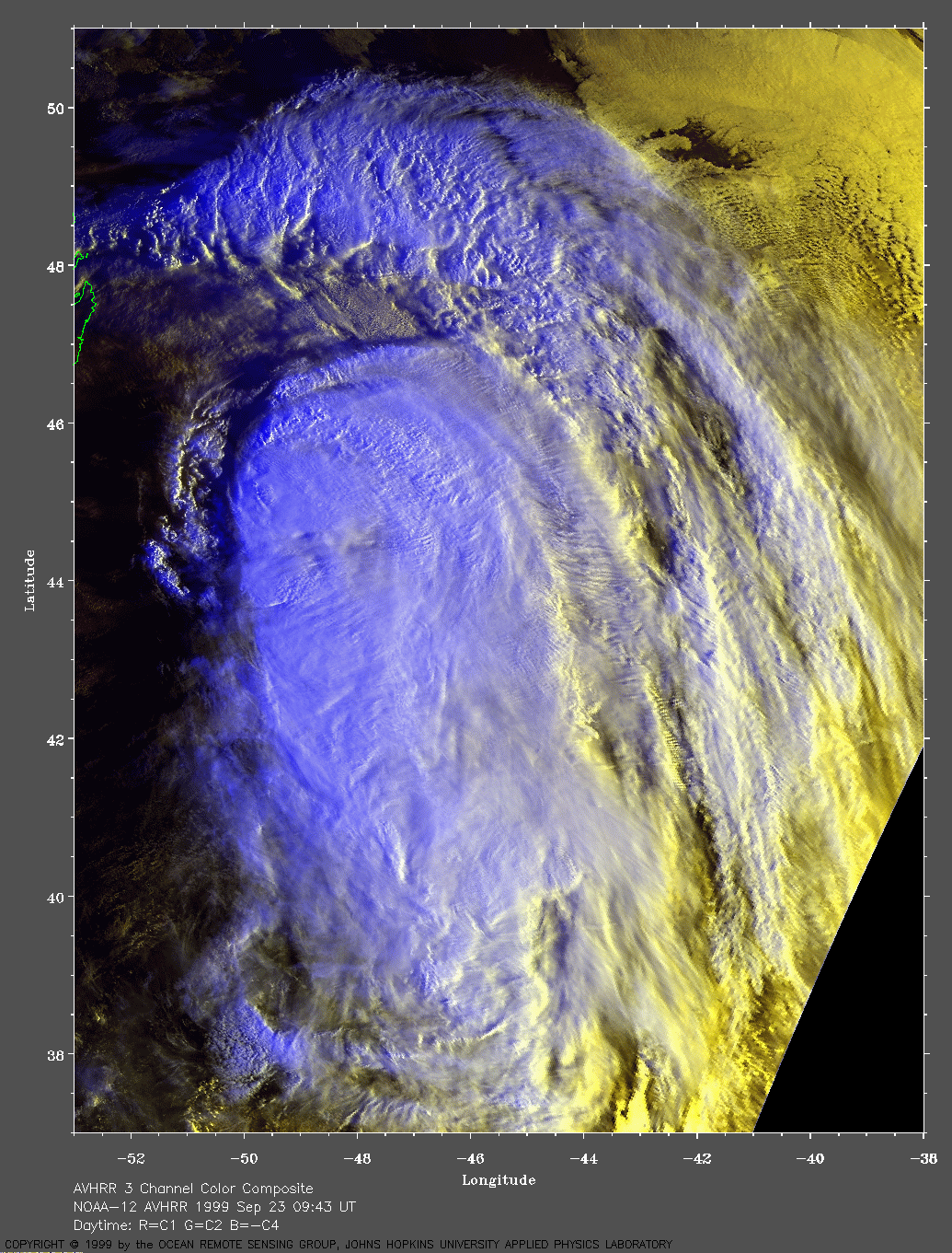