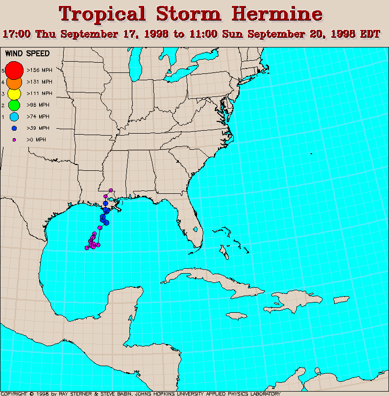
Track maps
 7 day SST Track Map Track map
overlaid on sea surface temperature (SST) image (409 Kb). This image is
derived from averaging SST data over 7 days ending 17 September 1998 to
remove clouds. The previous track of Frances is also shown (dash-dot
line). Note the remnants of the cool wake left by Frances.
7 day SST Track Map Track map
overlaid on sea surface temperature (SST) image (409 Kb). This image is
derived from averaging SST data over 7 days ending 17 September 1998 to
remove clouds. The previous track of Frances is also shown (dash-dot
line). Note the remnants of the cool wake left by Frances.
Track file
Track data (lat/lon, winds, etc.) in a text file.
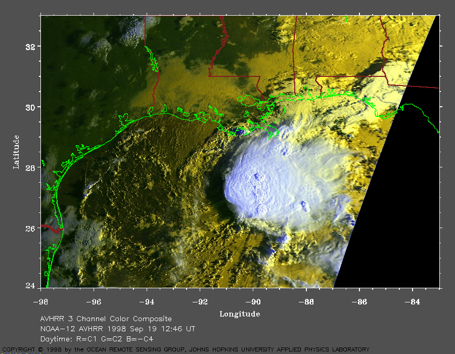 1998 September 19 12:46 UT
NOAA-12 AVHRR 3
channel composite early morning image. A closer view (298 Kb) is seen
by clicking on this small image. Hermine is a tropical depression
with 35 mph winds at this time. A very large image (618 Kb)
is also available.
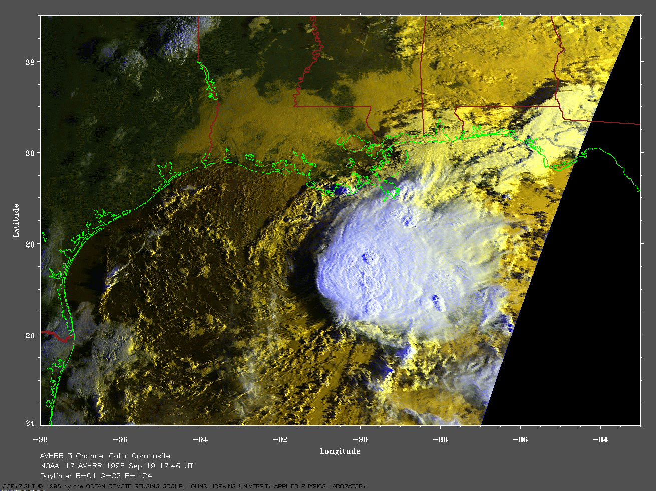
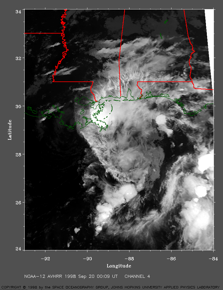 1998 September 20 00:09 UT
NOAA-12 channel 4
nighttime image. A closer view (351 Kb) is seen by clicking on this
small image. Hermine has developed into a tropical storm with 45 mph winds
and is making landfall on the Louisiana coast. A very large image (642 Kb)