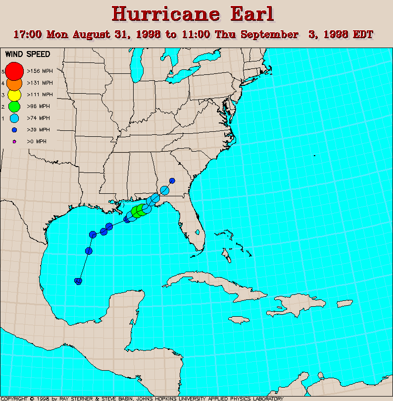
Track maps
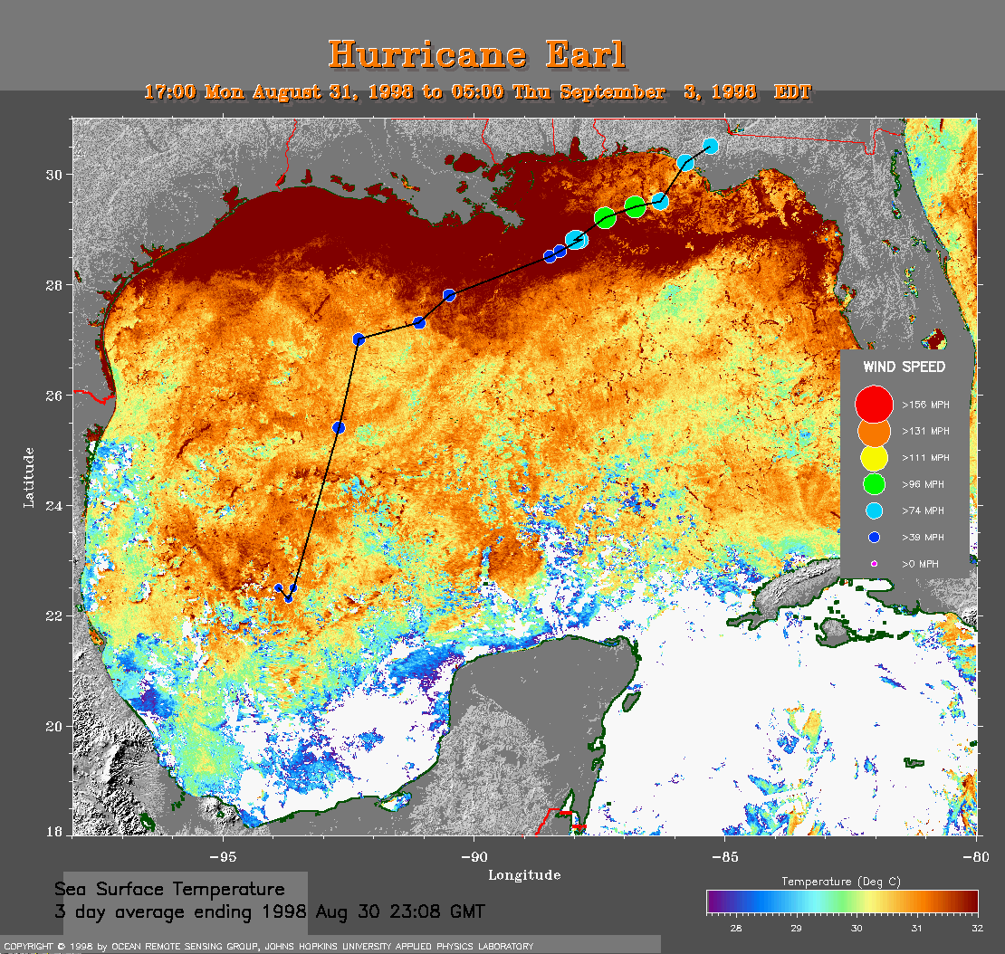 Aug 30 SST Track Map
Track superimposed on sea surface temperature (SST)
derived from averaging images over 3 days ending
August 30 in order to remove cloud cover.
Note how Earl intensified
over the warmer water near the coast.
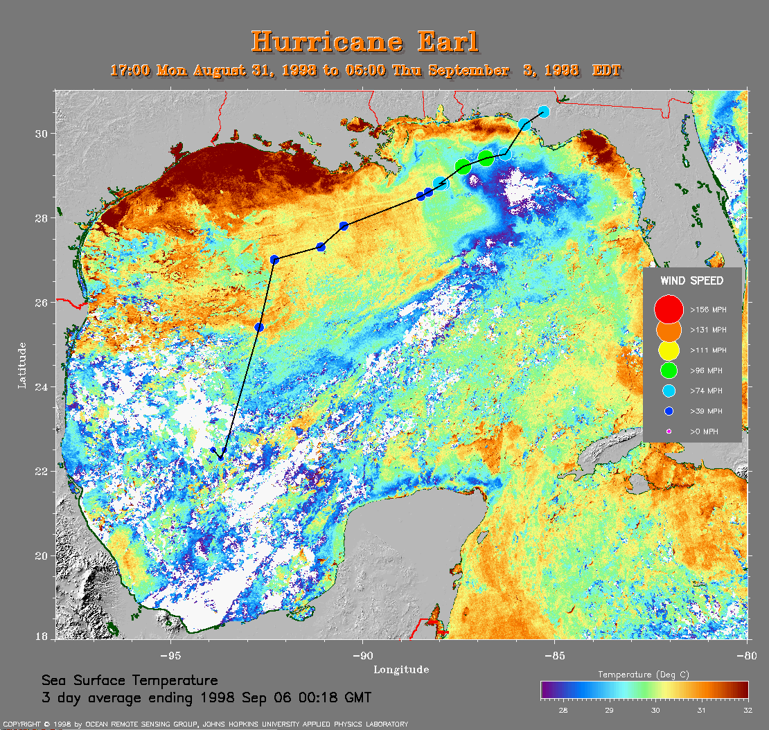 Sep 6 SST Track Map
Track superimposed on sea surface temperature (SST)
derived from averaging images over 3 days ending
September 6 in order to remove cloud cover.
Note the cool wake left
by Earl that has now drifted east of its track.
Track file
Track data (lat/lon, winds, etc.) in a text file.
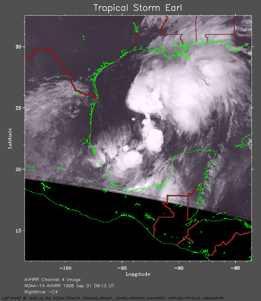 1998 September 1 09:13 UT
NOAA-14 AVHRR channel 4 nighttime
image. A closer view (231 Kb) is seen by clicking on this small
image. Earl is now a tropical storm with 40 mph winds. The
disorganized appearence of Earl in this image makes it difficult to
identify a center. Earl is nearly stationary at this time.
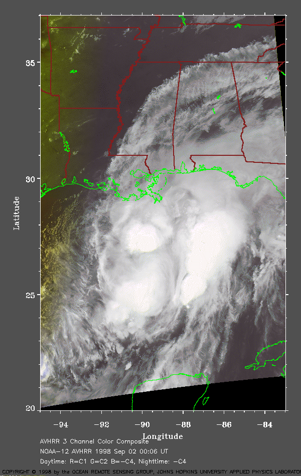 1998 September 2 00:06 UT
NOAA-12 AVHRR 3 channel composite late
evening image. A closer view (215 Kb) is seen by clicking on this small
image. The maximum sustained winds are now about 60 mph. Earl appears
a little better organized in this image than at 0913 UT on 1 September.
As a result of a shift in the
area of deep convection, the center has recently reformed
to the northeast of its previous position.
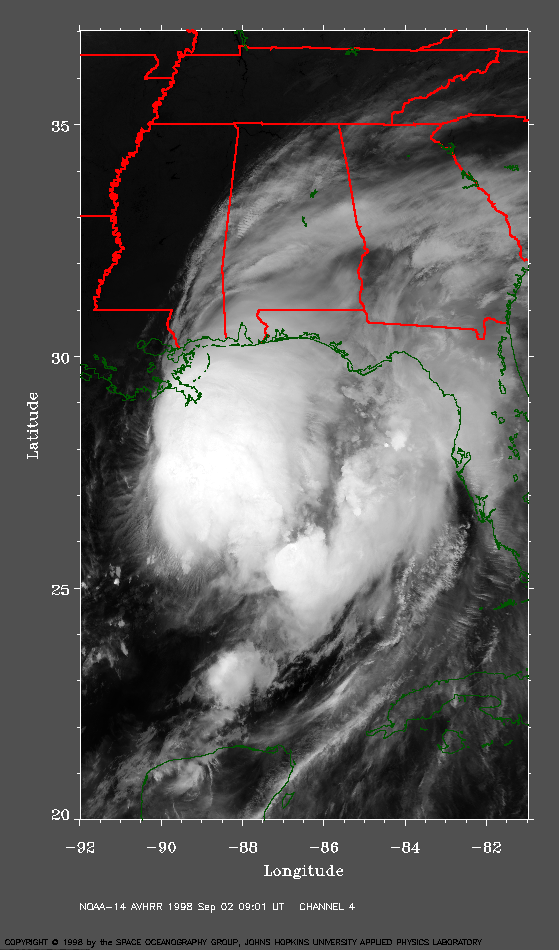 1998 September 2 09:01 UT
NOAA-14 AVHRR channel 4 nighttime
image. A closer view (315 Kb) is seen by clicking on this small
image. Due to Earl's disorganization, the location of the center of
the storm is uncertain. Consequently, observations from aircraft and
satellite are not in agreement.
The data from dropwindsondes suggests that Earl is a shallow
system that is not responding to deep layer steering.
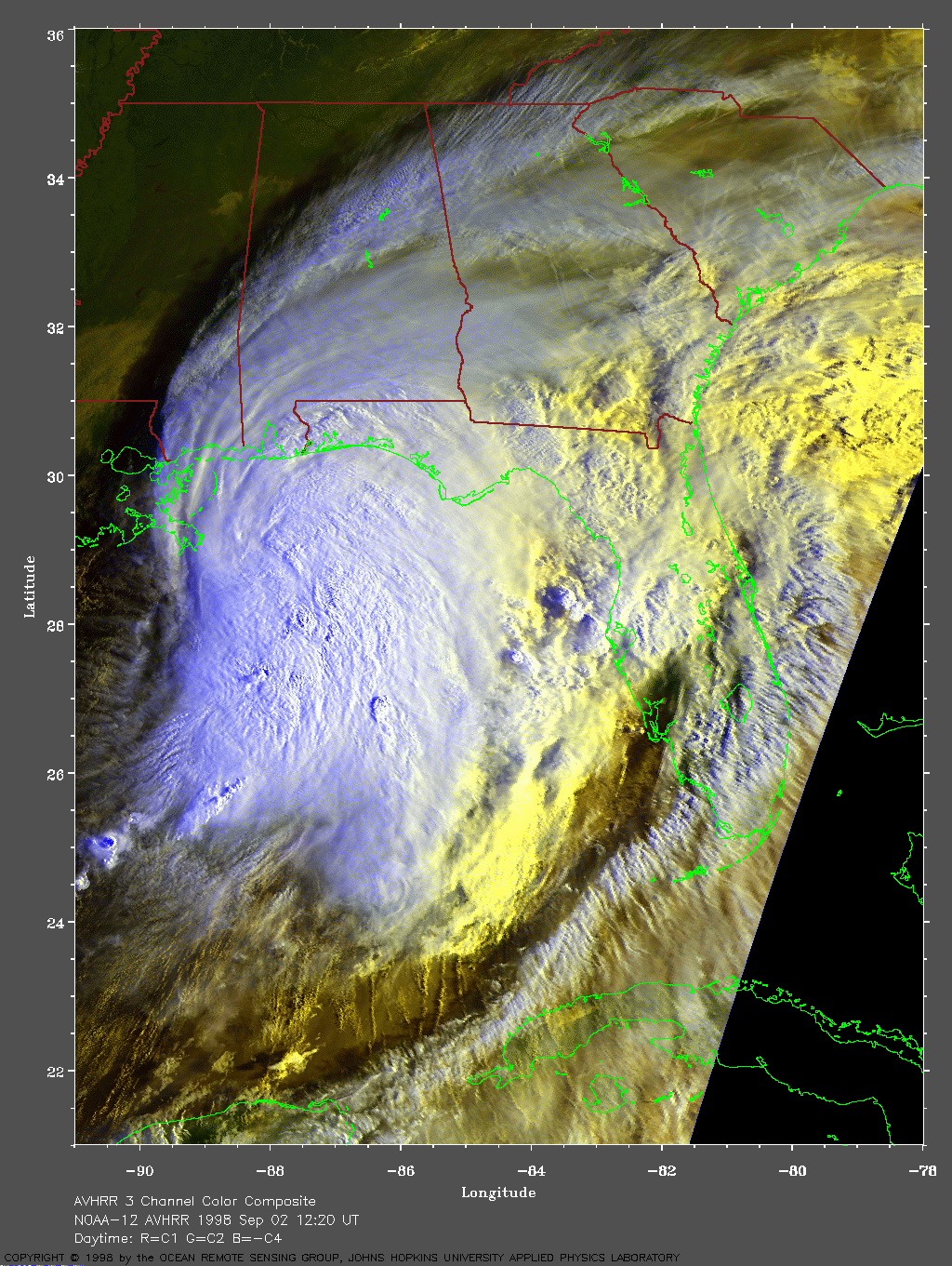
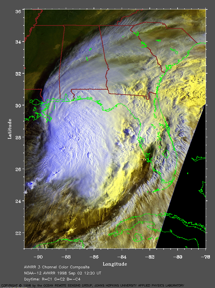 1998 September 2 12:20 UT
NOAA-12 AVHRR 3 channel composite
morning image. A closer view (354 Kb) is seen by clicking on this small
image. The cooler clouds are white and the warmer clouds are yellow.
It is apparent in this image that Earl is becoming better organized.
A
very large image (753 Kb) is also available.
 1998 September 2 23:42 UT
NOAA-12 AVHRR 3 channel composite
late evening image. A closer view (264 Kb) is seen by clicking on this small
image. Earl is now a hurricane with 100 mph winds.
A
very large image (583 Kb) is also available.
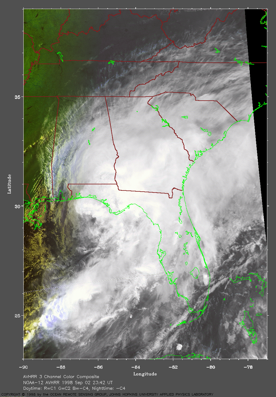
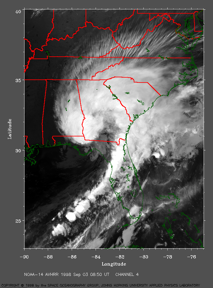 1998 September 3 08:50 UT
NOAA-14 AVHRR channel 4 nighttime
image. A closer view (438 Kb) is seen by clicking on this small
image. Earl has crossed the Gulf coast of Florida. The winds have
dropped to about 75 mph. Notice the cirrus outflow bands.
A
very large image (952 Kb) is also available.
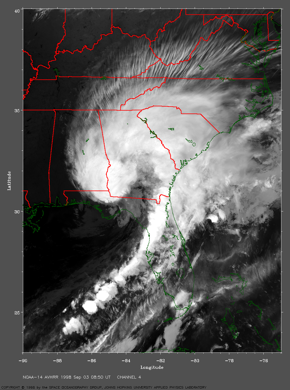
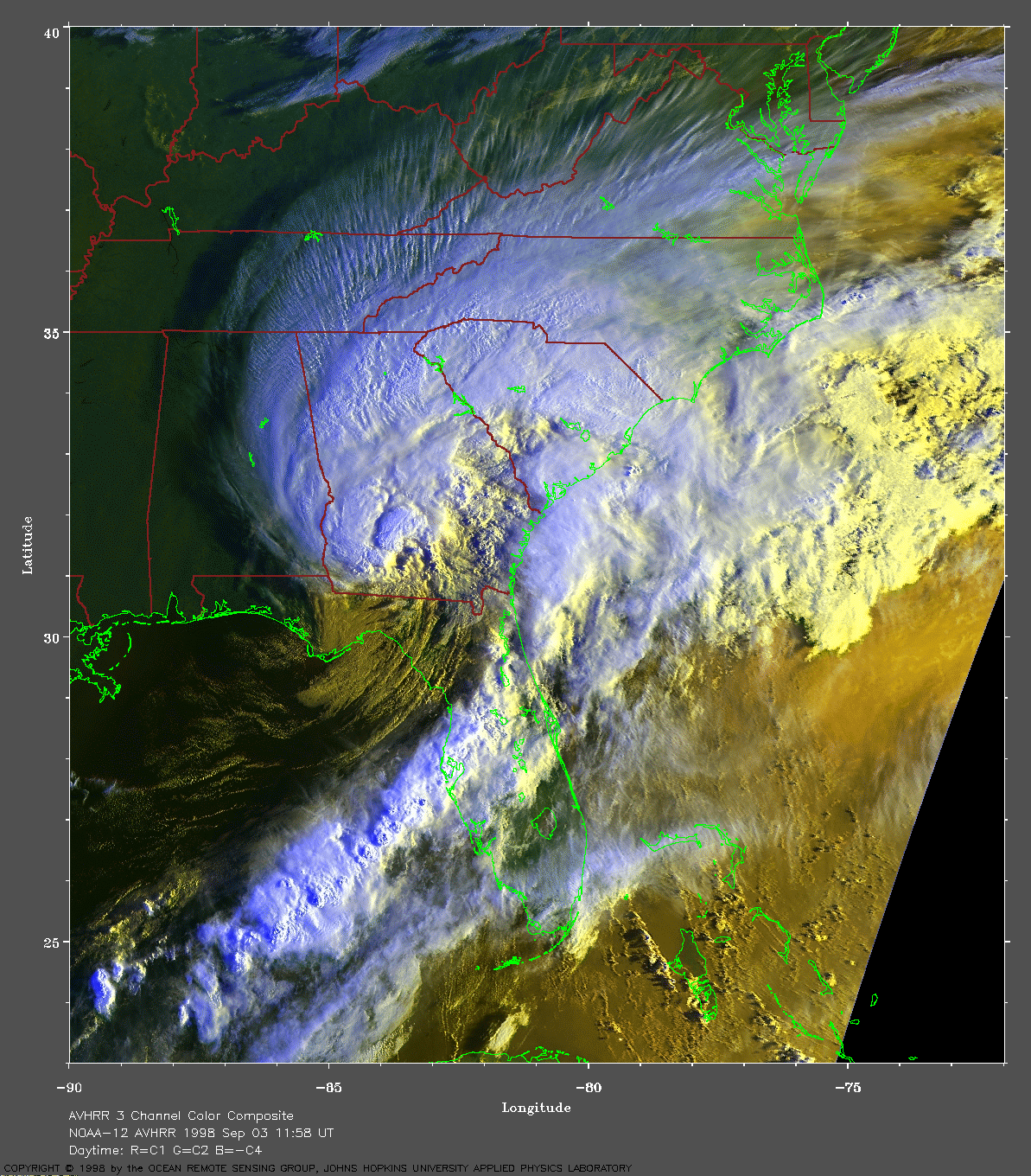
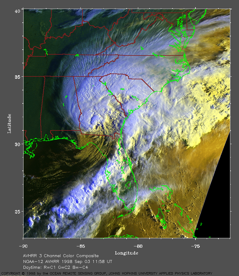 1998 September 3 11:58 UT
NOAA-12 AVHRR 3 channel composite
morning image. A closer view (424 Kb) is seen by clicking on this small
image. Earl is moving over Georgia. The maximum sustained winds remain
about 75 mph.
A
very large image (924 Kb) is also available.
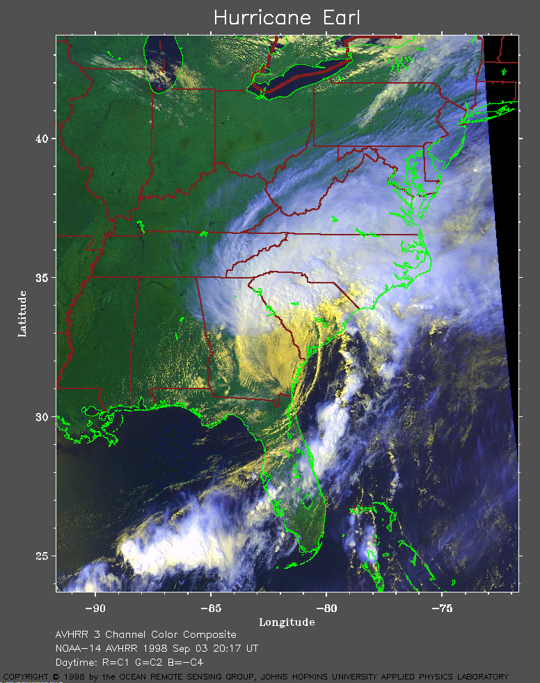 1998 September 3 20:17 UT
NOAA-14 AVHRR 3 channel composite
afternoon image. A closer view (352 Kb) is seen by clicking on this small
image. The maximum sustained winds have dropped below 45 mph.
 1998 September 3 23:20 UT
NOAA-12 AVHRR 3 channel composite
evening image. A closer view (333 Kb) is seen by clicking on this small
image.
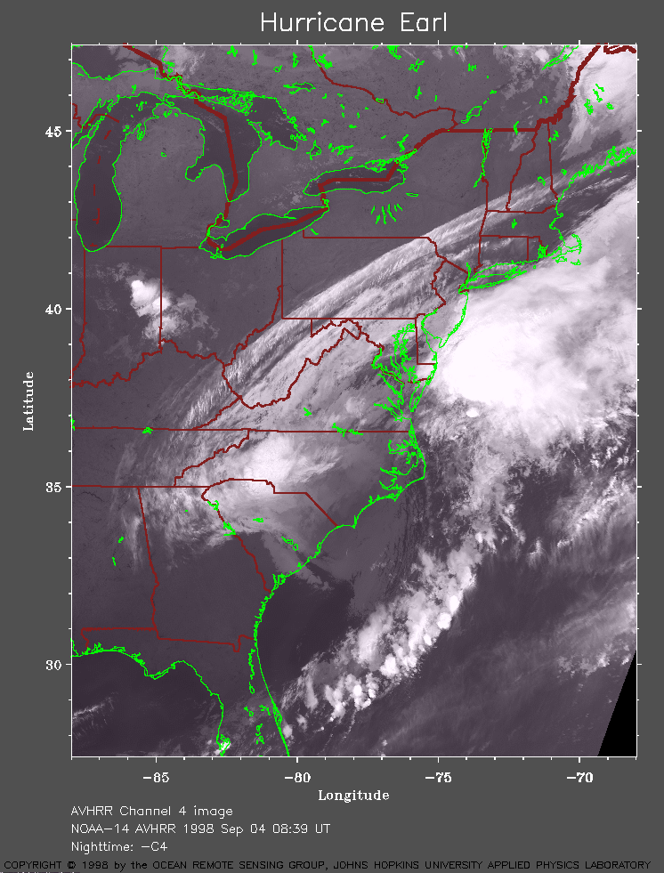 1998 September 4 08:39 UT
NOAA-14 AVHRR 3 channel composite
early morning image. A closer view (256 Kb) is seen by clicking on this
small image. The remnants of Earl are moving out to sea off the
Delmarva peninsula.