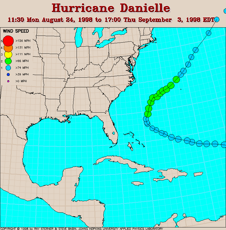
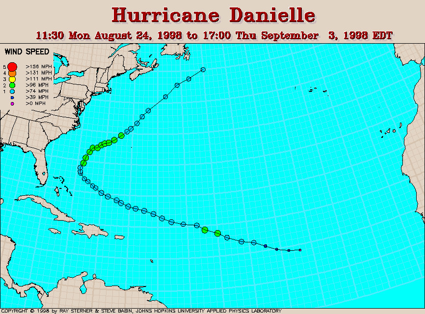
Track maps
August 30
SST with Final Track Map
The warmer sea surface temperature (SST) indicates the Gulf Stream. The
SST in this image is
derived from averaging images over 3 days ending August 30 in order to
remove cloud cover. The cooler SST's left in Bonnie's wake are plainly
visible in this image. The track of Bonnie is shown by the dash-dot
line.
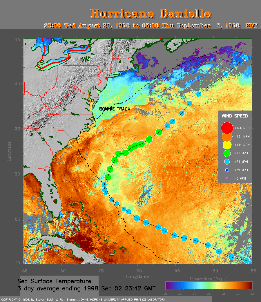
September 2 SST with Final
Track Map
The SST in this image is derived from averaging images over 3 days
ending September 2 in order to remove cloud cover. Notice the large
cool pool resulting from Danielle and the previous track of Bonnie
(dash-dot line).
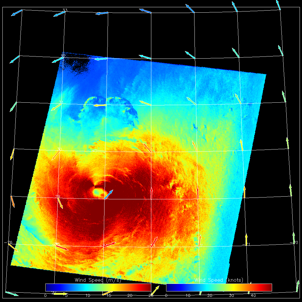 1998 August 31 10:53 UT
RADARSAT SAR-derived wind speeds (501 Kb).
These images were produced as part of the
StormWatch
project. At 09:00 UT (05:00 EDT) on 31 August, Danielle had
maximum sustained winds of 80 mph (about 36 m/s) and the center was located
at 28.8N, 74.4W. Later, at 15:00 UT (11:00 EDT), Danielle had maximum
sustained winds of 100 mph (about 45 m/s) and the center was located at
29.6N, 73.9W.
1998 August 31 10:53 UT
RADARSAT SAR-derived wind speeds (501 Kb).
These images were produced as part of the
StormWatch
project. At 09:00 UT (05:00 EDT) on 31 August, Danielle had
maximum sustained winds of 80 mph (about 36 m/s) and the center was located
at 28.8N, 74.4W. Later, at 15:00 UT (11:00 EDT), Danielle had maximum
sustained winds of 100 mph (about 45 m/s) and the center was located at
29.6N, 73.9W.
Track file
Track data (lat/lon, winds, etc.) in a text file.
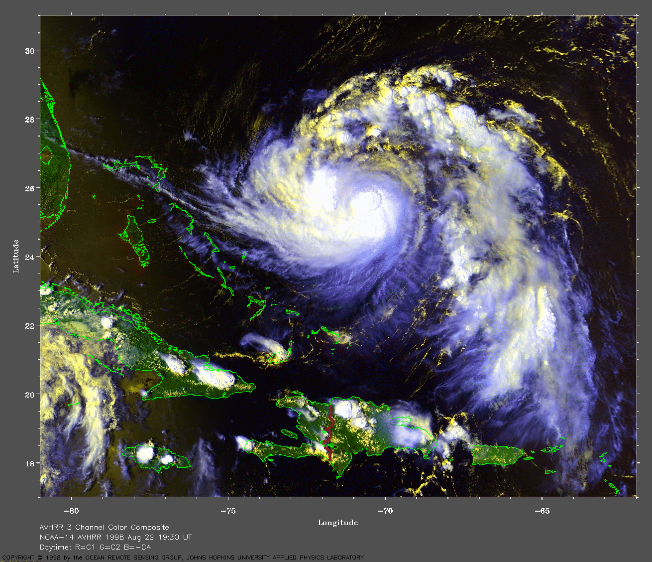
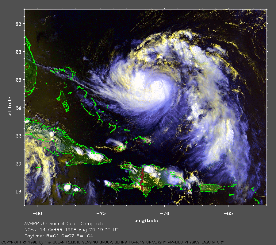 1998 August 29 19:30 UT
NOAA-14 AVHRR 3 channel composite daytime
image. A closer view (369 Kb) is seen by clicking on this small
image. The cooler clouds are white and the warmer clouds are yellow.
With 90 mph winds, Danielle is a Category 1 hurricane on the
Saffir-Simpson scale. It is moving to the northwest at the time of
this image. Notice the cirrus outflow (cool white clouds). A
very large image (796 Kb) is also available.
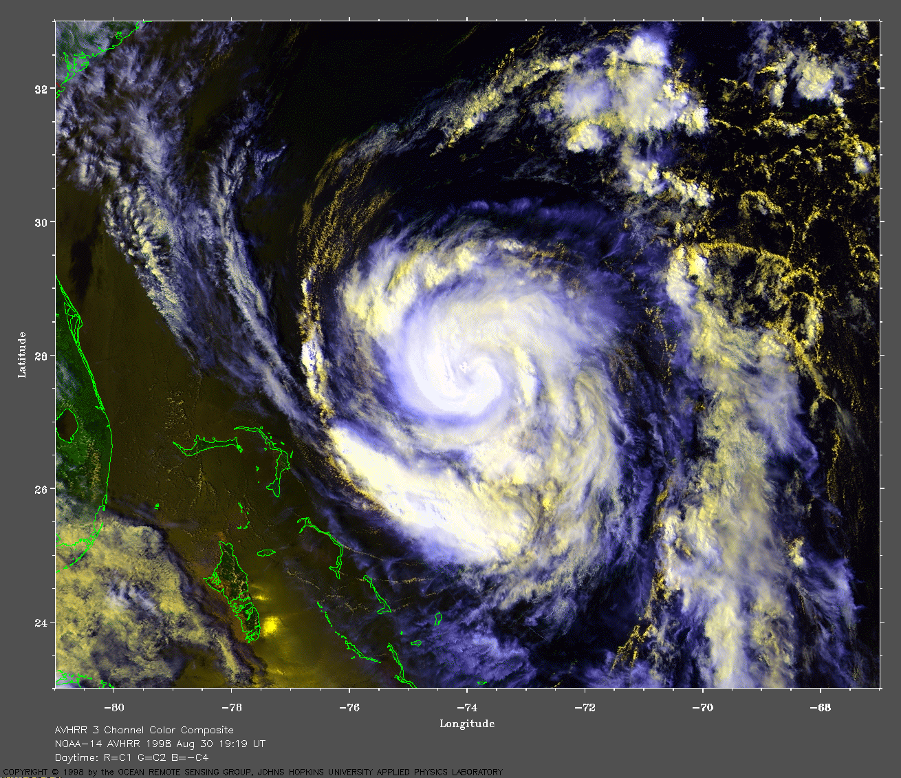
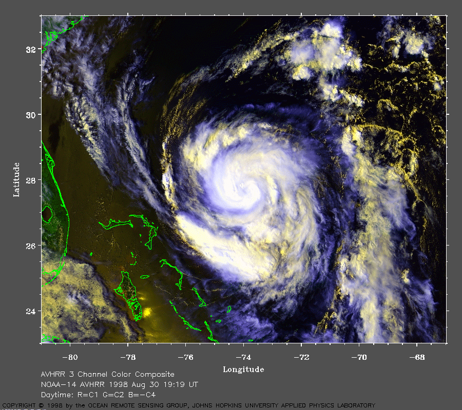 1998 August 30 19:19 UT
NOAA-14 AVHRR 3 channel composite daytime
image. A closer view (407 Kb) is seen by clicking on this small
image. The winds have decreased to about 75 mph. At least partially,
this may be due to the passage of Danielle
across the cool wake left by Bonnie (see sea surface temperature image
above). A
very large image (872 Kb) is also available.
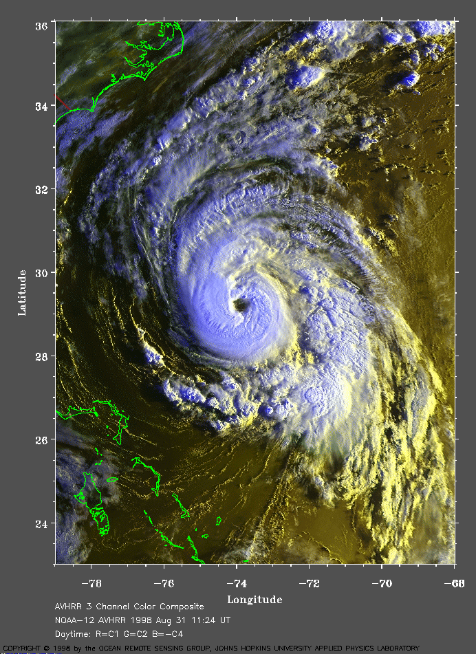 1998 August 31 11:24 UT
NOAA-12 AVHRR 3 channel composite morning
image. A closer view (411 Kb) is seen by clicking on this small
image. The maximum sustained winds have now increased to about 80 mph.
Danielle is now moving over warmer water. The eye of Danielle is
plainly visible in this image.
A
very large image (914 Kb) is also available.
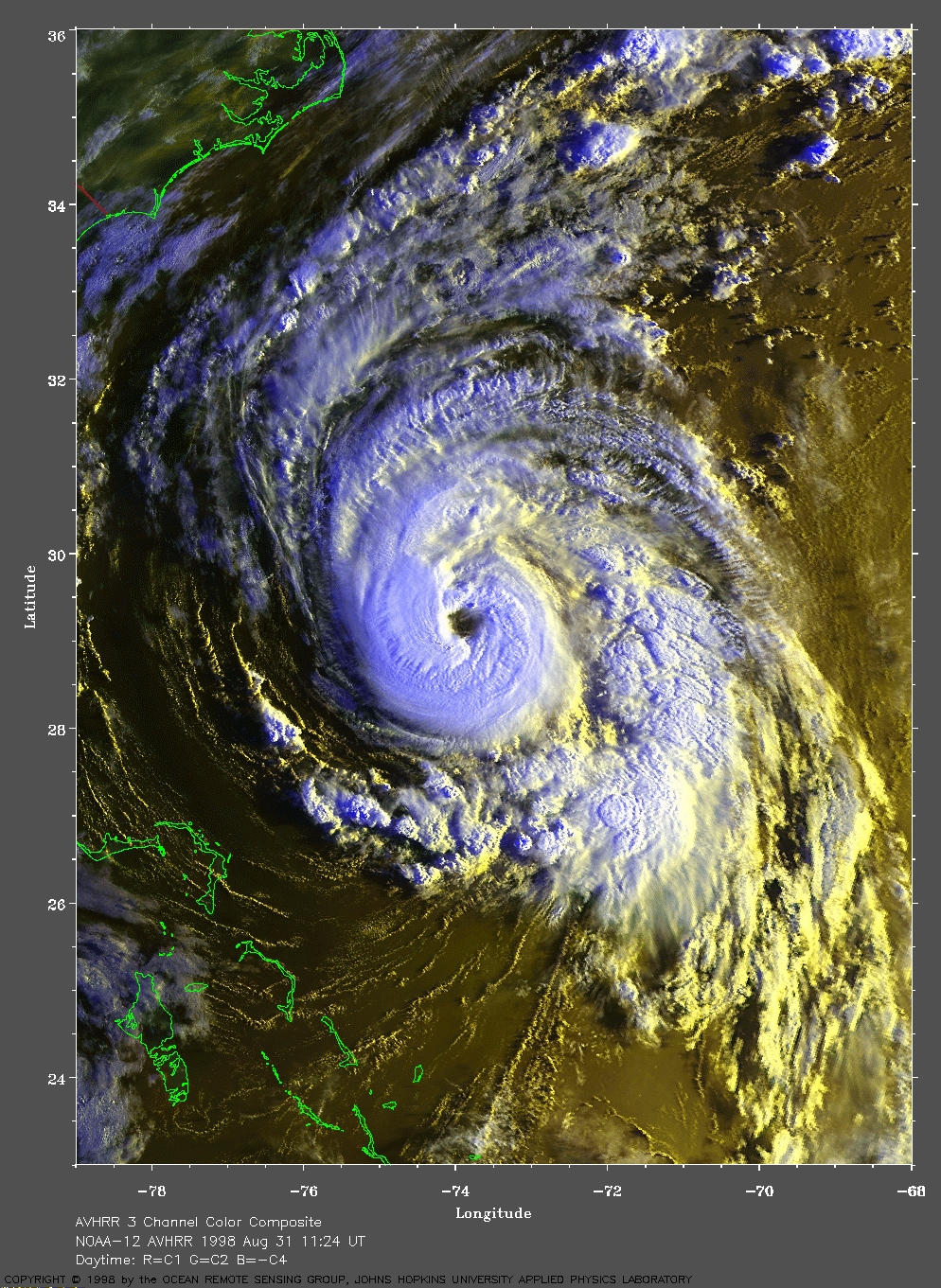
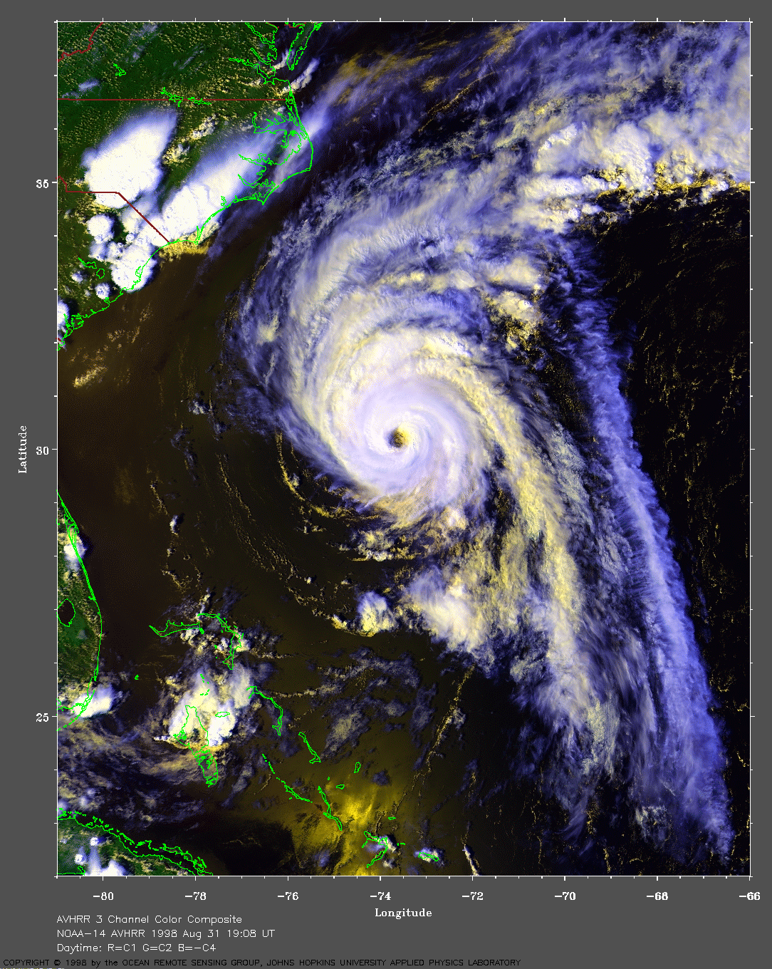
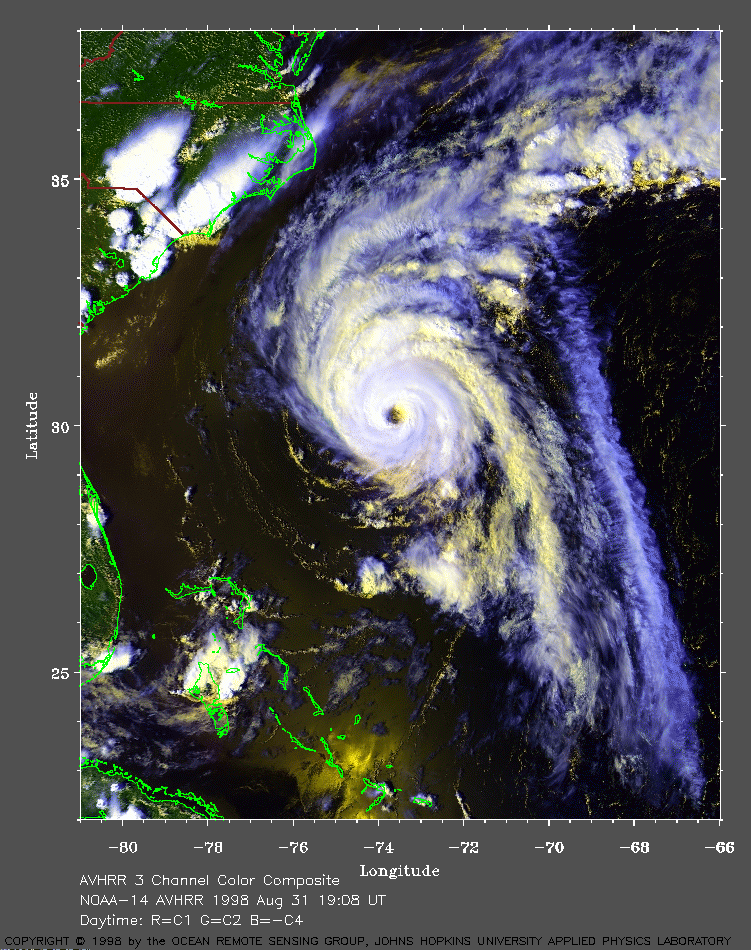 1998 August 31 19:08 UT
NOAA-14 AVHRR 3 channel composite daytime
image. A closer view (399 Kb) is seen by clicking on this small
image. Danielle has intensified to a Category 2 hurricane on the
Saffir-Simpson scale, with winds now at about 100 mph. Notice the
impressive cirrus outflow on the east side. Also notice how the lower
(warmer) clouds of the eyewall are yellow and the upper (cooler) clouds
are white.
A
very large image (844 Kb) is also available.
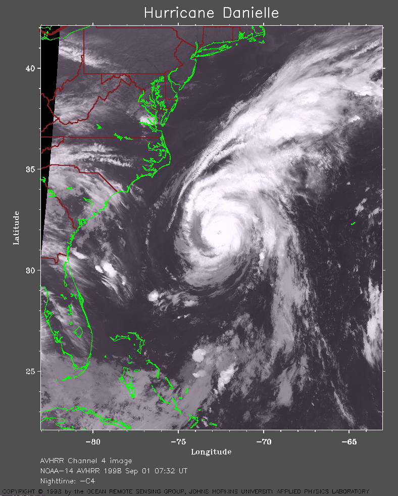 1998 September 1 07:32 UT
NOAA-14 AVHRR channel 4 nighttime
image. A closer view (289 Kb) is seen by clicking on this small
image. The maximum sustained winds have now increased to 100 mph.
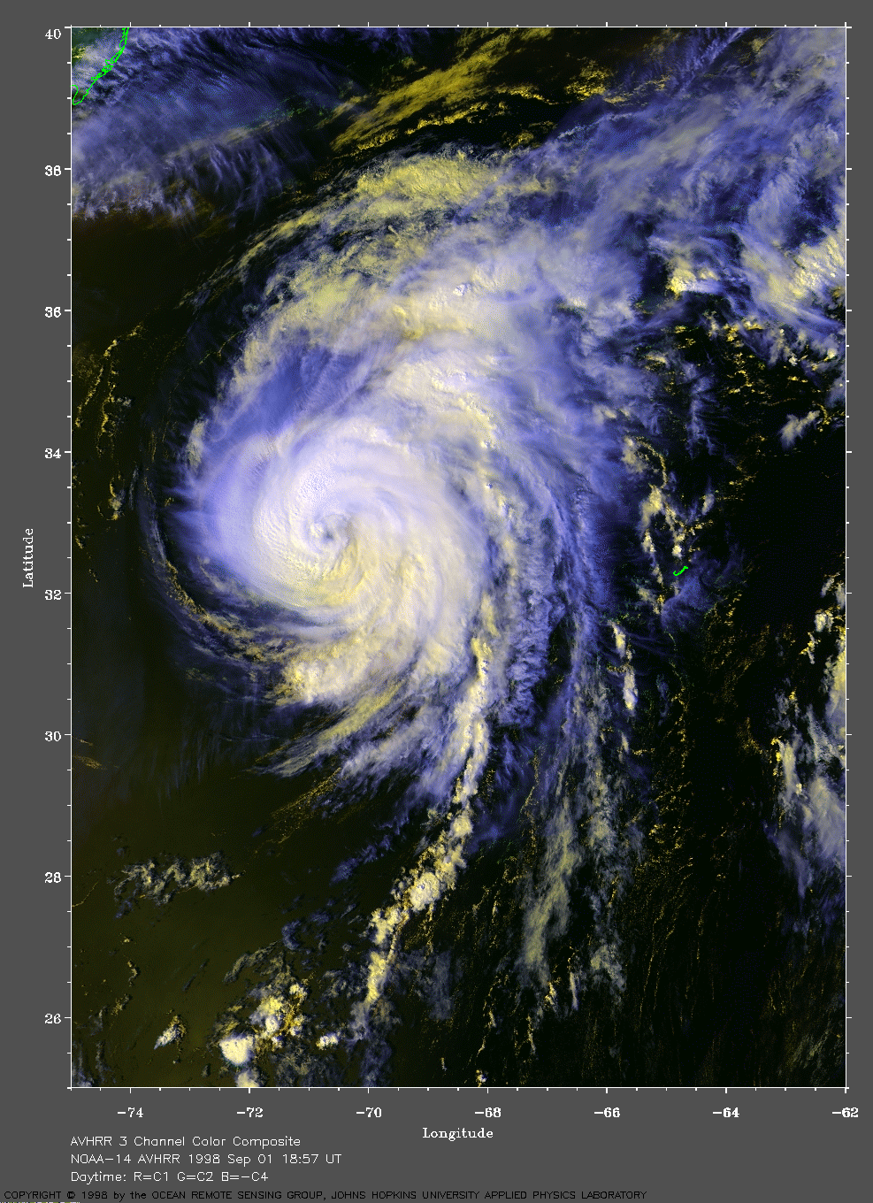
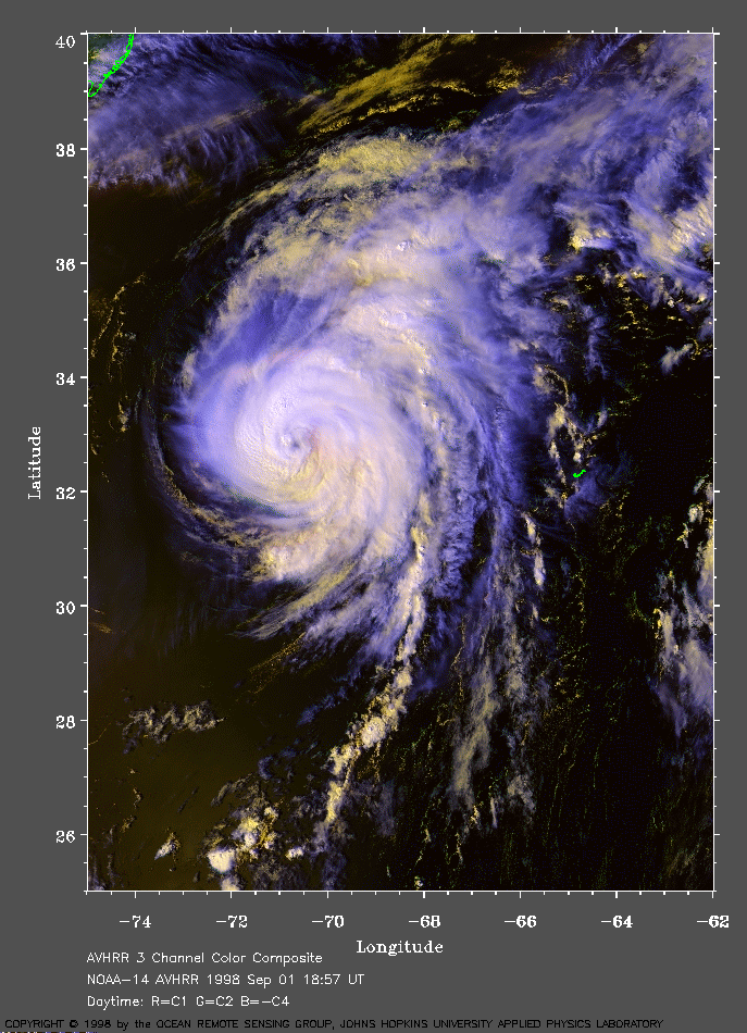 1998 September 1 18:57 UT
NOAA-14 AVHRR 3 channel composite daytime
image. A closer view (322 Kb) is seen by clicking on this small
image. Danielle lies just west of the island of Bermuda (small green
outline).
A
very large image (709 Kb) is also available.
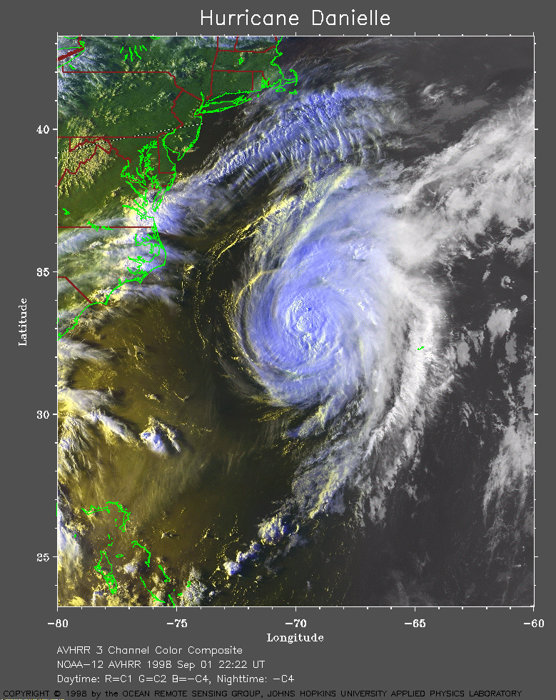 1998 September 1 22:22 UT
NOAA-12 AVHRR 3 channel composite evening
image. A closer view (411 Kb) is seen by clicking on this small
image.
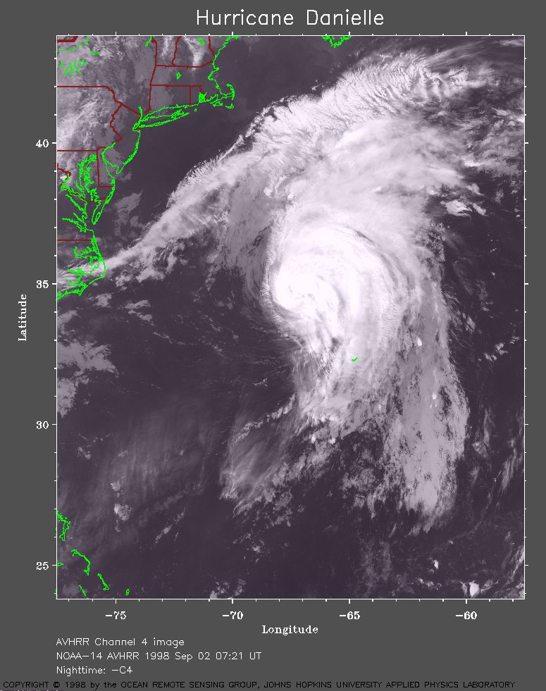 1998 September 2 07:21 UT
NOAA-14 AVHRR channel 4 nighttime
image. A closer view (278 Kb) is seen by clicking on this small
image.
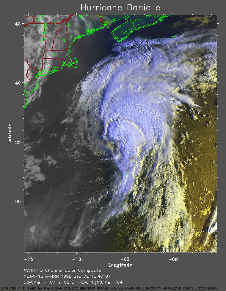 1998 September 2 10:40 UT
NOAA-12 AVHRR 3 channel composite early
morning image. A closer view (412 Kb) is seen by clicking on this small
image. As Danielle enters cooler waters, the winds have dropped to 85 mph.
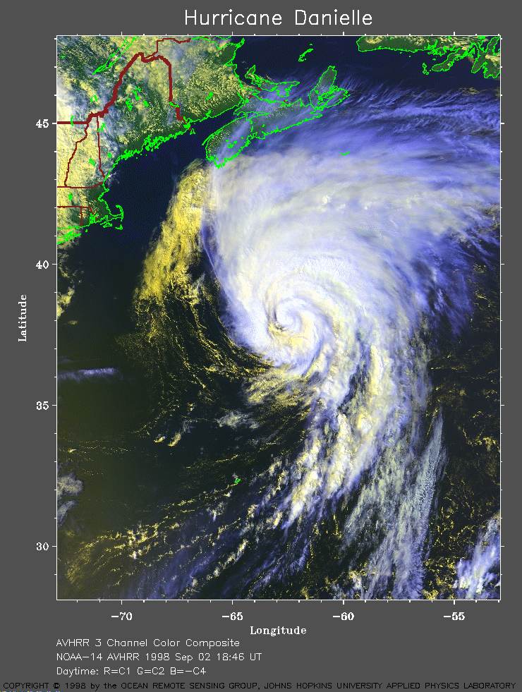 1998 September 2 18:46 UT
NOAA-14 AVHRR 3 channel composite
daytime image. A closer view (370 Kb) is seen by clicking on this small
image. The winds are now about 80 mph.
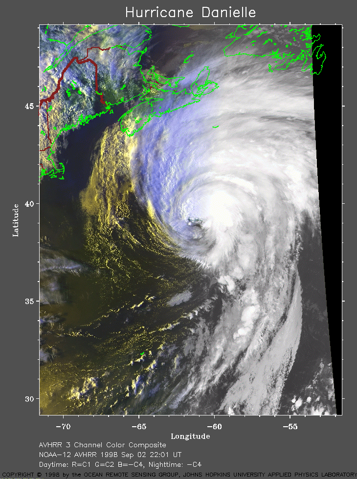 1998 September 2 22:01 UT
NOAA-12 AVHRR 3 channel composite evening
image. A closer view (358 Kb) is seen by clicking on this small
image.
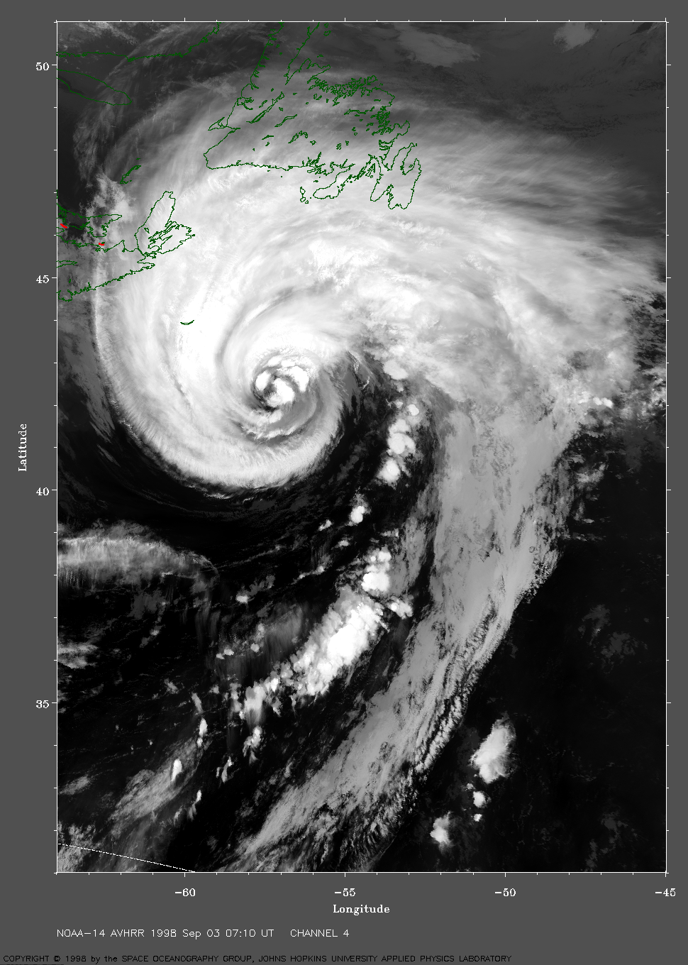
 1998 September 3 07:10 UT
NOAA-14 AVHRR channel 4 nighttime
image. A closer view (406 Kb) is seen by clicking on this small
image. The maximum sustained winds are now about 75 mph.
A very large image
(888 Kb) is also available.