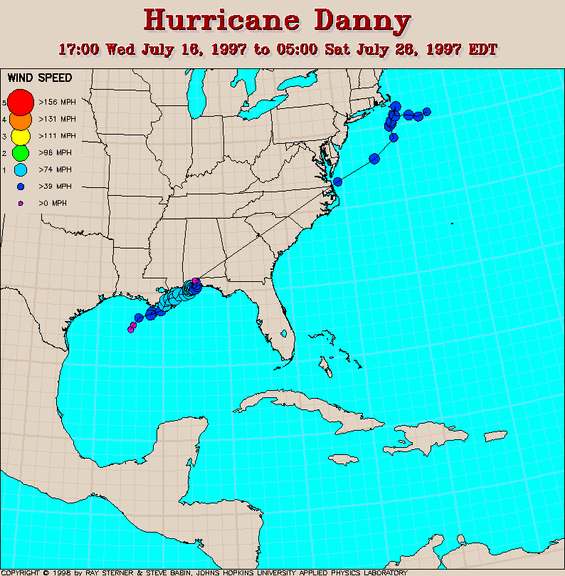
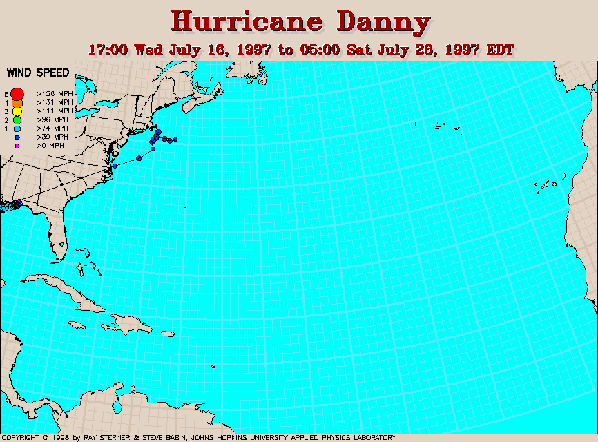
Track maps
Track file
Track data in a text file.
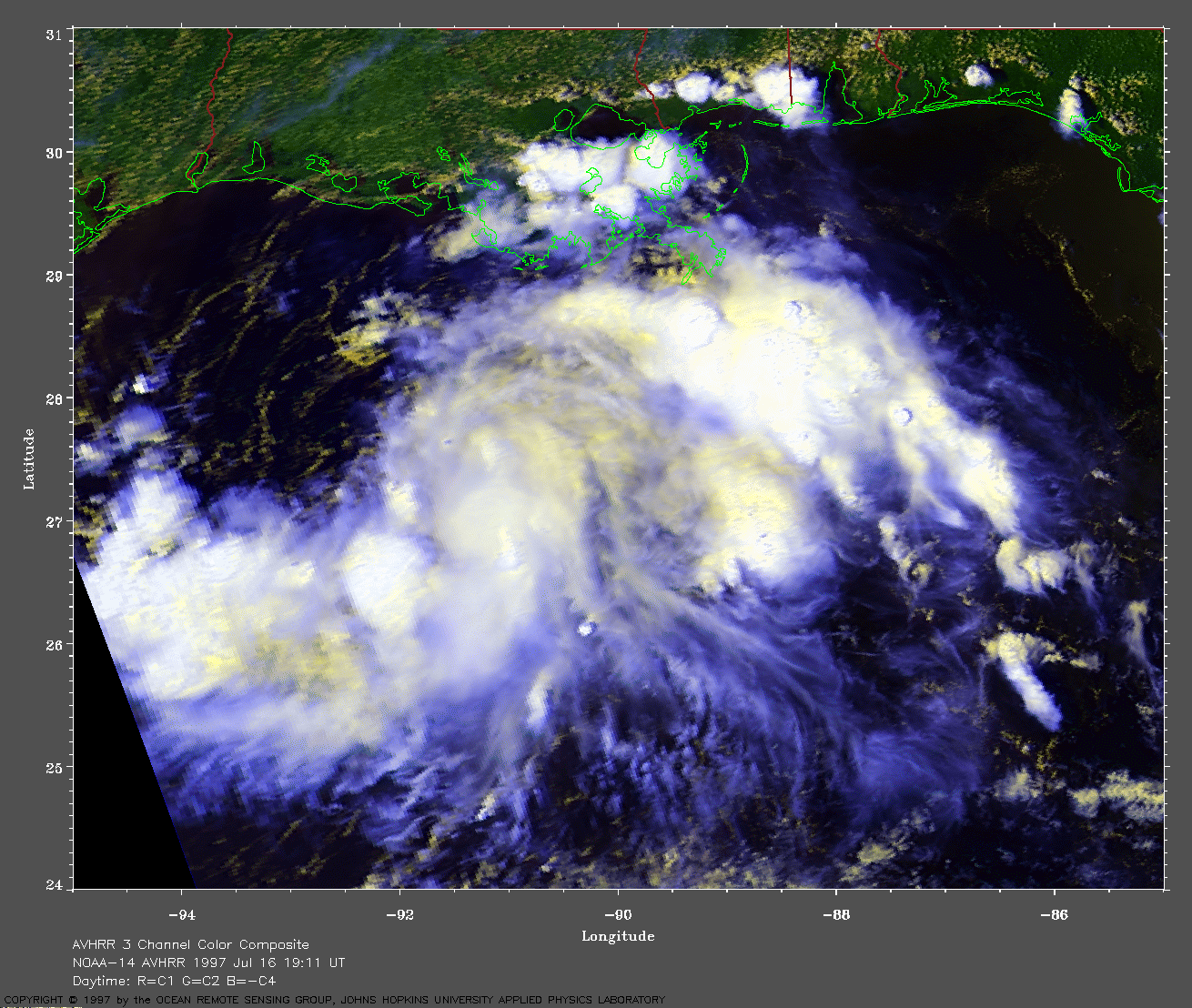
 1997 July 16 19:11
UT
1997 July 16 19:11
UT
NOAA-14 AVHRR 3 channel composite daytime image. The cooler
clouds are white and the warmer clouds are yellow. A closer view (334
Kb) is seen by clicking on this small image. At this time, Danny is
still a developing tropical depression.
A very large image (726
Kb) is also available.
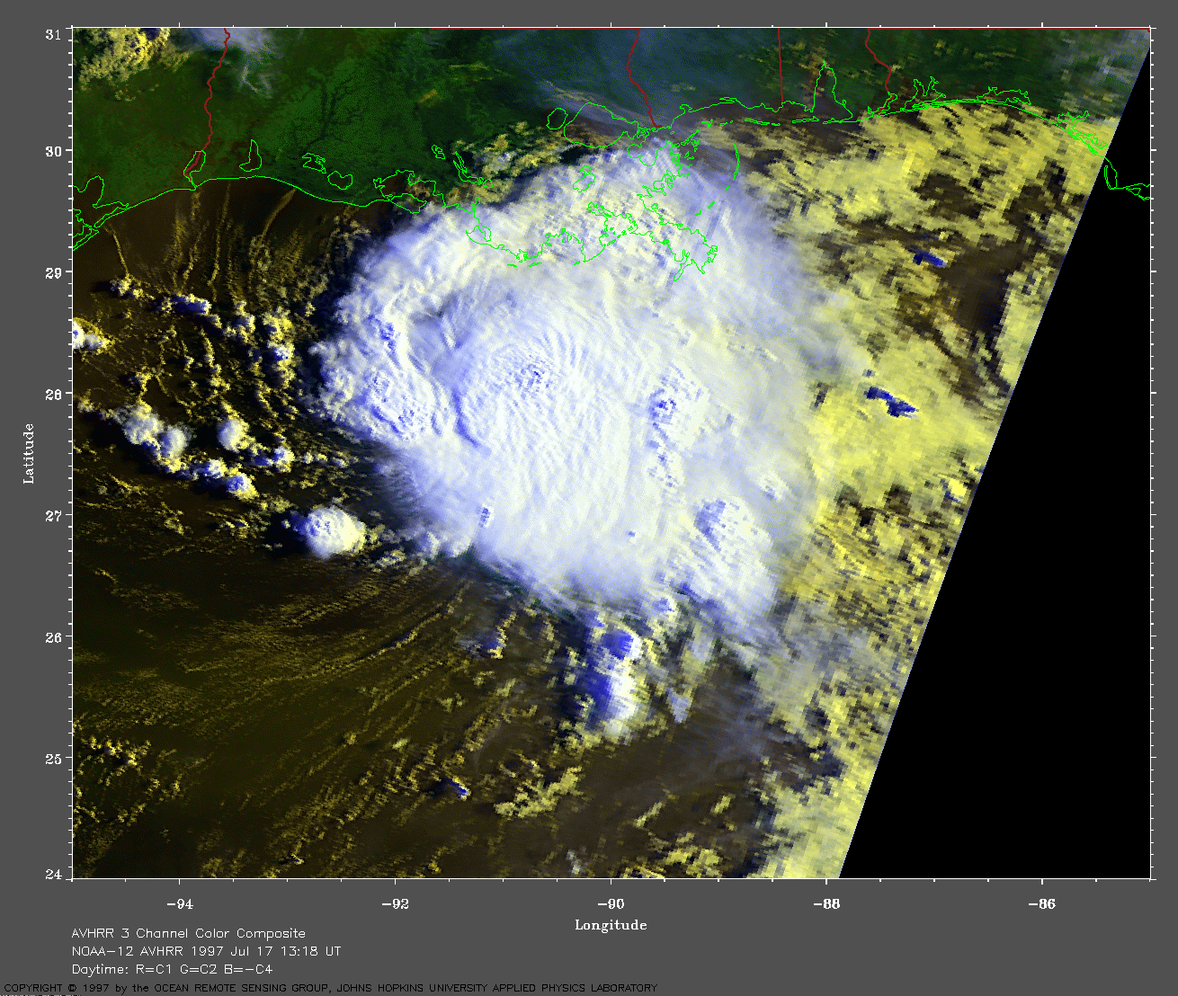
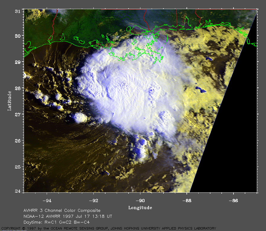 1997 July 17 13:18
UT
1997 July 17 13:18
UT
NOAA-12 AVHRR 3 channel composite daytime image. The cooler
clouds are white and the warmer clouds are yellow. A closer view (317
Kb) is seen by clicking on this small image. Danny is now classified as
a tropical storm.
A very large image (677
Kb) is also available.
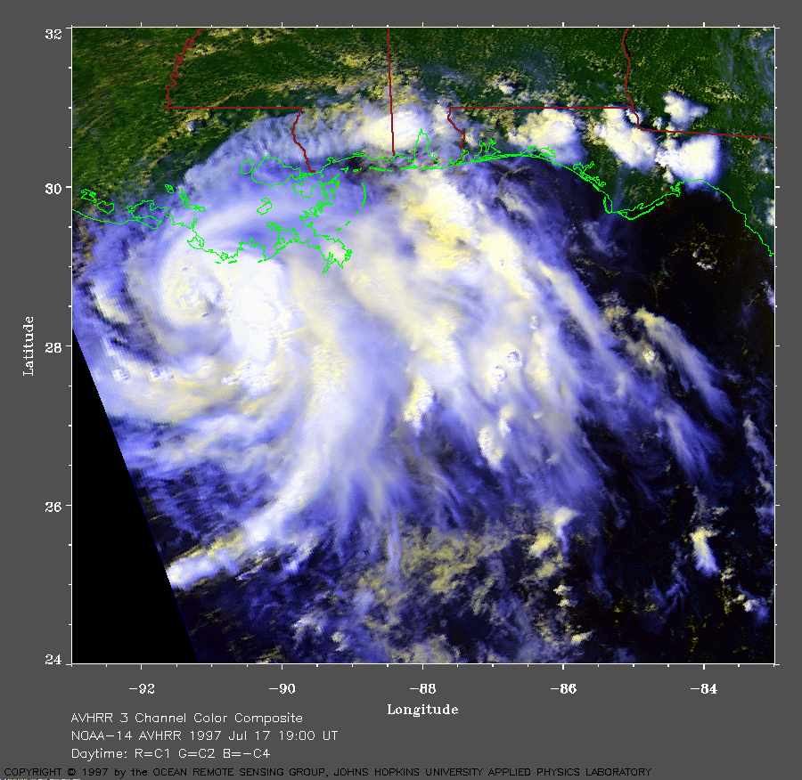 1997 July 17 19:00
UT
1997 July 17 19:00
UT
NOAA-14 AVHRR 3 channel composite daytime image. The cooler
clouds are white and the warmer clouds are yellow. A closer view (383
Kb) is seen by clicking on this small image. The storm is nearly
stationary and has maximum sustained winds of 60 mph.
A very large image (835
Kb) is also available.
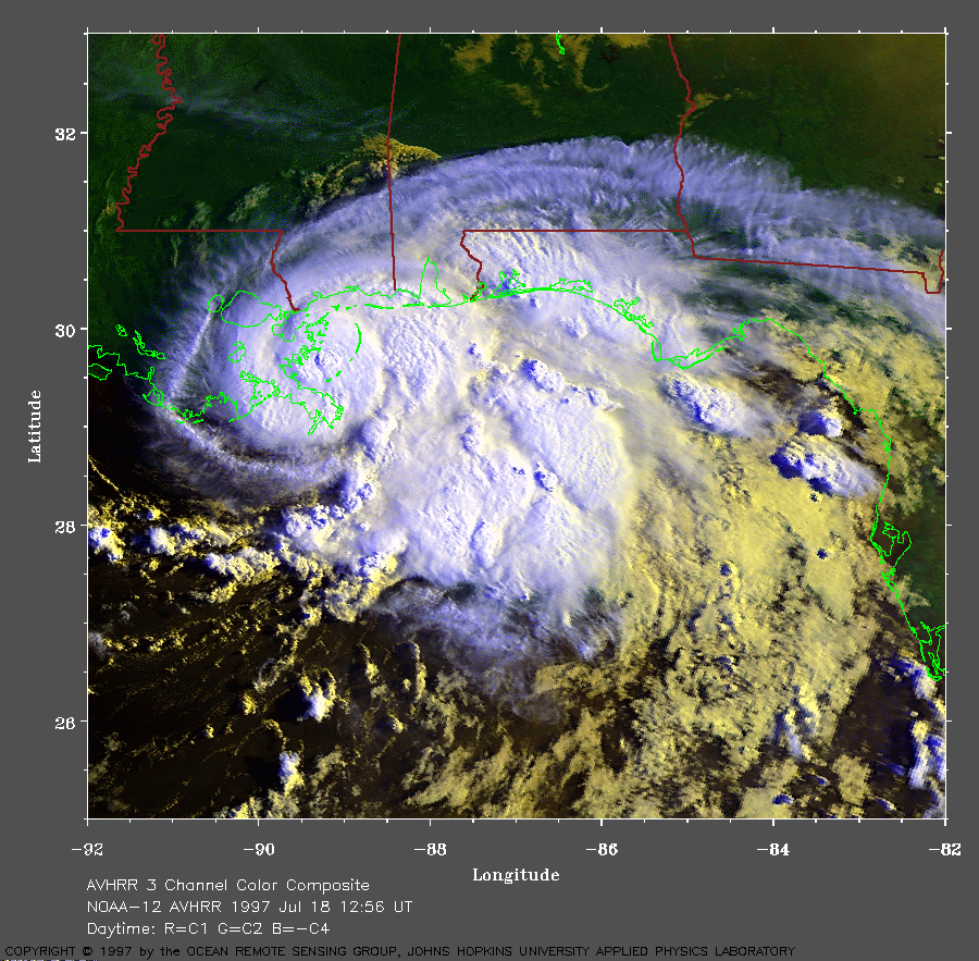 1997 July 18 12:56
UT
1997 July 18 12:56
UT
NOAA-12 AVHRR 3 channel composite daytime image. The cooler
clouds are white and the warmer clouds are yellow. A closer view (421
Kb) is seen by clicking on this small image. The storm is slowly moving
toward the northeast and has maximum sustained winds of 75 mph.
A very large image (888
Kb) is also available.
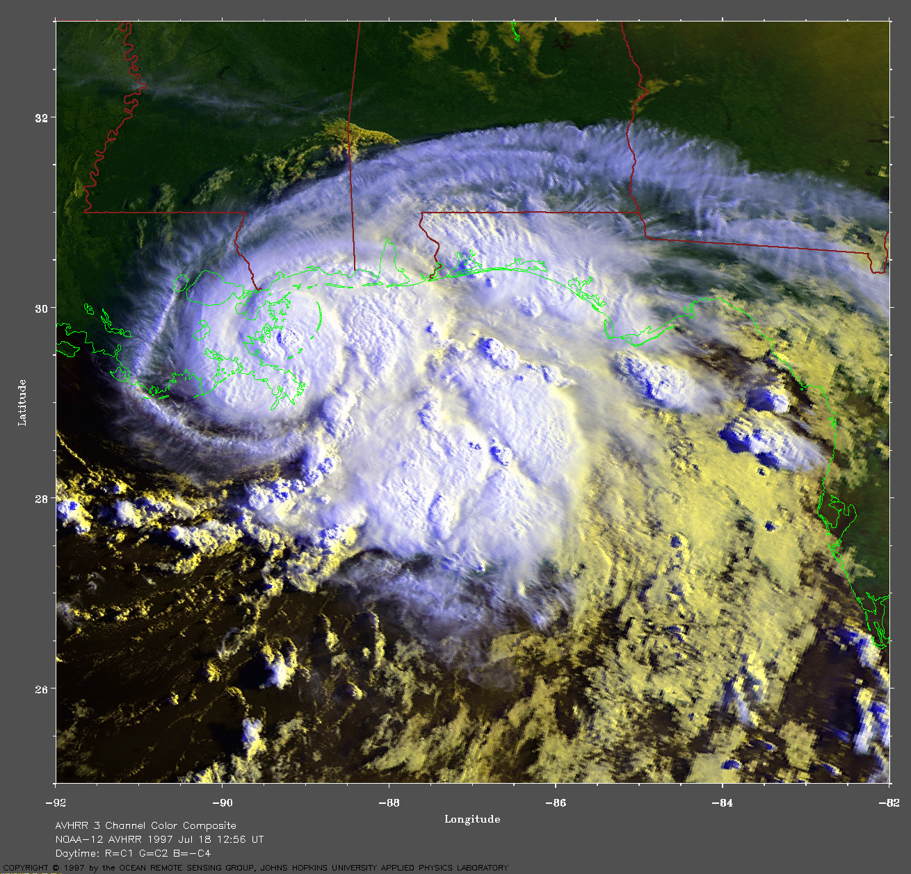
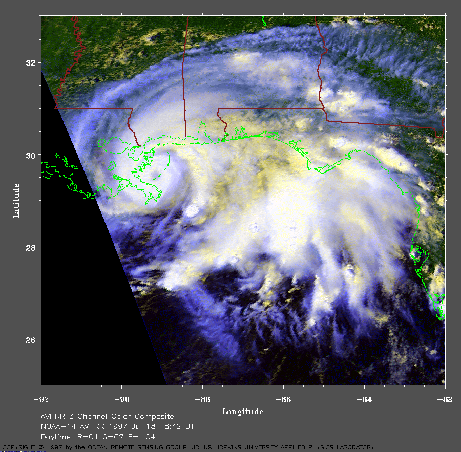 1997 July 18 18:49
UT
1997 July 18 18:49
UT
NOAA-14 AVHRR 3 channel composite daytime image. The cooler
clouds are white and the warmer clouds are yellow. A closer view (339
Kb) is seen by clicking on this small image. The eye of the hurricane
can be seen in these images. These images are somewhat blurred because
they are near the edge of the satellite viewing area.
A very large image (720
Kb) is also available.
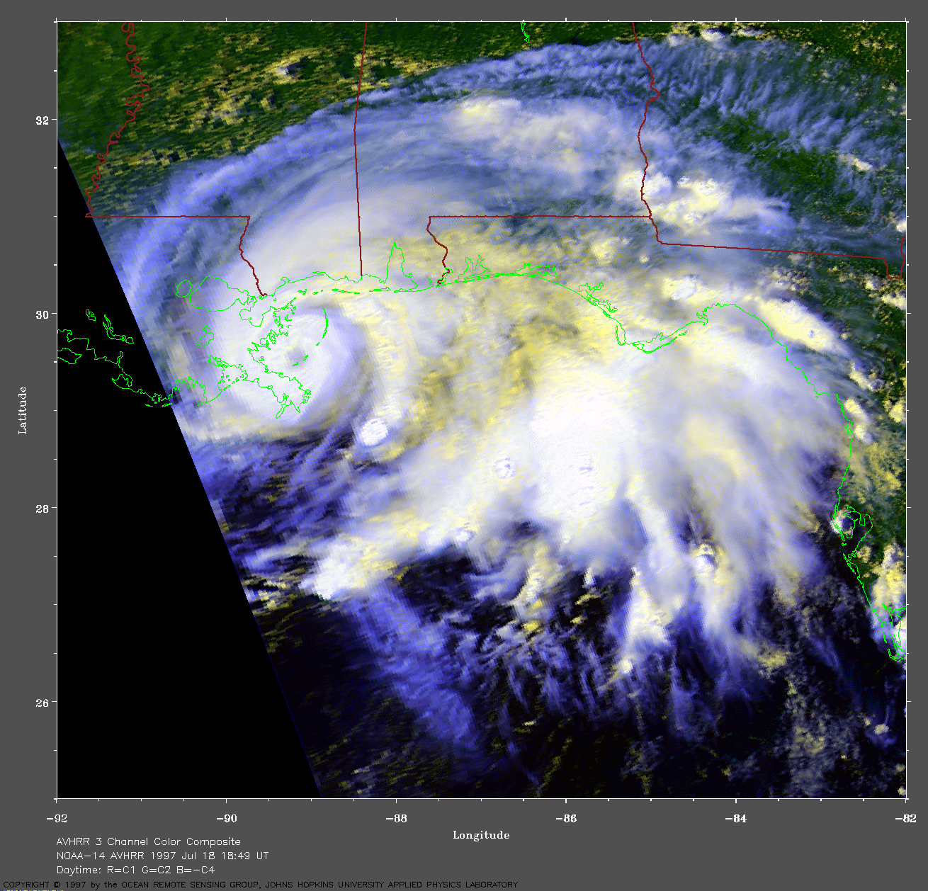
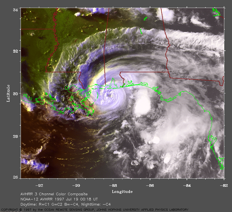 1997 July 19 00:18
UT
1997 July 19 00:18
UT
NOAA-12 AVHRR 3 channel composite daytime image. The cooler
clouds are white and the warmer clouds are yellow. A closer view (340
Kb) is seen by clicking on this small image. This late evening image
shows a well-defined eye moving slowly toward Mobile Bay.
A very large image (795
Kb) is also available.
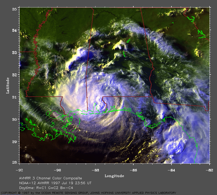 1997 July 19 23:56
UT
1997 July 19 23:56
UT
NOAA-12 AVHRR 3 channel composite daytime image. The cooler
clouds are white and the warmer clouds are yellow. A closer view (359
Kb) is seen by clicking on this small image. The storm is making
landfall on the coast of Alabama. Notice the waves in the rainband
clouds.
A very large image (781
Kb) is also available.
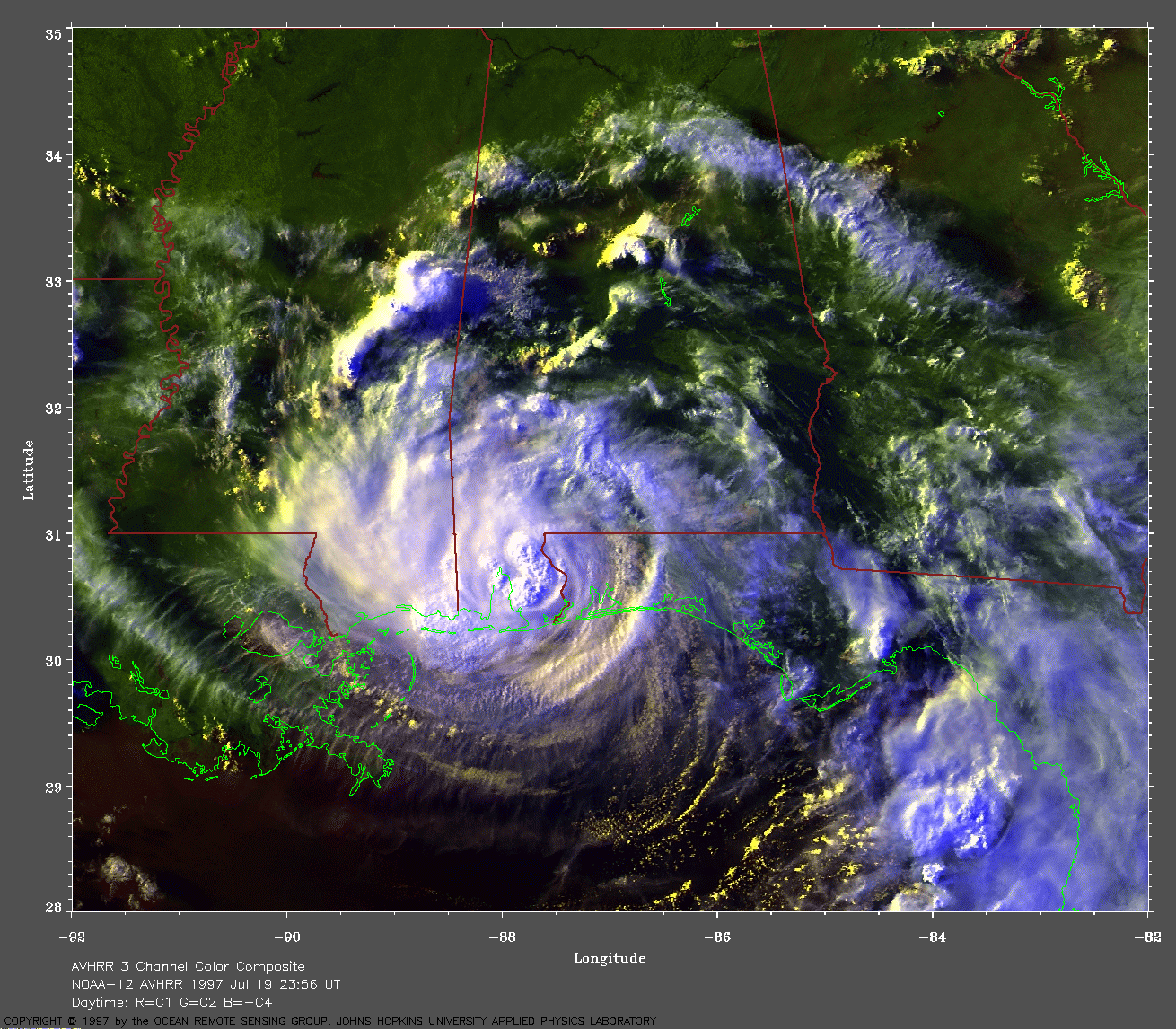
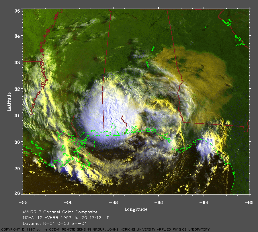 1997 July 20 12:12
UT
1997 July 20 12:12
UT
NOAA-12 AVHRR 3 channel composite daytime image. The cooler
clouds are white and the warmer clouds are yellow. A closer view (354
Kb) is seen by clicking on this small image. Danny is no longer a
hurricane. Notice the many wave features in the clouds surrounding
Danny.
A very large image (742
Kb) is also available.
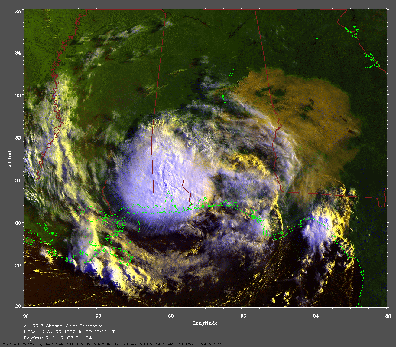
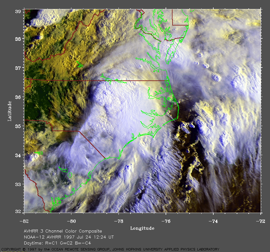 1997 July 24 12:24
UT
1997 July 24 12:24
UT
NOAA-12 AVHRR 3 channel composite daytime image. The cooler
clouds are white and the warmer clouds are yellow. A closer view (445
Kb) is seen by clicking on this small image. After making landfall on
the Gulf Coast, the storm slowly moved across Alabama, Georgia, and the
Carolinas, bringing heavy rains and flooding to these areas. The storm
is now beginning to strengthen over North Carolina. The pressure at
Raleigh-Durham airport dropped almost 20 hPa in 2 hours. The
circulation has become tighter and the winds are increasing. Notice how
rainbands are forming on the eastern side of the storm. The storm will
enter the Atlantic Ocean as Tropical Storm Danny.
A very large image (966
Kb) is also available.
 1997 July 24 19:25
UT
1997 July 24 19:25
UT
NOAA-14 AVHRR 3 channel composite daytime image. The cooler
clouds are white and the warmer clouds are yellow. A closer view (376
Kb) is seen by clicking on this small image. Tropical Storm Danny is
now over the Atlantic Ocean. Notice that an eye appears to be forming.
As it moved offshore, Danny spawned several tornadoes and water spouts
around Virginia Beach, VA, and Kitty Hawk, NC.
A very large image (822
Kb) is also available.
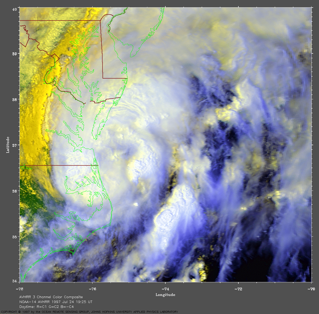
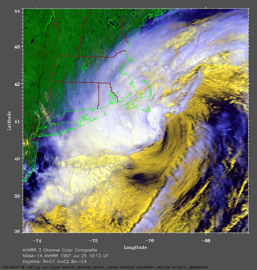 1997 July 25 19:13
UT
1997 July 25 19:13
UT
NOAA-14 AVHRR 3 channel composite daytime image. The cooler
clouds are white and the warmer clouds are yellow. A closer view (405
Kb) is seen by clicking on this small image. The storm has moved over
cooler water (17 C) off Nantucket. While it still has 60 mph winds, the
cooler water in this area will not be enough to sustain it much longer.
A very large image (880
Kb) is also available.
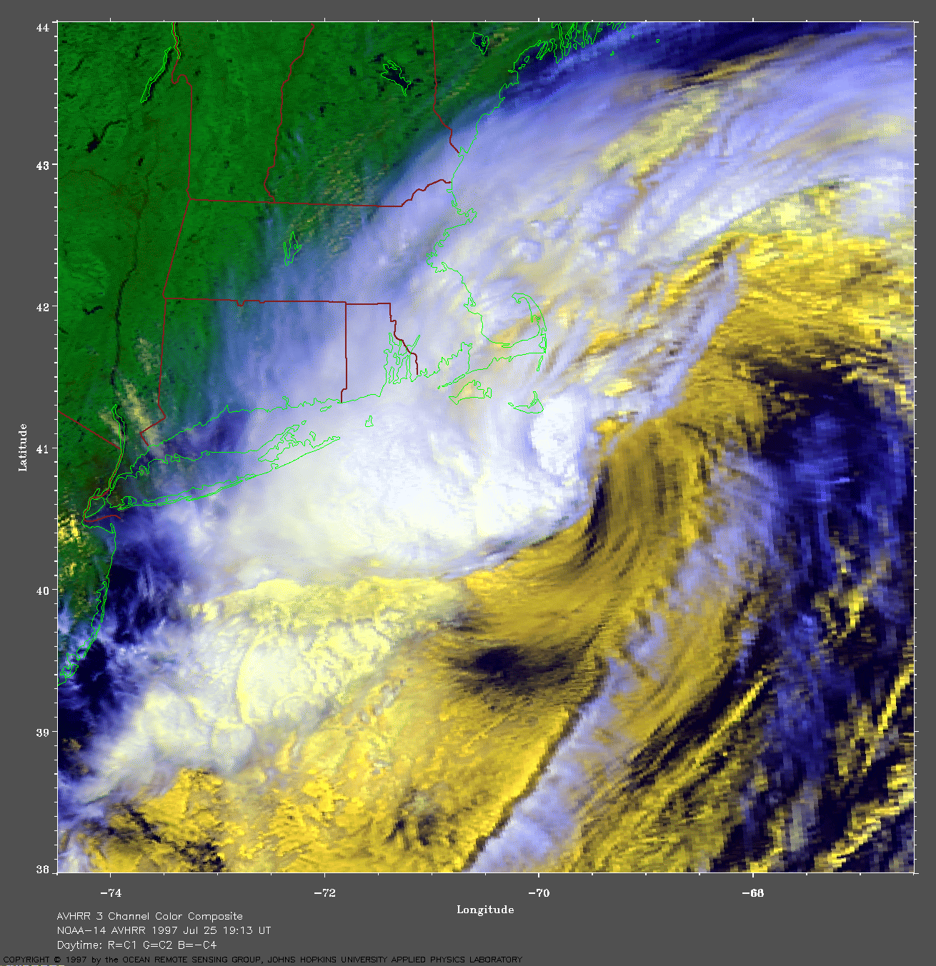
 Track of Danny
superimposed over SST imagery.
A closer view (302 Kb) is seen by clicking on this small image.
The image shows sea surface temperature (SST) of the
northern Gulf Stream region along the US coast. The SST's are derived
from averaging images over 3 days ending July 24 in order to remove
cloud cover.
Track of Danny
superimposed over SST imagery.
A closer view (302 Kb) is seen by clicking on this small image.
The image shows sea surface temperature (SST) of the
northern Gulf Stream region along the US coast. The SST's are derived
from averaging images over 3 days ending July 24 in order to remove
cloud cover.