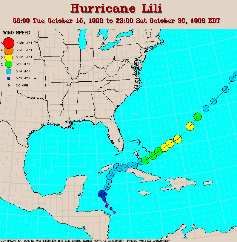
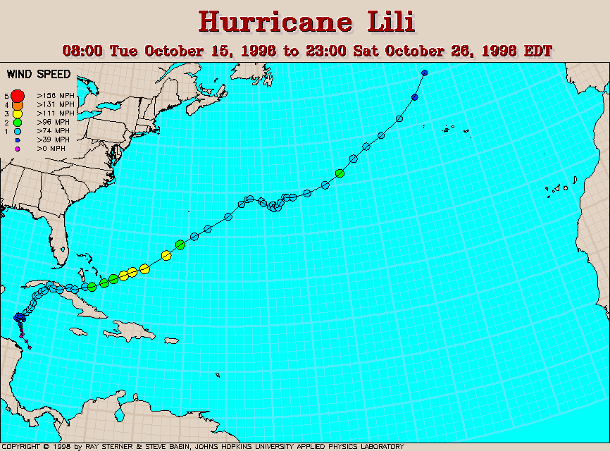
Track maps
Track file
Track data in a text file.

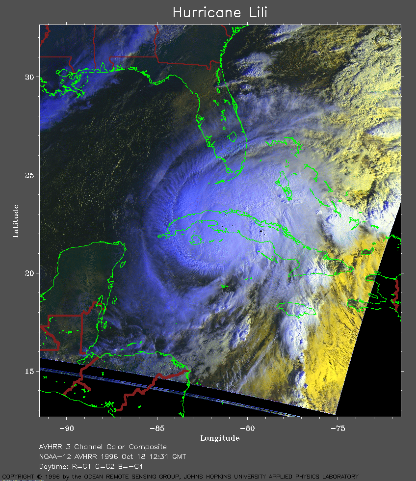
1996 Oct 18 12:31 UT
NOAA-12 AVHRR 3 channel color composite. The cooler
clouds appear white and the warmer clouds appear yellow. This image
shows the storm over Cuba. Click on the image for a larger (169 Kb)
view. Click here
for a very large view (407 Kb).
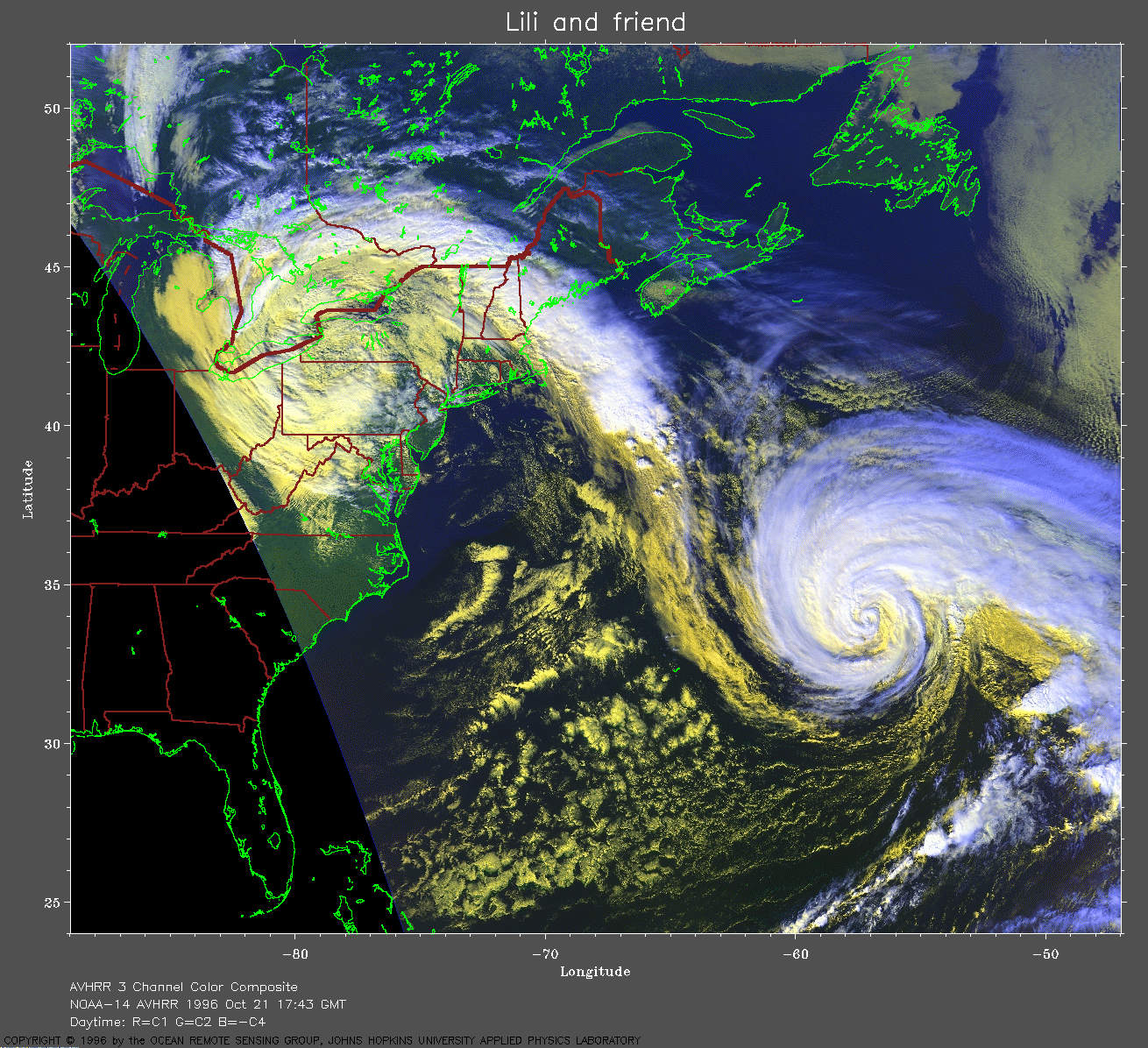
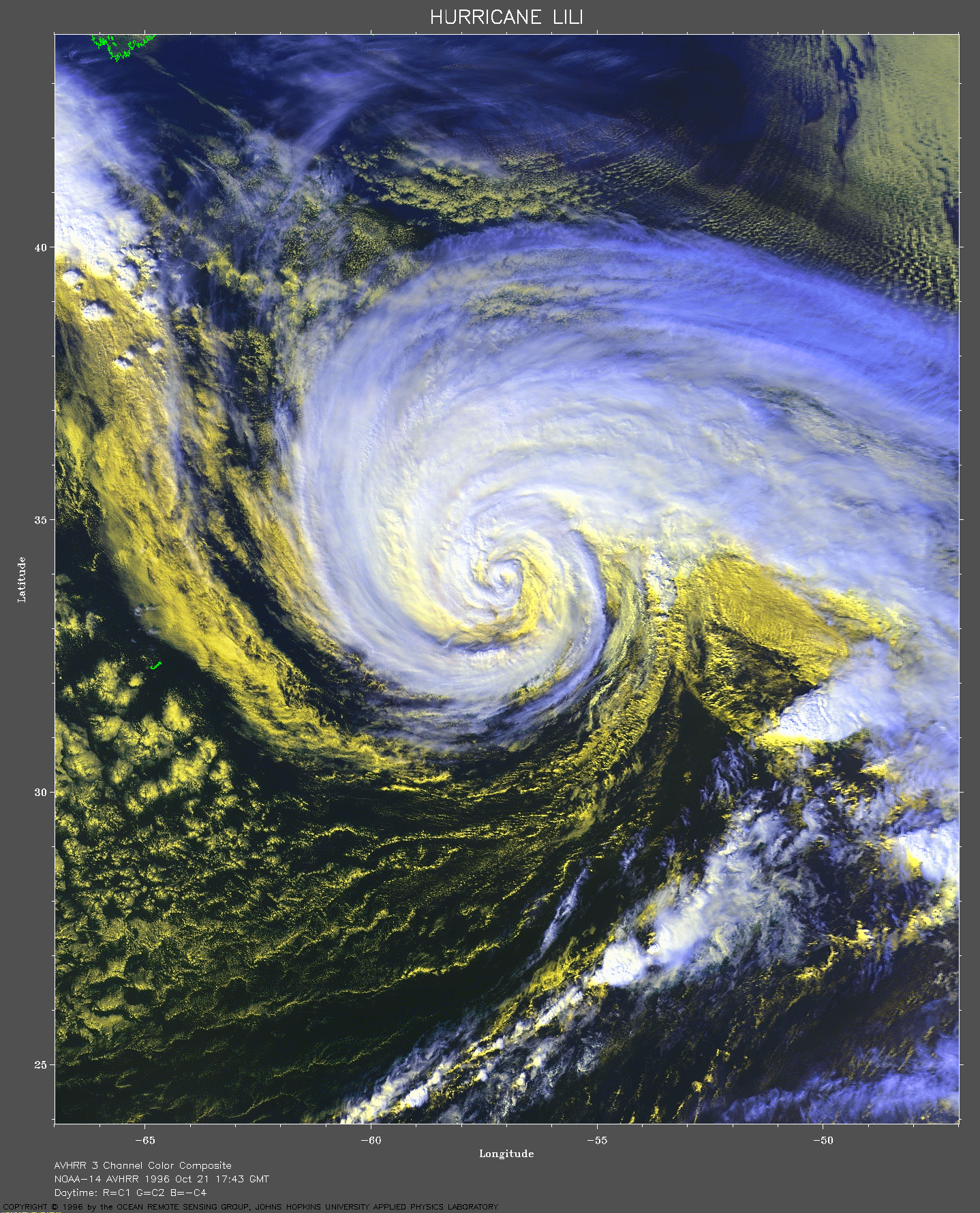
1996 Oct 21 17:43 UT
NOAA-14 AVHRR 3 channel color composite. The cooler
clouds appear white and the warmer clouds appear yellow. This image
shows the storm (lower right) forming a connection with a strong low
pressure system over the eastern U.S (upper left). Click on the image
for a larger (796 Kb) view.
1996 Oct 21 17:43 UT
Click on the image for a very large closeup of Lili (1551 Kb).
Software has been developed to image storms with a moving viewing window. Hurricane Lili is the first storm to be viewed with this software. During the course of the storm the software was refined so some variations in image quality may be seen. The images are presented on the web page with the latest at the top, so to view them in time order start at the bottom. Here are the images.