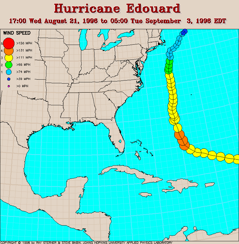
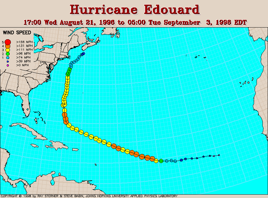
Track maps.
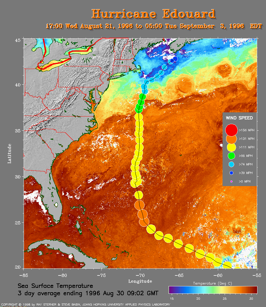 SST Map
Track plotted on average sea surface temperature.
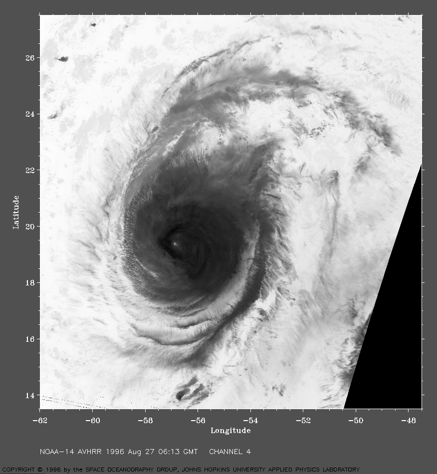
1996 Aug 27 06:13 UT
NOAA-14 AVHRR channel 4 image.
Channel 4 indicates temperature variations, the glow
from the warm sea below is blocked by the cooler clouds above.
The highest clouds are cold and show as dark in this image.
A small patch of warm water is seen through the tiny eye.
An idea of the size of this storm is given by the latitude scale,
1 degree in latitude is 60 nautical miles.
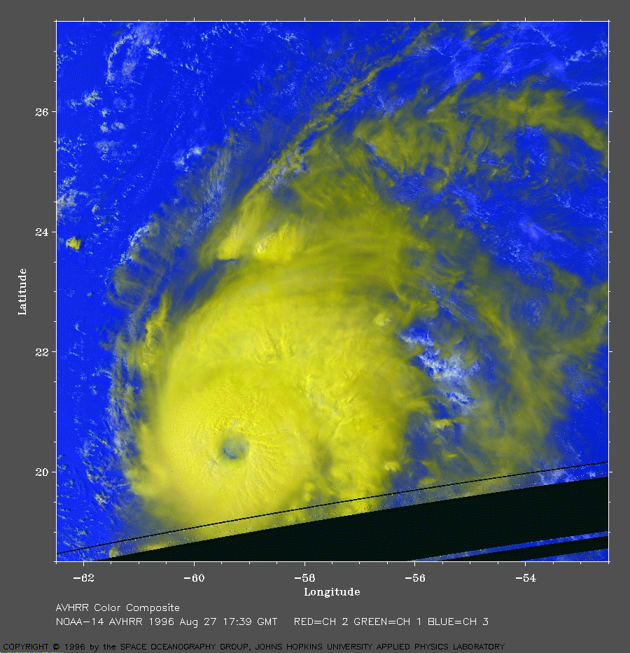
1996 Aug 27 17:39 UT
NOAA-14 AVHRR 3 channel color composite. The storm shows a well defined eye in this mid-day image. The lower warmer clouds appear white and the higher cold clouds yellow with this color combination.
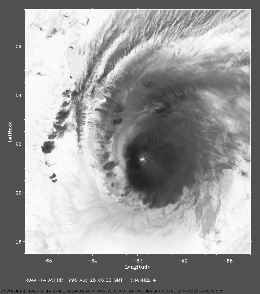
1996 Aug 28 06:02 UT
NOAA-14 AVHRR channel 4 image.
This image shows a lot of structure. Bright is warm, dark is
colder. The darker knots on the west side are likely thunderstorm
cells with tops that are high and cold.
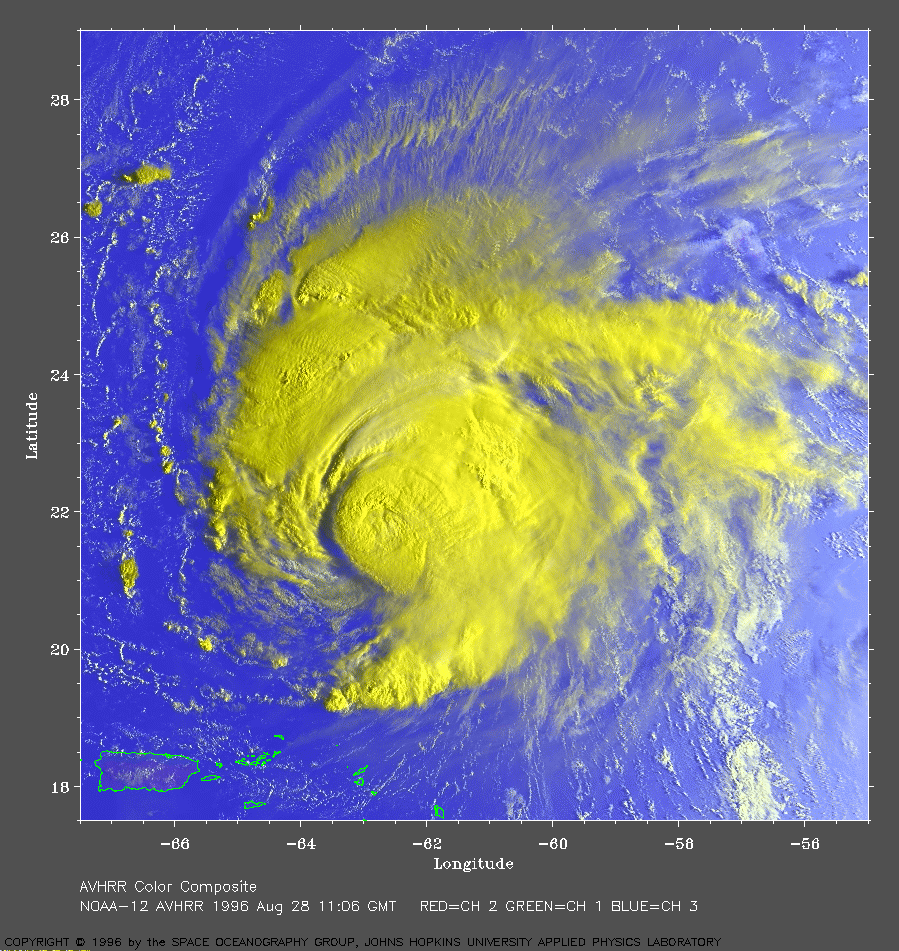
1996 Aug 28 11:06 UT
NOAA-12 AVHRR 3 channel color composite. This image shows spectacular detail in the low morning sunlight. Puerto Rico is the large island in the southwest corner of this image. AVHRR channel 3 is colored blue, as usual with the color images on these pages. This channel is sensitive to both the thermal emissions of the objects below and also, to a lesser extent reflected infrared in the sunlight. The ocean in this image appears to brighten toward the east from reflected sunlight from the waves covering the surface, the east side is farther into the glitter pattern. The eye is covered by high clouds and is not visible.
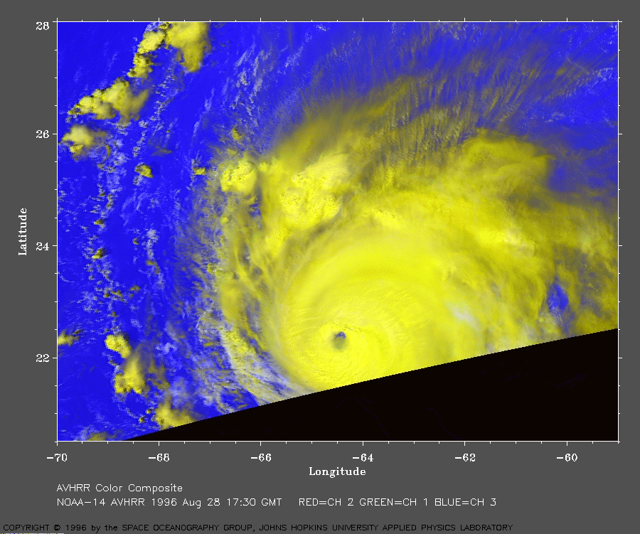
1996 Aug 28 17:30 UT
NOAA-14 AVHRR 3 channel color image.
The eye reappears in this view which barely catches the storm
at the start of the satellite pass.
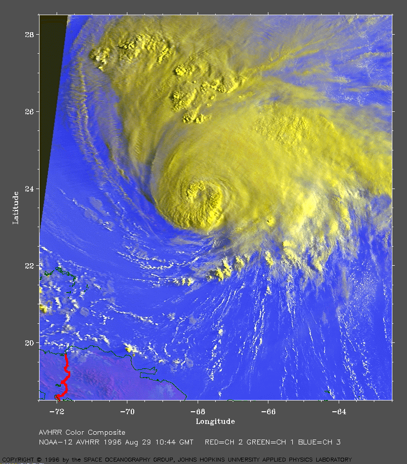
1996 Aug 29 10:44 UT
NOAA-12 AVHRR 3 channel color image. The island of Hispaniola is seen in the southwest corner of this image. The low morning sunlight brings out details in the clouds.
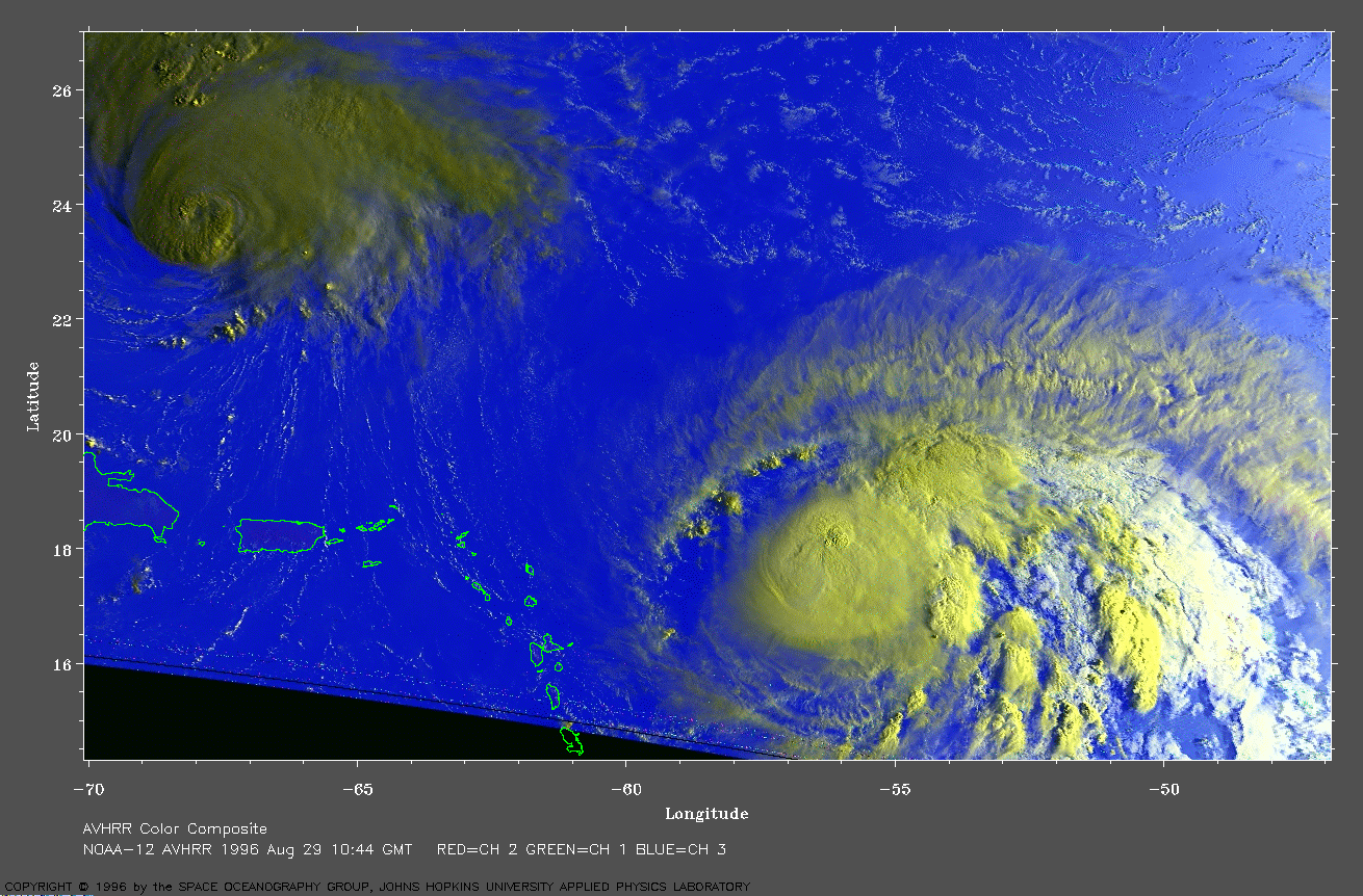
1996 Aug 29 10:44 UT
NOAA-12 AVHRR 3 channel color image.
This is an early morning image of both Edouard (left) and Fran
(right). Because of the low sun angle, Edouard appears much darker
than Fran.
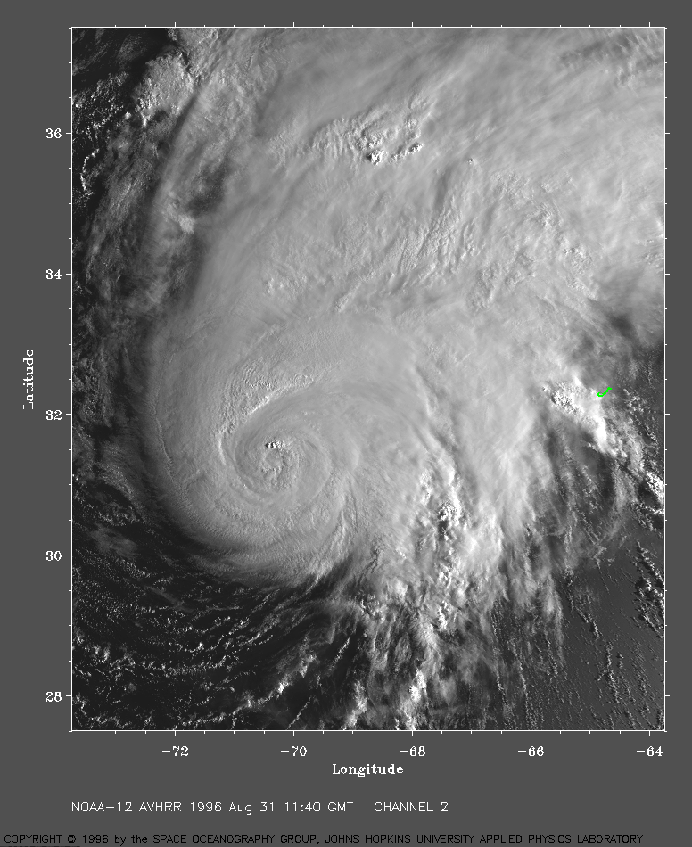
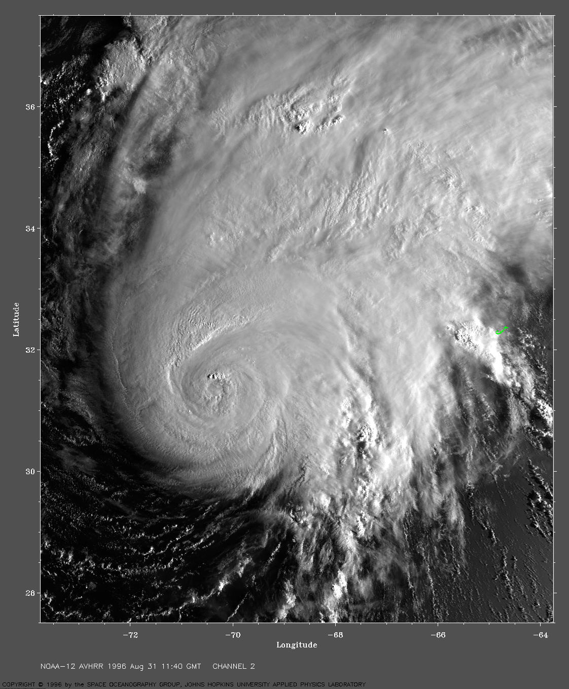
1996 Aug 31 11:40 UT
NOAA-12 AVHRR channel 2 image. Morning view. Note Bermuda near center of right edge of image. LARGE IMAGE.

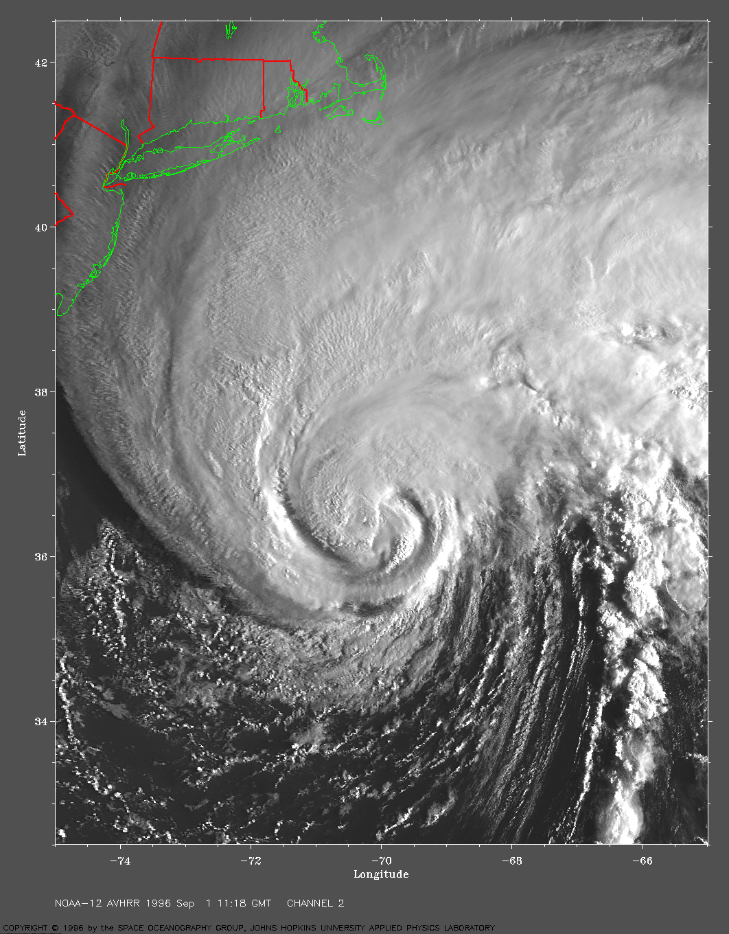
1996 Sep 01 11:18 UT
NOAA-12 AVHRR channel 2 image.
Morning view. LARGE IMAGE.

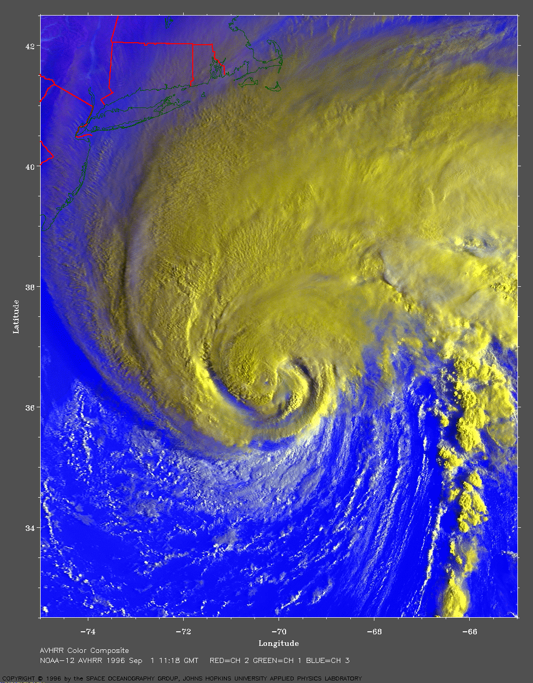
1996 Sep 1 11:18 UT
NOAA-12 AVHRR 3 channel color image.
LARGE IMAGE
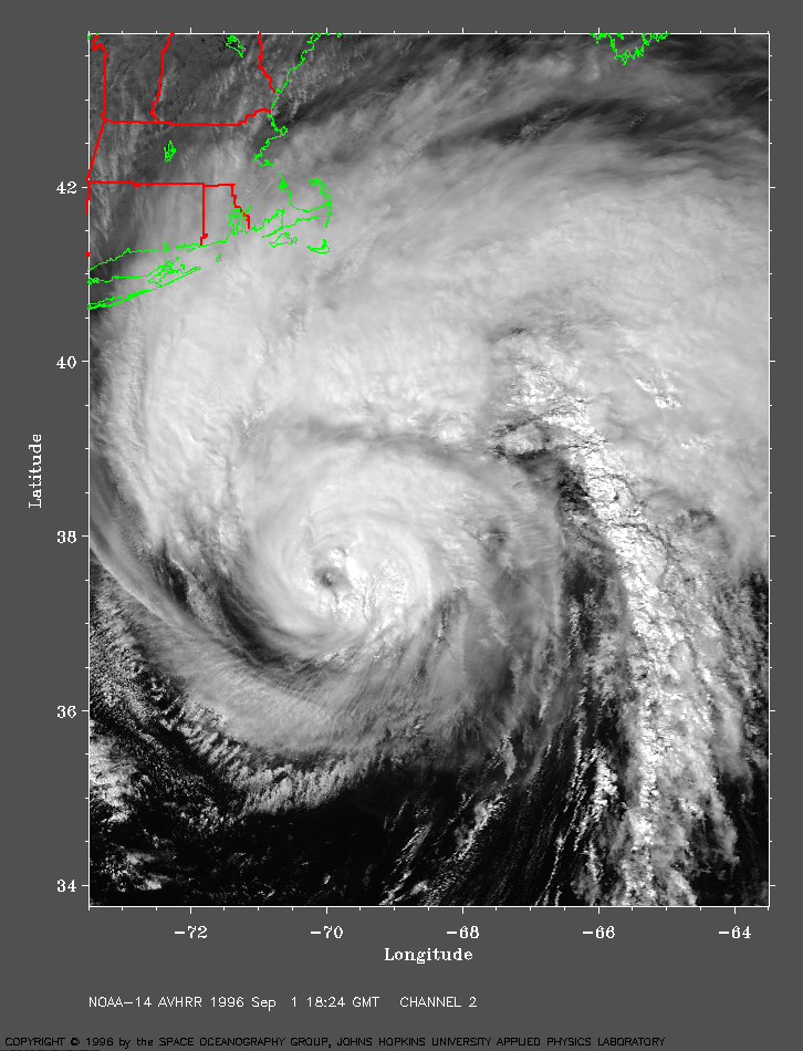
1996 Sep 01 18:24 UT
NOAA-14 AVHRR channel 2 image. Mid-day view. LARGE IMAGE.
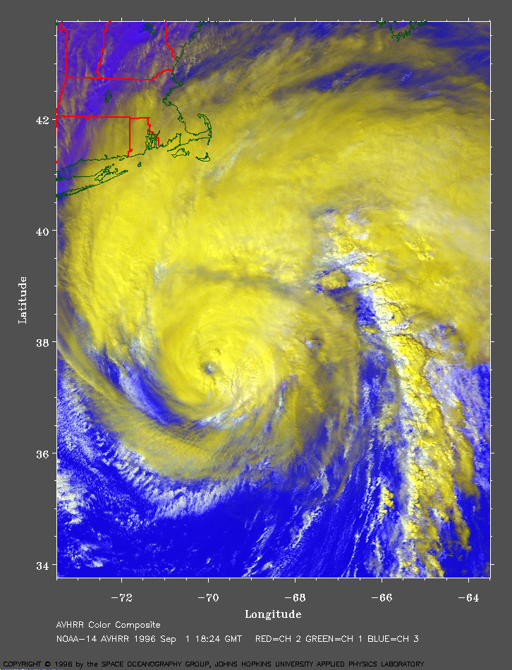
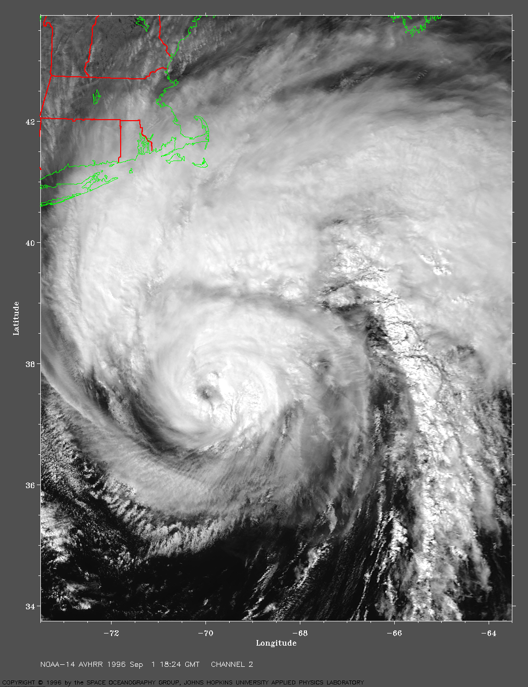
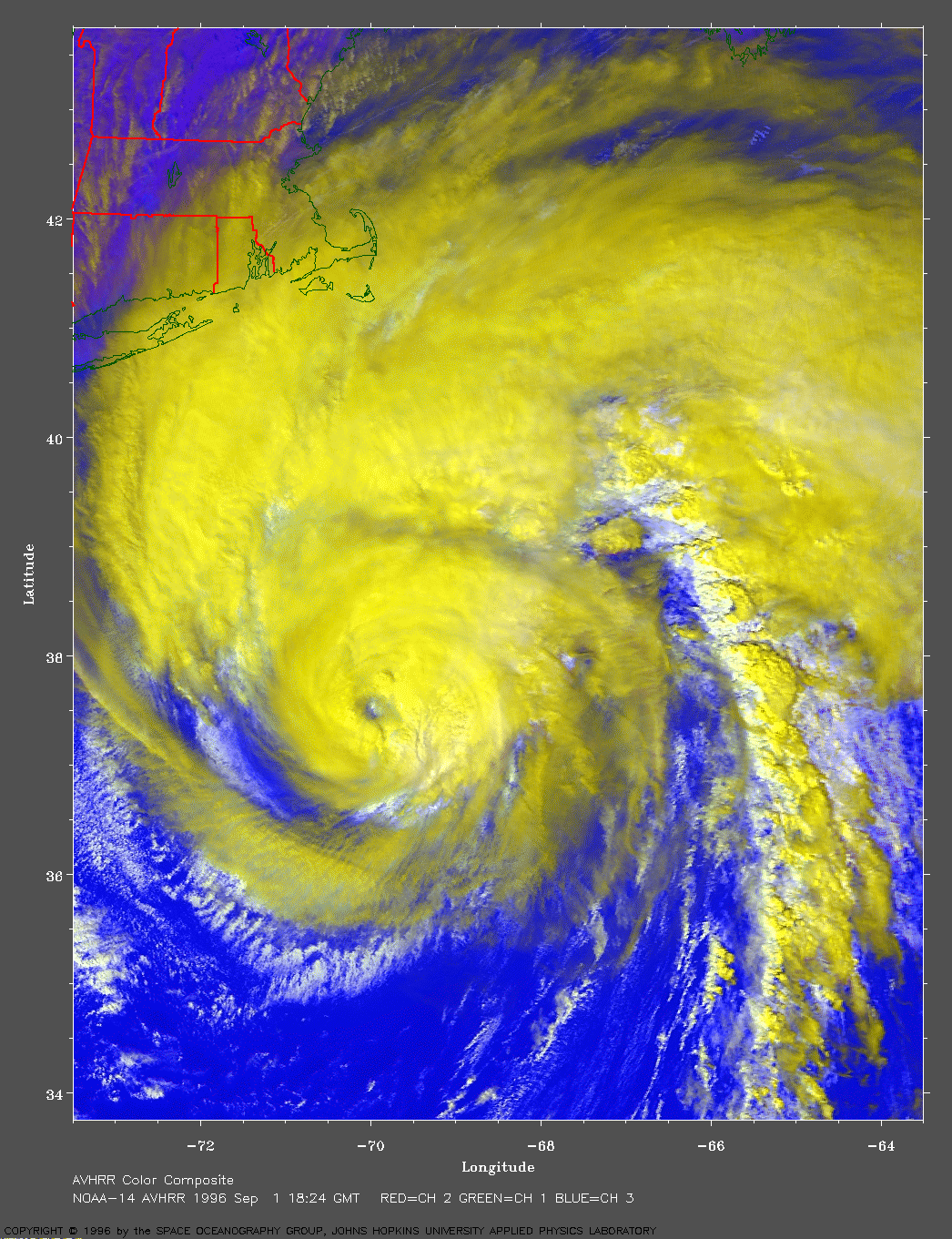
1996 Sep 1 18:24 UT
NOAA-14 AVHRR 3 channel color image.
LARGE IMAGE
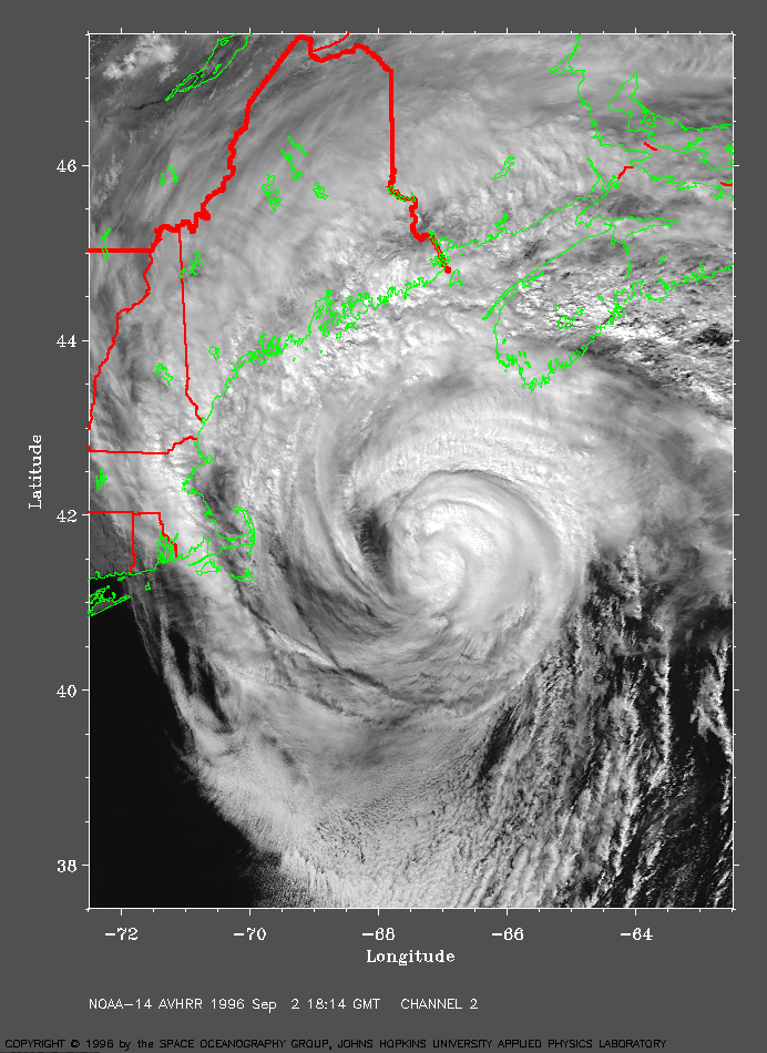
1996 Sep 02 18:14 UT
NOAA-14 AVHRR channel 2 image.
Mid-day view. LARGE IMAGE.
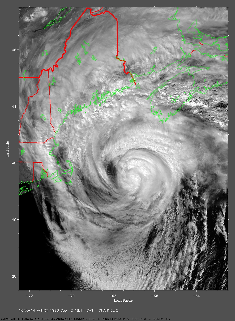
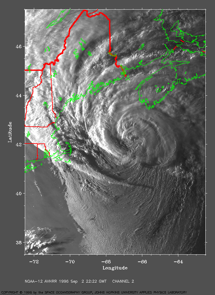
1996 Sep 02 22:22 UT
NOAA-14 AVHRR channel 2 image. Evening view. LARGE IMAGE.
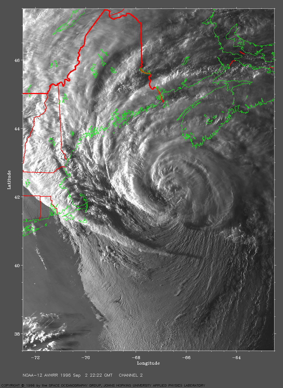
Track file : Track data in a text file.