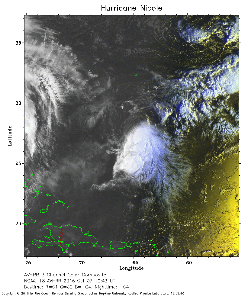
 2016 October 07 10:43 UT
NOAA-18 satellite AVHRR 3 channel color composite daytime image.
A closer view (330 Kb) is seen by clicking on this small image.
The maximum sustained winds are 100 mph.
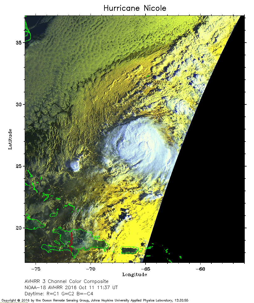 2016 October 11 11:37 UT
NOAA-18 satellite AVHRR 3 channel color composite daytime image.
A closer view (316 Kb) is seen by clicking on this small image.
The maximum sustained winds are 60 mph. The J-shaped island north of Nicole is Bermuda.
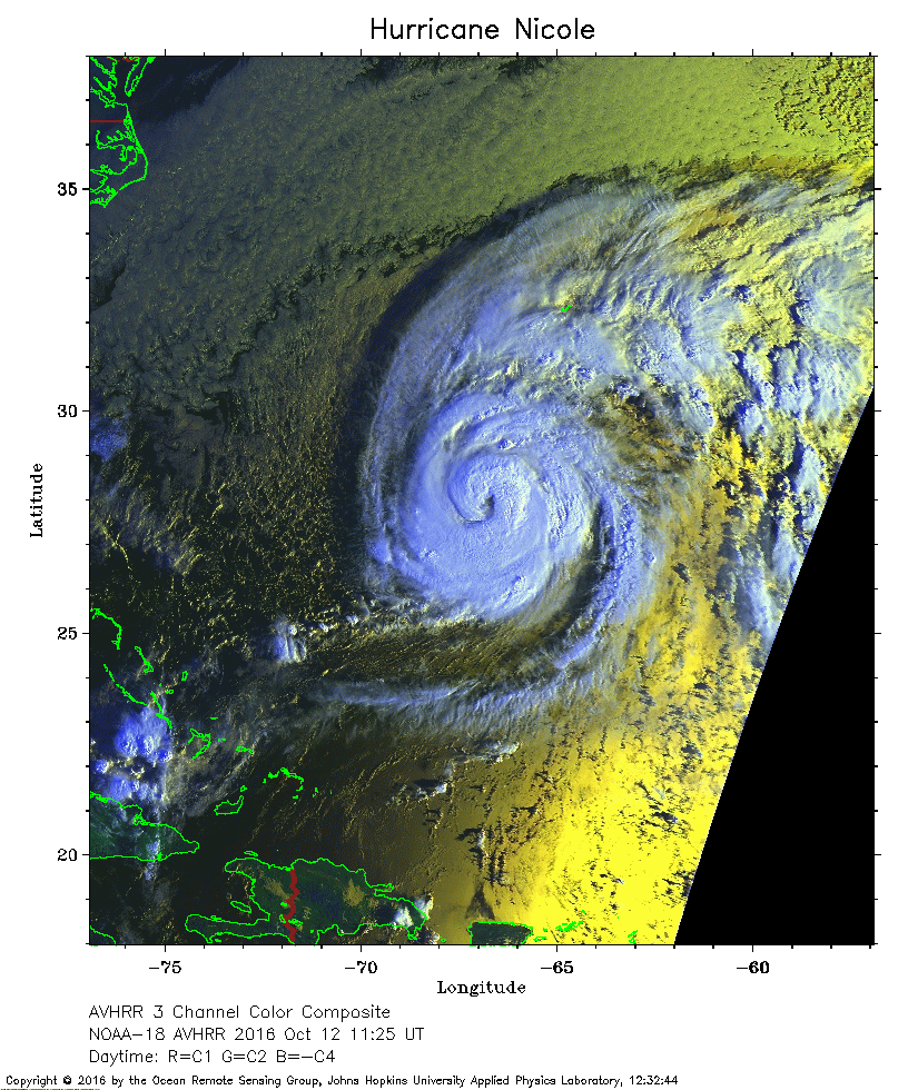 2016 October 12 11:25 UT
NOAA-18 satellite AVHRR 3 channel color composite daytime image.
A closer view (363 Kb) is seen by clicking on this small image.
The maximum sustained winds have increased to 100 mph. Nicole is moving north toward Bermuda (the J-shaped island).
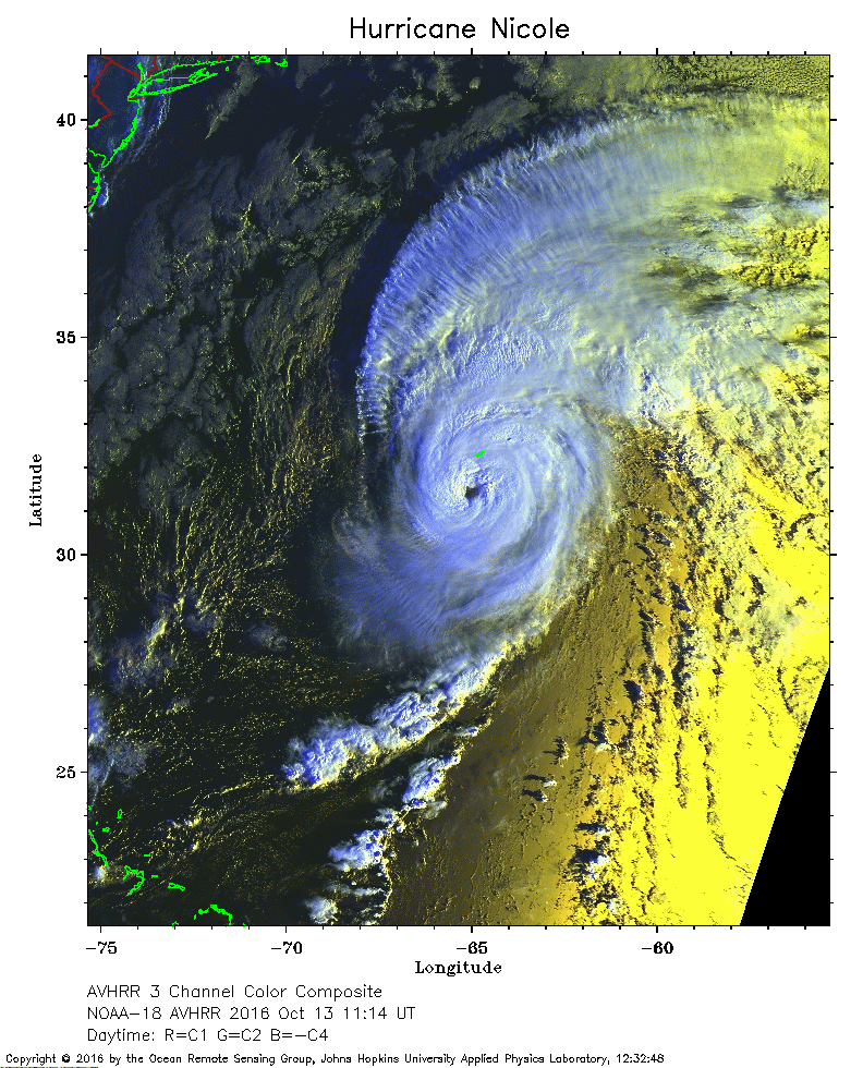 2016 October 13 11:14 UT
NOAA-18 satellite AVHRR 3 channel color composite daytime image.
A closer view (357 Kb) is seen by clicking on this small image.
The maximum sustained winds have increased to 130 mph. The eye of Nicole is just south of Bermuda (the J-shaped island).
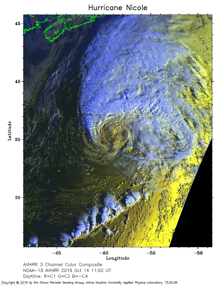 2016 October 14 11:02 UT
NOAA-18 satellite AVHRR 3 channel color composite daytime image.
A closer view (349 Kb) is seen by clicking on this small image.
The maximum sustained winds have decreased to 85 mph.
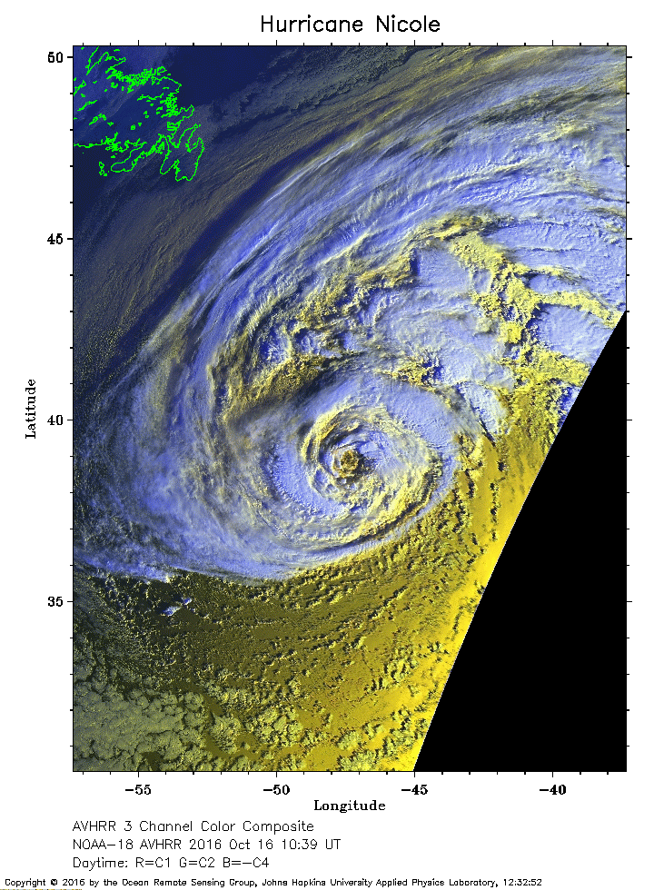 2016 October 16 10:39 UT
NOAA-18 satellite AVHRR 3 channel color composite daytime image.
A closer view (322 Kb) is seen by clicking on this small image.