 2015 October 01 21:44 UT
NOAA-18 satellite AVHRR 3 channel color composite daytime image.
A closer view (372 Kb) is seen by clicking on this small image.
The maximum sustained winds are 130 mph.
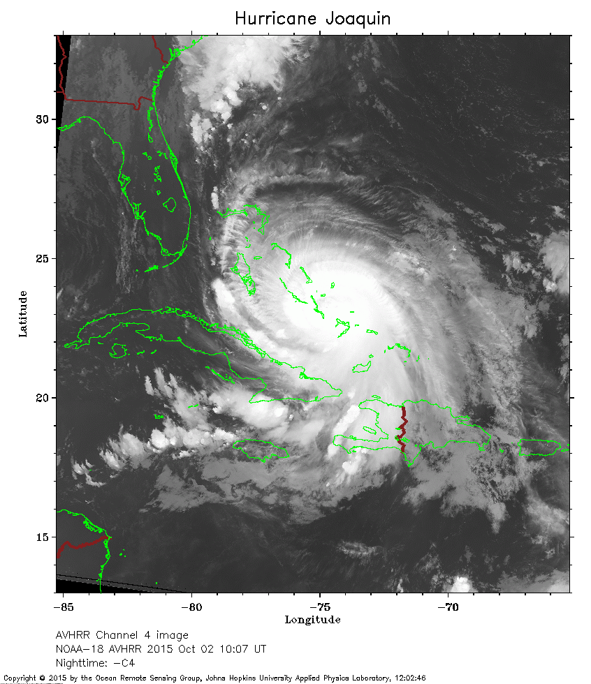 2015 October 02 10:07 UT
NOAA-18 satellite AVHRR channel 4 nighttime image.
A closer view (283 Kb) is seen by clicking on this small image.
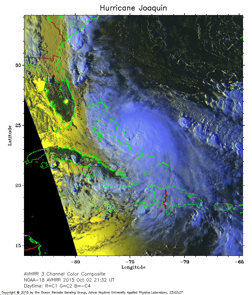 2015 October 02 21:32 UT
NOAA-18 satellite AVHRR 3 channel color composite daytime image.
A closer view (371 Kb) is seen by clicking on this small image.
The maximum sustained winds have decreased to 125 mph.
 2015 October 03 09:55 UT
NOAA-18 satellite AVHRR channel 4 nighttime image.
A closer view (272 Kb) is seen by clicking on this small image.
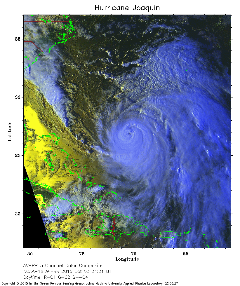 2015 October 03 21:21 UT
NOAA-18 satellite AVHRR 3 channel color composite daytime image.
A closer view (376 Kb) is seen by clicking on this small image.
The maximum sustained winds have increased to 150 mph.
Bermuda is the J-shaped island northeast of Joaquin.
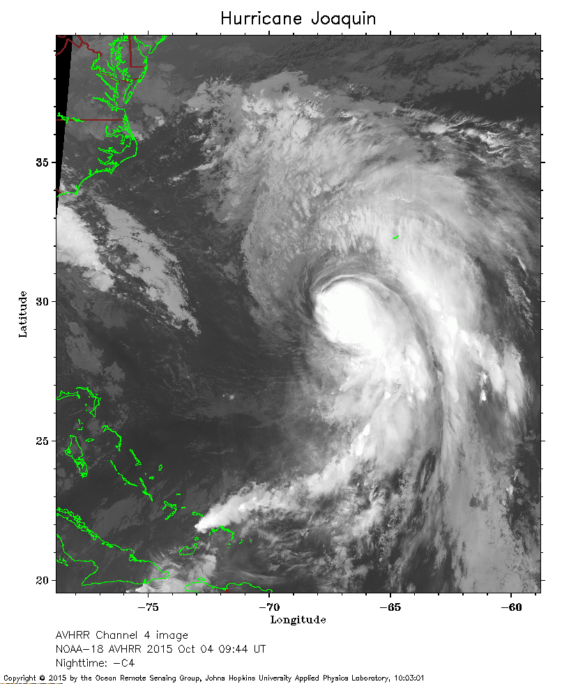 2015 October 04 09:44 UT
NOAA-18 satellite AVHRR channel 4 nighttime image.
A closer view (286 Kb) is seen by clicking on this small image.
The maximum sustained winds have decreased to 120 mph.