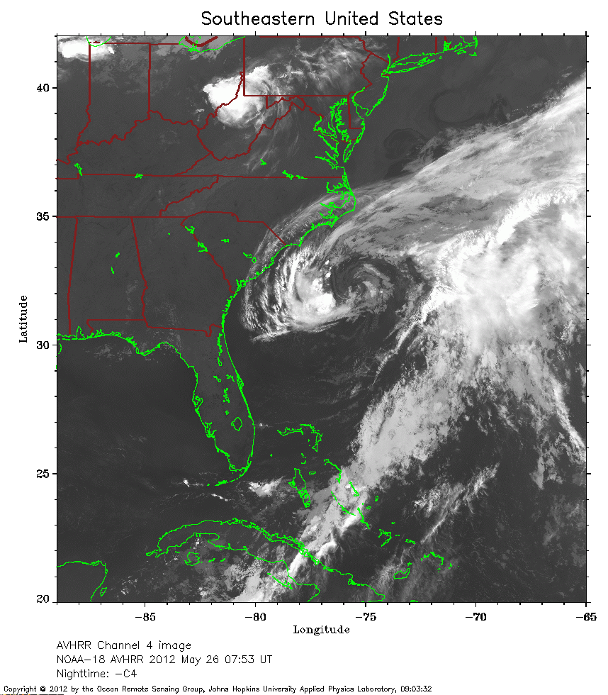
 2012 May 26 07:53 UT
NOAA-18 satellite AVHRR channel 4 nighttime image.
A closer view (285 Kb) is seen by clicking on this small image.
Beryl is a subtropical storm with maximum sustained winds of 45 mph.
 2012 May 26 19:18 UT
NOAA-18 satellite AVHRR 3 channel color composite daytime image.
A closer view (358 Kb) is seen by clicking on this small image.
 2012 May 27 10:28 UT
NOAA-15 satellite AVHRR 3 channel color composite early morning image.
A closer view (285 Kb) is seen by clicking on this small image.
The maximum sustained winds have increased to 50 mph.
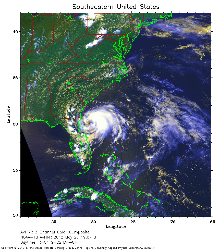 2012 May 27 19:07 UT
NOAA-18 satellite AVHRR 3 channel color composite daytime image.
A closer view (365 Kb) is seen by clicking on this small image.
Beryl has transitioned from a subtropical to a tropical storm with maximum sustained winds of 65 mph.
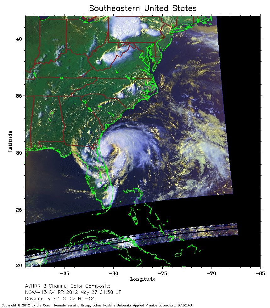 2012 May 27 21:50 UT
NOAA-15 satellite AVHRR 3 channel color composite daytime image.
A closer view (269 Kb) is seen by clicking on this small image.
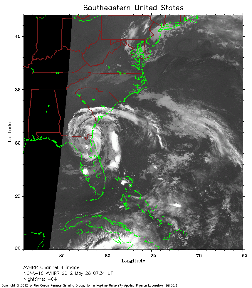 2012 May 28 07:31 UT
NOAA-18 satellite AVHRR channel 4 nighttime image.
A closer view (248 Kb) is seen by clicking on this small image.
Beryl made landfall at about 04:10 UT.
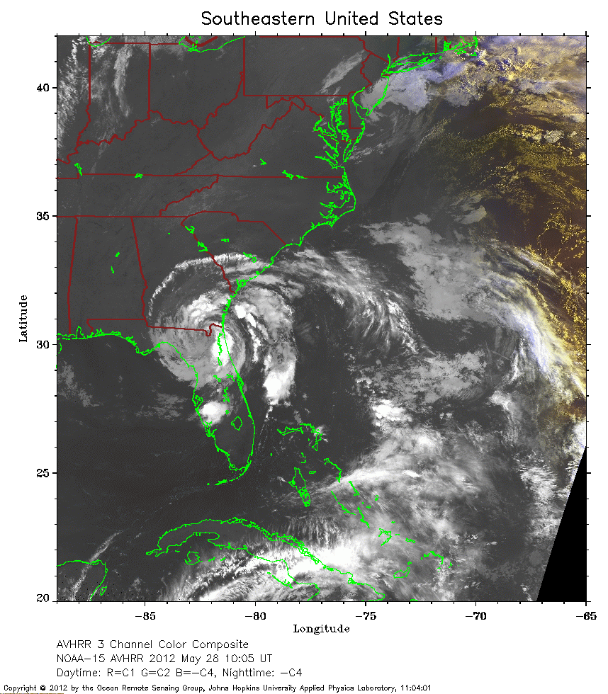 2012 May 28 10:05 UT
NOAA-15 satellite AVHRR 3 channel color composite early morning image.
A closer view (302 Kb) is seen by clicking on this small image.
The maximum sustained winds have decreased to 50 mph.
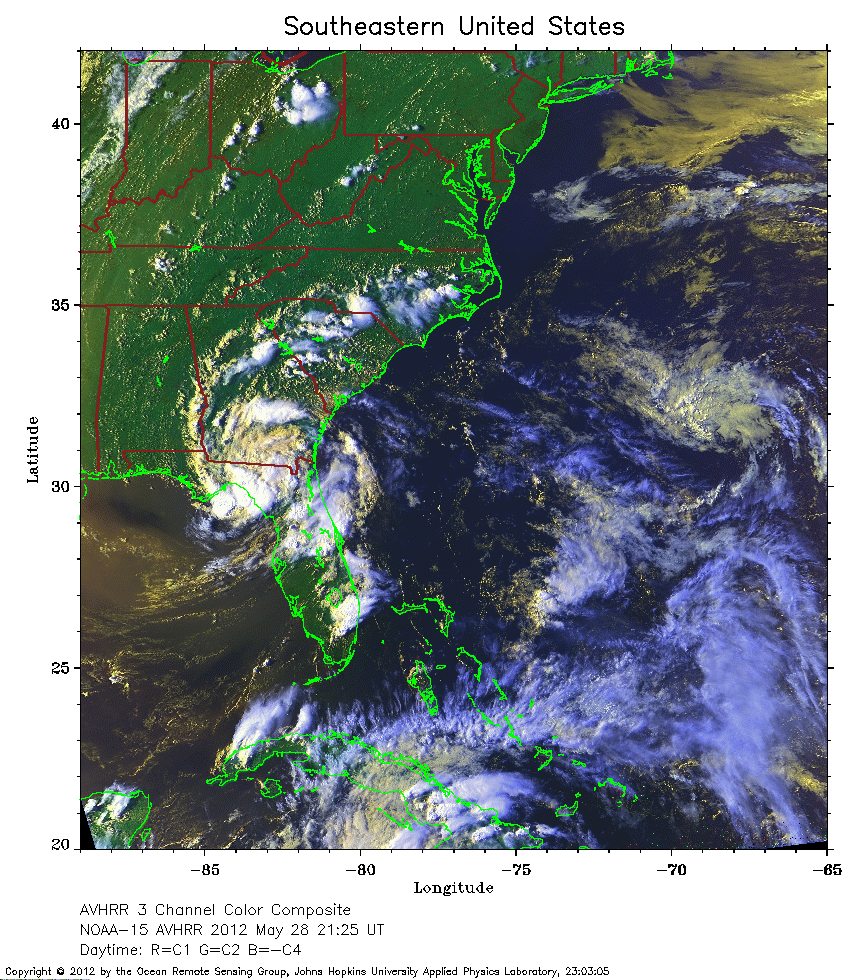 2012 May 28 21:25 UT
NOAA-15 satellite AVHRR 3 channel color composite daytime image.
A closer view (400 Kb) is seen by clicking on this small image.
The maximum sustained winds have decreased to 30 mph.
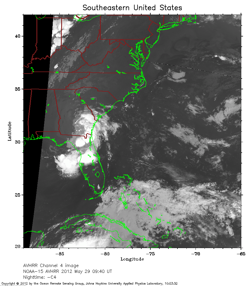 2012 May 29 09:40 UT
NOAA-15 satellite AVHRR channel 4 nighttime image.
A closer view (259 Kb) is seen by clicking on this small image.
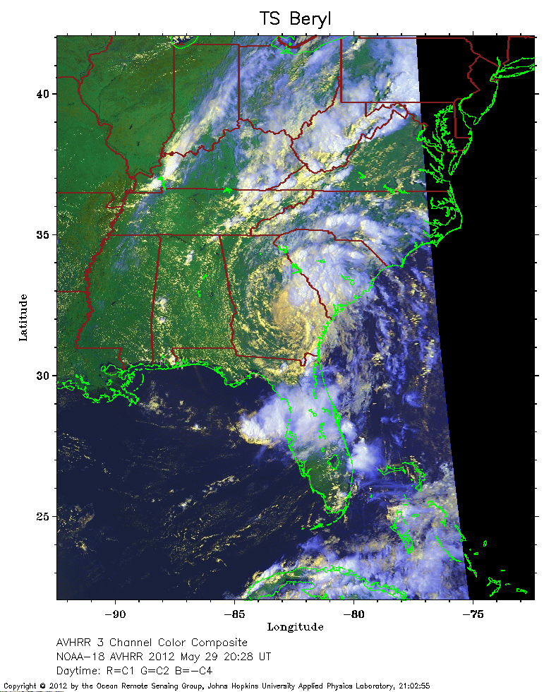 2012 May 29 20:28 UT
NOAA-18 satellite AVHRR 3 channel color composite daytime image.
A closer view (288 Kb) is seen by clicking on this small image.
 2012 May 29 20:59 UT
NOAA-15 satellite AVHRR 3 channel color composite daytime image.
A closer view (294 Kb) is seen by clicking on this small image.
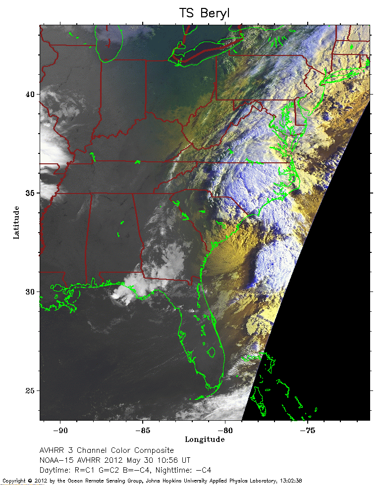 2012 May 30 10:56 UT
NOAA-15 satellite AVHRR 3 channel color composite early morning image.
A closer view (261 Kb) is seen by clicking on this small image.
The maximum sustained winds have increased to 35 mph.
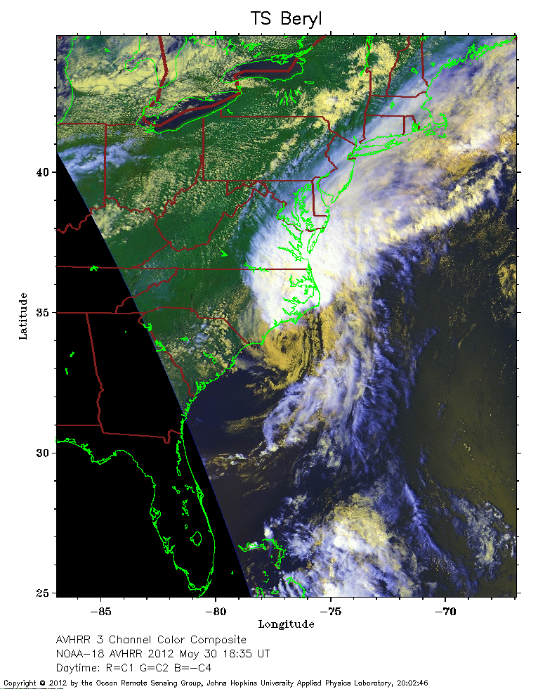 2012 May 30 18:35 UT
NOAA-18 satellite AVHRR 3 channel color composite daytime image.
A closer view (301 Kb) is seen by clicking on this small image.
 2012 May 30 20:38 UT
NOAA-15 satellite AVHRR 3 channel color composite daytime image.
A closer view (296 Kb) is seen by clicking on this small image.