 2011 August 22 21:00 UT
NOAA-15 satellite AVHRR 3 channel color composite daytime image.
A closer view (325 Kb) is seen by clicking on this small image.
The maximum sustained winds are 80 mph.
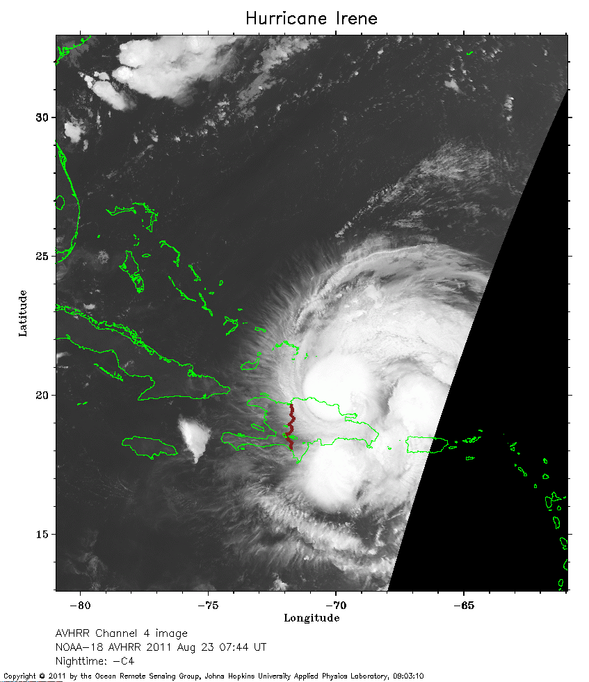 2011 August 23 07:44 UT
NOAA-18 satellite AVHRR channel 4 nighttime image.
A closer view (221 Kb) is seen by clicking on this small image.
The maximum sustained winds have increased to 100 mph.
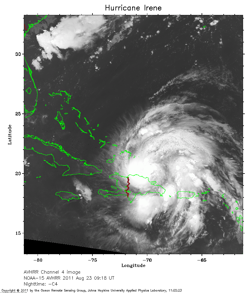 2011 August 23 09:18 UT
NOAA-15 satellite AVHRR channel 4 nighttime image.
A closer view (271 Kb) is seen by clicking on this small image.
 2011 August 23 19:10 UT
NOAA-18 satellite AVHRR 3 channel color composite daytime image.
A closer view (344 Kb) is seen by clicking on this small image.
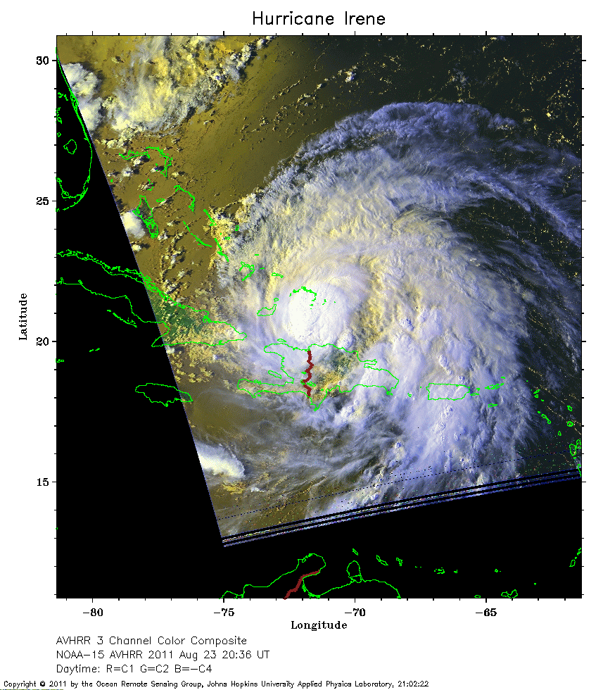 2011 August 23 20:36 UT
NOAA-15 satellite AVHRR 3 channel color composite daytime image.
A closer view (283 Kb) is seen by clicking on this small image.
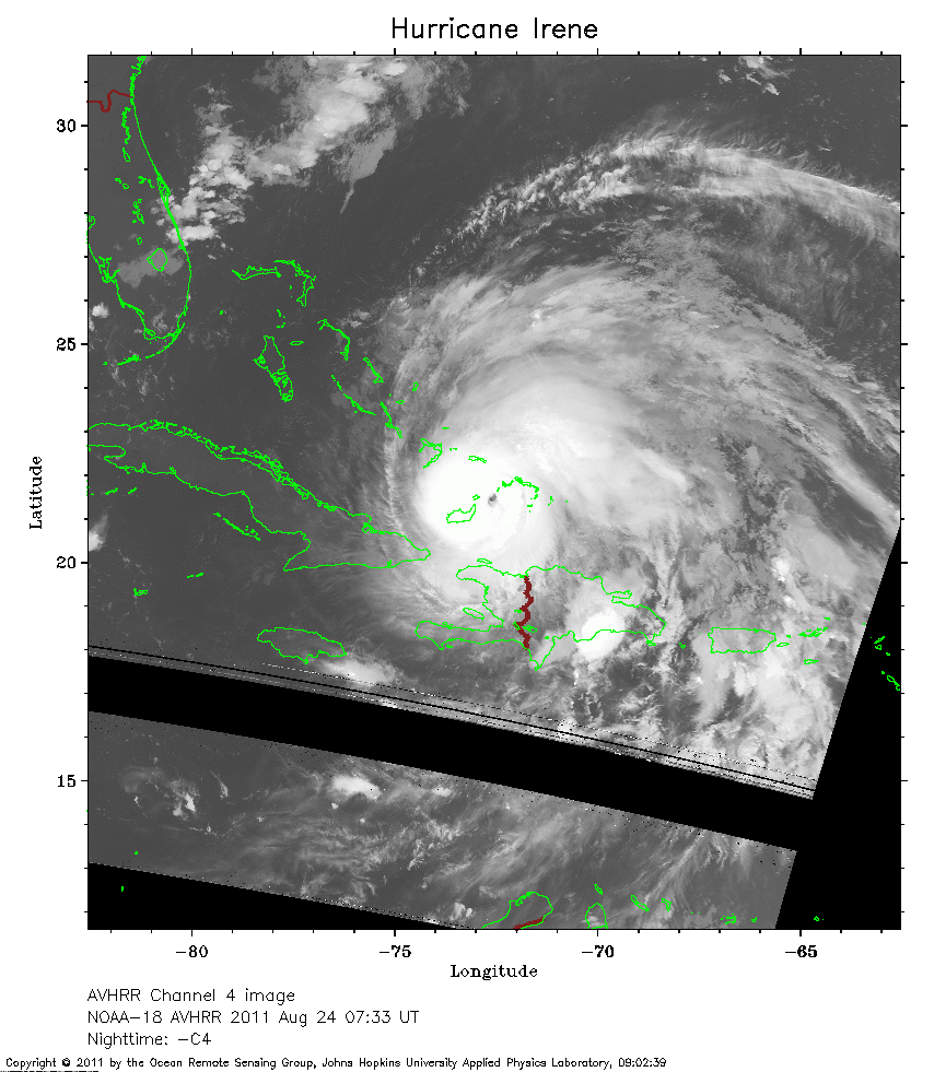 2011 August 24 07:33 UT
NOAA-18 satellite AVHRR channel 4 nighttime image.
A closer view (261 Kb) is seen by clicking on this small image.
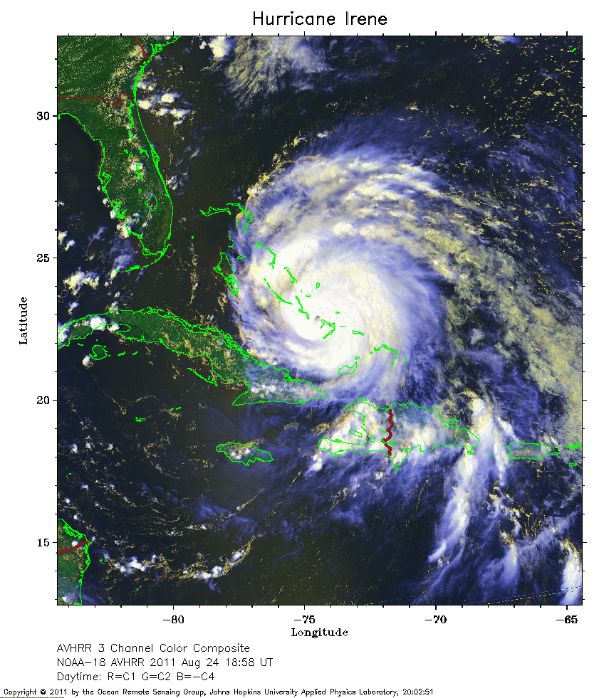 2011 August 24 18:58 UT
NOAA-18 satellite AVHRR 3 channel color composite daytime image.
A closer view (377 Kb) is seen by clicking on this small image.
The maximum sustained winds have increased to 120 mph.
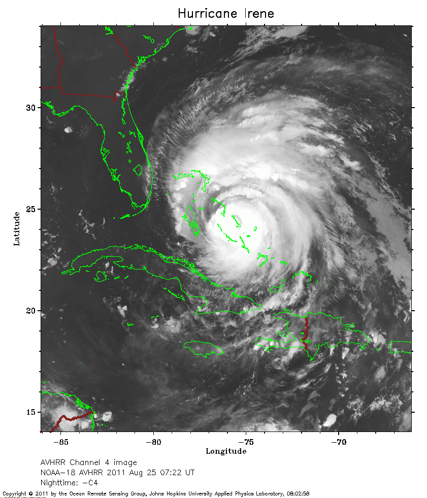 2011 August 25 07:22 UT
NOAA-18 satellite AVHRR channel 4 nighttime image.
A closer view (287 Kb) is seen by clicking on this small image.
The maximum sustained winds have decreased to 115 mph.
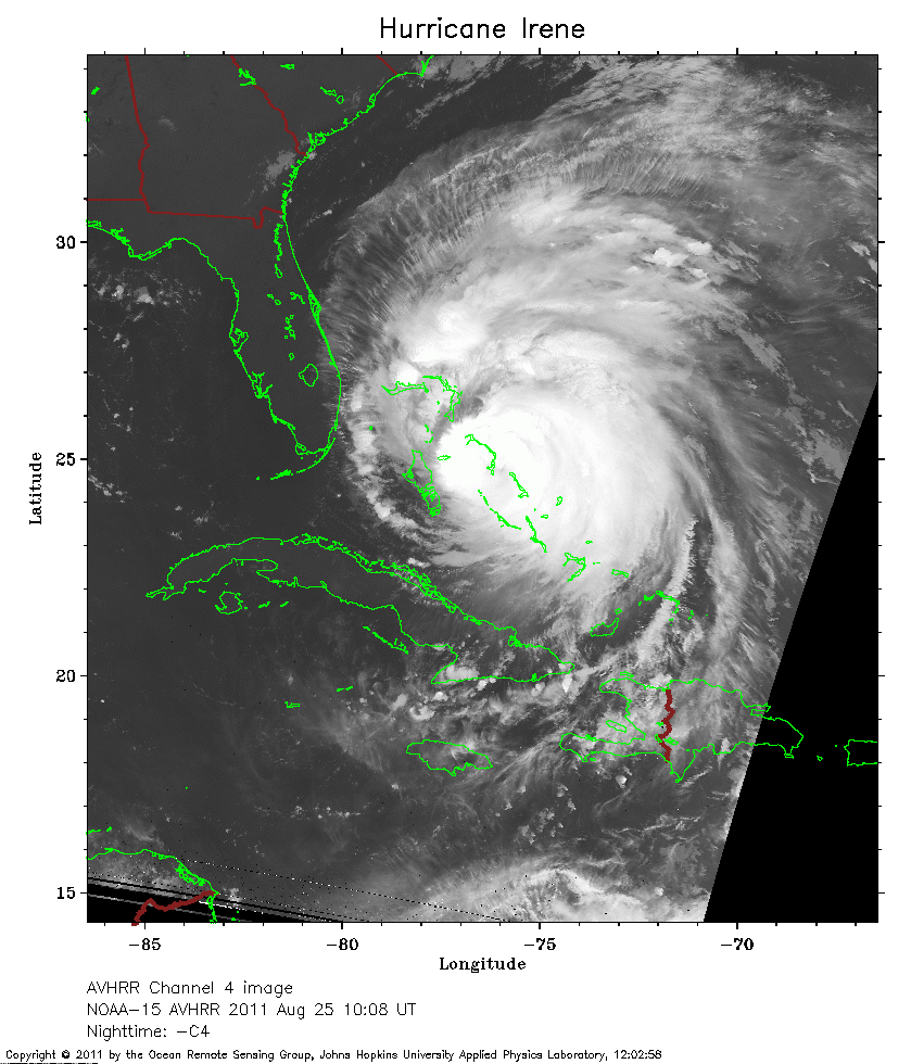 2011 August 25 10:08 UT
NOAA-15 satellite AVHRR channel 4 nighttime image.
A closer view (266 Kb) is seen by clicking on this small image.
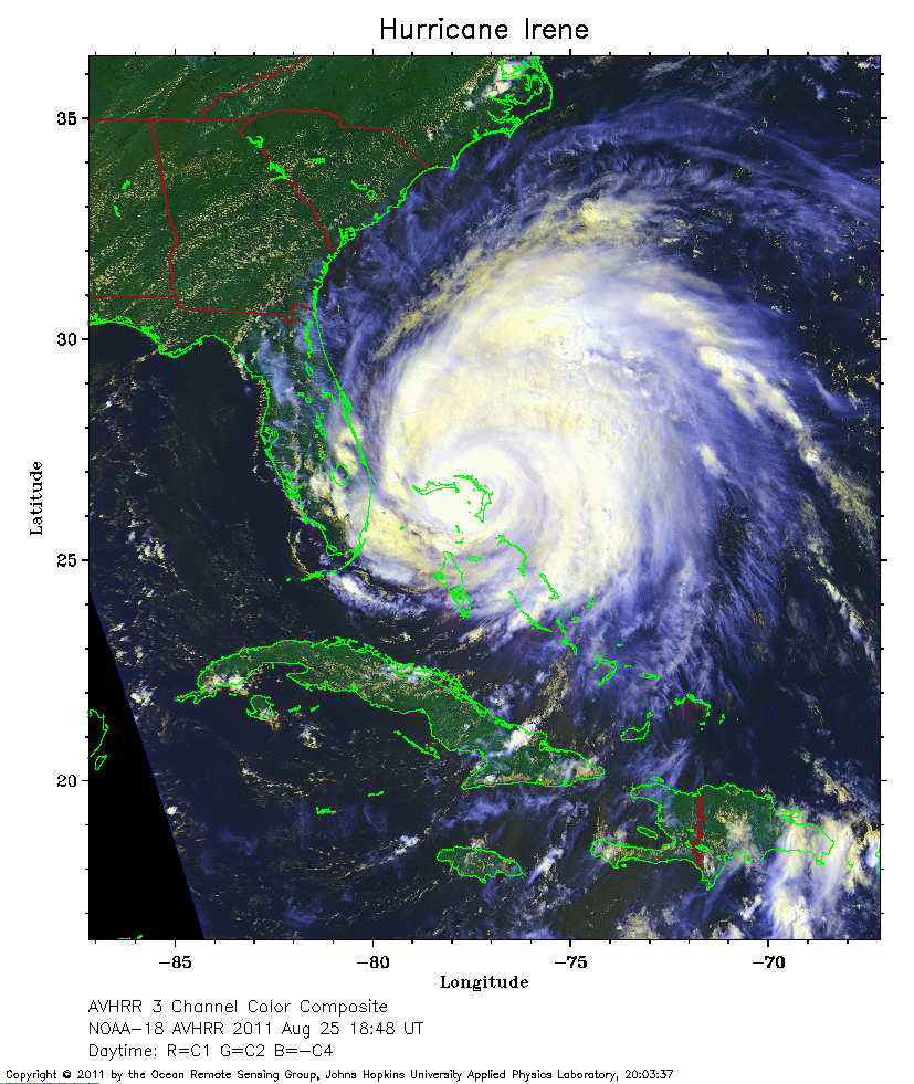 2011 August 25 18:48 UT
NOAA-18 satellite AVHRR 3 channel color composite daytime image.
A closer view (351 Kb) is seen by clicking on this small image.
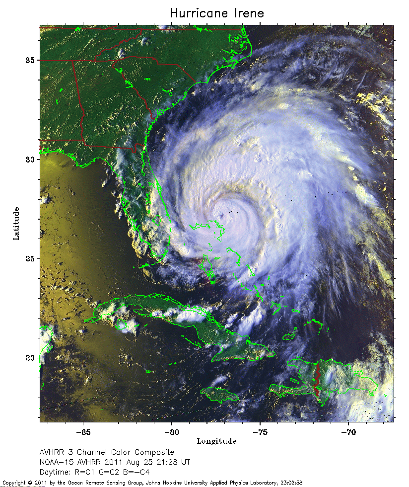 2011 August 25 21:28 UT
NOAA-15 satellite AVHRR 3 channel color composite daytime image.
A closer view (383 Kb) is seen by clicking on this small image.
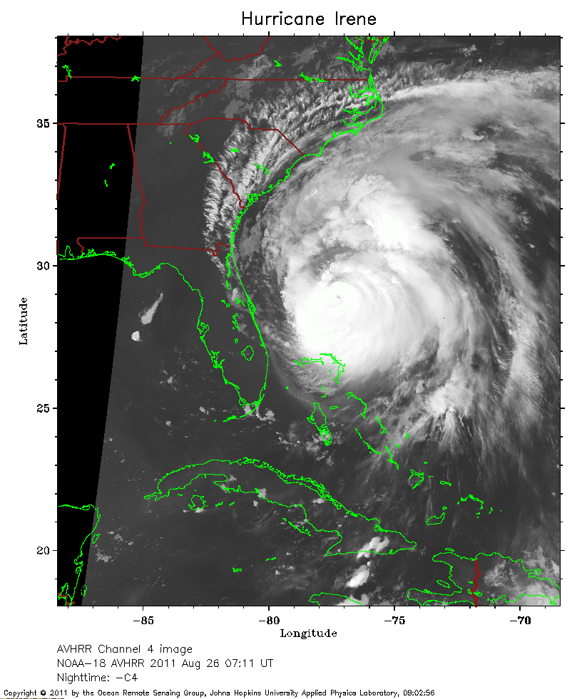 2011 August 26 07:11 UT
NOAA-18 satellite AVHRR channel 4 nighttime image.
A closer view (246 Kb) is seen by clicking on this small image.
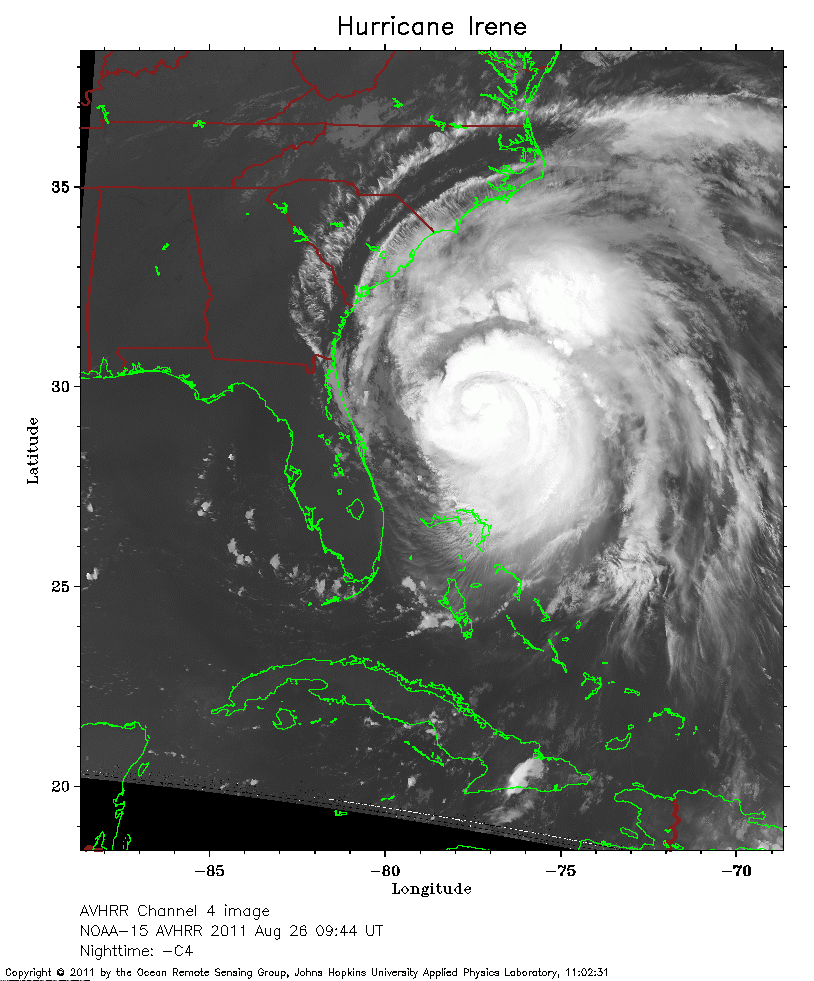 2011 August 26 09:44 UT
NOAA-15 satellite AVHRR channel 4 nighttime image.
A closer view (252 Kb) is seen by clicking on this small image.
The maximum sustained winds have decreased to 110 mph.
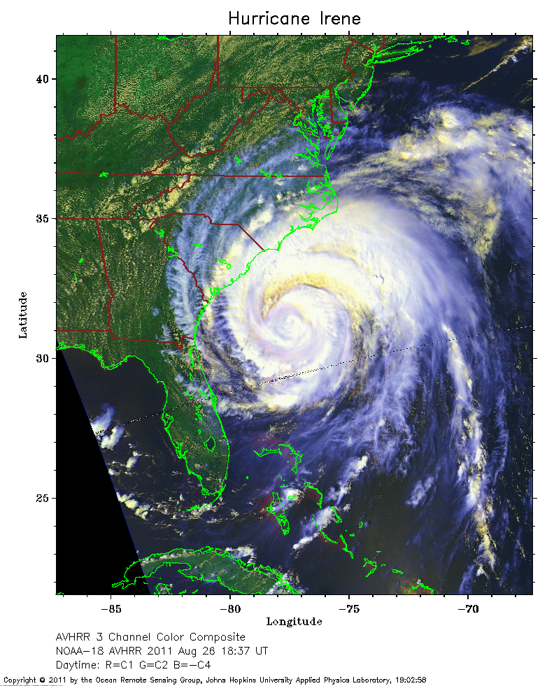 2011 August 26 18:37 UT
NOAA-18 satellite AVHRR 3 channel color composite daytime image.
A closer view (332 Kb) is seen by clicking on this small image.
The maximum sustained winds have decreased to 100 mph.
 2011 August 26 21:03 UT
NOAA-15 satellite AVHRR 3 channel color composite daytime image.
A closer view (354 Kb) is seen by clicking on this small image.