
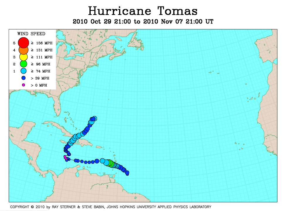
Track maps
Tomas developed in the tropical Atlantic Ocean east of Barbados.
 Tomas track on Atlantic Ocean SST image of 3 November (243 Kb) This image
represents the average composite sea surface temperature (SST) derived from
NOAA satellite AVHRR data over the 7 days ending 3 November 2010. The
averaging is done to remove clouds. The streaking artifacts are due to problems with the NOAA-17 satellite data. The temperature scale for SST is
22C to 32C. The track of Tomas is overlaid on this image.
Tomas track on Atlantic Ocean SST image of 3 November (243 Kb) This image
represents the average composite sea surface temperature (SST) derived from
NOAA satellite AVHRR data over the 7 days ending 3 November 2010. The
averaging is done to remove clouds. The streaking artifacts are due to problems with the NOAA-17 satellite data. The temperature scale for SST is
22C to 32C. The track of Tomas is overlaid on this image.
Track file
Track data (lat/lon, winds, etc.) in a text file.