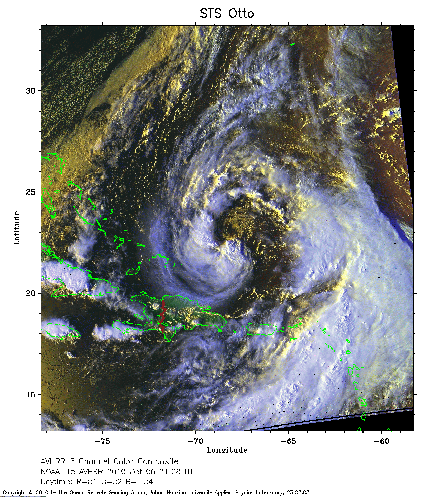
 2010 October 6 21:08 UT
NOAA-15 satellite AVHRR 3 channel color composite daytime image.
A closer view (418 Kb) is seen by clicking on this small image.
The maximum sustained winds are 60 mph.
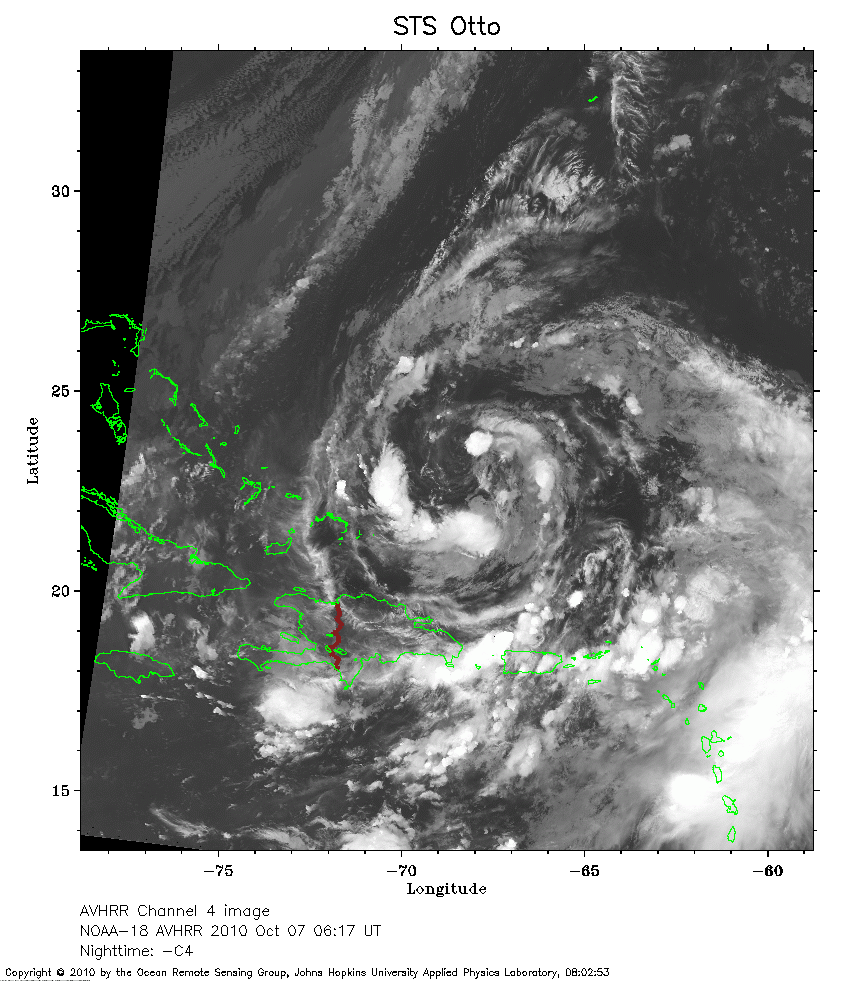 2010 October 7 06:17 UT
NOAA-18 satellite AVHRR channel 4 nighttime image.
A closer view (297 Kb) is seen by clicking on this small image.
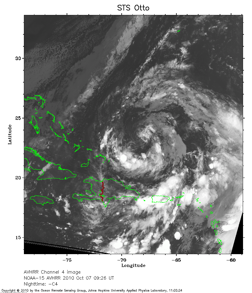 2010 October 7 09:26 UT
NOAA-15 satellite AVHRR channel 4 nighttime image.
A closer view (308 Kb) is seen by clicking on this small image.
Otto is expected to transition from a subtropical into a tropical storm soon.
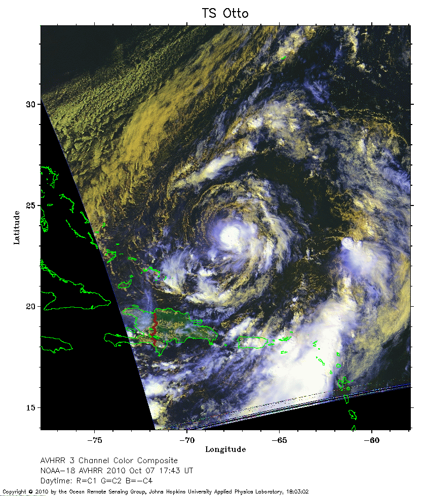 2010 October 7 17:43 UT
NOAA-18 satellite AVHRR 3 channel color composite daytime image.
A closer view (324 Kb) is seen by clicking on this small image.
Otto has completed the transition to a tropical storm.
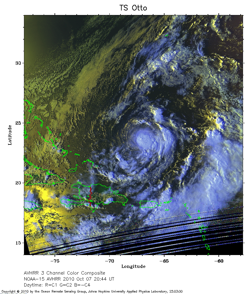 2010 October 7 20:44 UT
NOAA-15 satellite AVHRR 3 channel color composite daytime image.
A closer view (378 Kb) is seen by clicking on this small image.
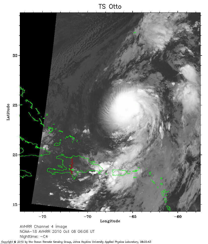 2010 October 8 06:06 UT
NOAA-18 satellite AVHRR channel 4 nighttime image.
A closer view (262 Kb) is seen by clicking on this small image.
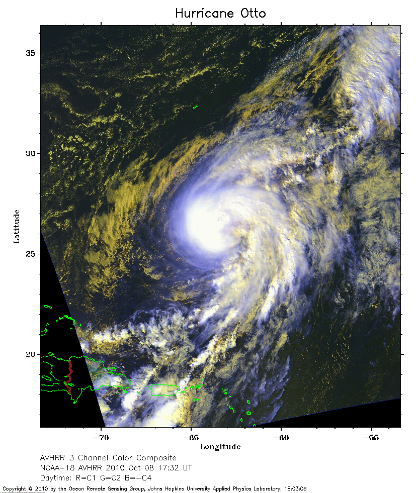 2010 October 8 17:32 UT
NOAA-18 satellite AVHRR 3 channel color composite daytime image.
A closer view (388 Kb) is seen by clicking on this small image.
The maximum sustained winds have increased to 75 mph, so Otto is now a hurricane.
Note that Bermuda is the J-shaped island to the north of Otto.
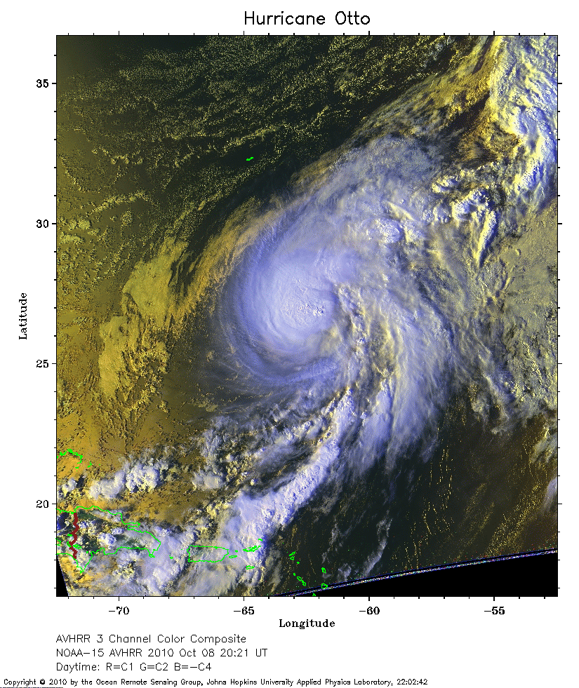 2010 October 8 20:21 UT
NOAA-15 satellite AVHRR 3 channel color composite daytime image.
A closer view (397 Kb) is seen by clicking on this small image.
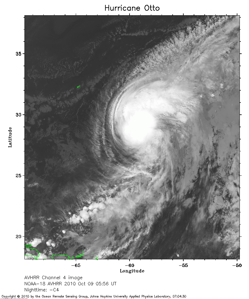 2010 October 9 05:56 UT
NOAA-18 satellite AVHRR channel 4 nighttime image.
A closer view (291 Kb) is seen by clicking on this small image.
The maximum sustained winds have increased to 85 mph.
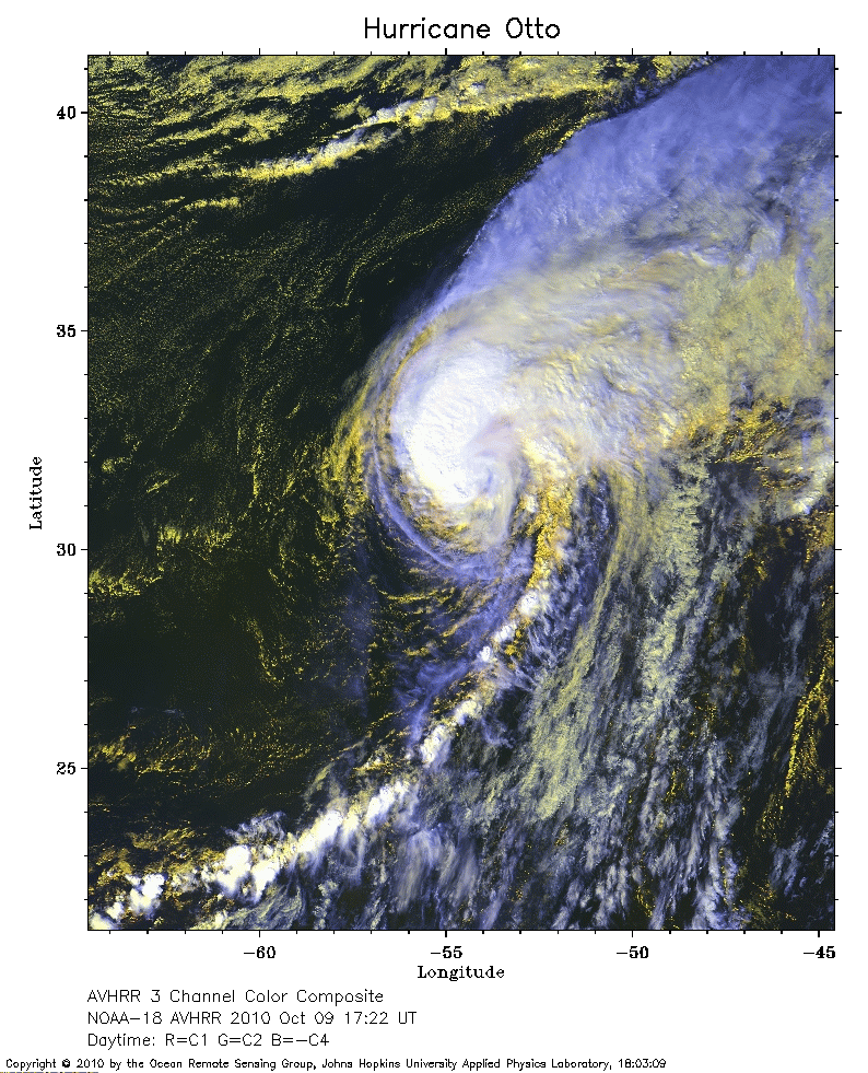 2010 October 9 17:22 UT
NOAA-18 satellite AVHRR 3 channel color composite daytime image.
A closer view (378 Kb) is seen by clicking on this small image.
The maximum sustained winds have decreased to 75 mph.
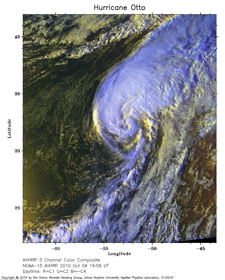 2010 October 9 19:58 UT
NOAA-15 satellite AVHRR 3 channel color composite daytime image.
A closer view (413 Kb) is seen by clicking on this small image.
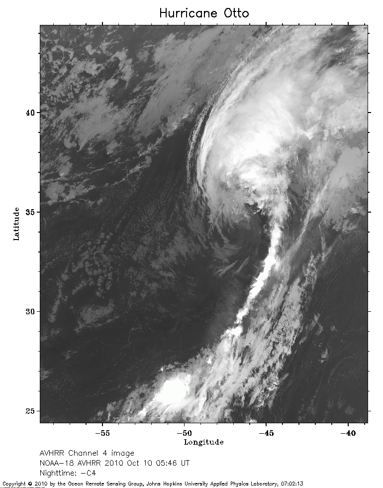 2010 October 10 05:46 UT
NOAA-18 satellite AVHRR channel 4 nighttime image.
A closer view (276 Kb) is seen by clicking on this small image.
The maximum sustained winds have decreased to 70 mph.