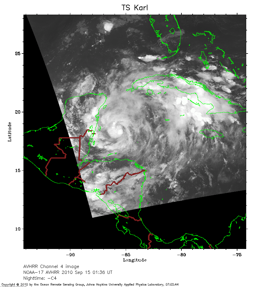
 2010 September 15 01:36 UT
NOAA-17 satellite AVHRR channel 4 nighttime image.
A closer view (222 Kb) is seen by clicking on this small image.
The maximum sustained winds are 45 mph.
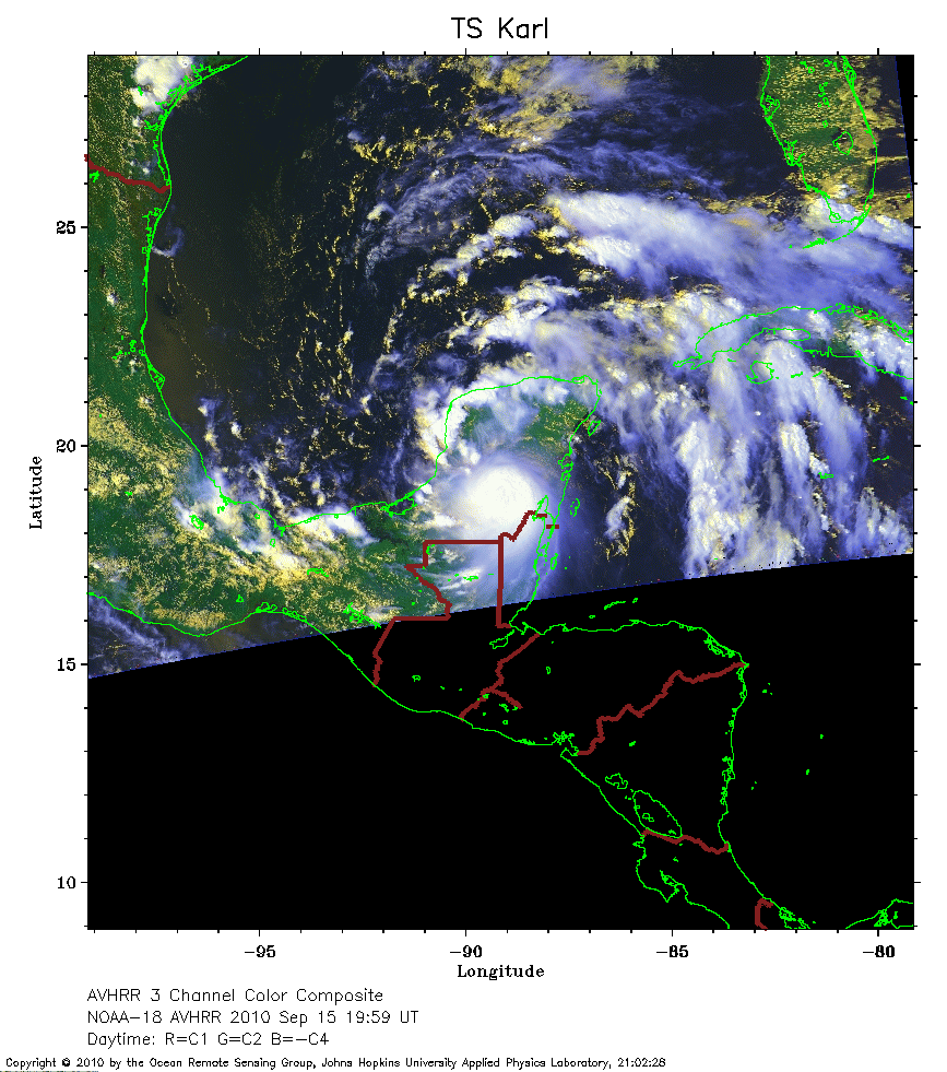 2010 September 15 19:59 UT
NOAA-18 satellite AVHRR 3 channel color composite daytime image.
A closer view (277 Kb) is seen by clicking on this small image.
The maximum sustained winds have increased to 55 mph.
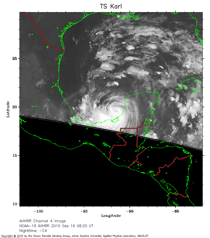 2010 September 16 08:20 UT
NOAA-18 satellite AVHRR channel 4 nighttime image.
A closer view (198 Kb) is seen by clicking on this small image.
The maximum sustained winds have decreased to 40 mph.
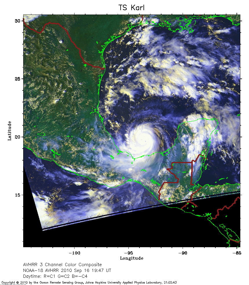 2010 September 16 19:47 UT
NOAA-18 satellite AVHRR 3 channel color composite daytime image.
A closer view (363 Kb) is seen by clicking on this small image.
The maximum sustained winds have increased to 75 mph and Karl is now a hurricane.
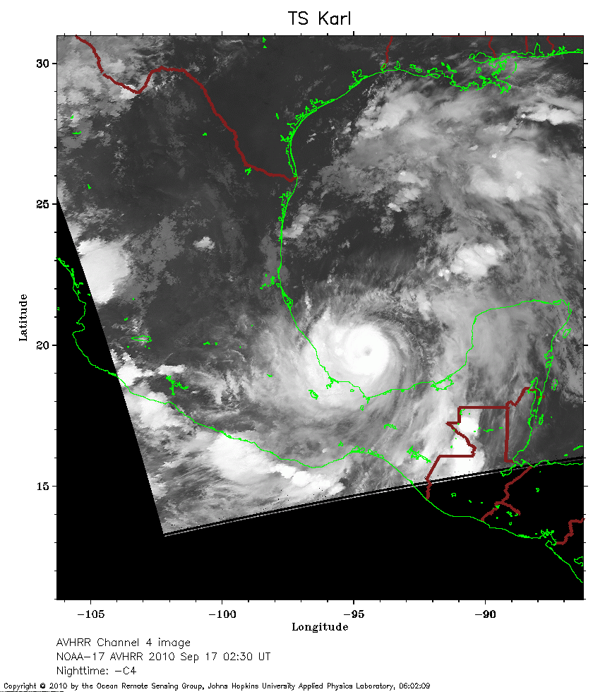 2010 September 17 02:30 UT
NOAA-17 satellite AVHRR channel 4 nighttime image.
A closer view (248 Kb) is seen by clicking on this small image.
An eye appears on this image. The maximum sustained winds have increased to 80 mph.
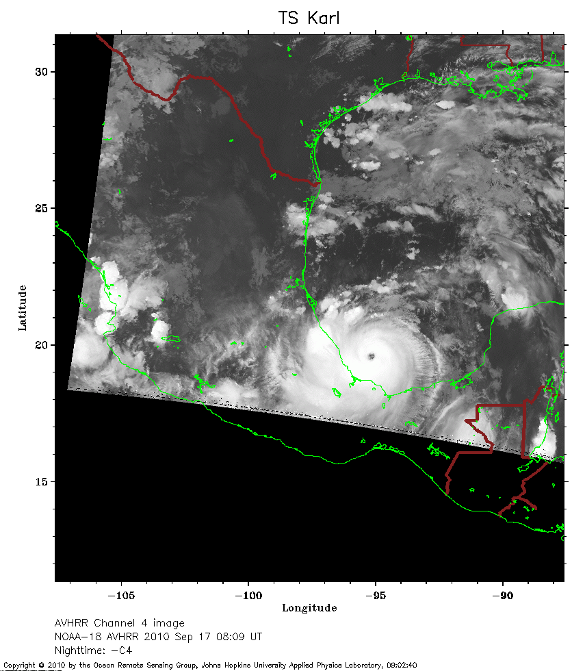 2010 September 17 08:09 UT
NOAA-18 satellite AVHRR channel 4 nighttime image.
A closer view (216 Kb) is seen by clicking on this small image.
The maximum sustained winds have increased to 105 mph.
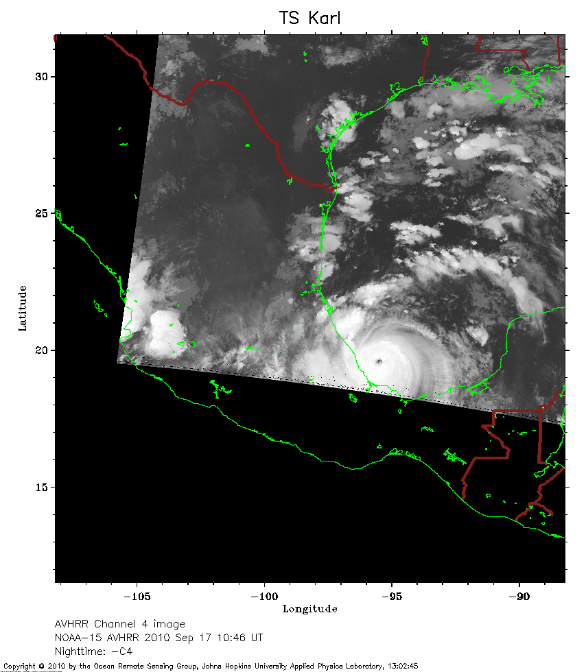 2010 September 17 10:46 UT
NOAA-15 satellite AVHRR channel 4 nighttime image.
A closer view (179 Kb) is seen by clicking on this small image.
The maximum sustained winds have increased to 120 mph.
 2010 September 17 14:46 UT
NOAA-17 satellite AVHRR 3 channel color composite daytime image.
A closer view (235 Kb) is seen by clicking on this small image.
 2010 September 17 19:36 UT
NOAA-18 satellite AVHRR 3 channel color composite daytime image.
A closer view (312 Kb) is seen by clicking on this small image.
The maximum sustained winds have decreased to 110 mph.