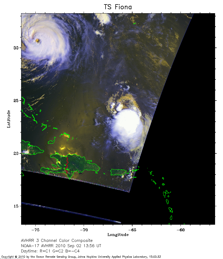
 2010 September 02 13:56 UT
NOAA-17 satellite AVHRR 3 channel color composite daytime image.
A closer view (179 Kb) is seen by clicking on this small image.
Hurricane Earl is in the upper left corner, while Fiona is just north of Puerto Rico. The maximum sustained winds of Fiona are 50 mph.
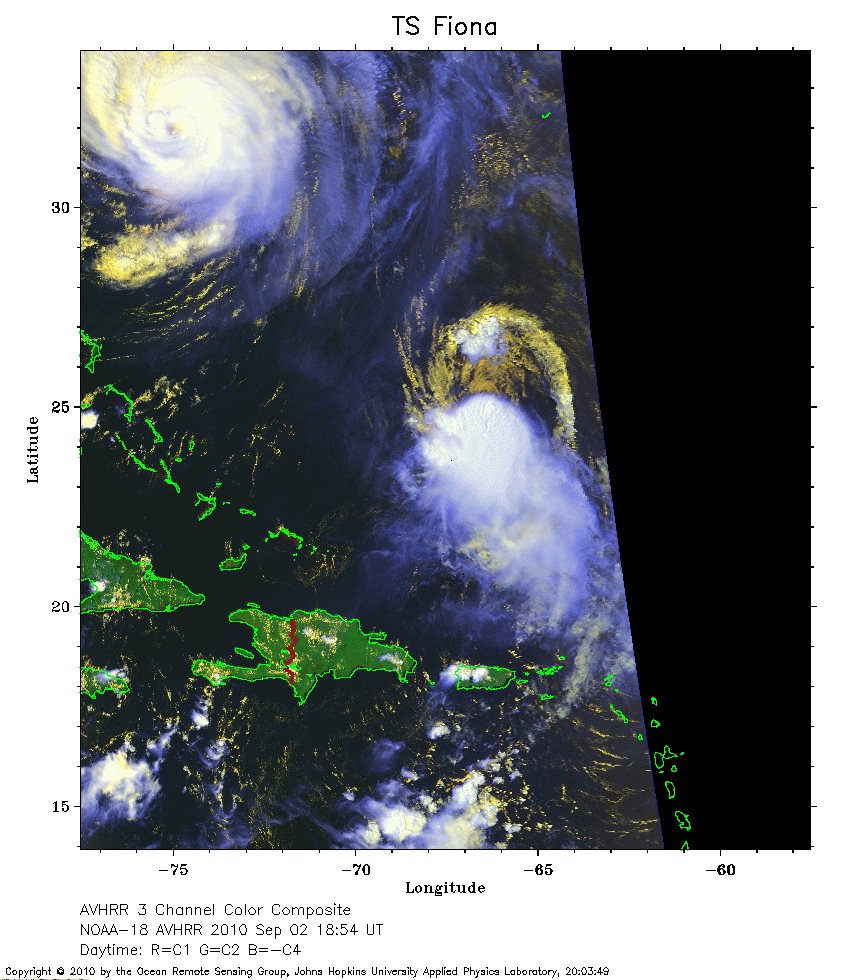 2010 September 02 13:56 UT
NOAA-17 satellite AVHRR 3 channel color composite daytime image.
A closer view (243 Kb) is seen by clicking on this small image.
Hurricane Earl is in the upper left corner, while Fiona is between Puerto Rico and Bermuda.
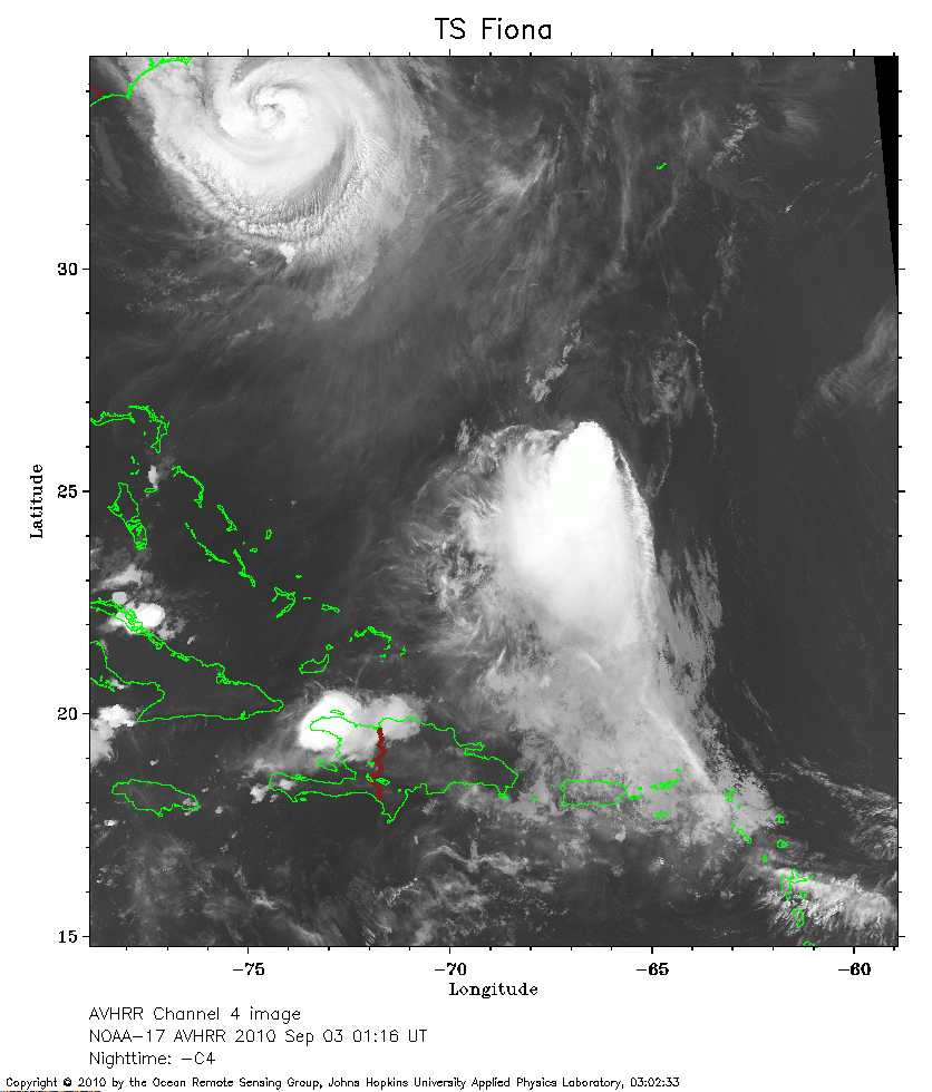 2010 September 03 01:16 UT
NOAA-17 satellite AVHRR channel 4 nighttime image.
A closer view (247 Kb) is seen by clicking on this small image.
Hurricane Earl is in the upper left corner of the image.
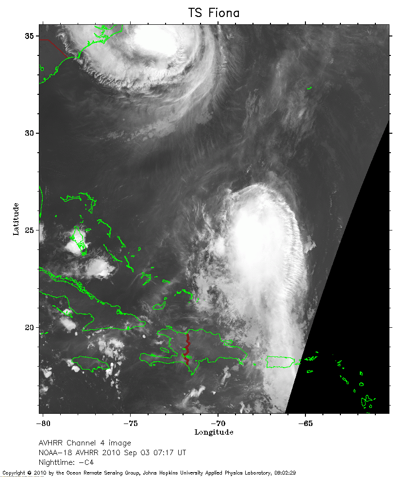 2010 September 03 07:17 UT
NOAA-18 satellite AVHRR channel 4 nighttime image.
A closer view (239 Kb) is seen by clicking on this small image.
Hurricane Earl is in the upper left corner of the image.
Notice that the appearance of Fiona is becoming more disorganized compared to earlier images.
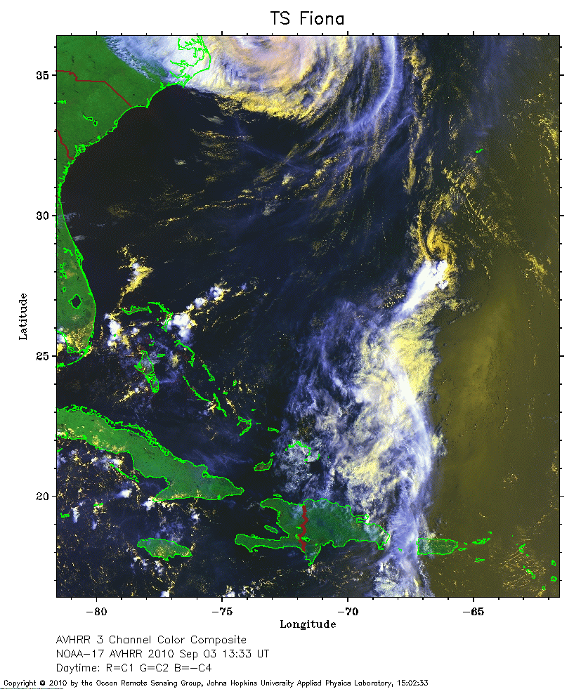 2010 September 03 13:33 UT
NOAA-17 satellite AVHRR 3 channel color composite daytime image.
A closer view (320 Kb) is seen by clicking on this small image.
The edge of Hurricane Earl can be seen at the very top of the image.
The appearance of Fiona is becoming more disorganized.
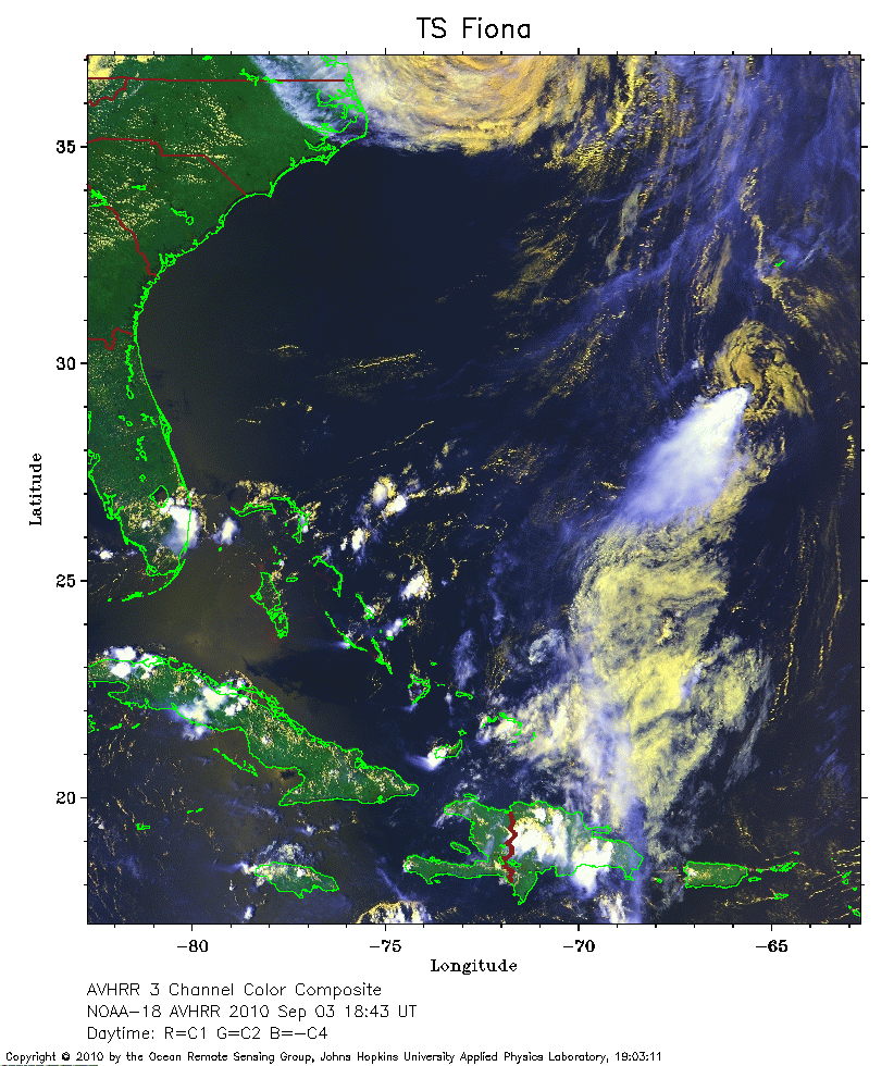 2010 September 03 18:43 UT
NOAA-18 satellite AVHRR 3 channel color composite daytime image.
A closer view (316 Kb) is seen by clicking on this small image.
Fiona is just south of Bermuda, while the edge of Earl is at the very top of the image.
The maximum sustained winds of Fiona have decreased to 45 mph.