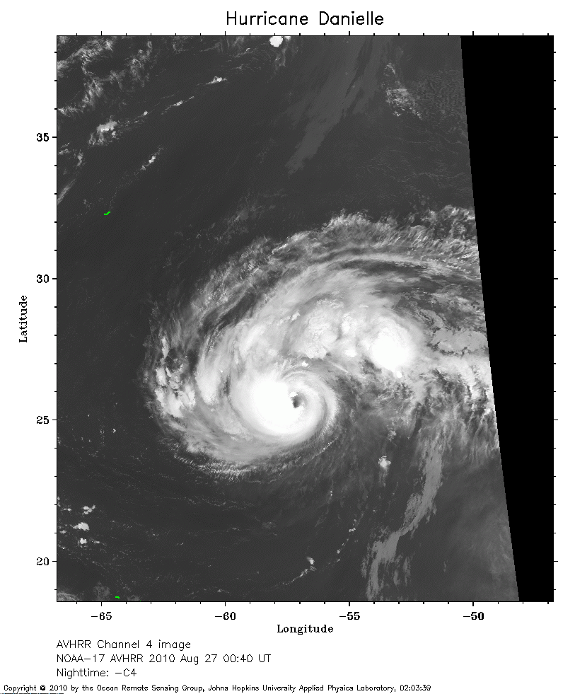
 2010 August 27 00:40 UT
NOAA-17 satellite AVHRR channel 4 nighttime image.
A closer view (215 Kb) is seen by clicking on this small image.
The maximum sustained winds are 110 mph.
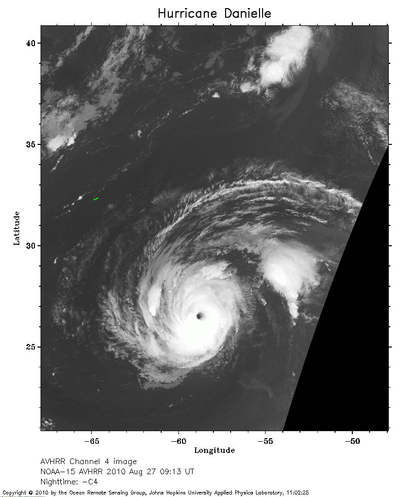 2010 August 27 09:13 UT
NOAA-15 satellite AVHRR channel 4 nighttime image.
A closer view (229 Kb) is seen by clicking on this small image.
The maximum sustained winds have increased to 135 mph.
The small J-shaped island to the left of the storm is Bermuda.
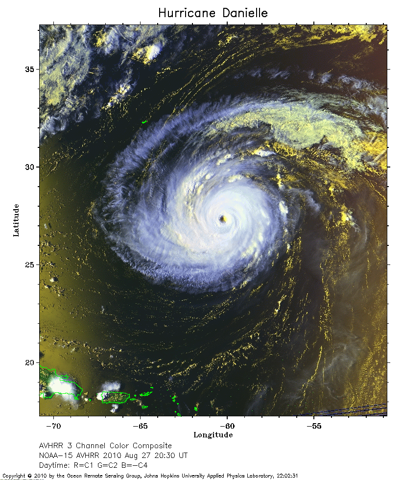 2010 August 27 20:30 UT
NOAA-15 satellite AVHRR 3 channel color composite afternoon image.
A closer view (359 Kb) is seen by clicking on this small image.
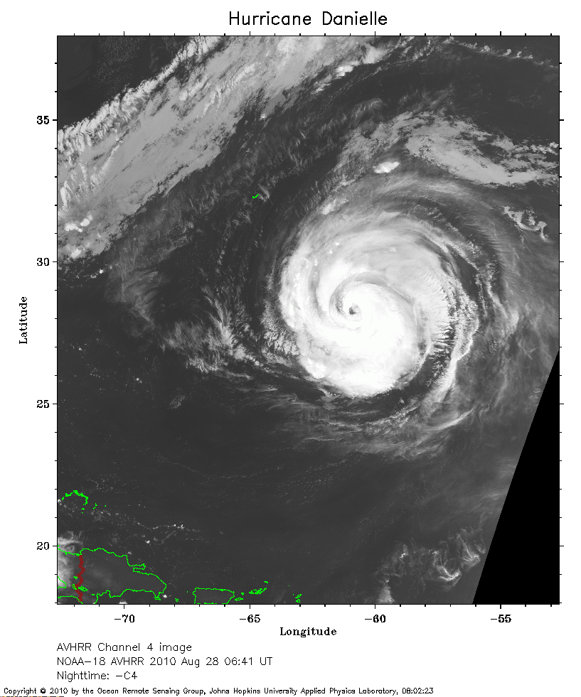 2010 August 28 06:41 UT
NOAA-18 satellite AVHRR channel 4 nighttime image.
A closer view (258 Kb) is seen by clicking on this small image.
The maximum sustained winds have decreased to 120 mph.
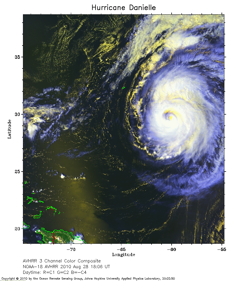 2010 August 28 18:06 UT
NOAA-18 satellite AVHRR 3 channel color composite daytime image.
A closer view (333 Kb) is seen by clicking on this small image.
Bermuda is the J-shaped island to the left of the storm.
The maximum sustained winds have decreased to 110 mph.