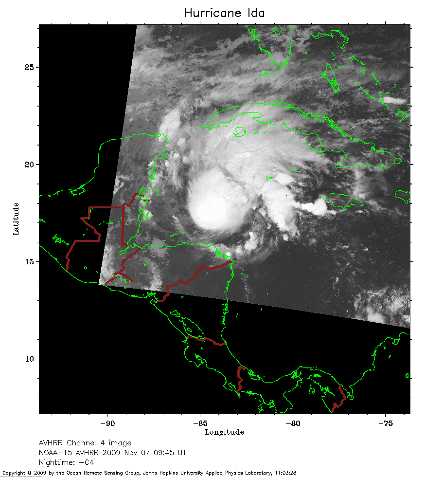
 2009 November 7 09:45 UT
NOAA-15 satellite AVHRR channel 4 early morning image.
A closer view (197 Kb) is seen by clicking on this small image.
The maximum sustained winds are 45 mph.
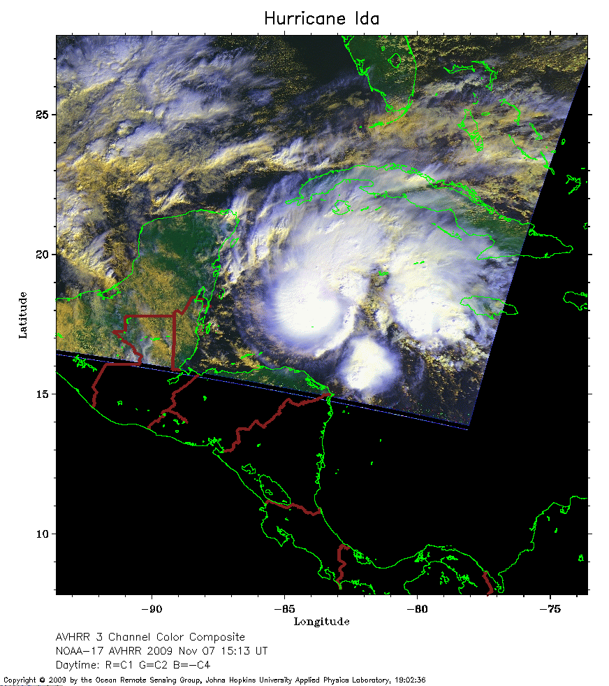 2009 November 7 15:13 UT
NOAA-17 satellite AVHRR 3 channel color composite daytime image.
A closer view (261 Kb) is seen by clicking on this small image.
The maximum sustained winds have increased to 60 mph.
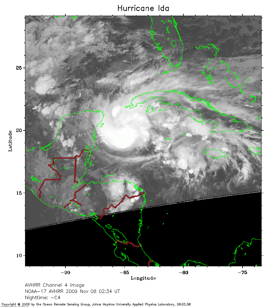 2009 November 8 02:34 UT
NOAA-17 satellite AVHRR channel 4 nighttime image.
A closer view (252 Kb) is seen by clicking on this small image.
The maximum sustained winds have increased to 70 mph.
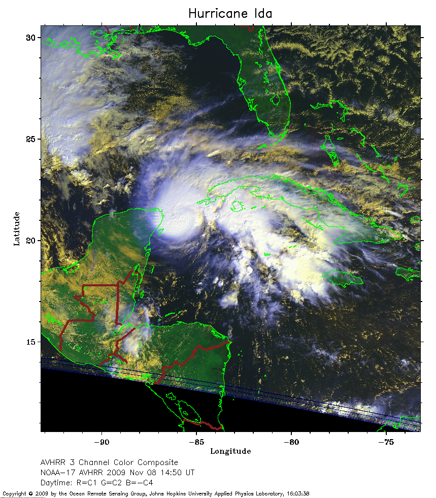 2009 November 8 14:50 UT
NOAA-17 satellite AVHRR 3 channel color composite daytime image.
A closer view (352 Kb) is seen by clicking on this small image.
The maximum sustained winds have increased to 90 mph.
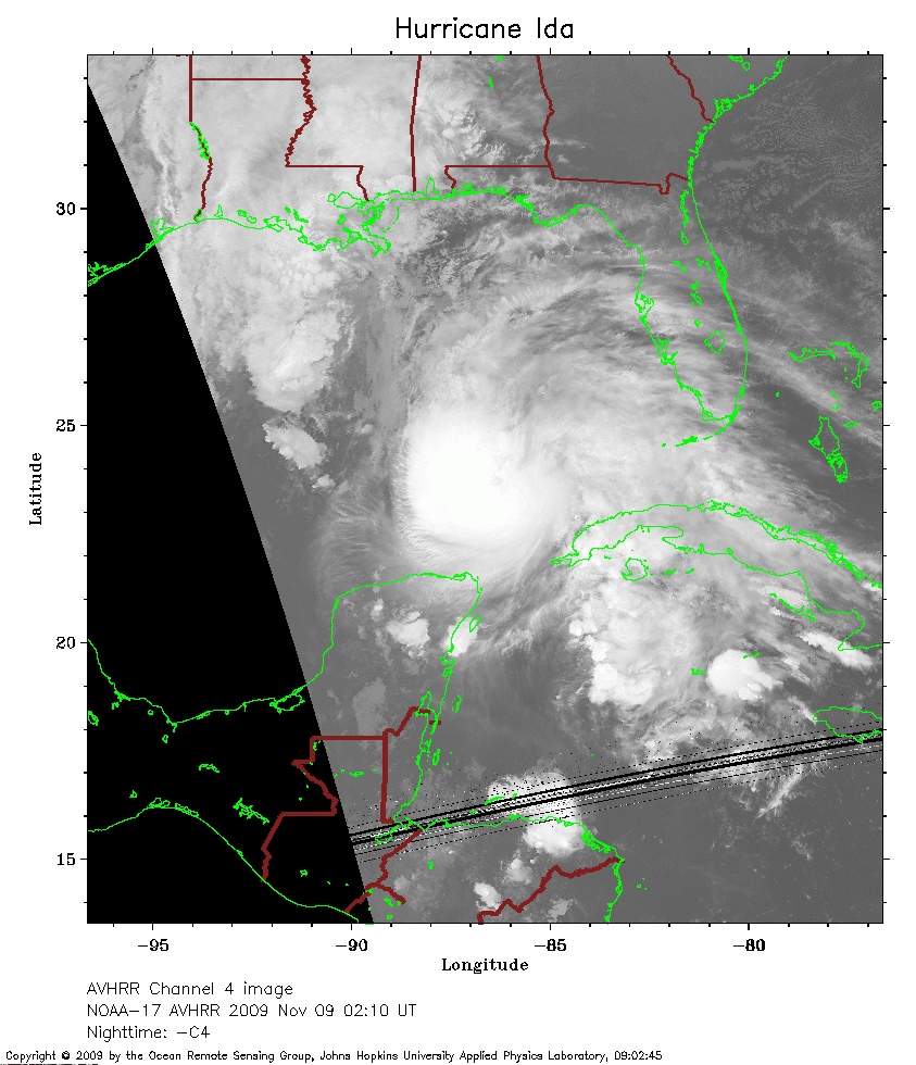 2009 November 9 02:10 UT
NOAA-17 satellite AVHRR channel 4 nighttime image.
A closer view (232 Kb) is seen by clicking on this small image.
The maximum sustained winds have increased to 105 mph.
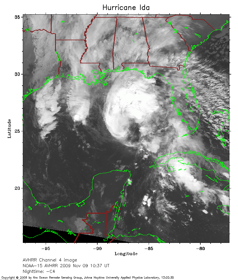 2009 November 9 10:37 UT
NOAA-15 satellite AVHRR channel 4 early morning image.
A closer view (294 Kb) is seen by clicking on this small image.
The maximum sustained winds have decreased to 90 mph.
 2009 November 9 14:27 UT
NOAA-17 satellite AVHRR 3 channel color composite daytime image.
A closer view (229 Kb) is seen by clicking on this small image.
The maximum sustained winds have decreased to 80 mph.
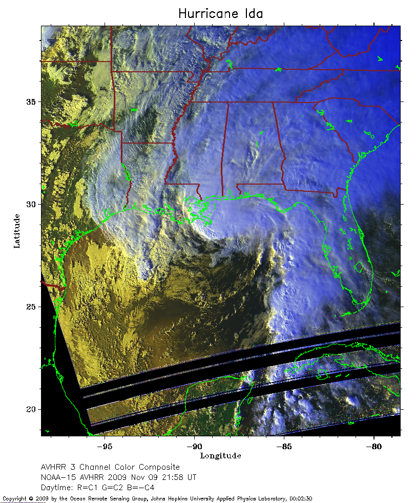 2009 November 9 21:58 UT
NOAA-15 satellite AVHRR 3 channel color composite daytime image.
A closer view (352 Kb) is seen by clicking on this small image.
The maximum sustained winds have decreased to 70 mph.
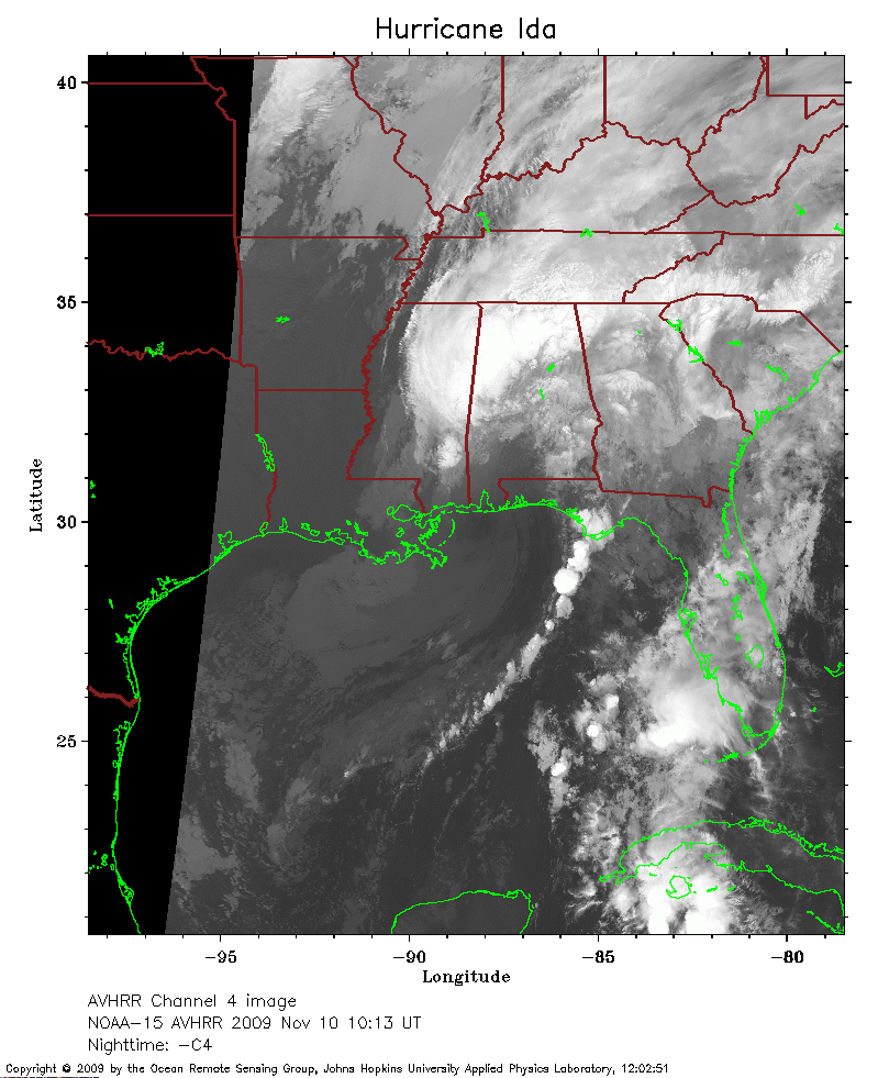 2009 November 10 10:13 UT
NOAA-15 satellite AVHRR channel 4 early morning image.
A closer view (235 Kb) is seen by clicking on this small image.
The maximum sustained winds have decreased to 50 mph.
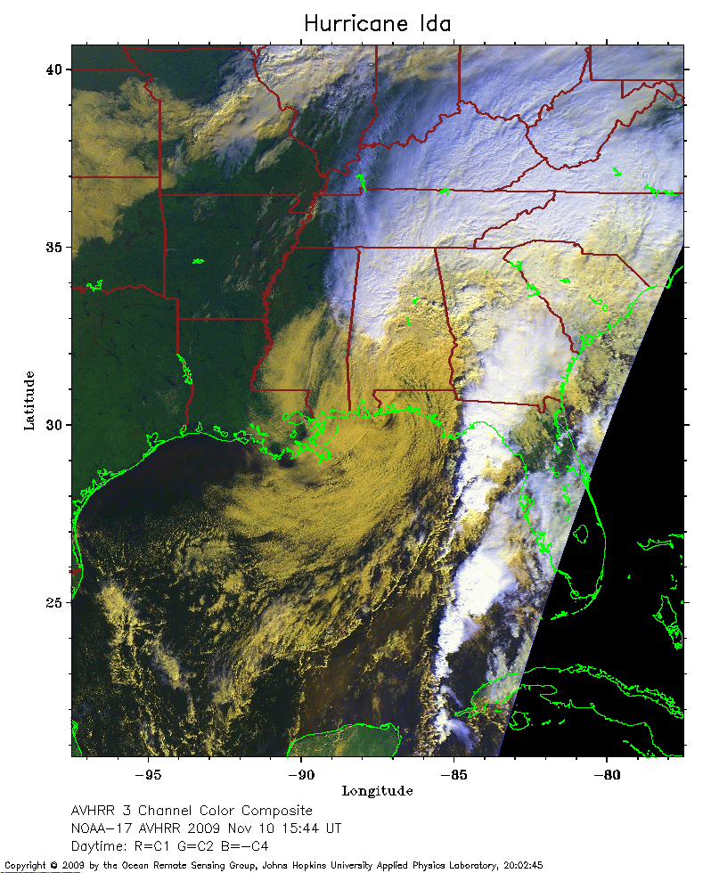 2009 November 10 15:44 UT
NOAA-17 satellite AVHRR 3 channel color composite daytime image.
A closer view (336 Kb) is seen by clicking on this small image.
Ida made its first US landfall on Dauphin Island, Alabama, at about
1140 UTC and a second landfall near Bon Secour, Alabama, at about 1300 UTC.
The maximum sustained winds have decreased to 35 mph and Ida has become extratropical.