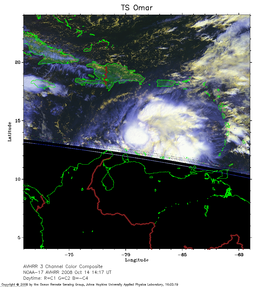
 2008 October 14 14:17 UT
NOAA-17 satellite AVHRR 3 channel color composite daytime image.
A closer view (243 Kb) is seen by clicking on this small image.
The maximum sustained winds are 35 mph.
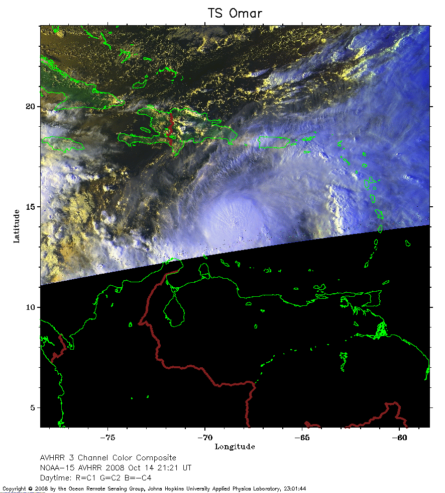 2008 October 14 21:21 UT
NOAA-15 satellite AVHRR 3 channel color composite daytime image.
A closer view (255 Kb) is seen by clicking on this small image.
The maximum sustained winds have increased to 70 mph.
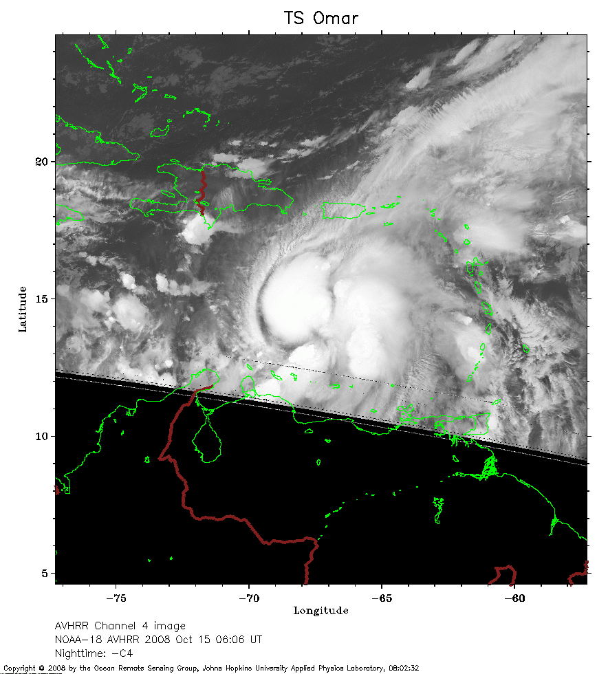 2008 October 15 06:06 UT
NOAA-18 satellite AVHRR channel 4 nighttime image.
A closer view (226 Kb) is seen by clicking on this small image.
The maximum sustained winds have increased to 75 mph and Omar is now a hurricane.
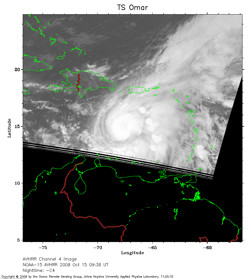 2008 October 15 09:38 UT
NOAA-15 satellite AVHRR channel 4 nighttime image.
A closer view (186 Kb) is seen by clicking on this small image.
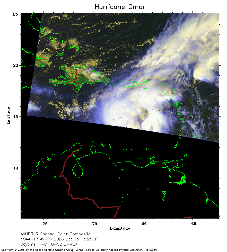 2008 October 15 13:55 UT
NOAA-17 satellite AVHRR 3 channel color composite daytime image.
A closer view (210 Kb) is seen by clicking on this small image.
The maximum sustained winds have increased to 80 mph.
 2008 October 15 17:32 UT
NOAA-18 satellite AVHRR 3 channel color composite daytime image.
A closer view (233 Kb) is seen by clicking on this small image.
The maximum sustained winds have increased to 85 mph.
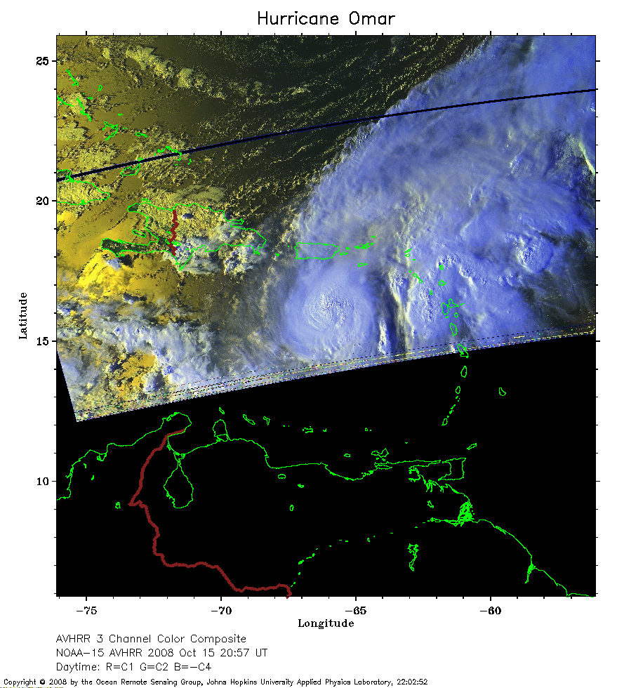 2008 October 15 20:57 UT
NOAA-15 satellite AVHRR 3 channel color composite daytime image.
A closer view (247 Kb) is seen by clicking on this small image.
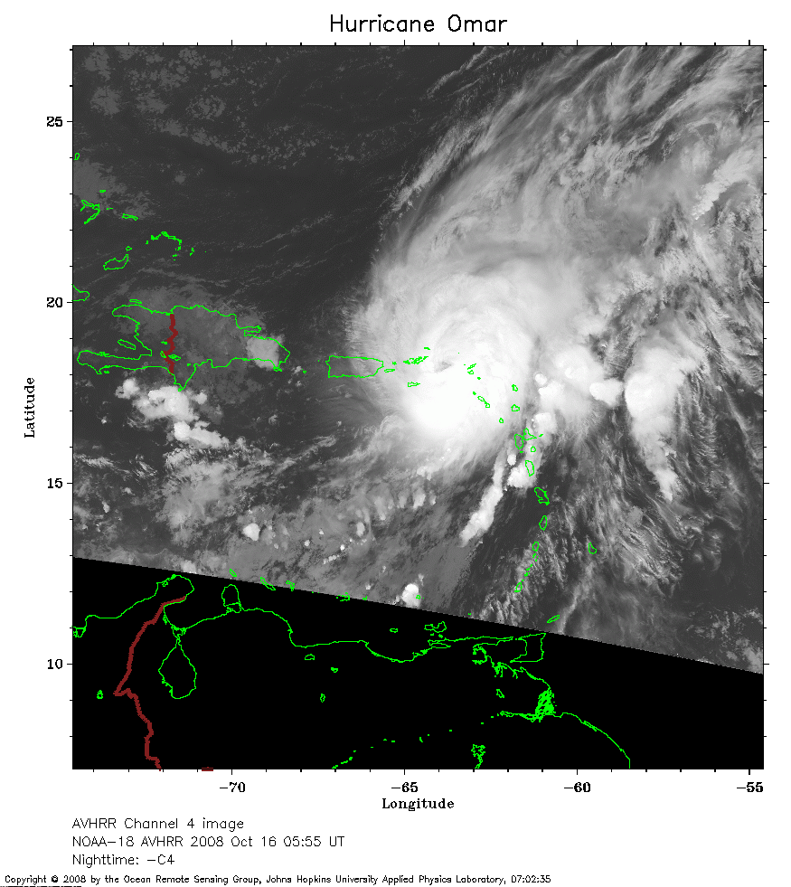 2008 October 16 05:55 UT
NOAA-18 satellite AVHRR channel 4 nighttime image.
A closer view (253 Kb) is seen by clicking on this small image.
The maximum sustained winds have increased to 120 mph.
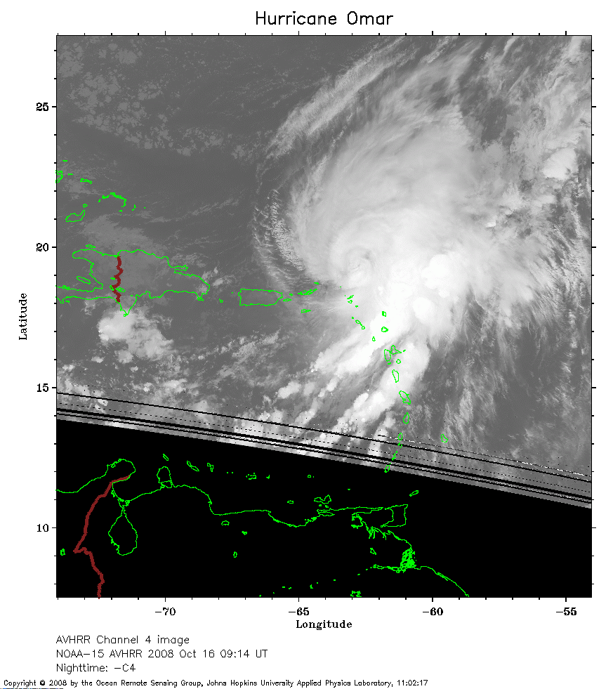 2008 October 16 09:14 UT
NOAA-15 satellite AVHRR channel 4 nighttime image.
A closer view (222 Kb) is seen by clicking on this small image.
The maximum sustained winds have increased to 125 mph.
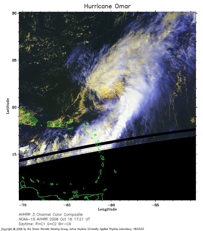 2008 October 16 17:21 UT
NOAA-18 satellite AVHRR 3 channel color composite daytime image.
A closer view (254 Kb) is seen by clicking on this small image.
The maximum sustained winds have decreased to 85 mph.
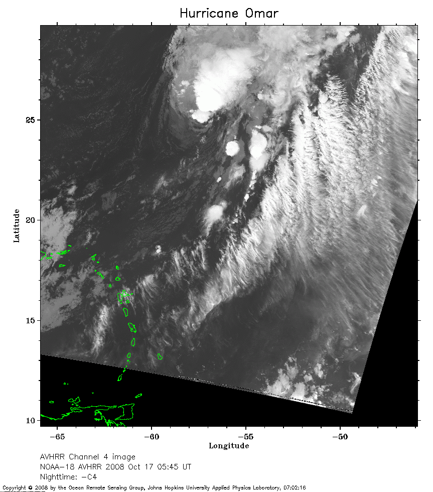 2008 October 17 05:45 UT
NOAA-18 satellite AVHRR channel 4 nighttime image.
A closer view (280 Kb) is seen by clicking on this small image.
The maximum sustained winds have decreased to 70 mph.
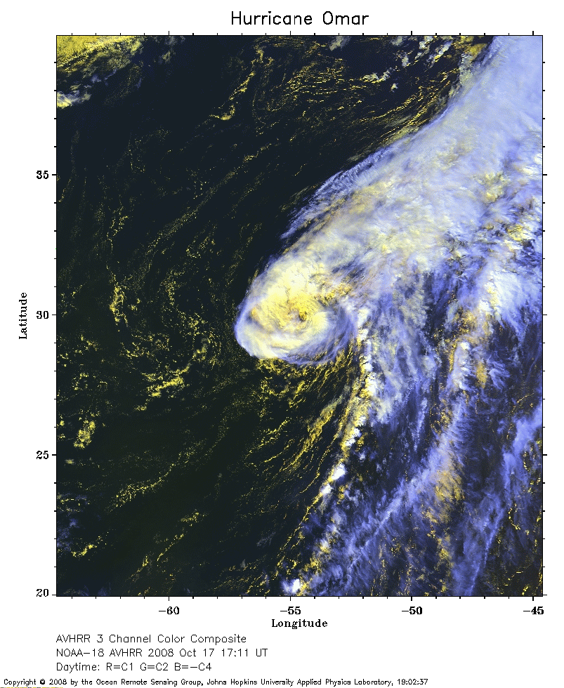 2008 October 17 17:11 UT
NOAA-18 satellite AVHRR 3 channel color composite daytime image.
A closer view (324 Kb) is seen by clicking on this small image.
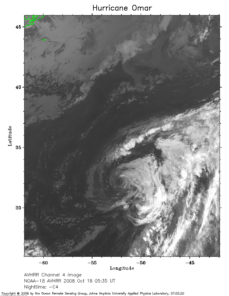 2008 October 18 05:35 UT
NOAA-18 satellite AVHRR channel 4 nighttime image.
A closer view (255 Kb) is seen by clicking on this small image.
The maximum sustained winds have decreased to 65 mph.
 2008 October 18 08:28 UT
NOAA-15 satellite AVHRR channel 4 nighttime image.
A closer view (258 Kb) is seen by clicking on this small image.