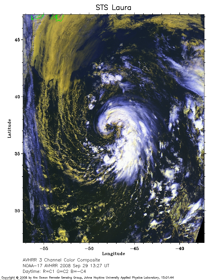
 2008 September 29 13:27 UT
NOAA-17 satellite AVHRR 3 channel color composite daytime image.
A closer view (354 Kb) is seen by clicking on this small image.
The maximum sustained winds are 60 mph.
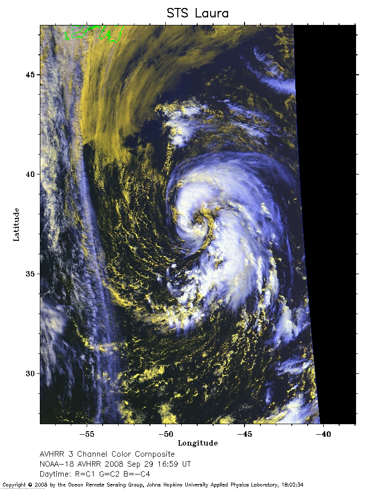 2008 September 29 16:59 UT
NOAA-18 satellite AVHRR 3 channel color composite daytime image.
A closer view (313 Kb) is seen by clicking on this small image.
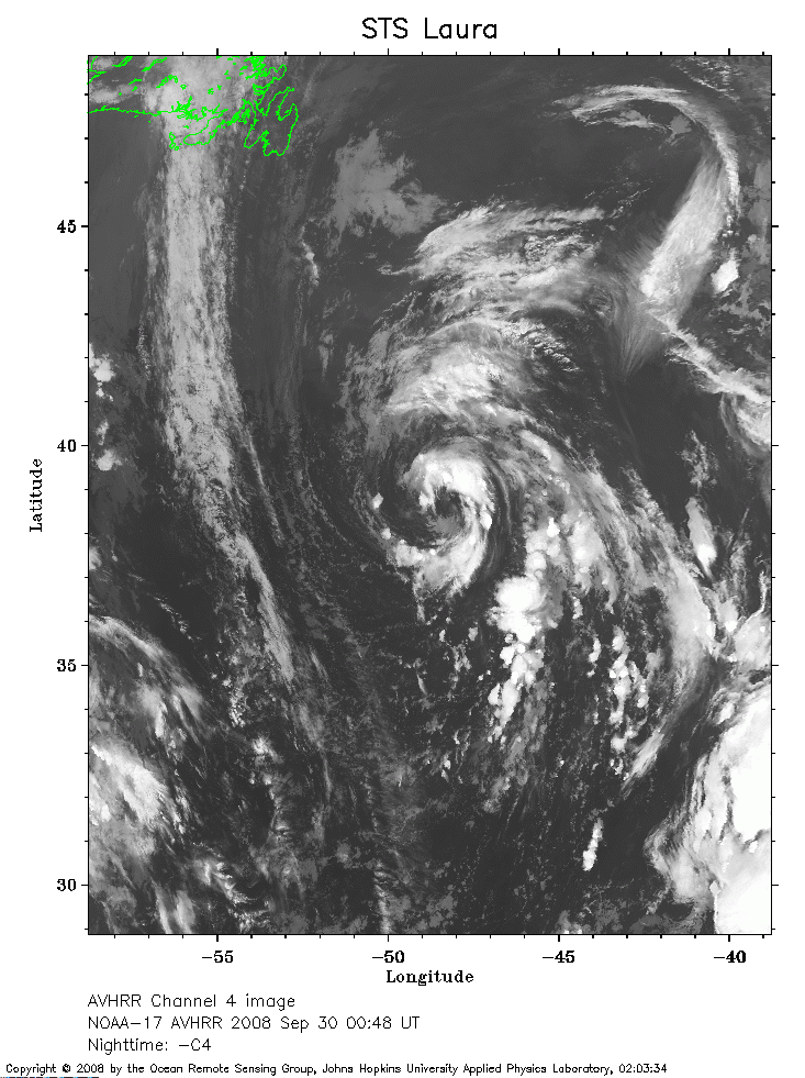 2008 September 30 00:48 UT
NOAA-17 satellite AVHRR channel 4 nighttime image.
A closer view (278 Kb) is seen by clicking on this small image.
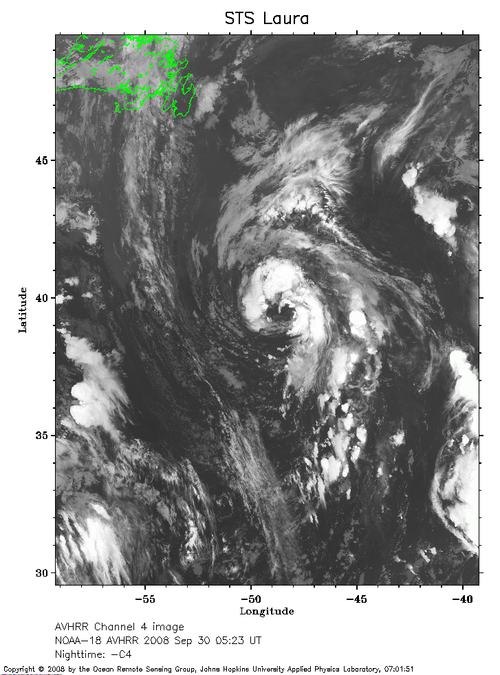 2008 September 30 05:23 UT
NOAA-18 satellite AVHRR channel 4 nighttime image.
A closer view (279 Kb) is seen by clicking on this small image.
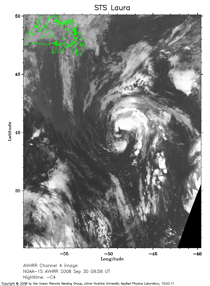 2008 September 30 08:58 UT
NOAA-15 satellite AVHRR channel 4 nighttime image.
A closer view (274 Kb) is seen by clicking on this small image.
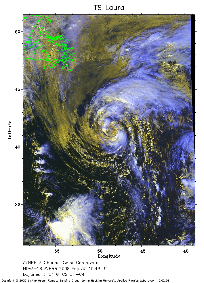 2008 September 30 16:49 UT
NOAA-18 satellite AVHRR 3 channel color composite daytime image.
A closer view (348 Kb) is seen by clicking on this small image.
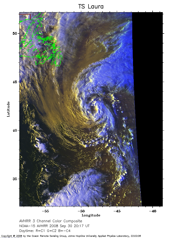 2008 September 30 20:17 UT
NOAA-15 satellite AVHRR 3 channel color composite daytime image.
A closer view (273 Kb) is seen by clicking on this small image.
 2008 October 01 00:26 UT
NOAA-17 satellite AVHRR channel 4 nighttime image.
A closer view (235 Kb) is seen by clicking on this small image.
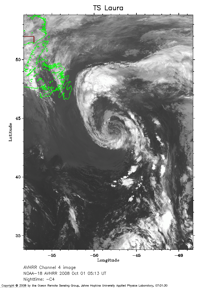 2008 October 01 05:13 UT
NOAA-18 satellite AVHRR channel 4 nighttime image.
A closer view (246 Kb) is seen by clicking on this small image.
The maximum sustained winds have decreased to 50 mph.
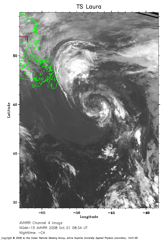 2008 October 01 08:34 UT
NOAA-15 satellite AVHRR channel 4 nighttime image.
A closer view (237 Kb) is seen by clicking on this small image.
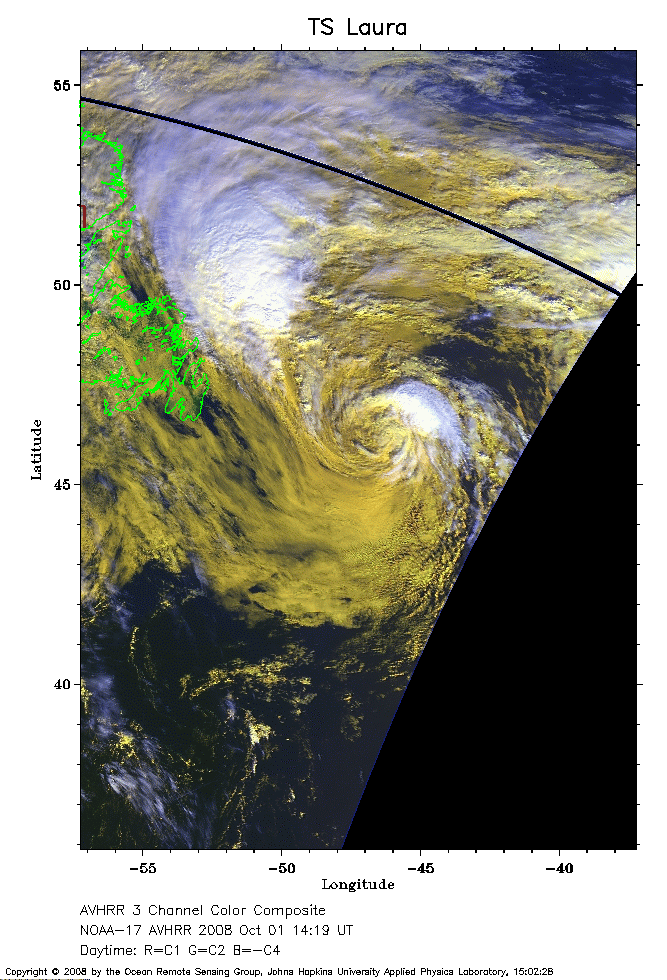 2008 October 01 14:19 UT
NOAA-17 satellite AVHRR 3 channel color composite daytime image.
A closer view (250 Kb) is seen by clicking on this small image.
The maximum sustained winds have decreased to 45 mph.