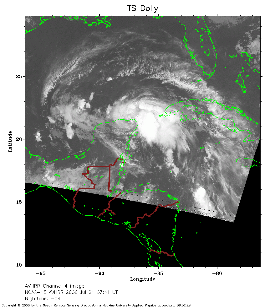
 2008 July 21 07:41 UT
NOAA-18 satellite AVHRR channel 4 nighttime image.
A closer view (224 Kb) is seen by clicking on this small image.
The maximum sustained winds are 50 mph.
 2008 July 21 10:34 UT
NOAA-15 satellite AVHRR channel 4 nighttime image.
A closer view (249 Kb) is seen by clicking on this small image.
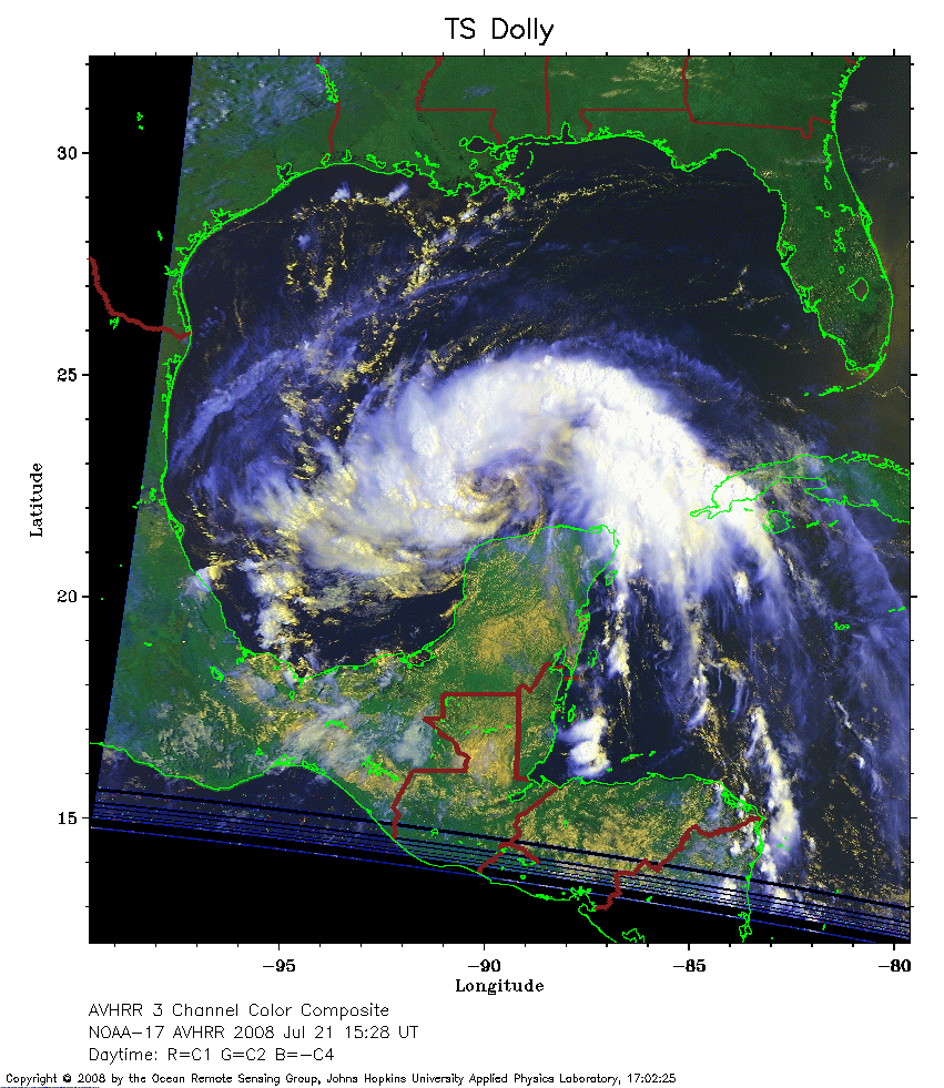 2008 July 21 15:28 UT
NOAA-17 satellite AVHRR 3 channel color composite daytime image.
A closer view (313 Kb) is seen by clicking on this small image.
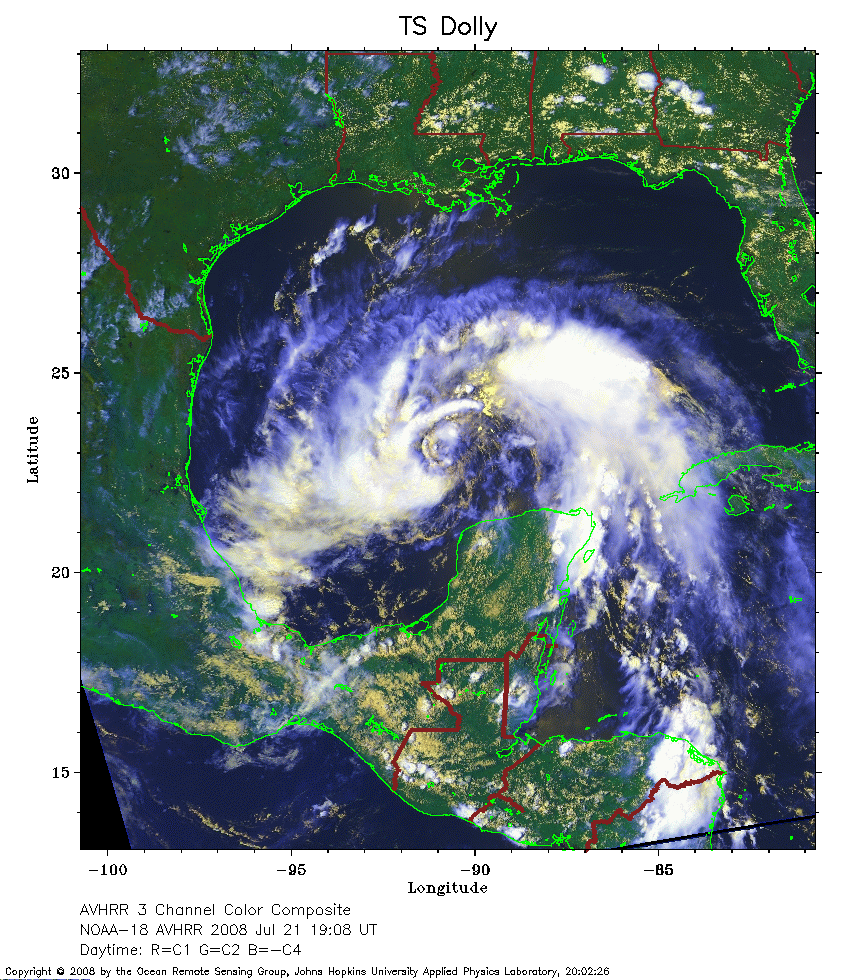 2008 July 21 19:08 UT
NOAA-18 satellite AVHRR 3 channel color composite daytime image.
A closer view (389 Kb) is seen by clicking on this small image.
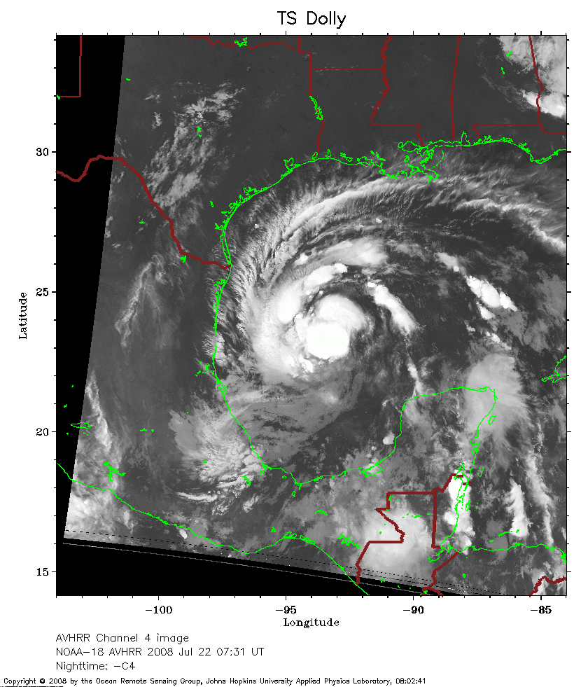 2008 July 22 07:31 UT
NOAA-18 satellite AVHRR channel 4 nighttime image.
A closer view (274 Kb) is seen by clicking on this small image.
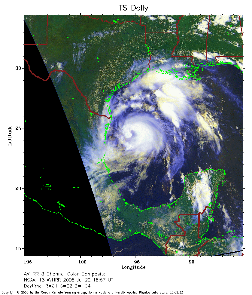 2008 July 22 18:57 UT
NOAA-18 satellite AVHRR 3 channel color composite daytime image.
A closer view (312 Kb) is seen by clicking on this small image.
The maximum sustained winds have increased to 70 mph.
 2008 July 22 23:13 UT
NOAA-15 satellite AVHRR 3 channel color composite evening image.
A closer view (213 Kb) is seen by clicking on this small image.
The maximum sustained winds have increased to 75 mph.
 2008 July 23 04:08 UT
NOAA-17 satellite AVHRR channel 4 nighttime image.
A closer view (202 Kb) is seen by clicking on this small image.
The maximum sustained winds have increased to 80 mph.
2008 July 23 04:08 UT
NOAA-17 satellite AVHRR channel 4 nighttime image.
A closer view (202 Kb) is seen by clicking on this small image.
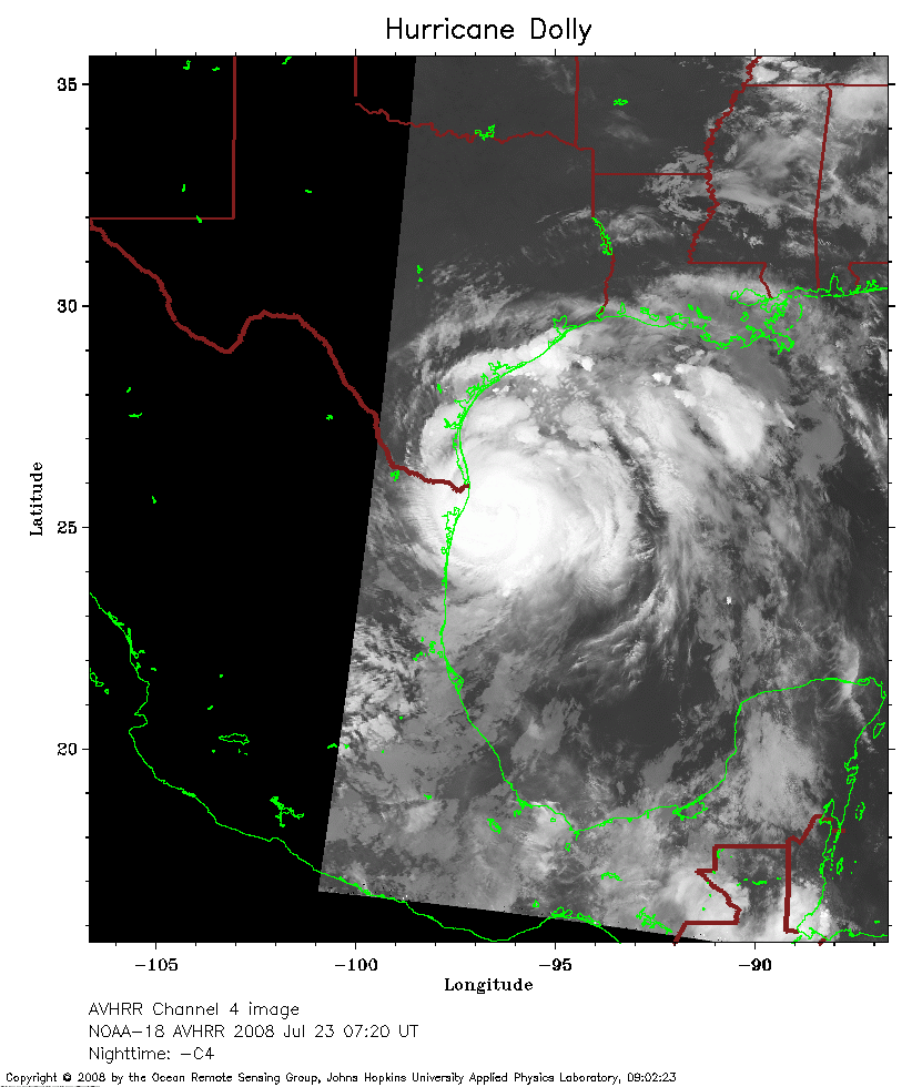 2008 July 23 07:20 UT
NOAA-18 satellite AVHRR channel 4 nighttime image.
A closer view (206 Kb) is seen by clicking on this small image.
 2008 July 23 11:27 UT
NOAA-15 satellite AVHRR channel 4 early morning image.
A closer view (215 Kb) is seen by clicking on this small image.
The maximum sustained winds have increased to 85 mph. In this image, you can
see the eye just east of the Gulf coast.
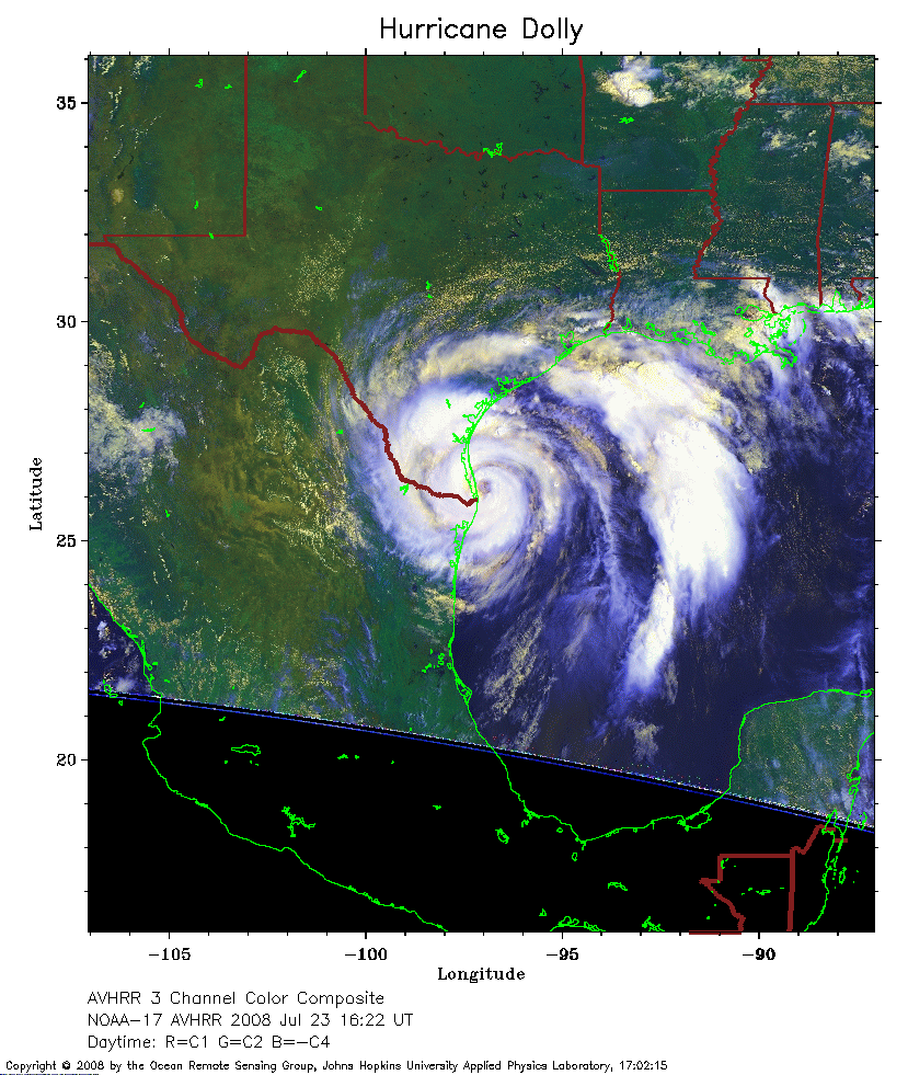 2008 July 23 16:22 UT
NOAA-17 satellite AVHRR 3 channel color composite daytime image.
A closer view (284 Kb) is seen by clicking on this small image.
Click here for a higher resolution version of the image (3853 Kb).
The maximum sustained winds have increased to 100 mph as the eye of Dolly nears the Texas coast.
 2008 July 24 03:44 UT
NOAA-17 satellite AVHRR channel 4 nighttime image.
A closer view (262 Kb) is seen by clicking on this small image.
The maximum sustained winds have decreased to 70 mph.
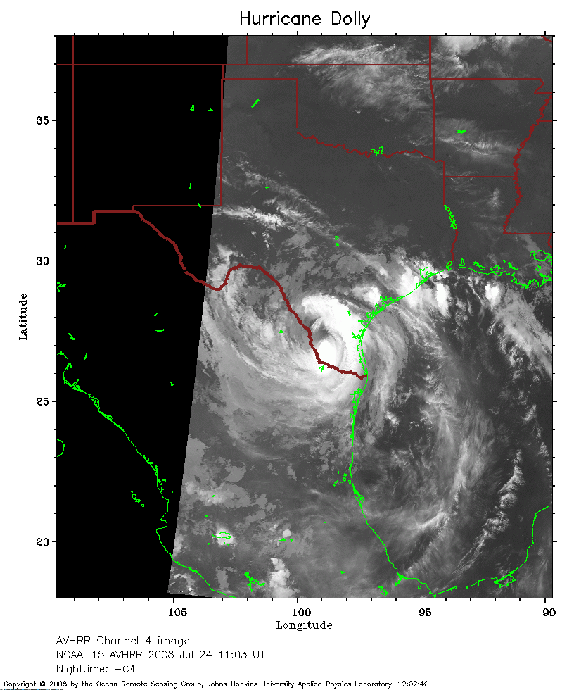 2008 July 24 11:03 UT
NOAA-15 satellite AVHRR channel 4 nighttime image.
A closer view (208 Kb) is seen by clicking on this small image.
The maximum sustained winds have decreased to 60 mph.
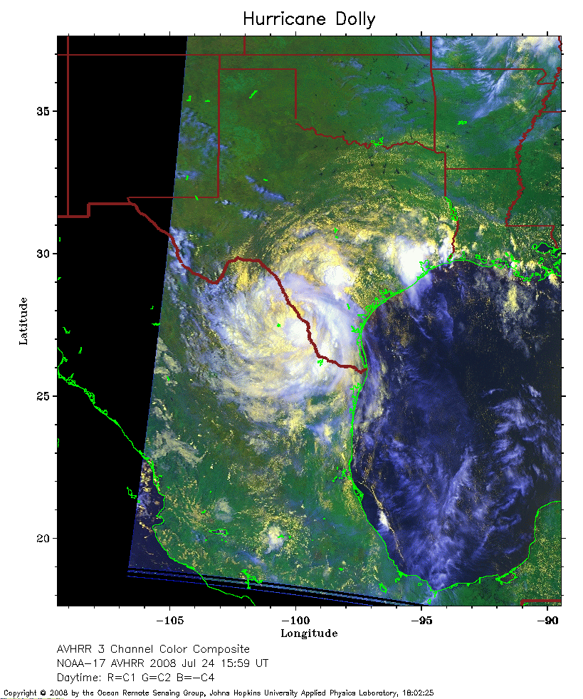 2008 July 24 15:59 UT
NOAA-17 satellite AVHRR 3 channel color composite daytime image.
A closer view (296 Kb) is seen by clicking on this small image.
The maximum sustained winds have decreased to 45 mph.