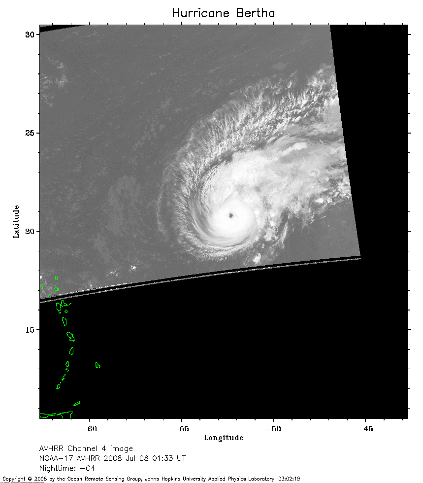
 2008 Jul 08 01:33 UT
NOAA-17 satellite AVHRR channel 4 nighttime image.
A closer view (147 Kb) is seen by clicking on this small image.
The maximum sustained winds are 115 mph.
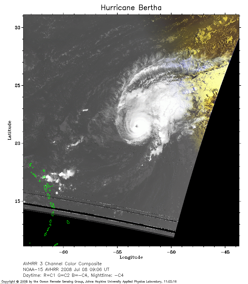 2008 Jul 08 09:06 UT
NOAA-15 satellite AVHRR 3 channel color composite early morning image.
A closer view (207 Kb) is seen by clicking on this small image.
The maximum sustained winds have increased to 120 mph.
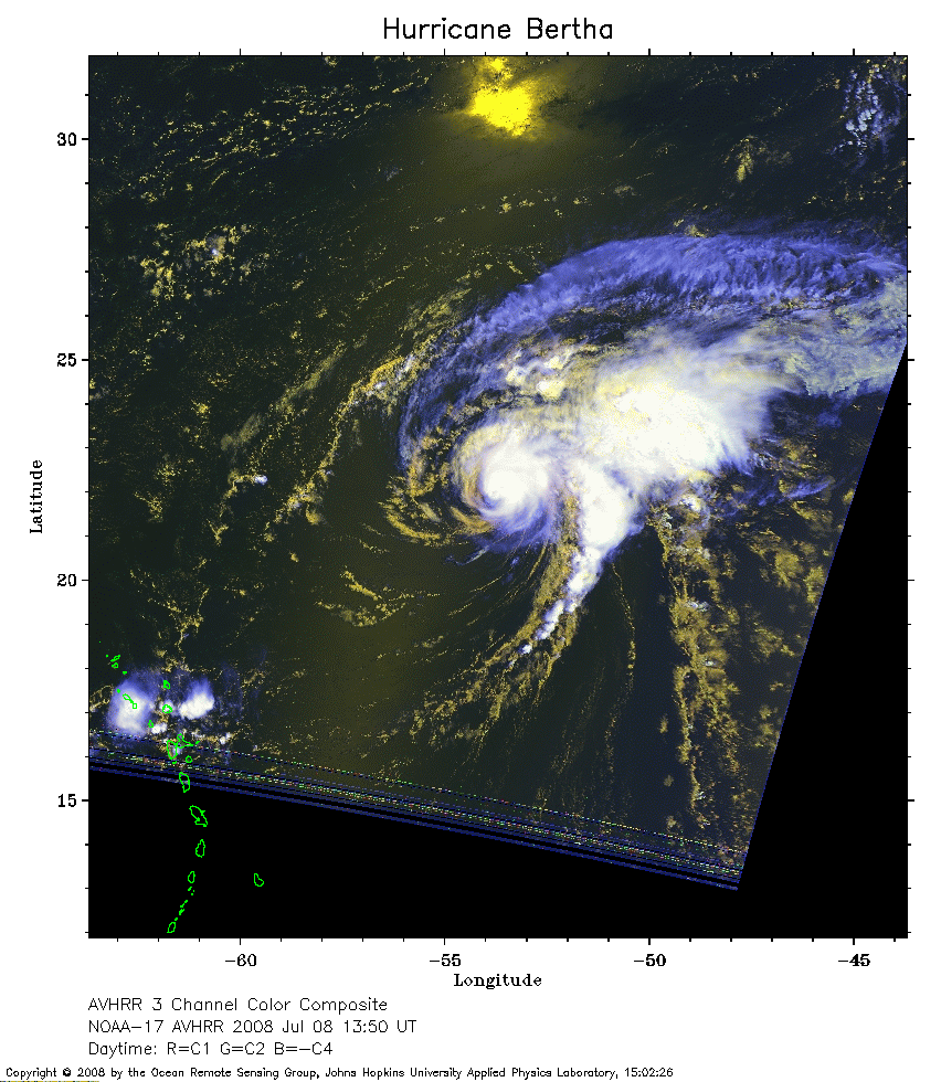 2008 Jul 08 13:50 UT
NOAA-17 satellite AVHRR 3 channel color composite daytime image.
A closer view (269 Kb) is seen by clicking on this small image.
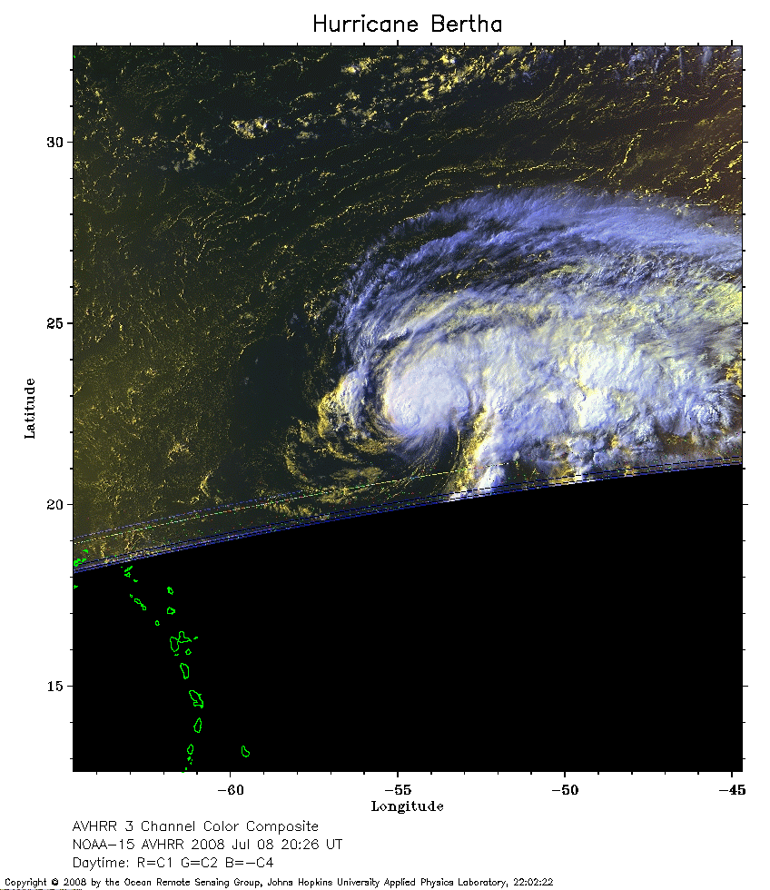 2008 Jul 08 20:26 UT
NOAA-15 satellite AVHRR 3 channel color composite daytime image.
A closer view (241 Kb) is seen by clicking on this small image.
The maximum sustained winds have decreased to 105 mph.
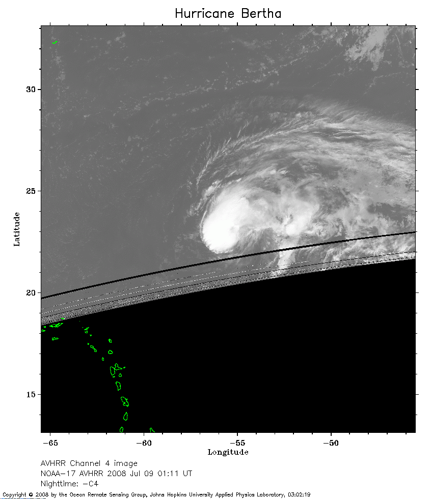 2008 Jul 09 01:11 UT
NOAA-17 satellite AVHRR channel 4 nighttime image.
A closer view (161 Kb) is seen by clicking on this small image.
The maximum sustained winds have decreased to 85 mph.
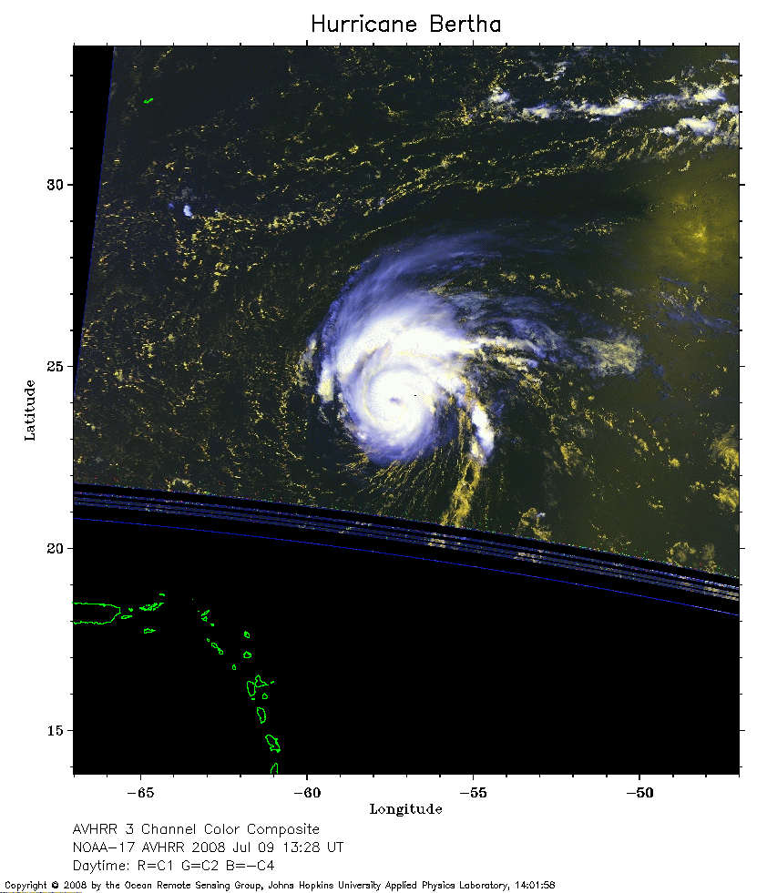 2008 Jul 09 13:28 UT
NOAA-17 satellite AVHRR 3 channel color composite daytime image.
A closer view (210 Kb) is seen by clicking on this small image.
The maximum sustained winds have decreased to 75 mph.
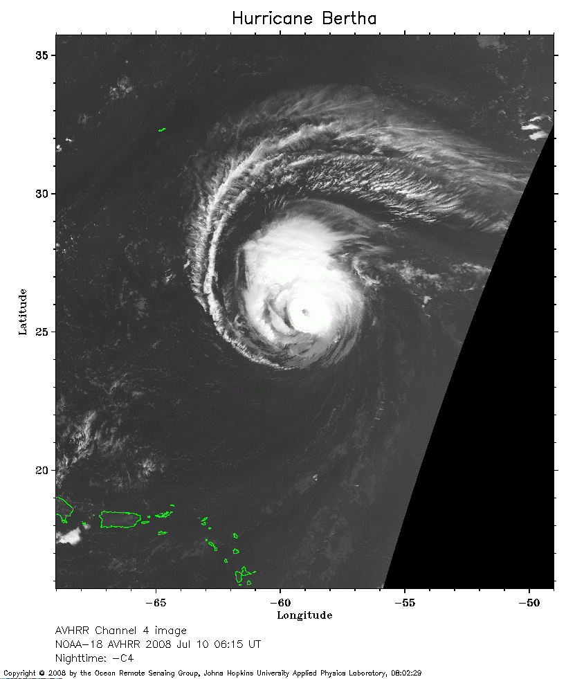 2008 Jul 10 06:15 UT
NOAA-18 satellite AVHRR channel 4 nighttime image.
A closer view (207 Kb) is seen by clicking on this small image.
The maximum sustained winds have increased to 105 mph.
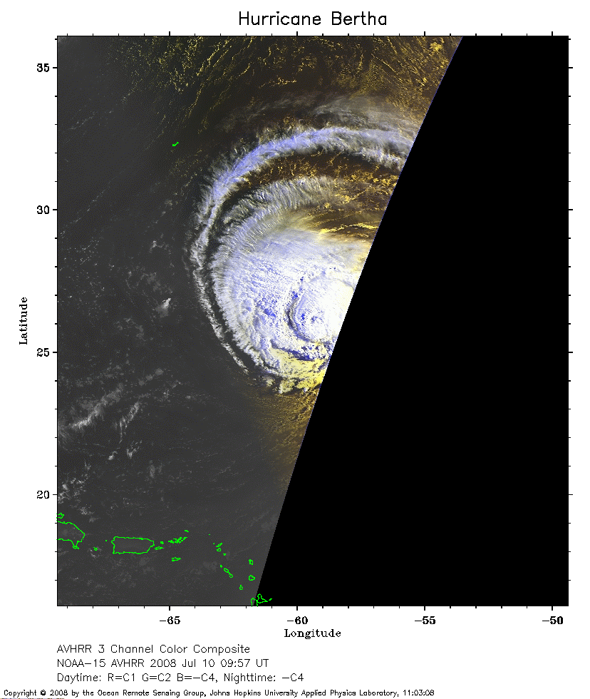 2008 Jul 10 09:57 UT
NOAA-15 satellite AVHRR 3 channel color composite early morning image.
A closer view (169 Kb) is seen by clicking on this small image.
Bermuda is the small J-shaped island to the northwest of Bertha.
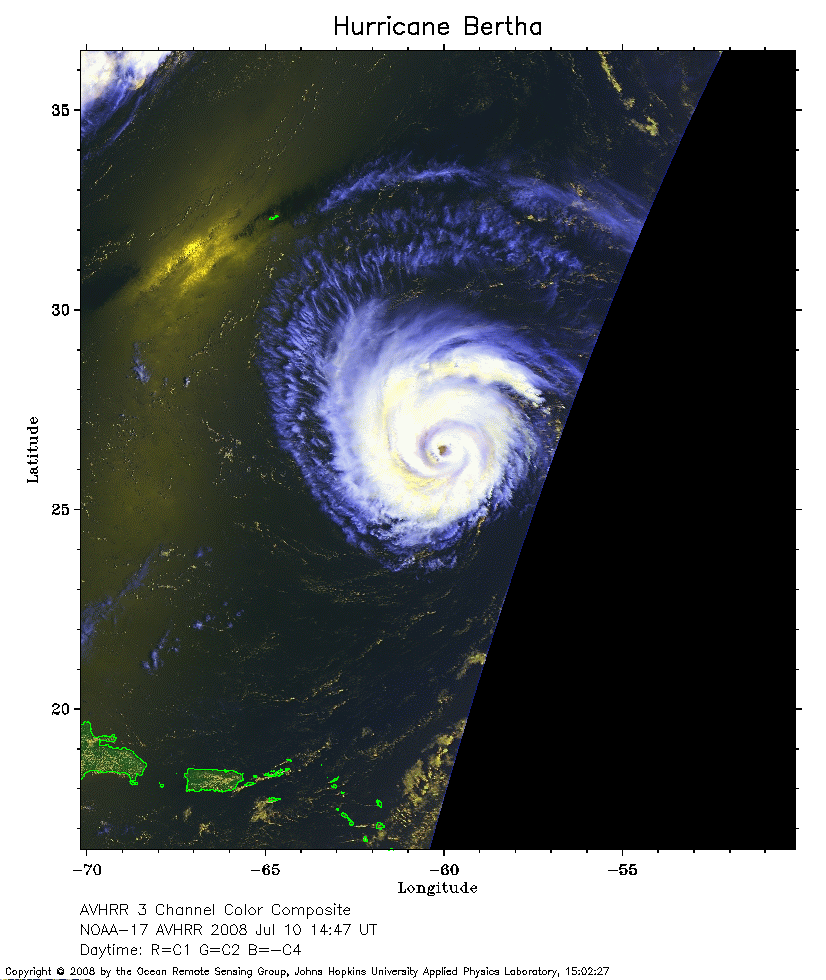 2008 Jul 10 14:47 UT
NOAA-17 satellite AVHRR 3 channel color composite daytime image.
A closer view (205 Kb) is seen by clicking on this small image.
 2008 Jul 10 17:41 UT
NOAA-18 satellite AVHRR 3 channel color composite daytime image.
A closer view (284 Kb) is seen by clicking on this small image.
The maximum sustained winds have decreased to 90 mph.
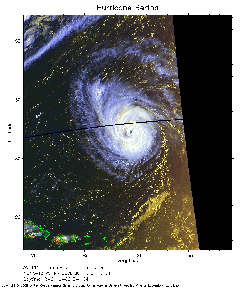 2008 Jul 10 21:17 UT
NOAA-15 satellite AVHRR 3 channel color composite evening image.
A closer view (268 Kb) is seen by clicking on this small image.
The maximum sustained winds have decreased to 85 mph.
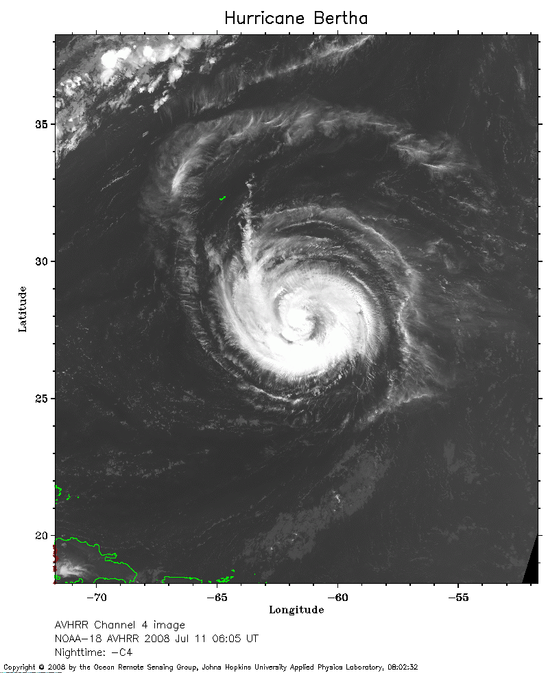 2008 Jul 11 06:05 UT
NOAA-18 satellite AVHRR channel 4 nighttime image.
A closer view (240 Kb) is seen by clicking on this small image.
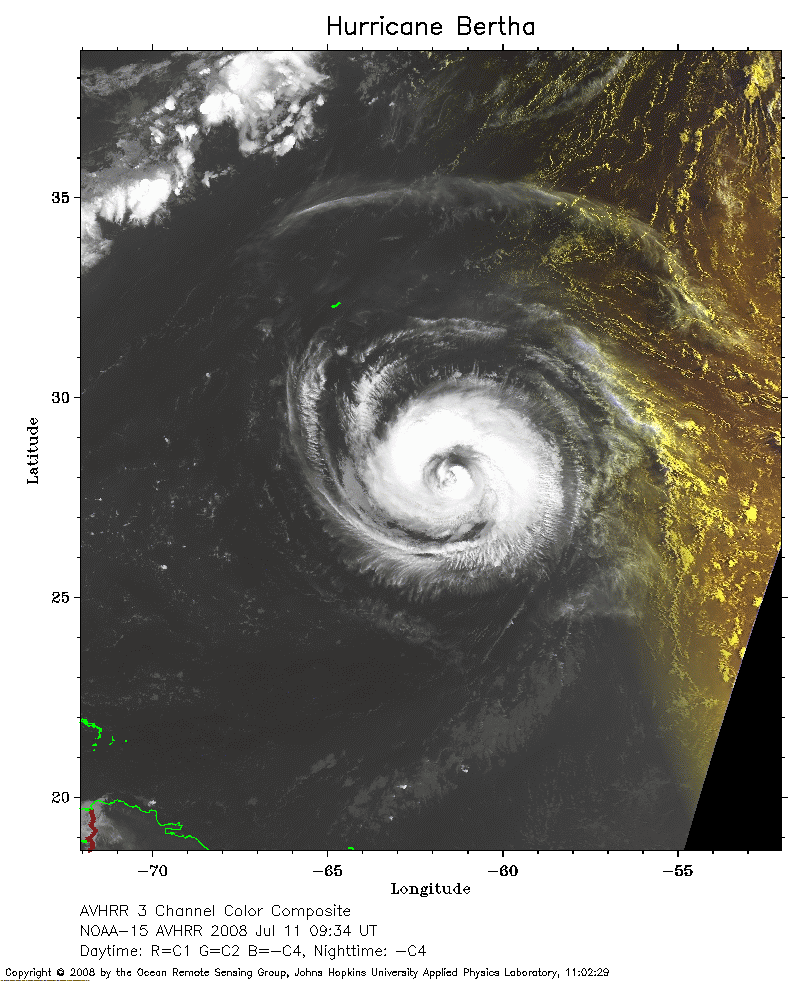 2008 Jul 11 09:34 UT
NOAA-15 satellite AVHRR 3 channel color composite early morning image.
A closer view (241 Kb) is seen by clicking on this small image.
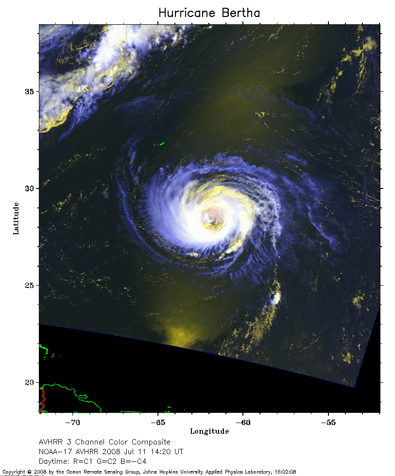 2008 Jul 11 14:20 UT
NOAA-17 satellite AVHRR 3 channel color composite daytime image.
A closer view (243 Kb) is seen by clicking on this small image.
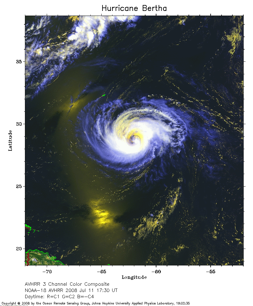 2008 Jul 11 17:30 UT
NOAA-18 satellite AVHRR 3 channel color composite daytime image.
A closer view (254 Kb) is seen by clicking on this small image.
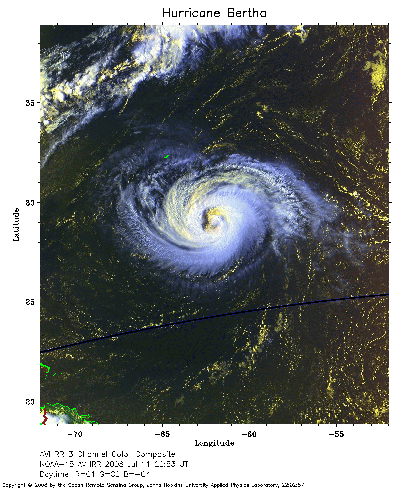 2008 Jul 11 20:53 UT
NOAA-15 satellite AVHRR 3 channel color composite early evening image.
A closer view (335 Kb) is seen by clicking on this small image.
 2008 Jul 12 01:40 UT
NOAA-17 satellite AVHRR channel 4 nighttime image.
A closer view (248 Kb) is seen by clicking on this small image.
The maximum sustained winds have increased to 90 mph.
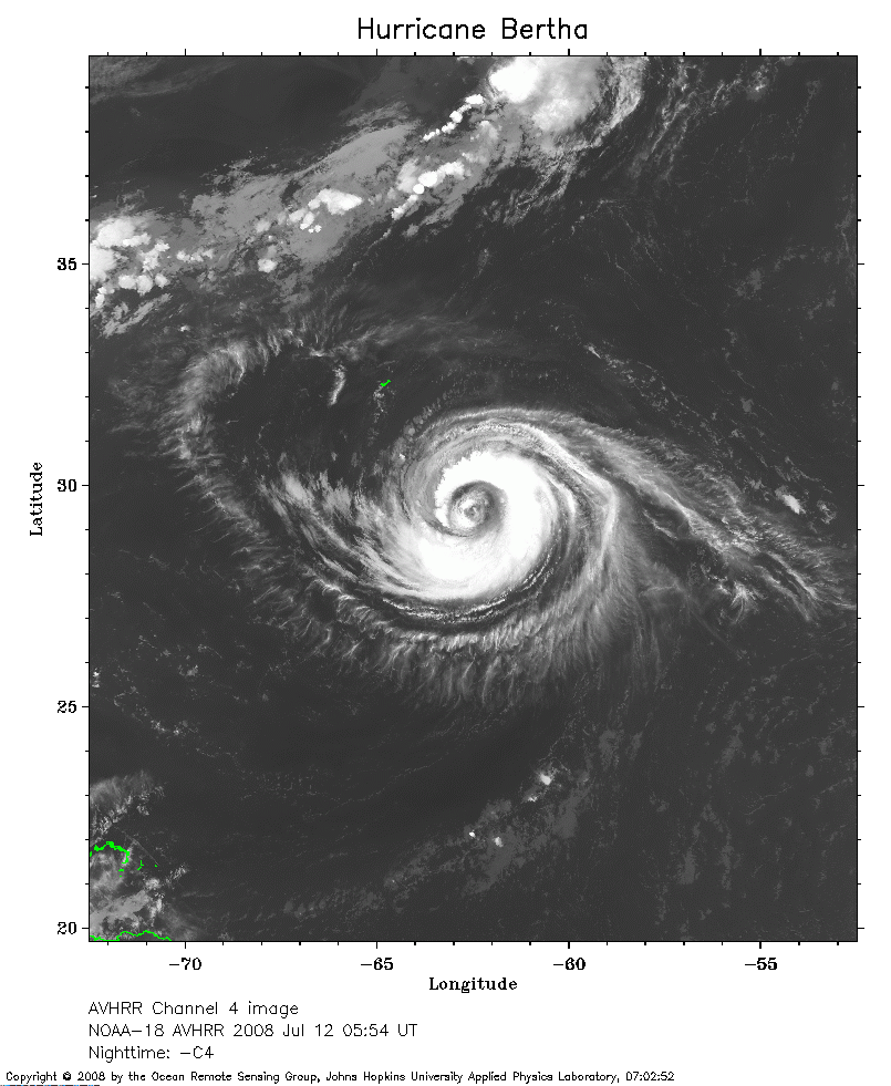 2008 Jul 12 05:54 UT
NOAA-18 satellite AVHRR channel 4 nighttime image.
A closer view (247 Kb) is seen by clicking on this small image.
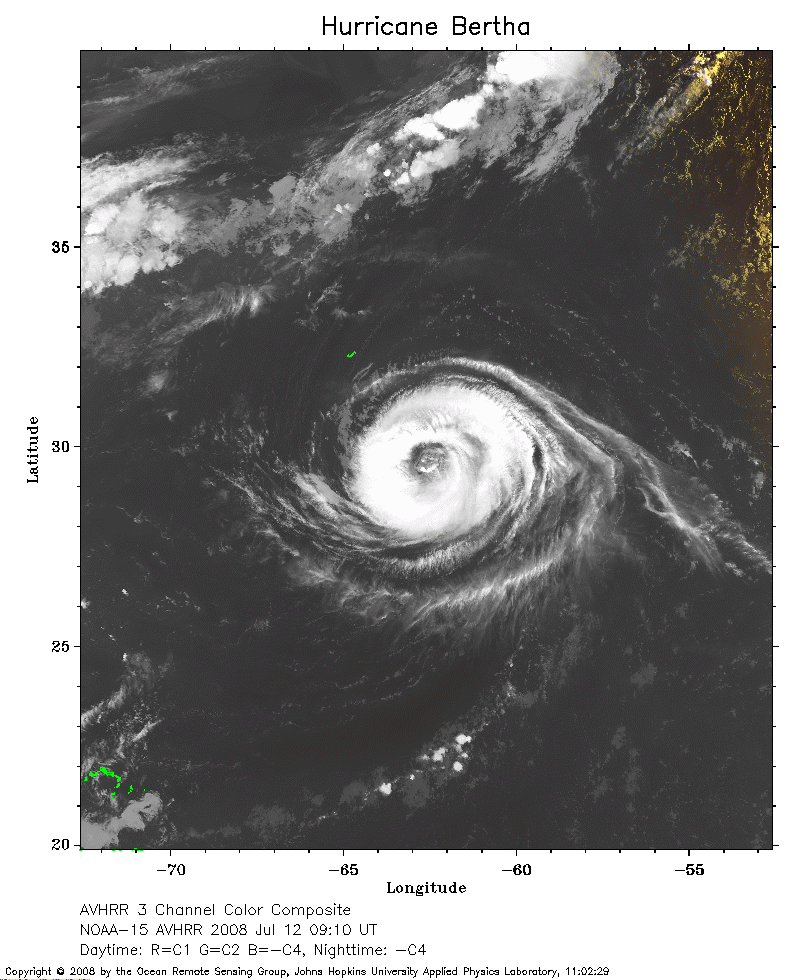 2008 Jul 12 09:10 UT
NOAA-15 satellite AVHRR channel 4 early morning image.
A closer view (207 Kb) is seen by clicking on this small image.
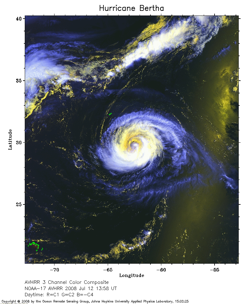 2008 Jul 12 13:58 UT
NOAA-17 satellite AVHRR 3 channel color composite daytime image.
A closer view (285 Kb) is seen by clicking on this small image.
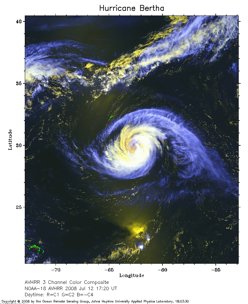 2008 Jul 12 17:20 UT
NOAA-18 satellite AVHRR 3 channel color composite daytime image.
A closer view (286 Kb) is seen by clicking on this small image.
The maximum sustained winds have decreased to 85 mph.
 2008 Jul 12 20:30 UT
NOAA-15 satellite AVHRR 3 channel color composite daytime image.
A closer view (343 Kb) is seen by clicking on this small image.
The maximum sustained winds have decreased to 80 mph.
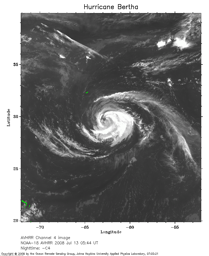 2008 Jul 13 05:44 UT
NOAA-18 satellite AVHRR channel 4 nighttime image.
A closer view (254 Kb) is seen by clicking on this small image.
The maximum sustained winds have decreased to 75 mph.
 2008 Jul 13 08:47 UT
NOAA-15 satellite AVHRR channel 4 nighttime image.
A closer view (215 Kb) is seen by clicking on this small image.
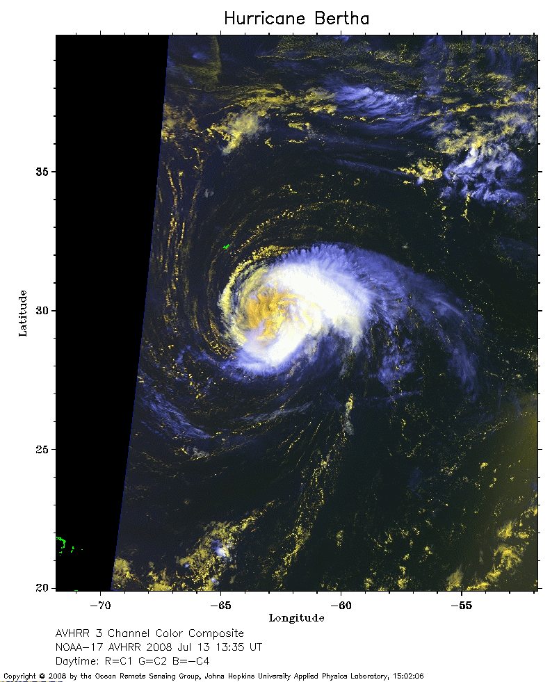 2008 Jul 13 13:35 UT
NOAA-17 satellite AVHRR channel 3 color composite daytime image.
A closer view (252 Kb) is seen by clicking on this small image.
The maximum sustained winds have decreased to 70 mph.
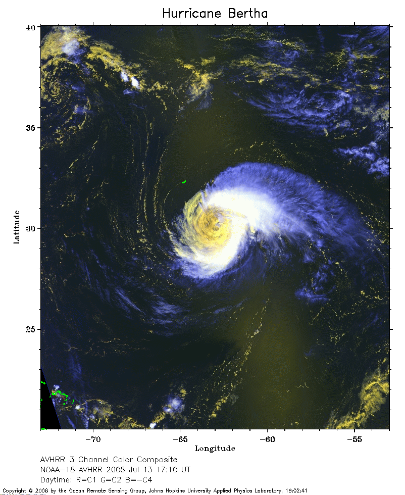 2008 Jul 13 17:10 UT
NOAA-18 satellite AVHRR channel 3 color composite daytime image.
A closer view (290 Kb) is seen by clicking on this small image.
The maximum sustained winds have decreased to 65 mph.
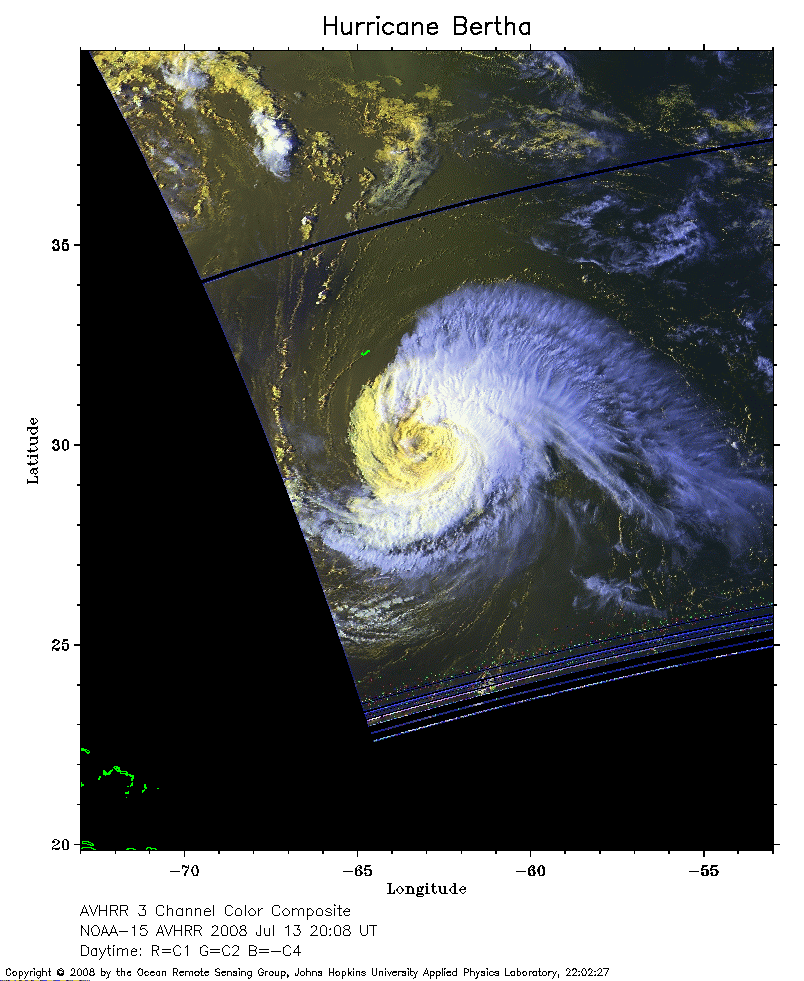 2008 Jul 13 20:08 UT
NOAA-15 satellite AVHRR channel 3 color composite daytime image.
A closer view (206 Kb) is seen by clicking on this small image.
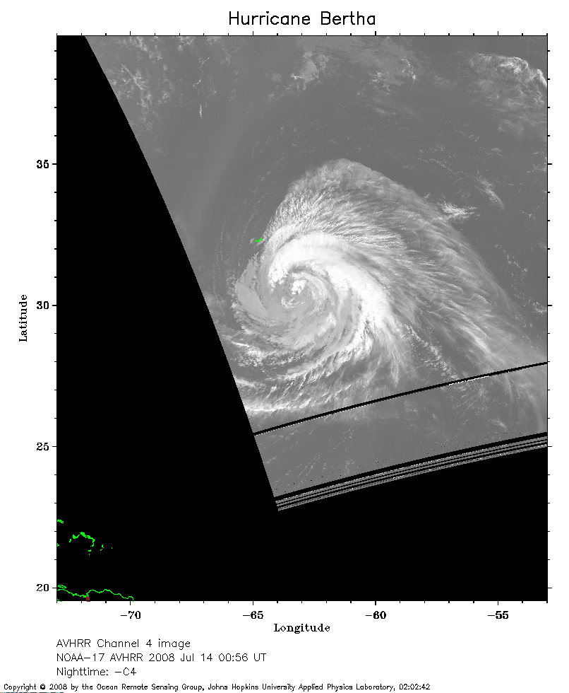 2008 Jul 14 00:56 UT
NOAA-17 satellite AVHRR channel 4 nighttime image.
A closer view (144 Kb) is seen by clicking on this small image.
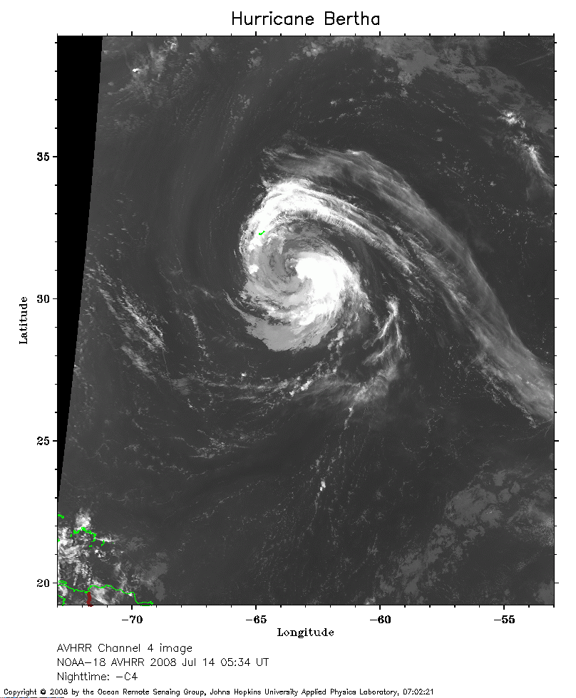 2008 Jul 14 05:34 UT
NOAA-18 satellite AVHRR channel 4 nighttime image.
A closer view (230 Kb) is seen by clicking on this small image.
 2008 Jul 14 10:02 UT
NOAA-15 satellite AVHRR 3 channel color composite morning image.
A closer view (228 Kb) is seen by clicking on this small image.
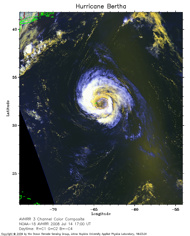 2008 Jul 14 17:00 UT
NOAA-18 satellite AVHRR 3 channel color composite daytime image.
A closer view (258 Kb) is seen by clicking on this small image.
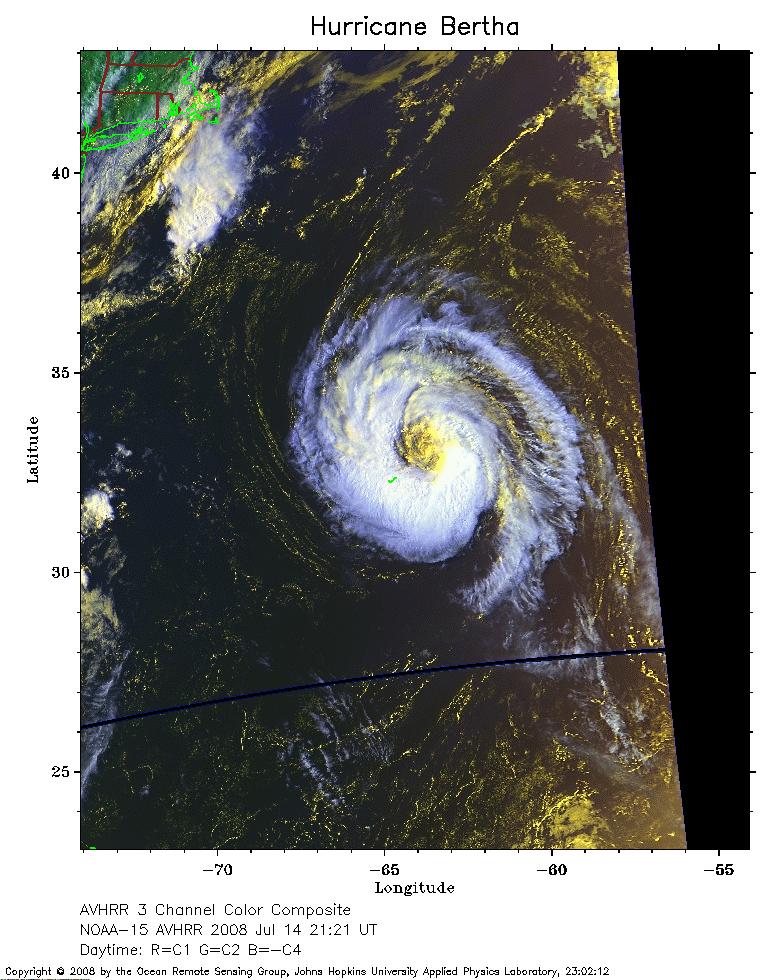 2008 Jul 14 21:21 UT
NOAA-15 satellite AVHRR 3 channel color composite daytime image.
A closer view (277 Kb) is seen by clicking on this small image.
The maximum sustained winds have increased to 70 mph.
 2008 Jul 15 05:24 UT
NOAA-18 satellite AVHRR channel 4 nighttime image.
A closer view (179 Kb) is seen by clicking on this small image.
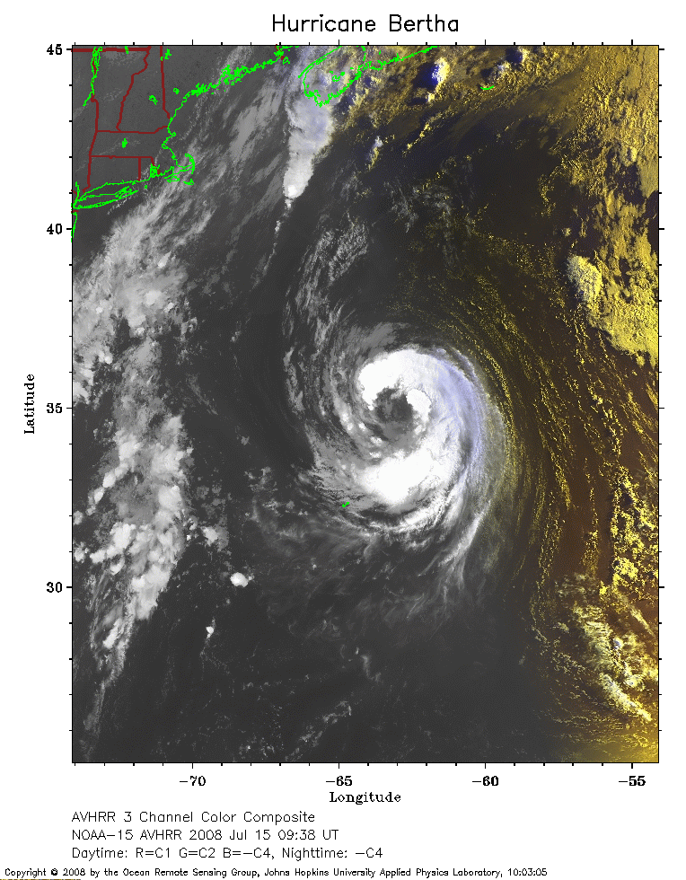 2008 Jul 15 09:38 UT
NOAA-15 satellite AVHRR 3 channel color composite early morning image.
A closer view (291 Kb) is seen by clicking on this small image.
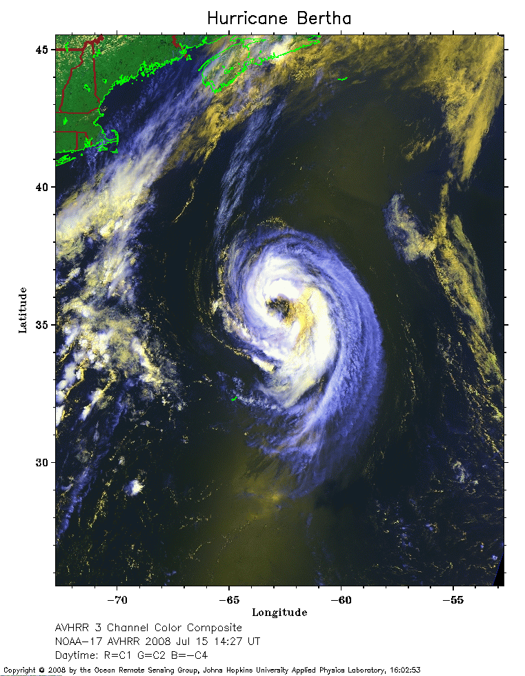 2008 Jul 15 14:27 UT
NOAA-17 satellite AVHRR 3 channel color composite daytime image.
A closer view (294 Kb) is seen by clicking on this small image.
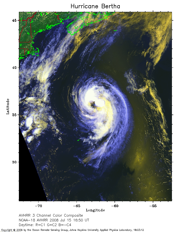 2008 Jul 15 16:50 UT
NOAA-18 satellite AVHRR 3 channel color composite daytime image.
A closer view (291 Kb) is seen by clicking on this small image.
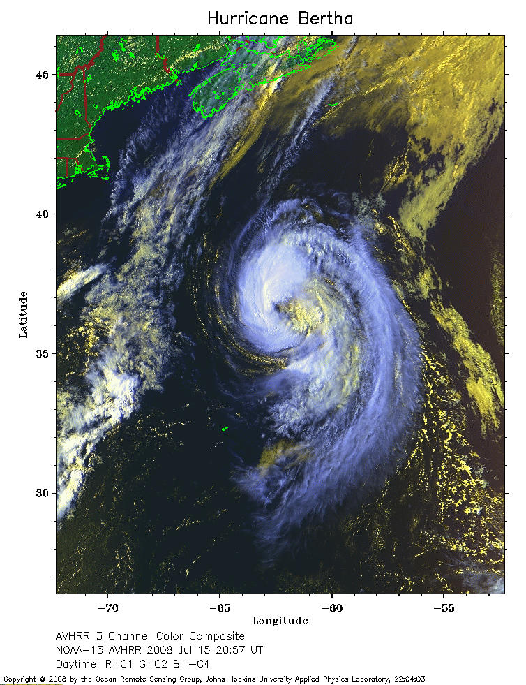 2008 Jul 15 20:57 UT
NOAA-15 satellite AVHRR 3 channel color composite daytime image.
A closer view (318 Kb) is seen by clicking on this small image.
 2008 Jul 16 01:47 UT
NOAA-17 satellite AVHRR channel 4 nighttime image.
A closer view (256 Kb) is seen by clicking on this small image.
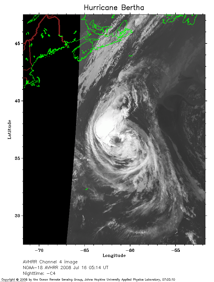 2008 Jul 16 05:14 UT
NOAA-18 satellite AVHRR channel 4 nighttime image.
A closer view (194 Kb) is seen by clicking on this small image.
The maximum sustained winds have decreased to 65 mph.
 2008 Jul 16 06:53 UT
NOAA-18 satellite AVHRR channel 4 nighttime image.
A closer view (204 Kb) is seen by clicking on this small image.
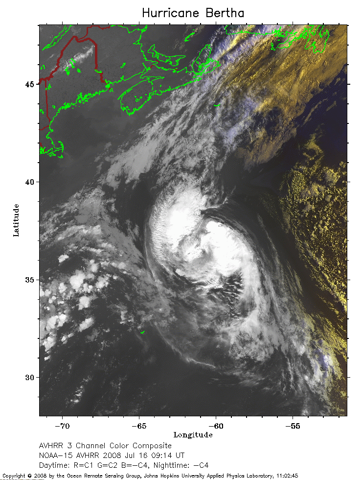 2008 Jul 16 09:14 UT
NOAA-15 satellite AVHRR 3 channel color composite early morning image.
A closer view (300 Kb) is seen by clicking on this small image.
 2008 Jul 16 14:05 UT
NOAA-17 satellite AVHRR 3 channel color composite daytime image.
A closer view (305 Kb) is seen by clicking on this small image.
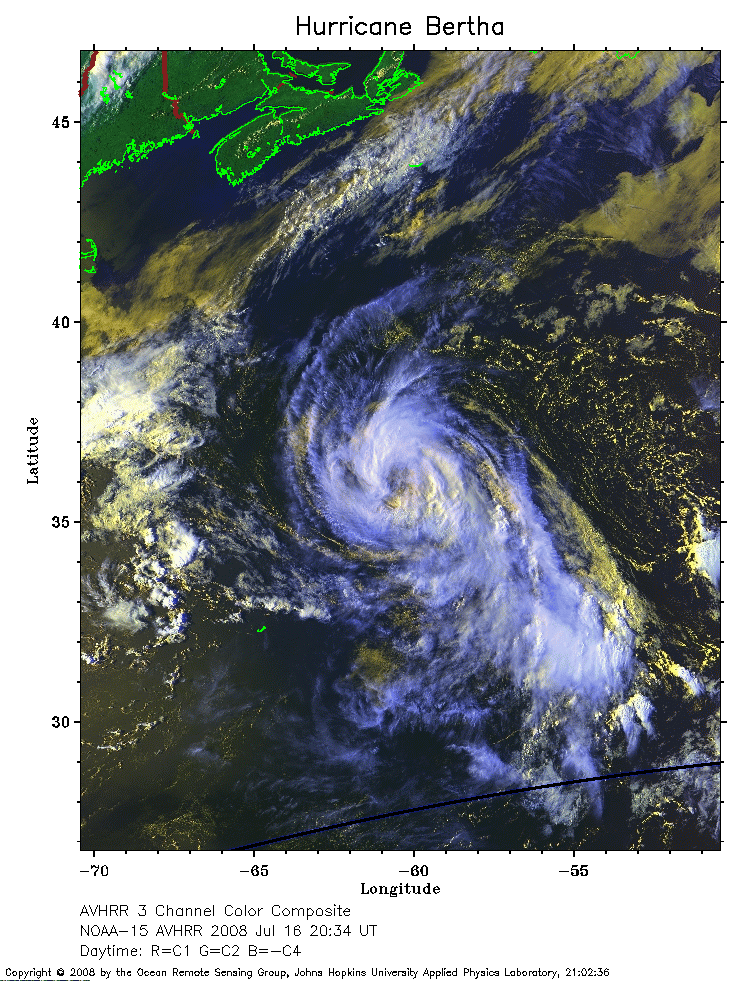 2008 Jul 16 20:34 UT
NOAA-15 satellite AVHRR 3 channel color composite daytime image.
A closer view (344 Kb) is seen by clicking on this small image.
The maximum sustained winds have increased to 70 mph.
 2008 Jul 17 01:25 UT
NOAA-17 satellite AVHRR channel 4 nighttime image.
A closer view (250 Kb) is seen by clicking on this small image.
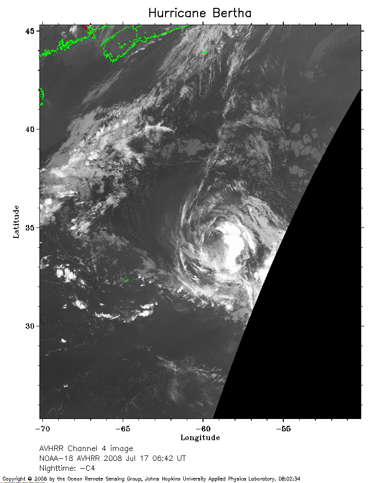 2008 Jul 17 06:42 UT
NOAA-18 satellite AVHRR channel 4 nighttime image.
A closer view (209 Kb) is seen by clicking on this small image.
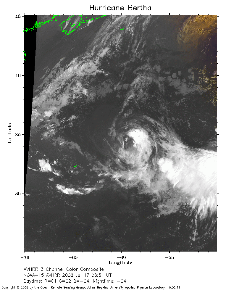 2008 Jul 17 08:51 UT
NOAA-15 satellite AVHRR 3 channel color composite early morning image.
A closer view (221 Kb) is seen by clicking on this small image.
 2008 Jul 17 13:42 UT
NOAA-17 satellite AVHRR 3 channel color composite daytime image.
A closer view (337 Kb) is seen by clicking on this small image.
The maximum sustained winds have decreased to 60 mph.
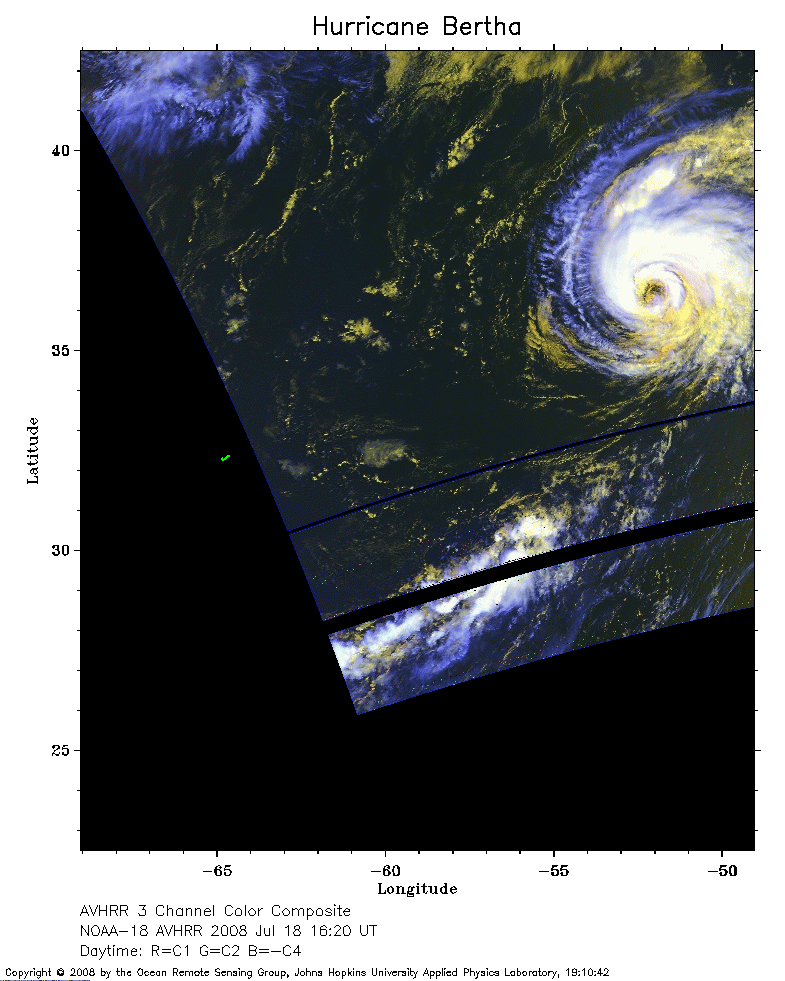 2008 Jul 18 16:20 UT
NOAA-18 satellite AVHRR 3 channel color composite daytime image.
A closer view (198 Kb) is seen by clicking on this small image.
The maximum sustained winds have increased to 65 mph.
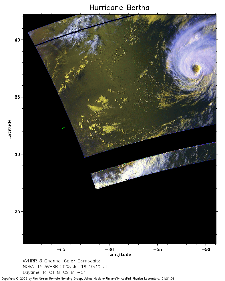 2008 Jul 18 19:49 UT
NOAA-15 satellite AVHRR 3 channel color composite daytime image.
A closer view (172 Kb) is seen by clicking on this small image.
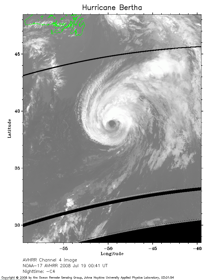 2008 Jul 19 00:41 UT
NOAA-17 satellite AVHRR channel 4 nighttime image.
A closer view (214 Kb) is seen by clicking on this small image.
The maximum sustained winds have increased to 75 mph.
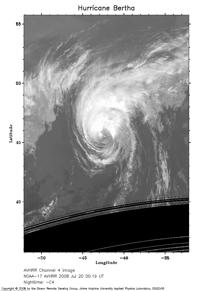 2008 Jul 20 00:19 UT
NOAA-17 satellite AVHRR channel 4 nighttime image.
A closer view (179 Kb) is seen by clicking on this small image.
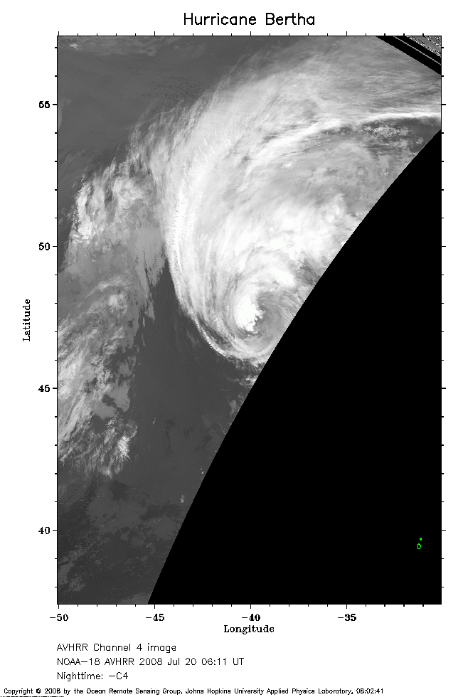 2008 Jul 20 06:11 UT
NOAA-18 satellite AVHRR channel 4 nighttime image.
A closer view (140 Kb) is seen by clicking on this small image.
The maximum sustained winds have decreased to 70 mph.