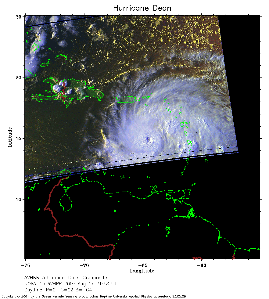
 2007 August 17 21:48 UT
NOAA-15 satellite AVHRR 3 channel color composite daytime image.
A closer view (222 Kb) is seen by clicking on this small image.
The maximum sustained winds are 125 mph. Some earlier very
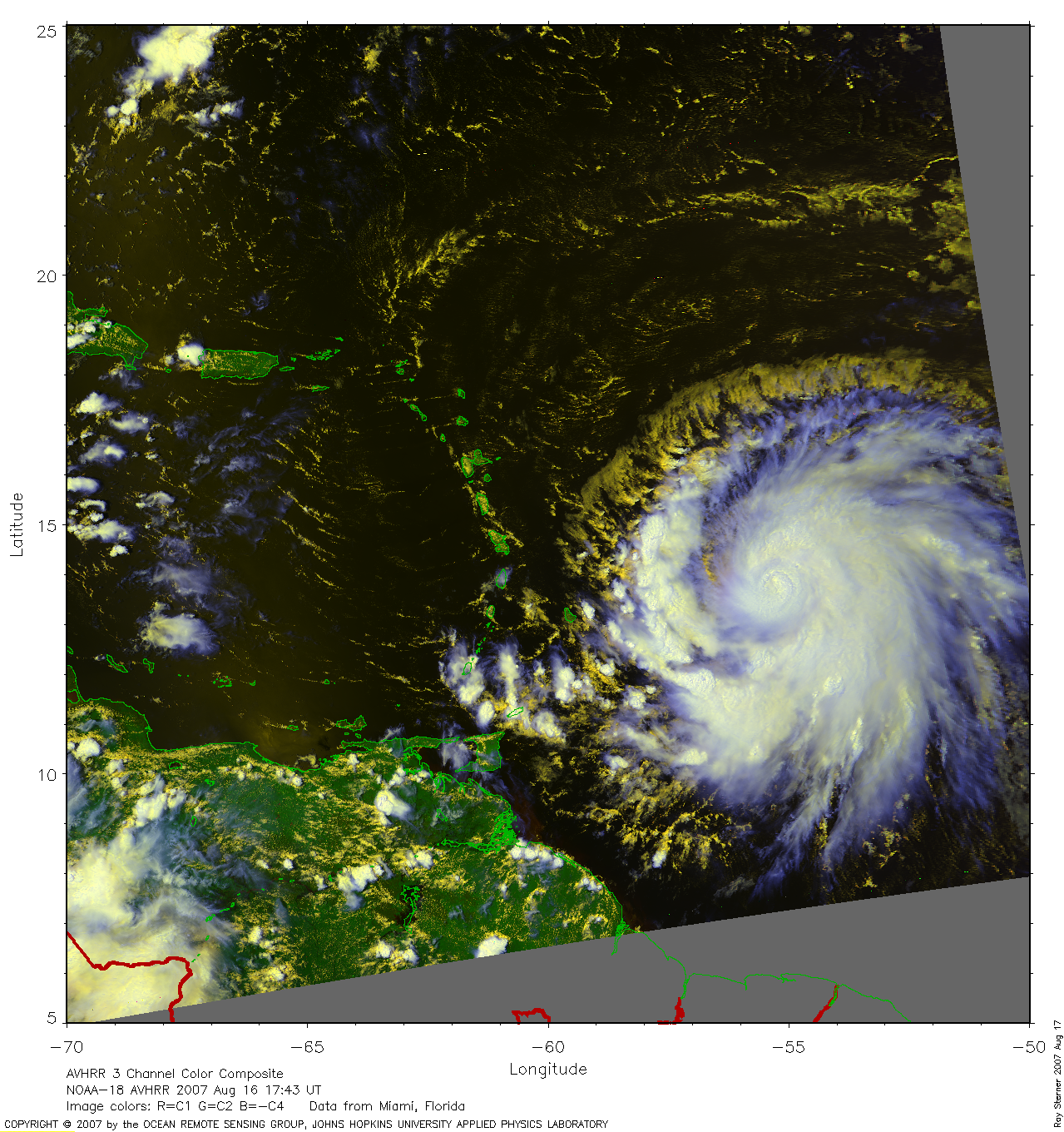
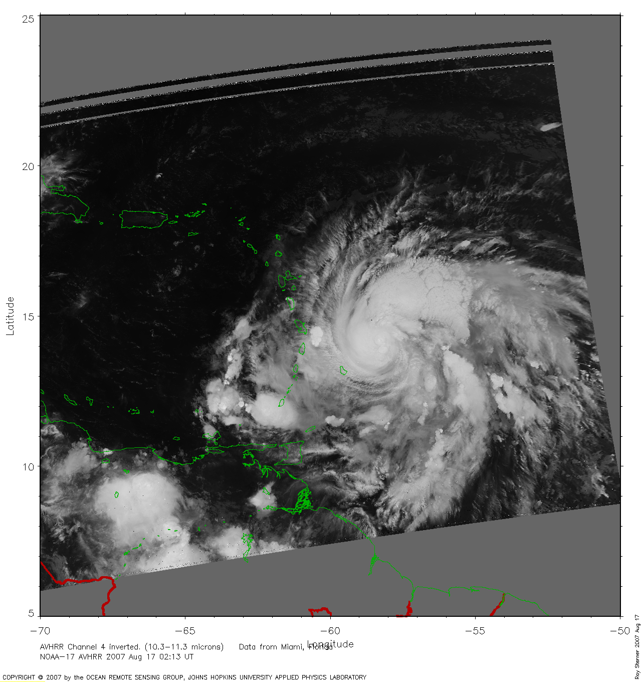
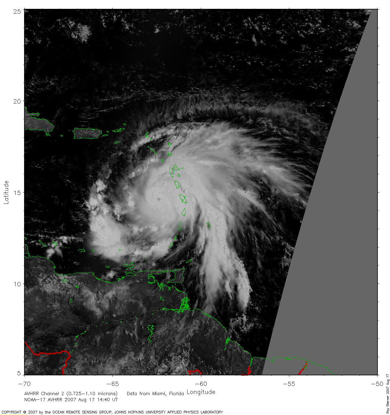
large images (made by Ray Sterner) are available here:
17:43 UT August 16 image (2154 Kb)
02:13 UT August 17 image (1022 Kb)
14:40 UT August 17 image (1160 Kb)
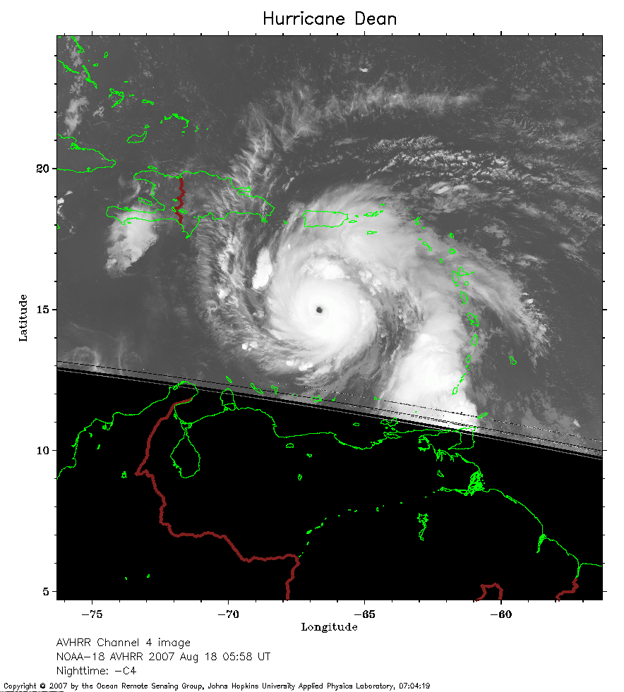 2007 August 18 05:58 UT
NOAA-18 satellite AVHRR channel 4 early morning image.
A closer view (198 Kb) is seen by clicking on this small image.
The maximum sustained winds have increased to 145 mph.
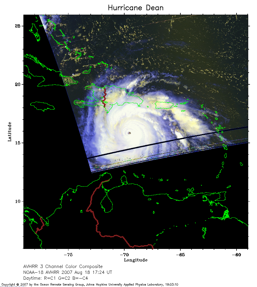 2007 August 18 17:24 UT
NOAA-18 satellite AVHRR 3 channel color composite daytime image.
A closer view (170 Kb) is seen by clicking on this small image.
The maximum sustained winds have increased to 150 mph.
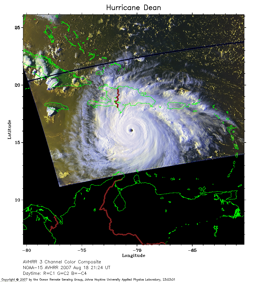 2007 August 18 21:24 UT
NOAA-15 satellite AVHRR 3 channel color composite afternoon image.
A closer view (274 Kb) is seen by clicking on this small image.
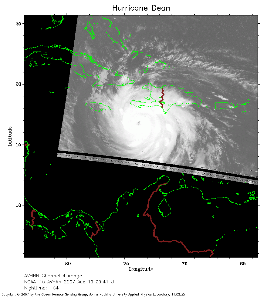 2007 August 19 09:41 UT
NOAA-15 satellite AVHRR channel 4 early morning image.
A closer view (158 Kb) is seen by clicking on this small image.
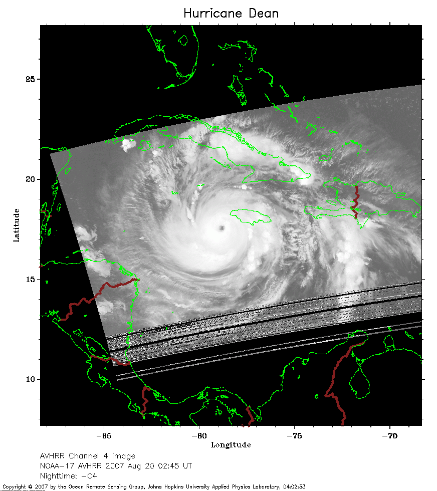 2007 August 20 02:45 UT
NOAA-17 satellite AVHRR channel 4 nighttime image.
A closer view (177 Kb) is seen by clicking on this small image.
 2007 August 20 07:18 UT
NOAA-18 satellite AVHRR channel 4 early morning image.
A closer view (207 Kb) is seen by clicking on this small image.
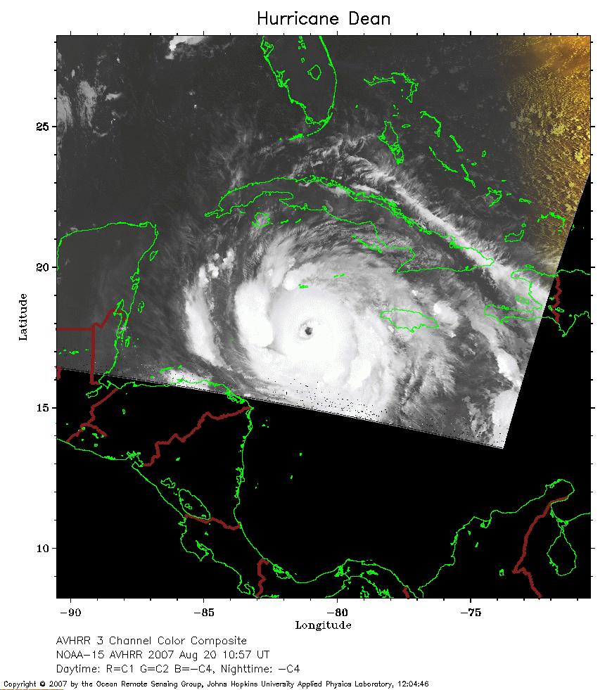 2007 August 20 10:57 UT
NOAA-15 satellite AVHRR channel 4 early morning image.
A closer view (177 Kb) is seen by clicking on this small image.
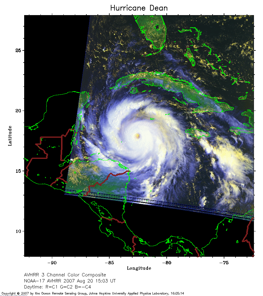 2007 August 20 15:03 UT
NOAA-17 satellite AVHRR 3 channel color composite image.
A closer view (243 Kb) is seen by clicking on this small image.
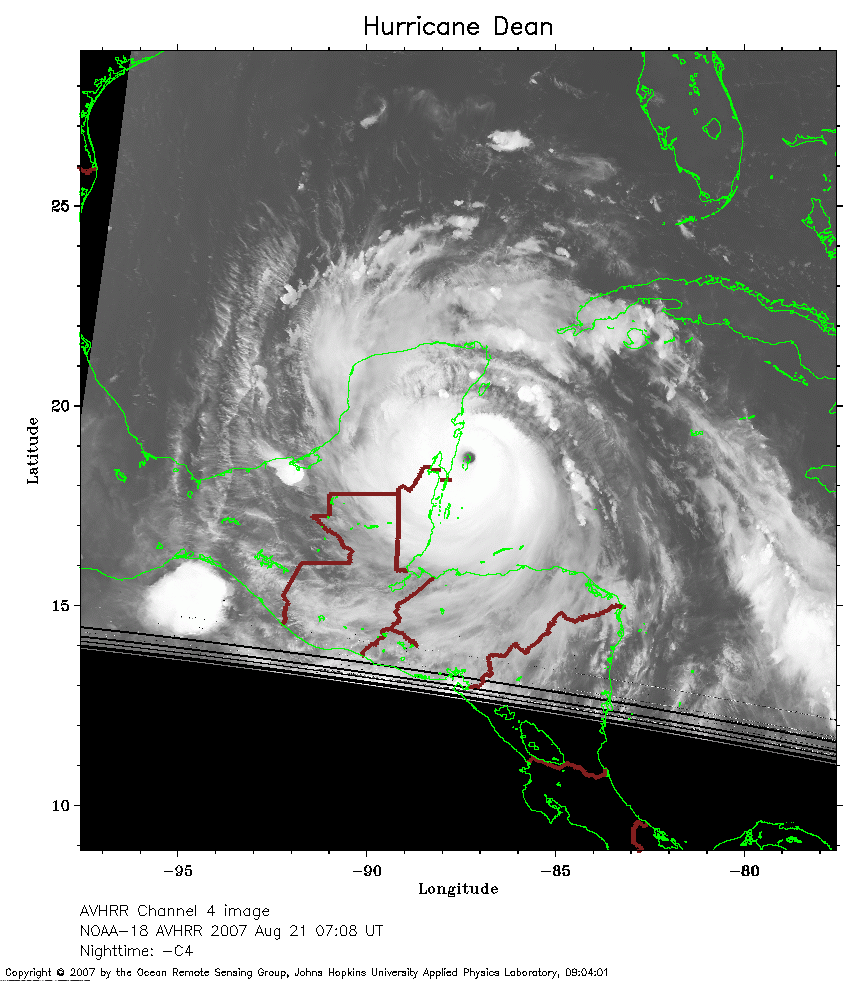 2007 August 21 07:08 UT
NOAA-18 satellite AVHRR channel 4 early morning image.
A closer view (231 Kb) is seen by clicking on this small image.
The maximum sustained winds have increased to 165 mph, making
Dean a Category 5 on the Saffir-Simpson scale. In this image,
Dean is making landfall on the coast of Mexico.
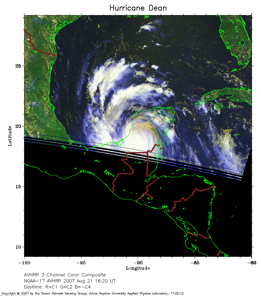 2007 August 21 16:20 UT
NOAA-17 satellite AVHRR 3 channel color composite daytime image.
A closer view (227 Kb) is seen by clicking on this small image.
The maximum sustained winds have decreased to 105 mph as the storm
moves across the Yucatan Peninsula.
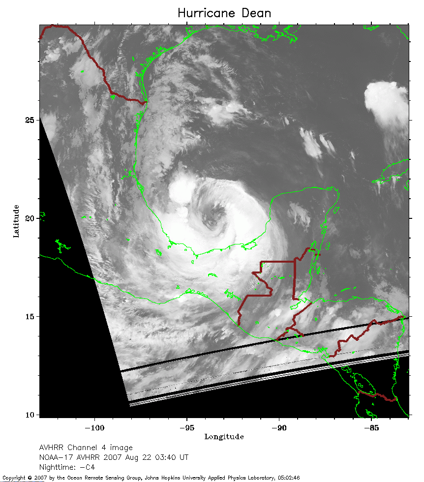 2007 August 22 03:40 UT
NOAA-17 satellite AVHRR channel 4 nighttime image.
A closer view (240 Kb) is seen by clicking on this small image.
The maximum sustained winds decreased to 80 mph after crossing the
Yucatan, but now the storm is intensifying over the Bay of Campeche.