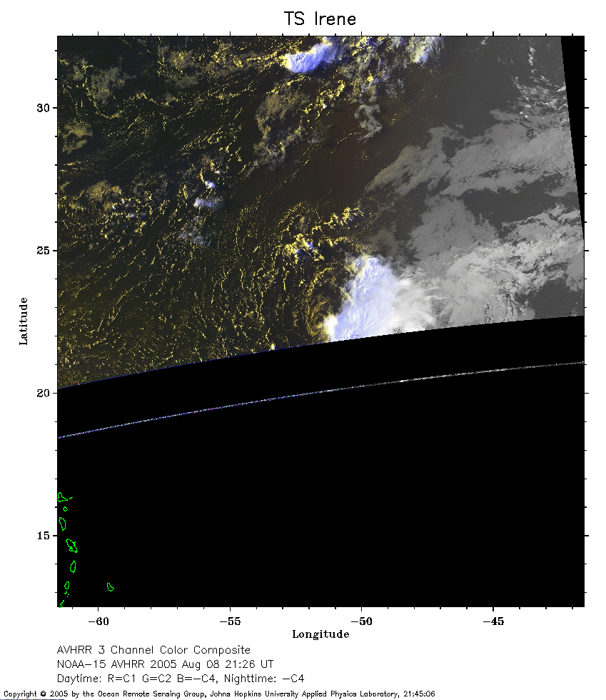
 2005 August 08 21:26 UT
NOAA-15 satellite AVHRR 3 channel color composite evening image.
A closer view (174 Kb) is seen by clicking on this small image.
The maximum sustained winds are 35 mph.
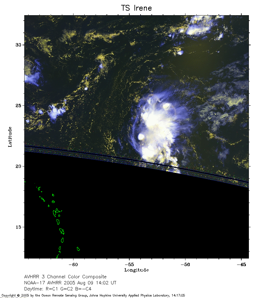 2005 August 09 14:02 UT
NOAA-17 satellite AVHRR 3 channel color composite morning image.
A closer view (215 Kb) is seen by clicking on this small image.
 2005 August 09 18:46 UT
NOAA-16 satellite AVHRR 3 channel color composite daytime image.
A closer view (253 Kb) is seen by clicking on this small image.
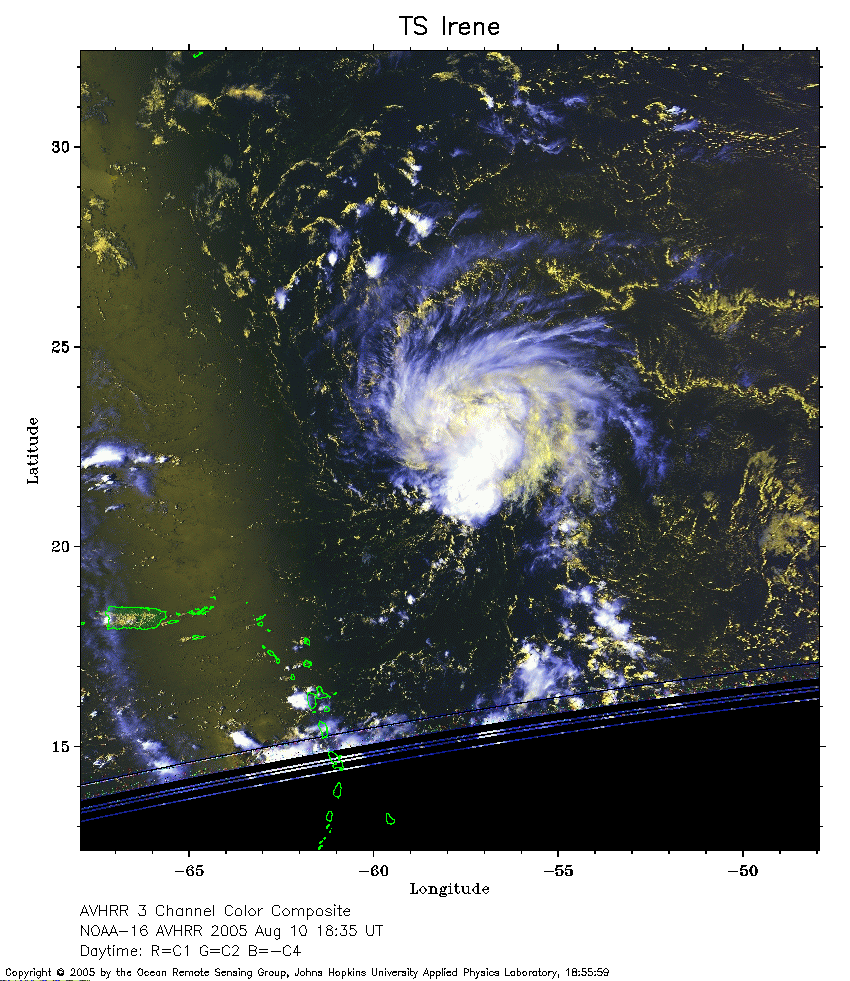 2005 August 10 18:35 UT
NOAA-16 satellite AVHRR 3 channel color composite daytime image.
A closer view (280 Kb) is seen by clicking on this small image.
 2005 August 10 22:17 UT
NOAA-15 satellite AVHRR 3 channel color composite evening image.
A closer view (217 Kb) is seen by clicking on this small image.
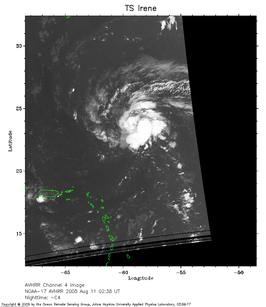 2005 August 11 02:38 UT
NOAA-17 satellite AVHRR channel 4 nighttime image.
A closer view (184 Kb) is seen by clicking on this small image.
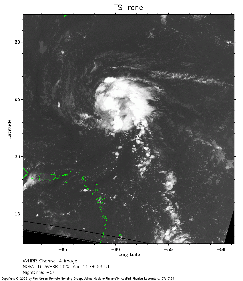 2005 August 11 06:58 UT
NOAA-16 satellite AVHRR channel 4 nighttime image.
A closer view (240 Kb) is seen by clicking on this small image.
The maximum sustained winds have increased to 40 mph.
 2005 August 11 10:35 UT
NOAA-15 satellite AVHRR 3 channel color composite morning image.
A closer view (293 Kb) is seen by clicking on this small image.
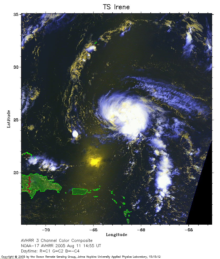 2005 August 11 14:55 UT
NOAA-17 satellite AVHRR 3 channel color composite daytime image.
A closer view (296 Kb) is seen by clicking on this small image.
 2005 August 11 18:24 UT
NOAA-16 satellite AVHRR 3 channel color composite daytime image.
A closer view (306 Kb) is seen by clicking on this small image.
The maximum sustained winds have increased to 50 mph.
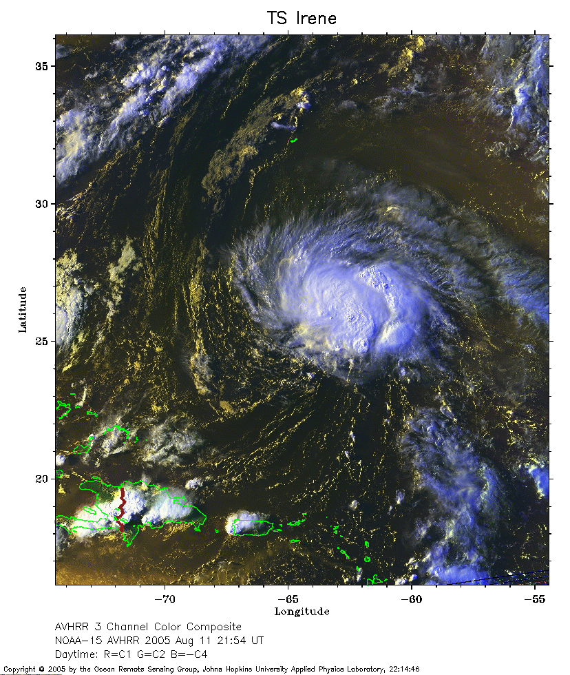 2005 August 11 21:54 UT
NOAA-15 satellite AVHRR 3 channel color composite daytime image.
A closer view (366 Kb) is seen by clicking on this small image.
 2005 August 12 02:15 UT
NOAA-17 satellite AVHRR channel 4 nighttime image.
A closer view (257 Kb) is seen by clicking on this small image.
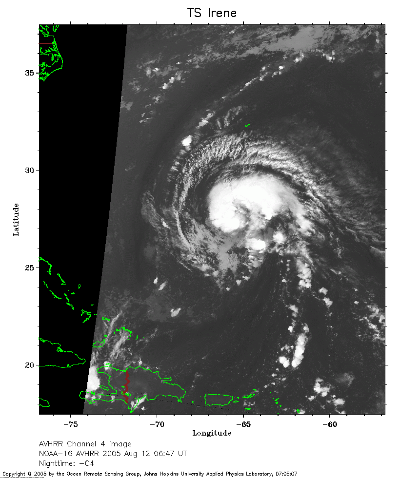 2005 August 12 06:47 UT
NOAA-16 satellite AVHRR channel 4 nighttime image.
A closer view (218 Kb) is seen by clicking on this small image.
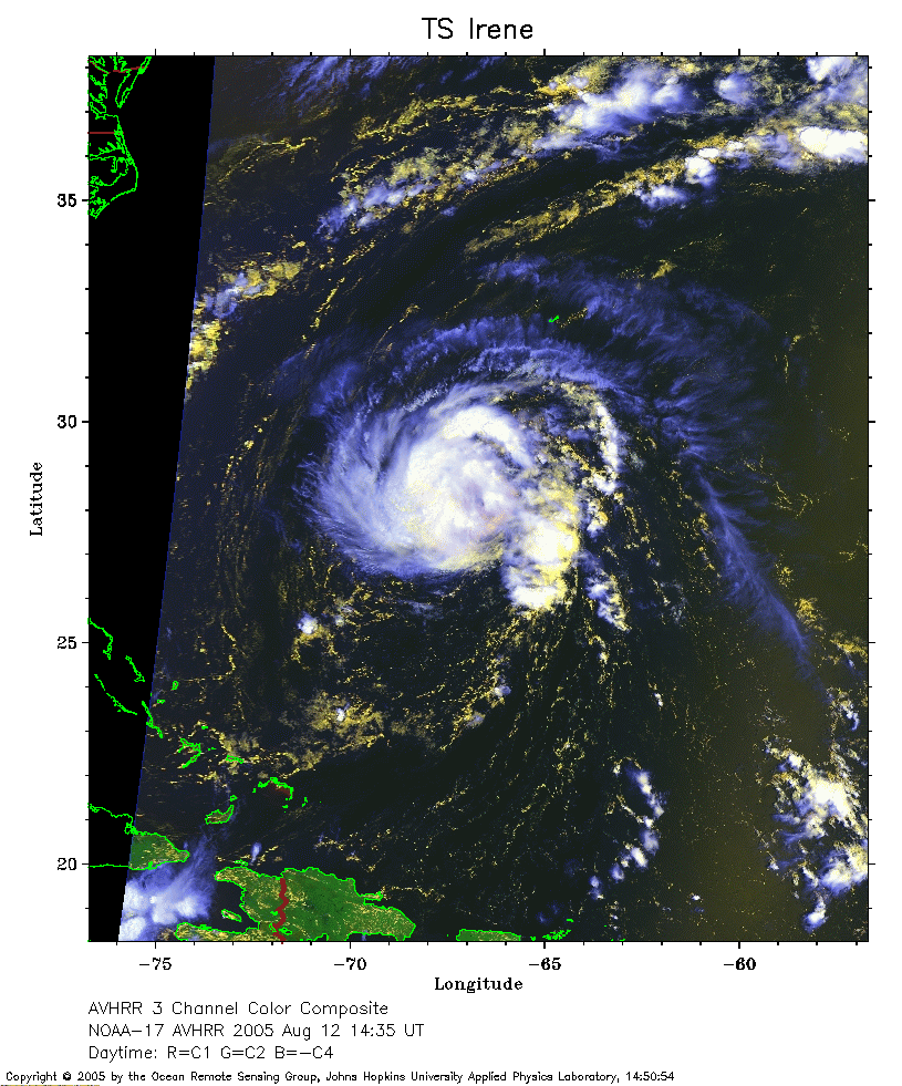 2005 August 12 14:35 UT
NOAA-17 satellite AVHRR 3 channel color composite daytime image.
A closer view (291 Kb) is seen by clicking on this small image.
The maximum sustained winds have increased to 60 mph.
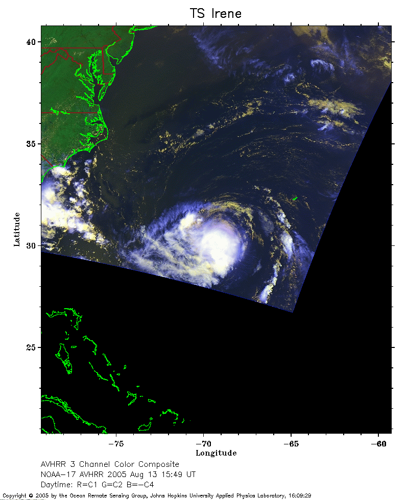 2005 August 13 15:49 UT
NOAA-17 satellite AVHRR 3 channel color composite daytime image.
A closer view (175 Kb) is seen by clicking on this small image.
The maximum sustained winds have increased to 70 mph.
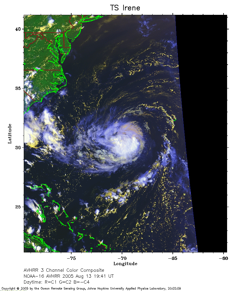 2005 August 13 19:41 UT
NOAA-16 satellite AVHRR 3 channel color composite daytime image.
A closer view (252 Kb) is seen by clicking on this small image.
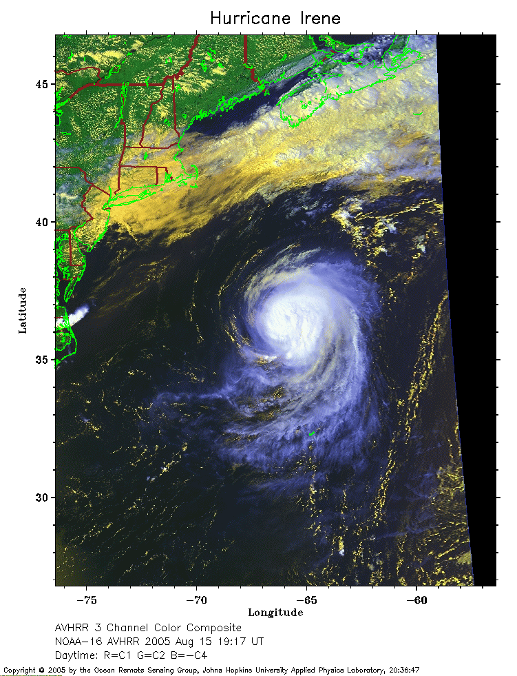 2005 August 15 19:17 UT
NOAA-16 satellite AVHRR 3 channel color composite daytime image.
A closer view (277 Kb) is seen by clicking on this small image.
Irene is now a hurricane with 85 mph maximum sustained winds.
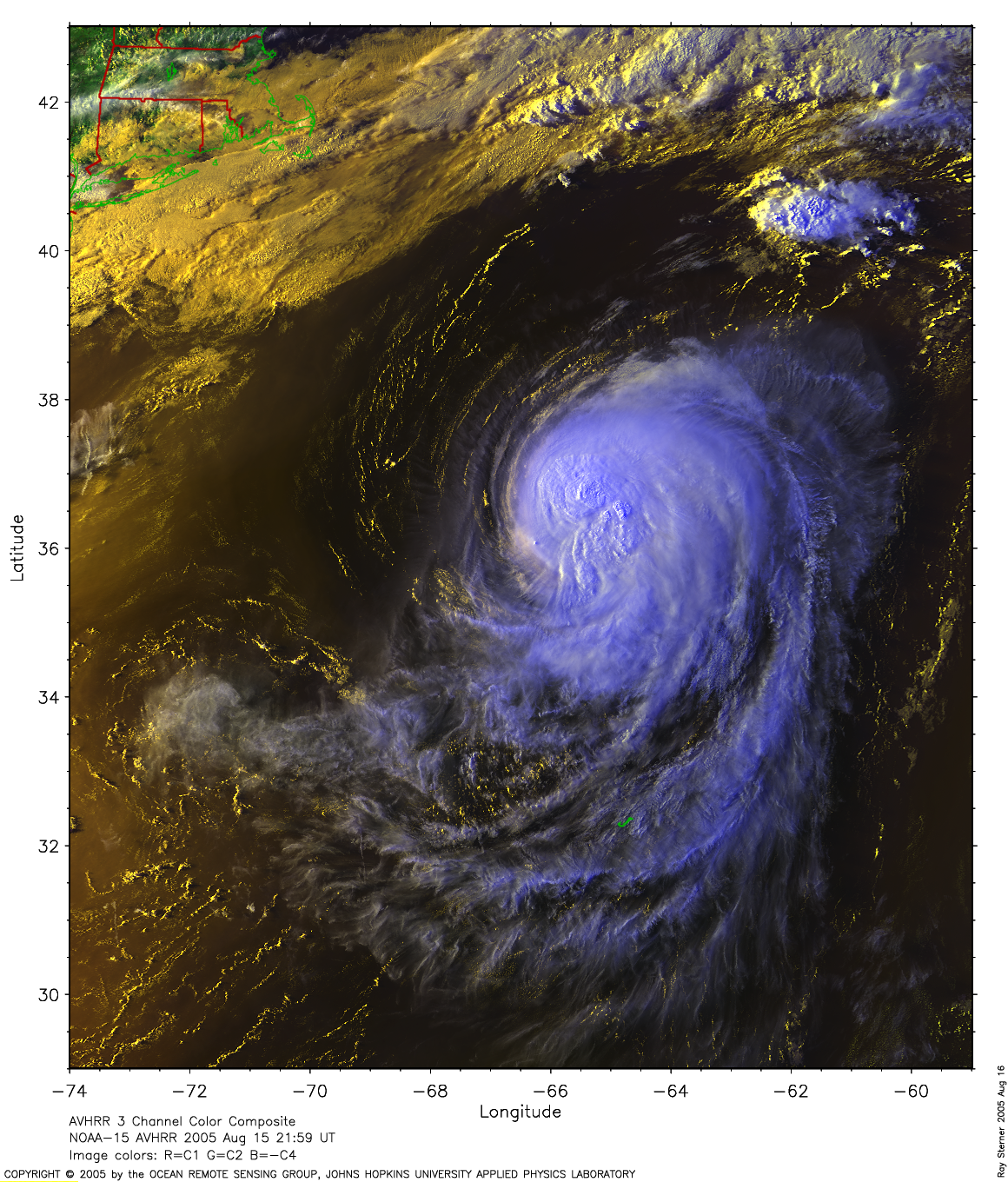
 2005 August 15 21:59 UT
NOAA-15 satellite AVHRR 3 channel color composite afternoon image.
A closer view (316 Kb) is seen by clicking on this small image.
The maximum sustained winds have increased to 90 mph.
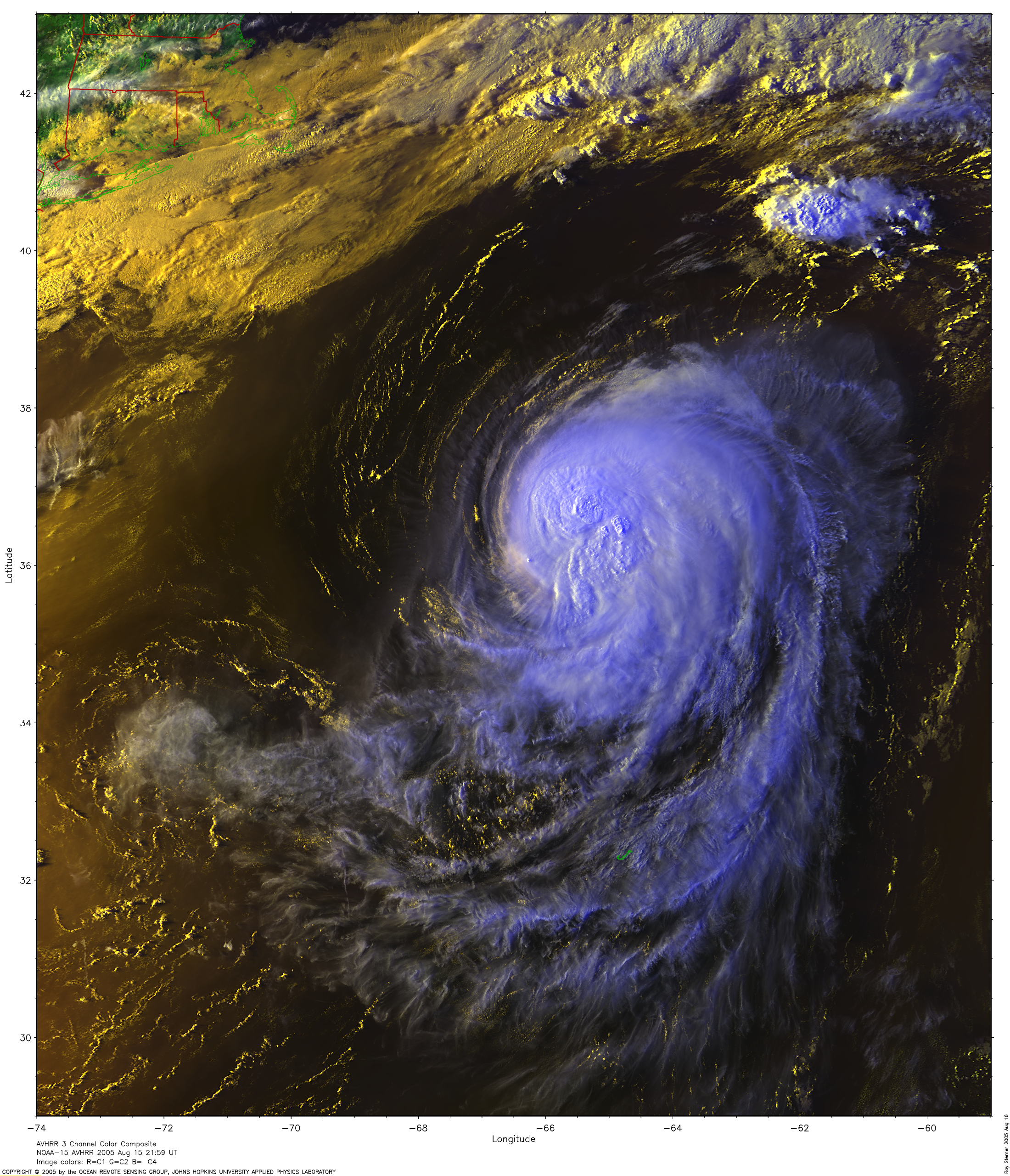
A larger image
(2218 Kb) made by Ray Sterner is also available.
A very large image
(6174 Kb) made by Ray Sterner is also available.
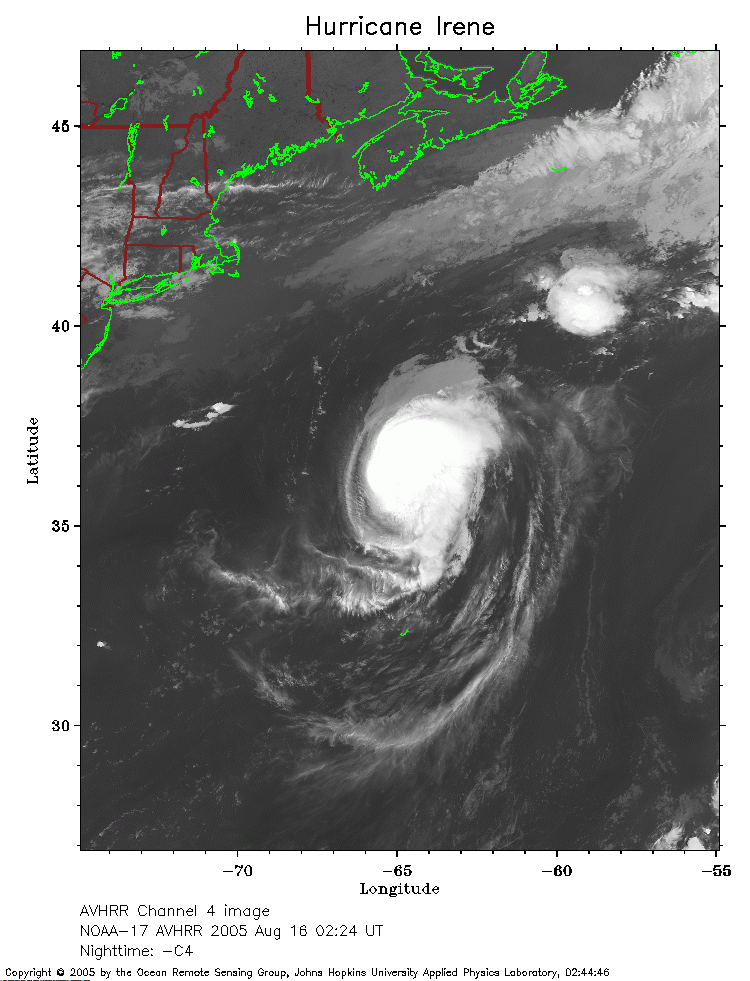 2005 August 16 02:24 UT
NOAA-17 satellite AVHRR channel 4 nighttime image.
A closer view (227 Kb) is seen by clicking on this small image.
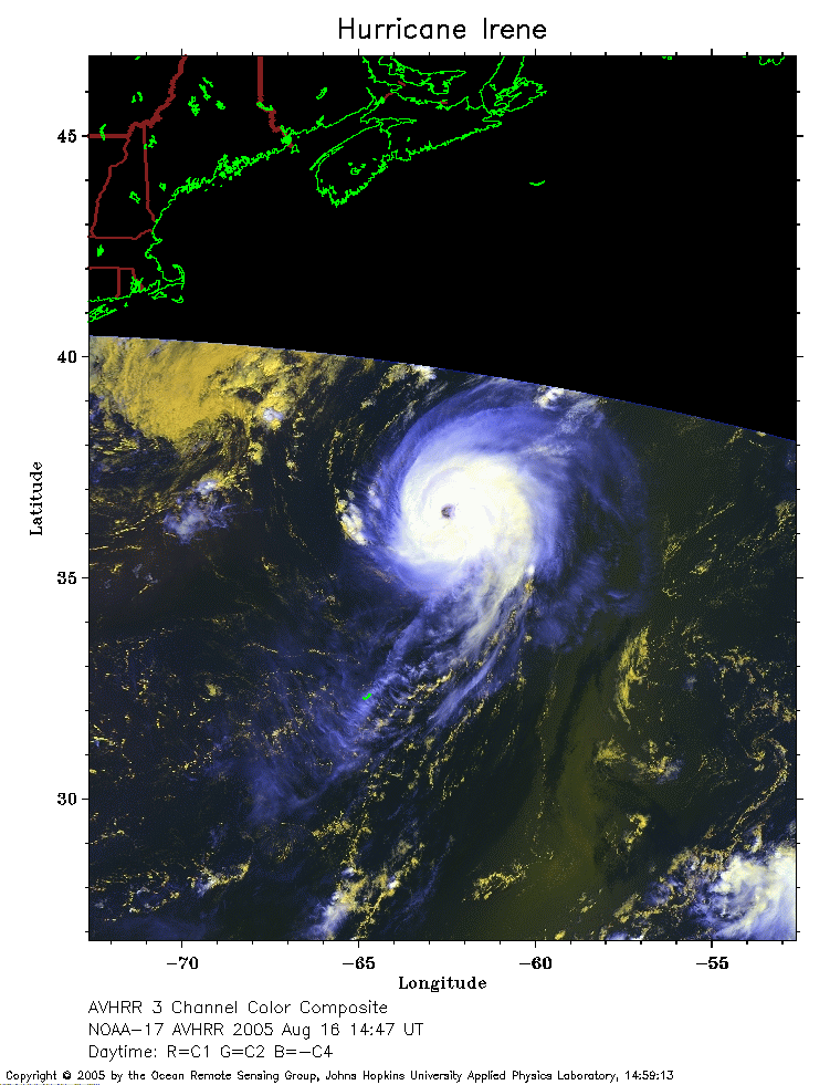 2005 August 16 14;47 UT
NOAA-17 satellite AVHRR 3 channel color composite daytime image.
A closer view (196 Kb) is seen by clicking on this small image.
The eye of Irene is visible in this image.
The maximum sustained winds have decreased to 85 mph.
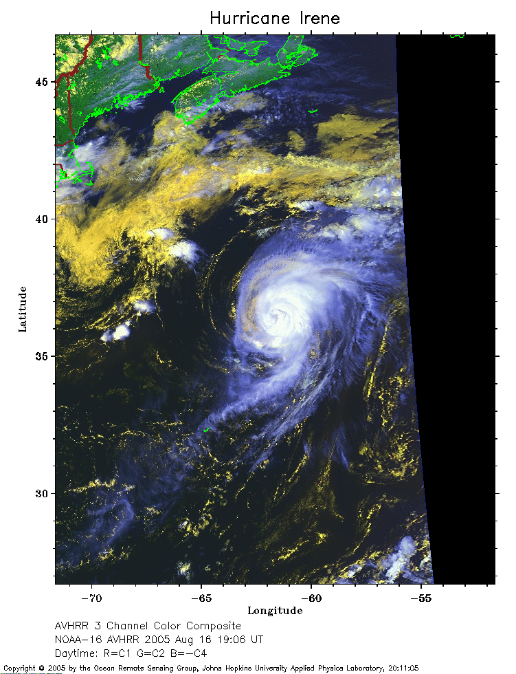 2005 August 16 19;06 UT
NOAA-16 satellite AVHRR 3 channel color composite daytime image.
A closer view (246 Kb) is seen by clicking on this small image.
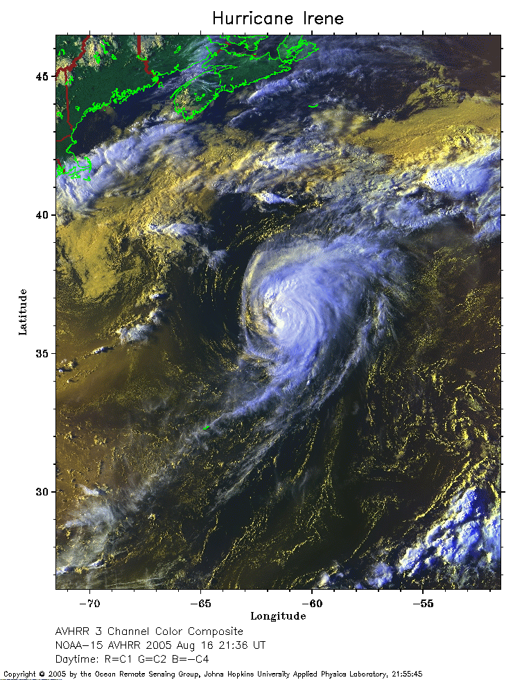 2005 August 16 21;36 UT
NOAA-15 satellite AVHRR 3 channel color composite afternoon image.
A closer view (348 Kb) is seen by clicking on this small image.
The maximum sustained winds have increased to 100 mph.
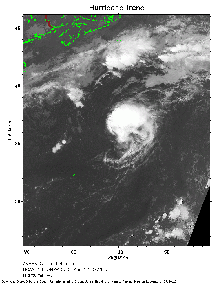 2005 August 17 07;29 UT
NOAA-16 satellite AVHRR channel 4 nighttime image.
A closer view (240 Kb) is seen by clicking on this small image.
The maximum sustained winds have decreased to 90 mph.
 2005 August 17 09;53 UT
NOAA-15 satellite AVHRR 3 channel color composite early morning image.
A closer view (300 Kb) is seen by clicking on this small image.
The maximum sustained winds have decreased to 85 mph.
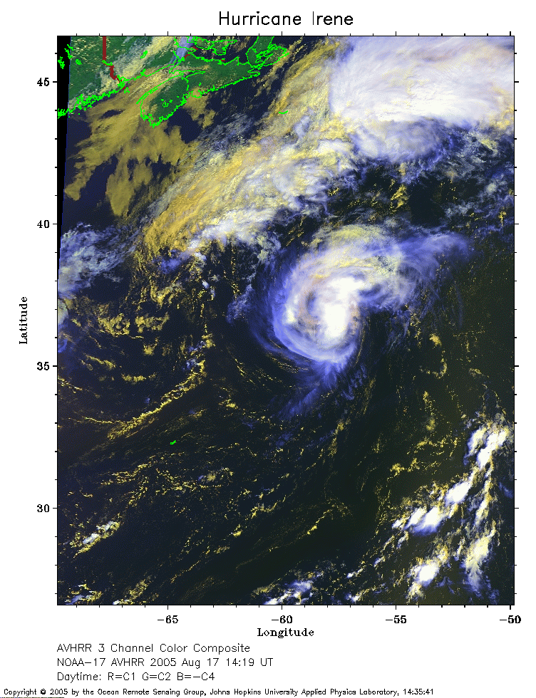 2005 August 17 14;19 UT
NOAA-17 satellite AVHRR 3 channel color composite daytime image.
A closer view (320 Kb) is seen by clicking on this small image.
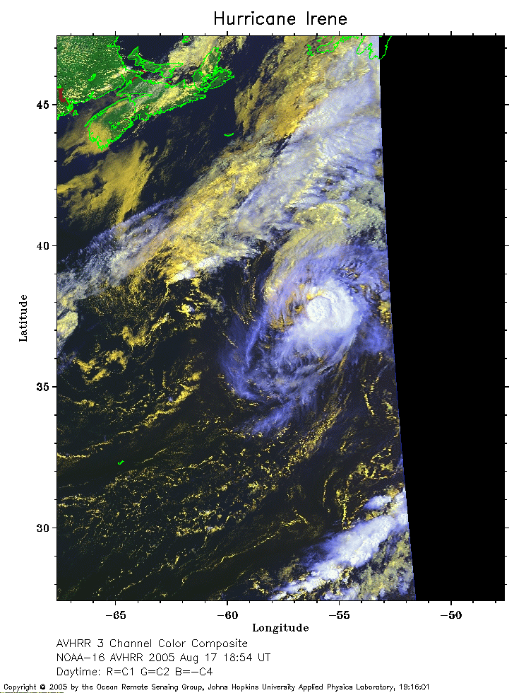 2005 August 17 18;54 UT
NOAA-16 satellite AVHRR 3 channel color composite daytime image.
A closer view (261 Kb) is seen by clicking on this small image.
The maximum sustained winds have decreased to 75 mph.
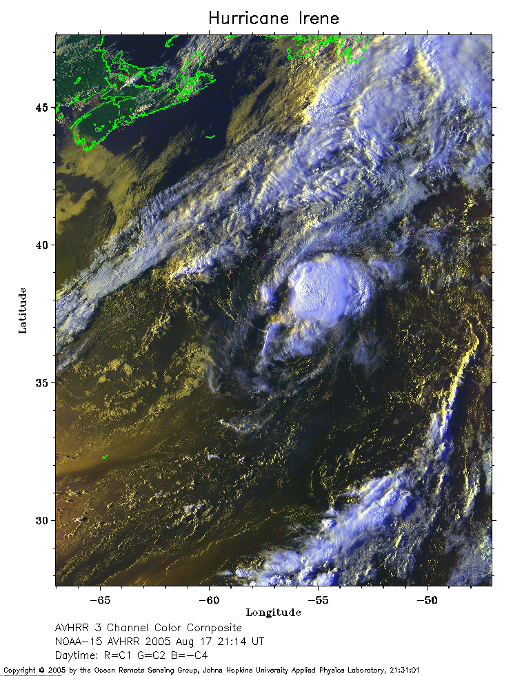 2005 August 17 21;14 UT
NOAA-15 satellite AVHRR 3 channel color composite afternoon image.
A closer view (363 Kb) is seen by clicking on this small image.
The maximum sustained winds have decreased to 70 mph.
 2005 August 18 01;39 UT
NOAA-17 satellite AVHRR channel 4 nighttime image.
A closer view (238 Kb) is seen by clicking on this small image.