 2005 July 22 11:48 UT
NOAA-15 satellite AVHRR 3 channel color composite daytime image.
A closer view (341 Kb) is seen by clicking on this small image.
The maximum sustained winds are 45 mph.
 2005 July 22 15:53 UT
NOAA-17 satellite AVHRR 3 channel color composite daytime image.
A closer view (321 Kb) is seen by clicking on this small image.
The maximum sustained winds have increased to 50 mph.
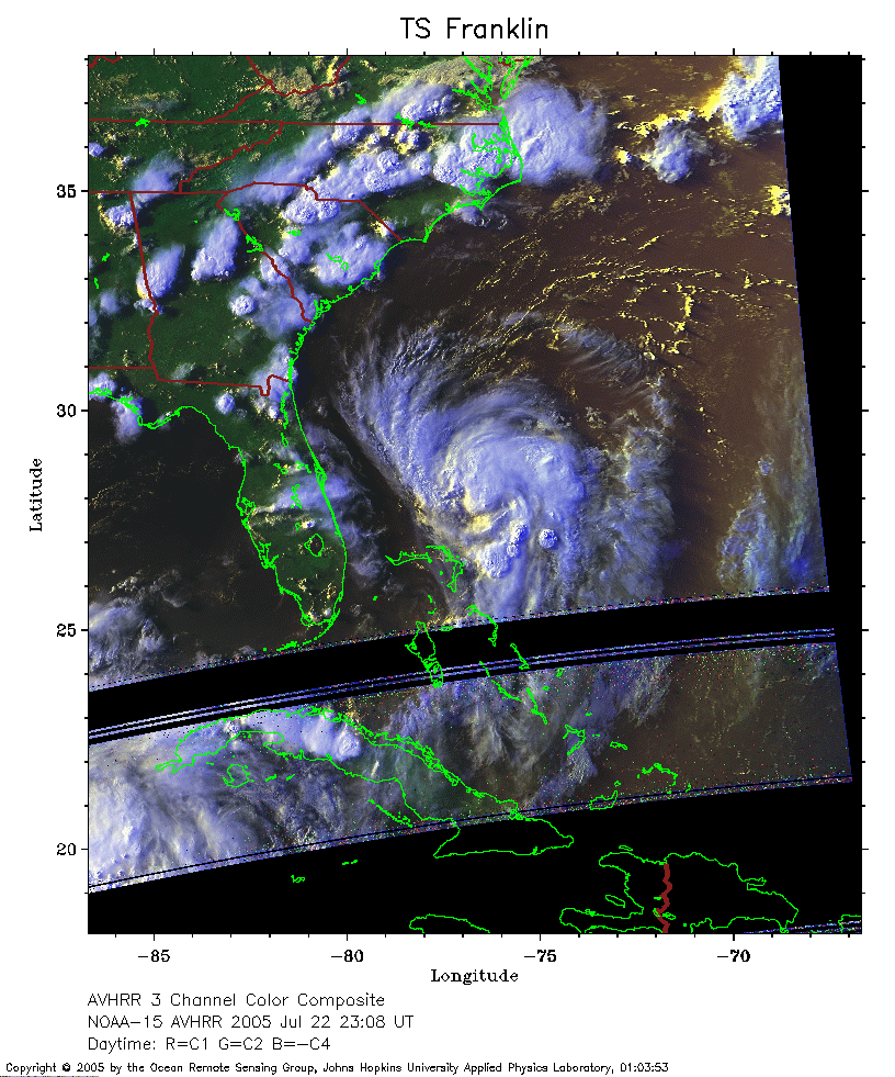 2005 July 22 23:08 UT
NOAA-15 satellite AVHRR 3 channel color composite evening image.
A closer view (279 Kb) is seen by clicking on this small image.
 2005 July 23 03:13 UT
NOAA-17 satellite AVHRR channel 4 nighttime image.
A closer view (232 Kb) is seen by clicking on this small image.
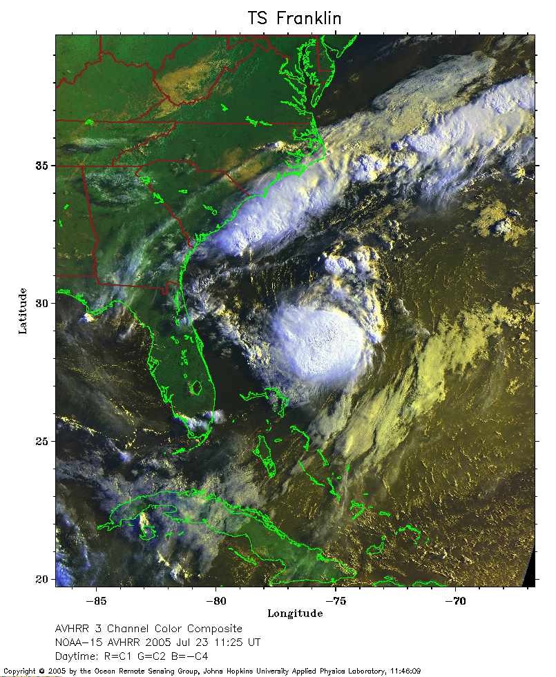 2005 July 23 11:25 UT
NOAA-15 satellite AVHRR 3 channel color composite morning image.
A closer view (379 Kb) is seen by clicking on this small image.
 2005 July 23 15:30 UT
NOAA-17 satellite AVHRR 3 channel color composite daytime image.
A closer view (304 Kb) is seen by clicking on this small image.
The maximum sustained winds have increased to 70 mph.
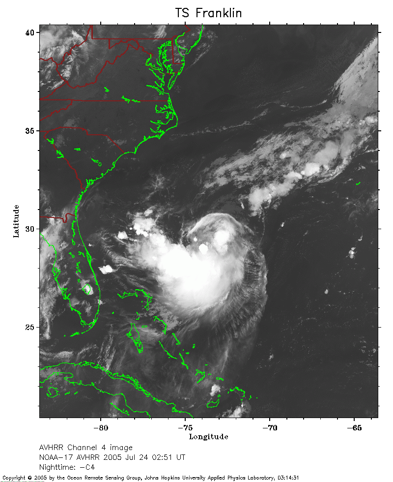 2005 July 24 02:51 UT
NOAA-17 satellite AVHRR channel 4 nighttime image.
A closer view (240 Kb) is seen by clicking on this small image.
 2005 July 24 11:01 UT
NOAA-15 satellite AVHRR 3 channel color composite morning image.
A closer view (313 Kb) is seen by clicking on this small image.
The maximum sustained winds have decreased to 65 mph.
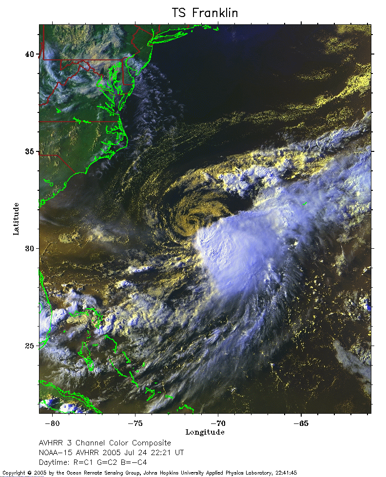 2005 July 24 22:21 UT
NOAA-15 satellite AVHRR 3 channel color composite evening image.
A closer view (352 Kb) is seen by clicking on this small image.
The maximum sustained winds have decreased to 50 mph.
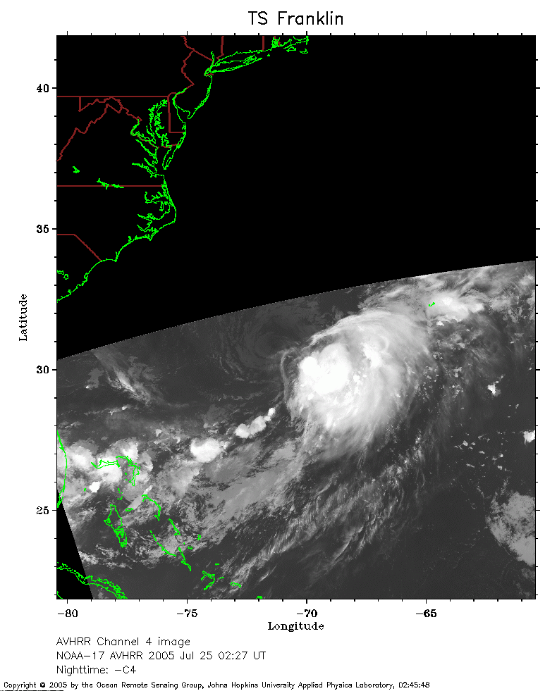 2005 July 25 02:27 UT
NOAA-17 satellite AVHRR channel 4 nighttime image.
A closer view (157 Kb) is seen by clicking on this small image.
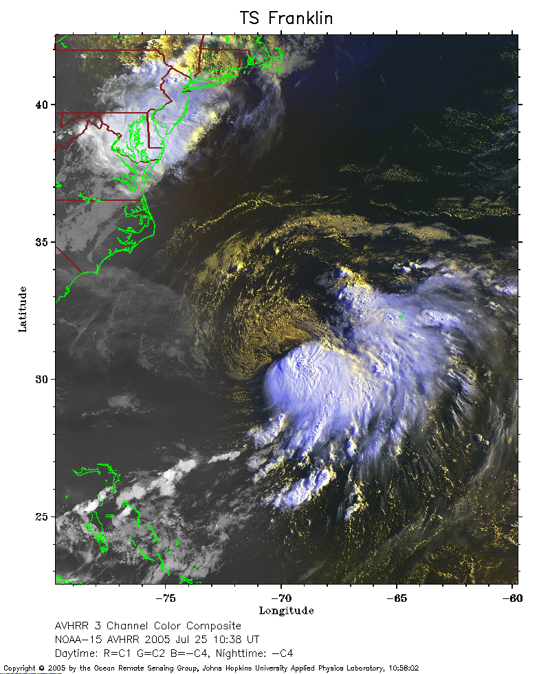 2005 July 25 10:38 UT
NOAA-15 satellite AVHRR 3 channel color composite morning image.
A closer view (317 Kb) is seen by clicking on this small image.
The maximum sustained winds have decreased to 40 mph.
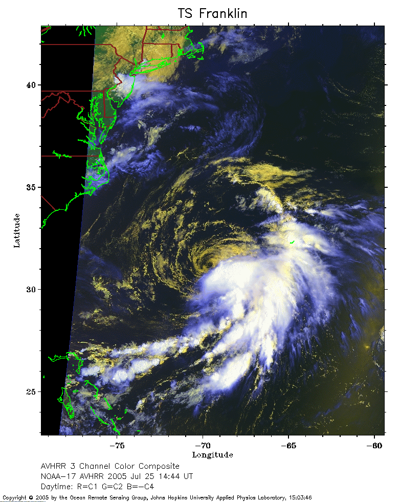 2005 July 25 14:44 UT
NOAA-17 satellite AVHRR 3 channel color composite daytime image.
A closer view (293 Kb) is seen by clicking on this small image.
 2005 July 25 21:57 UT
NOAA-15 satellite AVHRR 3 channel color composite evening image.
A closer view (343 Kb) is seen by clicking on this small image.
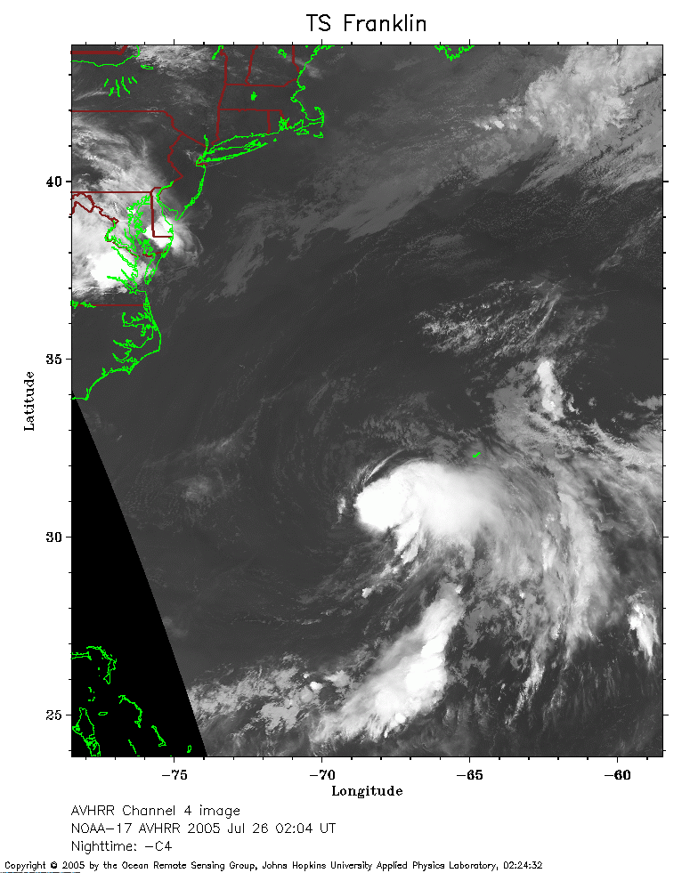 2005 July 26 02:04 UT
NOAA-17 satellite AVHRR channel 4 nighttime image. The J-shaped island
east of TS Franklin is Bermuda. A closer view (243 Kb) is seen by
clicking on this small image.
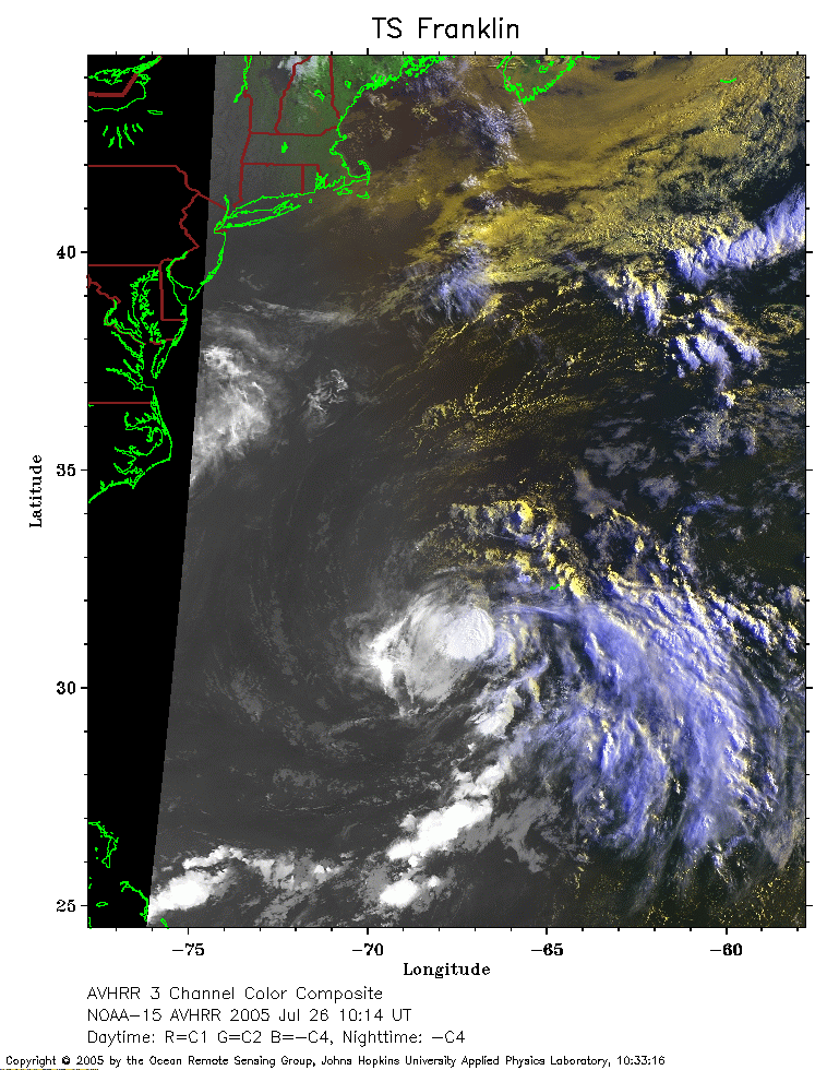 2005 July 26 10:14 UT
NOAA-15 satellite AVHRR 3 channel color composite early morning image.
A closer view (288 Kb) is seen by clicking on this small image.
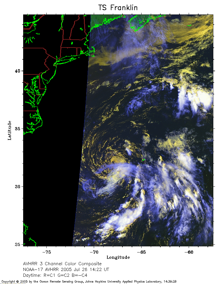 2005 July 26 14:22 UT
NOAA-17 satellite AVHRR 3 channel color composite daytime image.
A closer view (252 Kb) is seen by clicking on this small image.
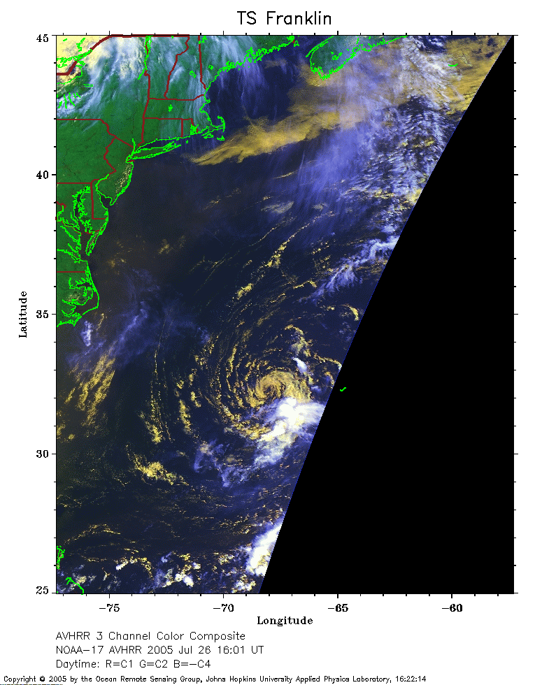 2005 July 26 16:01 UT
NOAA-17 satellite AVHRR 3 channel color composite daytime image.
A closer view (219 Kb) is seen by clicking on this small image.
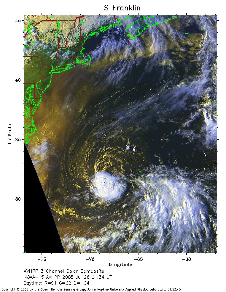 2005 July 26 21:34 UT
NOAA-15 satellite AVHRR 3 channel color composite daytime image.
A closer view (340 Kb) is seen by clicking on this small image.
 2005 July 27 01:43 UT
NOAA-17 satellite AVHRR channel 4 nighttime image.
A closer view (218 Kb) is seen by clicking on this small image.
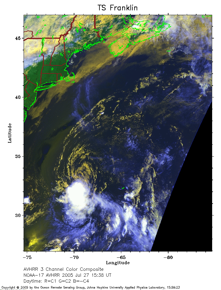 2005 July 27 15:38 UT
NOAA-17 satellite AVHRR 3 channel color composite daytime image.
A closer view (281 Kb) is seen by clicking on this small image.
The maximum sustained winds have increased to 45 mph.
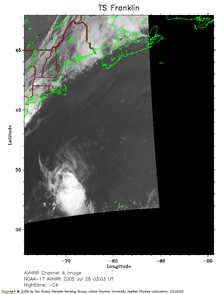 2005 July 28 03:03 UT
NOAA-17 satellite AVHRR channel 4 nighttime image.
A closer view (134 Kb) is seen by clicking on this small image.
The maximum sustained winds have increased to 50 mph.
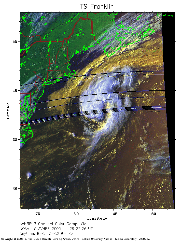 2005 July 28 22:26 UT
NOAA-15 satellite AVHRR 3 channel color composite evening image.
A closer view (286 Kb) is seen by clicking on this small image.
The maximum sustained winds have increased to 60 mph.
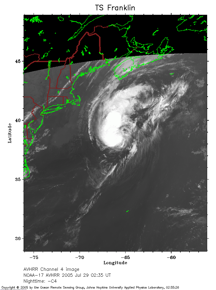 2005 July 28 02:35 UT
NOAA-17 satellite AVHRR channel 4 nighttime image.
A closer view (179 Kb) is seen by clicking on this small image.
 2005 July 28 14:53 UT
NOAA-17 satellite AVHRR 3 channel color composite daytime image.
A closer view (253 Kb) is seen by clicking on this small image.