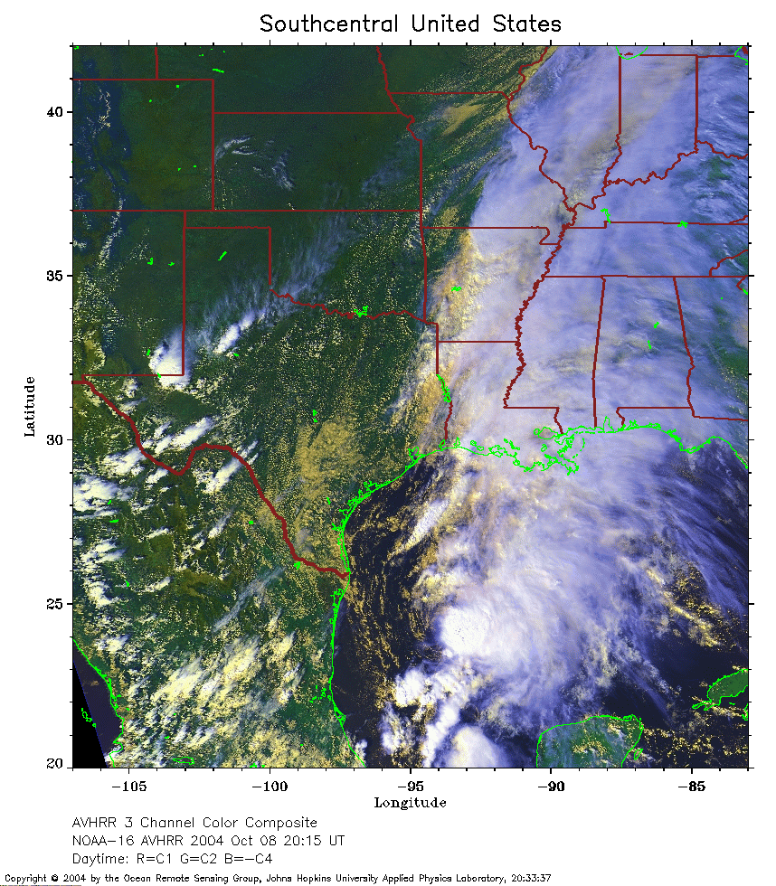
 2004 October 8 20:15 UT
NOAA-16 satellite AVHRR 3 channel color composite image.
A closer view (415 Kb) is seen by clicking on this small image.
The maximum sustained winds are 40 mph.
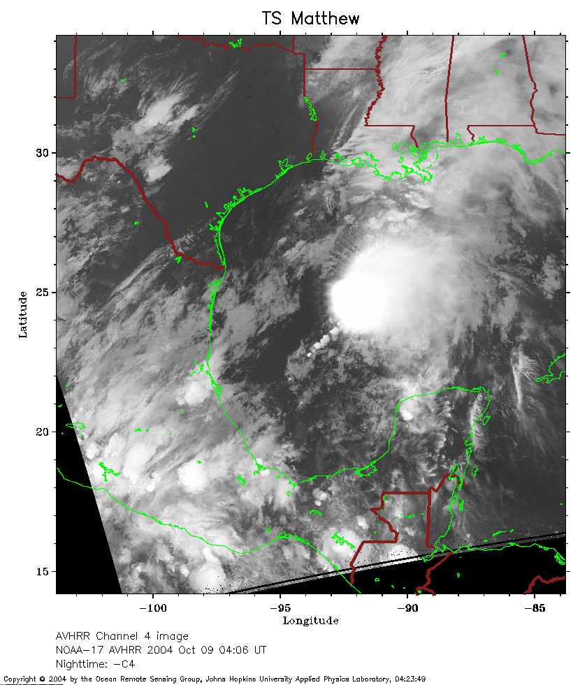 2004 October 9 04:06 UT
NOAA-17 satellite AVHRR channel 4 nighttime image.
A closer view (294 Kb) is seen by clicking on this small image.
The maximum sustained winds have increased to 45 mph.
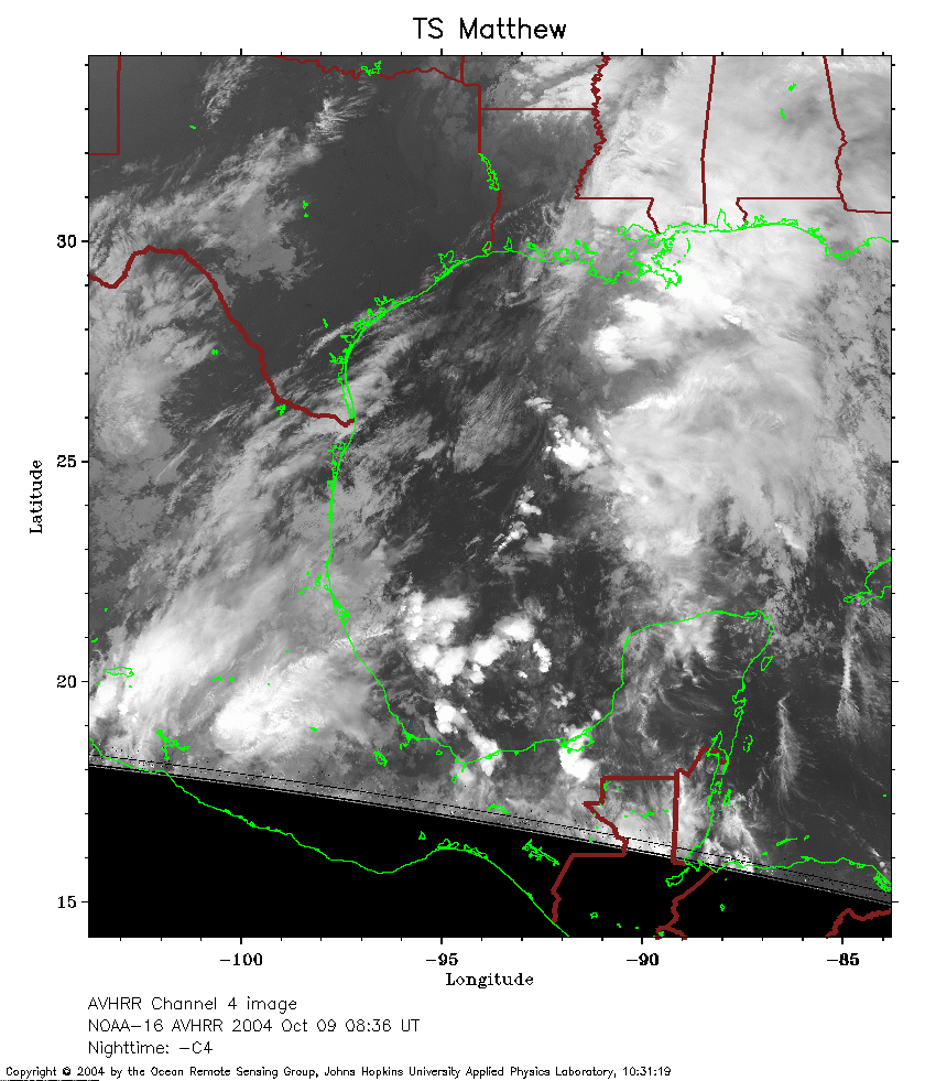 2004 October 9 08:36 UT
NOAA-16 satellite AVHRR channel 4 nighttime image.
A closer view (283 Kb) is seen by clicking on this small image.
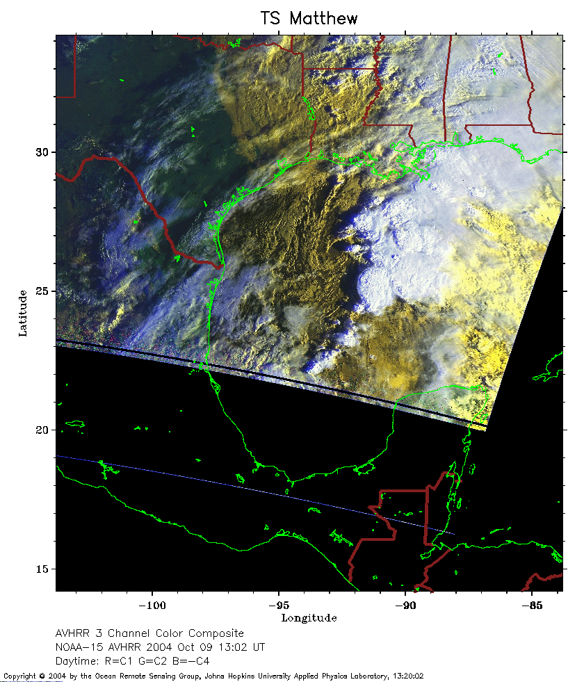 2004 October 9 13:02 UT
NOAA-15 satellite AVHRR 3 channel composite morning image.
A closer view (266 Kb) is seen by clicking on this small image.
The maximum sustained winds have decreased to 40 mph.
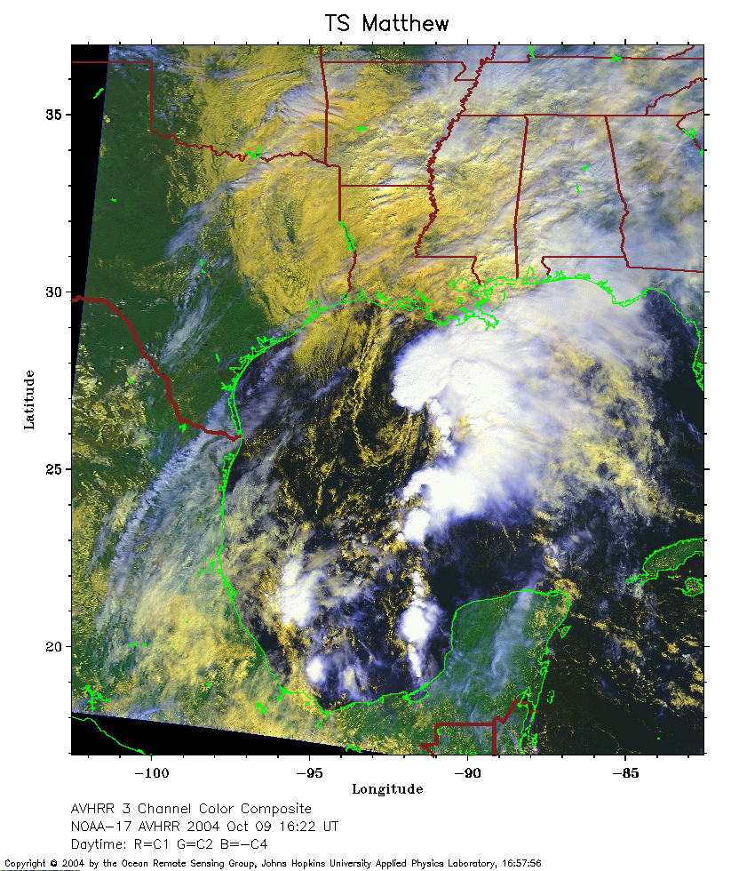 2004 October 9 16:22 UT
NOAA-17 satellite AVHRR 3 channel composite daytime image.
A closer view (397 Kb) is seen by clicking on this small image.
The maximum sustained winds have decreased to 35 mph.
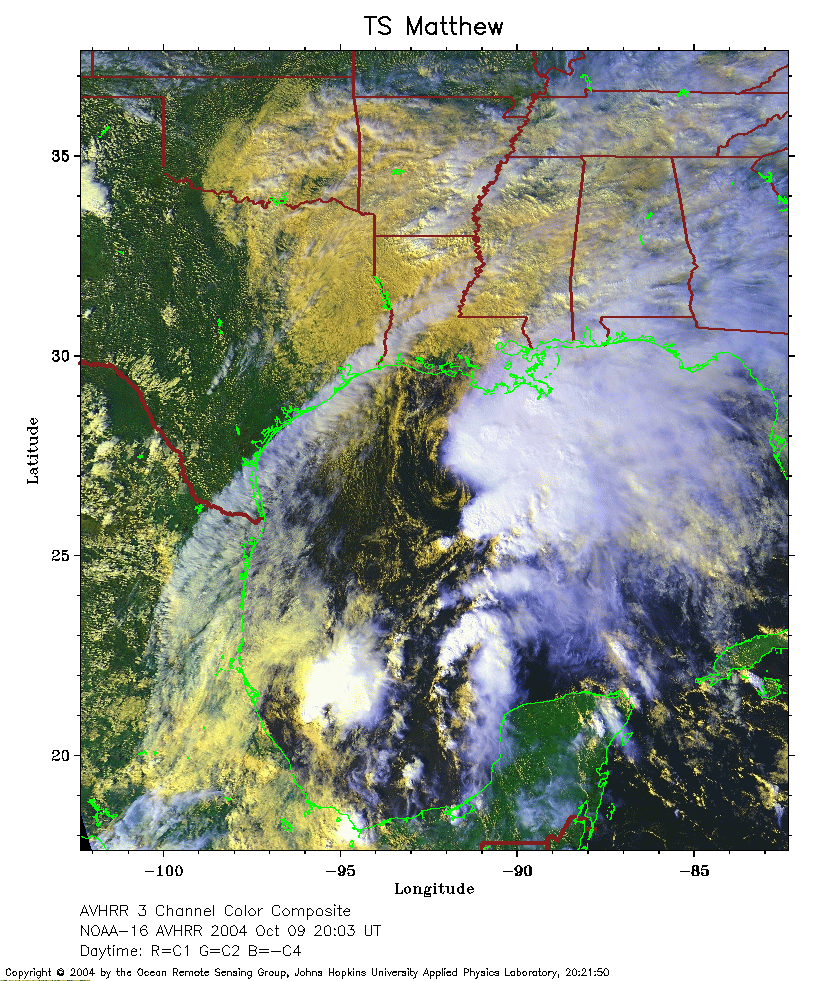 2004 October 9 20:03 UT
NOAA-16 satellite AVHRR 3 channel composite daytime image.
A closer view (434 Kb) is seen by clicking on this small image.
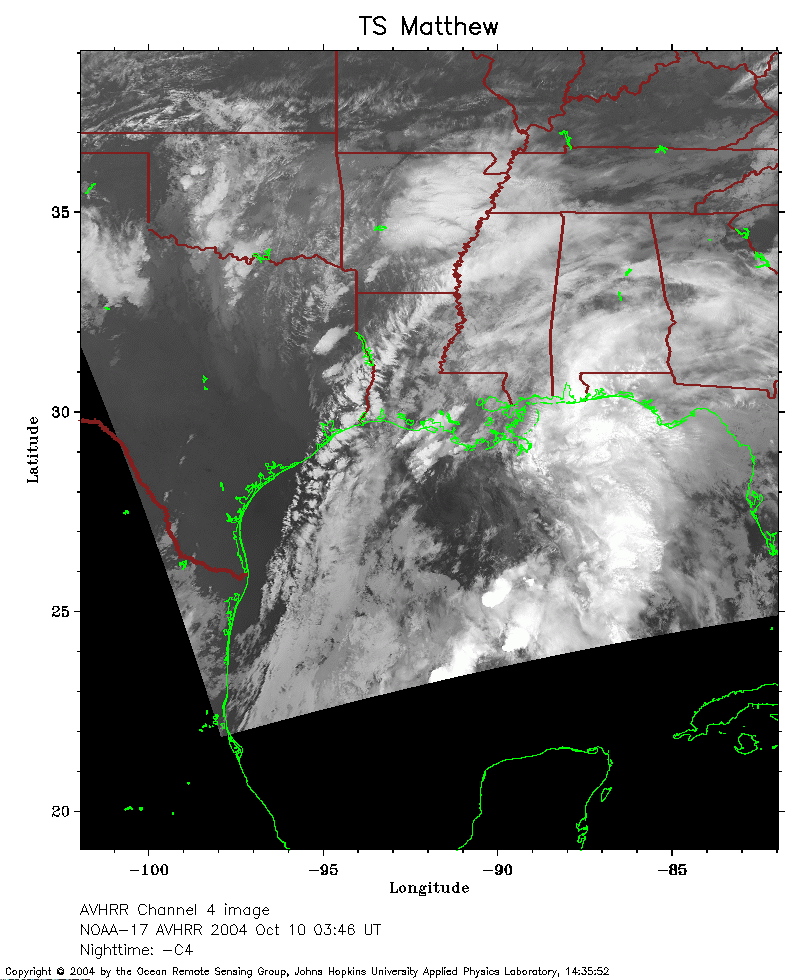 2004 October 10 03:46 UT
NOAA-17 satellite AVHRR channel 4 nighttime image.
A closer view (233 Kb) is seen by clicking on this small image.
The maximum sustained winds have increased to 40 mph.
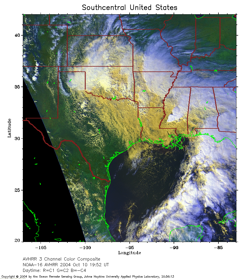 2004 October 10 19:52 UT
NOAA-16 satellite AVHRR 3 channel color composite daytime image.
A closer view (378 Kb) is seen by clicking on this small image.
The maximum sustained winds have decreased to 35 mph.