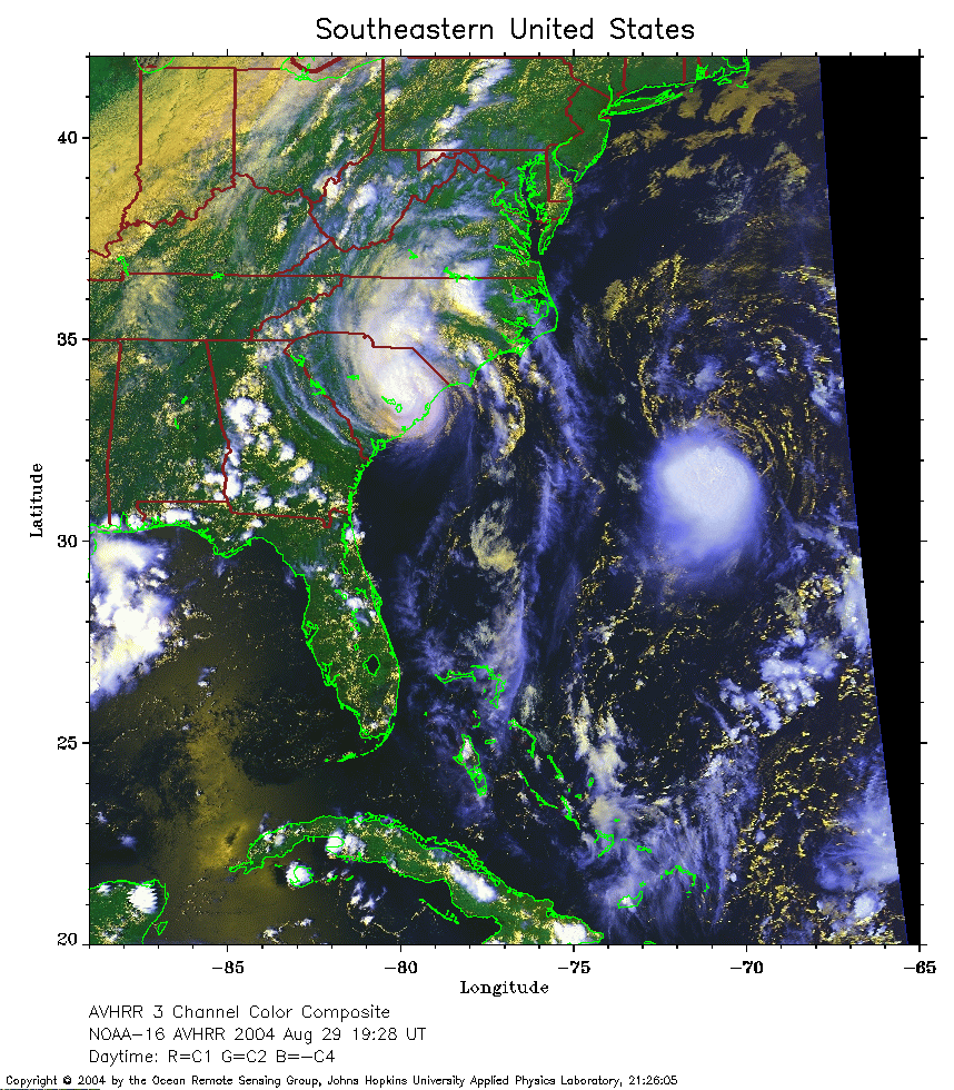
 2004 August 29 19:28 UT
NOAA-16 satellite AVHRR 3 channel color composite daytime image.
A closer view (380 Kb) is seen by clicking on this small image.
The maximum sustained winds were 40 mph at 21:00 UT. Gaston is also
visible on the left side of the image.
 2004 August 30 10:28 UT
NOAA-15 satellite AVHRR channel 4 early morning image.
A closer view (193 Kb) is seen by clicking on this small image.
The maximum sustained winds have increased to 50 mph.
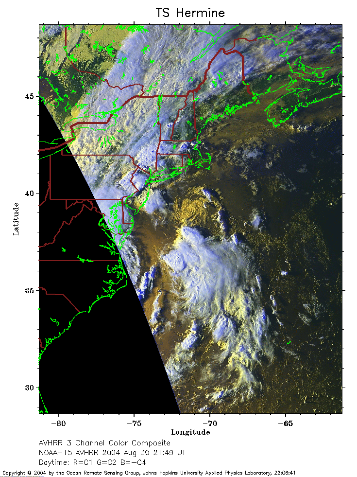 2004 August 30 21:49 UT
NOAA-15 satellite AVHRR 3 channel daytime image.
A closer view (296 Kb) is seen by clicking on this small image.
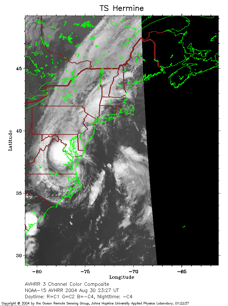 2004 August 30 23:27 UT
NOAA-15 satellite AVHRR channel 4 evening image.
A closer view (190 Kb) is seen by clicking on this small image.
Note Gaston over Virginia on the left side of this image. Hermine is over
the Atlantic Ocean south of the island of Martha's Vineyard.
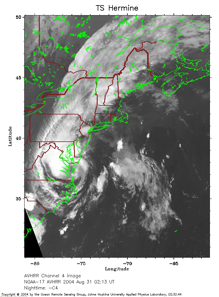 2004 August 31 02:13 UT
NOAA-17 satellite AVHRR channel 4 evening image.
A closer view (239 Kb) is seen by clicking on this small image.
Note Gaston over Virginia on the left side of this image. Hermine is over
the Atlantic Ocean south of the island of Martha's Vineyard.