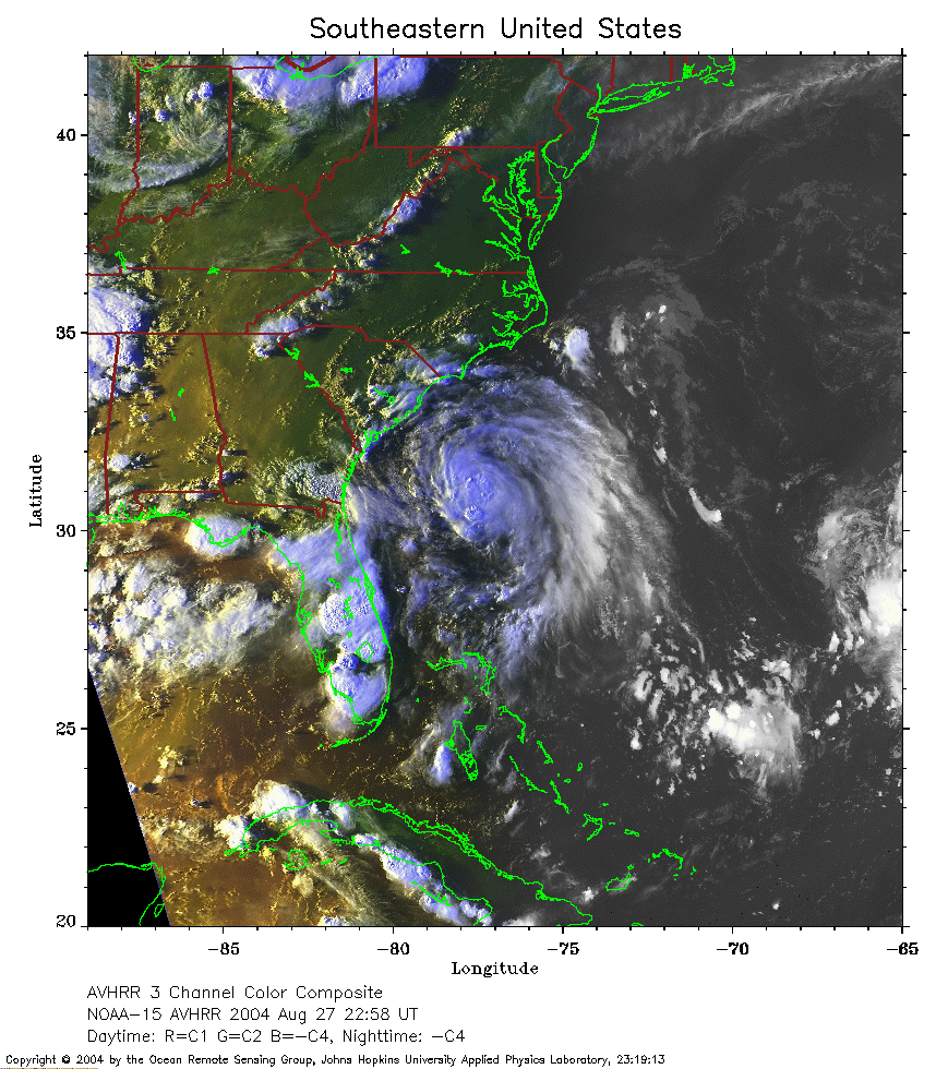
 2004 August 27 22:58 UT
NOAA-15 satellite AVHRR 3 channel color composite daytime image.
A closer view (362 Kb) is seen by clicking on this small image.
The maximum sustained winds were 30 mph at 21:00 UT.
 2004 August 28 11:15 UT
NOAA-15 satellite AVHRR 3 channel color composite daytime image.
A closer view (298 Kb) is seen by clicking on this small image.
The maximum sustained winds have increased to 35 mph.
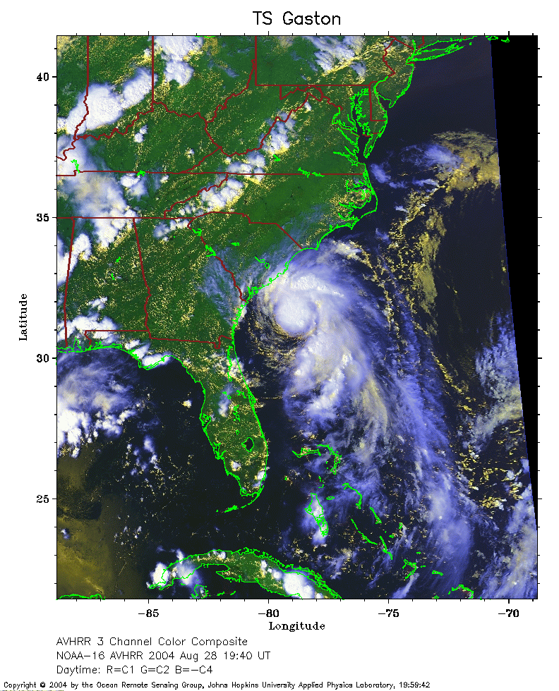 2004 August 28 19:40 UT
NOAA-16 satellite AVHRR 3 channel color composite daytime image.
A closer view (345 Kb) is seen by clicking on this small image.
The maximum sustained winds increased to 50 mph at 21:00 UT.
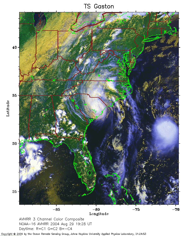 2004 August 29 19:28 UT
NOAA-16 satellite AVHRR 3 channel color composite daytime image.
A closer view (366 Kb) is seen by clicking on this small image.
The maximum sustained winds decreased to 45 mph at 18:00 UT.
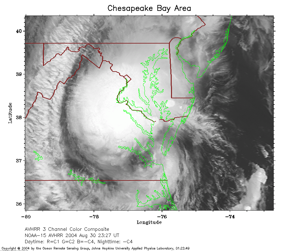 2004 August 30 23:27 UT
NOAA-15 satellite AVHRR channel 4 evening image.
A closer view (240 Kb) is seen by clicking on this small image.
Gaston is moving over the Chesapeake Bay and re-developing into a tropical
storm. The maximum sustained winds are increasing to 40 mph.
 2004 August 31 02:13 UT
NOAA-17 satellite AVHRR channel 4 evening image.
A closer view (241 Kb) is seen by clicking on this small image.
The maximum sustained winds are now 40 mph.
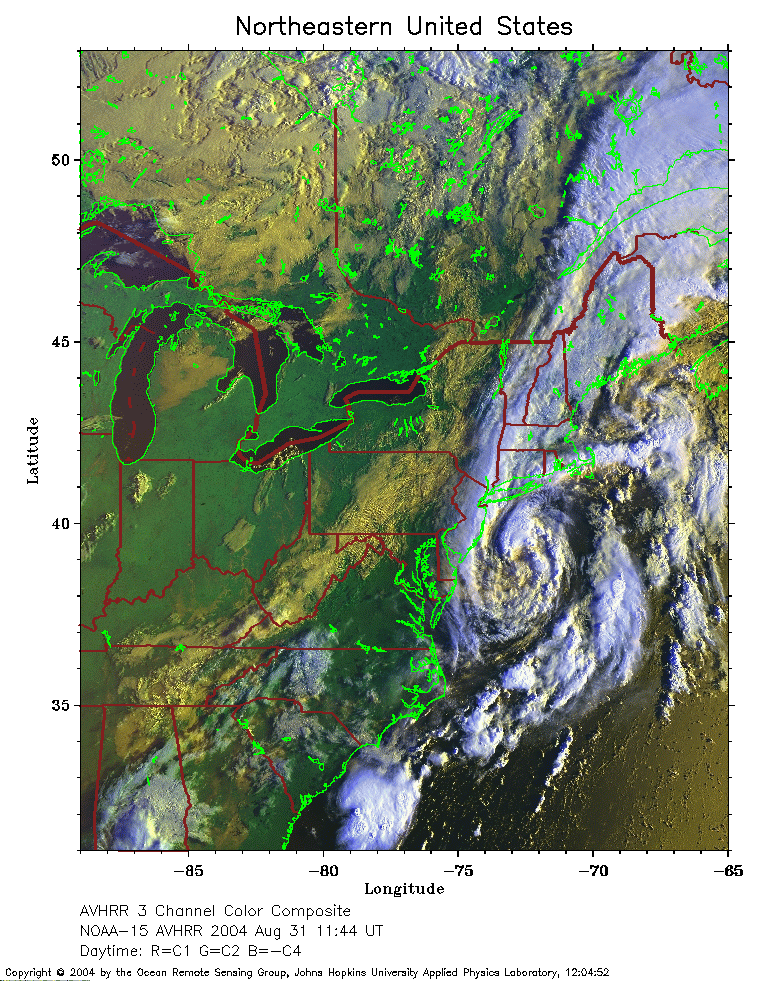 2004 August 31 11:44 UT
NOAA-15 satellite AVHRR 3 channel color composite daytime image.
A closer view (389 Kb) is seen by clicking on this small image.
Gaston is now a tropical storm with 40 mph winds off the coast of New Jersey.
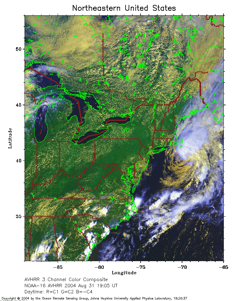 2004 August 31 19:05 UT
NOAA-16 satellite AVHRR 3 channel color composite daytime image.
A closer view (378 Kb) is seen by clicking on this small image.
Gaston is now off the coast of Massachusetts.