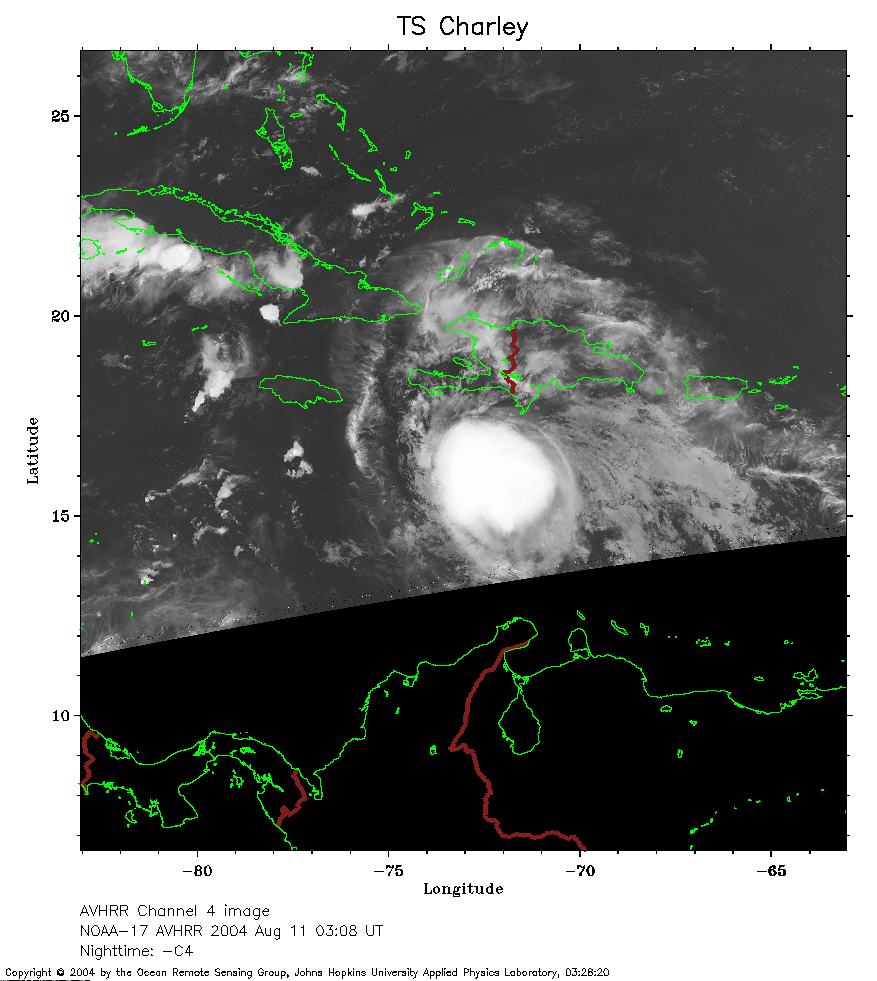
 2004 August 11 03:08 UT
NOAA-17 satellite AVHRR channel 4 nighttime image.
A closer view (200 Kb) is seen by clicking on this small image.
The maximum sustained winds are 65 mph.
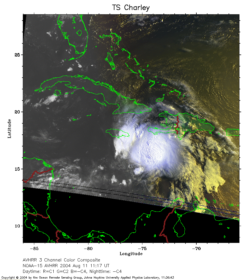 2004 August 11 11:17 UT
NOAA-15 satellite AVHRR 3 channel color composite daytime image.
A closer view (257 Kb) is seen by clicking on this small image.
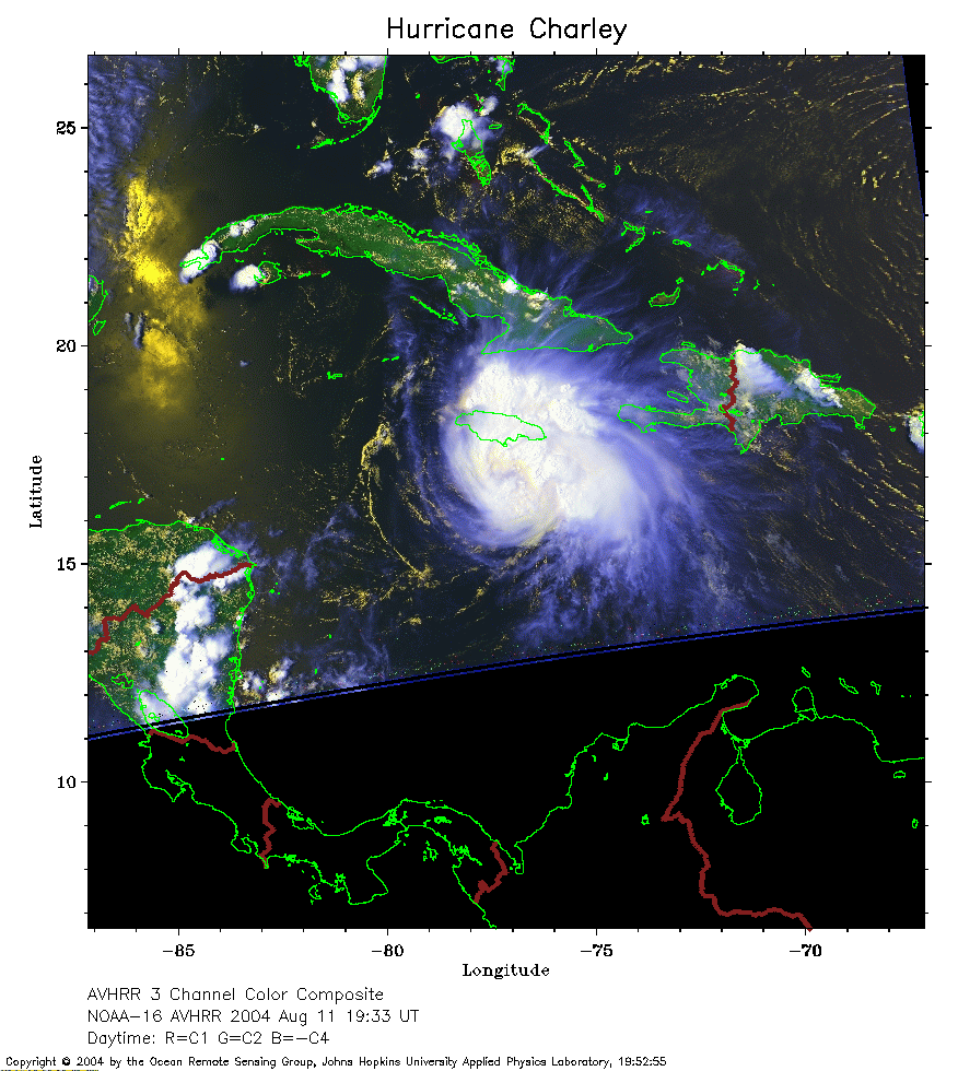 2004 August 11 19:33 UT
NOAA-16 satellite AVHRR 3 channel color composite daytime image.
A closer view (245 Kb) is seen by clicking on this small image.
The maximum sustained winds have increased to 75 mph.
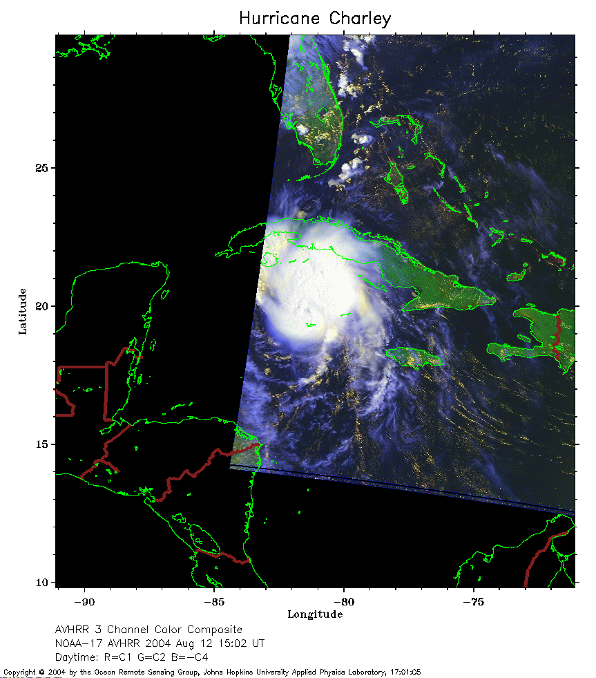 2004 August 12 15:02 UT
NOAA-17 satellite AVHRR 3 channel color composite daytime image.
A closer view (189 Kb) is seen by clicking on this small image.
The maximum sustained winds have increased to 90 mph.
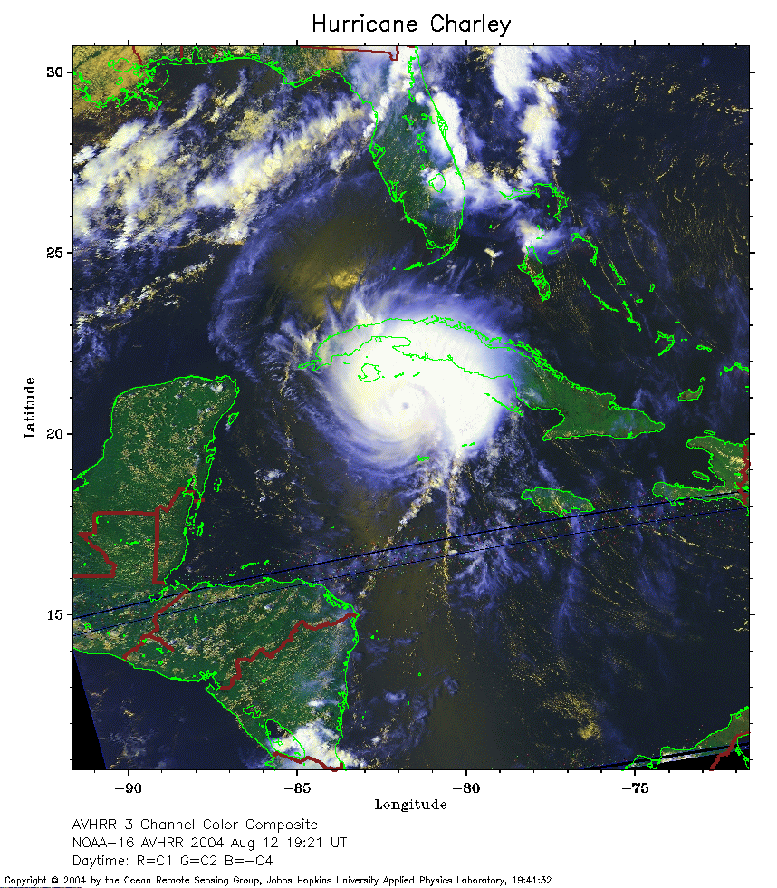 2004 August 12 19:33 UT
NOAA-16 satellite AVHRR 3 channel color composite daytime image.
A closer view (350 Kb) is seen by clicking on this small image.
The maximum sustained winds have increased to 105 mph.
The eye of Charley is clearly visible in this image.
 2004 August 13 19:10 UT
NOAA-16 satellite AVHRR 3 channel color composite daytime image.
A closer view (351 Kb) is seen by clicking on this small image.
The maximum sustained winds have increased to 145 mph.
Note how close the Charley's eye is to the Florida coast.
 2004 August 14 03:40 UT
NOAA-17 satellite AVHRR channel 4 nighttime image.
A closer view (263 Kb) is seen by clicking on this small image.
The maximum sustained winds have decreased to 85 mph.
 2004 August 14 15:57 UT
NOAA-17 satellite AVHRR 3 channel color composite daytime image.
A closer view (330 Kb) is seen by clicking on this small image.
The maximum sustained winds have decreased to 75 mph.
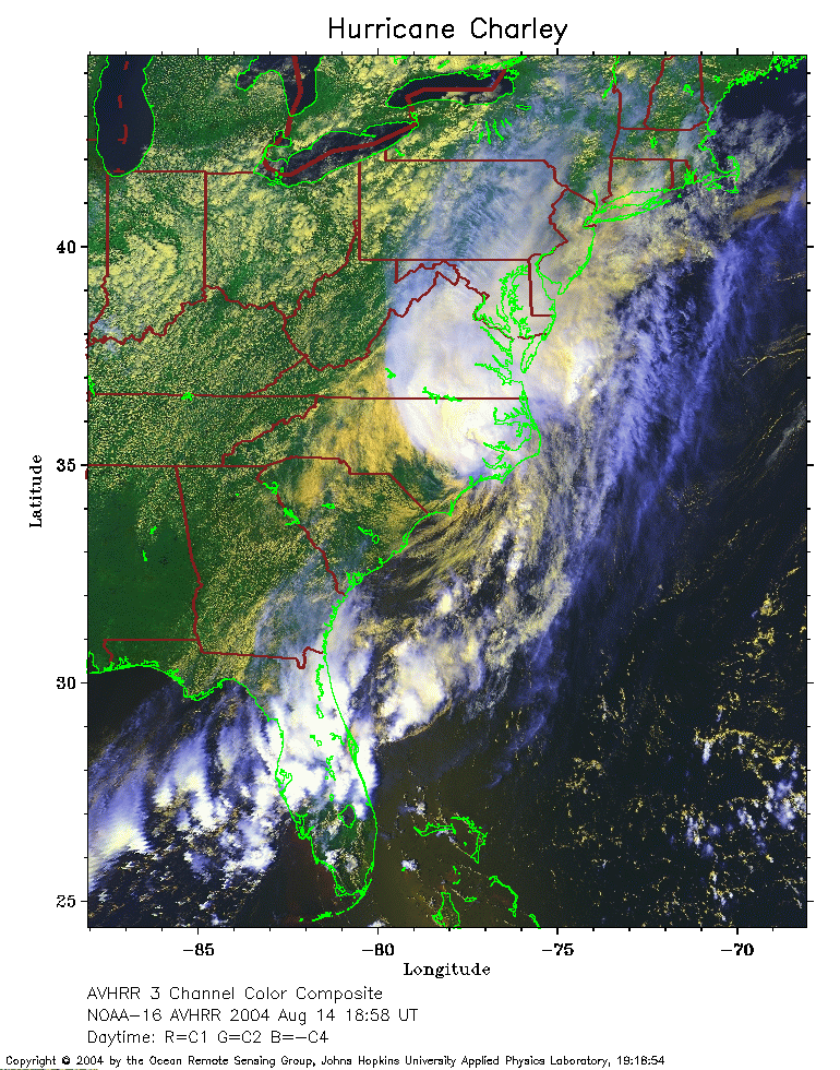 2004 August 14 18:58 UT
NOAA-16 satellite AVHRR 3 channel color composite daytime image.
A closer view (365 Kb) is seen by clicking on this small image.
The maximum sustained winds have decreased to 70 mph.
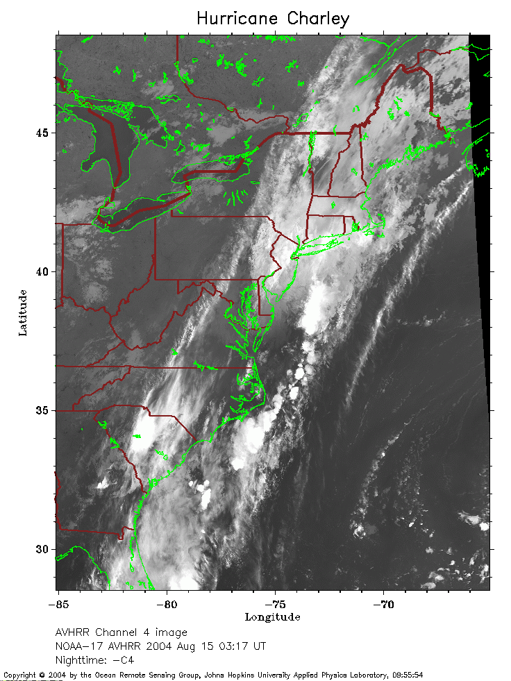 2004 August 15 03:17 UT
NOAA-17 satellite AVHRR channel 4 nighttime image.
A closer view (257 Kb) is seen by clicking on this small image.
The maximum sustained winds have decreased to 35 mph.
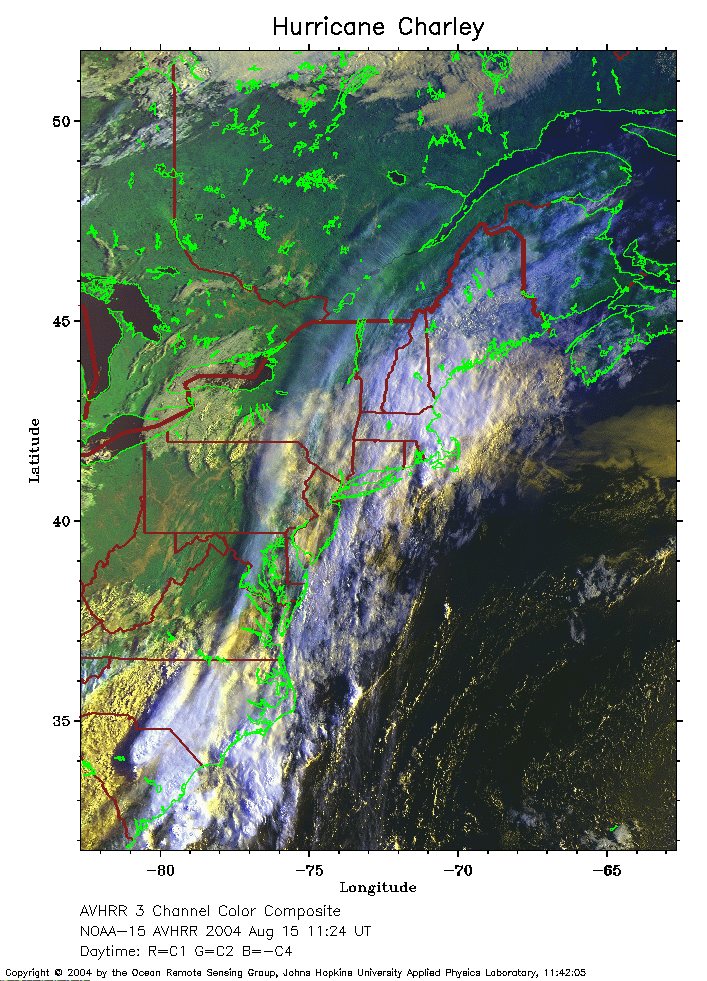 2004 August 15 11:24 UT
NOAA-15 satellite AVHRR 3 channel color composite daytime image.
A closer view (316 Kb) is seen by clicking on this small image.
The maximum sustained winds have decreased to 30 mph.