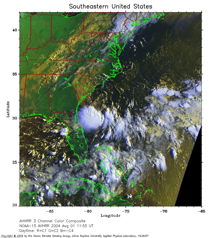
 2004 August 1 11:55 UT
NOAA-15 satellite AVHRR 3 channel color composite daytime image.
A closer view (414 Kb) is seen by clicking on this small image.
The maximum sustained winds are 30 mph.
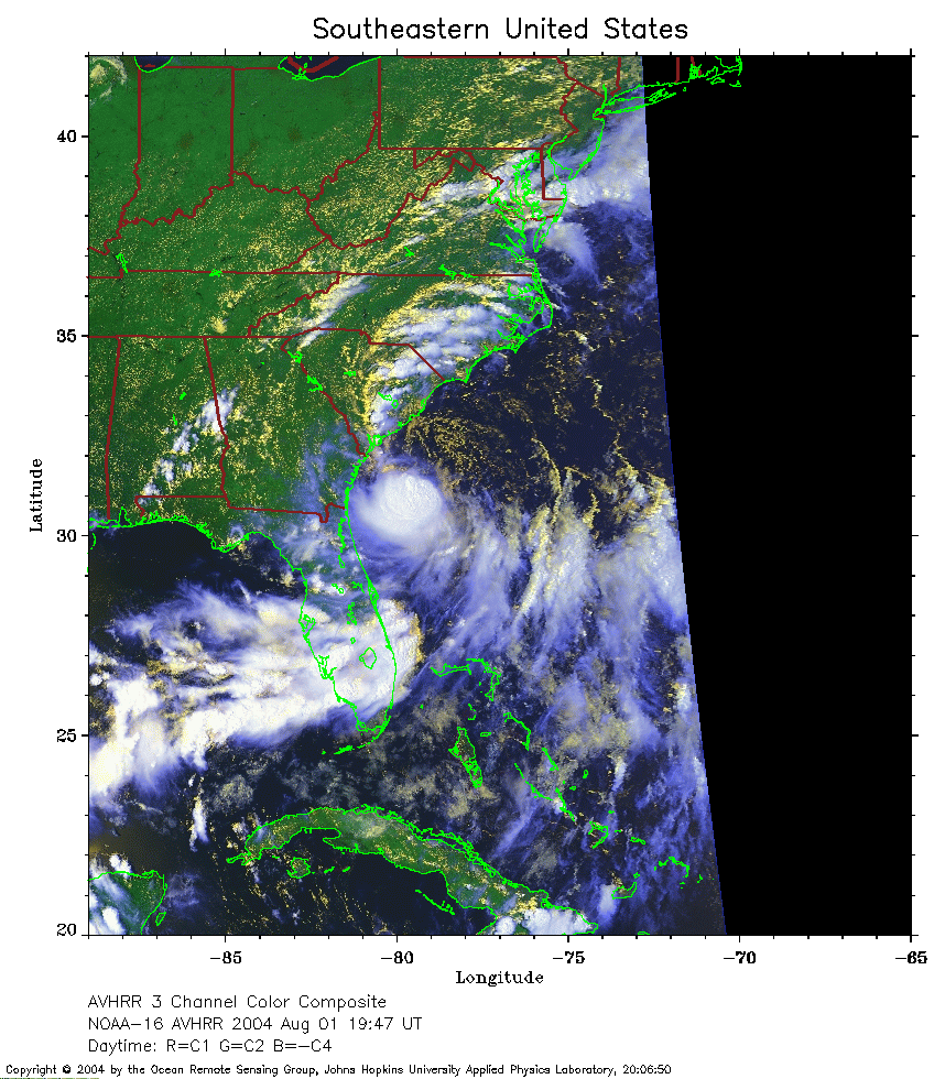 2004 August 1 19:47 UT
NOAA-16 satellite AVHRR 3 channel color composite daytime image.
A closer view (307 Kb) is seen by clicking on this small image.
The maximum sustained winds have increased to 40 mph.
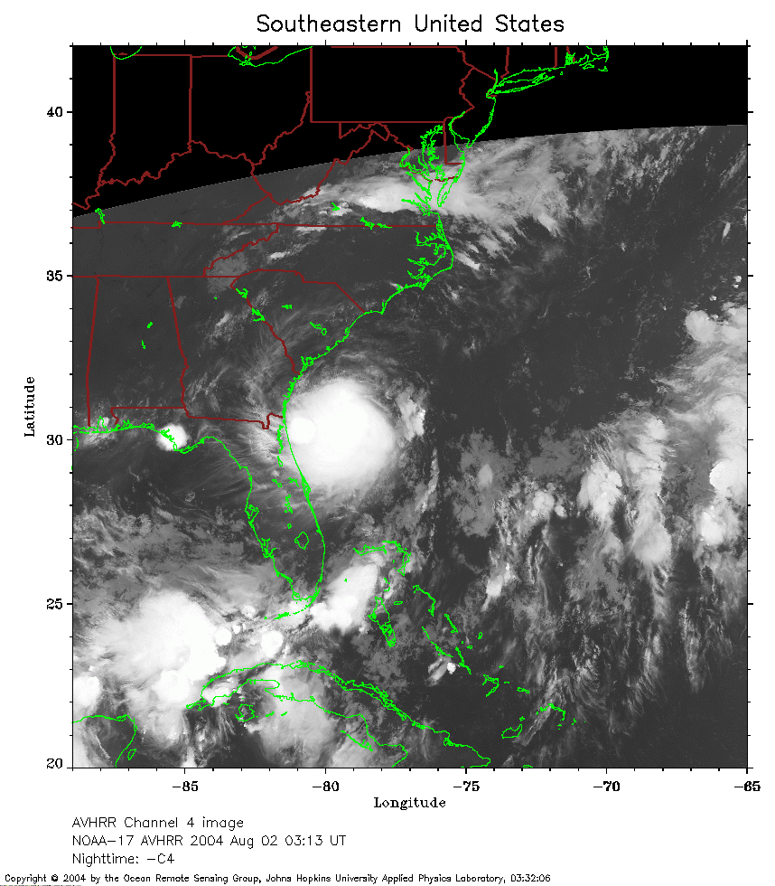 2004 August 2 03:13 UT
NOAA-17 satellite AVHRR channel 4 nighttime image.
A closer view (266 Kb) is seen by clicking on this small image.
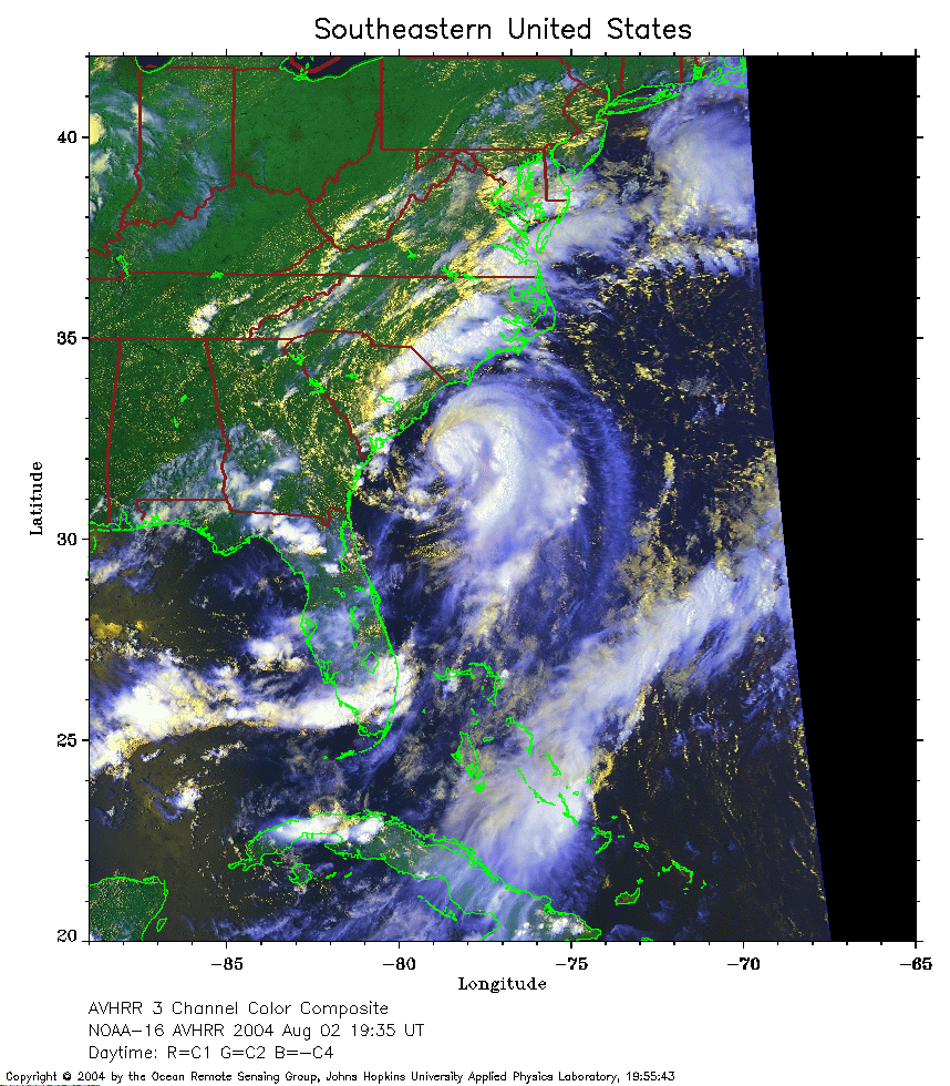 2004 August 2 19:35 UT
NOAA-16 satellite AVHRR 3 channel color composite afternoon image.
A closer view (349 Kb) is seen by clicking on this small image.
The maximum sustained winds have increased to 60 mph.
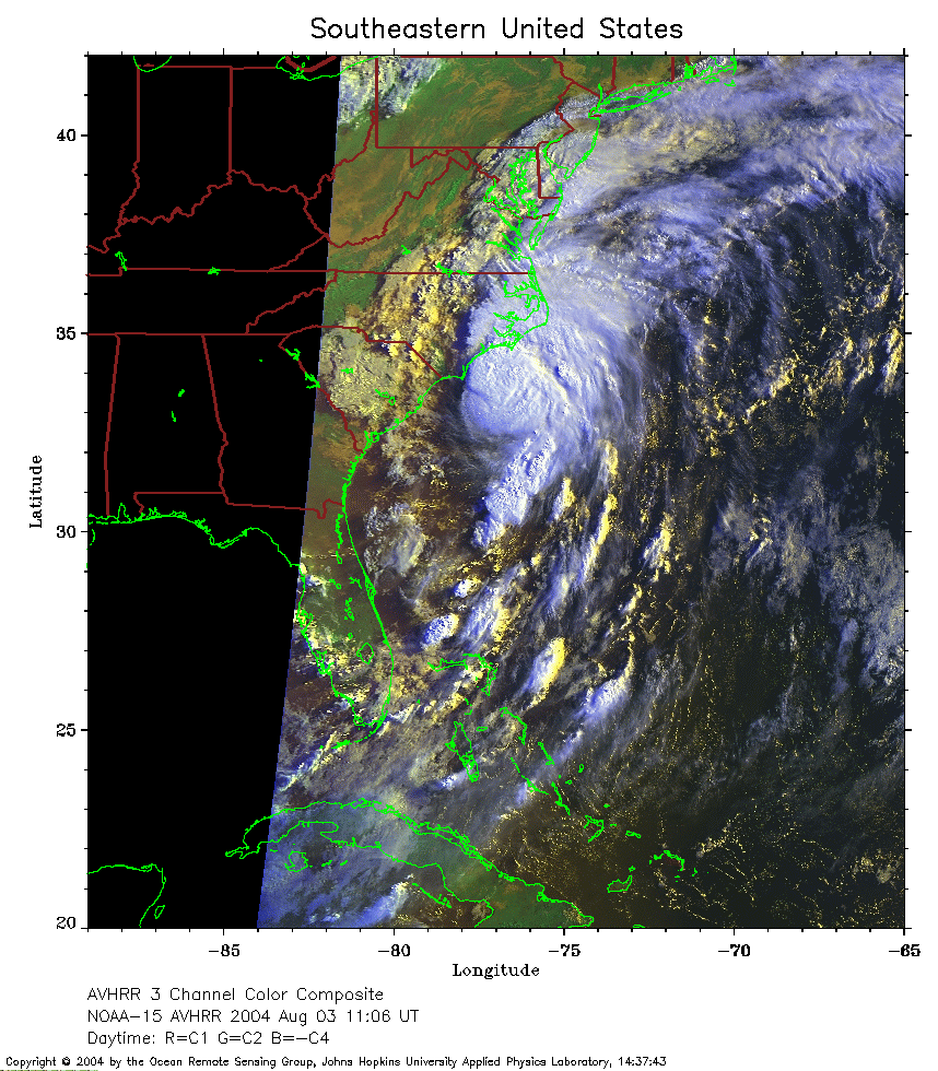 2004 August 3 11:06 UT
NOAA-15 satellite AVHRR 3 channel color composite daytime image.
A closer view (318 Kb) is seen by clicking on this small image.
The maximum sustained winds have increased to 80 mph and Alex is a
Saffir-Simpson Category 1 hurricane.
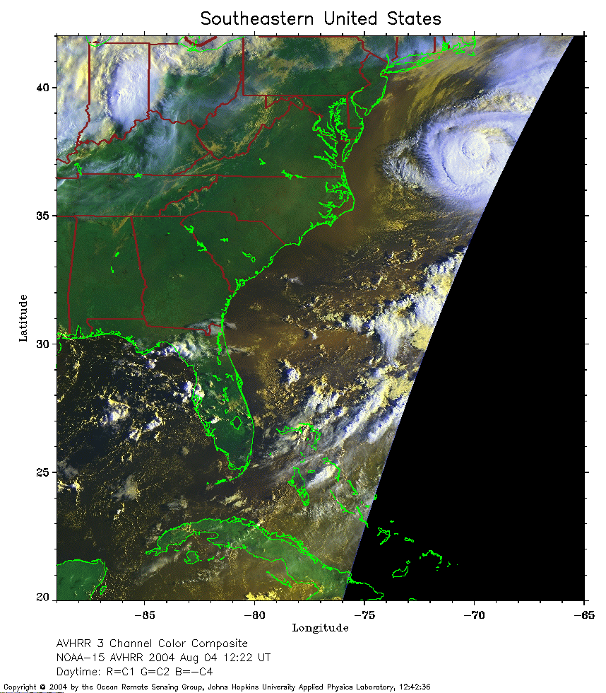 2004 August 4 12:22 UT
NOAA-15 satellite AVHRR 3 channel color composite daytime image.
A closer view (292 Kb) is seen by clicking on this small image.
The maximum sustained winds are 90 mph.
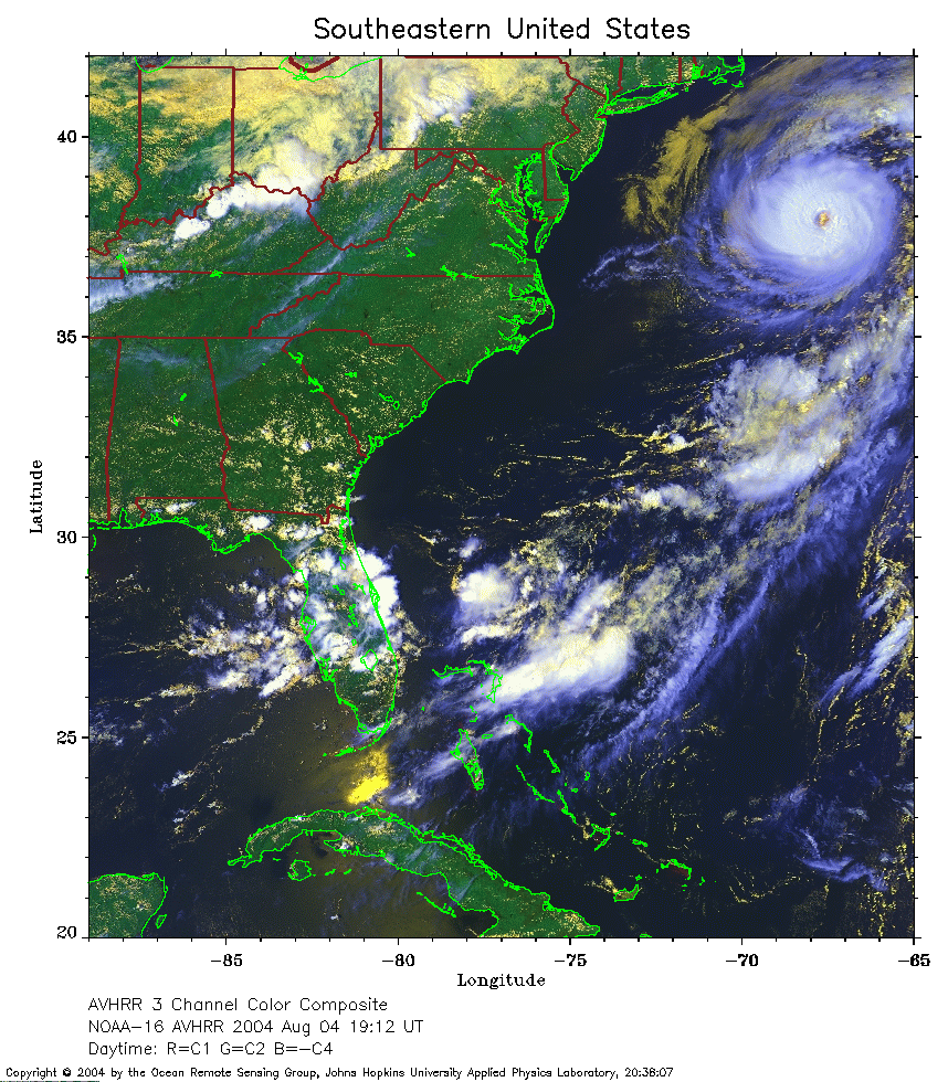 2004 August 4 19:12 UT
NOAA-16 satellite AVHRR 3 channel color composite daytime image.
A closer view (381 Kb) is seen by clicking on this small image.
The maximum sustained winds have decreased to 85 mph.
 2004 August 4 22:03 UT
NOAA-15 satellite AVHRR 3 channel color composite daytime image
made by Ray Sterner.
A closer view (1855 Kb) is seen by clicking on this small image.
Note Cape Cod in the upper lefthand corner of the image.
The maximum sustained winds have increased to 105 mph.
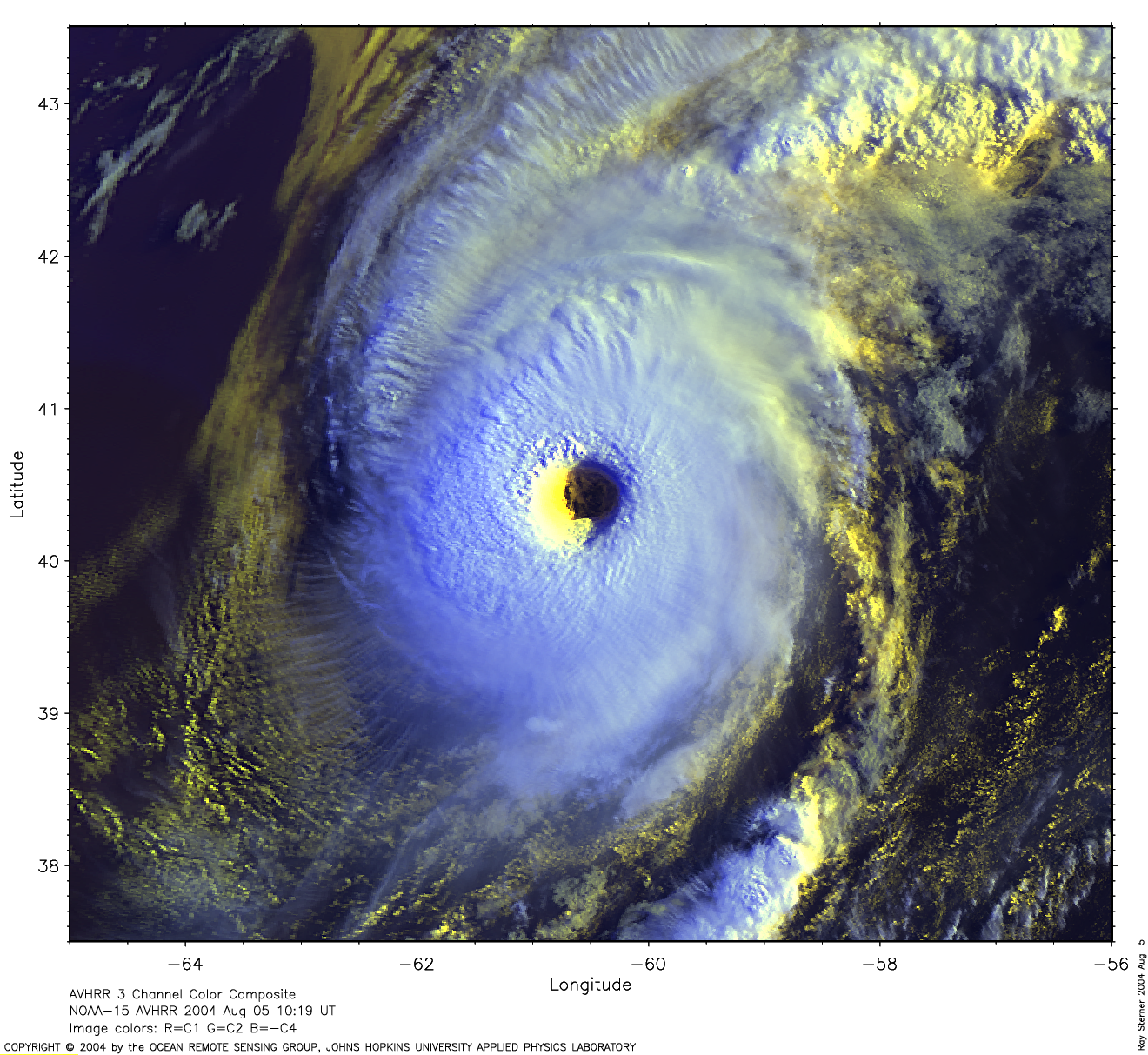 2004 August 5 10:19 UT
NOAA-15 satellite AVHRR 3 channel color composite daytime image
made by Ray Sterner.
A closer view (1398 Kb) is seen by clicking on this small image.
The maximum sustained winds have increased to 120 mph.