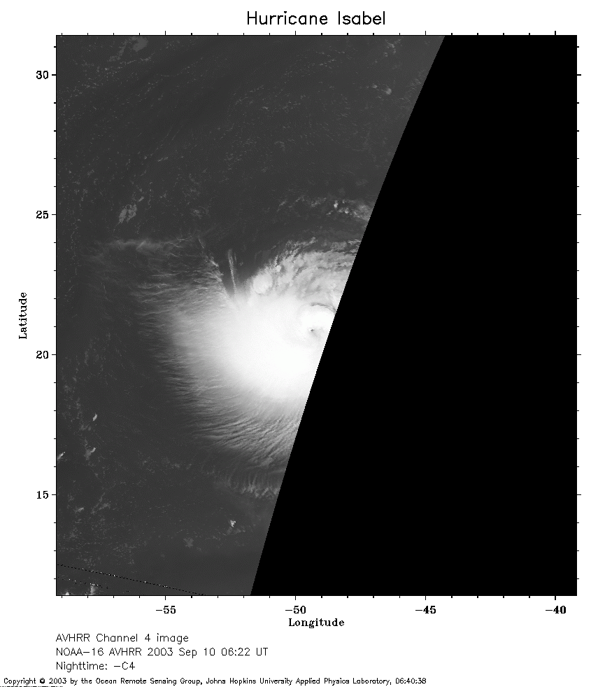
 2003 September 10 06:22 UT
NOAA-16 satellite AVHRR channel 4 early morning image.
A closer view (129 Kb) is seen by clicking on this small image.
The maximum sustained winds are 135 mph.
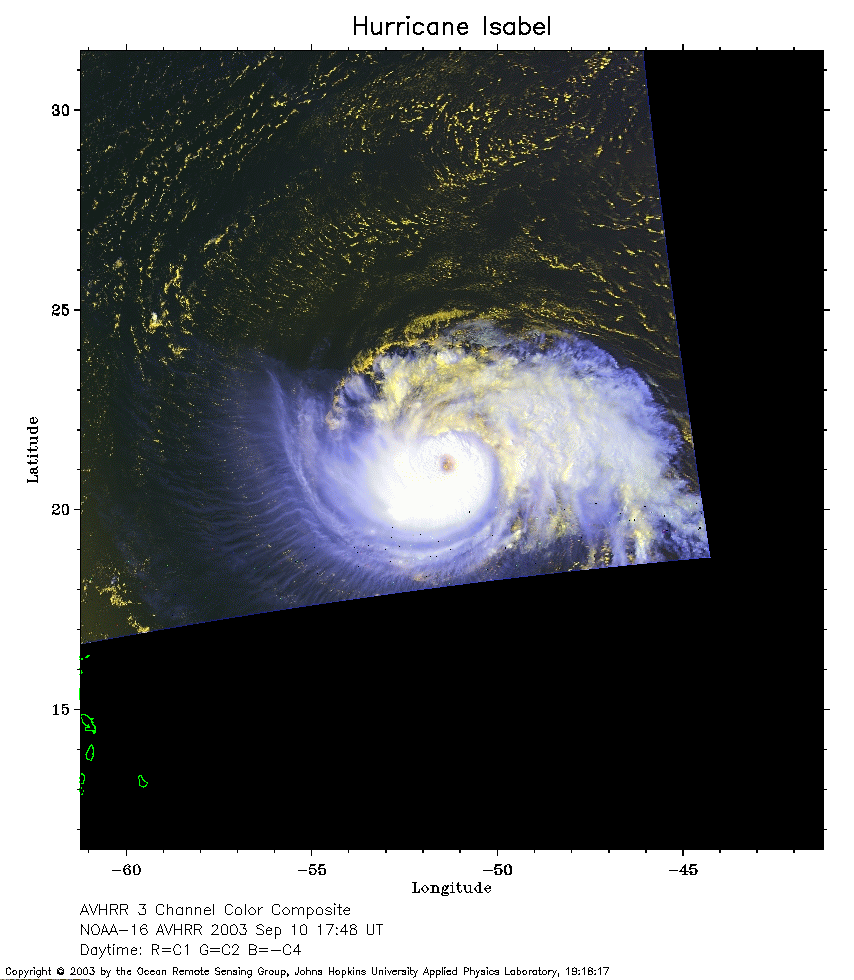 2003 September 10 17:48 UT
NOAA-16 satellite AVHRR 3 channel color composite afternoon image.
A closer view (188 Kb) is seen by clicking on this small image.
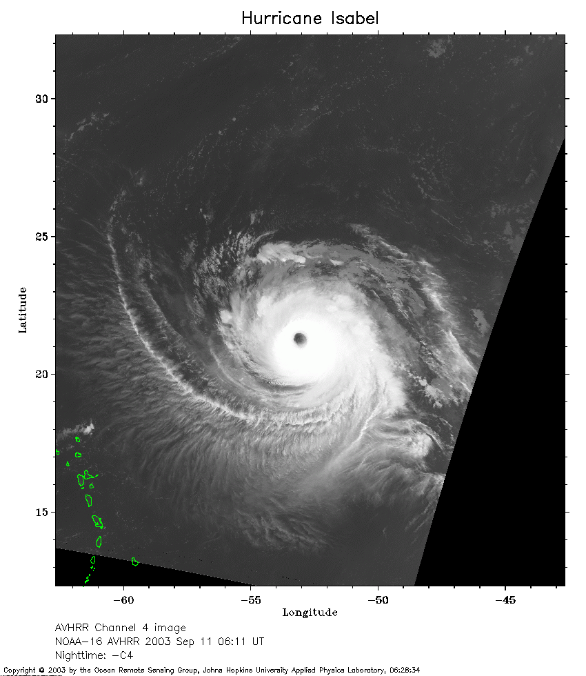 2003 September 11 06:11 UT
NOAA-16 satellite AVHRR channel 4 early morning image.
A closer view (216 Kb) is seen by clicking on this small image.
The maximum sustained winds have increased to 145 mph.
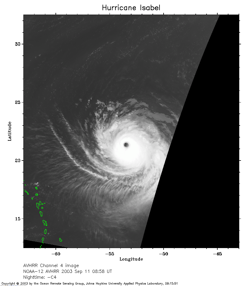 2003 September 11 08:58 UT
NOAA-12 satellite AVHRR channel 4 early morning image.
A closer view (169 Kb) is seen by clicking on this small image.
 2003 September 13 21:08 UT
NOAA-12 satellite AVHRR 3 channel color composite evening image.
A closer view (283 Kb) is seen by clicking on this small image.
The maximum sustained winds have increased to 160 mph.
 2003 September 14 07:17 UT
NOAA-16 satellite AVHRR channel 4 early morning image.
A closer view (159 Kb) is seen by clicking on this small image.
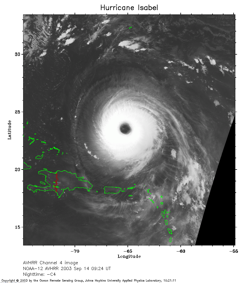 2003 September 14 09:24 UT
NOAA-12 satellite AVHRR channel 4 early morning image.
A closer view (249 Kb) is seen by clicking on this small image.
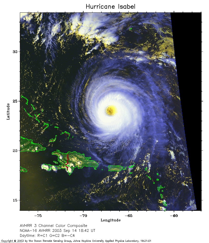 2003 September 14 18:42 UT
NOAA-16 satellite AVHRR 3 channel color composite afternoon image.
A closer view (309 Kb) is seen by clicking on this small image.
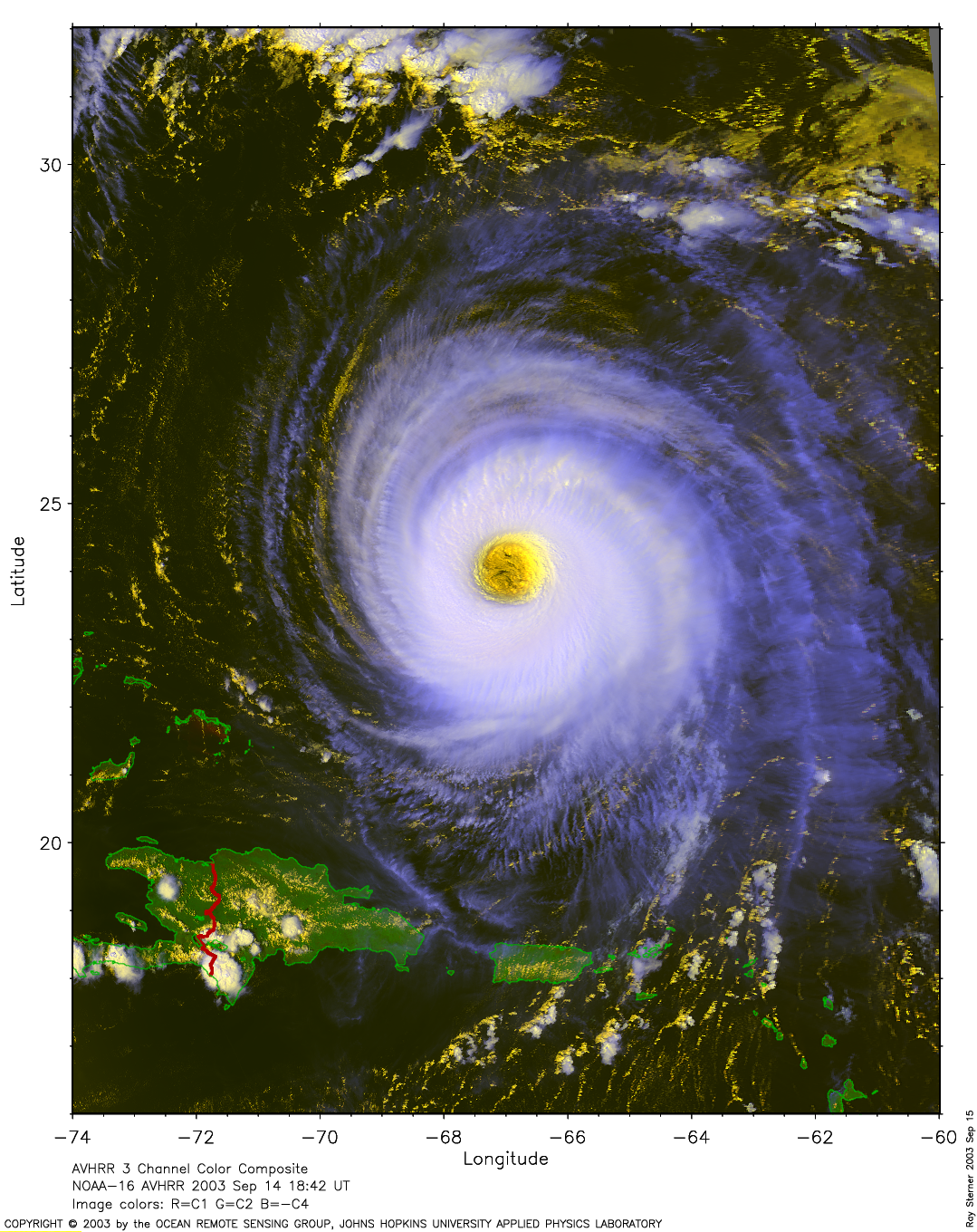
Click here for a
large close-up (1852 Kb) by Ray Sterner
A closer view (309 Kb) is seen by clicking on this small image.
Click here for a
very large close-up (4715 Kb) by Ray Sterner
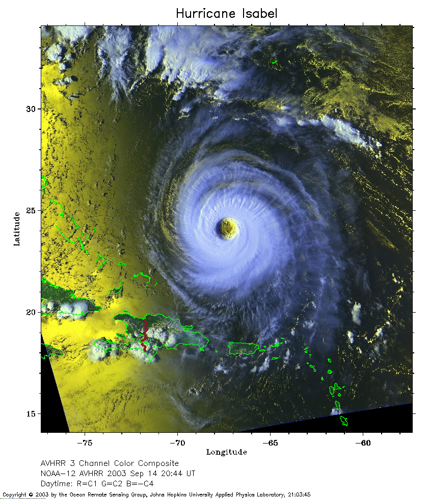 2003 September 14 20:44 UT
NOAA-12 satellite AVHRR 3 channel color composite afternoon image.
A closer view (373 Kb) is seen by clicking on this small image.
Click here for a
large close-up (2006 Kb) by Ray Sterner
A closer view (309 Kb) is seen by clicking on this small image.
Click here for a
very large close-up (6089 Kb) by Ray Sterner
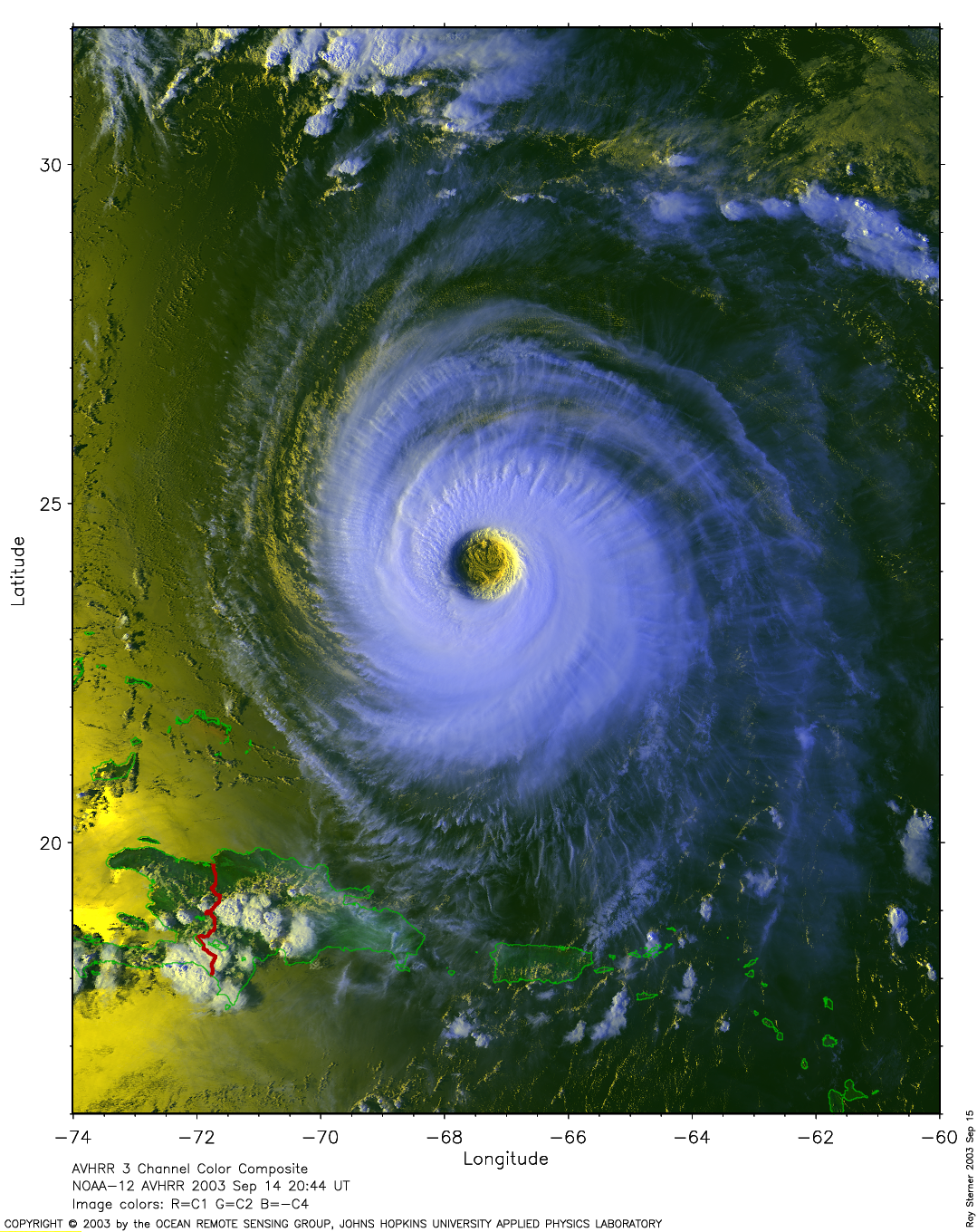
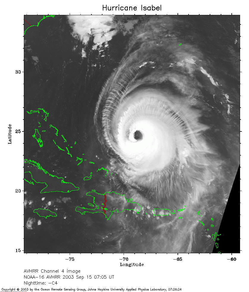 2003 September 15 07:05 UT
NOAA-16 satellite AVHRR channel 4 early morning image.
A closer view (266 Kb) is seen by clicking on this small image.
The maximum sustained winds have decreased to 155 mph.
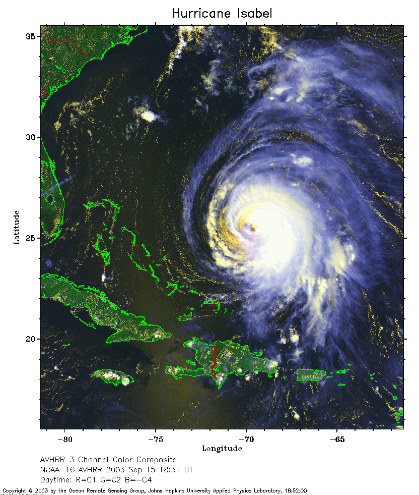 2003 September 15 18:31 UT
NOAA-16 satellite AVHRR 3 channel color composite afternoon image.
A closer view (335 Kb) is seen by clicking on this small image.
The maximum sustained winds have decreased to 140 mph.
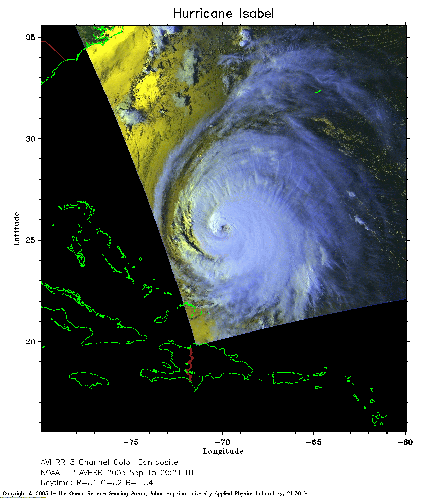 2003 September 15 20:21 UT
NOAA-12 satellite AVHRR 3 channel color composite afternoon image.
A closer view (210 Kb) is seen by clicking on this small image.
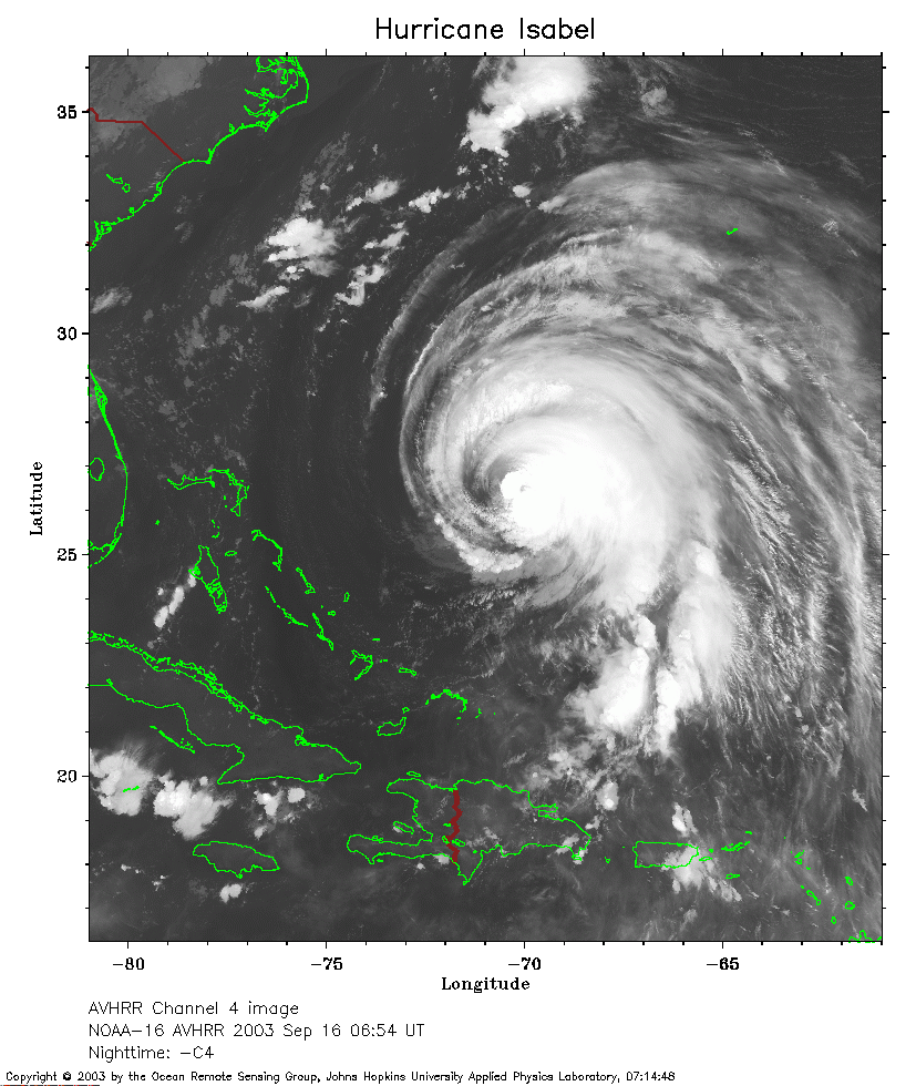 2003 September 16 06:54 UT
NOAA-16 satellite AVHRR channel 4 early morning image.
A closer view (283 Kb) is seen by clicking on this small image.
The maximum sustained winds have decreased to 120 mph.
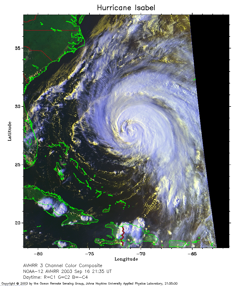 2003 September 16 21:35 UT
NOAA-12 satellite AVHRR 3 channel color composite evening image.
A closer view (329 Kb) is seen by clicking on this small image.
The maximum sustained winds have decreased to 105 mph.
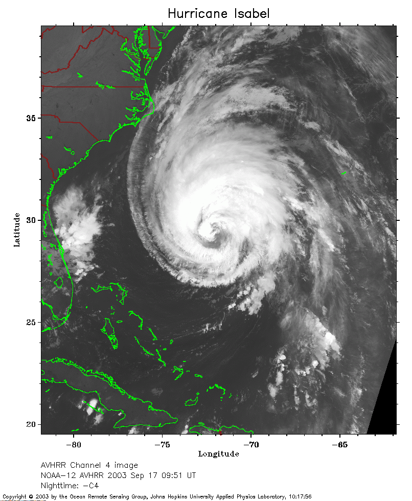 2003 September 17 09:51 UT
NOAA-12 satellite AVHRR channel 4 early morning image.
A closer view (267 Kb) is seen by clicking on this small image.
The maximum sustained winds have increased to 110 mph.
 2003 September 17 18:09 UT
NOAA-16 satellite AVHRR 3 channel color composite afternoon image.
A closer view (336 Kb) is seen by clicking on this small image.
The maximum sustained winds have decreased to 105 mph.
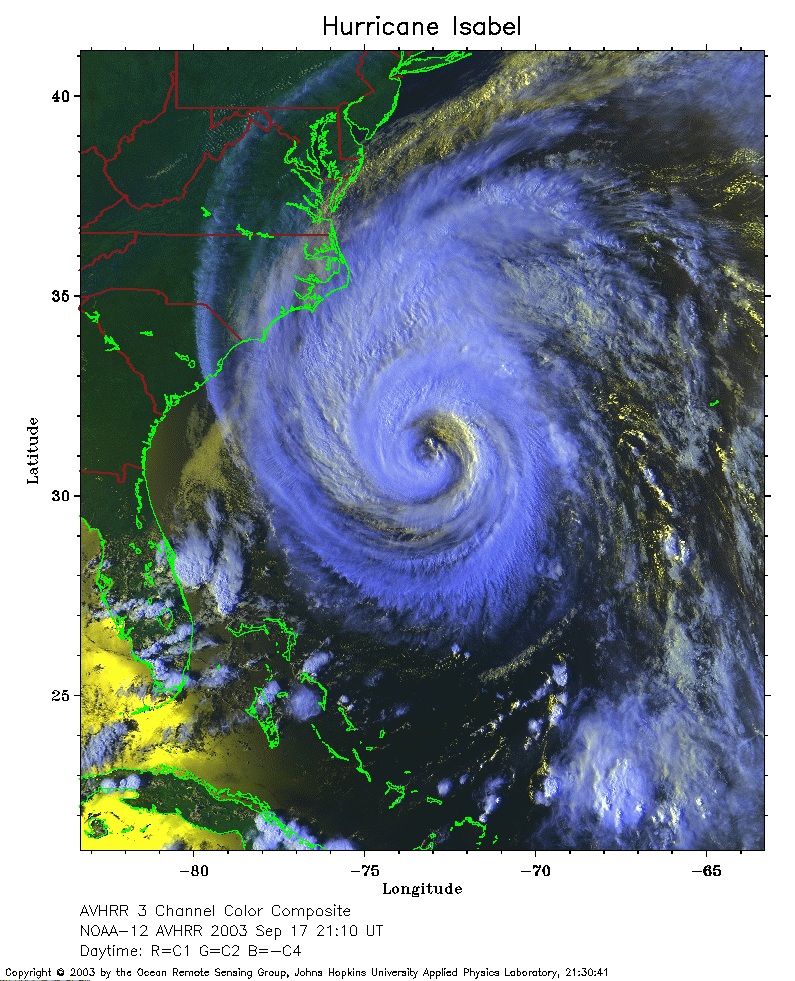 2003 September 17 21:10 UT
NOAA-16 satellite AVHRR 3 channel color composite evening image.
A closer view (344 Kb) is seen by clicking on this small image.
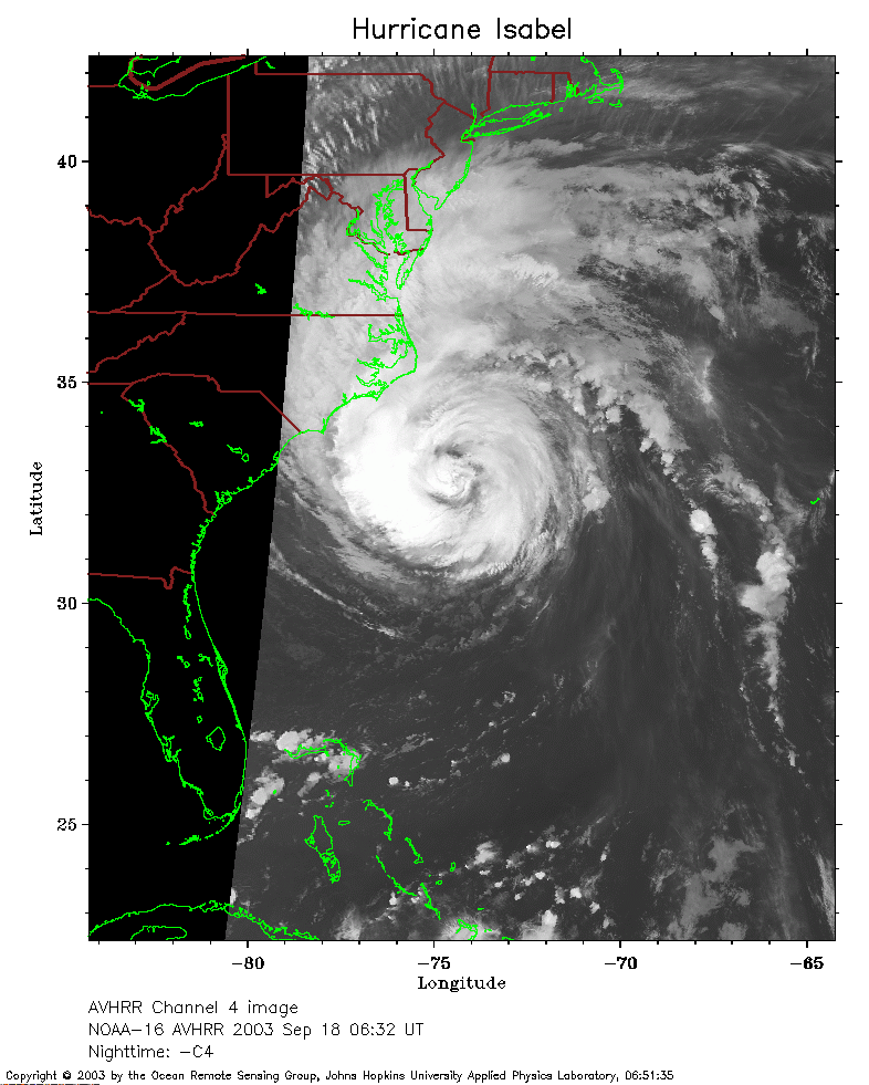 2003 September 18 06:32 UT
NOAA-16 satellite AVHRR channel 4 early morning image.
A closer view (209 Kb) is seen by clicking on this small image.
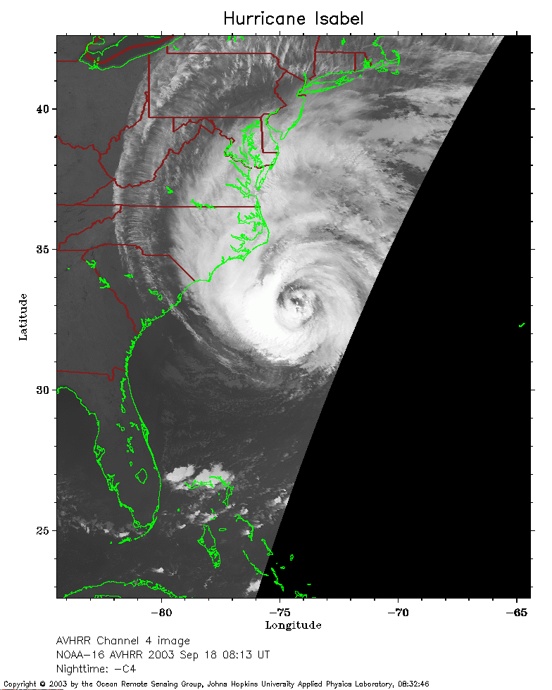 2003 September 18 08:13 UT
NOAA-16 satellite AVHRR channel 4 early morning image.
A closer view (176 Kb) is seen by clicking on this small image.
 2003 September 18 09:27 UT
NOAA-12 satellite AVHRR channel 4 early morning image.
A closer view (240 Kb) is seen by clicking on this small image.