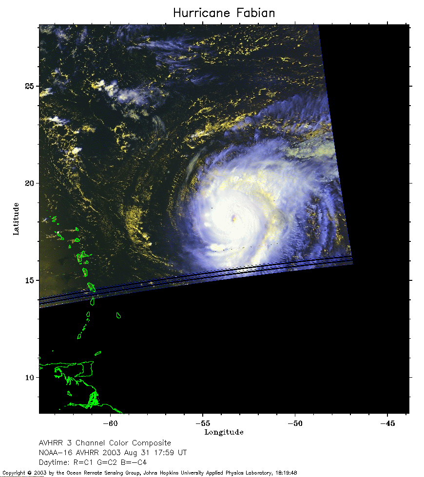
 2003 August 31 17:59 UT
NOAA-16 satellite AVHRR 3 channel color composite afternoon image.
A closer view (195 Kb) is seen by clicking on this small image.
The maximum sustained winds are 125 mph.
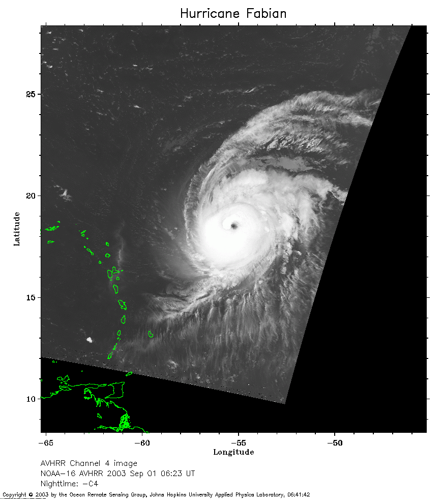 2003 September 1 06:23 UT
NOAA-16 satellite AVHRR channel 4 early morning image.
A closer view (193 Kb) is seen by clicking on this small image.
The maximum sustained winds have increased to 140 mph.
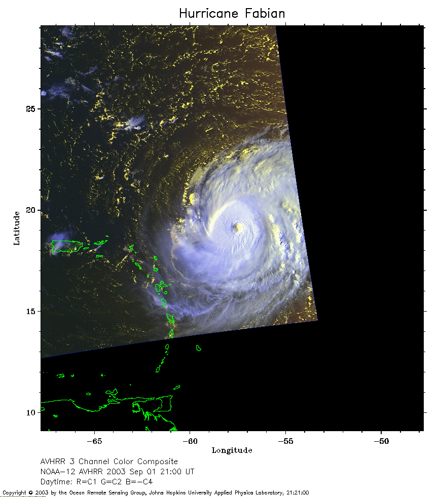 2003 September 1 21:00 UT
NOAA-12 satellite AVHRR 3 channel color composite afternoon image.
A closer view (196 Kb) is seen by clicking on this small image.
The maximum sustained winds have increased to 145 mph.
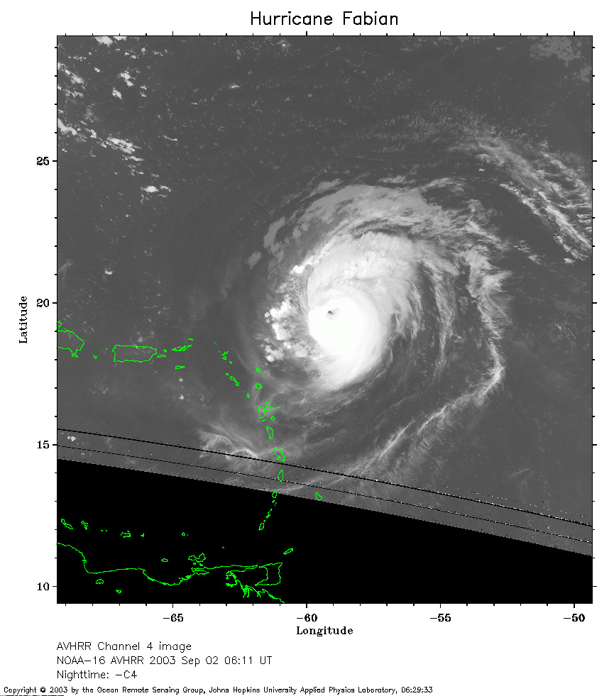 2003 September 2 06:11 UT
NOAA-16 satellite AVHRR channel 4 early morning image.
A closer view (209 Kb) is seen by clicking on this small image.
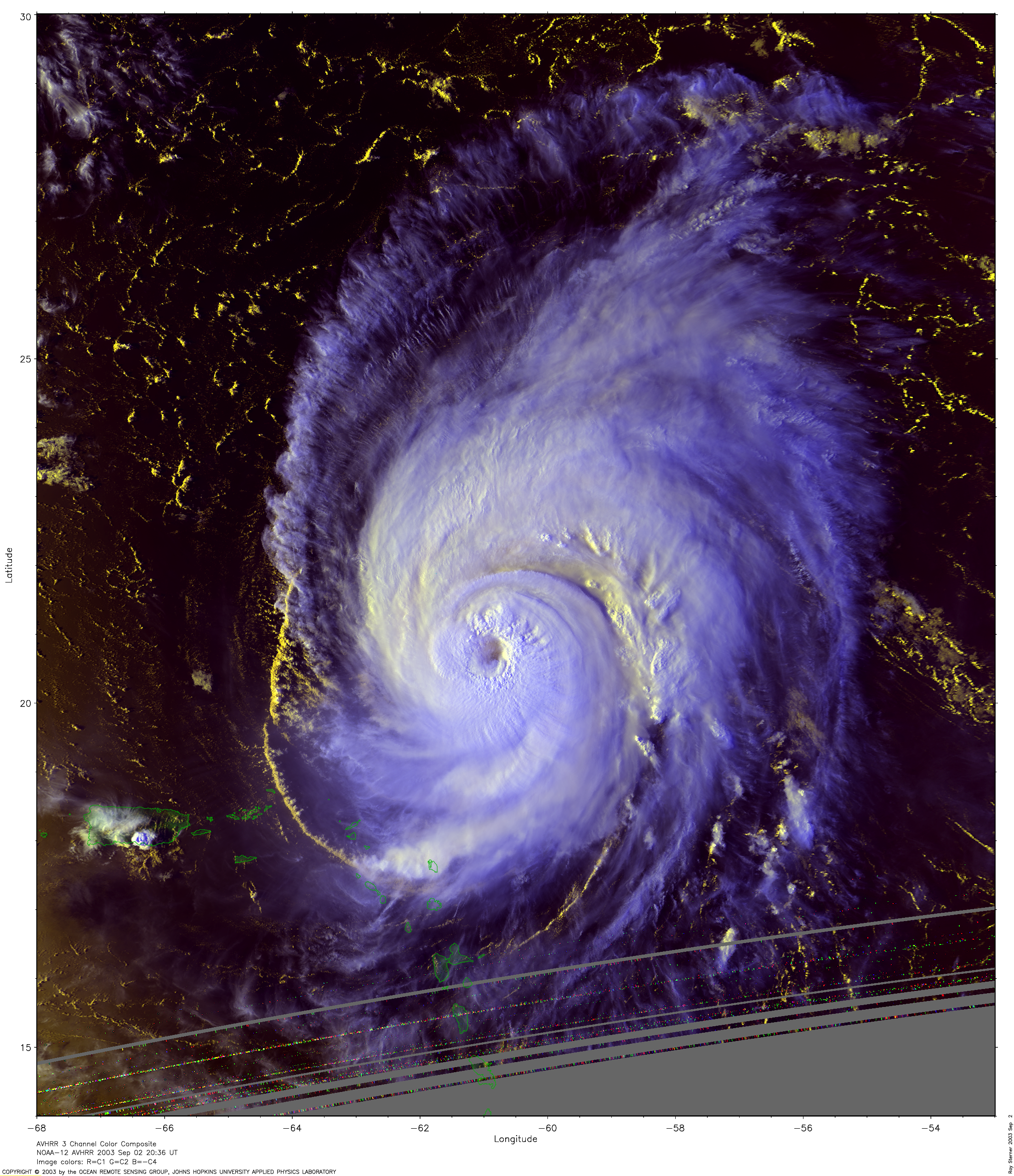
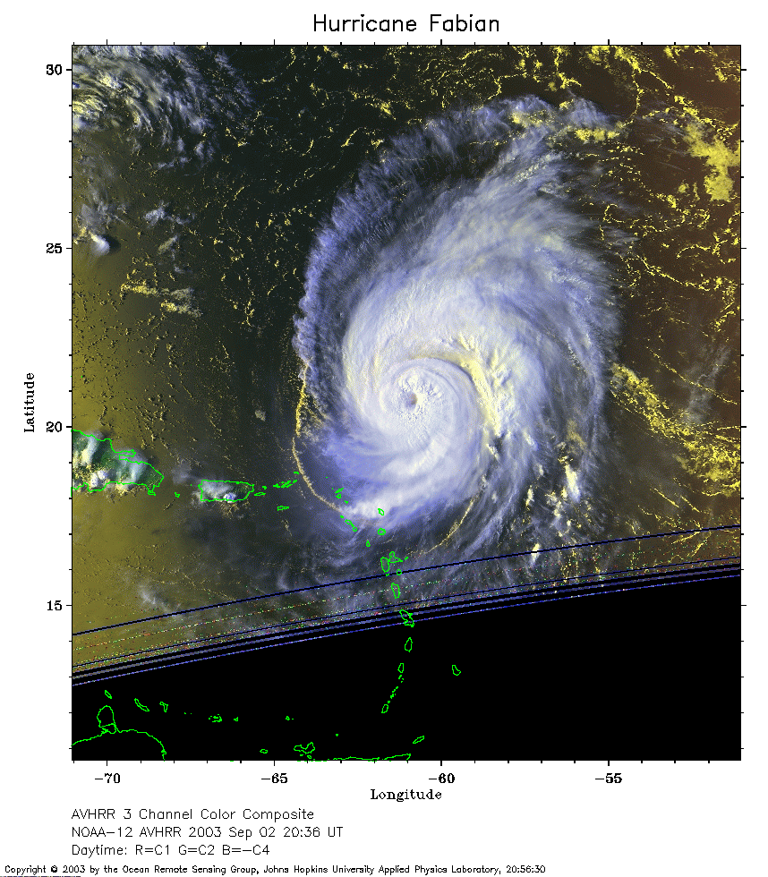 2003 September 2 20:36 UT
NOAA-12 satellite AVHRR 3 channel color composite afternoon image.
A closer view (287 Kb) is seen by clicking on this small image.
The maximum sustained winds have decreased to 140 mph.
For a very large image
(5950 Kb) made by Ray Sterner, click here
 2003 September 3 08:53 UT
NOAA-12 satellite AVHRR channel 4 early morning image.
A closer view (256 Kb) is seen by clicking on this small image.
The maximum sustained winds have decreased to 135 mph.
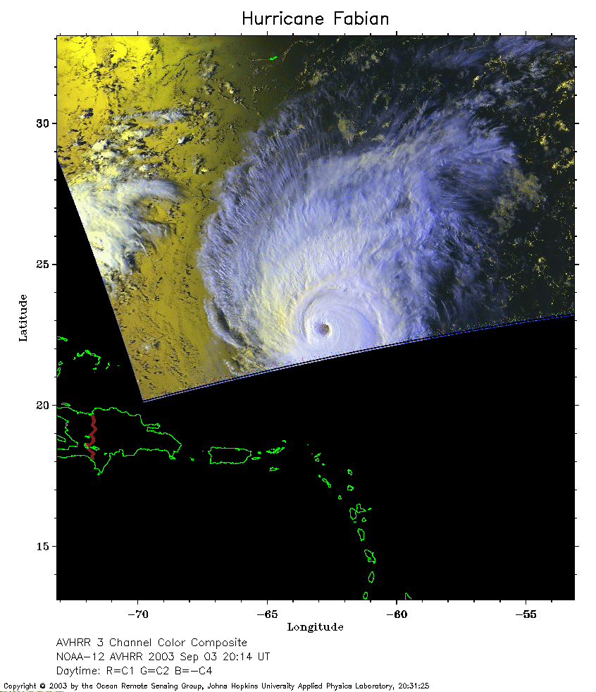 2003 September 3 20:14 UT
NOAA-12 satellite AVHRR 3 channel color composite afternoon image.
A closer view (216 Kb) is seen by clicking on this small image.
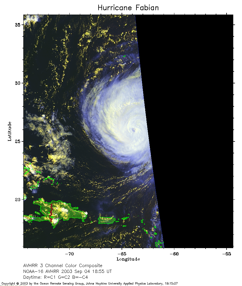 2003 September 4 18:55 UT
NOAA-16 satellite AVHRR 3 channel color composite afternoon image.
A closer view (199 Kb) is seen by clicking on this small image.
The maximum sustained winds have decreased to 120 mph.
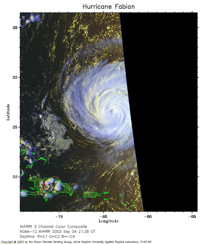 2003 September 4 21:28 UT
NOAA-12 satellite AVHRR 3 channel color composite evening image.
A closer view (233 Kb) is seen by clicking on this small image.
 2003 September 5 07:18 UT
NOAA-16 satellite AVHRR channel 4 early morning image.
A closer view (203 Kb) is seen by clicking on this small image.
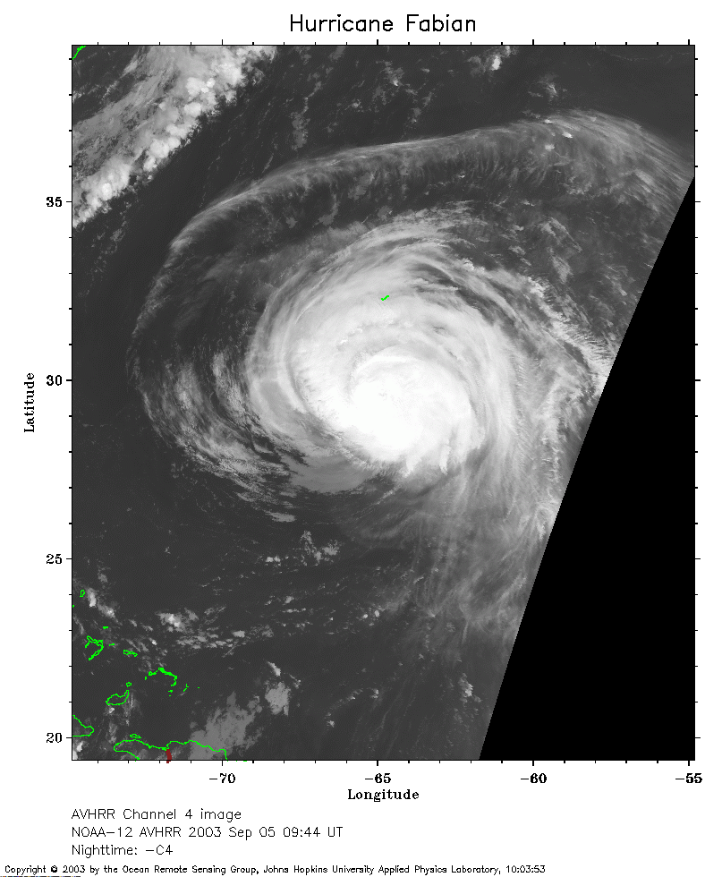 2003 September 5 09:44 UT
NOAA-12 satellite AVHRR channel 4 early morning image.
A closer view (223 Kb) is seen by clicking on this small image.
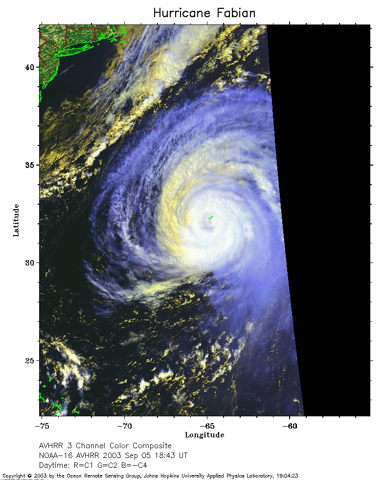 2003 September 5 18:43 UT
NOAA-16 satellite AVHRR 3 channel color composite afternoon image.
A closer view (258 Kb) is seen by clicking on this small image.
Notice the island of Bermuda in the northern eyewall of Fabian.
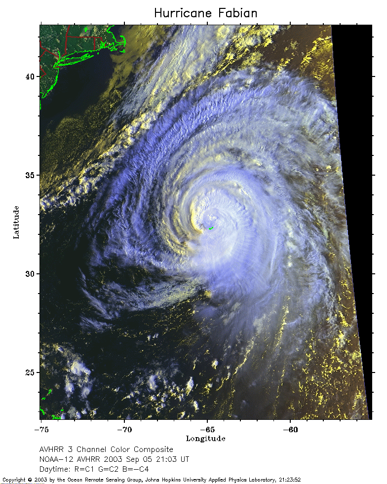 2003 September 5 21:03 UT
NOAA-12 satellite AVHRR 3 channel color composite evening image.
A closer view (341 Kb) is seen by clicking on this small image.
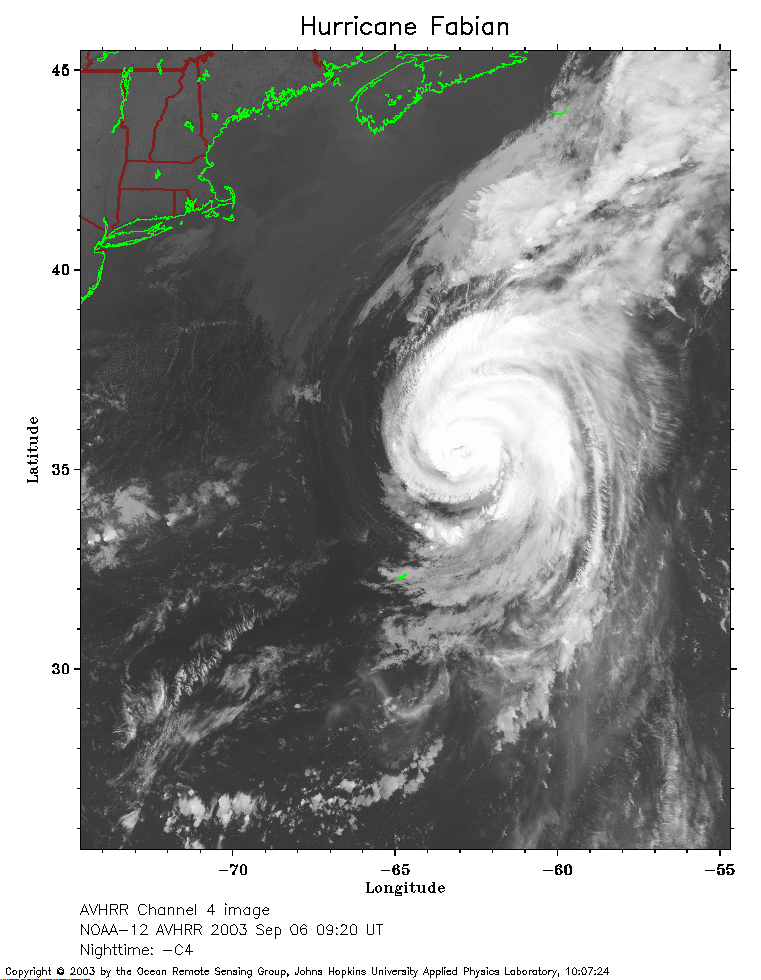 2003 September 6 09:20 UT
NOAA-12 satellite AVHRR channel 4 morning image.
A closer view (253 Kb) is seen by clicking on this small image.
The maximum sustained winds have decreased to 115 mph.
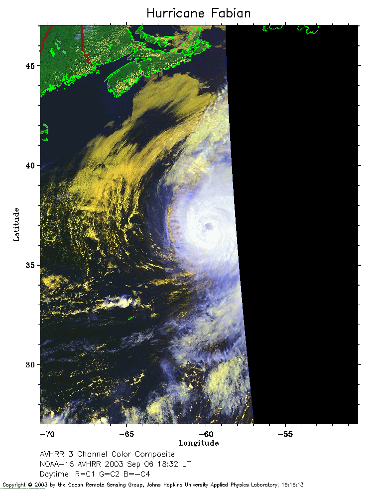 2003 September 6 18:32 UT
NOAA-16 satellite AVHRR 3 channel color composite afternoon image.
A closer view (199 Kb) is seen by clicking on this small image.
The maximum sustained winds have decreased to 110 mph.
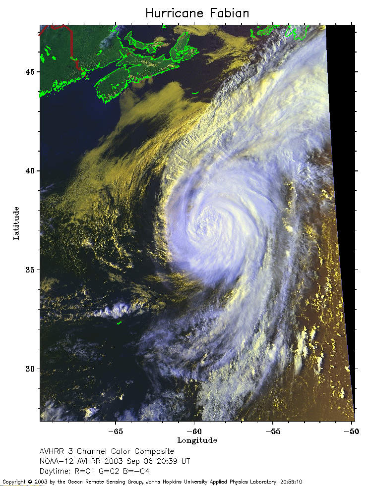 2003 September 6 20:39 UT
NOAA-12 satellite AVHRR 3 channel color composite afternoon image.
A closer view (318 Kb) is seen by clicking on this small image.
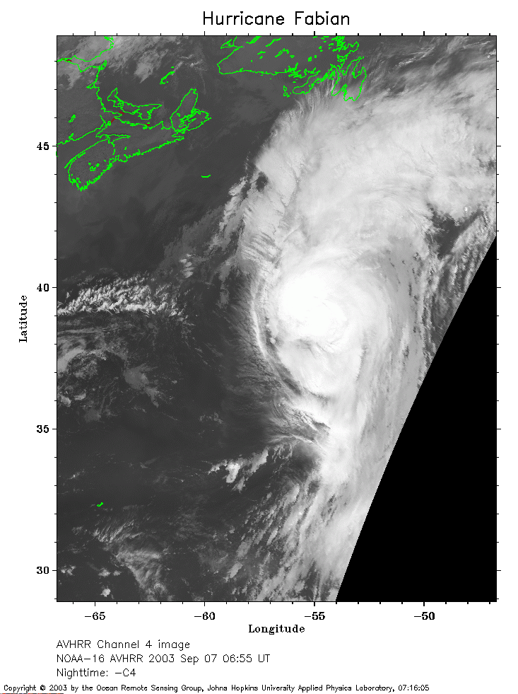 2003 September 7 06:55 UT
NOAA-16 satellite AVHRR channel 4 early morning image.
A closer view (214 Kb) is seen by clicking on this small image.
The maximum sustained winds have decreased to 105 mph.
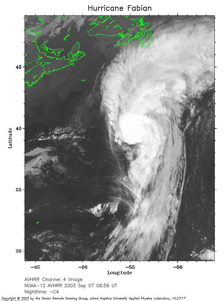 2003 September 7 08:56 UT
NOAA-12 satellite AVHRR channel 4 early morning image.
A closer view (240 Kb) is seen by clicking on this small image.
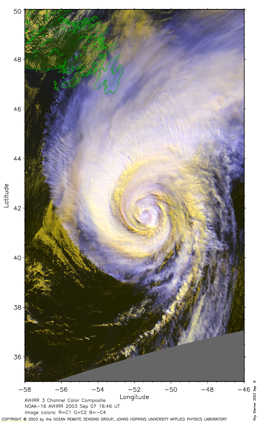
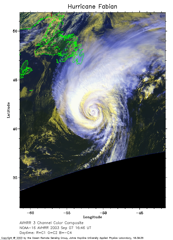 2003 September 7 16:46 UT
NOAA-16 satellite AVHRR 3 channel color composite afternoon image.
A closer view (253 Kb) is seen by clicking on this small image.
The maximum sustained winds have decreased to 90 mph.
For a larger image
(1426 Kb) made by Ray Sterner, click here
For a very large image
(4419 Kb) made by Ray Sterner, click here
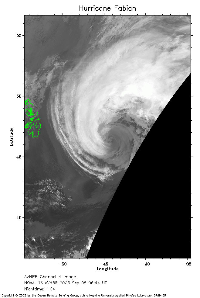 2003 September 8 06:44 UT
NOAA-16 satellite AVHRR channel 4 early morning image.
A closer view (158 Kb) is seen by clicking on this small image.
The maximum sustained winds have decreased to 80 mph.