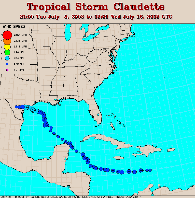
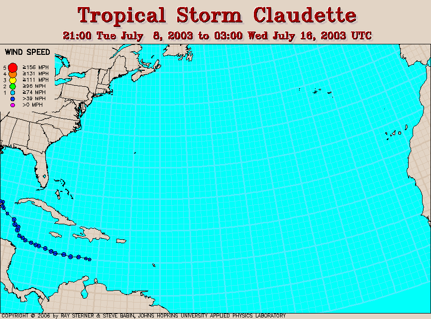
Track maps
Claudette developed in the central Caribbean Sea.
 Claudette
track overlaid on SST image (322 Kb). This image represents the
average composite sea surface temperature (SST) derived from NOAA
satellite AVHRR data over the 7 days ending 10 July 2003. The averaging
is done to remove clouds. The temperature scale for SST is 27C to 32C.
Claudette
track overlaid on SST image (322 Kb). This image represents the
average composite sea surface temperature (SST) derived from NOAA
satellite AVHRR data over the 7 days ending 10 July 2003. The averaging
is done to remove clouds. The temperature scale for SST is 27C to 32C.
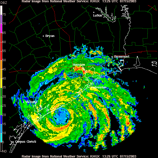
Houston NWS radar 15 July
1241 UT (52 Kb).
Houston NWS radar 15 July
1326 UT (52 Kb).
Houston NWS radar 15 July
1416 UT (52 Kb).
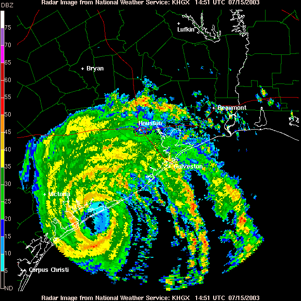
Houston NWS radar 15 July
1451 UT (52 Kb).
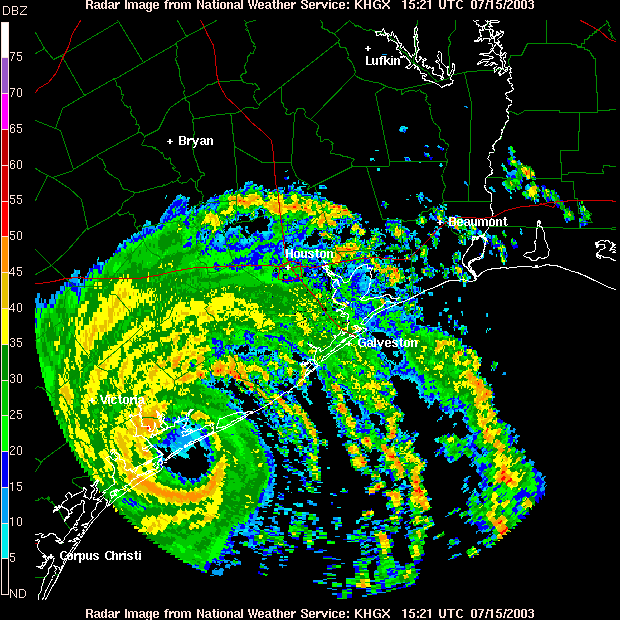
Houston NWS radar 15 July
1521 UT (54 Kb).
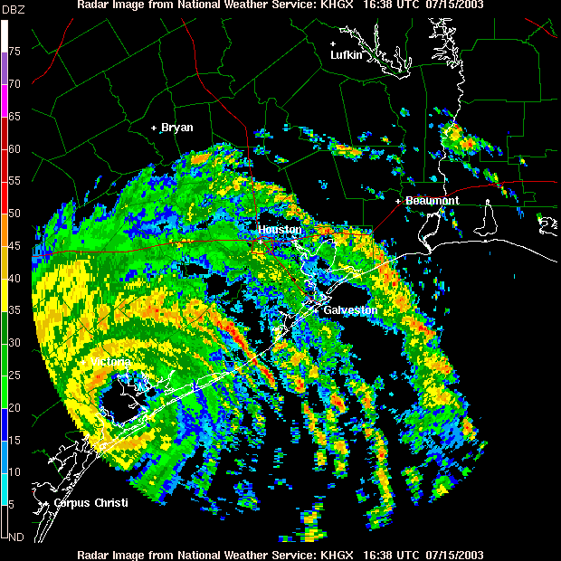
Houston NWS radar 15 July
1638 UT (55 Kb).
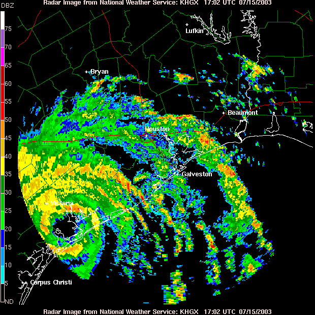
Houston NWS radar 15 July
1702 UT (56 Kb).
Houston NWS radar 15 July
1717 UT (56 Kb).
Houston NWS radar 15 July
1912 UT (47 Kb).
Track file
Track data (lat/lon, winds, etc.) in a text file.
GALLERY OF NOAA SATELLITE AVHRR IMAGES OF HURRICANE CLAUDETTE