 2003 July 8 21:41 UT
NOAA-12 satellite AVHRR 3 channel color composite evening image.
A closer view (939 Kb) is seen by clicking on this small image.
This image was made by Ray Sterner.
The maximum sustained winds are 50 mph.
 2003 July 10 07:56 UT
NOAA-16 satellite AVHRR channel 4 early morning image.
A closer view (189 Kb) is seen by clicking on this small image.
The maximum sustained winds are now 60 mph.
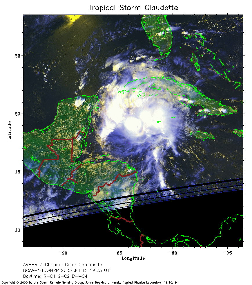 2003 July 10 19:23 UT
NOAA-16 satellite AVHRR 3 channel color composite afternoon image.
A closer view (295 Kb) is seen by clicking on this small image.
The maximum sustained winds are now 70 mph.
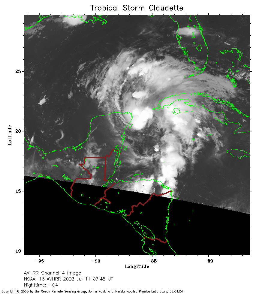 2003 July 11 07:45 UT
NOAA-16 satellite AVHRR channel 4 early morning image.
A closer view (220 Kb) is seen by clicking on this small image.
The maximum sustained winds have decreased to 55 mph.
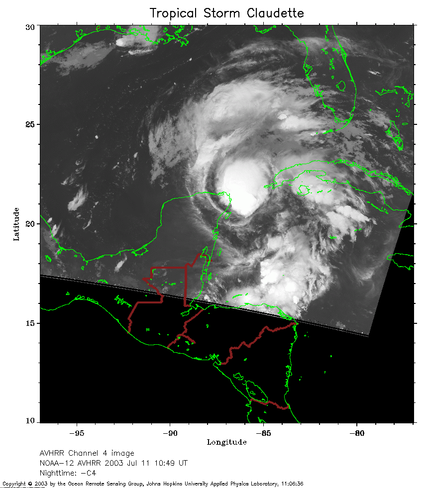 2003 July 11 10:49 UT
NOAA-12 satellite AVHRR channel 4 early morning image.
A closer view (205 Kb) is seen by clicking on this small image.
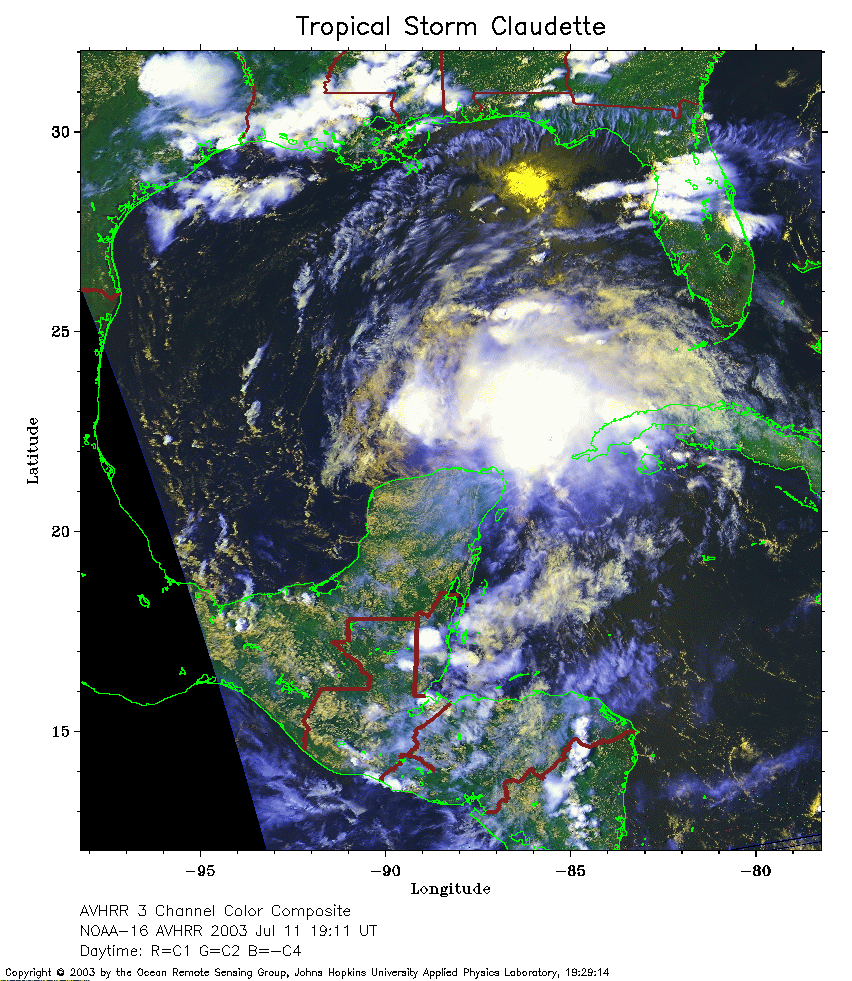 2003 July 11 19:11 UT
NOAA-16 satellite AVHRR 3 channel color composite afternoon image.
A closer view (365 Kb) is seen by clicking on this small image.
The maximum sustained winds have decreased to 50 mph.
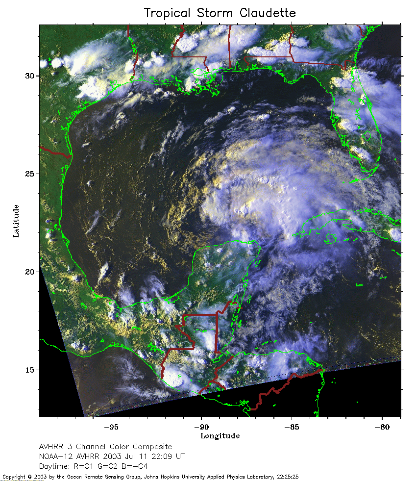 2003 July 11 22:09 UT
NOAA-12 satellite AVHRR 3 channel color composite evening image.
A closer view (367 Kb) is seen by clicking on this small image.
 2003 July 12 07:34 UT
NOAA-16 satellite AVHRR channel 4 early morning image.
A closer view (216 Kb) is seen by clicking on this small image.
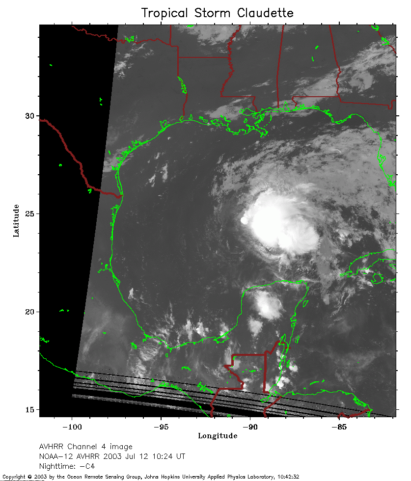 2003 July 12 10:24 UT
NOAA-12 satellite AVHRR channel 4 morning image.
A closer view (214 Kb) is seen by clicking on this small image.
 2003 July 12 19:00 UT
NOAA-16 satellite AVHRR 3 channel color composite afternoon image.
A closer view (230 Kb) is seen by clicking on this small image.
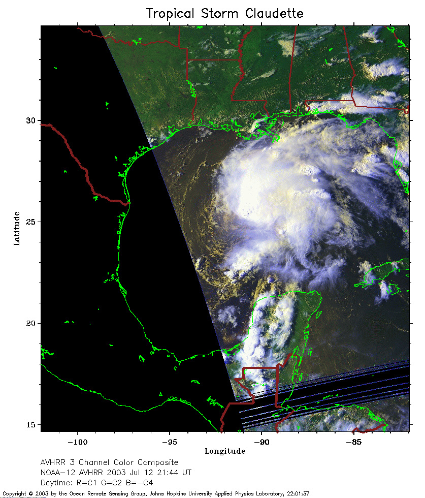 2003 July 12 21:44 UT
NOAA-12 satellite AVHRR 3 channel color composite evening image.
A closer view (235 Kb) is seen by clicking on this small image.
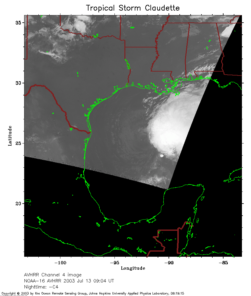 2003 July 13 09:04 UT
NOAA-16 satellite AVHRR channel 4 early morning image.
A closer view (132 Kb) is seen by clicking on this small image.
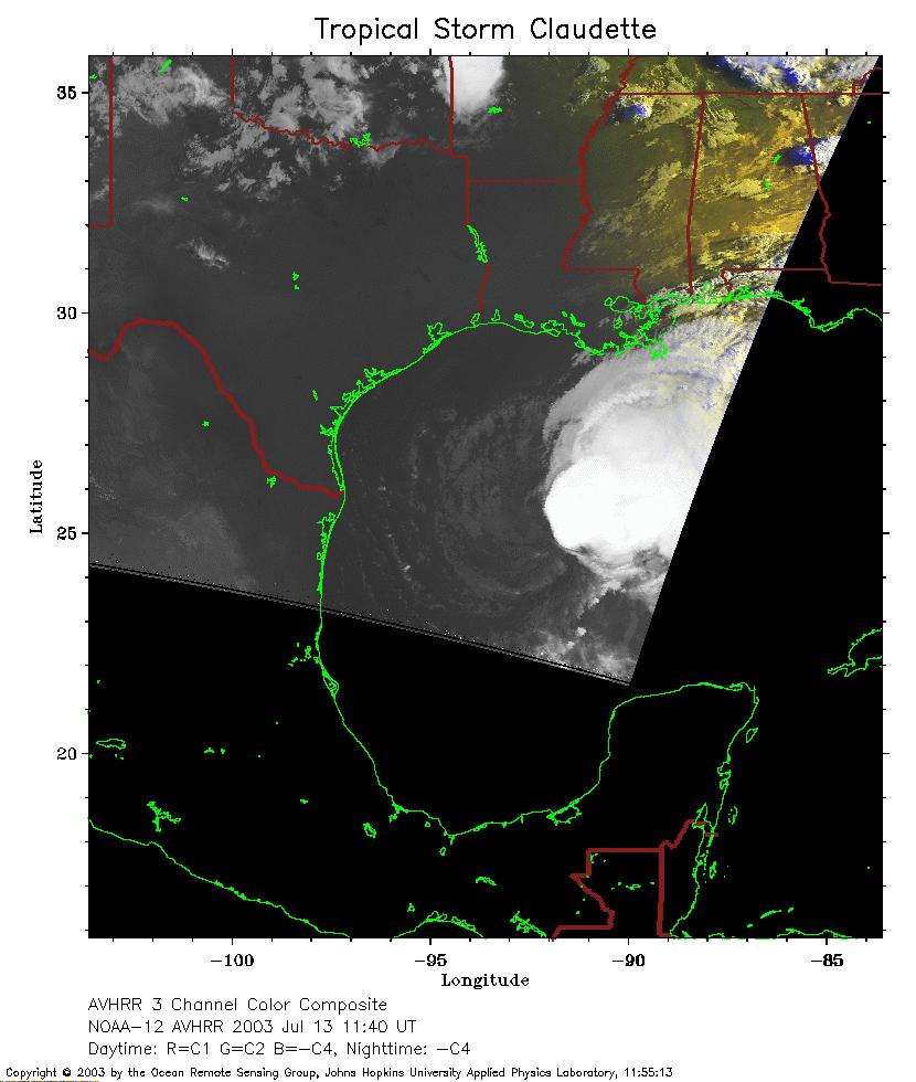 2003 July 13 11:40 UT
NOAA-12 satellite AVHRR channel 4 morning image.
A closer view (145 Kb) is seen by clicking on this small image.
 2003 July 13 18:49 UT
NOAA-16 satellite AVHRR 3 channel color composite afternoon image.
A closer view (208 Kb) is seen by clicking on this small image.
The maximum sustained winds have increased to 60 mph.
 2003 July 13 20:33 UT
NOAA-16 satellite AVHRR 3 channel color composite afternoon image.
A closer view (200 Kb) is seen by clicking on this small image.
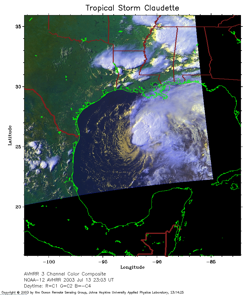 2003 July 13 23:03 UT
NOAA-12 satellite AVHRR 3 channel color composite evening image.
A closer view (230 Kb) is seen by clicking on this small image.
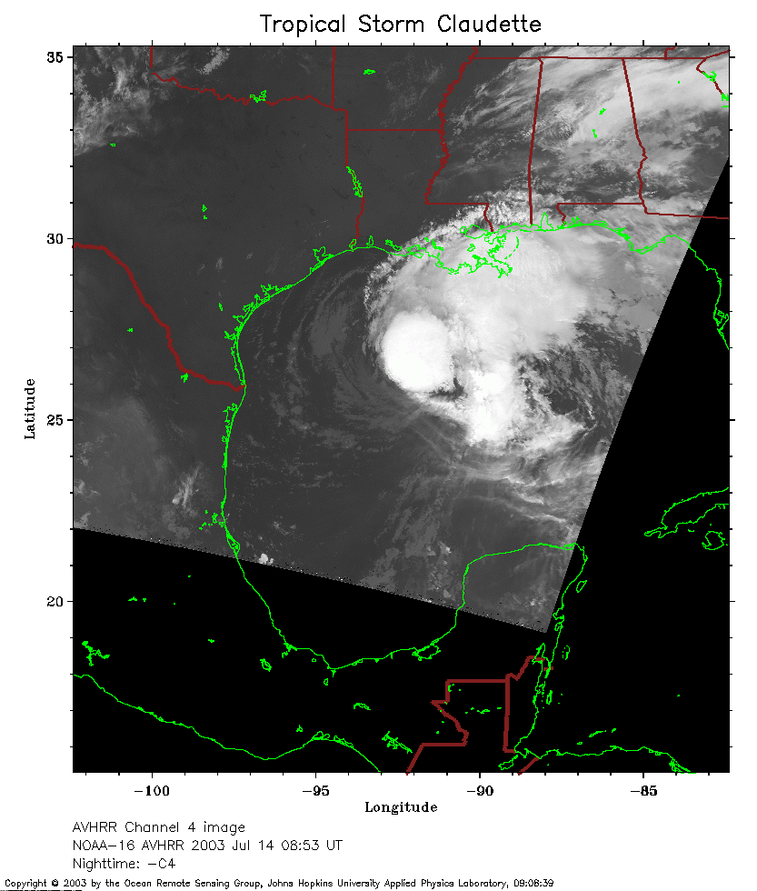 2003 July 14 08:53 UT
NOAA-16 satellite AVHRR channel 4 early morning image.
A closer view (183 Kb) is seen by clicking on this small image.
The maximum sustained winds have increased to 65 mph.
 2003 July 14 11:16 UT
NOAA-12 satellite AVHRR channel 4 morning image.
A closer view (196 Kb) is seen by clicking on this small image.
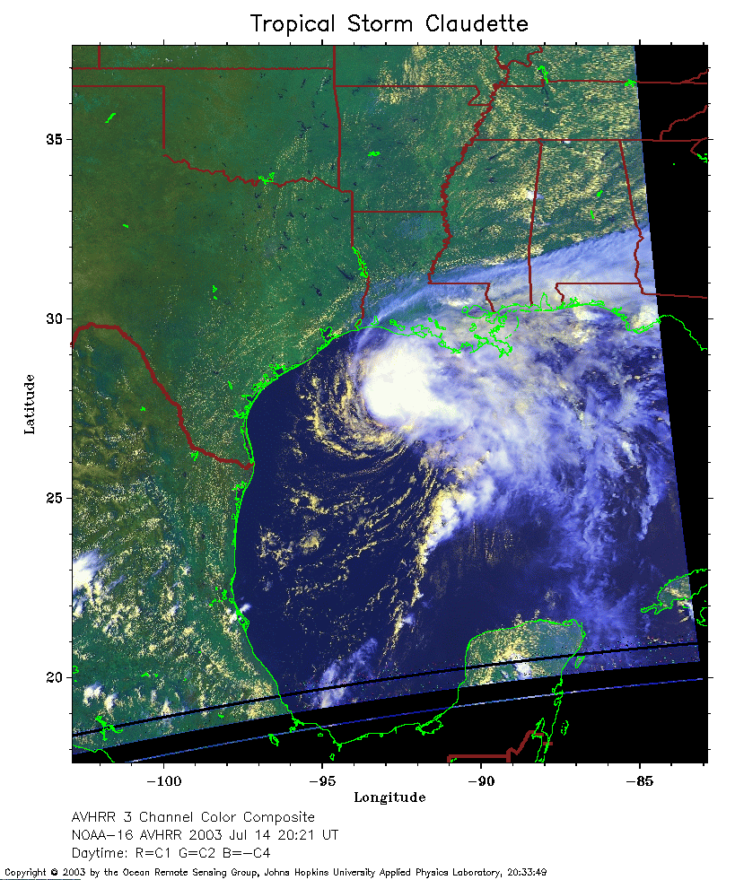 2003 July 14 20:21 UT
NOAA-16 satellite AVHRR 3 channel color composite afternoon image.
A closer view (308 Kb) is seen by clicking on this small image.
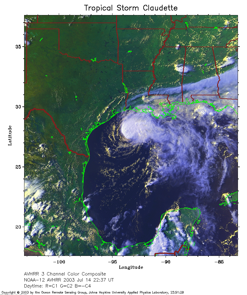 2003 July 14 22:37 UT
NOAA-12 satellite AVHRR 3 channel color composite evening image.
A closer view (351 Kb) is seen by clicking on this small image.
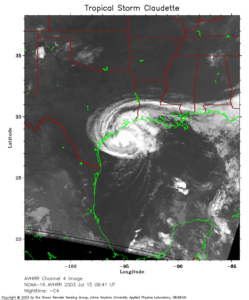 2003 July 15 08:41 UT
NOAA-16 satellite AVHRR channel 4 early morning image.
A closer view (244 Kb) is seen by clicking on this small image.
Claudette is now a hurricane with maximum sustained winds of 75 mph.
 2003 July 15 10:51 UT
NOAA-12 satellite AVHRR channel 4 morning image.
A closer view (243 Kb) is seen by clicking on this small image.
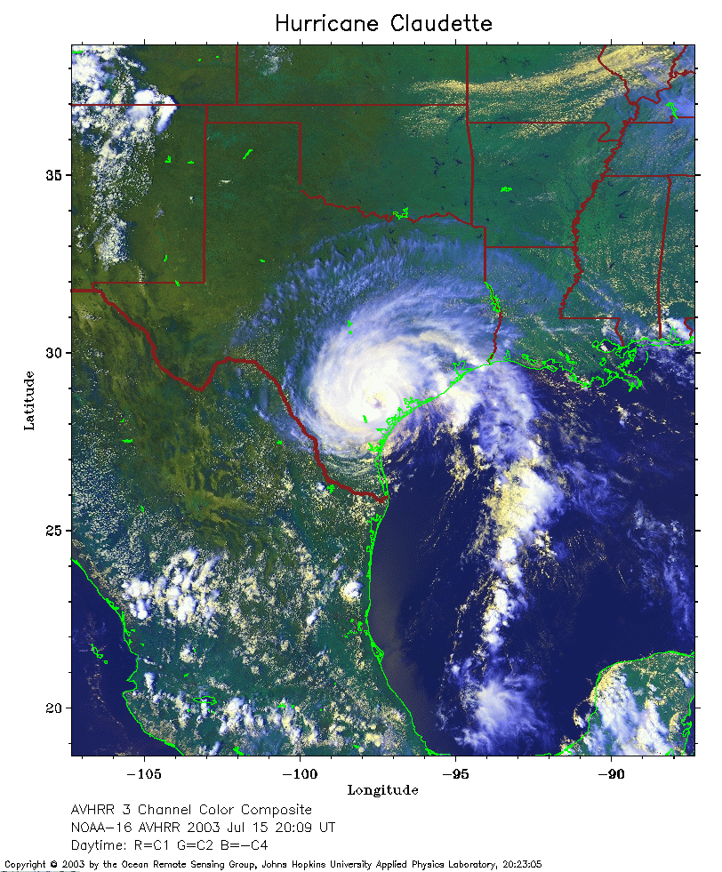 2003 July 15 20:09 UT
NOAA-16 satellite AVHRR 3 channel color composite afternoon image.
A closer view (373 Kb) is seen by clicking on this small image.
Claudette has moved onshore and the maximum sustained winds have
decreased from 80 mph at 1500-1700 UT to 75 mph at 1900 UT.
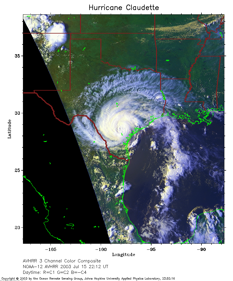 2003 July 15 22:12 UT
NOAA-12 satellite AVHRR 3 channel color composite evening image.
A closer view (292 Kb) is seen by clicking on this small image.
The maximum sustained winds have decreased to 70 mph.
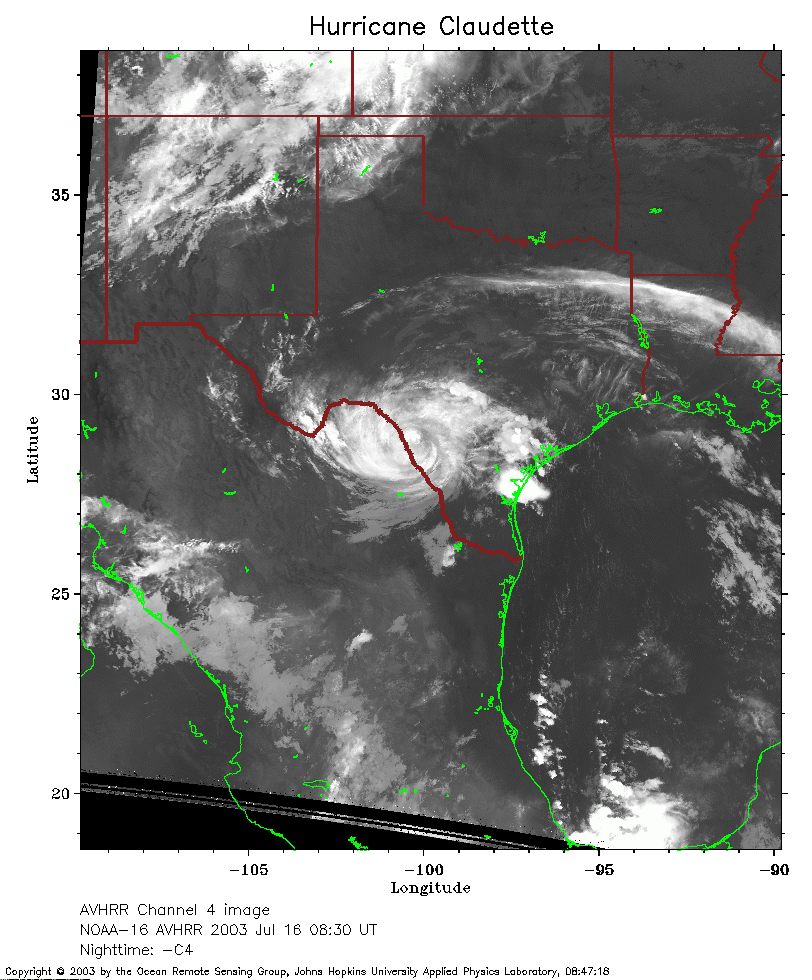 2003 July 16 08:30 UT
NOAA-16 satellite AVHRR channel 4 early morning image.
A closer view (267 Kb) is seen by clicking on this small image.
The maximum sustained winds have decreased to less than 50 mph.