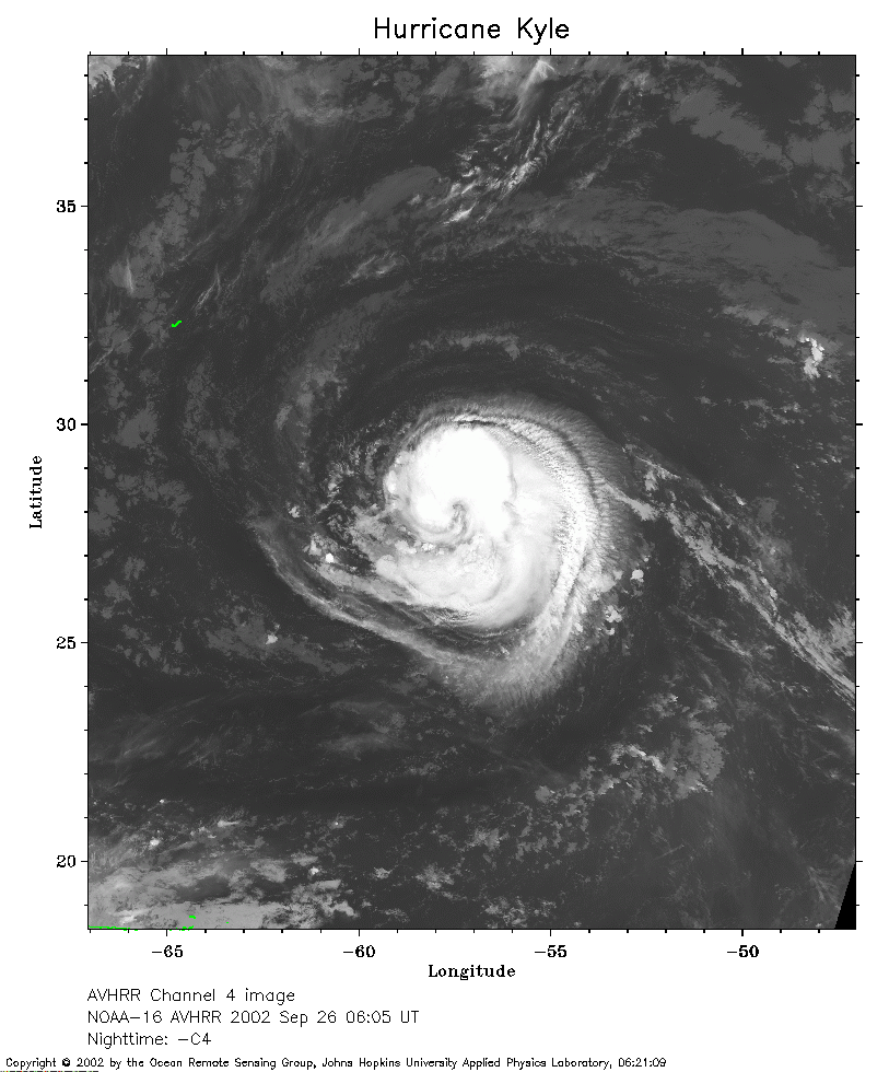
 2002 September 26 06:05 UT
NOAA-16 satellite AVHRR channel 4 early morning image.
A closer view (254 Kb) is seen by clicking on this small image.
The maximum sustained winds are 75 mph.
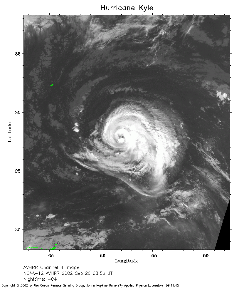 2002 September 26 08:56 UT
NOAA-12 satellite AVHRR channel 4 morning image.
A closer view (269 Kb) is seen by clicking on this small image.
The maximum sustained winds increased to 85 mph at 0900 UT.
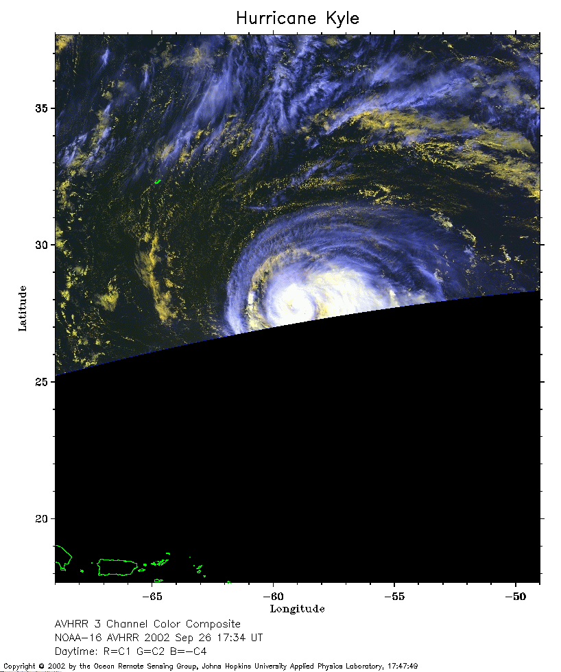 2002 September 26 17:34 UT
NOAA-16 satellite AVHRR 3 channel color composite afternoon image.
A closer view (199 Kb) is seen by clicking on this small image.
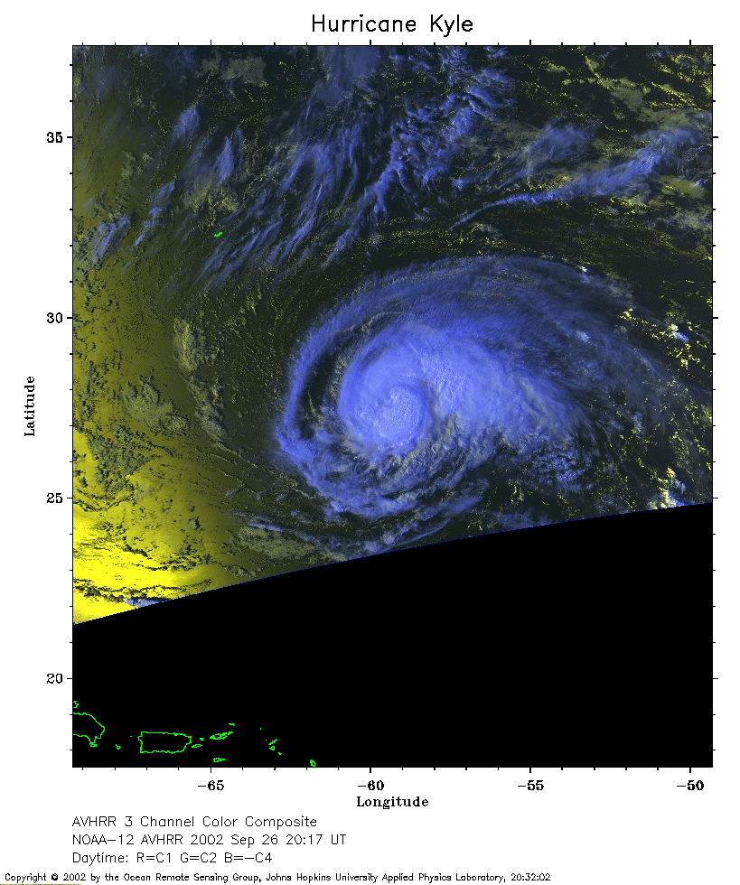 2002 September 26 20:17 UT
NOAA-12 satellite AVHRR 3 channel color composite afternoon image.
A closer view (264 Kb) is seen by clicking on this small image.
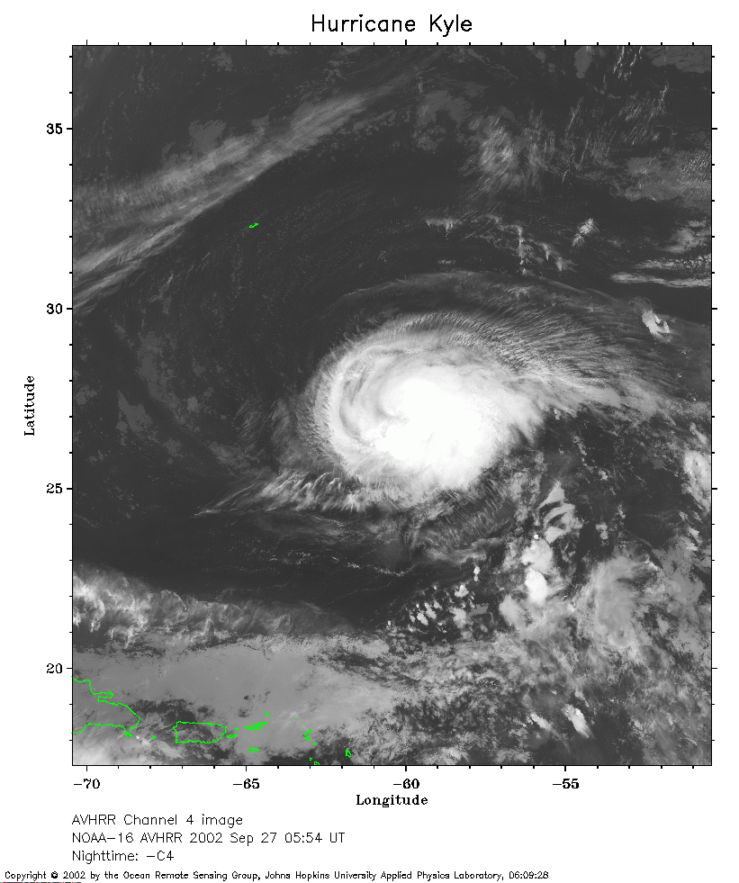 2002 September 27 05:54 UT
NOAA-16 satellite AVHRR channel 4 early morning image.
A closer view (145 Kb) is seen by clicking on this small image.
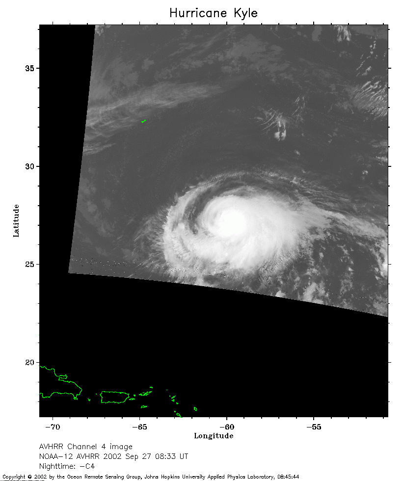 2002 September 27 08:33 UT
NOAA-12 satellite AVHRR channel 4 morning image.
A closer view (274 Kb) is seen by clicking on this small image.
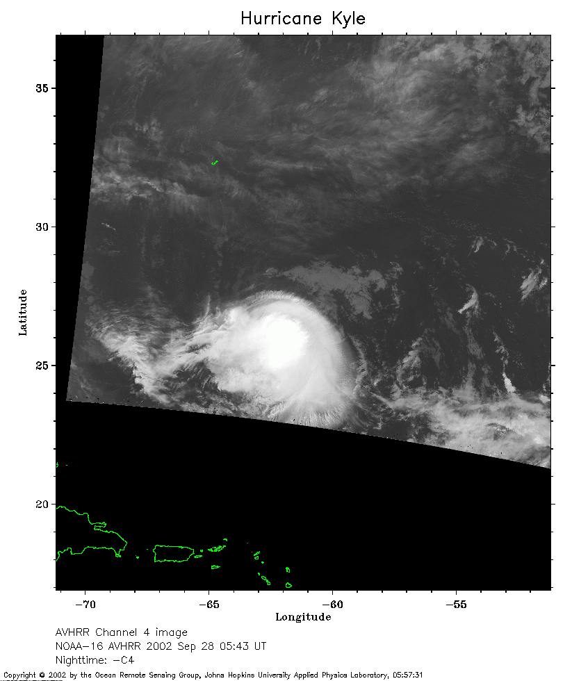 2002 September 28 05:43 UT
NOAA-16 satellite AVHRR channel 4 early morning image.
A closer view (171 Kb) is seen by clicking on this small image.
The maximum sustained winds have decreased to 80 mph.
 2002 September 28 09:47 UT
NOAA-12 satellite AVHRR channel 4 morning image.
A closer view (169 Kb) is seen by clicking on this small image.
The maximum sustained winds have decreased to 75 mph.
 2002 September 28 18:49 UT
NOAA-16 satellite AVHRR 3 channel color composite afternoon image.
A closer view (185 Kb) is seen by clicking on this small image.
The maximum sustained winds have decreased to 70 mph.
 2002 September 28 21:07 UT
NOAA-12 satellite AVHRR 3 channel color composite evening image.
A closer view (373 Kb) is seen by clicking on this small image.
The maximum sustained winds have decreased to 60 mph.
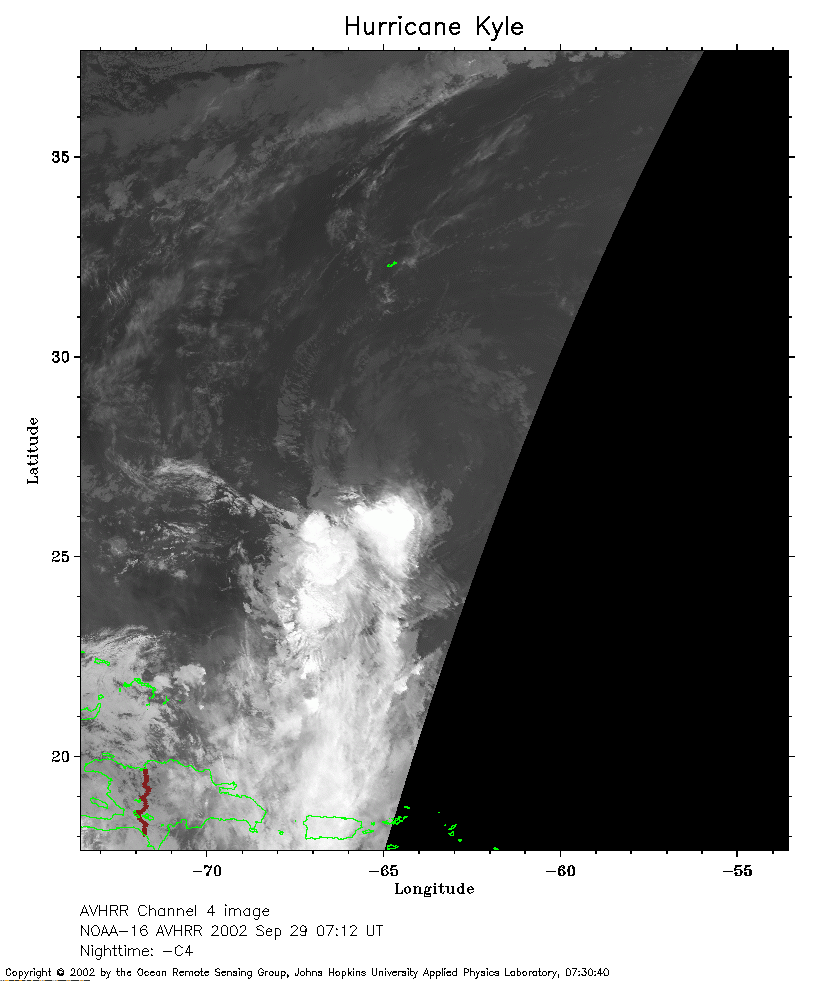 2002 September 29 07:12 UT
NOAA-16 satellite AVHRR channel 4 early morning image.
A closer view (175 Kb) is seen by clicking on this small image.
The maximum sustained winds have decreased to 50 mph.
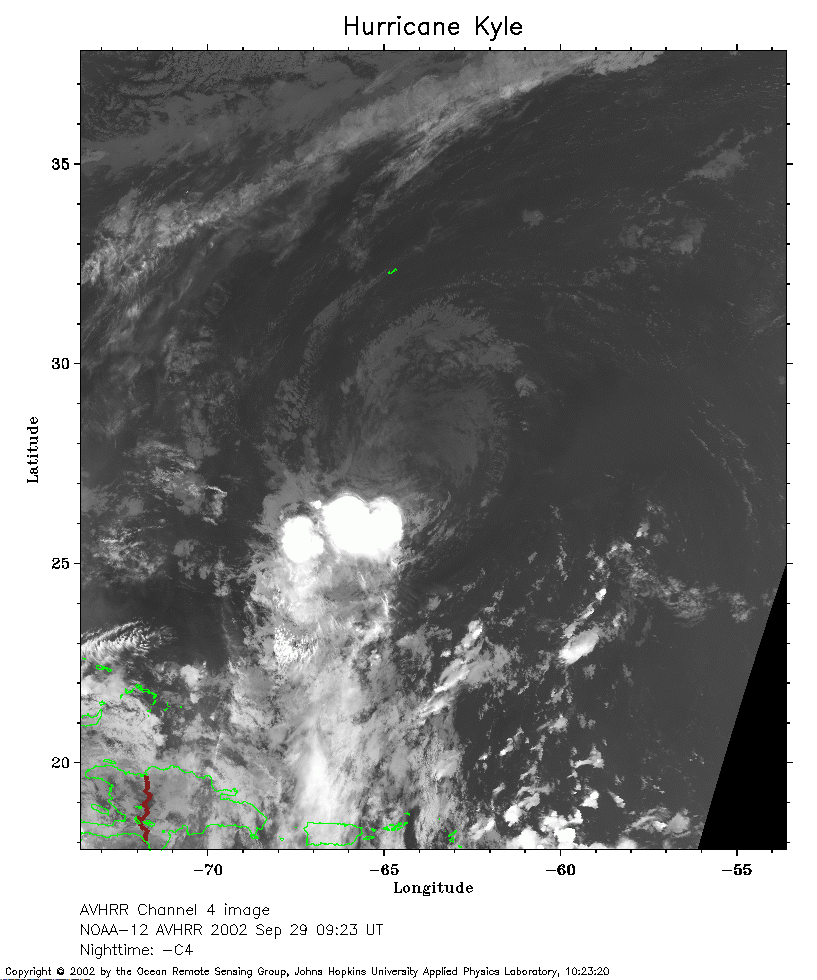 2002 September 29 09:23 UT
NOAA-12 satellite AVHRR channel 4 morning image.
A closer view (256 Kb) is seen by clicking on this small image.
The maximum sustained winds have decreased to 45 mph.
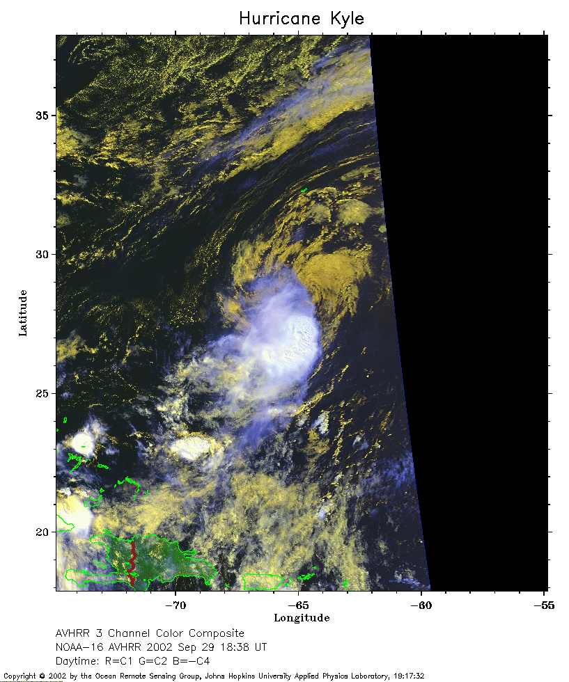 2002 September 29 18:38 UT
NOAA-16 satellite AVHRR 3 channel color composite afternoon image.
A closer view (275 Kb) is seen by clicking on this small image.
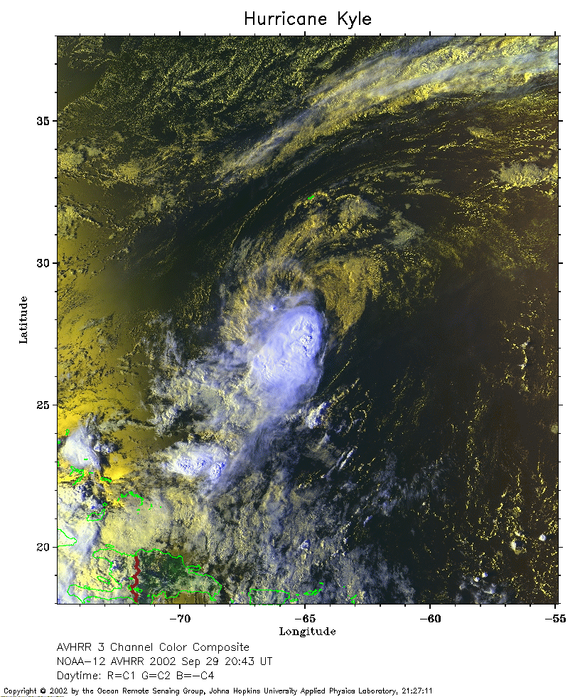 2002 September 29 20:43 UT
NOAA-12 satellite AVHRR 3 channel color composite evening image.
A closer view (388 Kb) is seen by clicking on this small image.
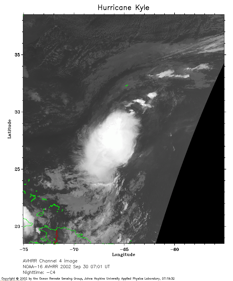 2002 September 30 07:01 UT
NOAA-16 satellite AVHRR channel 4 early morning image.
A closer view (220 Kb) is seen by clicking on this small image.
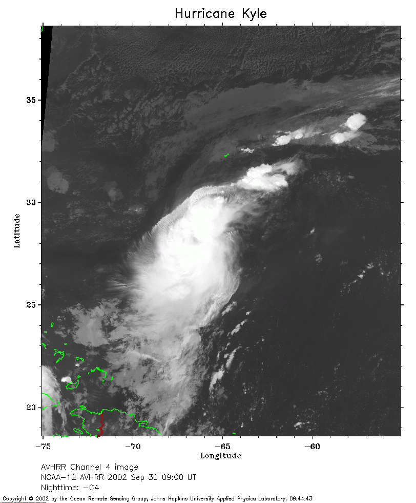 2002 September 30 09:00 UT
NOAA-12 satellite AVHRR channel 4 morning image.
A closer view (241 Kb) is seen by clicking on this small image.
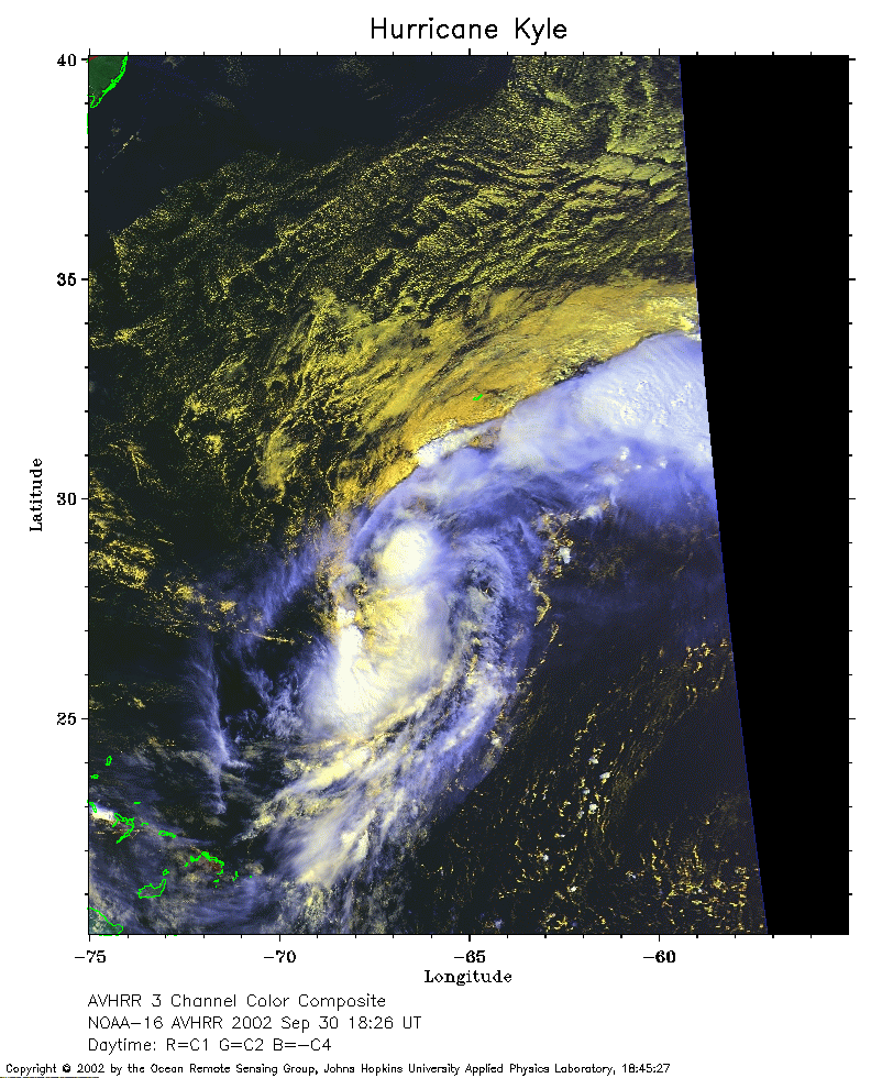 2002 September 30 18:26 UT
NOAA-16 satellite AVHRR 3 channel color composite afternoon image.
A closer view (285 Kb) is seen by clicking on this small image.
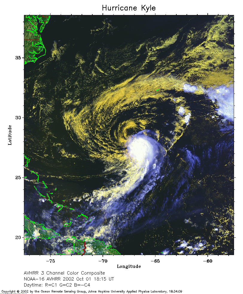 2002 October 1 18:15 UT
NOAA-16 satellite AVHRR 3 channel color composite afternoon image.
A closer view (330 Kb) is seen by clicking on this small image.
The maximum sustained winds have increased to 40 mph.
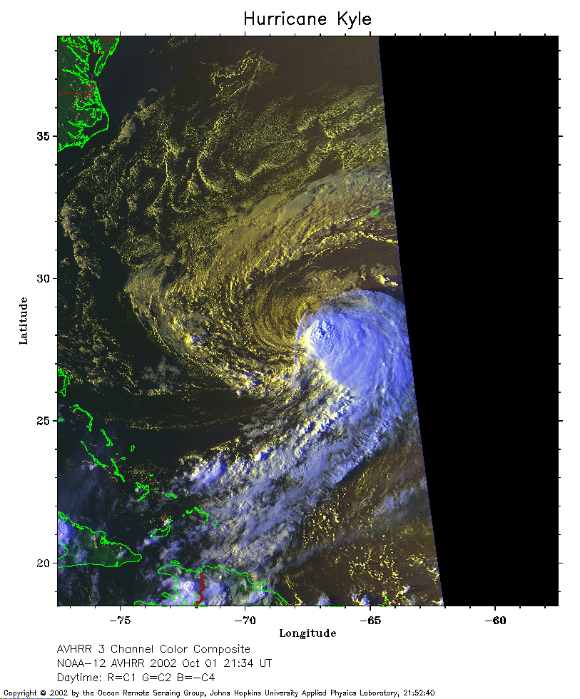 2002 October 1 21:34 UT
NOAA-12 satellite AVHRR 3 channel color composite evening image.
A closer view (263 Kb) is seen by clicking on this small image.
The maximum sustained winds have increased to 45 mph.
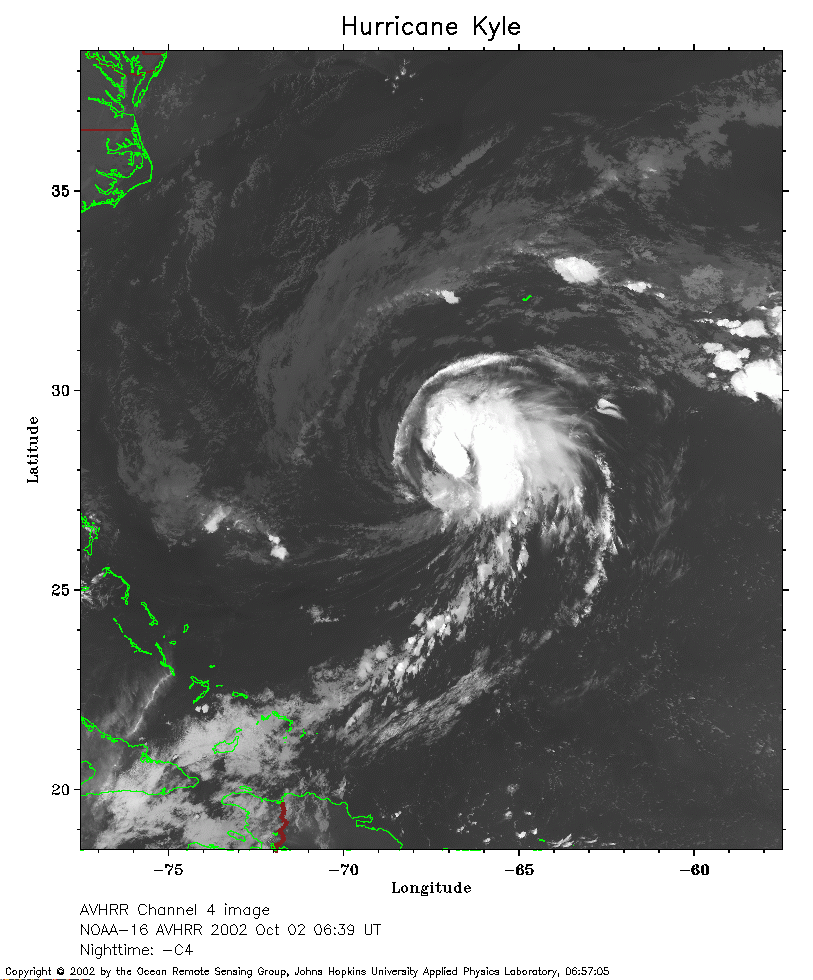 2002 October 2 06:39 UT
NOAA-16 satellite AVHRR channel 4 early morning image.
A closer view (249 Kb) is seen by clicking on this small image.
The maximum sustained winds have increased to 50 mph.
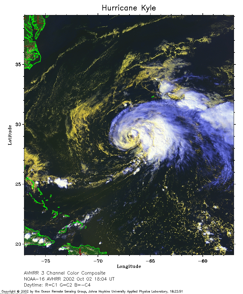 2002 October 2 18:04 UT
NOAA-16 satellite AVHRR 3 channel color composite afternoon image.
A closer view (316 Kb) is seen by clicking on this small image.
The maximum sustained winds have increased to 60 mph.
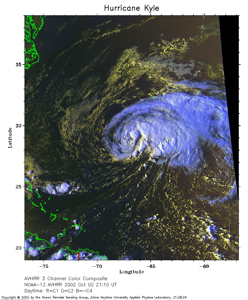 2002 October 2 21:10 UT
NOAA-12 satellite AVHRR 3 channel color composite evening image.
A closer view (336 Kb) is seen by clicking on this small image.
The maximum sustained winds have increased to 70 mph.
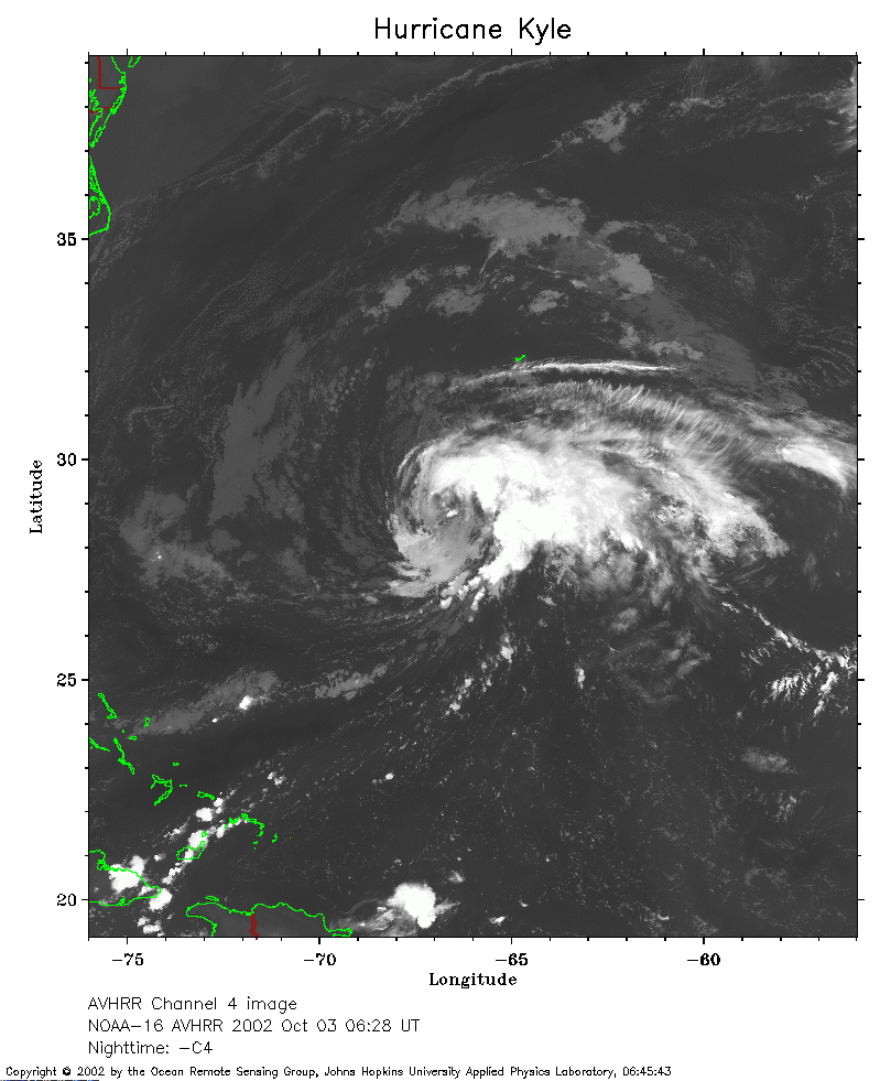 2002 October 3 06:28 UT
NOAA-16 satellite AVHRR channel 4 early morning image.
A closer view (240 Kb) is seen by clicking on this small image.
The maximum sustained winds have decreased to 65 mph.
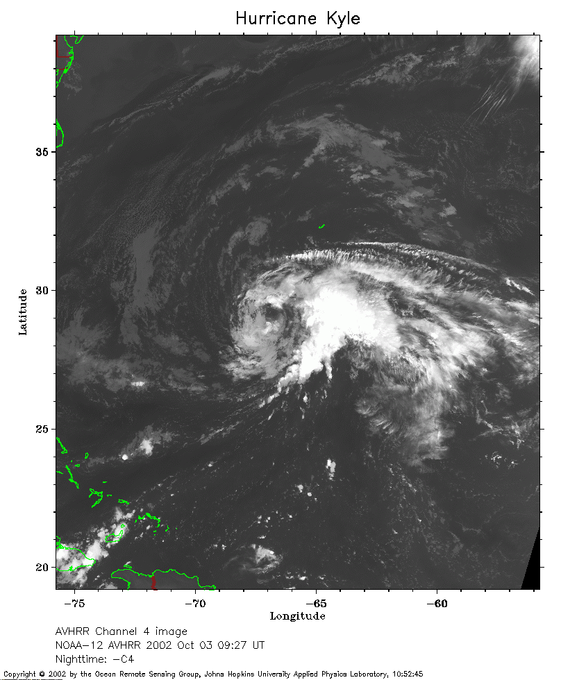 2002 October 3 09:27 UT
NOAA-12 satellite AVHRR channel 4 morning image.
A closer view (243 Kb) is seen by clicking on this small image.
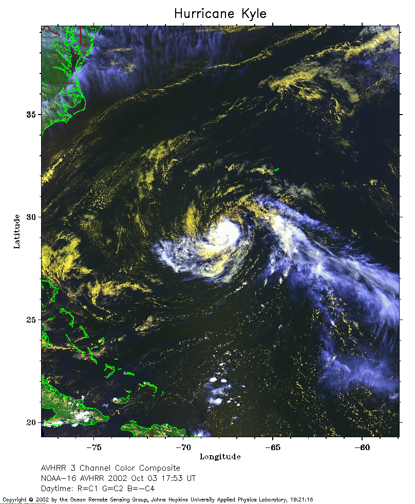 2002 October 3 17:53 UT
NOAA-16 satellite AVHRR 3 channel color composite afternoon image.
A closer view (311 Kb) is seen by clicking on this small image.
The maximum sustained winds have decreased to 50 mph.
 2002 October 3 20:46 UT
NOAA-12 satellite AVHRR 3 channel color composite evening image.
A closer view (323 Kb) is seen by clicking on this small image.
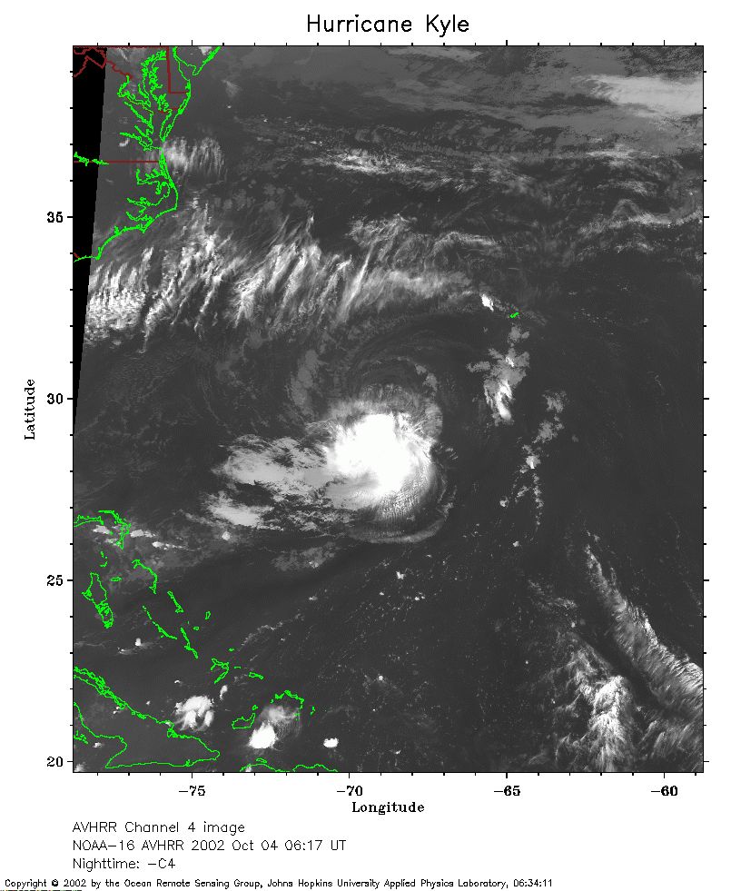 2002 October 4 06:17 UT
NOAA-16 satellite AVHRR channel 4 early morning image.
A closer view (249 Kb) is seen by clicking on this small image.
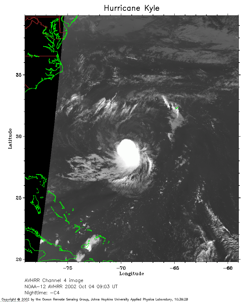 2002 October 4 09:03 UT
NOAA-12 satellite AVHRR channel 4 morning image.
A closer view (212 Kb) is seen by clicking on this small image.
The maximum sustained winds have decreased to 40 mph.
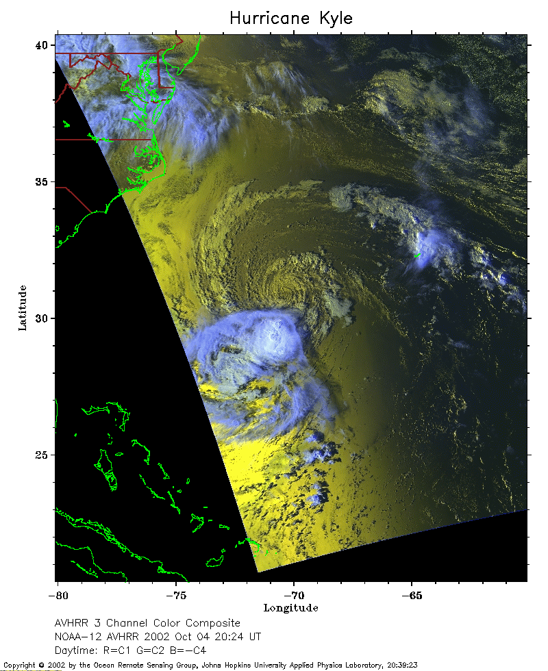 2002 October 4 20:24 UT
NOAA-12 satellite AVHRR 3 channel color composite afternoon image.
A closer view (267 Kb) is seen by clicking on this small image.
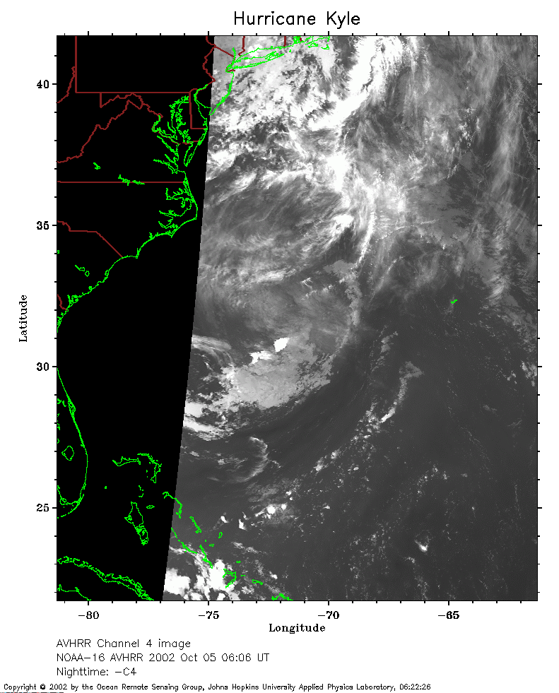 2002 October 5 06:06 UT
NOAA-16 satellite AVHRR channel 4 early morning image.
A closer view (210 Kb) is seen by clicking on this small image.
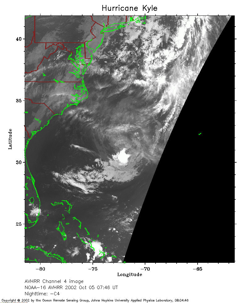 2002 October 5 07:46 UT
NOAA-16 satellite AVHRR channel 4 early morning image.
A closer view (207 Kb) is seen by clicking on this small image.
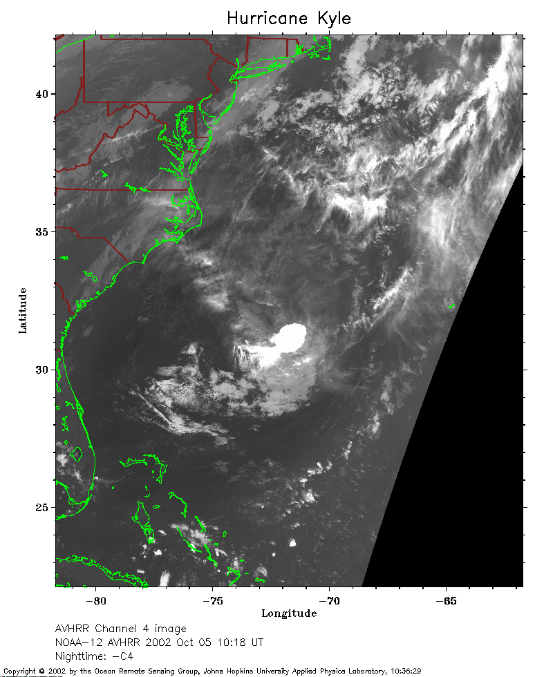 2002 October 5 10:18 UT
NOAA-12 satellite AVHRR channel 4 morning image.
A closer view (235 Kb) is seen by clicking on this small image.
The maximum sustained winds have decreased to 35 mph.
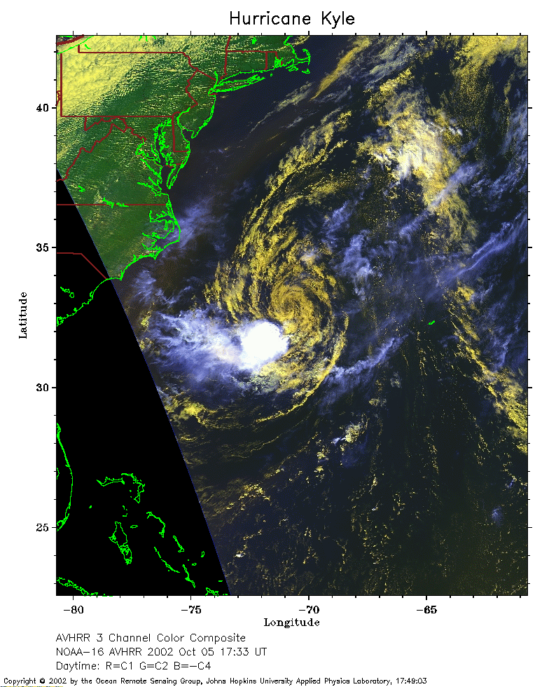 2002 October 5 17:33 UT
NOAA-16 satellite AVHRR 3 channel color composite afternoon image.
A closer view (289 Kb) is seen by clicking on this small image.
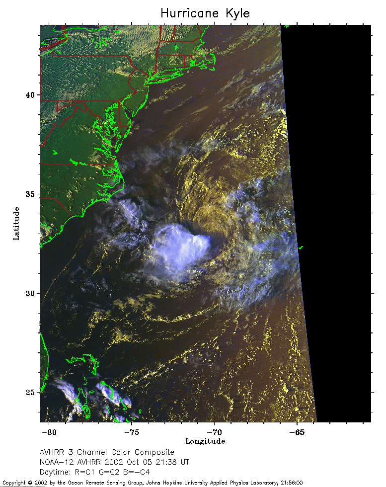 2002 October 5 21:38 UT
NOAA-12 satellite AVHRR 3 channel color composite evening image.
A closer view (264 Kb) is seen by clicking on this small image.
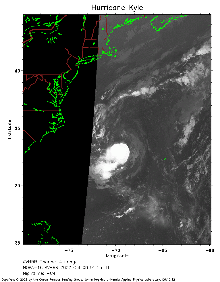 2002 October 6 05:55 UT
NOAA-16 satellite AVHRR channel 4 early morning image.
A closer view (164 Kb) is seen by clicking on this small image.
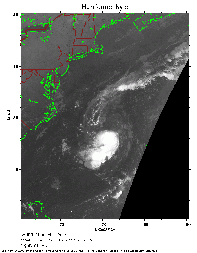 2002 October 6 07:35 UT
NOAA-16 satellite AVHRR channel 4 early morning image.
A closer view (183 Kb) is seen by clicking on this small image.
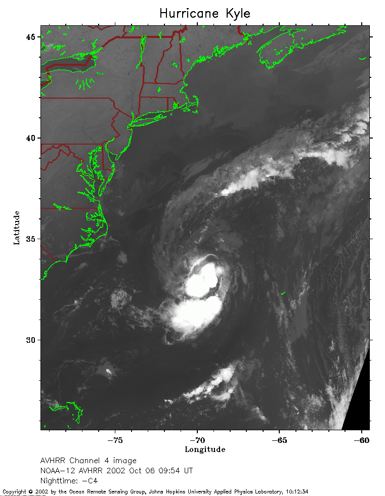 2002 October 6 09:54 UT
NOAA-12 satellite AVHRR channel 4 morning image.
A closer view (213 Kb) is seen by clicking on this small image.
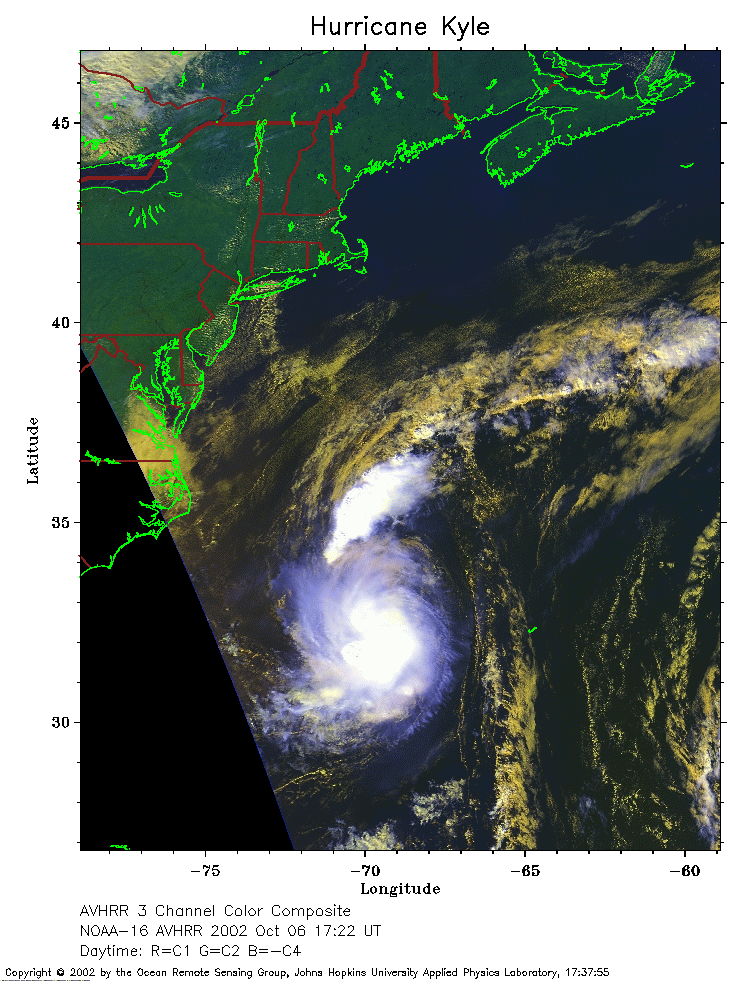 2002 October 6 17:22 UT
NOAA-16 satellite AVHRR 3 channel color composite afternoon image.
A closer view (255 Kb) is seen by clicking on this small image.
The maximum sustained winds have increased to 40 mph.
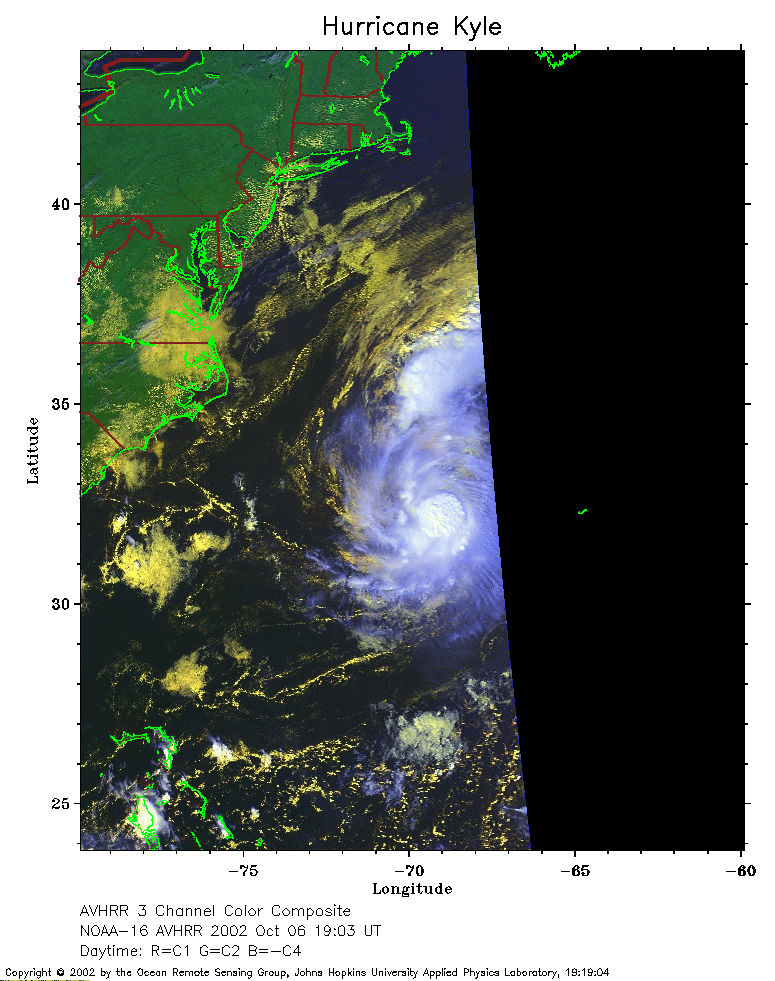 2002 October 6 19:03 UT
NOAA-16 satellite AVHRR 3 channel color composite afternoon image.
A closer view (211 Kb) is seen by clicking on this small image.
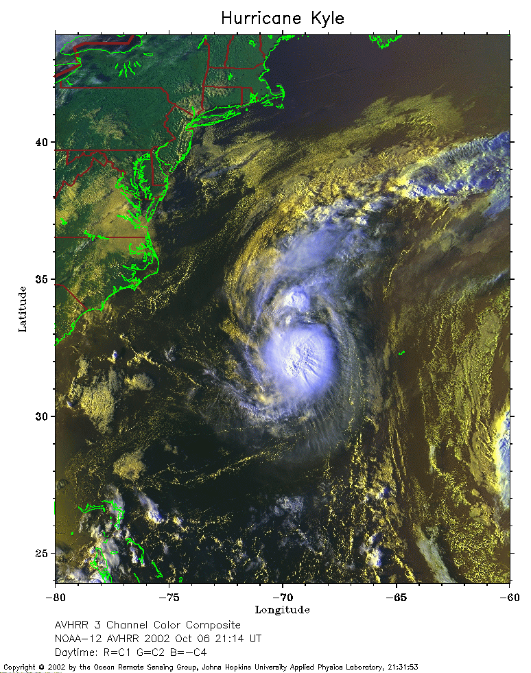 2002 October 6 21:14 UT
NOAA-12 satellite AVHRR 3 channel color composite evening image.
A closer view (352 Kb) is seen by clicking on this small image.
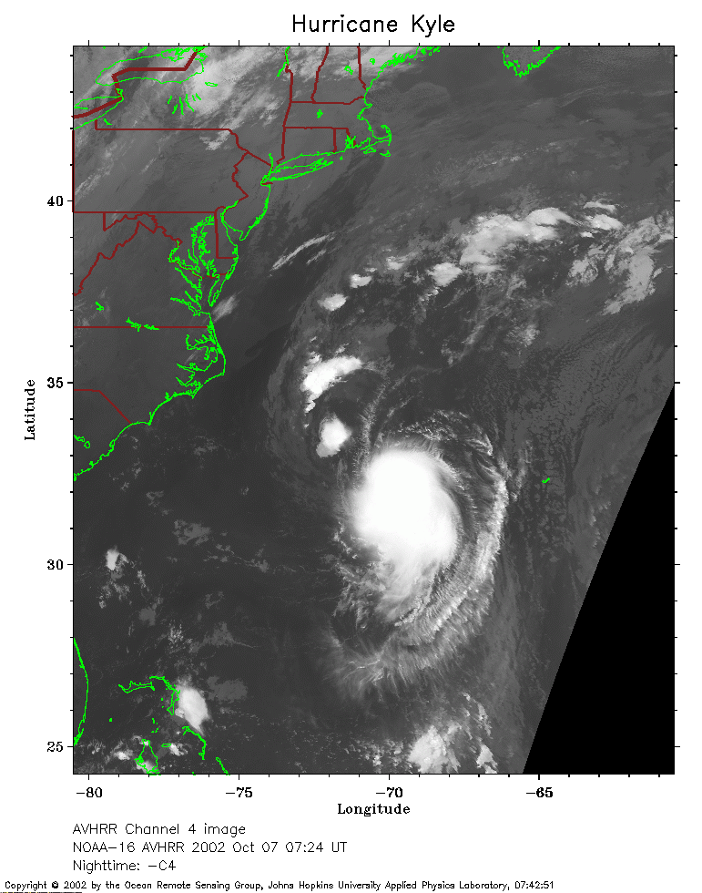 2002 October 7 07:24 UT
NOAA-16 satellite AVHRR channel 4 early morning image.
A closer view (226 Kb) is seen by clicking on this small image.
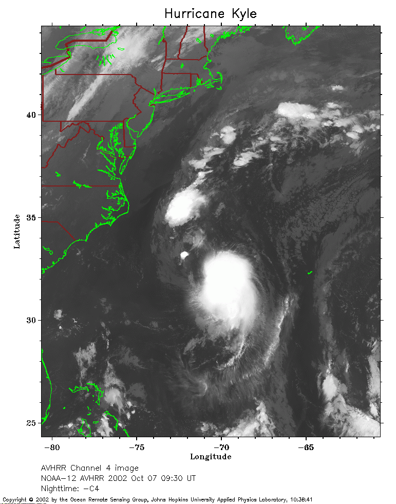 2002 October 7 09:30 UT
NOAA-12 satellite AVHRR channel 4 morning image.
A closer view (242 Kb) is seen by clicking on this small image.
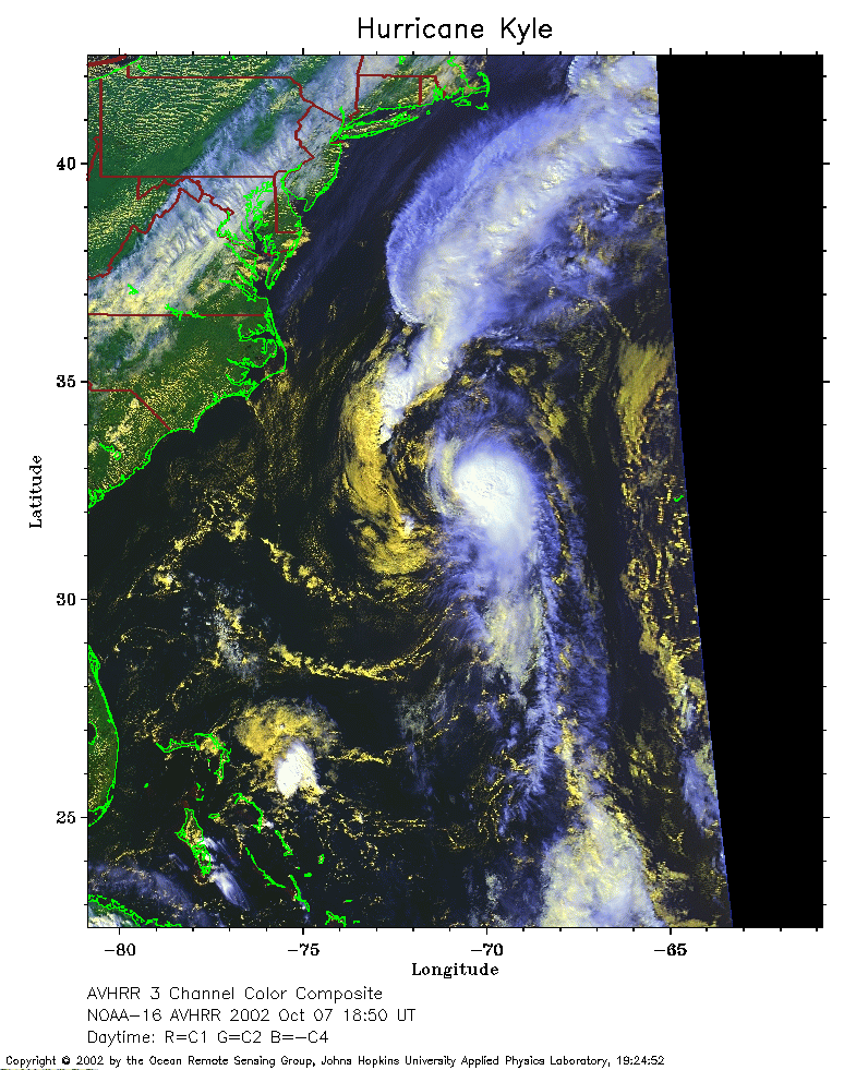 2002 October 7 18:50 UT
NOAA-16 satellite AVHRR 3 channel color composite afternoon image.
A closer view (298 Kb) is seen by clicking on this small image.
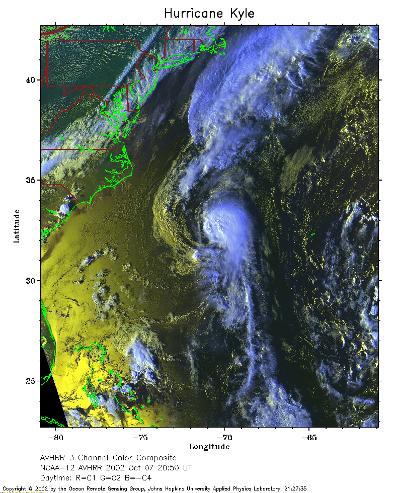 2002 October 7 20:50 UT
NOAA-12 satellite AVHRR 3 channel color composite afternoon image.
A closer view (377 Kb) is seen by clicking on this small image.
 2002 October 8 07:13 UT
NOAA-16 satellite AVHRR channel 4 early morning image.
A closer view (261 Kb) is seen by clicking on this small image.
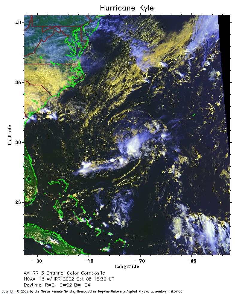 2002 October 7 18:39 UT
NOAA-16 satellite AVHRR 3 channel color composite afternoon image.
A closer view (349 Kb) is seen by clicking on this small image.
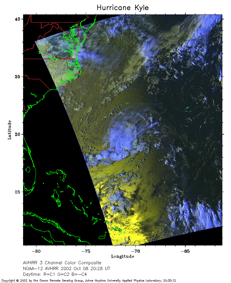 2002 October 8 20:28 UT
NOAA-12 satellite AVHRR 3 channel color composite afternoon image.
A closer view (260 Kb) is seen by clicking on this small image.
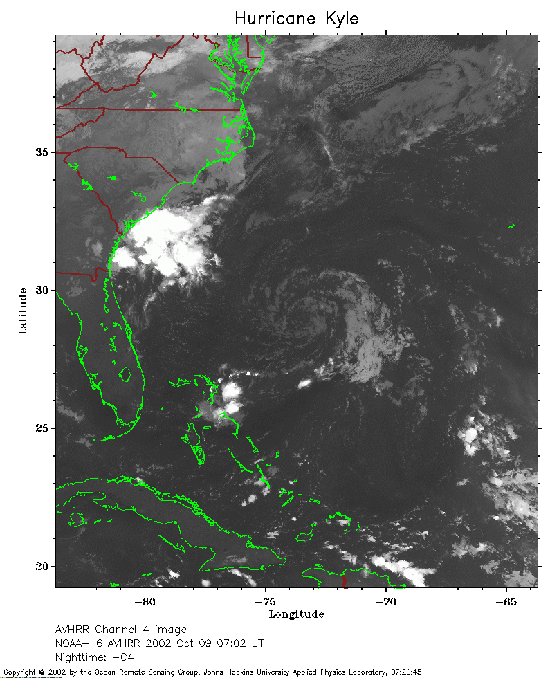 2002 October 9 07:02 UT
NOAA-16 satellite AVHRR channel 4 early morning image.
A closer view (247 Kb) is seen by clicking on this small image.
The maximum sustained winds have decreased to 35 mph.
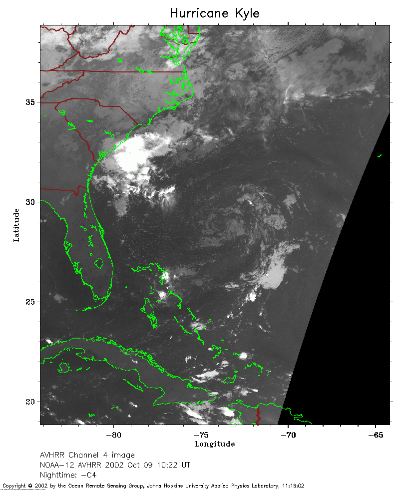 2002 October 9 10:22 UT
NOAA-12 satellite AVHRR channel 4 morning image.
A closer view (223 Kb) is seen by clicking on this small image.
 2002 October 9 18:27 UT
NOAA-16 satellite AVHRR 3 channel color composite afternoon image.
A closer view (339 Kb) is seen by clicking on this small image.
 2002 October 9 21:42 UT
NOAA-12 satellite AVHRR 3 channel color composite evening image.
A closer view (345 Kb) is seen by clicking on this small image.
The maximum sustained winds have decreased to 30 mph.
 2002 October 10 06:51 UT
NOAA-16 satellite AVHRR channel 4 early morning image.
A closer view (259 Kb) is seen by clicking on this small image.
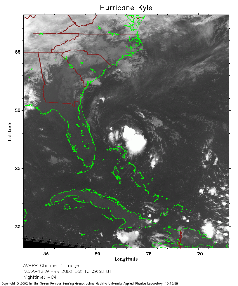 2002 October 10 09:58 UT
NOAA-12 satellite AVHRR channel 4 morning image.
A closer view (246 Kb) is seen by clicking on this small image.
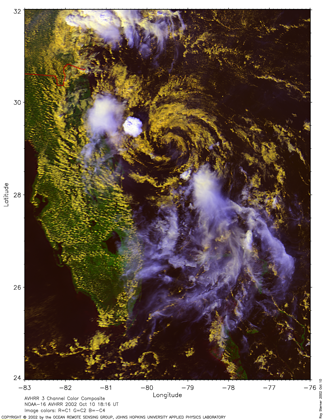
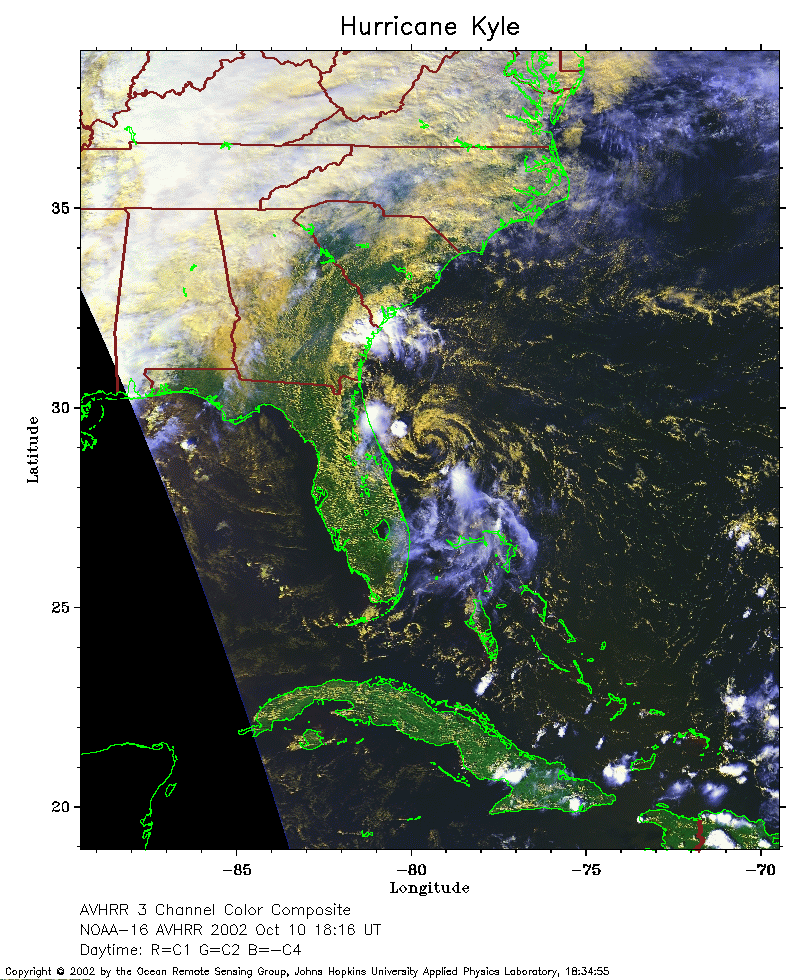 2002 October 10 18:16 UT
NOAA-16 satellite AVHRR 3 channel color composite afternoon image.
A closer view (313 Kb) is seen by clicking on this small image.
A very large (1585 Kb)
image is also available.
 2002 October 10 21:17 UT
NOAA-12 satellite AVHRR 3 channel color composite evening image.
A closer view (335 Kb) is seen by clicking on this small image.
The maximum sustained winds have increased to 35 mph.
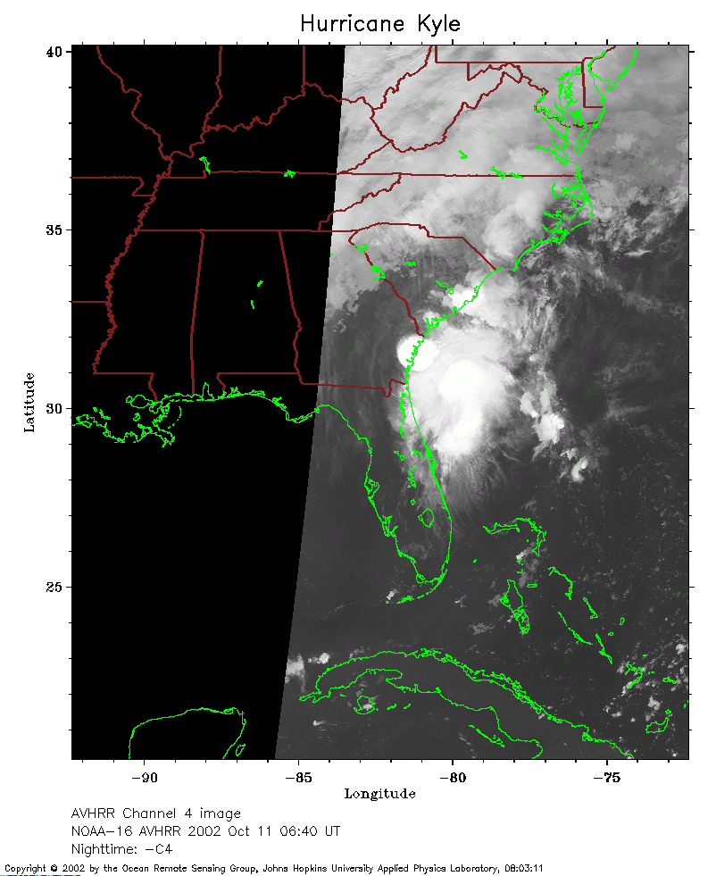 2002 October 11 06:40 UT
NOAA-16 satellite AVHRR channel 4 early morning image.
A closer view (159 Kb) is seen by clicking on this small image.
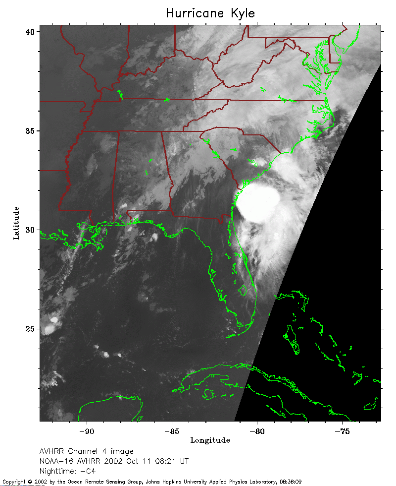 2002 October 11 08:21 UT
NOAA-16 satellite AVHRR channel 4 early morning image.
A closer view (198 Kb) is seen by clicking on this small image.
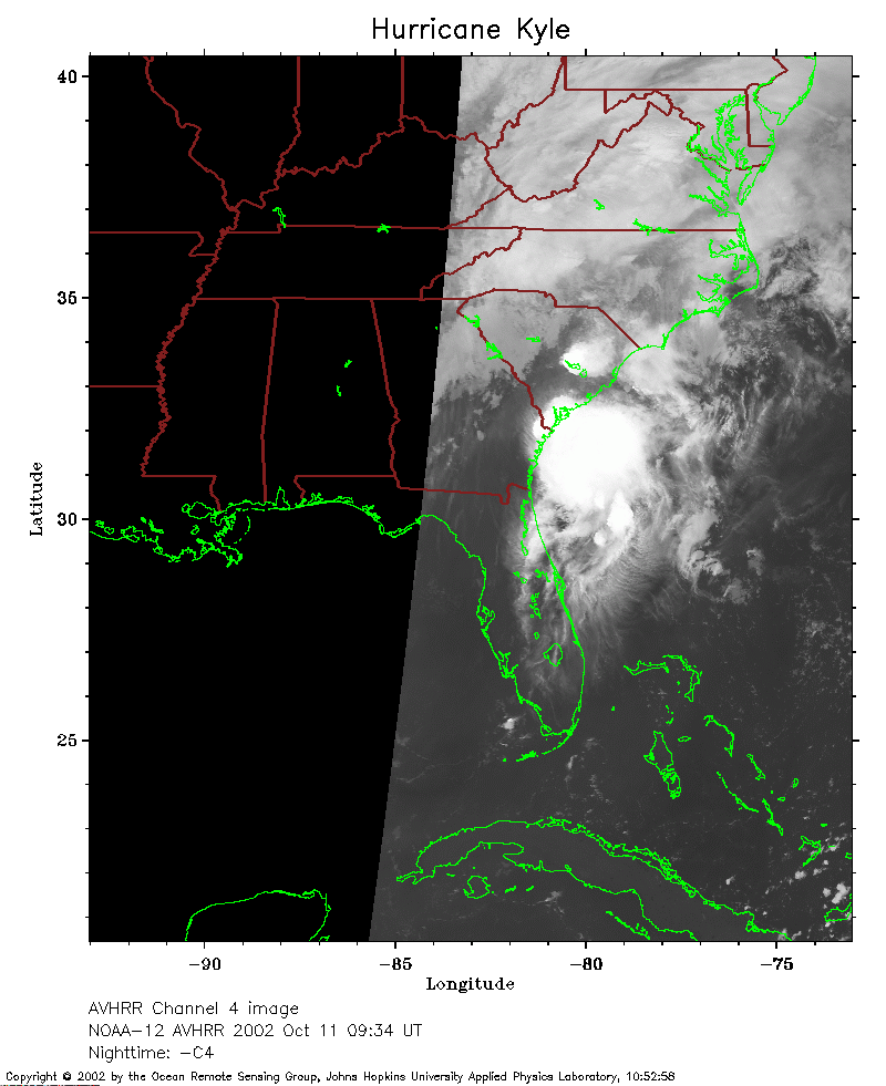 2002 October 11 09:34 UT
NOAA-12 satellite AVHRR channel 4 morning image.
A closer view (149 Kb) is seen by clicking on this small image.
The maximum sustained winds have increased to 40 mph.
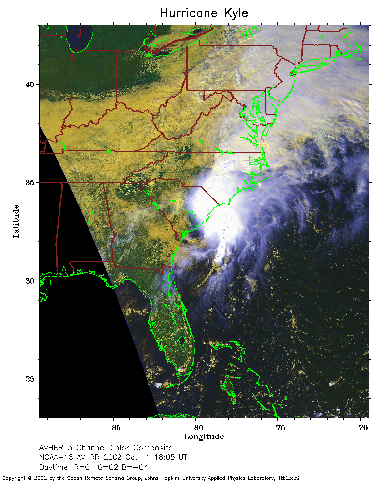 2002 October 11 18:05 UT
NOAA-16 satellite AVHRR 3 channel color composite afternoon image.
A closer view (290 Kb) is seen by clicking on this small image.
The maximum sustained winds have increased to 45 mph.
A very large (1308 Kb)
image is also available.
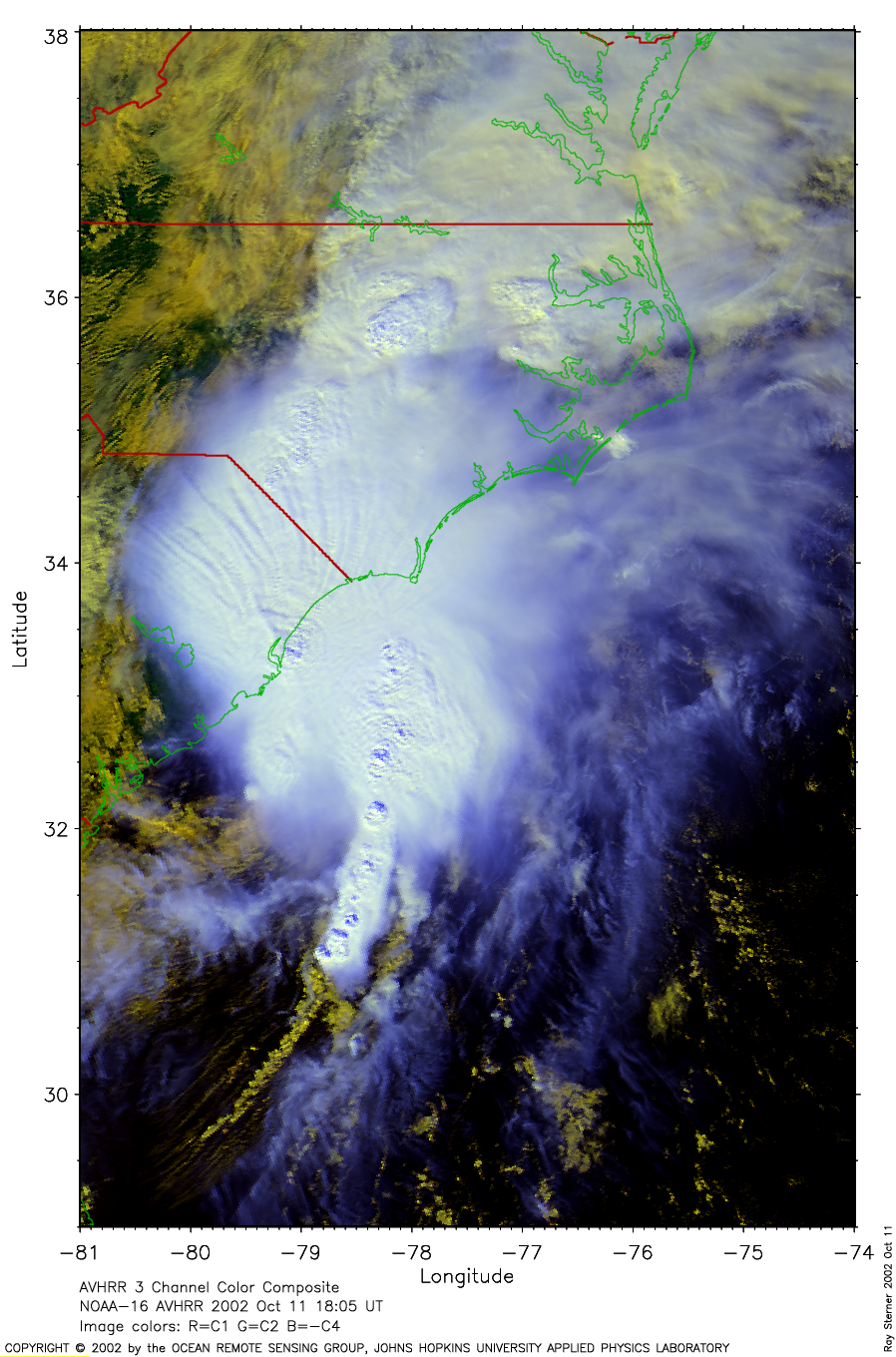
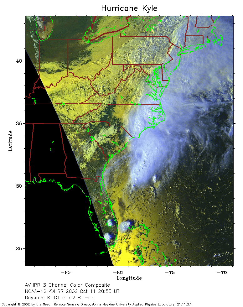 2002 October 11 20:53 UT
NOAA-12 satellite AVHRR 3 channel color composite evening image.
A closer view (300 Kb) is seen by clicking on this small image.
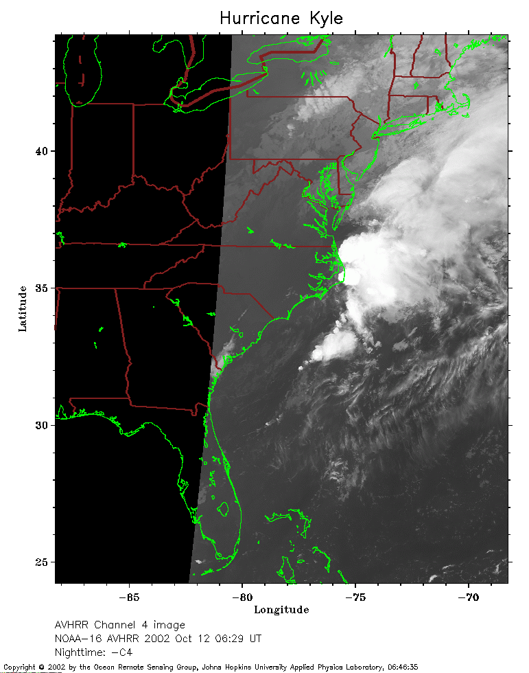 2002 October 12 06:29 UT
NOAA-16 satellite AVHRR channel 4 early morning image.
A closer view (163 Kb) is seen by clicking on this small image.
The maximum sustained winds have decreased to 35 mph.
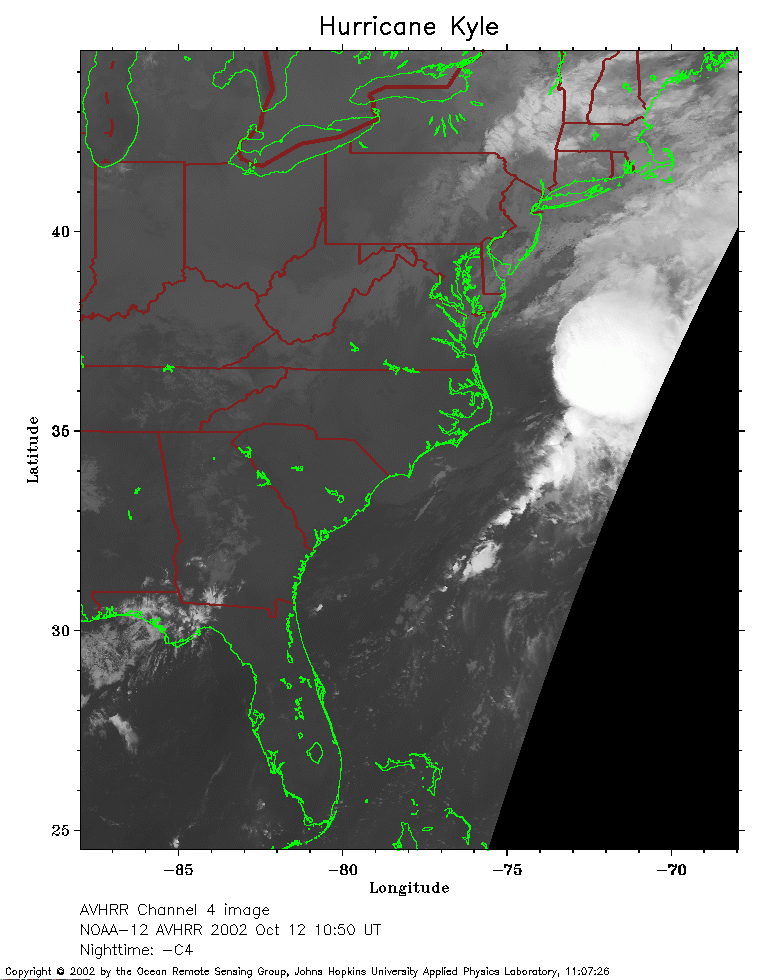 2002 October 12 10:50 UT
NOAA-12 satellite AVHRR channel 4 morning image.
A closer view (174 Kb) is seen by clicking on this small image.
The maximum sustained winds have increased to 45 mph.