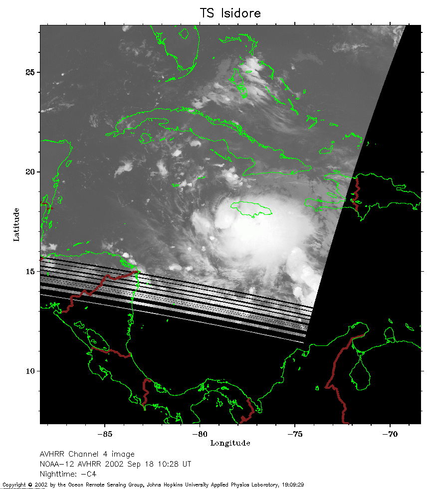
 2002 September 18 10:28 UT
NOAA-12 satellite AVHRR channel 4 morning image.
A closer view (162 Kb) is seen by clicking on this small image.
The maximum sustained winds are 40 mph.
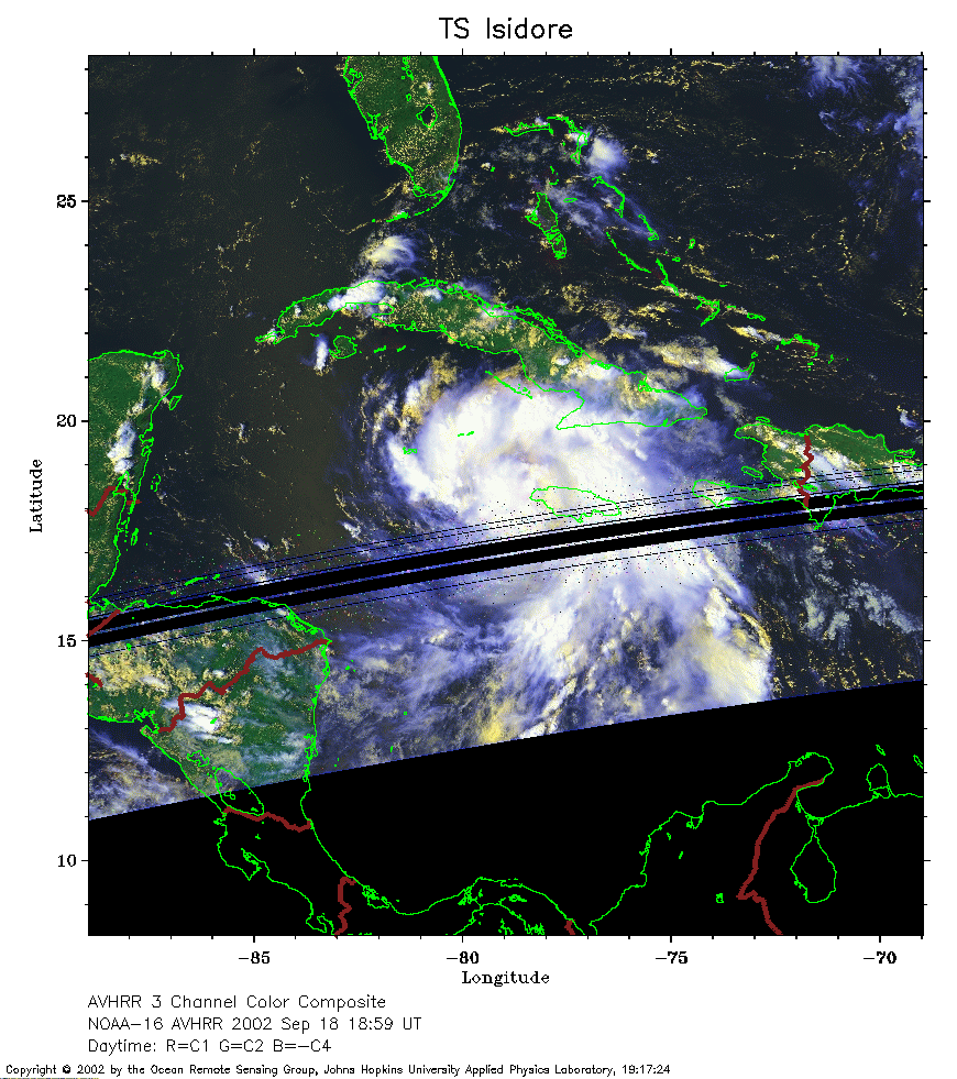 2002 September 18 18:59 UT
NOAA-16 satellite AVHRR 3 channel color composite afternoon image.
A closer view (274 Kb) is seen by clicking on this small image.
The maximum sustained winds have increased to 50 mph.
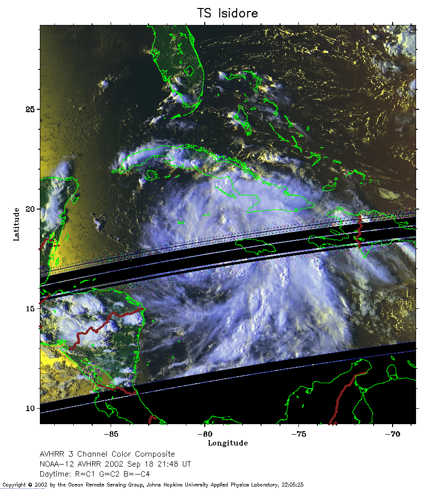 2002 September 18 21:48 UT
NOAA-12 satellite AVHRR 3 channel color composite evening image.
A closer view (305 Kb) is seen by clicking on this small image.
The maximum sustained winds have increased to 60 mph.
 2002 September 19 07:22 UT
NOAA-16 satellite AVHRR channel 4 early morning image.
A closer view (262 Kb) is seen by clicking on this small image.
 2002 September 19 10:04 UT
NOAA-12 satellite AVHRR channel 4 morning image.
A closer view (267 Kb) is seen by clicking on this small image.
The maximum sustained winds have increased to 65 mph.
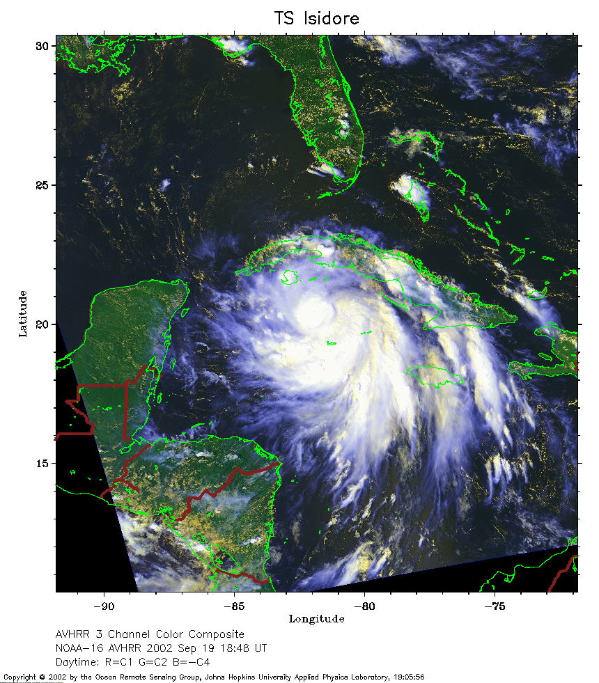 2002 September 19 18:48 UT
NOAA-16 satellite AVHRR 3 channel color composite afternoon image.
A closer view (353 Kb) is seen by clicking on this small image.
The maximum sustained winds have increased to 70 mph.
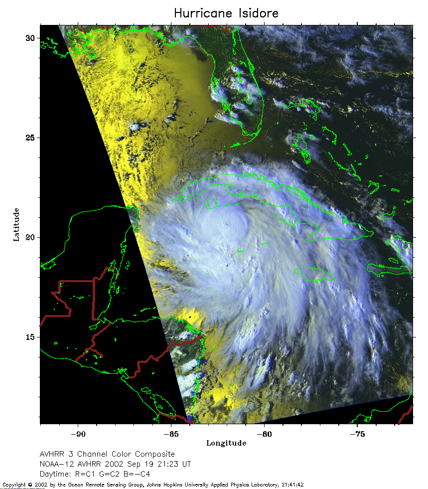 2002 September 19 21:23 UT
NOAA-12 satellite AVHRR 3 channel color composite evening image.
A closer view (314 Kb) is seen by clicking on this small image.
The maximum sustained winds have increased to 75 mph, making Isidore a
hurricane.
 2002 September 20 07:11 UT
NOAA-16 satellite AVHRR channel 4 early morning image.
A closer view (262 Kb) is seen by clicking on this small image.
The maximum sustained winds have increased to 85 mph.
 2002 September 20 09:40 UT
NOAA-12 satellite AVHRR channel 4 morning image.
A closer view (200 Kb) is seen by clicking on this small image.
The maximum sustained winds have increased to 105 mph.
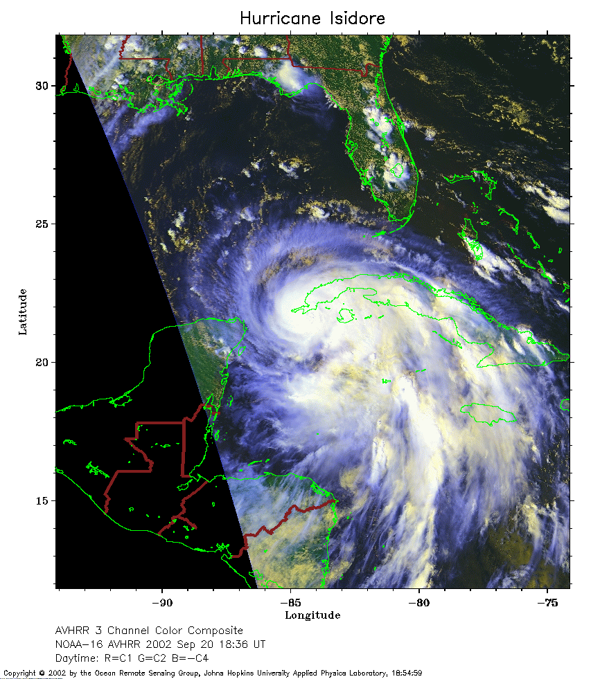 2002 September 20 18:36 UT
NOAA-16 satellite AVHRR 3 channel color composite afternoon image.
A closer view (313 Kb) is seen by clicking on this small image.
The maximum sustained winds have decreased to 100 mph as Isidore makes
landfall in western Cuba.
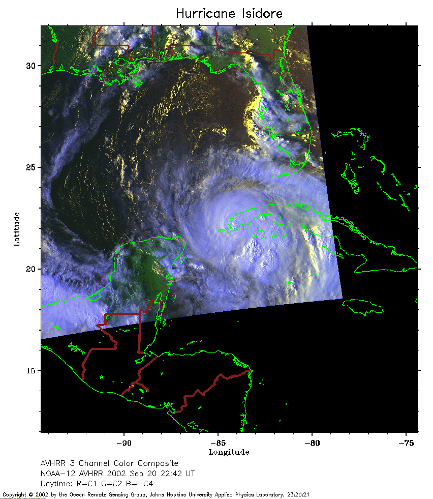 2002 September 20 22:42 UT
NOAA-12 satellite AVHRR 3 channel color composite afternoon image.
A closer view (220 Kb) is seen by clicking on this small image.
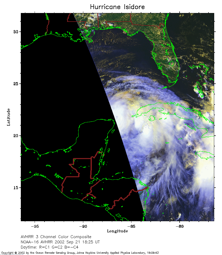 2002 September 21 18:25 UT
NOAA-16 satellite AVHRR 3 channel color composite afternoon image.
A closer view (210 Kb) is seen by clicking on this small image.
Although at the edge of the satellite pass, the eye can now be seen in
this image. The maximum sustained winds have increased to 120 mph.
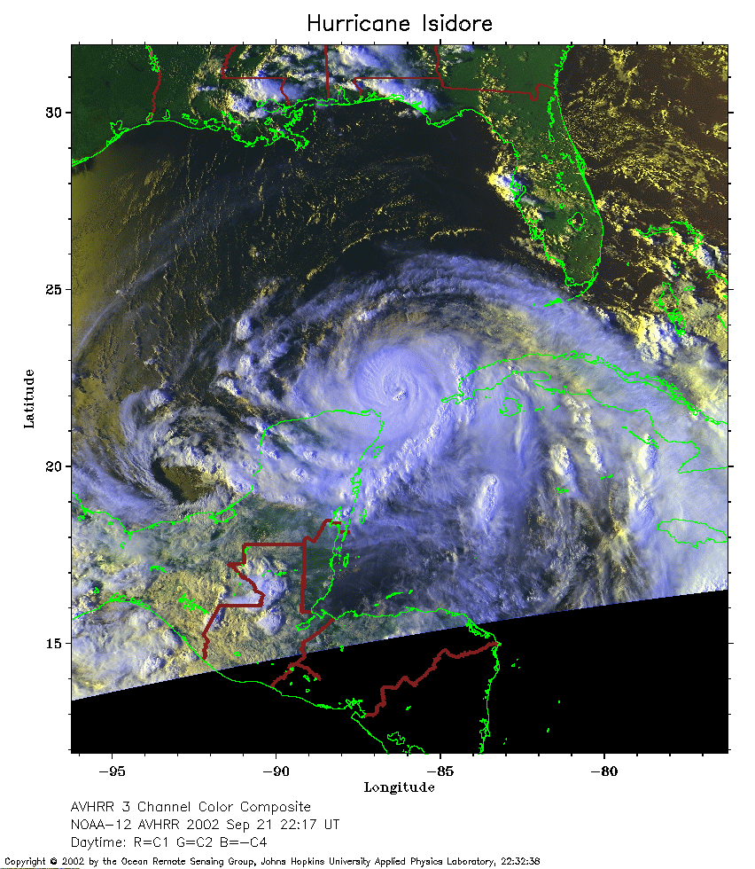 2002 September 21 22:17 UT
NOAA-12 satellite AVHRR 3 channel color composite evening image.
A closer view (344 Kb) is seen by clicking on this small image.
The maximum sustained winds have increased to 125 mph.
 2002 September 22 08:30 UT
NOAA-16 satellite AVHRR channel 4 early morning image.
A closer view (165 Kb) is seen by clicking on this small image.
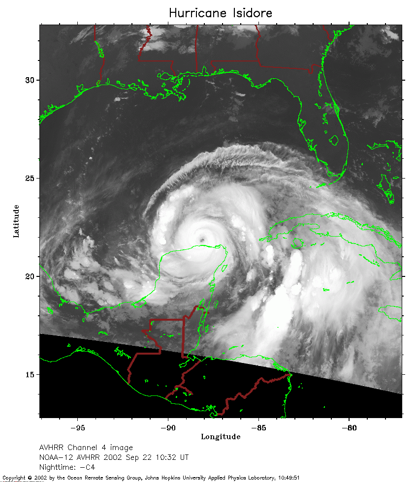 2002 September 22 10:32 UT
NOAA-12 satellite AVHRR channel 4 morning image.
A closer view (236 Kb) is seen by clicking on this small image.
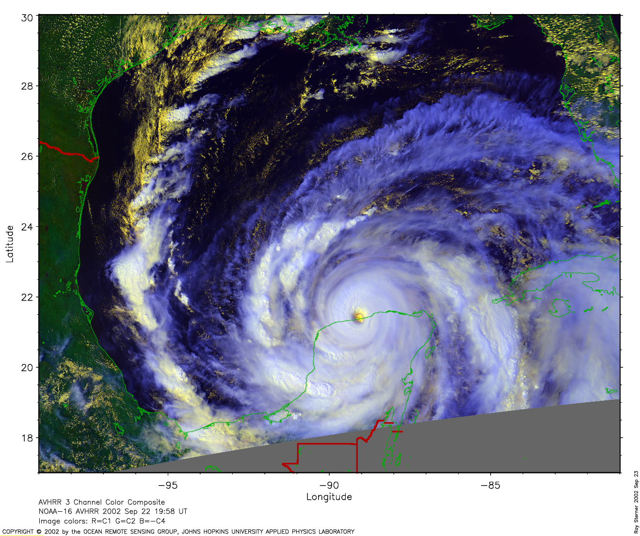
 2002 September 22 19:58 UT
NOAA-16 satellite AVHRR 3 channel color composite afternoon image.
A closer view (268 Kb) is seen by clicking on this small image.
A very large image (1975 Kb) is
also available. Note the eye is now located over the Yucatan coast.
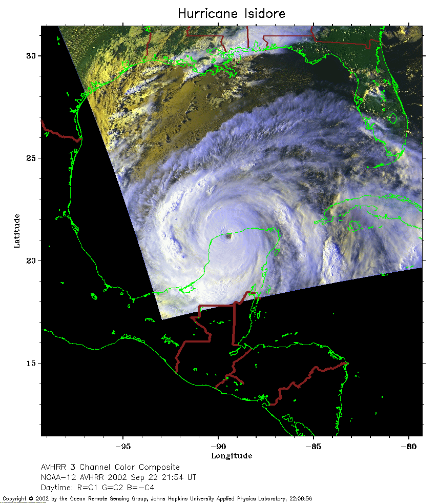 2002 September 22 21:54 UT
NOAA-12 satellite AVHRR 3 channel color composite evening image.
A closer view (233 Kb) is seen by clicking on this small image.
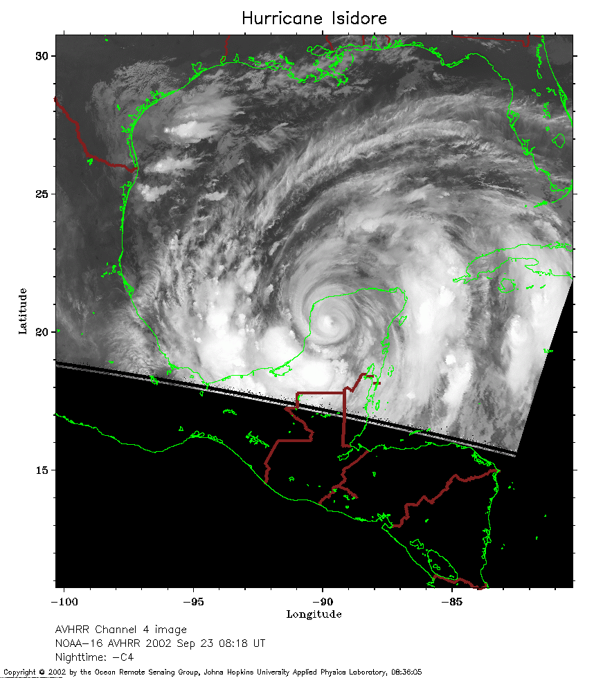 2002 September 23 08:18 UT
NOAA-16 satellite AVHRR channel 4 early morning image.
A closer view (220 Kb) is seen by clicking on this small image.
Isidore is now over land and the maximum sustained winds have decreased
to 80 mph.
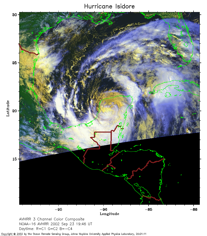 2002 September 23 19:46 UT
NOAA-16 satellite AVHRR 3 channel color composite afternoon image.
A closer view (318 Kb) is seen by clicking on this small image.
The maximum sustained winds have decreased to 60 mph.
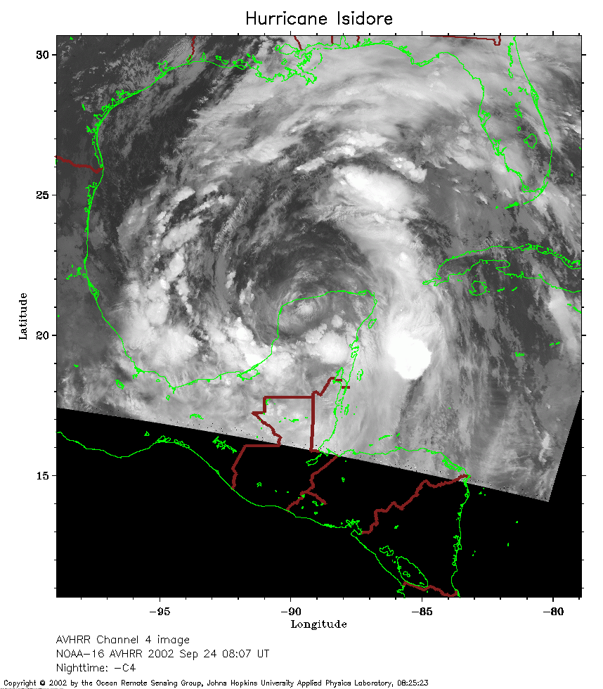 2002 September 24 08:07 UT
NOAA-16 satellite AVHRR channel 4 early morning image.
A closer view (250 Kb) is seen by clicking on this small image.
The maximum sustained winds have decreased to 40 mph.
 2002 September 24 19:35 UT
NOAA-16 satellite AVHRR 3 channel color composite afternoon image.
A closer view (356 Kb) is seen by clicking on this small image.
The maximum sustained winds have increased to 60 mph as Isidore moves back over the warm waters of the
Gulf of Mexico.
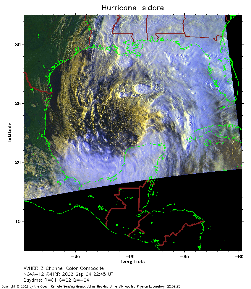 2002 September 24 22:45 UT
NOAA-12 satellite AVHRR 3 channel color composite evening image.
A closer view (310 Kb) is seen by clicking on this small image.
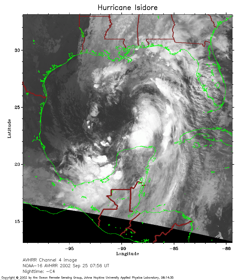 2002 September 25 07:56 UT
NOAA-16 satellite AVHRR channel 4 early morning image.
A closer view (292 Kb) is seen by clicking on this small image.
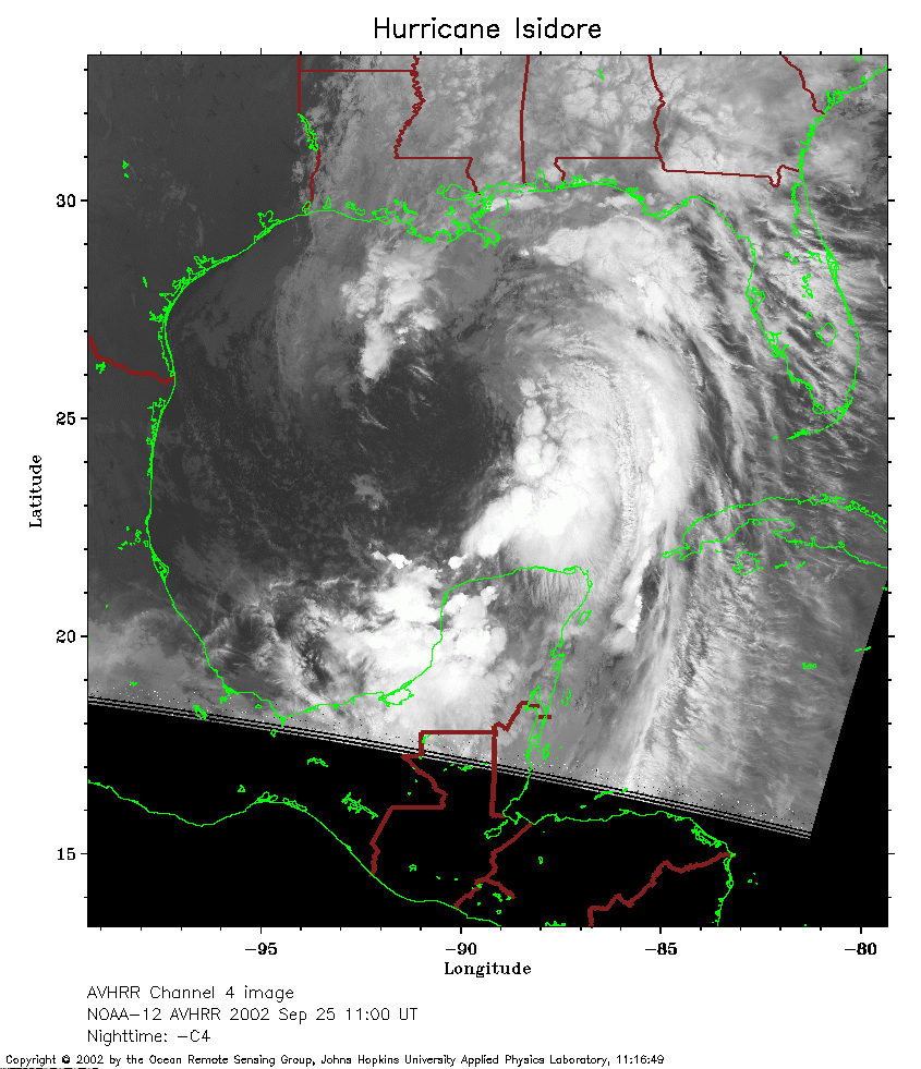 2002 September 25 11:00 UT
NOAA-12 satellite AVHRR channel 4 morning image.
A closer view (259 Kb) is seen by clicking on this small image.
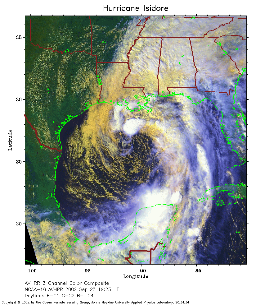 2002 September 25 19:23 UT
NOAA-16 satellite AVHRR 3 channel color composite afternoon image.
A closer view (404 Kb) is seen by clicking on this small image.
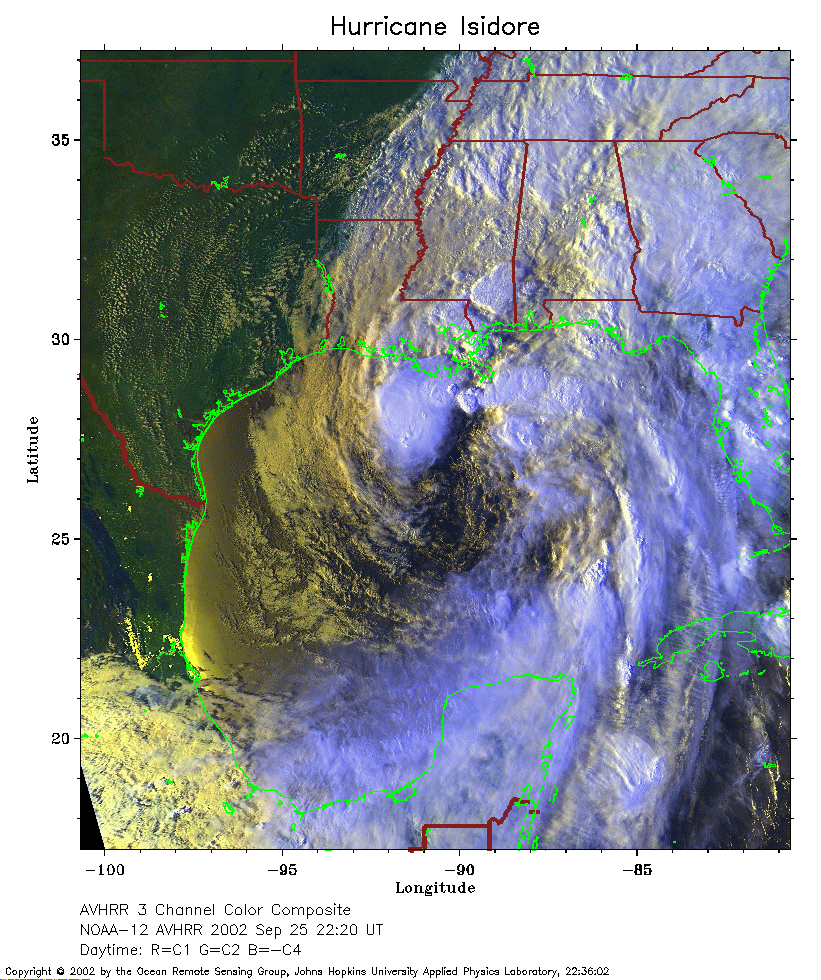 2002 September 25 22:20 UT
NOAA-12 satellite AVHRR 3 channel color composite evening image.
A closer view (407 Kb) is seen by clicking on this small image.
The maximum sustained winds have increased to 65 mph.
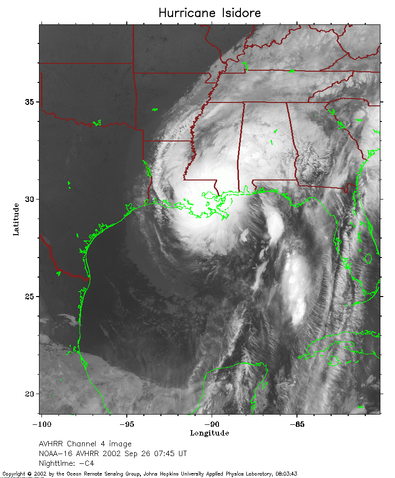 2002 September 26 07:45 UT
NOAA-16 satellite AVHRR channel 4 early morning image.
A closer view (277 Kb) is seen by clicking on this small image.
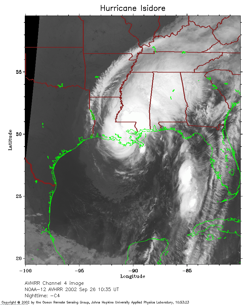 2002 September 26 10:35 UT
NOAA-12 satellite AVHRR channel 4 morning image.
A closer view (258 Kb) is seen by clicking on this small image.
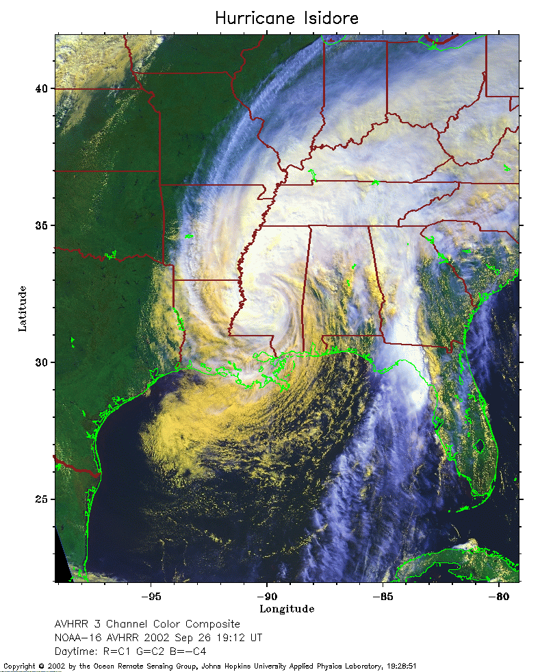 2002 September 26 19:12 UT
NOAA-16 satellite AVHRR 3 channel color composite afternoon image.
A closer view (338 Kb) is seen by clicking on this small image.
The maximum sustained winds have decreased to 50 mph.
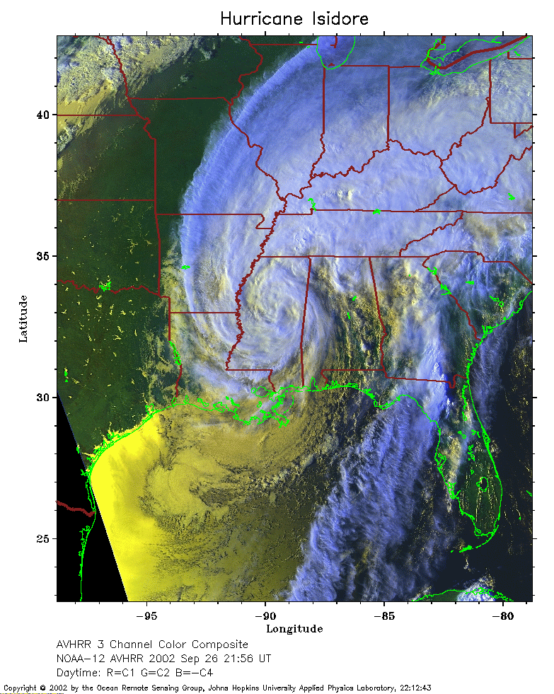 2002 September 26 21:56 UT
NOAA-12 satellite AVHRR 3 channel color composite evening image.
A closer view (345 Kb) is seen by clicking on this small image.
The maximum sustained winds have decreased to 35 mph.