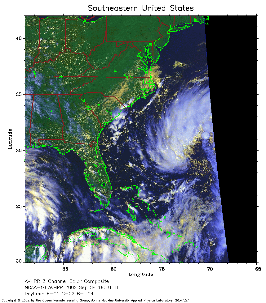
 2002 September 8 19:10 UT
NOAA-16 satellite AVHRR 3 channel color composite afternoon image.
A closer view (332 Kb) is seen by clicking on this small image.
The maximum sustained winds are 35 mph.
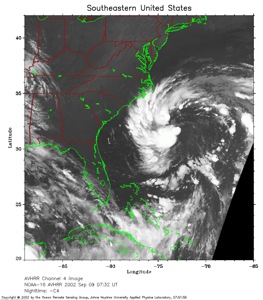 2002 September 9 07:32 UT
NOAA-16 satellite AVHRR channel 4 early morning image. A closer view (298 Kb) is seen by clicking on this small image. The maximum sustained winds have increased to 45 mph.
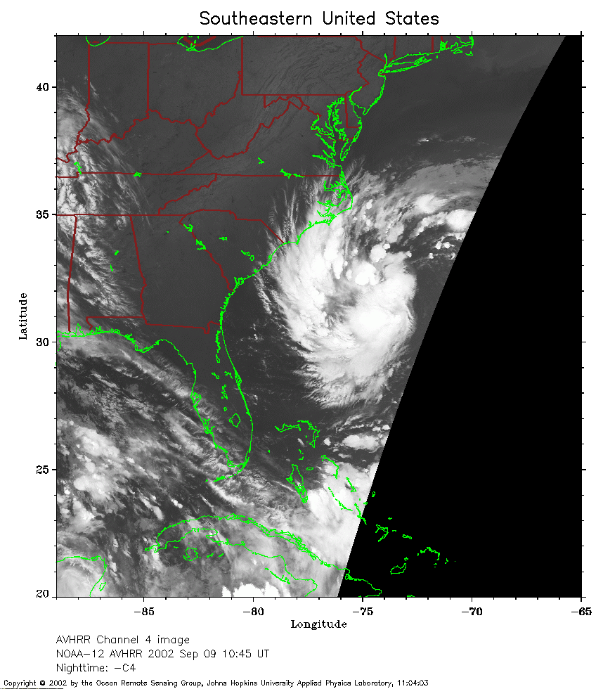 2002 September 8 10:45 UT
NOAA-12 satellite AVHRR channel 4 morning image.
A closer view (228 Kb) is seen by clicking on this small image.
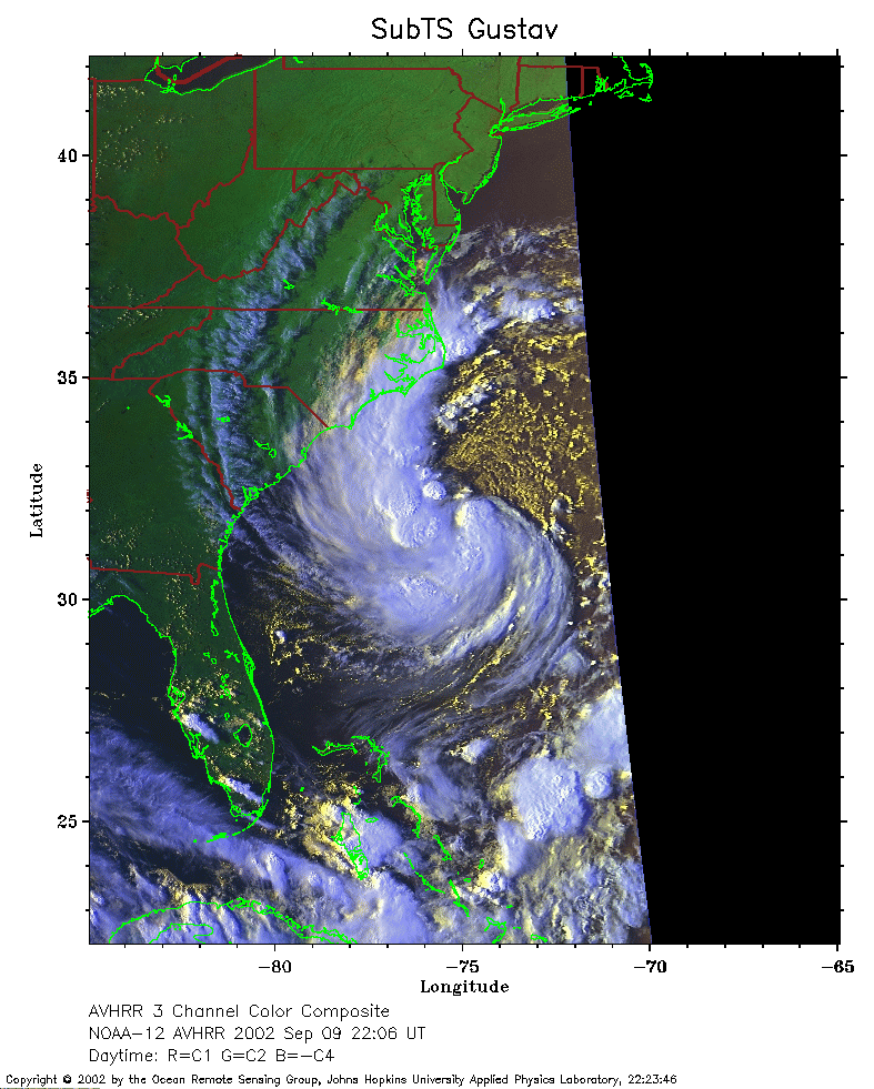 2002 September 9 22:06 UT
NOAA-12 satellite AVHRR 3 channel color composite evening image.
A closer view (257 Kb) is seen by clicking on this small image.
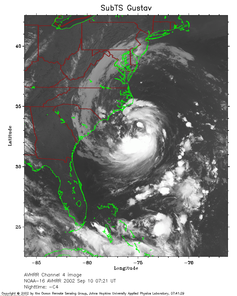 2002 September 10 07:21 UT
NOAA-16 satellite AVHRR channel 4 early morning image.
A closer view (268 Kb) is seen by clicking on this small image.
The maximum sustained winds have increased to 60 mph.
 2002 September 10 10:21 UT
NOAA-12 satellite AVHRR channel 4 morning image.
A closer view (266 Kb) is seen by clicking on this small image.
Sub-Tropical Storm Gustav is now classified as Tropical Storm Gustav.
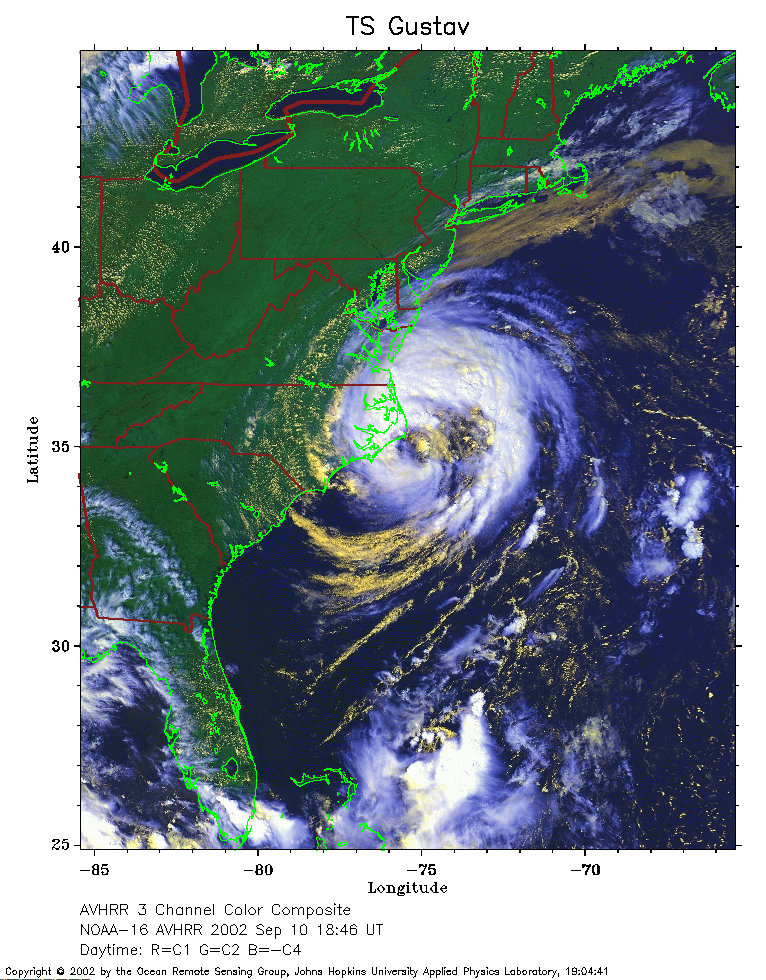 2002 September 10 18:46 UT
NOAA-16 satellite AVHRR 3 channel color composite afternoon image.
A closer view (337 Kb) is seen by clicking on this small image.
 2002 September 10 21:40 UT
NOAA-12 satellite AVHRR 3 channel color composite evening image.
A closer view (344 Kb) is seen by clicking on this small image.
 2002 September 11 07:09 UT
NOAA-16 satellite AVHRR channel 4 early morning image.
A closer view (259 Kb) is seen by clicking on this small image.
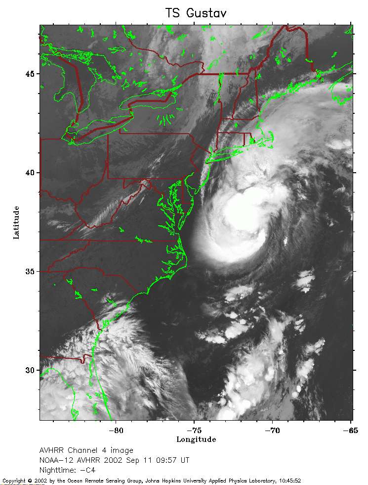 2002 September 11 09:57 UT
NOAA-12 satellite AVHRR channel 4 morning image.
A closer view (252 Kb) is seen by clicking on this small image.
The maximum sustained winds have increased to 70 mph.
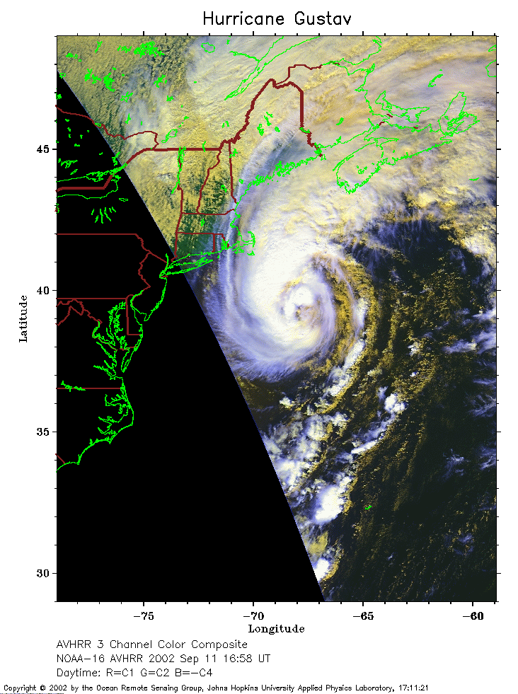 2002 September 11 16:58 UT
NOAA-16 satellite AVHRR 3 channel color composite afternoon image.
A closer view (238 Kb) is seen by clicking on this small image.
The maximum sustained winds have increased to 75 mph and Gustav is now a
hurricane.
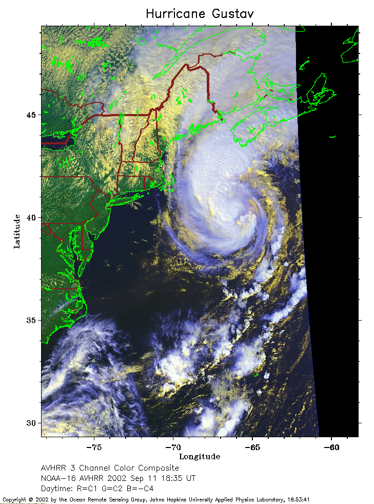 2002 September 11 18:35 UT
NOAA-16 satellite AVHRR 3 channel color composite afternoon image.
A closer view (294 Kb) is seen by clicking on this small image.
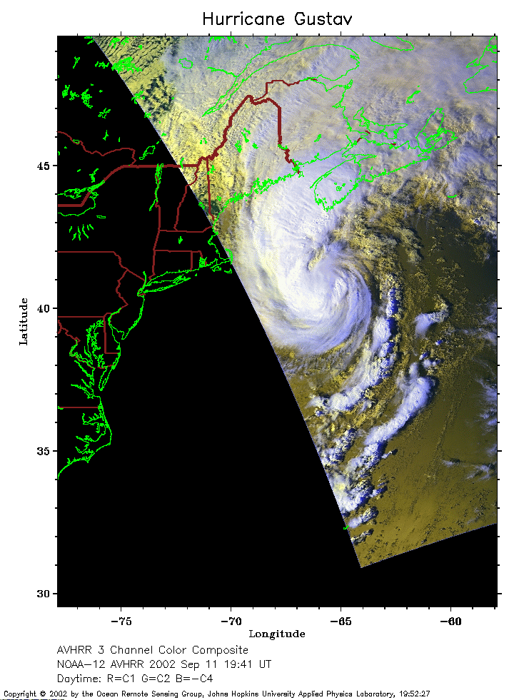 2002 September 11 19:41 UT
NOAA-12 satellite AVHRR 3 channel color composite afternoon image.
A closer view (201 Kb) is seen by clicking on this small image.
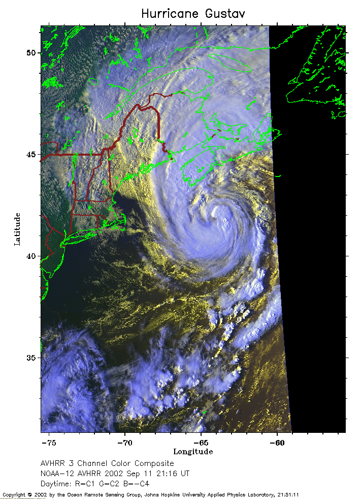 2002 September 11 21:16 UT
NOAA-12 satellite AVHRR 3 channel color composite evening image.
A closer view (282 Kb) is seen by clicking on this small image.
The maximum sustained winds have increased to 90 mph.
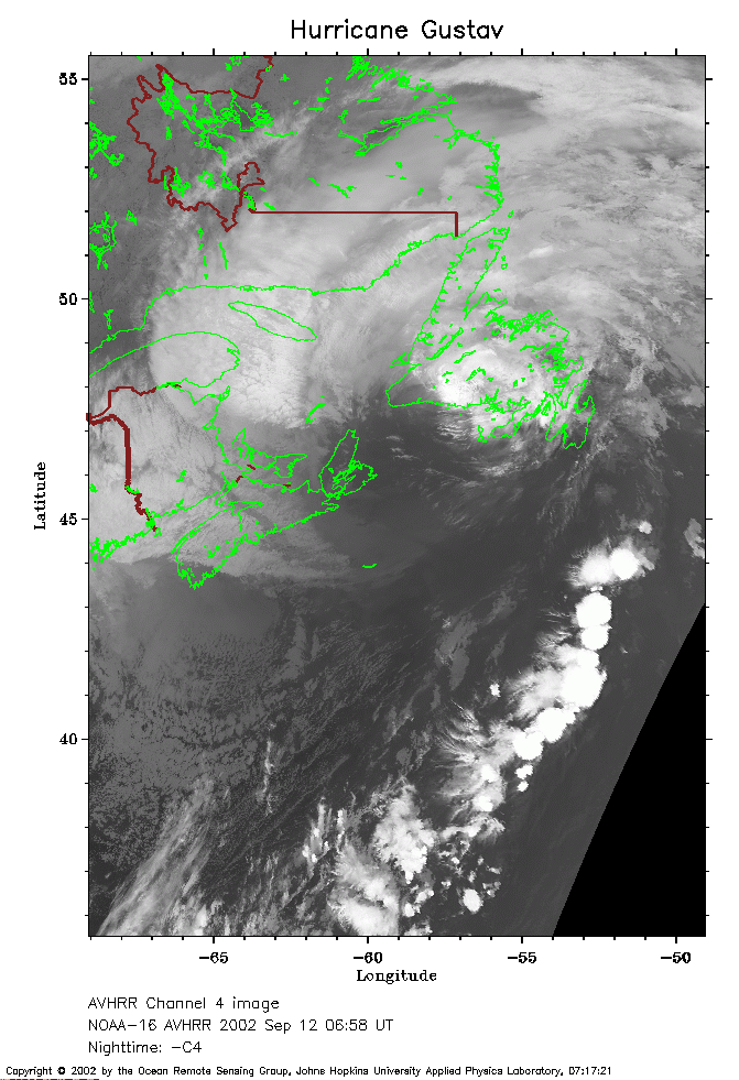 2002 September 12 06:58 UT
NOAA-16 satellite AVHRR channel 4 early morning image.
A closer view (216 Kb) is seen by clicking on this small image.
The maximum sustained winds have decreased to 80 mph.
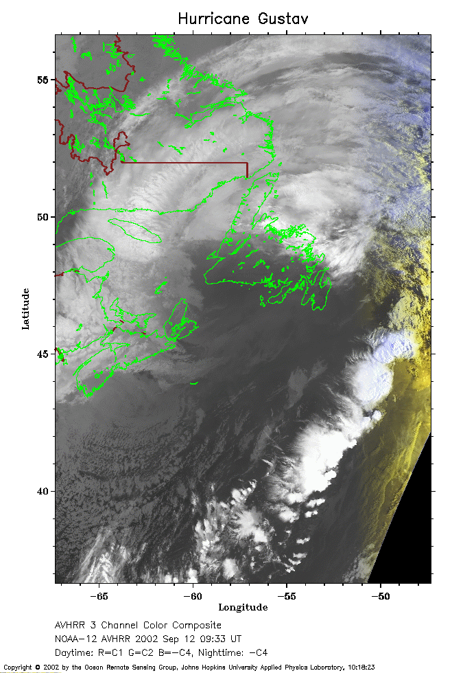 2002 September 12 09:33 UT
NOAA-12 satellite AVHRR channel 4 morning image.
A closer view (214 Kb) is seen by clicking on this small image.
The maximum sustained winds have decreased to 75 mph and Gustav is
becoming extratropical.