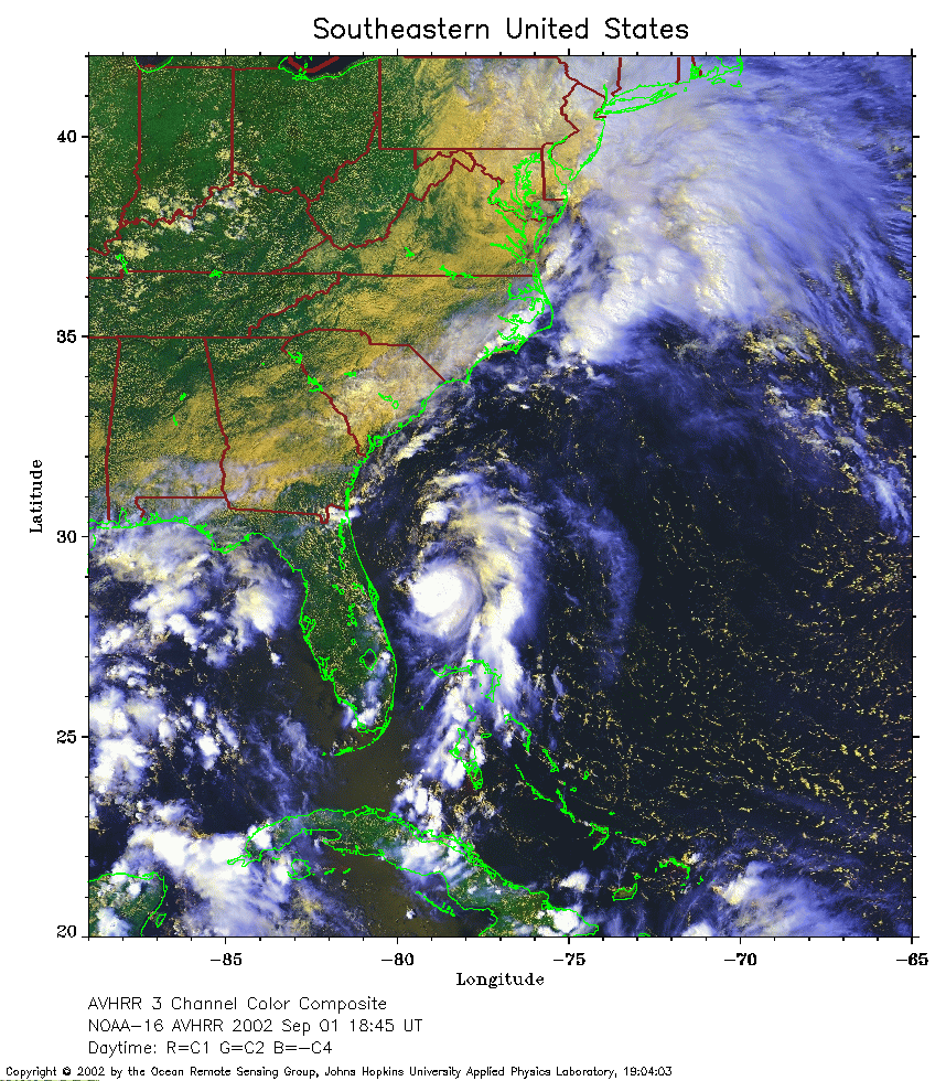
 2002 September 1 18:45 UT
NOAA-16 satellite AVHRR 3 channel color composite afternoon image.
A closer view (406 Kb) is seen by clicking on this small image.
The maximum sustained winds are 30 mph. Edouard is in its tropical
depression stage.
 2002 September 1 21:58 UT
NOAA-12 satellite AVHRR 3 channel color composite evening image.
A closer view (358 Kb) is seen by clicking on this small image.
The maximum sustained winds have increased to 35 mph. Edouard is still
a tropical depression.
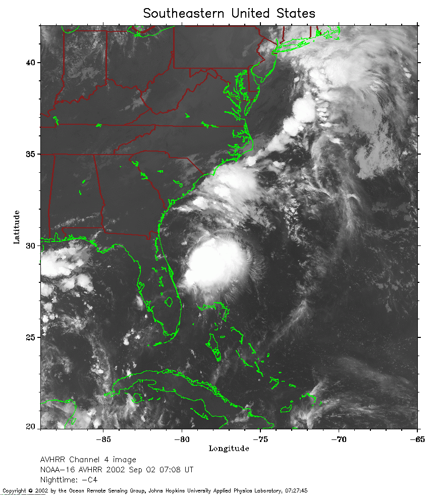 2002 September 2 07:08 UT
NOAA-16 satellite AVHRR channel 4 early morning image.
A closer view (285 Kb) is seen by clicking on this small image.
The maximum sustained winds are now 40 mph, making Edouard a tropical
storm.
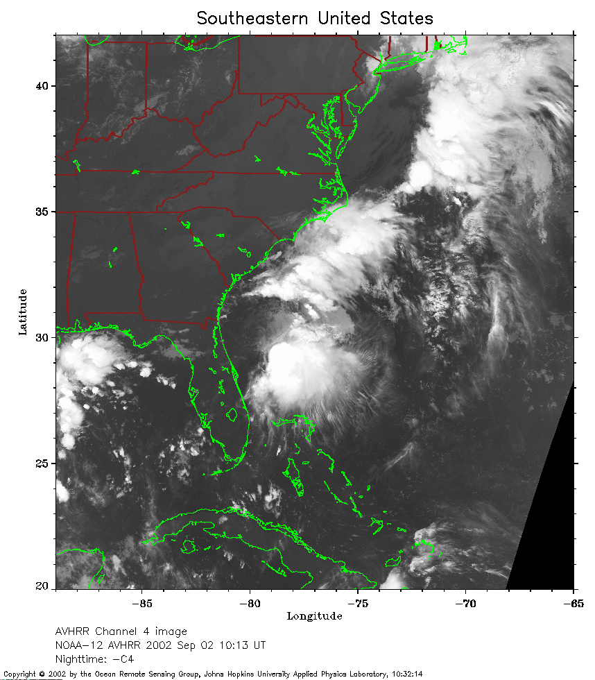 2002 September 2 10:13 UT
NOAA-12 satellite AVHRR channel 4 morning image.
A closer view (273 Kb) is seen by clicking on this small image.
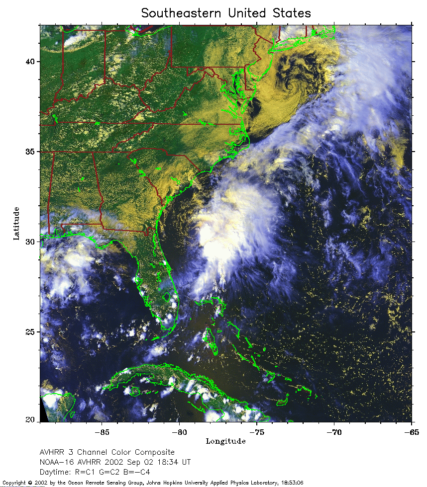 2002 September 2 18:34 UT
NOAA-16 satellite AVHRR 3 channel color composite afternoon image.
A closer view (415 Kb) is seen by clicking on this small image.
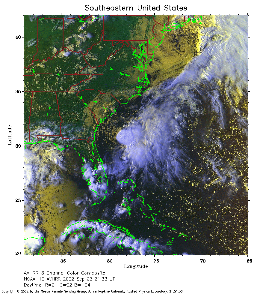 2002 September 2 21:33 UT
NOAA-12 satellite AVHRR 3 channel color composite evening image. A closer view (424 Kb) is seen by clicking on this small image.
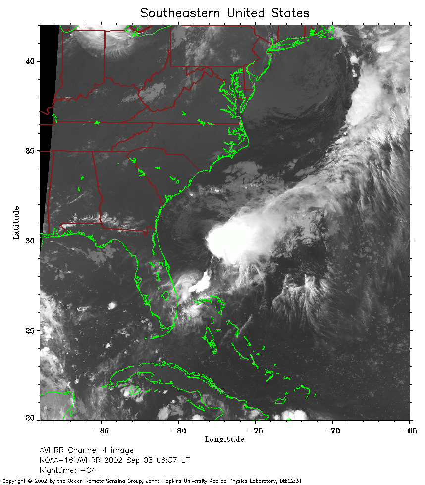 2002 September 3 06:57 UT
NOAA-16 satellite AVHRR channel 4 early morning image.
A closer view (281 Kb) is seen by clicking on this small image.
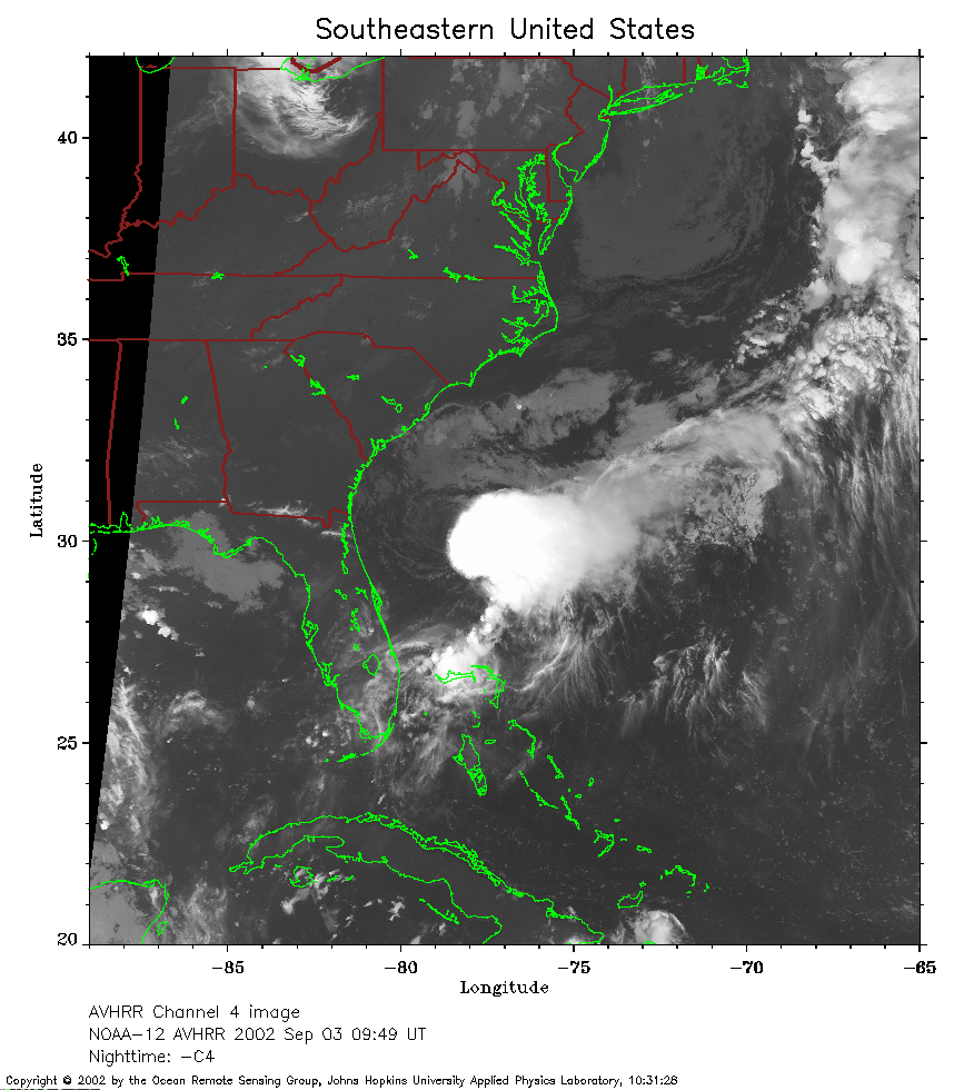 2002 September 3 09:49 UT
NOAA-12 satellite AVHRR channel 4 morning image. A closer view (260 Kb) is seen by clicking on this small image. The maximum sustained winds remain 40 mph.
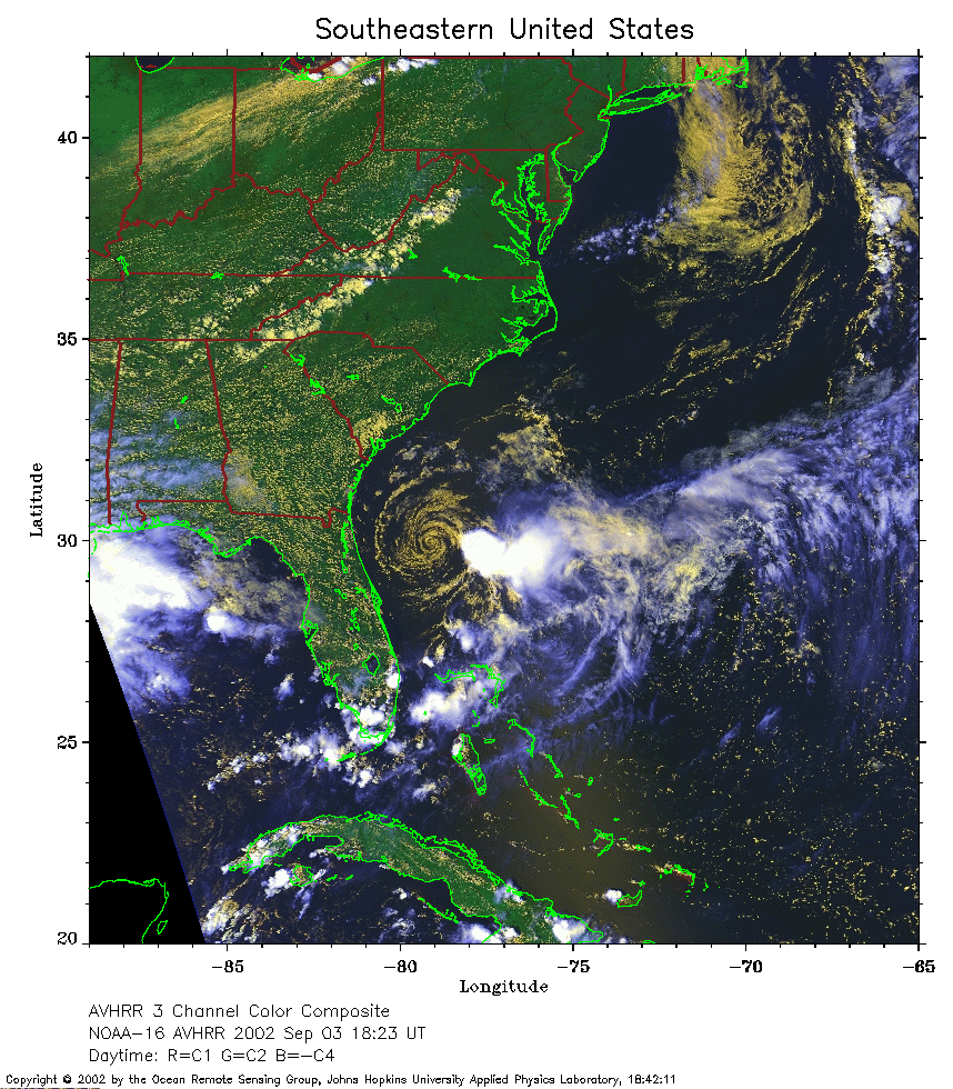 2002 September 3 18:23 UT
NOAA-16 satellite AVHRR 3 channel color composite afternoon image.
A closer view (371 Kb) is seen by clicking on this small image.
The maximum sustained winds have increased to 60 mph.
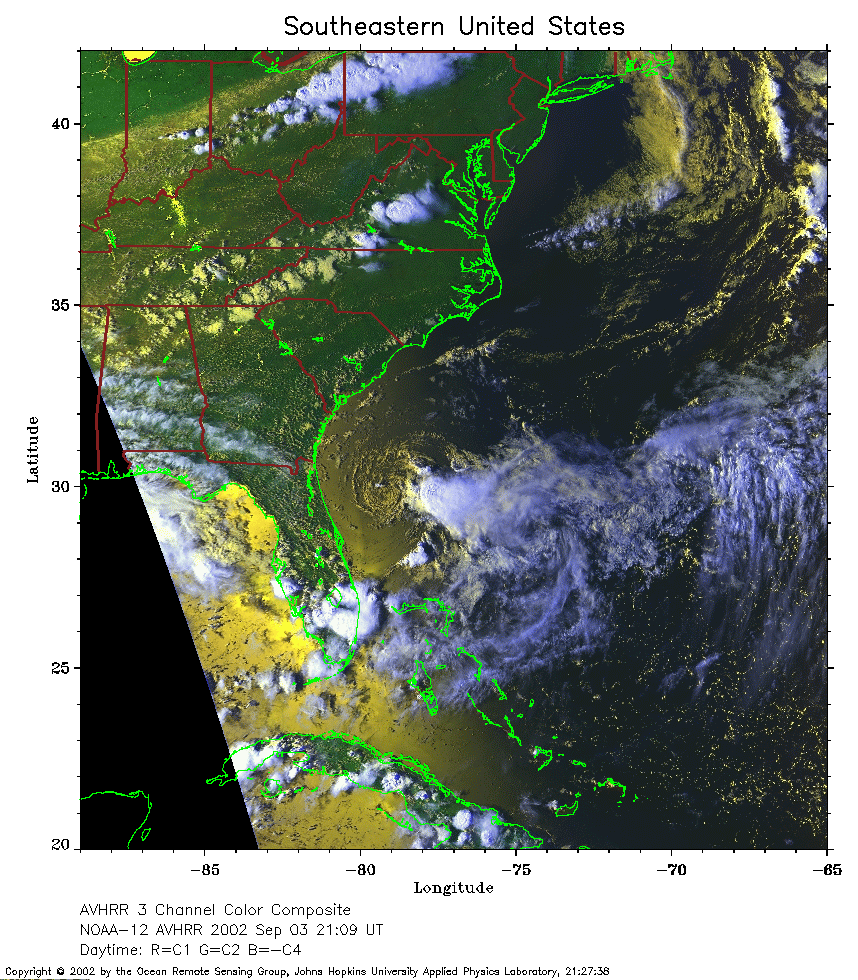 2002 September 3 21:09 UT
NOAA-12 satellite AVHRR 3 channel color composite evening image. A closer view (358 Kb) is seen by clicking on this small image. The maximum sustained winds have decreased to 50 mph.
 2002 September 4 06:46 UT
NOAA-16 satellite AVHRR channel 4 early morning image.
A closer view (257 Kb) is seen by clicking on this small image.
The maximum sustained winds have decreased to 40 mph.
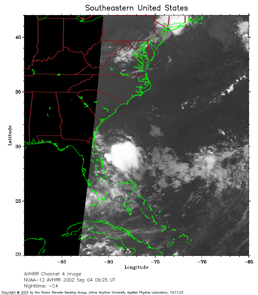 2002 September 4 09:25 UT
NOAA-12 satellite AVHRR channel 4 morning image. A closer view (199 Kb) is seen by clicking on this small image.
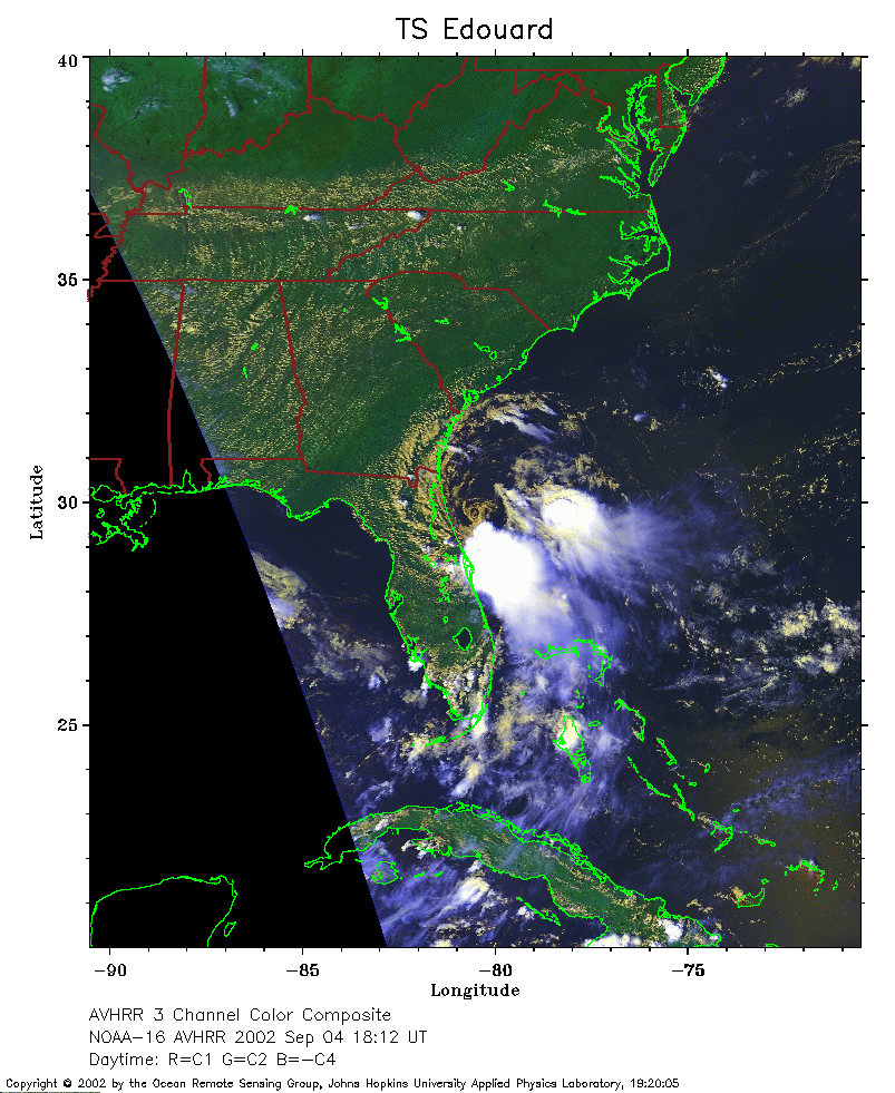 2002 September 4 18:12 UT
NOAA-16 satellite AVHRR 3 channel color composite afternoon image.
A closer view (263 Kb) is seen by clicking on this small image.
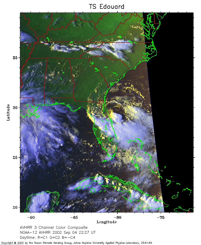 2002 September 4 22:27 UT
NOAA-12 satellite AVHRR 3 channel color composite evening image. A closer view (265 Kb) is seen by clicking on this small image.
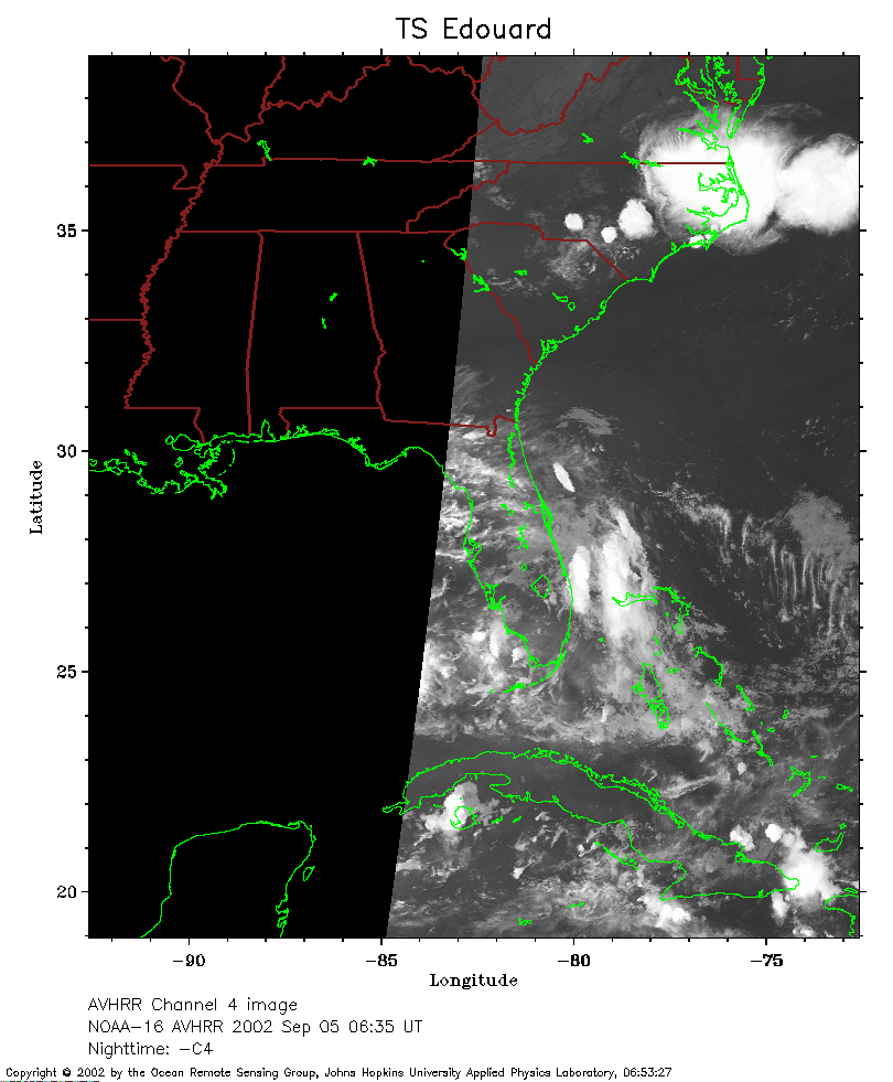 2002 September 5 06:35 UT
NOAA-16 satellite AVHRR channel 4 early morning image.
A closer view (167 Kb) is seen by clicking on this small image.
Edouard made landfall a few hours earlier.
The maximum sustained winds have decreased to 35 mph.
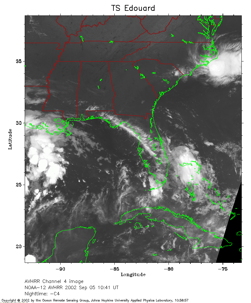 2002 September 5 10:41 UT
NOAA-12 satellite AVHRR channel 4 morning image. A closer view (252 Kb) is seen by clicking on this small image. The maximum sustained winds have decreased to 30 mph.