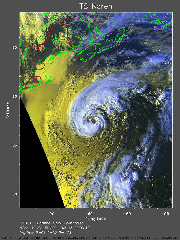
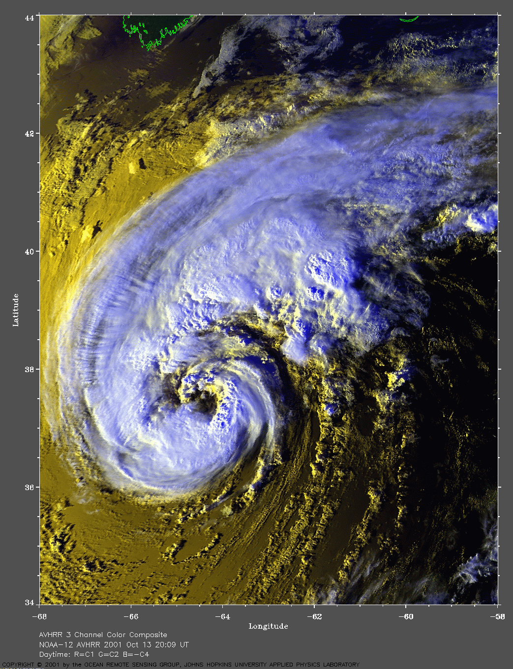
 2001 October 13 20:09 UT
NOAA-12 satellite AVHRR 3 channel color composite afternoon image.
A closer view (393 Kb) is seen by clicking on this small image.
The maximum sustained winds increased from 70 mph at 15:00 UT to 75 mph
at 21:00 UT, making Karen a hurricane.
A very large image
(800 Kb) is also available.
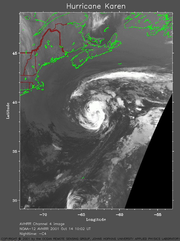 2001 October 14 10:02 UT
NOAA-12 satellite AVHRR channel 4 morning image.
A closer view (218 Kb) is seen by clicking on this small image.
The maximum sustained winds have increased to 80 mph at 09:00 UT.
A very large image
(887 Kb) is also available.
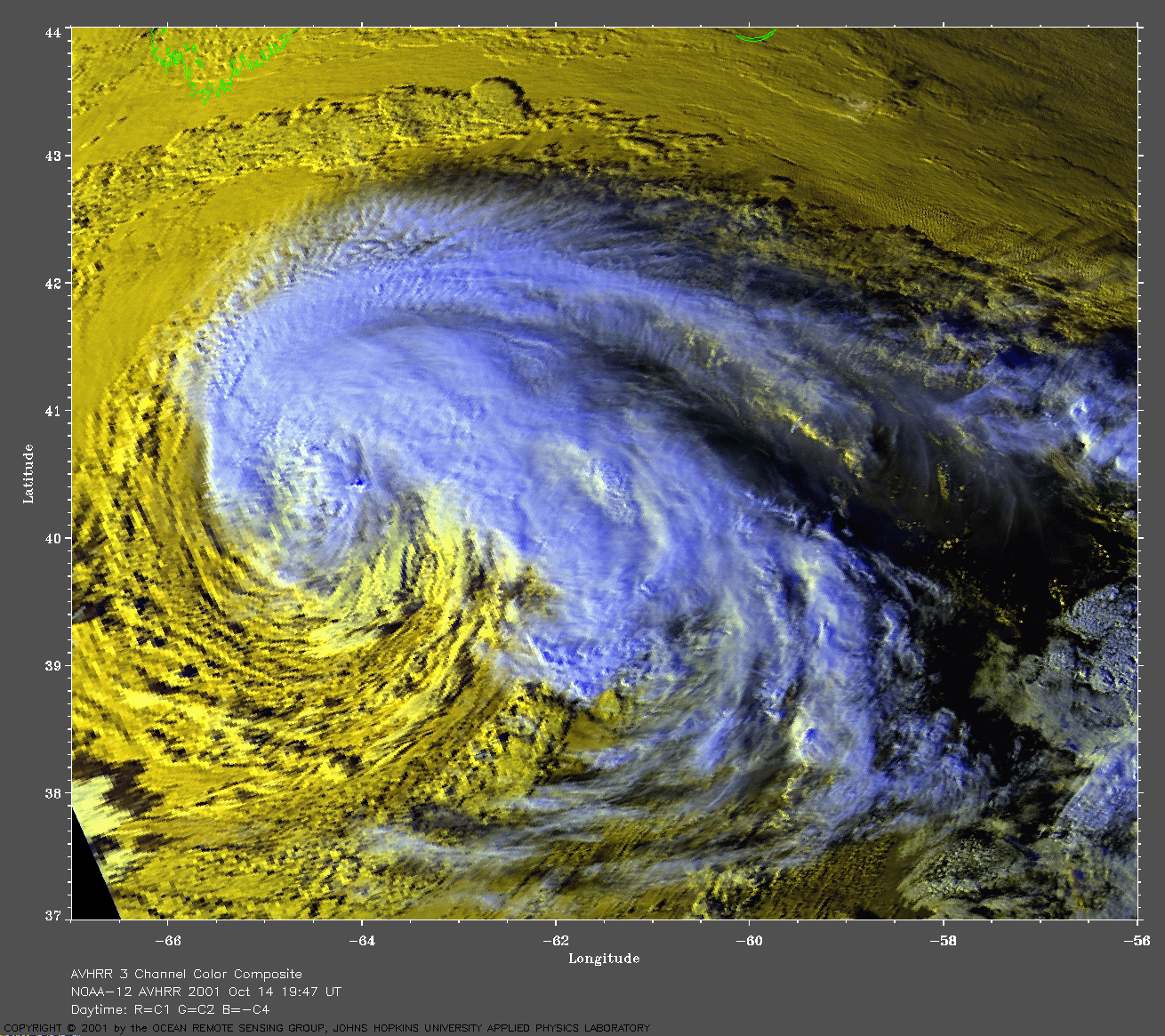
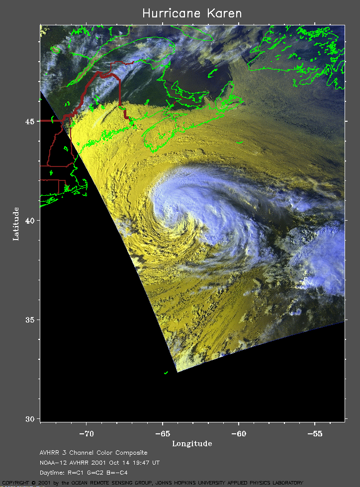 2001 October 14 19:47 UT
NOAA-12 satellite AVHRR 3 channel color composite afternoon image.
A closer view (275 Kb) is seen by clicking on this small image.
The maximum sustained winds decreased to 75 mph
at 15:00 UT.
A very large image
(885 Kb) is also available.
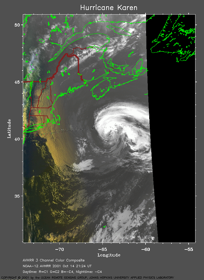 2001 October 14 21:24 UT
NOAA-12 satellite AVHRR channel 4 evening image.
A closer view (201 Kb) is seen by clicking on this small image.
The maximum sustained winds decreased to 65 mph at 21:00 UT.
A very large image
(449 Kb) is also available.
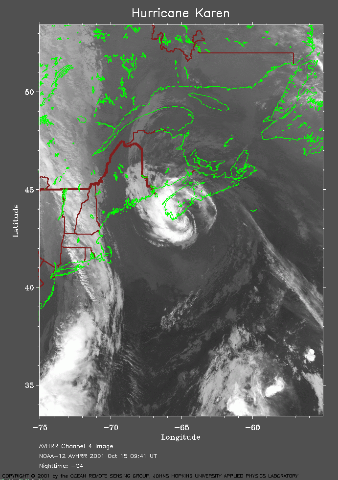 2001 October 15 09:41 UT
NOAA-12 satellite AVHRR channel 4 morning image.
A closer view (243 Kb) is seen by clicking on this small image.
The maximum sustained winds decreased to 50 mph at 09:00 UT.
A very large image
(801 Kb) is also available.
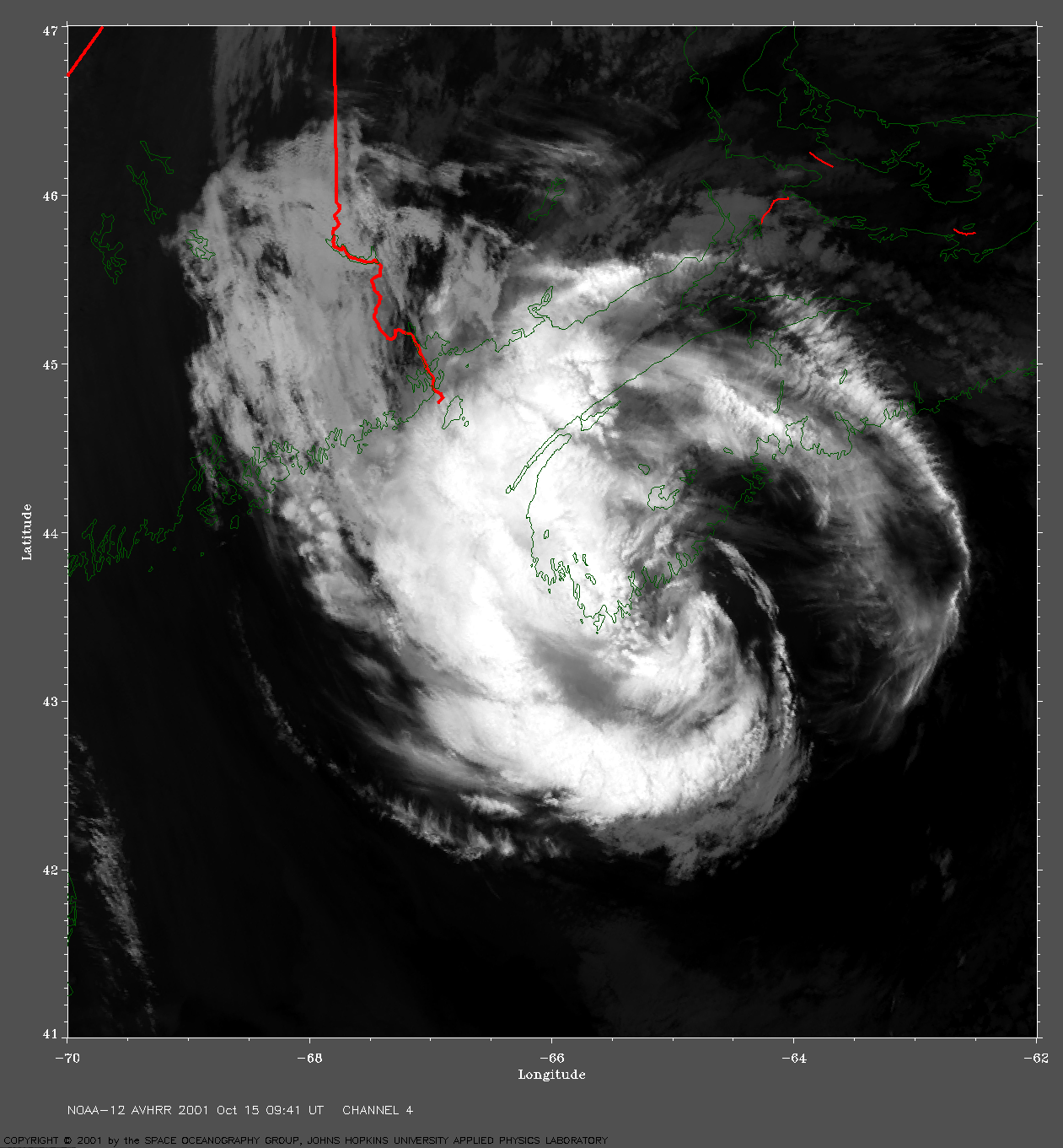