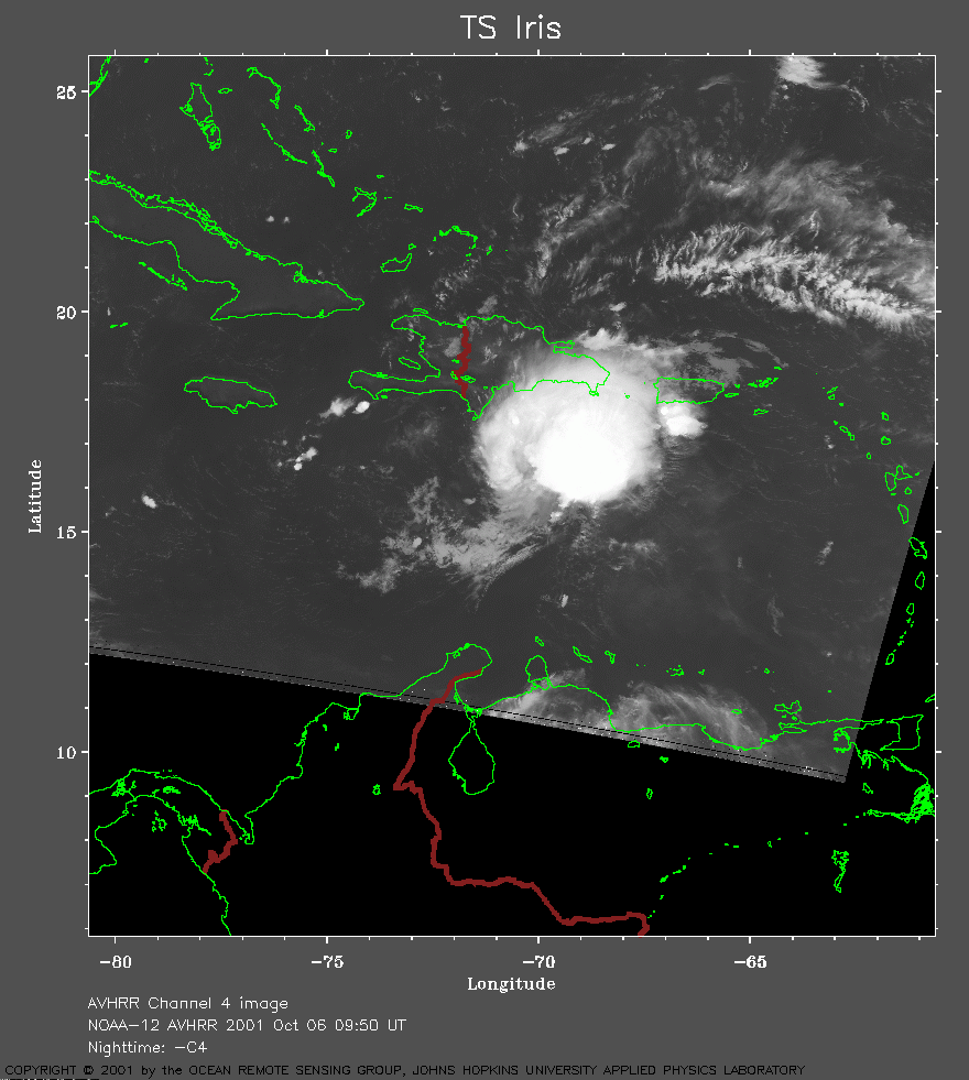
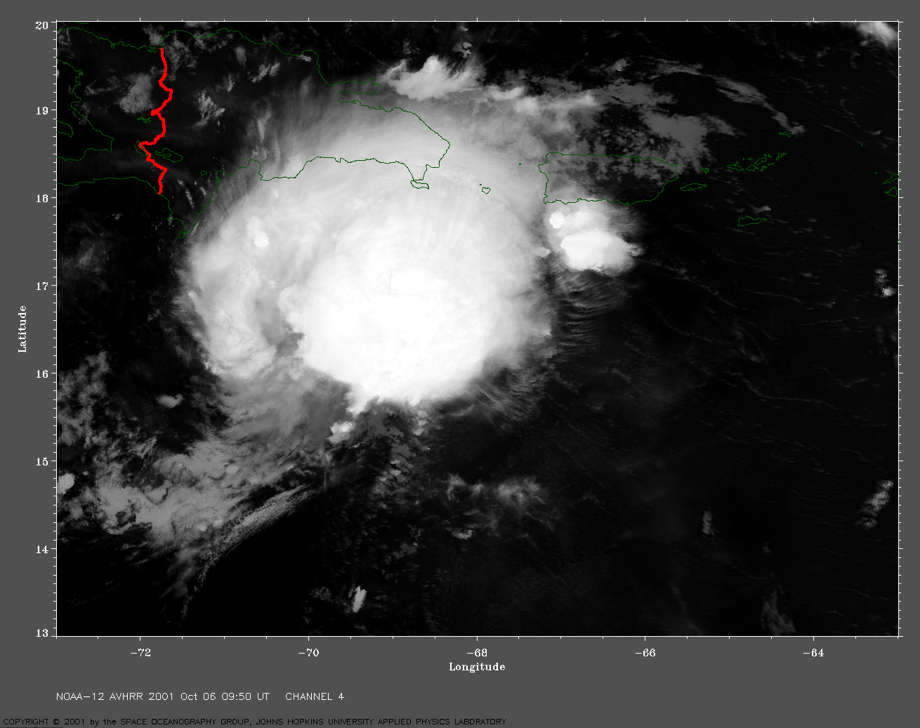
 2001 October 6 09:50 UT
NOAA-12 satellite AVHRR channel 4 early morning image.
A closer view (195 Kb) is seen by clicking on this small image.
The maximum sustained winds are 65 mph at 09:00 UT.
A very large channel 4 image
(641 Kb) is also available.
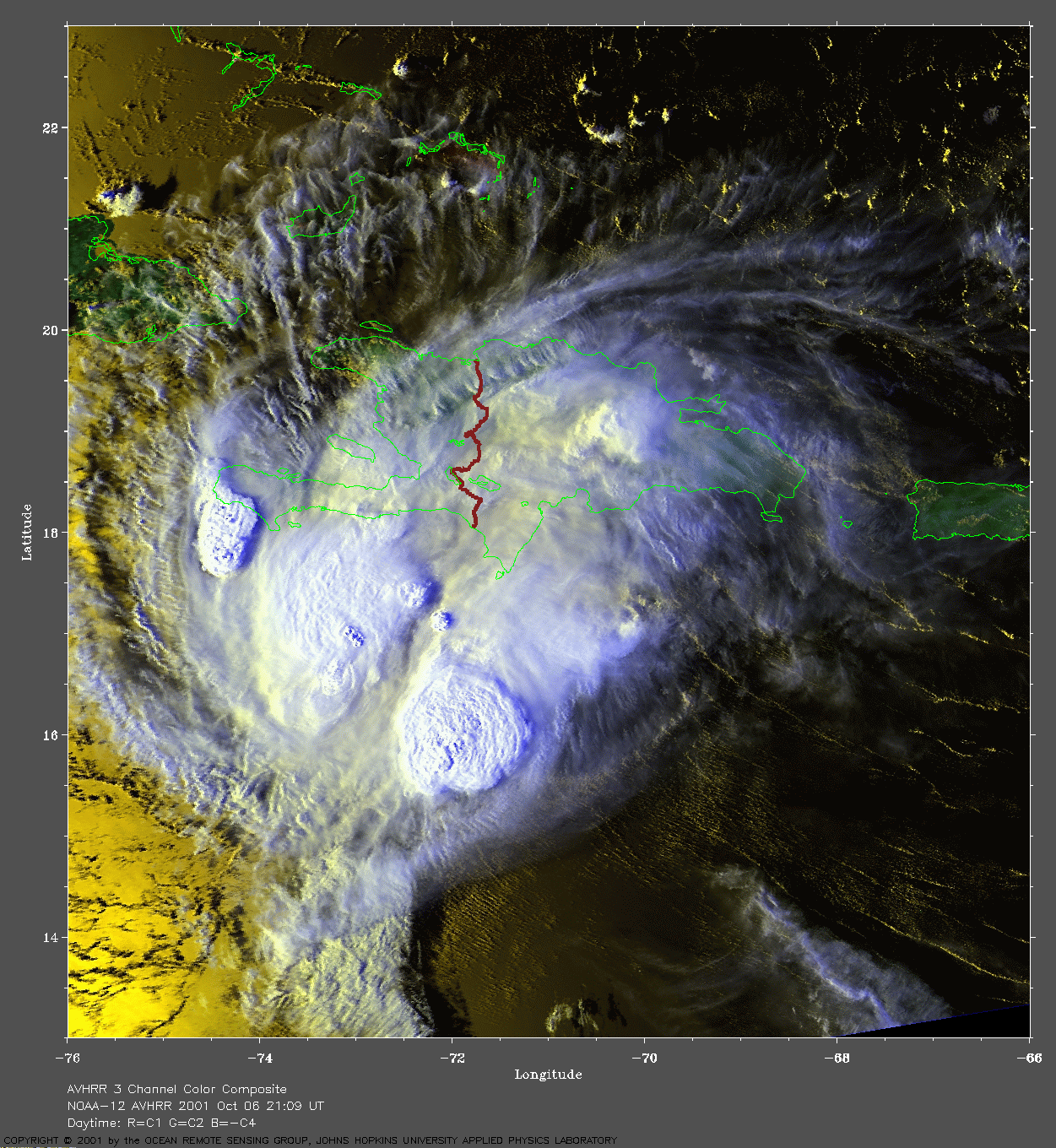
 2001 October 6 21:09 UT
NOAA-12 satellite AVHRR 3 channel color composite evening image.
A closer view (266 Kb) is seen by clicking on this small image.
Iris is now a hurricane with maximum sustained winds of 75 mph at 21:00 UT.
A very large image
(832 Kb) is also available.
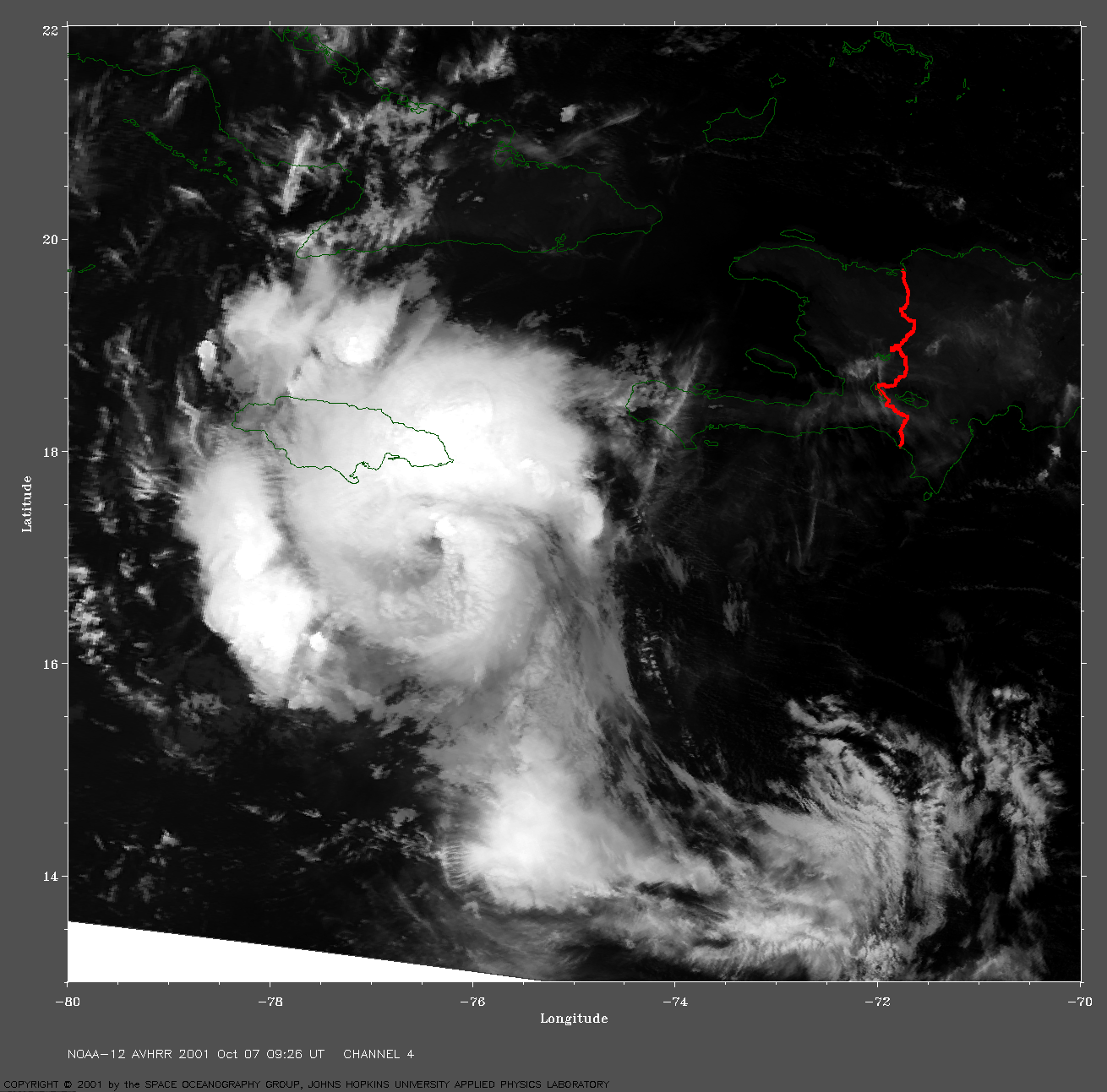
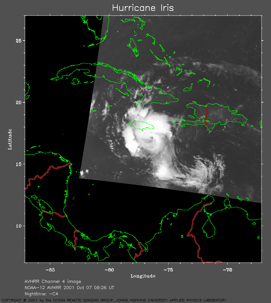 2001 October 7 09:26 UT
NOAA-12 satellite AVHRR channel 4 early morning image.
A closer view (154 Kb) is seen by clicking on this small image.
The maximum sustained winds are 85 mph at 09:00 UT.
A very large channel 4 image
(818 Kb) is also available.
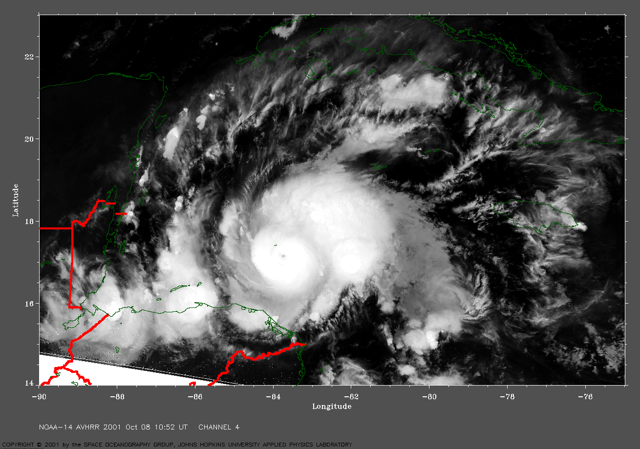
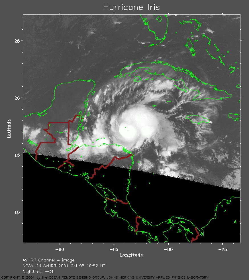 2001 October 8 10:52 UT
NOAA-14 satellite AVHRR channel 4 early morning image.
A closer view (204 Kb) is seen by clicking on this small image.
The maximum sustained winds are increasing from 110 mph at 09:00 UT to
140 mph at 12:00 UT. Note the small eye in these images.
A very large channel 4 image
(792 Kb) is also available.