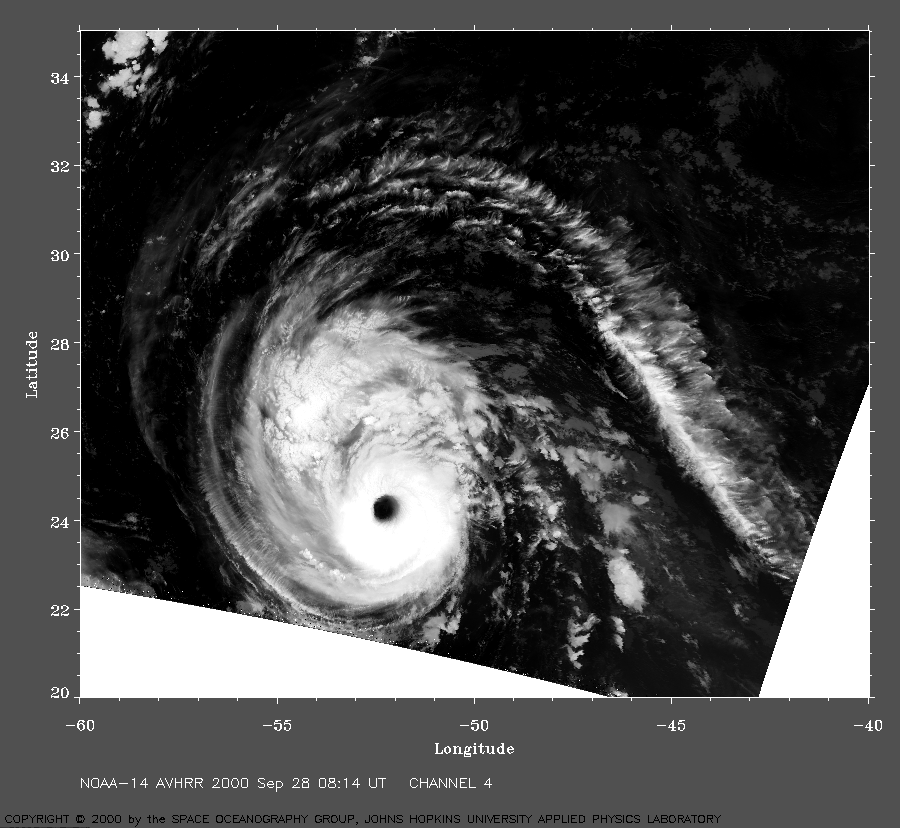
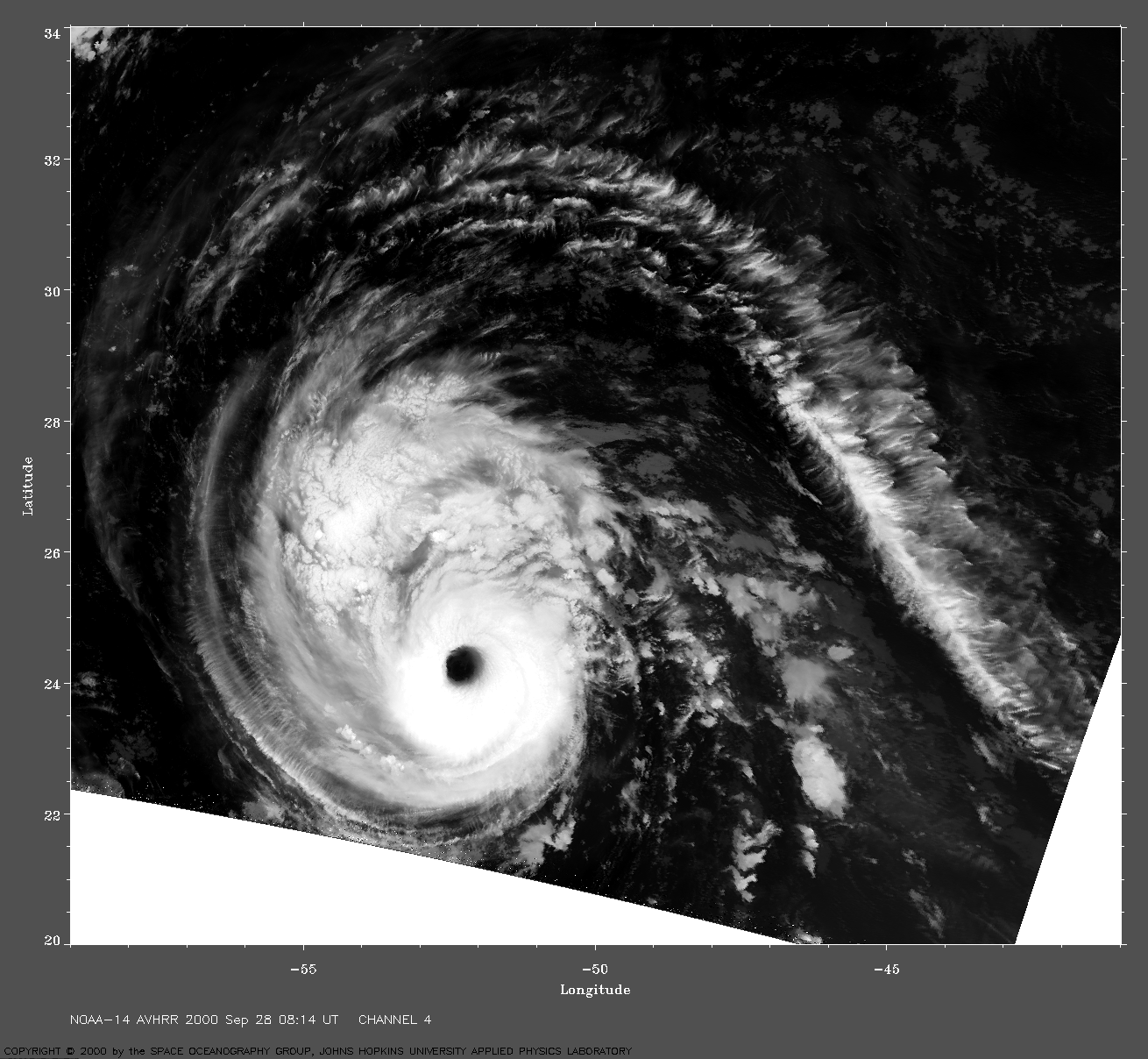
 2000 September 28 08:14 UT
NOAA-14 satellite AVHRR channel 4 early morning image.
A closer view (400 Kb) is seen by clicking on this small image.
The maximum sustained winds are increasing to 120 mph at 09:00 UT.
A very large image
(980 Kb) is also available.
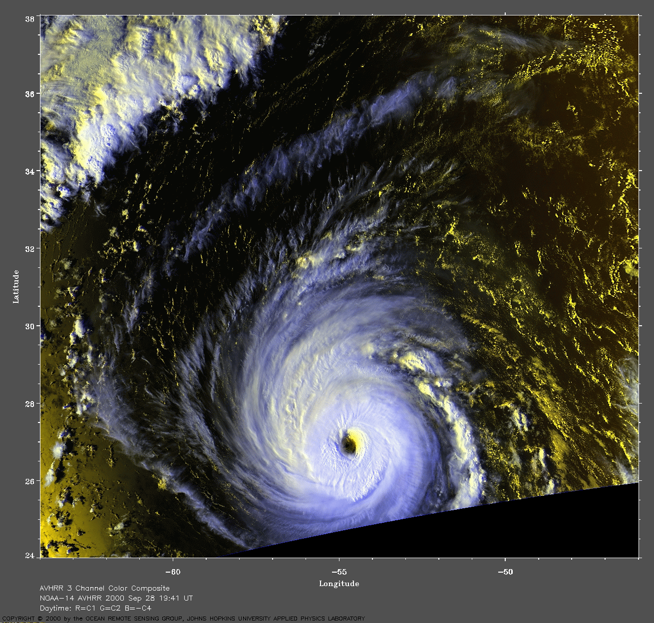
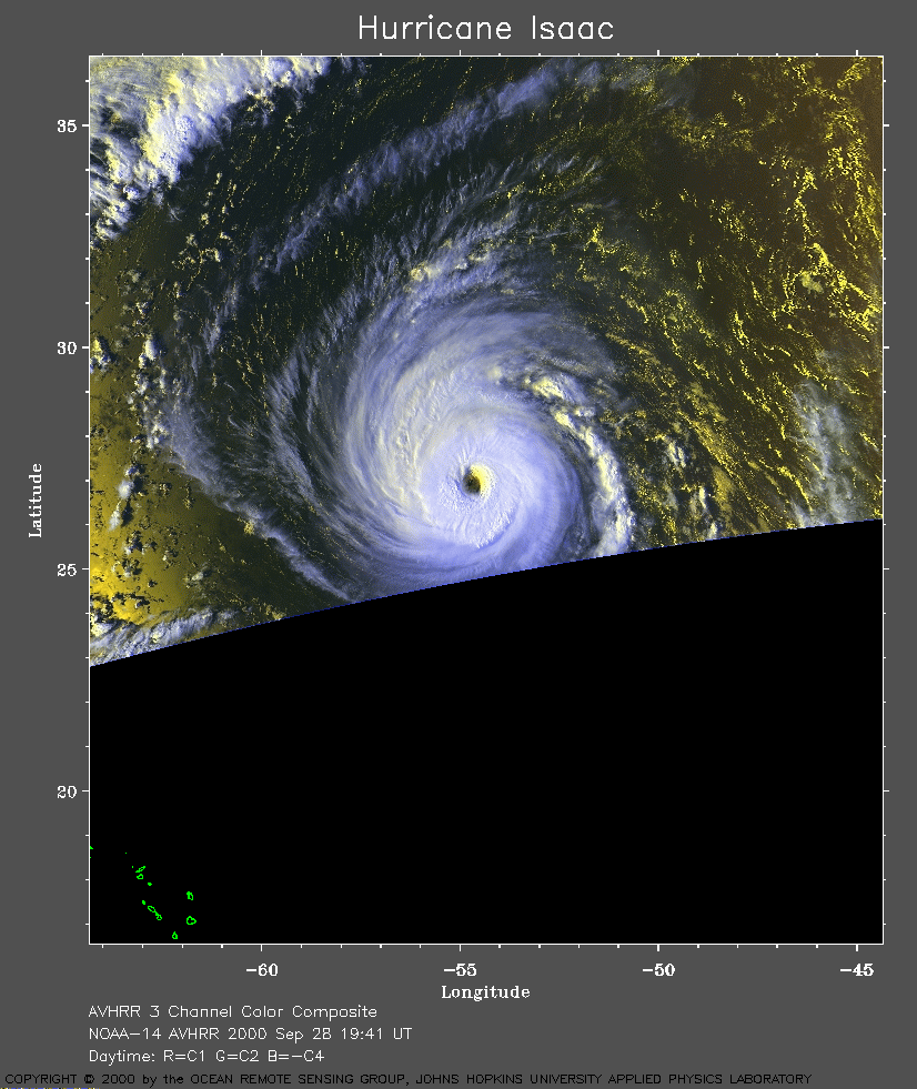 2000 September 28 19:41 UT
NOAA-14 satellite AVHRR 3 channel color composite afternoon image.
A closer view (283 Kb) is seen by clicking on this small image.
The maximum sustained winds are increasing to 140 mph at 21:00 UT.
A very large image
(814 Kb) is also available.
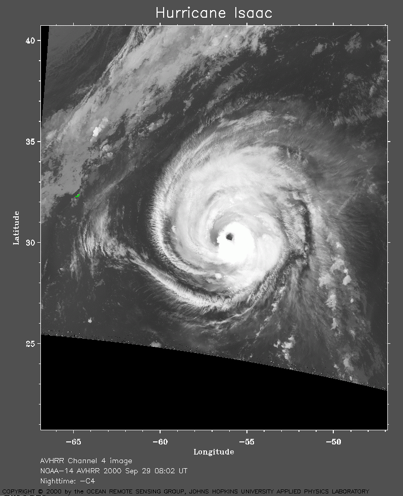 2000 September 29 08:02 UT
NOAA-14 satellite AVHRR channel 4 early morning image.
A closer view (256 Kb) is seen by clicking on this small image.
The maximum sustained winds have decreased to 130 mph.
A very large image
(1131 Kb) is also available.
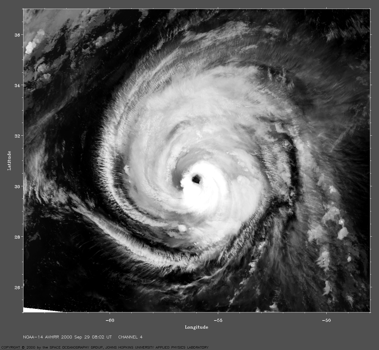
 2000 September 29 19:29 UT
NOAA-14 satellite AVHRR 3 channel color composite afternoon image.
A closer view (391 Kb) is seen by clicking on this small image.
The maximum sustained winds have decreased to 120 mph.
A very large image
(1017 Kb) is also available.
Note the island of Bermuda (J-shaped) near the left edge of the image at
about 32 degrees north latitude.
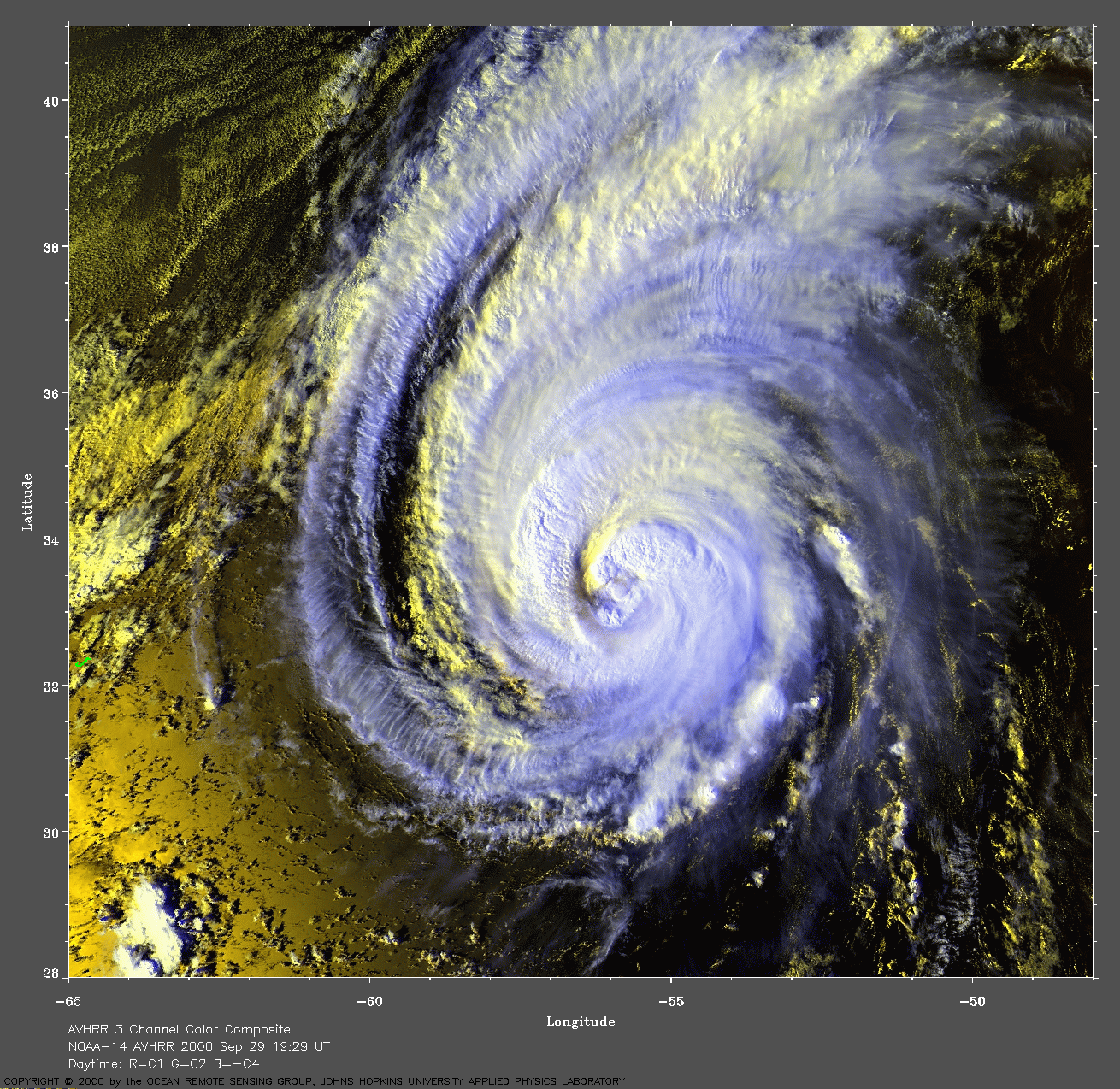
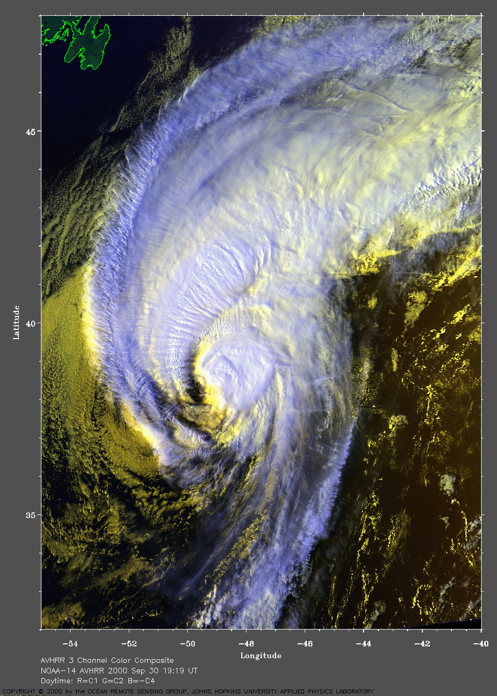
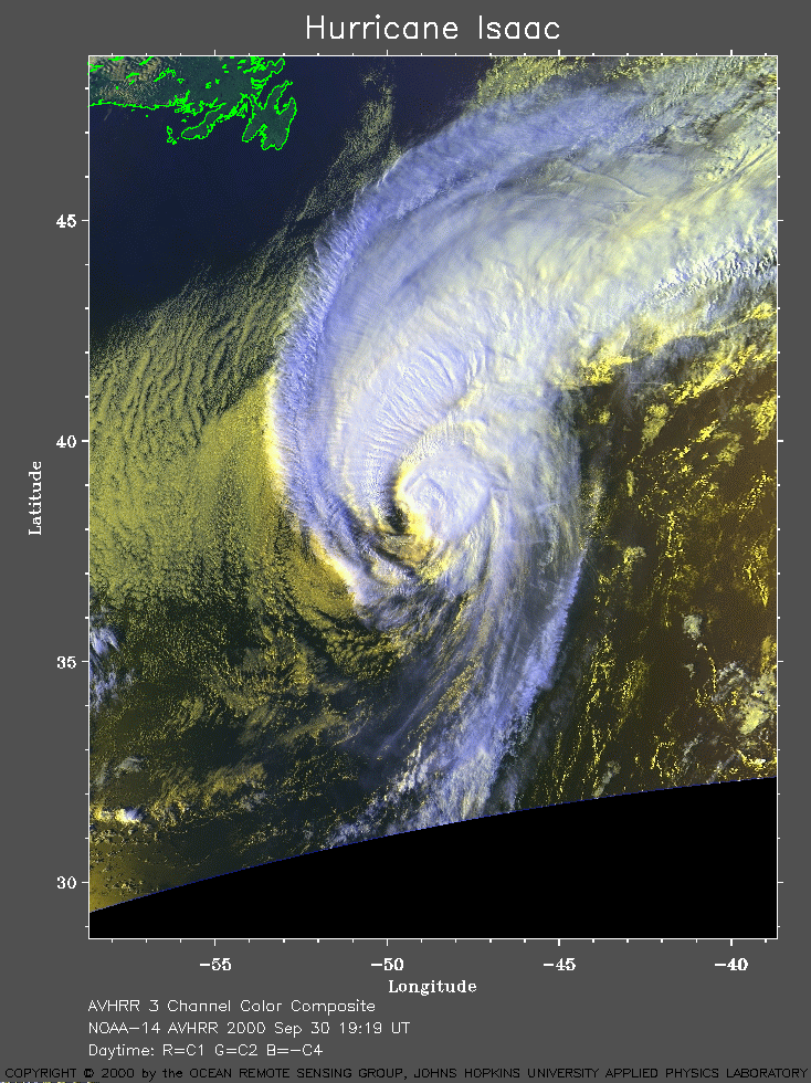 2000 September 30 19:19 UT
NOAA-14 satellite AVHRR 3 channel color composite afternoon image.
A closer view (352 Kb) is seen by clicking on this small image.
The maximum sustained winds are decreasing from 85 mph at 15:00 UT to 75
mph at 21:00 UT.
A very large image
(1017 Kb) is also available.
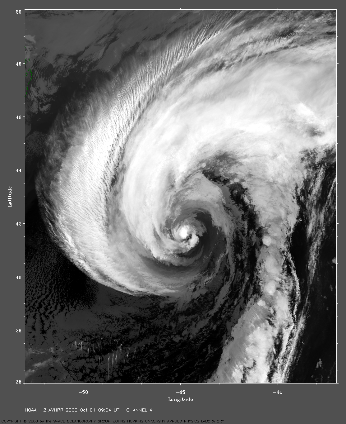
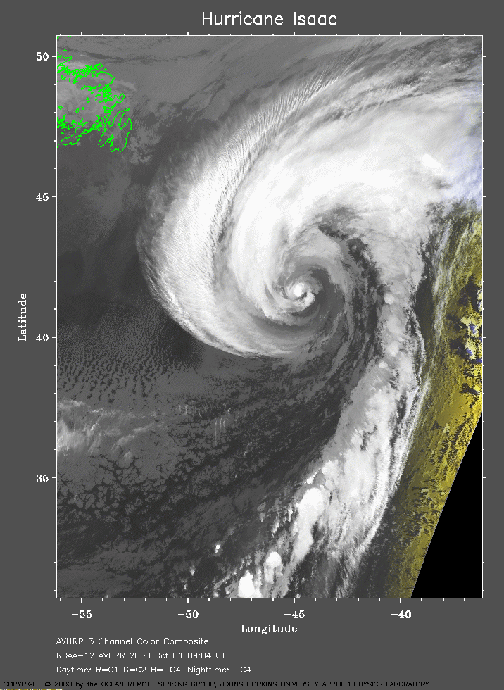 2000 October 01 09:04 UT
NOAA-122satellite AVHRR channel 4 early morning image.
A closer view (263 Kb) is seen by clicking on this small image.
The maximum sustained winds have decreased to 70 mph.
A very large image
(1095 Kb) is also available.