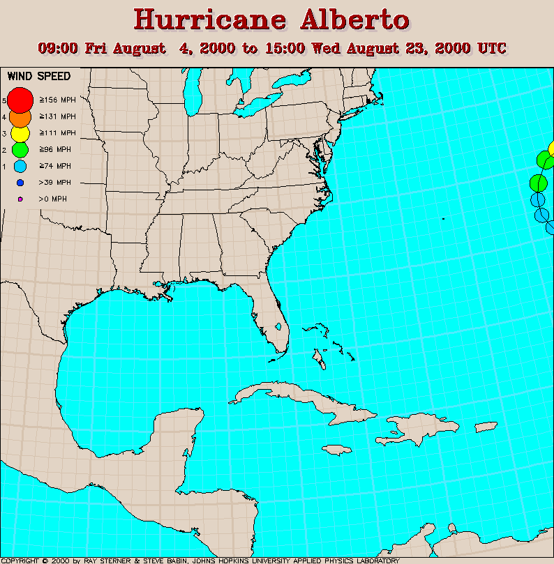
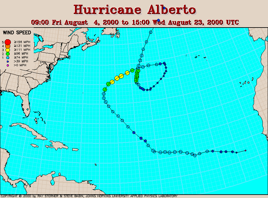
Track maps
Alberto developed from Tropical Depression Three in the eastern tropical Atlantic Ocean.
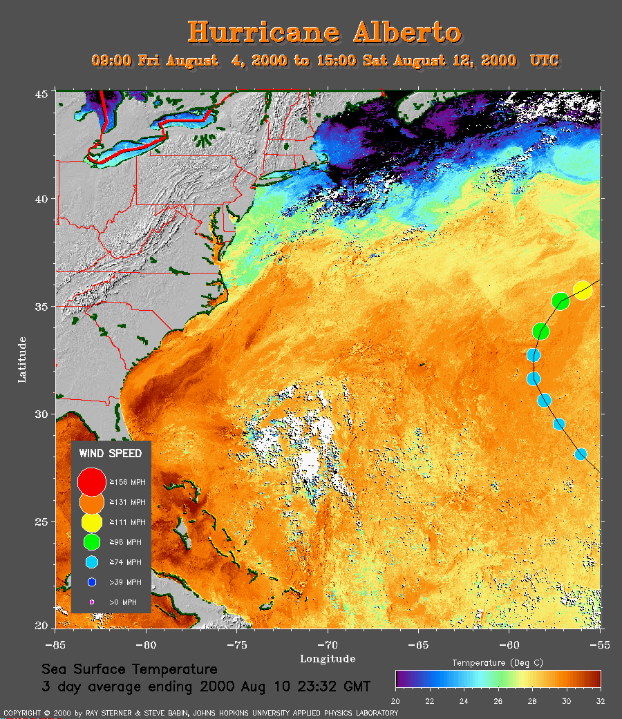 3 day average SST image from 10 August
(277 Kb) This image is derived from the average composite sea
surface
temperature (SST) data over 3 days ending 10 August 2000. The averaging
is done to remove clouds. The temperature scale for the SST in this
image is 20 to 32 C.
The track of Alberto is overlaid on this image.
Note how Alberto intensifies after crossing some warmer water.
3 day average SST image from 10 August
(277 Kb) This image is derived from the average composite sea
surface
temperature (SST) data over 3 days ending 10 August 2000. The averaging
is done to remove clouds. The temperature scale for the SST in this
image is 20 to 32 C.
The track of Alberto is overlaid on this image.
Note how Alberto intensifies after crossing some warmer water.
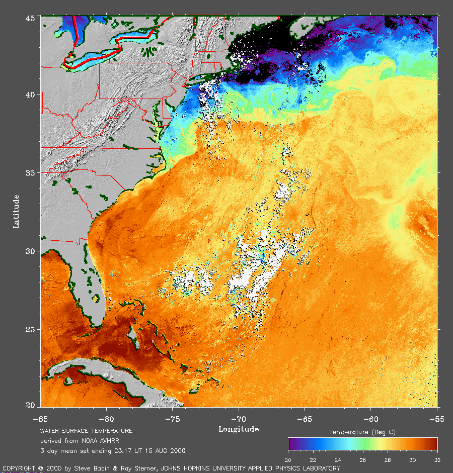 3 day average SST image from 15 August
(281 Kb) This image is derived from the average composite sea
surface
temperature (SST) data over 3 days ending 15 August 2000. The averaging
is done to remove clouds. The temperature scale for the SST in this
image is 20 to 32 C.
Note the cool wake of Alberto in the right side of the image. As of
August 16, Alberto is heading to the southwest (see track map) so it is
possible it may cross its own cool wake!
3 day average SST image from 15 August
(281 Kb) This image is derived from the average composite sea
surface
temperature (SST) data over 3 days ending 15 August 2000. The averaging
is done to remove clouds. The temperature scale for the SST in this
image is 20 to 32 C.
Note the cool wake of Alberto in the right side of the image. As of
August 16, Alberto is heading to the southwest (see track map) so it is
possible it may cross its own cool wake!
Track file
Track data (lat/lon, winds, etc.) in a text file.