|
|
||||||||||||||||||||||||
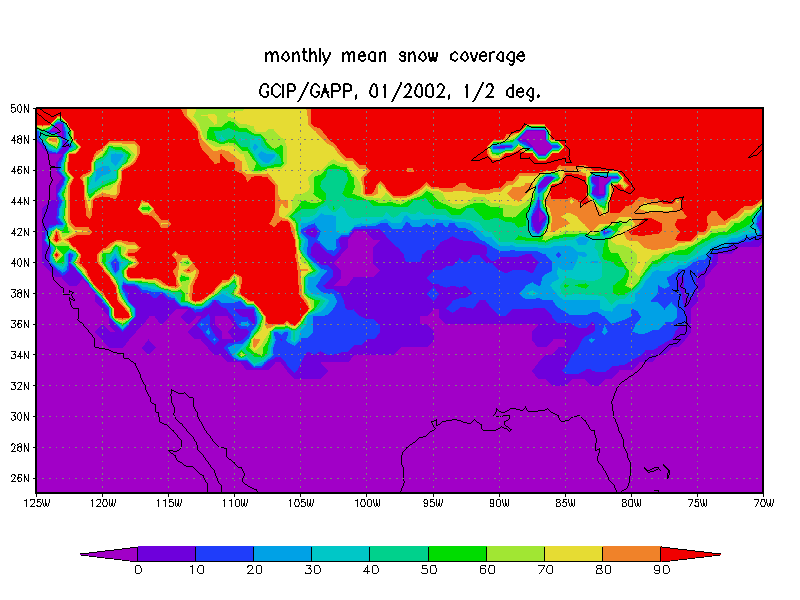
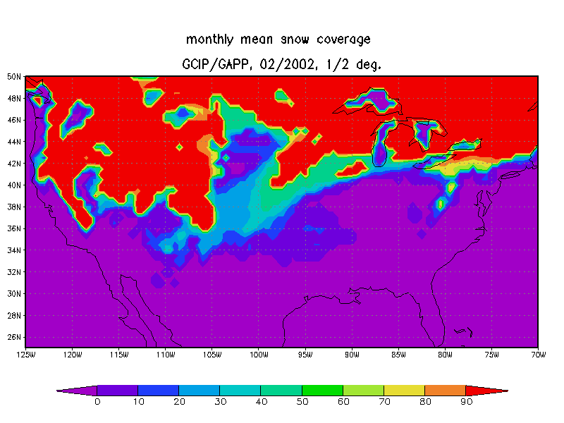
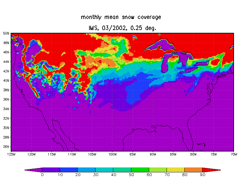
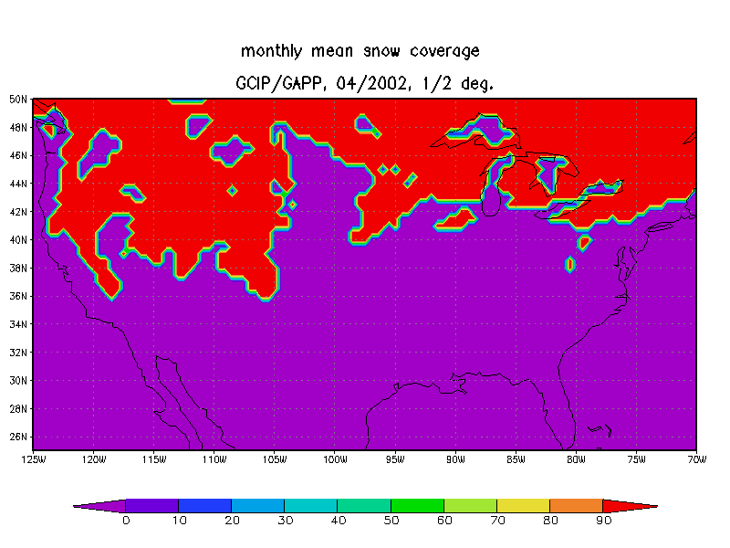
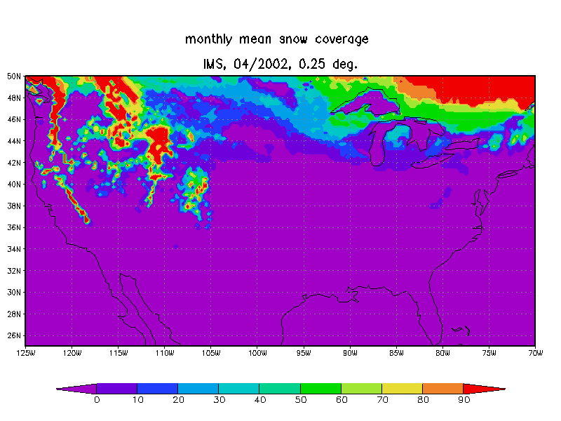
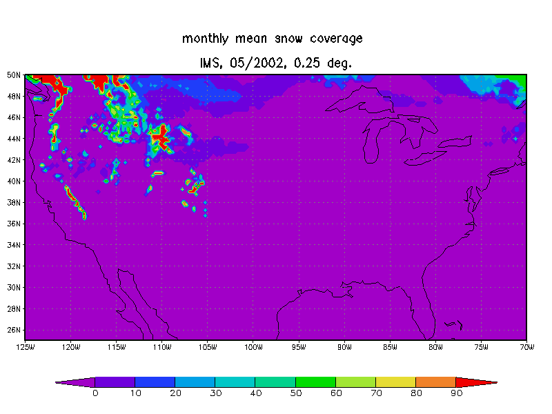
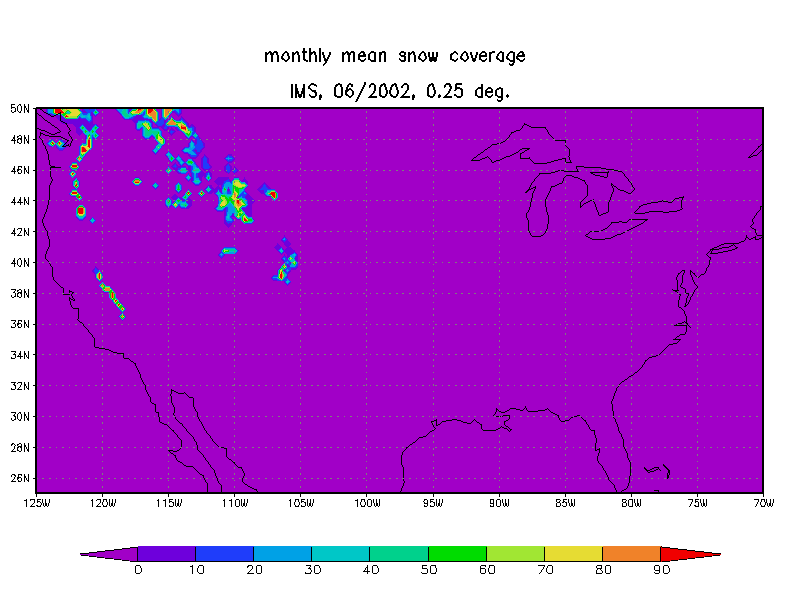
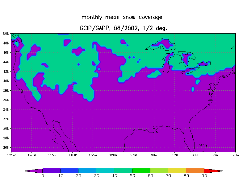
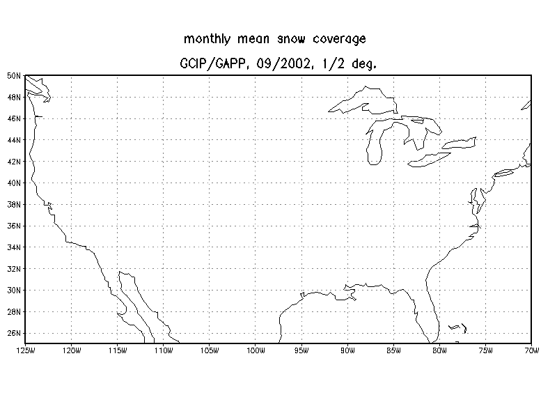
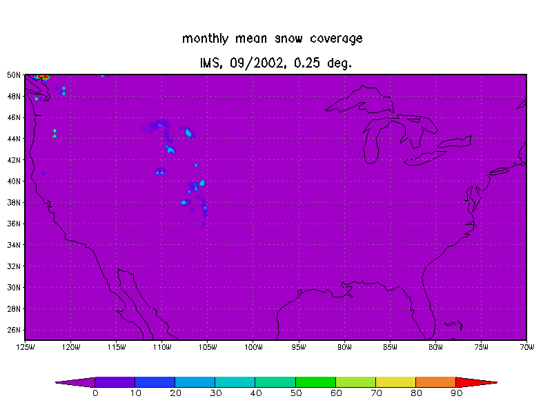
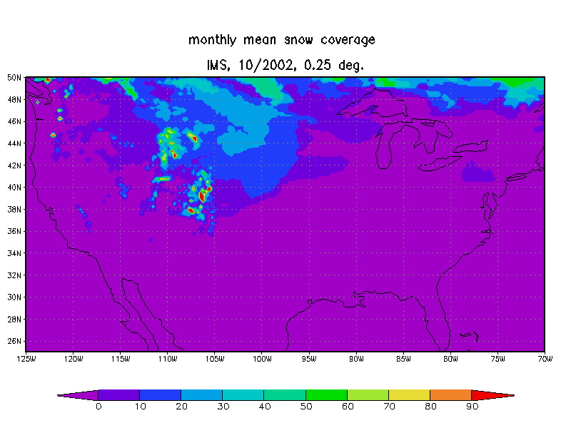
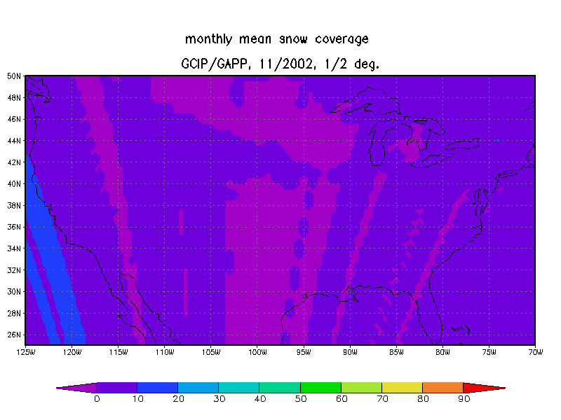
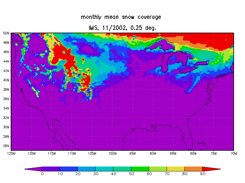
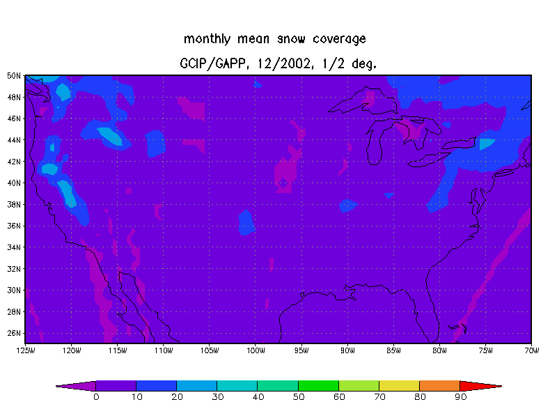
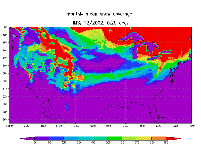
2002 - 2003 Snow ProblemDuring the 2002 - 2003 period, several problems related to snow information transfer to the NOAA/NESDIS GCIP SRB operational model were encountered. Initially, the snow field as it existed in February 2002, was not updated till the middle of August 2002. Subsequently, the transfer of information on snow to the radiation model encountered technical problems. Therefore, the satellite based estimates of surface radiative fluxes in snow covered areas will be in error. To illustrate the problem, a comparison between the snow field as used by the GCIP radiation model and the NOAA/NESDIS Interactive Multi-sensor Snow and Ice Mapping System (IMS) snow product is presented in the following figure.
|