Hurricane Wilma (2005) was the most powerful hurricane ever recorded in the Atlantic Basin, with a minimum central pressure of 882 hPa and a maximum surface wind speed of 83 m/s. It devastated portions of the Yucatan Peninsula as a Category 4 Hurricane, and then produced an estimated $12.2 billion in damages over southern Florida.
In this project, we simulated the rapid development stage of Hurricane Wilma (2005) using the next generation of the Weather Research and Forecast (WRF) model with the finest grid resolution of 1 km and the smallest time step of a few second. The WRF model is initialized at 0000 UTC 18 October 2005, and integrated for 48 hours. Such high temporal and spatial resolution data will be used to study the nonlinear dynamics, the three-dimensional structures and evolution, and the processes leading to the development of such a record-breaking storm.
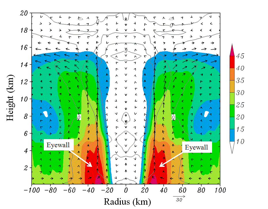
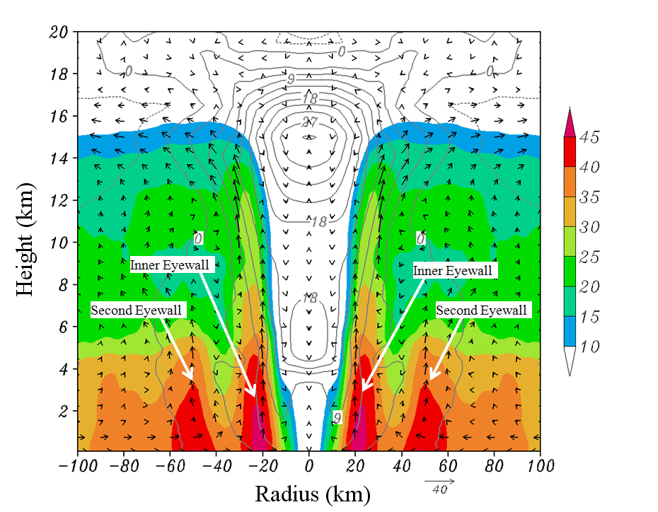
This figure shows that the model reproduces reasonably well the intensity change, particularly the rapid deepening rate of 9 hPa per hour. The storm track is also reasonably well reproduced. During the rapid deepening period, Wilma's eyewall exhibits polygonal shapes, ranging from triangles to hexagons associated with mesovortices (see a movie of the model-simulated radar reflectivity in the inner-core region ), and the eyewall replacement processes (see Fig. 1, Fig. 2, Fig. 3, Fig. 4).
Figures 1 - 4 shows vertical cross sections through Wilma's center of the model-simulated radar reflectivity (shaded), the temperature perturbations (with respect to the storm environmental values, contoured), and in-plan flow vectors from the 24-, 36-, 42-, and 48-h simulations, respectively. Two warm cores are evident in the eye, with a stronger one in the upper troposphere.